

Mori Atlas logo
National parkGunung Gede Pangrango National Park

Discover the geographic identity and protected boundaries of this Indonesian national park.

Gunung Gede Pangrango National Park: Indonesia's Protected Landscape and Mapped Geography

(Taman Nasional Gunung Gede Pangrango)

Gunung Gede Pangrango National Park stands as a significant protected area within Indonesia's vast archipelago. This national park offers a detailed look at its specific geographic scope, allowing for exploration of its mapped boundaries and the natural terrain it encompasses. Understanding this park contributes to a broader appreciation of Indonesia's diverse protected lands and their regional context.

volcanic mountainsmontane forestUNESCO Biosphere Reserveendemic biodiversitytwin peaksJava wildlife

Gunung Gede Pangrango National Park

National park

Park overview

Structured park overview, official facts, and landscape profile for Gunung Gede Pangrango National Park

Gunung Gede Pangrango National Park park facts, protected area profile, and essential visitor context

Review the core facts for Gunung Gede Pangrango National Park, including designation, size, terrain, visitor scale, habitats, and operating context in one park-focused overview.

About Gunung Gede Pangrango National Park

Gunung Gede Pangrango National Park protects one of the most significant mountain ecosystems in Southeast Asia, centred on two volcanic peaks that form a dramatic backdrop to the western Javan landscape. The park's ecological importance derives from its position as Java's largest and most intact montane forest reserve, containing vertically stacked habitat zones that support extraordinary biodiversity within a relatively compact area. The twin volcanoes, though considered dormant, display clear volcanic activity with Mount Gede featuring four active craters and ongoing geothermal processes. The connection between these peaks at Kandang Badak creates a high-altitude corridor that allows species movement between the two summit zones, supporting genetic exchange in the isolated subalpine environment. The park's significance extends beyond biological conservation to include hydrological functions, as its upper watersheds feed major river systems serving millions of people in the Javan lowlands. The park's long conservation history, beginning with the establishment of the Cibodas Botanical Gardens in 1830 and the first nature reserve designation in 1889, has created an documented ecological baseline that makes this area invaluable for understanding tropical mountain ecosystem dynamics.

Quick facts and research context for Gunung Gede Pangrango National Park

Gunung Gede Pangrango National Park is located in West Java Province, Indonesia, approximately two hours drive from Jakarta via the hill station of Cibodas. The park encompasses two volcanic peaks: Mount Gede at 2,958 metres and Mount Pangrango at 3,019 metres, connected by a high saddle known as Kandang Badak at roughly 2,400 metres elevation. The park protects Java's most studied montane forest ecosystem, with vegetation zones ranging from lower montane forest through upper montane forest to subalpine forest and alpine meadows. The area supports over 250 bird species, more than 100 mammal species, and contains significant endemic Java-only wildlife including the Javan hawk-eagle, Javan leopard, silvery gibbon, and Javan trogon. The park is managed by the Indonesian Ministry of Environment and Forestry through the Gede Pangrango National Park Centre headquartered at Cibodas.

Protection and recognition

Verifying terrestrial conservation scope and official designation details dating back to 1977.

Gunung Gede Pangrango National Park Protected Area Status and Designation

Establishment of Gunung Gede Pangrango National Park as a terrestrial protected area in 1977 marked a key step in regional ecological preservation. Documented records outline the official management boundaries and designation history while tracking international conservation databases for verified global recognition status.

Protection details

Protection scope
Terrestrial
Designated year
1977
Transboundary protection
No
Park context

Deeper park guide and search-rich context for Gunung Gede Pangrango National Park

Gunung Gede Pangrango National Park history, landscape, wildlife, and travel context

Explore Gunung Gede Pangrango National Park through its history, landscape character, ecosystems, wildlife, conservation priorities, cultural context, and seasonal travel timing in a structured park guide built for atlas discovery and search intent.

Why Gunung Gede Pangrango National Park stands out

Gunung Gede Pangrango is best known for its dramatic twin volcanic peaks rising above Java's most intact montane forest ecosystem, creating a vertically compressed sequence of habitats from subtropical forest to subalpine meadows. The park's signature feature is the Alun-alun Suryakancana, a high-altitude alpine meadow at 2,750 metres where dense stands of Javan edelweiss create one of Indonesia's most distinctive mountain landscapes. The park is also famous as one of Indonesia's oldest conservation areas and a living laboratory where pioneering botanists and naturalists including Reinwardt, Blume, Junghuhn, and Wallace conducted foundational research on tropical mountain ecology. Its designation as a UNESCO Biosphere Reserve since 1977 reflects nearly two centuries of continuous scientific study and protection effort.

Gunung Gede Pangrango National Park history and protected-area timeline

The conservation legacy of Gunung Gede Pangrango stretches back to the early 19th century when Dutch colonial botanists first recognized the botanical significance of Java's mountain forests. The foundation of modern conservation began in 1830 with the establishment of Cibodas Botanical Gardens as an acclimatization garden for potentially commercial plants, which later evolved into a major research institution. In 1889, following proposals by botanist Melchior Treub, the Dutch colonial government designated approximately 240 hectares of montane forest above Cibodas as the first nature reserve in Indonesia, a landmark in Southeast Asian conservation history. This reserve expanded in 1926 to encompass both summit peaks, reaching 1,200 hectares. Following Indonesian independence, the park underwent multiple expansions: 1979 saw designation as a wildlife sanctuary covering 14,000 hectares, and formal establishment as a national park occurred on 6 March 1980 with 15,196 hectares. Subsequent expansions in 2003, 2009, and 2014 brought the total area to approximately 24,270 hectares through integration of formerly state-managed forest lands. The park became part of the UNESCO World Network of Biosphere Reserves in 1977, cementing its international recognition as a conservation priority area.

Gunung Gede Pangrango National Park landscape and geographic character

The landscape of Gunung Gede Pangrango is dominated by the dramatic volcanic forms of its two namesake peaks, which rise steeply from the surrounding Javan highlands with individual relief exceeding 2,000 metres. Mount Pangrango, the higher summit at 3,019 metres, displays a relatively youthful volcanic cone with smooth contours, while Mount Gede at 2,958 metres presents a more complex profile with multiple crater remnants and evidence of more recent volcanic activity. Between the peaks, the Kandang Badak saddle at approximately 2,400 metres creates a distinctive high-altitude pass that defines the park's central geography. The northern slopes are carved by numerous steep stream valleys that have cut deep ridges into the volcanic slopes, creating a highly dissected terrain characteristic of young volcanic mountains. Within the crater complex of Mount Gede lie four active volcanic vents, while the remnants of an older collapsed cone called Gunung Gumuruh (2,929 metres) form an outer caldera rim. The Alun-alun Suryakancana at 2,750 metres occupies a high plateau valley between the Gede and Gumuruh ridges, creating a unique alpine meadow environment surrounded by volcanic walls.

Gunung Gede Pangrango National Park ecosystems, habitats, and plant life

The vegetation of Gunung Gede Pangrango exhibits a classic tropical mountain succession from lower montane forest through upper montane forest to subalpine formations, each zone supporting distinct ecological communities. The lower montane forest zone, occurring between 1,000 and 1,500 metres elevation, features tall forest with canopy heights reaching 30 to 40 metres and four to five distinct vegetation layers, dominated by oak family trees (Lithocarpus, Quercus, Castanopsis) and laurels (Litsea and other Lauraceae), with emergent individuals of rasamala, jamuju, and ki putri rising above the general canopy. The upper montane forest between approximately 1,500 and 2,400 metres displays more uniform canopy height around 20 metres, greater atmospheric moisture, persistent cloud cover, and reduced species diversity, with dominance of the conifer jamuju creating distinctive dark forest character. Above Kandang Badak, the subalpine zone features dwarfed, gnarled trees of cantigi gunung forming sparse, single-layer canopy over thin soils, interspersed with the iconic Javan edelweiss meadows of Alun-alun Suryakancana where this endemic flowering plant forms dense silver-gray cushions across the alpine turf.

Gunung Gede Pangrango National Park wildlife and species highlights

Gunung Gede Pangrango supports Java's richest mountain wildlife community, with more than 250 bird species and over 100 mammal species documented within its boundaries. The park is particularly significant for endemic Java species, including the endangered Javan hawk-eagle and Javan scops owl among birds, and the critically important Javan leopard, silvery gibbon, Javan surili, and Javan lutung among primates. The mammal community also includes the Sumatran dhole, Indian muntjac, Java mouse-deer, Malayan porcupine, and the endemic Bartels's rat. More common species include long-tailed macaques, silvered langurs, Sunda stink badgers, tree shrews, and flying squirrels. The avifauna includes the Javan trogon, a distinctive endemic restricted to the park's montane forests, along with numerous thrushes, sunbirds, flycatchers, and hornbills. The park also supports important amphibian populations including rare species such as the red frog and caecilians, plus several endemic mountain snake species.

Gunung Gede Pangrango National Park conservation status and protection priorities

Gunung Gede Pangrango holds exceptional conservation significance as one of Indonesia's oldest and most scientifically studied protected areas, representing the prototype for modern conservation in the nation. The park's UNESCO Biosphere Reserve designation since 1977 reflects both its biodiversity value and its role as a model for integrating conservation with sustainable use. The park serves critical hydrological functions, acting as the upper watershed for the Cisadane, Ciliwung, and Citarum river basins that supply water to millions of Javan residents. Conservation programs include the Bodogol Nature Conservation Education Centre, the Javan Gibbon Rescue and Rehabilitation Centre, the Adopsi Pohon tree adoption program, and collaborative management with Perhutani for integrated landscape protection. The presence of numerous endemic species, including nine plant species found only on Mount Gede itself, creates urgent conservation priorities for protecting remaining habitat from pressures including encroachment, invasive species, and climate impacts on montane ecosystems.

Gunung Gede Pangrango National Park cultural meaning and human context

The Gunung Gede Pangrango region holds deep cultural significance in Sundanese tradition, appearing in the 15th-century travel manuscript of Bujangga Manik which mentions Puncak and Bukit Ageung (Mount Gede) as the highest places near the ancient Sundanese capital of Pakuan (modern Bogor). The mountain was sacred in pre-colonial Sundanese belief systems, and traditional routes across the mountain passes connected the Bogor and Cianjur regions through what is now the park area. During the Dutch colonial period, the fertile highland slopes became a centre of tea plantation development beginning in 1835, transforming the landscape around Puncak while the higher mountain forests remained protected. The establishment of Cibodas Botanical Gardens in 1830 created a lasting institutional presence that influenced both scientific research and conservation policy for the region. Indigenous communities within and adjacent to the park maintain traditional relationships with the landscape, though much of the park's cultural heritage exists as historical references in manuscripts and colonial records rather than active contemporary practice.

Top sights and standout views in Gunung Gede Pangrango National Park

The Gunung Gede Pangrango experience centres on ascending through vertically stacked ecosystems from subtropical forest to alpine meadows, with the twin summit climbs offering different character: Mount Pangrango's longer but more gradual ascent through pristine forest versus Mount Gede's steeper climb past active crater zones. The pre-dawn summit push to witness sunrise from either peak delivers spectacular views across the Javan highlands and, on clear days, to distant volcanic ranges. The Alun-alun Suryakancana represents a unique photographic opportunity where Javan edelweiss creates surreal silver landscapes. The network of well-maintained trails from Cibodas, Gunung Putri, Selabintana, and Situ Gunung gates provides options ranging from family-friendly lake visits to challenging multi-day summit expeditions. The park's position within two hours of Jakarta makes it the most accessible major mountain wilderness in Indonesia for both researchers and visitors seeking accessible wilderness experiences.

Best time to visit Gunung Gede Pangrango National Park

The optimal visiting period for Gunung Gede Pangrango spans the dry season from May through September, when precipitation is reduced and trail conditions are most favourable for extended hikes to the summit zones. June through August typically offers the clearest weather and most stable atmospheric conditions, though morning fog is common even in the dry season. The wet season from November through April brings heavy rainfall, particularly during January and February when monsoonal rains combined with high winds make mountain conditions hazardous and summit attempts inadvisable. Year-round, temperatures at higher elevations remain cool, typically ranging from 10 to 20 degrees Celsius, with significant temperature drops at night and in the subalpine zones. The park experiences high average humidity and annual rainfall exceeding 4,000 millimetres, meaning visitors should prepare for wet conditions regardless of season and expect persistent cloud cover above approximately 1,500 metres elevation.

Monthly climate preview

Long term temperature and precipitation records across twelve months

Gunung Gede Pangrango National Park Climate Normals and Weather by Month

Representative coordinate measurements reveal measured annual temperature bounds and shifting monthly precipitation rates across the recorded climatology period. Examining the complete monthly climate profile provides deeper context for the recorded thermal and moisture patterns.
Annual mean24 °C
23 °C24 °C
Jan24°
Feb24°
Mar24°
Apr24°
May24°
Jun24°
Jul23°
Aug23°
Sep24°
Oct24°
Nov24°
Dec24°
Warmest month
May

24.3 °C

Coolest month
August

22.9 °C

Wettest month
February

11.5 mm/day

Driest month
August

2 mm/day

Park location guide

Geography guide, regional context, and park location map for Gunung Gede Pangrango National Park

Gunung Gede Pangrango National Park park geography, regions, and map view in Indonesia

Understand where Gunung Gede Pangrango National Park sits in Indonesia through a broader geographic reading of the surrounding landscape, nearby location context, and its mapped position within the national park landscape.

How Gunung Gede Pangrango National Park fits into Indonesia

Indonesia is a vast archipelagic nation in Southeast Asia and Oceania, spanning over 17,000 islands between the Indian and Pacific Oceans. As the world's fourth-most populous country with 288 million people, it features extraordinary cultural and biological diversity, withJavanese and Sundanese being the largest ethnic groups. The country gained independence from the Netherlands in 1945 and operates as a unitary presidential republic.

Wider geography shaping Gunung Gede Pangrango National Park in Indonesia

Indonesia is situated in Southeast Asia and Oceania, spanning the equatorial region between the Indian Ocean to the west and the Pacific Ocean to the east. The archipelago includes major islands such as Sumatra, Java, Sulawesi, and parts of Borneo and New Guinea. It borders Papua New Guinea, Timor-Leste, and Malaysia by land, with extensive maritime boundaries throughout the region.

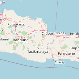
Map view of Gunung Gede Pangrango National Park

Use this park location map to pinpoint Gunung Gede Pangrango National Park in Indonesia, understand its exact geographic position, and read its mapped placement within the surrounding landscape more clearly.

Pigeon | © OpenStreetMap contributors

Location context for Gunung Gede Pangrango National Park

West Java
Park atlas

Trace Surrounding Protected Landscapes, Montane Forests, and Volcanic Terrain in Java, Indonesia

Continue Your Discovery: Nearby National Parks and Protected Areas Beyond Gunung Gede Pangrango National Park

After discovering Gunung Gede Pangrango National Park, browse other national parks and protected areas to compare diverse landscapes across Java and its adjacent regions. This regional park context helps you understand the geographic spread of montane forests, volcanic ecosystems, and significant conservation landscapes, providing valuable comparative insights.
National parkIndonesia
About 50 km away#1 closest

West

Gunung Halimun National Park: Mapped Protected Landscape within Indonesia's Geography

Explore the park's national park designation and regional terrain.

Gunung Halimun National Park stands as a key protected national park in Indonesia, offering a deep dive into its specific geographic identity and landscape context. Through this detail page, users can explore the mapped boundaries, understand its place within the regional geography of Indonesia, and gain insight into its protected area status. This content focuses on the atlas exploration value of Gunung Halimun National Park, detailing its terrain and conservation landscape.

Watercolor illustration of islands with trees and a sunset over the water
National parkIndonesia
About 124 km away#2 closest

North

Kepulauan Seribu National Park: Mapped Marine Protected Landscape in Indonesia

Explore the coral reefs and island geography of this unique national park.

Kepulauan Seribu National Park is a significant marine protected area located in Indonesia's Java Sea. This archipelago comprises numerous islands and extensive coral reef systems, serving as a crucial habitat for diverse marine life, including endangered sea turtles. The park's geography is characterized by low-lying coral islands and underwater reef platforms, offering unique opportunities for understanding marine conservation efforts and island ecosystems within the broader Indonesian context. Its protected status underscores its importance for both ecological preservation and geographic study.

Area
1,074.89 km²
Established
1982
IUCN
II
Visitors
777K annual
National parkBanten
About 142 km away#3 closest

West

Ujung Kulon National Park: Atlas of Java's Last Lowland Rainforest and Protected Landscapes

Explore the unique geography and critical conservation importance of this vital protected area.

Ujung Kulon National Park, located in Banten, Indonesia, is a crucial protected landscape recognized for its ecological significance. This national park represents the last substantial area of lowland rainforest remaining on Java, making it an indispensable sanctuary. It is globally recognized as the primary and final refuge for the Javan rhinoceros, a critically endangered species. The park's geography encompasses the Ujung Kulon peninsula and mountain ranges, alongside vital marine environments, contributing to its status as a UNESCO World Heritage Site and a cornerstone of regional conservation efforts.

Area
497.59 km²
Established
1992
IUCN
II
Visitors
12K annual
National parkIndonesia
About 165 km away#4 closest

East

Mount Ciremai National Park: A Protected Landscape Within Indonesia's Geography

Explore mapped boundaries and regional park context.

This national park in Indonesia provides a unique opportunity to study protected landscape geography. Access detailed information on Mount Ciremai National Park's mapped boundaries and its regional context, contributing to a richer understanding of Indonesia's diverse natural terrain and protected areas. It serves as a crucial point for atlas-based geographic discovery within the archipelago.

Area
155 km²
Established
2004
Visitors
15.1K annual
Relief
Mountain
National parkLampung
About 205 km away#5 closest

Northwest

Way Kambas National Park: Mapped Lowland Rainforest and Wetland Ecosystems

Explore the geography and protected landscape of this Indonesian national park.

Way Kambas National Park in Lampung, Indonesia, is a significant protected area characterized by its extensive lowland rainforest and varied wetland habitats. The park's landscape features swamp forests, coastal fringes, and river systems, creating a unique ecological mosaic. It serves as a critical sanctuary for endangered species, offering a vital context for understanding Sumatra's remaining natural landscapes. Explore the mapped boundaries and geographic identity of this important conservation area.

Area
1,300 km²
Established
1989
IUCN
II
Visitors
2.6K annual
National parkSumatra
About 260 km away#6 closest

Northwest

Bukit Barisan Selatan National Park: Sumatra's Critical Tropical Rainforest Corridor

Explore mapped boundaries and regional geography within this protected area.

Bukit Barisan Selatan National Park is a substantial national park located in Sumatra, Indonesia, designated as a protected landscape along the southern Bukit Barisan mountain range. Spanning a considerable area, it functions as a crucial corridor of tropical rainforest, playing a pivotal role in conservation efforts and the preservation of Sumatra's unique geographic identity. This page serves as a dedicated entry point for understanding the park's protected area status and its mapped presence within the broader regional geography of Indonesia.

Area
3,568 km²
Established
1982
IUCN
II
Relief
Mountain
National parkIndonesia
About 395 km away#7 closest

East

Gunung Merbabu National Park: A Key Protected Landscape in Indonesia's Geography

Explore its mapped protected area boundaries and regional setting.

Gunung Merbabu National Park represents a distinct protected area entity within Indonesia's expansive geography. This page provides detailed information on the park's status as a national park, emphasizing its mapped territory and contribution to the understanding of protected landscapes. Discover its geographic context and how it fits into the broader atlas of Indonesian natural areas, offering a focused view for those interested in regional park geography and landscape exploration.

Area
57 km²
Established
2004
Relief
Mountain
Climate
Tropical
National parkIndonesia
About 397 km away#8 closest

East

Gunung Merapi National Park: Indonesia's Protected National Park Landscape and Geography

Explore mapped boundaries and regional natural terrain within Indonesia.

Gunung Merapi National Park stands as a distinct protected area within the Indonesian atlas, offering insights into its specific landscape and geographic identity. This page provides a focused entry point for understanding the park's designation as a national park, detailing its mapped environmental features and regional context. Discover the characteristics that define Gunung Merapi National Park as a key component of Indonesia's protected lands, facilitating a structured approach to geographic exploration.

Area
64.1 km²
Established
2004
Relief
Mountain
Climate
Tropical

Common questions about visiting, size, designation, and location context for Gunung Gede Pangrango National Park

Gunung Gede Pangrango National Park FAQs for park facts, access, geography, and protected area context

Find quick answers about Gunung Gede Pangrango National Park, including protected-area facts, park geography, trail and visitor context, and how the park fits into its surrounding country and regional landscape.
MoriAtlas Explorer

Continue Your Protected Areas Search Across the Global Atlas

Deepen your exploration by continuing the structured search for national parks and protected areas worldwide. Utilize the comprehensive filtering capabilities to compare different conservation landscapes and refine your understanding of global park geography. Discover more about the distribution and characteristics of protected natural areas.

Global natural geography