
Why Har Us Nuur National Park stands out
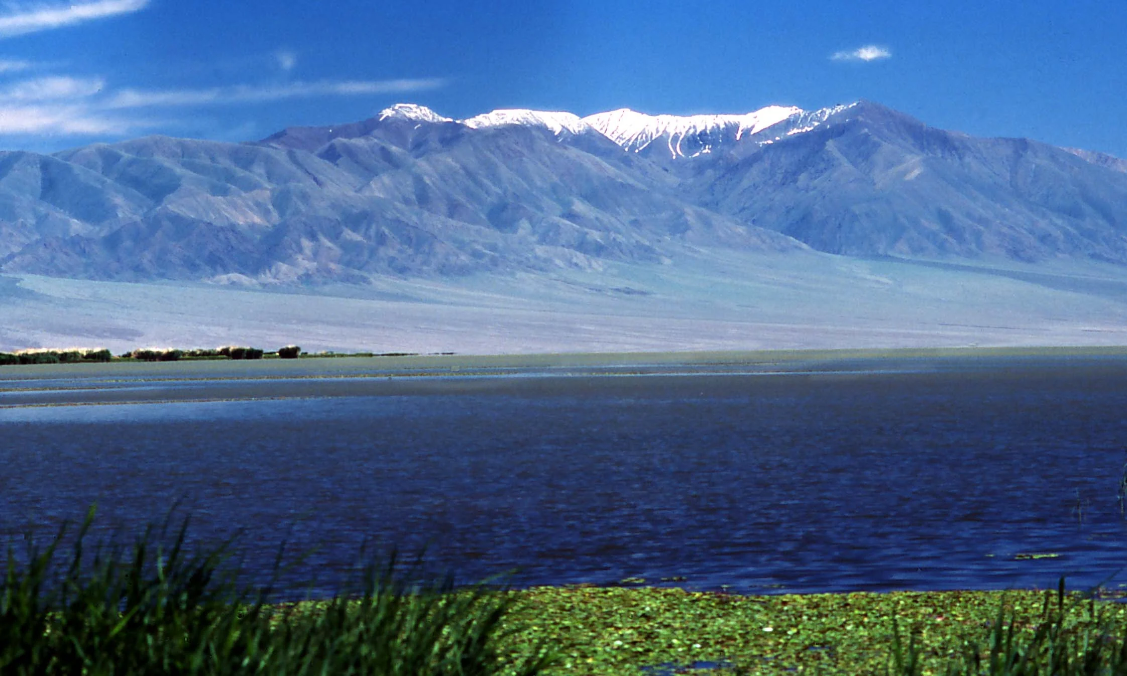
Har Us Nuur National Park is best known for its exceptional importance as a bird sanctuary, particularly for breeding waterfowl and migratory species. The extensive marshes and reed-beds provide critical habitat for the endangered White-headed duck, the near-threatened Dalmatian pelican, and the vulnerable Swan goose. The park's three-lake system, each with distinct freshwater or saline characteristics, creates a diverse ecological environment uncommon in this arid region. The dramatic backdrop of Jargalant Mountain rising from the southern shore adds a striking visual dimension, while the contrast between the wetland complex and surrounding desert steppe defines the park's distinctive character.
Har Us Nuur National Park history and protected-area timeline
Har Us Nuur National Park was established in 1997 as part of Mongolia's expanding network of protected areas designed to conserve the country's most ecologically significant landscapes. The park's designation reflected growing recognition of the Great Lakes Basin's importance as a biological hotspot, particularly for waterbird populations that depend on the region's wetland habitats. Prior to formal protection, the lake system had been subject to various uses including fishing, with infrastructure development along the shores. The establishment came during a period of increased environmental attention in Mongolia following the transition to democracy in the early 1990s, when new protected area legislation enabled the creation of national parks with improved legal frameworks. The park is governed by Mongolia's Ministry of Environment and Green Development, which oversees management priorities balancing conservation with sustainable use of natural resources. In the 1960s, muskrats were introduced to the area for fur production, an action that has since created management challenges as the population has expanded and placed increasing pressure on the critical reed-bed habitats.
Har Us Nuur National Park landscape and geographic character
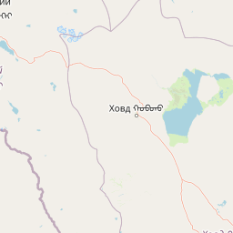
The landscape of Har Us Nuur National Park presents a dramatic interplay between aquatic and terrestrial environments set within the broader context of Mongolia's western mountain and steppe terrain. The three-lake chain occupies a basin surrounded by the foothills of the Altai Mountains, which contribute seasonal meltwater and sediment to the lake system. Khar-Us Nuur dominates the park's central area, its extensive surface area creating a marine-like expanse in this otherwise arid landscape. The lake's western shoreline features a prominent delta where the Khovd Gol deposits sediments, creating a zone of shallower waters and enhanced ecological productivity. The northern portion of Khar-Us Nuur contains Agbash island, a significant landform that breaks the lake's surface and provides terrestrial habitat. The terrain transitions from the lake margins through marsh and reed-bed zones to the surrounding desert steppe, which extends to the park boundaries. Jargalant Mountain rises abruptly along the southern shore of Khar-Us, its steep slopes and alpine character providing sharp contrast to the lakeside wetlands below. The overall visual character combines the horizontal expanse of water with the vertical relief of mountain backdrop, framed by the horizontal sweep of the semi-arid steppe.
Har Us Nuur National Park ecosystems, habitats, and plant life
The nature of Har Us Nuur centers on its wetland ecosystems, which represent isolated pockets of high productivity within the broader desert steppe environment. The marshes surrounding the lakes are dominated by Phragmites communis (common reed), forming extensive beds that provide cover, nesting habitat, and food resources for numerous species. These reed-beds represent the most ecologically productive zones within the park, acting as filters for incoming water and providing critical functions for waterbird reproduction. The lake system itself supports distinct ecological zones based on depth, salinity, and vegetation, with freshwater portions supporting different communities than the saline Dörgön Lake. The Great Lakes Basin desert steppe ecoregion experiences a cold semi-arid climate characterized by precipitation that exceeds evapotranspiration only marginally, making the lake wetlands disproportionately important for regional biodiversity. The presence of three endemic fish species, including the Narrow-headed Altai osman, indicates the evolutionary significance of these lake systems. The annual freeze period from November through April creates a seasonal cycle that influences all ecological processes, while the relatively low annual precipitation of 122 millimeters underscores the rarity and value of the wetland habitats.
Har Us Nuur National Park wildlife and species highlights
The wildlife of Har Us Nuur National Park is defined by its exceptional importance for waterbirds and the presence of specialized aquatic species. Over 200 bird species have been identified within the park, a remarkable number for this interior Asian location. The endangered White-headed duck (Oxyura leucocephala) relies on the marsh habitats for breeding, making the park globally significant for the survival of this species. The near-threatened Dalmatian pelican (Pelecanus crispus) historically bred within the park and continues to use the area as a passage site, though breeding populations have declined in recent years. The vulnerable Swan goose (Anser cygnoides) utilizes the wetlands for breeding and staging during migration. The fish community includes three endemic species, with the Narrow-headed Altai osman (Oreoleuciscus angusticephalus) representing a species found nowhere else. The introduced muskrat has become established throughout the marsh systems since its introduction in the 1960s, creating both ecological interactions and management challenges as populations expand. The surrounding desert steppe supports characteristic fauna adapted to arid conditions, though the park's primary wildlife significance lies in its aquatic and wetland-dependent species.
Har Us Nuur National Park conservation status and protection priorities
Har Us Nuur National Park represents a critical conservation priority within Mongolia's protected area network, safeguarding one of the nation's most important wetland complexes. The park's designation as IUCN Category II reflects its primary function as a national park with comprehensive protection of natural ecosystems. The wetlands are recognized as internationally significant for waterbird conservation, providing breeding habitat for species with global conservation concerns including White-headed duck and Swan goose. The lake system's importance for migratory birds establishes the park as a node within the Central Asian flyway, connecting breeding grounds in Mongolia with wintering areas further south. The presence of endemic fish species underscores the evolutionary distinctiveness of the Great Lakes Basin, while the diverse habitat mosaic spanning freshwater to saline lakes creates ecological complexity worthy of protection. Challenges include managing the introduced muskrat population, which threatens reed-bed integrity, and addressing broader pressures on the lakes from regional water use. Climate change poses additional concerns for semi-arid wetland systems dependent on predictable hydrological patterns.
Har Us Nuur National Park cultural meaning and human context
Har Us Nuur National Park is situated in Khovd Province, a region historically inhabited by Mongolian ethnic groups including the Khalkha and Kazakh communities. The lakes have traditionally supported local communities through fishing, with the regional center of Khovd city located nearby. The Mongolian name "Хар Ус Нуар" translates to "Black Water Lake," reflecting local naming conventions that characterize water bodies by their visual properties. The surrounding desert steppe has supported traditional pastoral lifestyles, with livestock grazing occurring in areas adjacent to the park boundaries. While the park itself does not contain major cultural heritage sites, the landscape represents the broader cultural geography of western Mongolia where nomadic and semi-settled communities have interacted with the lake environments for generations. The area's position within the Great Lakes Basin places it within a region that has been important for trade and movement across Central Asia, though the park's protected status now emphasizes ecological values over historical human uses.
Top sights and standout views in Har Us Nuur National Park
The most distinctive highlights of Har Us Nuur National Park include the three-lake chain system with its mix of freshwater and saline waters, the extensive Phragmites reed-beds that create a nearly continuous marsh around the lake margins, and the dramatic presence of Jargalant Mountain rising from the southern shoreline. The park's global significance for breeding White-headed ducks and other threatened waterbird species makes it a priority destination for conservation-focused visitation. The size of Khar-Us Nuur, at nearly 1,852 square kilometers, creates a landscape where the water surface dominates the horizon in all directions, providing an unexpected marine quality in the Mongolian steppe. Agbash island in the northern portion of the main lake adds diversity to the aquatic environment, while the seasonal freeze of the lakes from November through April creates a dramatic winter transformation of the landscape.
Best time to visit Har Us Nuur National Park
The optimal time to visit Har Us Nuur National Park is during the summer months of June through August, when temperatures are warmest and the lakes are free of ice. This period coincides with the breeding season for waterbirds, offering the best opportunities to observe species such as White-headed ducks and Swan geese in their active breeding behaviors. The reed-beds reach their fullest development during summer, providing lush green habitat contrasts against the desert steppe backdrop. Visitor access during this period is most practical, though the park's remote location in western Mongolia requires planning for transportation from Khovd or other regional centers. Spring and autumn coincide with bird migration periods, when additional species pass through the area, though these shoulder seasons may have more variable weather conditions. Winter visitation is possible but challenging, as the lakes remain frozen from November through April and temperatures drop significantly in this cold semi-arid climate.