
Mori Atlas logo
Protected landscapeHönnetal

Tracing the limestone cliffs, deep river gorges, and historical conservation heritage of this German valley.

Hönnetal Protected Landscape: An Atlas of Karst Topography and Geological Wonders in Nordrhein-Westfalen

(Naturschutzgebiet Hönnetal)

The Hönnetal is a significant karst valley in the Sauerland region of Nordrhein-Westfalen, defined by its massive limestone cliffs and intricate subterranean cave systems. Carved by the river Hönne, this protected landscape connects historic settlements through a complex terrain of gorge forests and dramatic rock formations. Our geographic analysis provides insight into the valley's physical boundaries, its role in modern nature conservation, and the layered intersection of geology and human history.

karst valleylimestone cavesSauerland nature reservegorge forestsFFH arearock climbing heritage
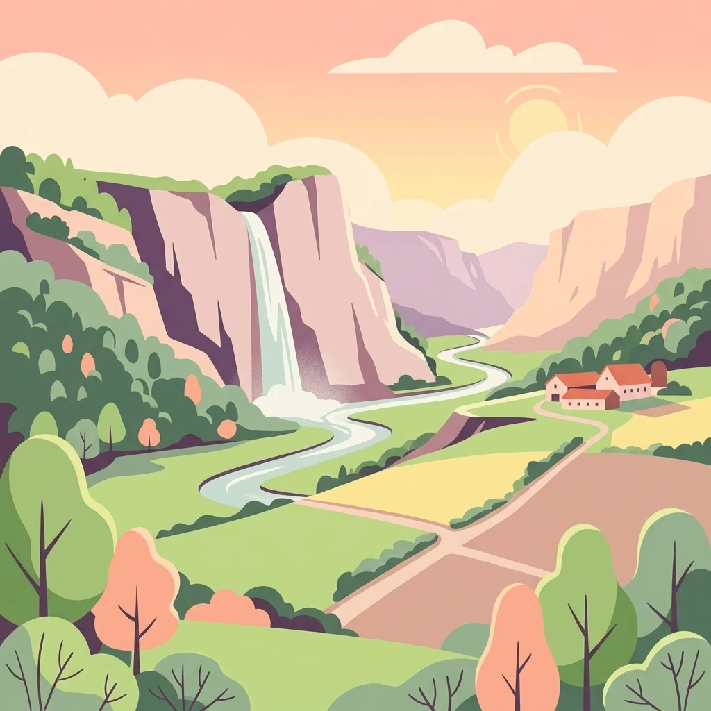
A colorful vector illustration of a valley featuring high cliffs with a waterfall on the left, a winding river, green and brown fields, and a small cluster of houses on the right, surrounded by trees under a pastel sky.

Hönnetal

Protected landscape

Park overview

Structured park overview, official facts, and landscape profile for Hönnetal

Hönnetal park facts, protected area profile, and essential visitor context

Review the core facts for Hönnetal, including designation, size, terrain, visitor scale, habitats, and operating context in one park-focused overview.

About Hönnetal

The Hönnetal is a sweeping river valley in the western Sauerland region of North Rhine Westphalia, Germany, carved over millennia by the river Hönne, a tributary of the Ruhr. Stretching roughly 33 kilometers and draining a basin of over 260 square kilometers, the valley connects a series of historic settlements including Neuenrade, Garbeck, Balve, Sanssouci, Volkringhausen, Binolen, and Menden. It is widely recognized as one of the most significant karst landscapes in Germany, defined by steep limestone cliffs, dense gorge forests, and a vast network of subterranean cave systems.

Beyond its physical geography, the Hönnetal holds a highly layered cultural and historical identity. In the medieval era, its rugged terrain served as a contested borderland between the Catholic Duchy of Westphalia, known as Kurköln, and the Protestant County of Mark. This political division shaped the strategic placement of castles such as Burg Klusenstein and Burg Binolen, which acted as fortified outposts during centuries of regional disputes. The valley's dramatic scenery later captured the imagination of 19th century Romantic writers, notably Levin Schücking and Ferdinand Freiligrath, whose vivid descriptions of the cliffs, mills, and caverns cemented the area's reputation as a landscape of profound natural beauty.

In the contemporary era, the Hönnetal stands as a focal point of European nature conservation, while simultaneously bearing the heavy industrial scars of intensive limestone quarrying and dark chapters of 20th century history. The juxtaposition of preservation, heavy industry, infrastructure, and public recreation makes the Hönnetal an exemplary case study in modern German environmental management, where ancient caves, protected flora, and tragic human history intersect beneath towering white rock faces.

Quick facts and research context for Hönnetal

The Hönnetal is a protected nature reserve in the Sauerland region of North Rhine Westphalia, centered along the 33.4 kilometer course of the river Hönne. The valley encompasses a significant karst landscape characterized by carbonic limestone formations, a large network of caves, and extensive beech forests. Officially secured as a protected area through a pioneering early 20th century conservation movement known as the Schutzaktion, the valley also operates as a European Fauna Flora Habitat site. The modern protected zone spans approximately 144 hectares, safeguarding priority habitats such as gorge forests, limestone pioneer grasslands, and undisturbed subterranean cave environments.

Protection and recognition

Documented terrestrial designation history and Natura 2000 records for Hönnetal

Hönnetal Protection Status and International Recognition Data

Terrestrial protection records detail the designation history and management scope established for Hönnetal since twenty fifteen. Official Natura 2000 listings provide verified international recognition sources for this protected natural area profile.

International recognition

Protection details

Protection scope
Terrestrial
Designated year
2015
Transboundary protection
No
Park context

Deeper park guide and search-rich context for Hönnetal

Hönnetal history, landscape, wildlife, and travel context

Explore Hönnetal through its history, landscape character, ecosystems, wildlife, conservation priorities, cultural context, and seasonal travel timing in a structured park guide built for atlas discovery and search intent.

Why Hönnetal stands out

The Hönnetal is best known for its expansive karst topography, featuring towering white limestone cliffs that rise up to 60 meters above the riverbed. It hosts a remarkable concentration of natural caves, including the culturally significant Balver Höhle and the accessible Reckenhöhle, alongside specialized flora such as orchidée calcareous beech forests. The valley is equally celebrated as the historic site of one of Germany's earliest and most successful civic conservation campaigns, a movement that permanently preserved the iconic shape of the valley against industrial limestone extraction in the early 20th century.
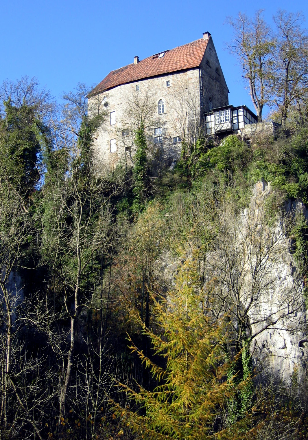
A stone castle with a red tiled roof sits atop a steep rocky cliff surrounded by trees with autumn foliage under a clear blue sky.
Burg Klusenstein castle perched on a limestone cliff in the Hönnetal.

Hönnetal history and protected-area timeline

The human history of the Hönnetal stretches back to the Paleolithic era, when early settlers utilized the natural shelter of the valley's numerous limestone caves. During the Iron Age and Bronze Age, these caverns served as dwelling places, burial sites, and potentially ritual spaces, leaving behind a rich archaeological record. By the Middle Ages, the valley had become a deeply contested political boundary. It largely belonged to the County of Arnsberg within the Catholic Duchy of Westphalia, except for the town of Neuenrade in the upper valley, which fell under the Protestant County of Mark. The shifting border ran through the dense Balver Wald forest and along the river, leading to centuries of localized conflict over resources like oak mast. Border castles like Klusenstein and Binolen emerged as defensive strongholds during this era.

The 19th century introduced widespread industrial extraction to the valley, bringing large scale limestone quarrying operations that fundamentally altered parts of the natural landscape. Following the completion of a dedicated road in 1814, the opening of the Hönnetalbahn railway in 1912 brought further economic integration, though it also raised immediate threats to the valley's geological integrity. To prevent the complete quarrying of the iconic cliffs, a pioneering state led conservation effort known as the Schutzaktion des Hönnetals was initiated in 1912 by the Arnsberg district president. Interrupted by the First World War, the campaign successfully concluded in 1920, securing over 23 hectares of crucial rock formations through public funding and establishing the valley as an official nature reserve.

The valley's 20th century history is also deeply marked by the atrocities of the Second World War. Hidden within the existing quarries near Balve, the Nazi regime constructed a colossal underground facility code named Eisenkies, intended for the production of synthetic aviation fuel. Thousands of forced laborers and concentration camp prisoners were exploited in the construction of these tunnels under the supervision of local Gestapo officials. Many perished from starvation, accidents, and execution. Following the liberation of the valley by the United States Army in April 1945, the area transitioned into a formally protected ecological zone, expanded in 2015, while the physical remnants of the wartime tunnels remain largely inaccessible.

Hönnetal landscape and geographic character

The physical landscape of the Hönnetal is dominated by massive limestone formations that have been shaped by millions of years of chemical weathering and water erosion. The river Hönne carves a distinct path through the terrain, initially flowing towards the northeast before curving northwest toward the Ruhr valley. The valley's defining geological feature is its status as a prominent karst region ; carbonic acid in the groundwater has slowly dissolved the calcium carbonate bedrock, creating an intricate subterranean world of caves, sinkholes, and underground drainage channels.

Above ground, this geological process manifests as towering white and gray cliffs that rise up to 60 meters above the valley floor. Iconic rock formations, such as the Sieben Jungfrauen and the Uhuwand, create dramatic vertical faces that frame the narrow river passages. The topography is further enriched by the Balver Wald, a hilly and heavily forested highland that borders the valley to the west. The changing elevations, combined with the deeply incised river gorges, create a microclimate that supports exceptional biodiversity. The river itself features sections of dry riverbed during the summer months alongside deep, shadowed pools, reflecting the dynamic interaction between the surface water and the underlying karst aquifers.
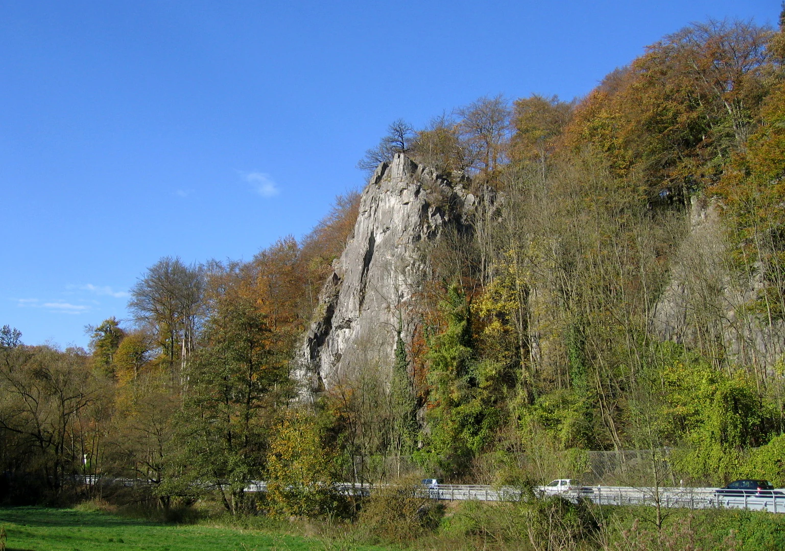
A tall limestone rock formation surrounded by autumn trees with a road and cars at its base under a clear blue sky.
The Sieben Jungfrauen rock formation rising above the autumn forest in the Hönnetal valley.

Hönnetal ecosystems, habitats, and plant life

Ecologically, the Hönnetal is celebrated for its remarkably preserved habitat diversity, which forms the core of its protected environmental status. The steep valley walls host extensive gorge forests, locally known as Schluchtwälder, alongside broad stretches of woodruff beech forest, a specific woodland type characterized by rich, calcareous soil. Higher up the rock faces, the thin layers of soil support delicate limestone pioneer grasslands and highly specialized rock crevice vegetation. These surviving ecosystems are considered priority habitats under European conservation guidelines, making the Hönnetal an essential sanctuary for species that rely on undisturbed calcareous environments.

The continuous canopy of the deciduous forests, combined with the structural complexity of the cliff faces, creates a stable environment for a wide variety of flora and fauna. Ancient woodland indicators flourish in the damp, shaded recesses of the gorge, while rare orchids and nutrient rich herb layers thrive in the calcareous beech forest zones. The untouched nature of the subterranean environment further enhances the ecological profile of the valley, offering a dark, climate stable refuge for specialized organisms that cannot survive in exposed surface conditions. This intact ecological chain, extending from the riverbanks through the ancient forests to the highest cliff ledges, establishes the Hönnetal as a critical node in the regional biodiversity network.
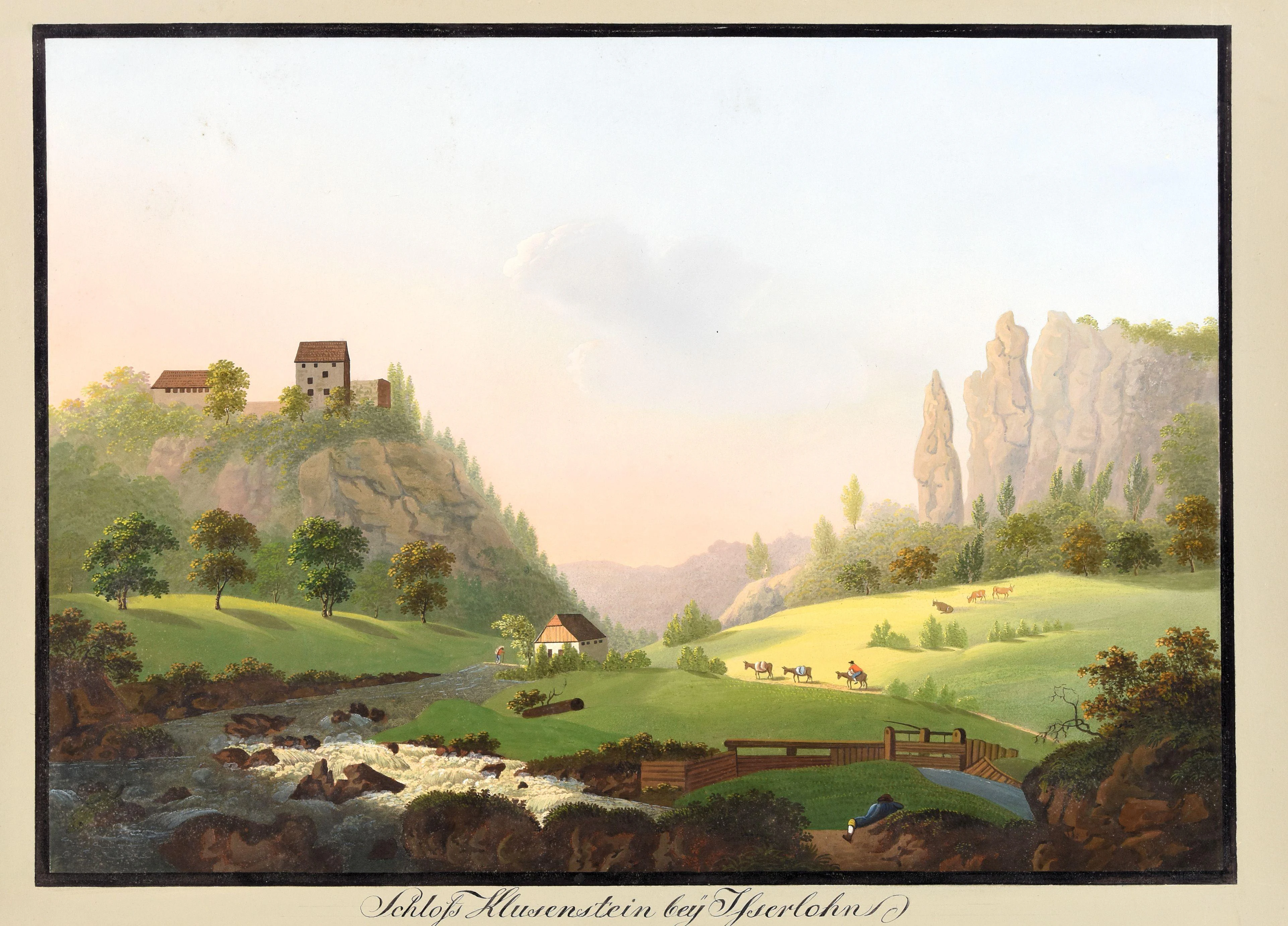
Historical landscape painting from circa 1810 depicting Schloss Klusenstein castle on a rocky hilltop, a river flowing through a green valley, limestone rock formations on the right, grazing animals in meadows, and a figure seated near the water in the foreground
Historical gouache illustration of Schloss Klusenstein near Iserlohn, circa 1810, showing the castle atop a limestone cliff overlooking the Hönne river valley

Hönnetal wildlife and species highlights

The fauna of the Hönnetal is closely tied to the availability of deep limestone crevices, ancient trees, and undisturbed subterranean chambers. The valley is particularly notable for its bat populations, serving as a documented habitat for several protected species, including the pond bat, the greater mouse eared bat, the bearded bat, the Daubenton's bat, and the fringe bat. These mammals rely entirely on the network of non commercial caves and dense woodland cover for roosting and foraging, making the preservation of the valley's structural integrity vital to their survival.

Birdlife also holds a significant place in the valley's ecological history. The high, inaccessible cliffs historically provided secure nesting ledges for large raptors. As early as 1841, historical records document the presence of the Eurasian eagle owl utilizing the ruins of Burg Klusenstein and the surrounding rock reefs, with local chronicles referring to the bird by its older regional name. Later observations also confirmed the valley as a former breeding ground for the Peregrine falcon. While modern conservation efforts and climbing restrictions aim to protect these sensitive nesting sites, the historical presence of these apex predators underscores the valley's capacity to support highly sensitive wildlife populations.
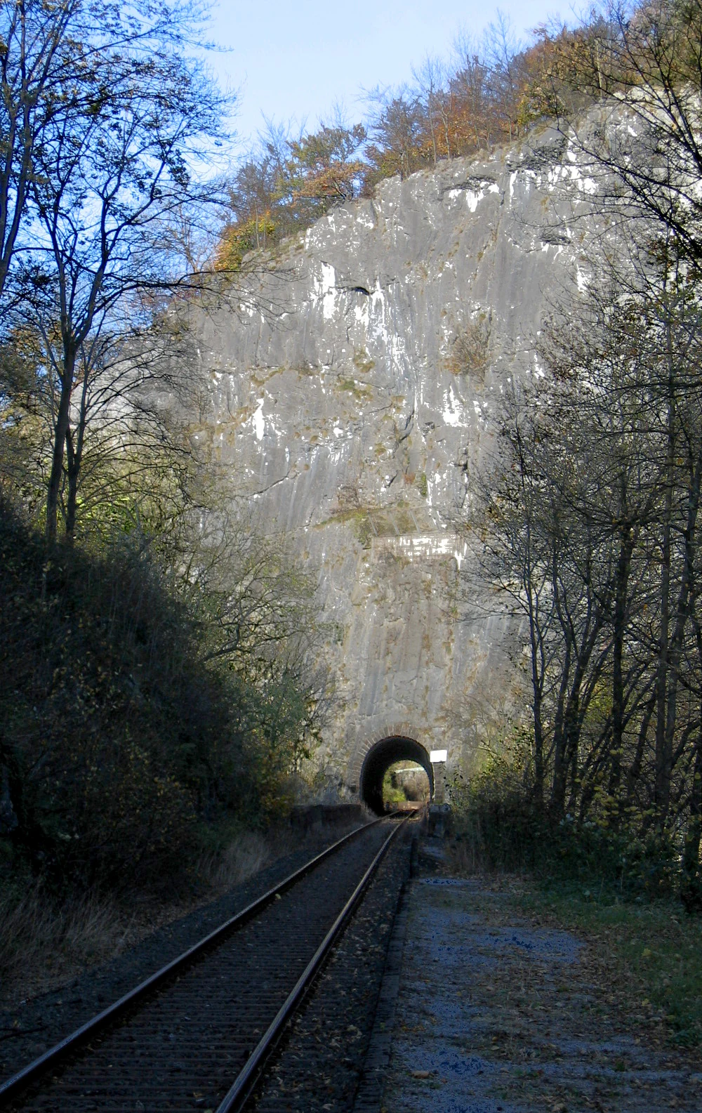
A railway track leading into a dark tunnel entrance carved through a tall gray limestone cliff, with bare and autumn-colored trees on either side under a blue sky
Railway track leading into a tunnel through a limestone cliff face in the Hönnetal valley near Balve

Hönnetal conservation status and protection priorities

The conservation history of the Hönnetal stands as an early and influential model of active landscape preservation in Germany. Faced with the imminent destruction of the valley's famous white cliffs by the expanding limestone industry in the early 20th century, a coalition of state authorities and regional civic groups initiated a mass campaign to purchase the threatened rock faces. By negotiating with industrial operators and utilizing public funds, this movement effectively halted the complete quarrying of the valley, preserving the dominant geological silhouettes and securing the foundational character of the landscape for future generations.

Today, the conservation framework governing the Hönnetal operates on both regional and European levels. The protected nature reserve encompasses roughly 144 hectares, having been significantly expanded in 2015 to include additional ecological corridors. It is concurrently designated as a European Fauna Flora Habitat area under the Natura 2000 network. This dual recognition strictly prioritizes the protection of calcareous beech forests, unpolluted cave systems, and specialized rock habitats. Despite this robust legal framework, the ongoing conservation of the valley involves navigating complex tensions between strict ecological preservation, the presence of active industrial quarries, and the demands of public recreational use.

Hönnetal cultural meaning and human context

The cultural fabric of the Hönnetal is extraordinarily rich, woven from threads of medieval conflict, Romantic artistic appreciation, and profound 20th century tragedy. For centuries, the valley functioned as a frontline in the territorial disputes between the territories of Kurköln and the County of Mark. The physical remnants of this history persist in the form of Burg Klusenstein and Burg Binolen, castles built specifically to enforce shifting political boundaries and control vital river crossings. The lingering memory of these localized feuds is embedded in the regional identity, particularly through the legends and folklore associated with the dense surrounding forests.

In the 19th century, the Hönnetal became an iconic subject of the German Romantic movement. Writers such as Levin Schücking and Ferdinand Freiligrath traveled through the region, immortalizing its subterranean rivers, dramatic gorges, and ancient caverns in widely read travel literature, which characterized the landscape as a deeply emotional and mystical space. By stark contrast, the mid 20th century brought an overwhelming human tragedy to the valley. The hidden construction of a massive underground military complex turned the natural beauty of the location into a site of immense suffering for thousands of forced laborers. Today, the relative absence of expansive public memorials for these victims contrasts sharply with the area's celebrated natural history, leaving a heavy, silent legacy within the cultural consciousness of the region.
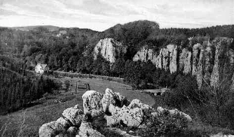
Black and white historical photograph showing a valley with prominent limestone rock cliffs, dense forest, a river winding through the valley floor, and a few buildings in the distance.
Historical black and white view of the Hönnetal valley with limestone rock formations, circa 1903.

Top sights and standout views in Hönnetal

The defining highlights of the Hönnetal are anchored in its profound geological formations, its pioneering conservation history, and its deep cultural footprint. The sheer scale of the white limestone cliffs provides one of the most striking karst landscapes in central Europe, often reaching heights of 60 meters. Embedded within these rocks is a world class network of caves, including the Balver Höhle and the Reckenhöhle, which draw visitors interested in both natural geology and prehistoric archaeology.

Beyond the physical terrain, the valley bears the unique distinction of housing the historical Schutzaktion des Hönnetals, a monumental early 20th century citizen initiative that successfully halted industrial destruction and established the foundation for modern nature reserves. While the surface offers recreational pursuits through extensive hiking networks and a historic railway route, the valley also conceals the vast, sealed tunnels of the Schwalbe I wartime complex, a sobering reminder of hidden historical layers. Together, these elements combine natural wonder, active ecological preservation, and complex human history into a single, cohesive protected environment.
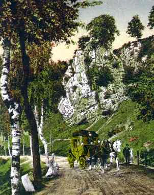
A historical colorized photograph showing a horse-drawn carriage on a dirt road in a valley, with tall limestone rock formations and green trees in the background.
Historical view of the Hönnetal valley with a horse-drawn carriage near limestone cliffs, circa 1901.

Best time to visit Hönnetal

The Hönnetal offers distinct seasonal experiences shaped by its heavy forest cover, deep gorges, and microclimate. Spring brings vibrant new growth to the deciduous beech forests and a fresh atmosphere to the river valleys, accompanied by milder temperatures ideal for exploring the extensive network of hiking trails. Summer offers the warmest conditions, though visitors should expect dense foliage that partially obscures the tallest cliff faces ; this is also the season when the underground caves provide the most refreshing escape from surface heat.

Autumn is widely considered a spectacular time to experience the valley's landscape, as the broadleaf canopy surrounding the river and slopes transforms into shades of yellow, orange, and deep red. The crisp autumn air often enhances visibility, offering clear views of the towering limestone formations and historical castles. Winter introduces a stark, austere beauty to the gorge, though path conditions can become slippery due to ice and wet leaves. Regardless of the season, the sub surface temperatures of the accessible caves remain remarkably constant, offering a year round climatic refuge beneath the shifting surface weather.

Monthly climate preview

Track representative annual temperature ranges and precipitation patterns across twelve recorded months

Hönnetal Climate Normals and Long-Term Weather by Month

Representative coordinate records show measured temperature swings from sub-zero winter minimums to warm summer highs alongside steady daily precipitation averages throughout the year. Reviewing the complete twelve-month climate profile provides detailed historical baseline data for understanding regional meteorological trends.
Annual mean9 °C
0 °C18 °C
Jan
Feb
Mar
Apr
May12°
Jun16°
Jul18°
Aug18°
Sep14°
Oct
Nov
Dec
Warmest month
July

18.2 °C

Coolest month
January

0.3 °C

Wettest month
December

2.7 mm/day

Driest month
April

1.7 mm/day

Park location guide

Geography guide, regional context, and park location map for Hönnetal

Hönnetal park geography, regions, and map view in Germany

Understand where Hönnetal sits in Germany through a broader geographic reading of the surrounding landscape, nearby location context, and its mapped position within the national park landscape.

How Hönnetal fits into Germany

Germany is a federal republic in Western and Central Europe with a population of over 83 million across sixteen constituent states. It is Europe's largest economy by nominal GDP and a major global exporter and importer. The capital is Berlin, and the country borders Denmark, Poland, Czech Republic, Austria, Switzerland, France, Luxembourg, Belgium, and the Netherlands.

Wider geography shaping Hönnetal in Germany

Germany is located in Western and Central Europe, spanning 357,022 km². It borders Denmark to the north, Poland and the Czech Republic to the east, Austria and Switzerland to the south, and France, Luxembourg, Belgium, and the Netherlands to the west. The country has coastlines on the Baltic Sea and North Sea to the north, with the Alps located in the southern region.

Map view of Hönnetal

Use this park location map to pinpoint Hönnetal in Germany, understand its exact geographic position, and read its mapped placement within the surrounding landscape more clearly.

Pigeon | © OpenStreetMap contributors

Location context for Hönnetal

Nordrhein-Westfalen
Recorded earthquake history

Explore Recorded Seismic Activity and Earthquake History for Hönnetal

Access a detailed catalogue of historical earthquakes associated with the Hönnetal valley. This collection presents event data including magnitudes and proximity, providing a factual resource for reviewing the recorded seismic history of this unique German landscape.

Hönnetal Earthquake History

Catalogued events

33 events

Strongest magnitude

Magnitude 4.6

Most recent event

Dec 20, 2008

This history includes earthquakes recorded inside the park or within 50 km of its borders

Explore high-resolution imagery capturing towering limestone cliffs, gorge forests, and subterranean cave environments.

Hönnetal Photos and Landscape Scenery: Visualizing the Protected Karst Valley

Visual documentation of Hönnetal reveals the dramatic scale of vertical rock formations, winding river passages, and dense beech forests defining the protected valley. Photographic records provide essential context for understanding the complex topography, geological features, and natural habitats shaping the regional landscape.

A stone castle with a red tiled roof sits atop a steep rocky cliff surrounded by trees with autumn foliage under a clear blue sky.

An aerial photograph showing a lush green valley with dense forests, agricultural fields, a castle with a red roof, and a limestone quarry in the background.

A tall limestone rock formation surrounded by autumn trees with a road and cars at its base under a clear blue sky.

Historical landscape painting from circa 1810 depicting Schloss Klusenstein castle on a rocky hilltop, a river flowing through a green valley, limestone rock formations on the right, grazing animals in meadows, and a figure seated near the water in the foreground

A railway track leading into a dark tunnel entrance carved through a tall gray limestone cliff, with bare and autumn-colored trees on either side under a blue sky

A wide landscape view of green agricultural fields leading to a large, light-colored limestone quarry cliff face in the distance under a blue sky with scattered clouds.

Black and white historical photograph showing a valley with prominent limestone rock cliffs, dense forest, a river winding through the valley floor, and a few buildings in the distance.

A historical colorized photograph showing a horse-drawn carriage on a dirt road in a valley, with tall limestone rock formations and green trees in the background.

Black and white historical photograph from 1902 depicting a stone arch bridge spanning a rocky riverbed, with a large limestone cliff and trees rising behind it. Text at the bottom reads 'Im romantischen Hönnetal'.

Black and white historical photograph from 1902 showing a view from inside Balver Cave, with the cave opening framing a large leafy tree, a small building, and rolling hills in the background. Text reading Balver Hohle appears in the lower right corner.

Black and white historical photograph from 1901 showing a large cave entrance in a limestone cliff face, surrounded by densely forested hills with a grassy field and scattered trees in the foreground

Interior of a rocky tunnel with rough stone walls and ceiling, utility pipes running along the right side, scattered concrete blocks and debris on the gravel floor, and a dark opening visible at the far end.

Black and white historical engraving depicting the rocky interior of a large cave looking out through a wide arched entrance towards trees and small figures in the distance, with the text 'Die Balver Höhle.' at the bottom.

Park atlas

Compare regional karst landscapes, river valleys, and connected nature reserves

Parks Near Hönnetal and Protected Areas Across the Surrounding Region

Continue exploring protected areas near Hönnetal by examining adjacent river valleys and limestone terrain across the Sauerland region. Comparing these neighboring conservation zones provides a broader geographical perspective on German karst topography and regional ecology.
A soft watercolor painting of a green, rolling valley with a stream winding through the grassy foreground against a background of distant, misty hills.
Nature reserveNordrhein-Westfalen
About 2.9 km away#1 closest

Southeast

Naturschutzgebiet Orlebachtal Protected Stream Valley and Floodplain Geography

A preserved meandering valley in the Sauerland foothills

This nature reserve protects a small but geomorphically active stream valley featuring a clean, oxygen-rich brook and diverse floodplain meadows. Managed through traditional grazing to sustain rare grassland species, the valley provides a representative look at the terrain and riparian ecology of the North Rhine-Westphalia region.

Area
0.151 km²
Established
1989
Relief
Upland
Scope
Terrestrial
A soft watercolor illustration depicting rolling green hills, dense forest patches, and a winding stream flowing through a grassy meadow.
Protected landscapeGermany
3.2 km away#2 closest

Northeast

Luerwald und Bieberbach Protected Landscape: Regional Forest Map and Habitat Overview

A major continuous woodland reserve in North Rhine-Westphalia, Germany.

Spanning the landscape between Neheim and Menden, Luerwald und Bieberbach functions as a critical Special Protection Area. The terrain features extensive beech and oak woodlands intersected by the Bieberbach stream, creating an important haven for woodland species and maintaining a large, undisturbed environmental mosaic across the northern Sauerland.

Nature reserveNorth Rhine-Westphalia
5.6 km away#3 closest

Northeast

Naturschutzgebiet Schakenberg: Protected Beech Forest Landscape and Regional Geography

A rare calcareous woodland reserve in the Hachener Kuppenland

Naturschutzgebiet Schakenberg safeguards a near-natural Waldmeister-Buchenwald forest on a limestone hilltop. This protected area acts as a crucial ecological anchor within the Luerwald and Bieberbach Natura 2000 network, showcasing the distinct hilly topography and forest biodiversity characteristic of the eastern Sauerland.

Area
0.022 km²
Established
1998
Relief
Upland
Climate
Temperate
A watercolor painting depicting a soft-focus landscape with rolling green hills, a small pond or marshy water feature in the foreground, and distant hazy hills in the background.
Nature reserveHochsauerlandkreis
About 6.2 km away#4 closest

East

Naturschutzgebiet Piepenbruch: Protected Spring-Fed Grassland in Hochsauerlandkreis

A localized nature reserve protecting rare wet meadow ecosystems

Naturschutzgebiet Piepenbruch serves as a textbook example of a small-scale, high-value nature reserve. The site provides a critical refuge for rush vegetation and moisture-dependent wildflowers, acting as an important ecological buffer within the broader Flasmecketal landscape protection area of the Hochsauerlandkreis.

Area
0.023 km²
Established
2019
IUCN
IV
Relief
Upland
Nature reserveHochsauerlandkreis
About 6.7 km away#5 closest

Northeast

Naturschutzgebiet Oelinghauser Bruch: Nature Reserve and Protected Brook Valley Map

Detailed geographic overview of Hochsauerlandkreis floodplain forest and valley terrain.

Naturschutzgebiet Oelinghauser Bruch acts as a vital refugium for floodplain and brook-side communities. This nature reserve, situated north of Oelinghausen in the Hochsauerlandkreis region, contains a sharp Kerbtal landform and rare alder-ash wet woodland. The area demonstrates active forest restoration and ecological connectivity across its varied slopes and narrow valley floor.

Area
0.098 km²
Established
1998
Relief
Upland
Climate
Temperate
A horizontal watercolor painting depicting a soft-toned landscape with a winding river, grassy banks, and distant rolling hills in light pastel colors.
Protected landscapeMaerkischer Kreis
About 6.8 km away#6 closest

Southwest

Landschaftsschutzgebiet Balve Mittleres Hönnetal Protected Landscape and Map

Regional geography and forested valley terrain in Maerkischer Kreis

Covering roughly 4,745 hectares, this protected landscape is defined by its extensive beech and spruce woodlands alongside the Hönne river. The area highlights the unique proximity between traditional forest and agricultural zones and residential edges. This atlas entry details the topographic profile and land use patterns found across this distinctive German protected territory.

Area
47.457 km²
Established
1989
Relief
Upland
Climate
Temperate
A soft watercolor painting of a river flowing through a lush green landscape with trees lining both banks under a bright, pale sky.
Nature reserveNorth Rhine-Westphalia
About 10 km away#7 closest

North

Naturschutzgebiet Obergraben westlich Wickede: Protected Floodplain and Nature Reserve Atlas

Mapped Ruhr river habitats and protected meadow corridors in North Rhine-Westphalia

Naturschutzgebiet Obergraben westlich Wickede functions as a vital ecological corridor along the Ruhr, featuring a compact mosaic of floodplain woodland, wet meadows, and river island structures. This nature reserve plays a significant role in supporting waterbird populations and maintaining the connectivity of protected riverine landscapes across North Rhine-Westphalia.

Area
0.47 km²
Established
2002
IUCN
IV
Relief
Lowland
Nature reserveHochsauerlandkreis
About 10 km away#8 closest

East

Naturschutzgebiet Oberes Walpketal: Protected Nature Reserve and Valley Geography

Brook valley habitat in the Hochsauerlandkreis region of Germany.

Located in the Sundern area, Naturschutzgebiet Oberes Walpketal encompasses a 5.6-hectare valley corridor shaped by the upper Walpke stream. The site serves as a vital protected area, showcasing the ecological transition from moist alder riparian forests to upland beech stands typical of the Sauerland landscape. This record outlines the reserve's topography, stream-side composition, and its function as a stepping-stone biotope.

Area
0.056 km²
Established
2019
Relief
Upland
Climate
Temperate

Common questions about visiting, size, designation, and location context for Hönnetal

Hönnetal FAQs for park facts, access, geography, and protected area context

Find quick answers about Hönnetal, including protected-area facts, park geography, trail and visitor context, and how the park fits into its surrounding country and regional landscape.
MoriAtlas Explorer

Continue Your Protected Areas Search Across the Global Atlas

Deepen your exploration by continuing the structured search for national parks and protected areas worldwide. Utilize the comprehensive filtering capabilities to compare different conservation landscapes and refine your understanding of global park geography. Discover more about the distribution and characteristics of protected natural areas.

Global natural geography