
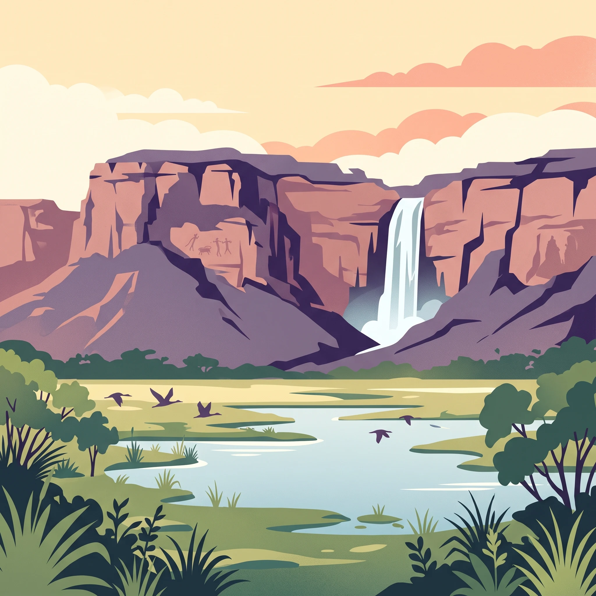
Trip Timing Fundamentals
When Is the Best Time to Visit Kakadu National Park
Deciding on the best time to visit Kakadu National Park requires balancing two fundamentally different experiences. Because the park undergoes dramatic seasonal shifts, the timing of your trip determines which landscapes you will see and which areas remain accessible. There is no single ideal window for every traveler, but rather a choice between the high-utility environment of the dry season and the vibrant, high-energy biological cycles of the wet season.
The Dry Season Advantage
For most visitors, the period from May through September represents the most reliable time to explore the park. During these months, the humidity drops, rainfall becomes negligible, and temperatures generally hover in the comfortable-to-hot range, peaking as the season progresses. This reliability allows for consistent access to the park's extensive network of walking trails, rock art sites like Ubirr and Nourlangie, and standard road connections. If your priority is experiencing the cultural heritage and archaeological sites of the Arnhem Land escarpment, this season provides the most predictable environment for planning and logistics.
The Wet Season Transformation
Visiting outside of the dry months offers a completely different, albeit more volatile, perspective. From roughly December to March, the climate shifts to high humidity and significant precipitation. While this limits land-based travel due to rising water levels, it triggers a transformation in the ecosystem. The escarpment waterfalls, including the iconic Jim Jim and Twin Falls, are at their most active and powerful during these months. Travelers who choose to visit during this time often rely on air-based tours or specific water-bound excursions to see the landscape, as ground access to some remote regions of the park becomes restricted or fully submerged. This period is best suited for those looking to witness the raw, biological intensity of the park rather than those seeking extensive hiking or off-road exploration.
Balancing Access and Experience
Your choice should center on your primary goal. If you want to cover large distances, visit multiple art sites, and hike across the plateau, you must align your travel with the dry season, when the infrastructure supports continuous movement. If, however, you are motivated by the dramatic power of the wetlands and the sight of cascading waterfalls, you must accept the constraints of the monsoon season. The trade-off is clear: you sacrifice total physical mobility during the wet season to gain access to a landscape that is actively evolving and teeming with moisture-dependent life. Regardless of when you choose to arrive, the park's management and current environmental conditions dictate actual access, making it essential to consult official park reports for any changes to site availability before finalizing your itinerary.
Visitor Timing Overview
Best Months to Visit Kakadu National Park for Different Experiences
Peak Travel Windows for Comfortable Exploration
The most accessible time to explore the park falls between May and August, corresponding with the Yegge and Wurrgeng seasons. During these months, the humidity drops significantly, often falling below 50 percent, and daytime temperatures remain manageable compared to the extreme heat of the pre-monsoon period. This window is ideal for visitors prioritizing land-based activities such as hiking to rock art sites or scenic lookouts. The trade-off for this comfortable climate is that many waterfalls, which rely on the heavy rains of the monsoon, may reduce to a trickle or cease flowing entirely during the late dry season. Travelers choosing these months gain consistent weather for outdoor movement but miss the most dramatic visual peak of the major escarpment falls.
The Monsoon Window for Landscape Enthusiasts
Visiting during the monsoon, specifically from December to March, offers a completely different experience focused on the park's raw environmental power. This is when the tropical landscape transforms, with lush vegetation and the highest waterfall activity. Visitors planning their trip during this time must accept significant limitations on mobility, as localized flooding and high water levels often restrict vehicle access to remote areas and some well-known trails. This period is best suited for those interested in birdwatching, the unique green landscapes of the monsoon, and witnessing the park’s water-centric ecological processes. The compromise is high heat, humidity levels that frequently exceed 80 percent, and the necessity of being flexible with itineraries due to changing road conditions.
Transition Seasons and Niche Interests
The shoulder periods of April and October represent distinct timing choices for travelers with specific goals. April, or the Banggerreng season, offers a balance as the floodwaters begin to recede and the climate cools, often providing a rare opportunity to see both the tail end of the lush, green landscape and the return of dry-season accessibility. Conversely, the transition into October, or the late Gurrung season, represents the final stretch of the dry period. This is the hottest part of the year, with maximum temperatures frequently exceeding 40 degrees Celsius. While this season is challenging for long-distance hiking, it provides clear, cloudless skies and concentrated wildlife sightings at remaining waterholes, as animals gather around the last reliable surface water sources. Those visiting in late September and October should prepare for intense heat and prioritize early morning or late afternoon activities, as the midday heat often makes strenuous outdoor exploration physically demanding and unsafe.
Climate and Seasonal Norms
Kakadu National Park Weather and Climate by Month
Understanding the climate of this park requires moving beyond simple temperature ranges to recognize the dramatic shifts in humidity and rainfall that define the Australian tropical savanna. Climate normals indicate a distinct annual cycle where the interplay of solar intensity and moisture levels creates two very different experiences for visitors. These figures reflect long-term trends recorded at a single reference point and should be treated as a guide for what to expect during a visit rather than a precise weather forecast for specific terrain or individual days.
The Shift from Arid Dryness to Monsoon Humidity
The most significant transition in the annual cycle occurs as the year ends. In the mid-year months, particularly June and July, humidity levels are at their lowest point, frequently dropping below 50 percent. This creates the crisp, comfortable conditions often sought for land-based exploration. As the calendar approaches December and January, this moisture profile reverses sharply. Average relative humidity climbs significantly, often exceeding 85 percent during the heart of the monsoon. This surge in humidity is accompanied by a dramatic increase in daily rainfall, signaling a transition that affects visibility, air quality, and the overall feel of the landscape.
Peak Heat and Solar Exposure
Temperature patterns in the park do not follow the typical northern hemisphere summer-winter curve. Instead, the highest average maximum temperatures are recorded in the lead-up to the wet season. September and October consistently emerge as the warmest months, with average maximums often exceeding 40 degrees Celsius. This period, categorized locally as the transition toward the monsoon, sees high sun angles and building cloud cover, which combine to create an intense heat load. Even in the cooler middle months, such as June and July, daily maximums remain high, often reaching the mid-30s. The primary relief in the dry season comes not from a lack of heat, but from the significantly lower humidity, which makes the afternoon temperatures feel less oppressive than the heavy, saturated air found during the wetter months.
Rainfall Patterns and Seasonal Boundaries
The annual rainfall distribution is heavily concentrated in a four-month window. While May through September remain nearly devoid of significant precipitation, the months of January and February see daily rainfall averages frequently surpassing 10 millimeters. This data reflects the monsoon influence where tropical rain cells track across the northern landscape. October and November serve as crucial bridge months where the climate begins to show the first signs of the coming weather change, characterized by erratic thunderheads and shifting wind patterns. Visitors looking at these normals should anticipate that the transition from a bone-dry landscape to a saturated one is rarely instantaneous, though the meteorological data highlights a clear break between the parched conditions of late dry season and the onset of the monsoon.
Influence of Wind and Daylight
Wind speeds are generally higher during the cooler, drier months of May, June, and July, often providing a consistent breeze that assists with managing the afternoon heat. As the wind speeds decrease toward the end of the year, the air becomes more stagnant, which contributes to the feeling of intensity as temperatures peak in October and November. Daylight hours remain relatively stable compared to higher latitudes, fluctuating by only about 90 minutes between the shortest and longest days. This consistency means that regardless of the time of year, visitors can rely on roughly 11 to 12 hours of daylight, allowing for stable planning windows for daily activities throughout the year.
Seasonal dynamics
Understanding Kakadu National Park Weather and Seasonal Transitions
Navigating the Six Seasons of Kakadu
Visitors often expect a standard four-season calendar, but the environmental rhythm of this park is defined by six distinct phases recognized by the Bininj and Mungguy people. These periods track shifts in humidity, wind, temperature, and vegetation, moving beyond simple meteorological averages. Understanding these transitions is essential for timing a trip to align with your personal comfort and interests, as the environment shifts from the arid, cool conditions of the early dry season to the explosive, high-humidity growth of the monsoon.
The Dry Season Transition: Yegge and Wurrgeng
From May through August, the environment enters its most stable phase. Yegge, occurring in May and June, marks the transition from the wet season, characterized by cooling temperatures and a drop in humidity. This is when the wetlands are at their most vibrant, often carpeted in water lilies, providing a brief window of mild weather before the harsher dryness of mid-year. As June moves into August, the region enters Wurrgeng, the early dry season. During these months, the landscape dries significantly, creeks cease their flow, and the floodplains recede. This phase is defined by predictable access and clear skies, though the relative humidity drops to its annual low of around 40 percent, making it a stark contrast to the wetter months.
The Intense Dry: Gurrung and Gunumeleng
From August to October, the park experiences Gurrung, the hot dry season. This is the period of the year with the highest temperatures, where average maximums can exceed 40 degrees Celsius. The environment is extremely arid, and wildlife, such as file snakes and long-term turtles, retreat to the remaining waterholes. This phase is followed by Gunumeleng, or the pre-monsoon, which spans October through December. This transition is marked by the first arrival of thunderclouds and a gradual rise in humidity as the landscape begins to prepare for the heavy rains. Streams start to run again, and the scorched earth begins to show early signs of new growth, signaling that the dry cycle is drawing to a close.
The Monsoon and Recovery: Gudjewg and Banggerreng
The peak of the annual cycle is Gudjewg, the monsoon season, which runs from December to March. This period is defined by high rainfall, significant humidity, and an explosion of life. Landscapes are transformed by fast-growing spear grass and saturated floodplains. Following the heavy rains, the park enters Banggerreng in April, the harvest or clear-sky season. As floodwaters begin to recede and the skies clear, the vegetation remains lush, and the local wildlife focus on caring for their young. This transition month acts as the final reset before the cooling winds of the next dry cycle begin to dominate, completing the annual rhythm that dictates travel access and the visibility of the park's iconic natural features.
Seasonal Experiences
Seasonal Shifts and Visitor Experiences Across Kakadu National Park
Cultural and Natural Rhythms in Activity Planning
Visitors often find that the best time to engage with specific park landmarks depends on the cyclical nature of the environment. The Indigenous six-season framework provides the most accurate guide for anticipating what you will encounter, as these periods dictate where water flows, where wildlife congregates, and where human access is physically possible.
During the Yegge and Wurrgeng seasons, which roughly span from May through August, the landscape is defined by drying floodplains and cooler, more stable weather. This is the period when ground-based exploration of rock art sites like Ubirr and Nourlangie is most supported. Because the humidity levels are significantly lower than during the monsoon months, and the temperature is not consistently reaching the extreme highs seen in October, these months are the most practical for walking. Exposed paths and cliff-top viewings are more comfortable when daily maximums are in the mid-30s Celsius rather than the 40s.
Accessing the Arnhem Land Escarpment
The most dramatic features of the park, such as Jim Jim Falls and Twin Falls, are physically tied to the wet-to-dry transition. In the peak of the monsoon, these areas are often inaccessible due to high water levels and road conditions. As the floodwaters recede during the Banggerreng season in April, access begins to open, but the transition is gradual. Visitors seeking to see waterfalls at their peak flow should note that these features require specific environmental conditions that often conflict with the ease of road travel. If your priority is viewing the escarpment in its most active state, you must balance the potential for restricted access with the visual spectacle of the landscape. Always check current status reports, as the physical ability to reach the southern escarpment country fluctuates annually based on the intensity of the preceding wet season.
Wildlife and Wetland Experiences
For those interested in the park's biodiversity, particularly the birdlife and crocodile populations associated with Ramsar-listed wetlands, the timing of the seasons creates distinct viewing opportunities. During the Gunumeleng and Gudjewg months, when humidity is high and rainfall is frequent, the wetlands become the center of activity. The abundance of surface water means that wildlife is spread across a wider area, while in the late dry season, the shrinking billabongs concentrate the animals, making them easier to spot on cruises. Yellow Water Billabong is a central point for these experiences throughout the year, but the atmosphere and animal behaviors shift noticeably as the water levels move through their annual cycle. Choosing between the lush, green, and water-heavy landscape of the monsoon or the concentrated wildlife viewing of the late dry season is a fundamental trade-off for visitors prioritizing nature photography and biological encounters.
Visitor Priorities
Optimizing Kakadu National Park Visits by Travel Goals
Prioritizing Milder Temperatures for Exploration
Visitors who prioritize cooler walking conditions and lower humidity should target the period from May through July. During these months, the average daily minimums often drop below 15 degrees Celsius, providing comfortable mornings for exploring rock art galleries at Ubirr and Nourlangie without the oppressive heat of the late dry season. This period benefits from low rainfall and clear skies, which are essential for those seeking to traverse walking trails. The compromise for choosing this window is the lack of flowing waterfalls, as many creeks and seasonal cascades have stopped by mid-year. Travelers must accept that these months offer a landscape that is notably arid compared to the lush, flooded conditions found during the monsoon.
Targeting Maximum Landscape Drama and Wetland Activity
For travelers whose primary goal is witnessing the power of the monsoon, including thunderous waterfalls like Jim Jim Falls and the verdant growth of the floodplains, the period from January to March is distinct. This window offers the most significant ecological transformation, where humidity levels consistently exceed 80 percent and daily rainfall is at its annual peak. This intense environment creates a unique visual experience, yet it presents a significant limitation: physical access to many inland sites is heavily restricted due to rising water levels and potential track closures. Choosing this time requires accepting that many land-based activities will be inaccessible, shifting the focus from ground-level exploration to scenic flights or boat-based wildlife viewing.
Balancing Heat and Wildlife Viewing
Those who prioritize seeing high concentrations of wildlife, such as magpie geese and crocodiles, often find the late dry season of August and September highly effective. As surface water shrinks into the remaining billabongs, animals congregate in predictable locations. However, this preference comes with the challenge of extreme heat. Mean temperatures begin to rise sharply, with average maximums climbing toward 40 degrees Celsius and higher by late September. While the weather is dry and highly predictable, visitors must be prepared for the intense heat that accompanies these months, which significantly limits the duration and timing of outdoor activity to the very early morning or late afternoon.
Assessing the Shoulder Season Trade-Offs
The transition months of April and October serve as the primary bridge between the distinct wet and dry climatic patterns. In April, the landscape is often green and receding water allows for the gradual reopening of roads, though temperatures remain warm. In contrast, October signals the arrival of the pre-monsoon, where heat index levels are at their most extreme before the first major rains provide relief. Travelers choosing these periods must accept variable access, as some secondary roads may still be recovering from the previous monsoon or closing in anticipation of the next. These months are best suited for those who prioritize flexibility over certainty, as they offer the possibility of seeing transitional landscapes that are neither fully arid nor fully inundated.
Visitor Access
Seasonal Access and Practical Planning for Kakadu National Park
Navigating Seasonal Road Access
Seasonal changes significantly dictate how you travel within the park. During the dry season months, most main roads and highways remain accessible, allowing for standard vehicle transit between key sites like Jabiru, Cooinda, and the major rock art galleries. However, the wet season introduces dynamic conditions where roads can become impassable due to rising water levels or standard seasonal maintenance protocols. It is essential to understand that while regional climate patterns provide a general outlook on accessibility, actual road status is subject to change at any time. Before you depart, you must consult official resources to confirm whether specific secondary tracks or remote access routes are currently open or restricted.
Transport and Independent Travel
The most flexible way to experience the park is by using your own vehicle. This allows you to follow the Arnhem and Kakadu Highways at your own pace, which is particularly useful for connecting the primary tourism loops. While the main thoroughfares are generally well-maintained, remote areas or specialized routes often require high-clearance or four-wheel-drive vehicles regardless of the season. Rental agreements often include specific clauses regarding where you can drive during different times of the year, so verify your rental terms before planning your itinerary. If you are not traveling by private vehicle, explore regional transport options and guided tour services that operate on seasonal schedules. Because these services are highly dependent on prevailing conditions and demand, verify availability directly with operators well in advance of your trip dates.
Managing Essential Permits and Documentation
Visitors should always verify the most recent requirements for park passes and any necessary permits before arrival. Entry to the park typically requires a valid pass, which can be purchased through official digital channels. While the park is open year-round, specific sites, trails, or campgrounds may operate under varying rules or temporary closures based on management needs, cultural obligations, or safety assessments. Never assume that a site accessible in one season remains open in the next. Always check the latest park alerts and official announcements to confirm current permit requirements and site-specific access regulations for the dates of your visit. Staying informed via official updates ensures your planning remains aligned with the park's current operational reality.
Safety and Preparation
Seasonal Safety and Travel Preparation in Kakadu National Park
Navigating Extreme Heat and Humidity Patterns
Preparation for Kakadu requires an awareness of how local climate normals dictate comfort and safety throughout the year. The transition from the dry, cooler months to the intense build-up of the late dry season introduces significant temperature shifts. Average daily maximums can climb from the mid-30s during the comfortable months of June and July to over 40 degrees Celsius by September and October. During these hotter months, physical exertion levels should be adjusted to reflect the reality that the environment is significantly more taxing than average climate data suggests. Visitors should prioritize early morning or late afternoon activities, avoiding the hottest parts of the day when exposure risk is highest. Hydration is a constant requirement regardless of the season, and because the humidity levels fluctuate from below 40 percent in August to over 80 percent during the peak wet season, the way your body manages heat will change. Recognizing these environmental shifts is essential for managing your own energy and minimizing the risk of heat-related illness.
Seasonal Terrain and Water Safety Considerations
The most significant safety factor in the park relates to its water systems, which change dramatically between the wet and dry seasons. The presence of both freshwater and estuarine crocodiles is a permanent environmental reality. Visitors must strictly adhere to all signage near billabongs, rivers, and coastal areas, as water bodies deemed safe in one season may change status rapidly. Never assume a location is safe for swimming unless it is explicitly designated as such and confirmed by current park updates. Even in designated pools, exercise caution and observe warning signs that are updated based on routine park surveys. If you plan to hike near gorges or waterfalls, be aware that flash flooding can occur during the monsoon transitions, and steep terrain can become treacherous when wet. Always respect cliff edges, particularly when surfaces are slick, as injuries from falls represent a serious risk across the sandstone escarpment.
Essential Preparation for Dynamic Conditions
Effective preparation for a visit is less about a static packing list and more about being ready for environmental variety. During the cooler, dry months, pack layers that allow you to adapt to temperature drops in the mornings and evenings. As you move toward the warmer months, lightweight, breathable clothing that protects against sun exposure and insects becomes the priority. Because mosquitoes and other insects can be prevalent, using reliable repellent is a standard safety measure. When exploring remote areas, ensure you understand how to use emergency communication devices if they are present, and always inform someone of your planned itinerary. Before travelling, check the latest information provided by the Bowali Visitor Centre regarding road access, trail closures, and official safety alerts. Conditions can change rapidly due to fires, sudden rainfall, or management actions, making official updates your most critical source for daily decision-making.
Final Trip Planning
How to Select Your Ideal Time to Visit Kakadu National Park
Balancing Climate Realities and Personal Priorities
Deciding when to travel to Kakadu requires weighing the necessity of physical access against the desire to witness the landscape in its most dramatic states. If your primary goal is to explore the extensive trail networks, visit remote rock art galleries, and traverse the park's secondary roads with confidence, the dry season months from May through August provide the most stable environment. During this period, the lowering of humidity and consistent sunshine facilitates outdoor activity, though the trade-off is a landscape that is visibly dormant and significantly drier than during the monsoon cycle.
Alternatively, if you prioritize viewing the Arnhem Land escarpment at its most vibrant, with waterfalls like Jim Jim and Twin Falls at peak volume, you must consider the risks and limitations of the wet season between December and March. This window offers an entirely different perspective on the park's ecology, but it demands an acceptance of reduced road access, high humidity, and the possibility that significant portions of the infrastructure may be closed due to rising water levels. The transition periods, such as the hot, dry build-up in October or the clearing skies of April, offer a middle ground for those willing to accept higher temperatures in exchange for thinner crowds and changing natural phenomena.
Refining Your Travel Decision
There is no single calendar month that serves every visitor, because the park undergoes such profound shifts in water, heat, and vegetation. Rather than searching for an ideal month, identify which of these environmental shifts aligns with your specific interests. Travelers who suffer from heat sensitivity should focus on the cooler, mid-year months, whereas those interested in the intensity of tropical storm cycles may find the monsoon season more rewarding despite the logistical challenges.
Always remember that climate normals are merely historical averages and cannot predict the specific weather you will encounter. Access to specific sites, trails, and regions within the park can change rapidly based on seasonal rainfall, flood levels, and management decisions. Before finalizing your plans or booking travel, consult current information regarding road statuses, fire management, and park safety alerts provided by the Bowali Visitor Centre or official park authorities. By staying flexible and prioritizing the most recent updates over historical trends, you ensure your visit remains both safe and aligned with the seasonal conditions currently present in the region.