Why Karimunjawa National Park stands out
Karimunjawa is best known for its exceptionally rich coral reef systems, which support 51 genera with over 90 species of coral and 242 species of ornamental fish. The park's fringing, barrier, and patch reefs include protected species such as black coral and organ pipe coral. The islands are famous for the sacred dewadaru tree, an endemic species central to local legend and traditional beliefs. The archipelago also serves as a nesting site for hawksbill and green sea turtles. The blend of pristine marine environments, endemic terrestrial species, and cultural heritage centered on the Sunan Nyamplungan legend makes Karimunjawa distinctive among Indonesia's marine parks.
Karimunjawa National Park history and protected-area timeline
The protection history of Karimunjawa dates to 1986 when the Indonesian Ministry of Forestry declared the archipelago a Strict Natural Reserve through decision No. 123/Kpts-II/1986. This initial protection recognized the area's significant ecological value at a time when marine conservation was still emerging as a priority in Indonesian environmental policy. In 1988, the area received the status of Nature Conservation Area (Kawasan Pelestarian Alam) through Ministry declaration No. 161/Menhut-II/1988. The formal designation as a national park came on February 22, 1999, through decision No. 78/Kpts-II/1999, elevating the protected status to the national park category. Finally, in 2001, an area of approximately 110,117 hectares was declared as a Marine Protection Area, cementing the park's role in Indonesia's marine conservation network. The park is now among the first areas recognized as important for marine biodiversity protection in Southeast Asia, with management overseen by the Ministry of Environment and Forestry.
Karimunjawa National Park landscape and geographic character
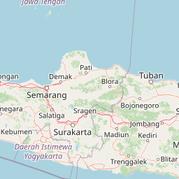
The Karimunjawa archipelago rises from the Java Sea as a collection of 27 islands spanning from 5°49' to 5°57' South Latitude and 110°04' to 110°40' East Longitude. The geological foundation consists primarily of quartz sandstone, gravel, mud, and clay, creating relatively low-lying terrain across most islands. The highest elevation reaches 506 meters at Gajah Hill, which provides panoramic views of the surrounding archipelago. The islands feature white sandy beaches along their coastlines, particularly at locations like Tanjung Gelam, while the interior areas support tropical forest growth. The marine landscape is characterized by clear waters supporting extensive coral reef formations, seagrass beds, and mangrove areas in protected coves. The largest island, Karimunjawa, contains the primary settlements, while islands such as Kemujan, Parang, and Genting also host communities. Many smaller islands remain uninhabited, preserving their natural character. The surrounding sea floor includes the wreck of the Panamanian ship Indono near Kemujan Island, which sank in 1955 and has since become an artificial reef supporting marine life.
Karimunjawa National Park ecosystems, habitats, and plant life
Karimunjawa National Park encompasses five distinct ecosystem types that create remarkable ecological diversity across the archipelago. The coral reef systems represent the most significant marine habitat, consisting of fringing reefs, barrier reefs, and patch reefs that support extraordinary biodiversity. These reefs host 51 genera with more than 90 coral species and 242 species of ornamental fish. Seagrass and seaweed communities dominate certain shallow areas, with ten genera of seagrass recorded and seaweed species distributed across Chlorophyta, Phaeophyta, and Rhodophyta divisions. Mangrove forests cover approximately 300 hectares, providing habitat for 13 genera and 32 mangrove species. The lowland tropical rainforest extends across roughly 1,285 hectares and supports endemic tree species including the sacred dewadaru (Fagraea elliptica), setigi (Pemphis acidula), and kalimasada (Cordia subcordata). Freshwater on the islands is limited to small wells and forest streams, making the terrestrial ecosystems dependent on rainfall patterns.
Karimunjawa National Park wildlife and species highlights
The marine wildlife of Karimunjawa is exceptionally diverse, centered on the coral reef communities that support hundreds of fish species and invertebrates. The reefs contain protected species including black coral, organ pipe coral, hornet helmet, triton trumpet, chambered nautilus, green shell, and six species of clam. Sea turtles regularly nest on the islands, with hawksbill turtles and green turtles among the species recorded. The terrestrial fauna, while less diverse than the marine life, includes notable species such as Javan rusa deer, Sunda pangolin, and Malayan pit viper. The avifauna comprises approximately 40 bird species, including resident birds like green imperial-pigeon, yellow-vented bulbul, and red-breasted parakeet, as well as migratory species such as common sandpiper and whimbrel. The lowland tropical rainforest provides critical habitat for the rare white-bellied sea eagle, while endemic butterfly species include Euploea crameri karimodjawensis and Idea leuconoe karimodjawensis discovered through Indonesian Science Institute expeditions.
Karimunjawa National Park conservation status and protection priorities
Karimunjawa Marine National Park was one of the first areas in Indonesia and Southeast Asia recognized for its importance in marine biodiversity protection. The park was formally declared a Strict Natural Reserve in 1986 and has since been designated as a priority conservation area for marine biodiversity in the region. Management operates through a zonation system that divides the park into sanctuary, wilderness, utilization, and buffer zones. The sanctuary zone covers 1,299 hectares as a no-take area on Burung and Geleang Islands, permitting only research and education. The wilderness zone encompasses 7,801 hectares with limited tourist access, while the utilization zone spans 4,431 hectares for recreational and sustainable use. The buffer zone of 98,093.5 hectares includes inhabited islands. Conservation challenges include habitat degradation and the pressure placed on endemic species like the dewadaru tree through extraction. Current management is working to update the zonation framework to address these dynamic conservation needs.
Karimunjawa National Park cultural meaning and human context
The Karimunjawa archipelago holds deep cultural significance rooted in the legend of Sunan Nyamplungan, one of the Wali Sanga (Nine Muslim Saints of Java). According to tradition, the islands were discovered by Sunan Nyamplungan, the nephew of Sunan Kudu, after he was exiled from his father's home on Mount Muria. The name Karimunjawa derives from the old Javanese word kerimun, meaning vague or unclear, referring to how the islands appear from the mainland Java coast. The sacred dewadaru tree, believed to have sprouted from the walking sticks Sunan Nyamplungan used, remains central to local beliefs and is regarded as a totem guardian of the islands. The local population of approximately 8,842 people comprises diverse ethnic groups including Javanese, Madurese, Bugis, Mandar, Bajak, and Luwu, each contributing to the cultural fabric of the community. The Javanese are known for agricultural activities and craft production, while the Bugis are recognized for seafaring traditions and fishing.
Top sights and standout views in Karimunjawa National Park
Karimunjawa National Park stands out for its combination of world-class diving and snorkeling opportunities among pristine coral reefs, uninhabited islands with secluded beaches, and meaningful cultural heritage. The archipelago offers exceptional marine biodiversity with coral fish populations, sea turtles, and the historic Indono shipwreck. On land, the endemic dewadaru tree and its associated legends provide a unique cultural dimension not found in typical nature reserves. The park supports five major ecosystem types within a relatively compact archipelago, allowing visitors to experience mangrove forests, tropical rainforest, coral reefs, and sandy beaches during a single trip. The diverse ethnic community of fishermen and the traditional practices surrounding the sacred dewadaru tree add depth to the visitor experience beyond pure natural appreciation.
Best time to visit Karimunjawa National Park
Karimunjawa can be visited year-round, though the dry season from April to October generally offers more stable weather conditions for marine activities and island exploration. The surrounding Java Sea tends to be calmer during these months, making boat transfers between islands more comfortable and diving conditions more favorable. The wet season from November to March brings increased rainfall and rougher sea conditions, though this period may offer different marine wildlife viewing opportunities. Water visibility for diving and snorkeling is typically best during the dry season when rainfall is minimal and ocean conditions are calmer. Visitors interested in turtle nesting may find different seasonal patterns depending on the species, while bird observation opportunities exist throughout the year with both resident and migratory species present.