
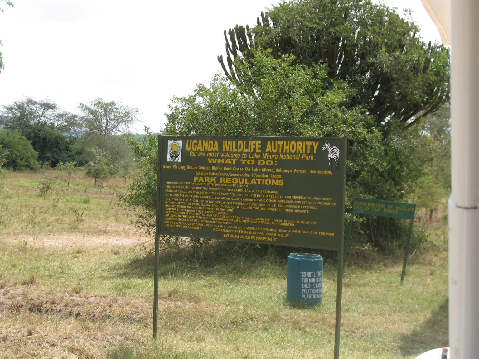
Why Lake Mburo National Park stands out
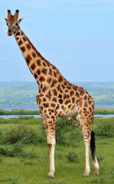
Lake Mburo National Park is best known for its accessible savanna ecosystem and the presence of Rothschild's giraffes, which were introduced to the park in 2015. The park offers one of the few opportunities in Uganda to see zebra in their natural habitat, as these striking striped equids are not found in most other Ugandan protected areas. The park's wetland system, centered on Lake Mburo, supports substantial populations of hippopotamus and provides critical habitat for waterbird species. The landscape features a mix of rolling grasslands and woodland that supports diverse herbivore communities, making it a prime location for wildlife viewing and photographic safaris.
Lake Mburo National Park history and protected-area timeline
The land that now comprises Lake Mburo National Park has a complex history intertwined with the pastoral traditions of the Banyankole Bahima people, who traditionally herded Ankole cattle in the region. The area was first gazetted as a controlled hunting area in 1933 and subsequently upgraded to a game reserve in 1963. The transition to national park status in 1983 was accompanied by the displacement of local pastoralists from their traditional grazing lands, a decision that came during a turbulent period in Uganda's history including the Operation Bonanza massacre and the Ugandan Bush War. In 1985, following the fall of the Obote regime, the previous residents reoccupied the park, destroying infrastructure and displacing park management. By 1986, the National Resistance Movement government had re-gazetted only a portion of the park's original extent. Within the park remain culturally significant sites including Rubanga, where traditional sacrifices were made to the gods, Ruroko associated with the semi-mythical Bachwezi people, and Kigarama, historically used by servants of the king.
Lake Mburo National Park landscape and geographic character
The physical landscape of Lake Mburo National Park centers on the lake itself, a large shallow body of water that dominates the park's central area. The surrounding terrain consists of rolling savanna grasslands interspersed with woodland thickets and areas of wetland along the lake's margins. The park's elevation and positioning create a distinctive ecosystem that differs markedly from Uganda's more famous mountain and forest habitats. The landscape features a mix of open grassland plains where visitors can observe wildlife in relatively unobstructed views, transitioning into denser woodland areas that provide refuge for more secretive species. The wetland areas around the lake create a complex ecological mosaic that supports both aquatic and terrestrial wildlife. The park's position in the Western Region of Uganda places it within a landscape that has been historically important for pastoral activities and continues to maintain cultural connections to the Banyankole people.
Lake Mburo National Park ecosystems, habitats, and plant life
The ecological character of Lake Mburo National Park is defined by its savanna and wetland habitats, which support exceptional biodiversity despite the park's relatively small size. The lake and associated wetlands provide critical habitat for waterbirds and aquatic species, while the surrounding savanna supports diverse herbivore communities. The park's status as an Important Bird Area reflects the presence of over 300 bird species, making it a significant destination for ornithologists and birdwatchers. The ecosystem has experienced notable changes in recent decades, with invasive Acacia hockii colonizing former grassland areas and transforming the habitat structure. This vegetation change has created thicker bush and woodland in areas that were previously more open, affecting wildlife distribution and creating challenges for both conservation management and neighboring communities.
Lake Mburo National Park wildlife and species highlights
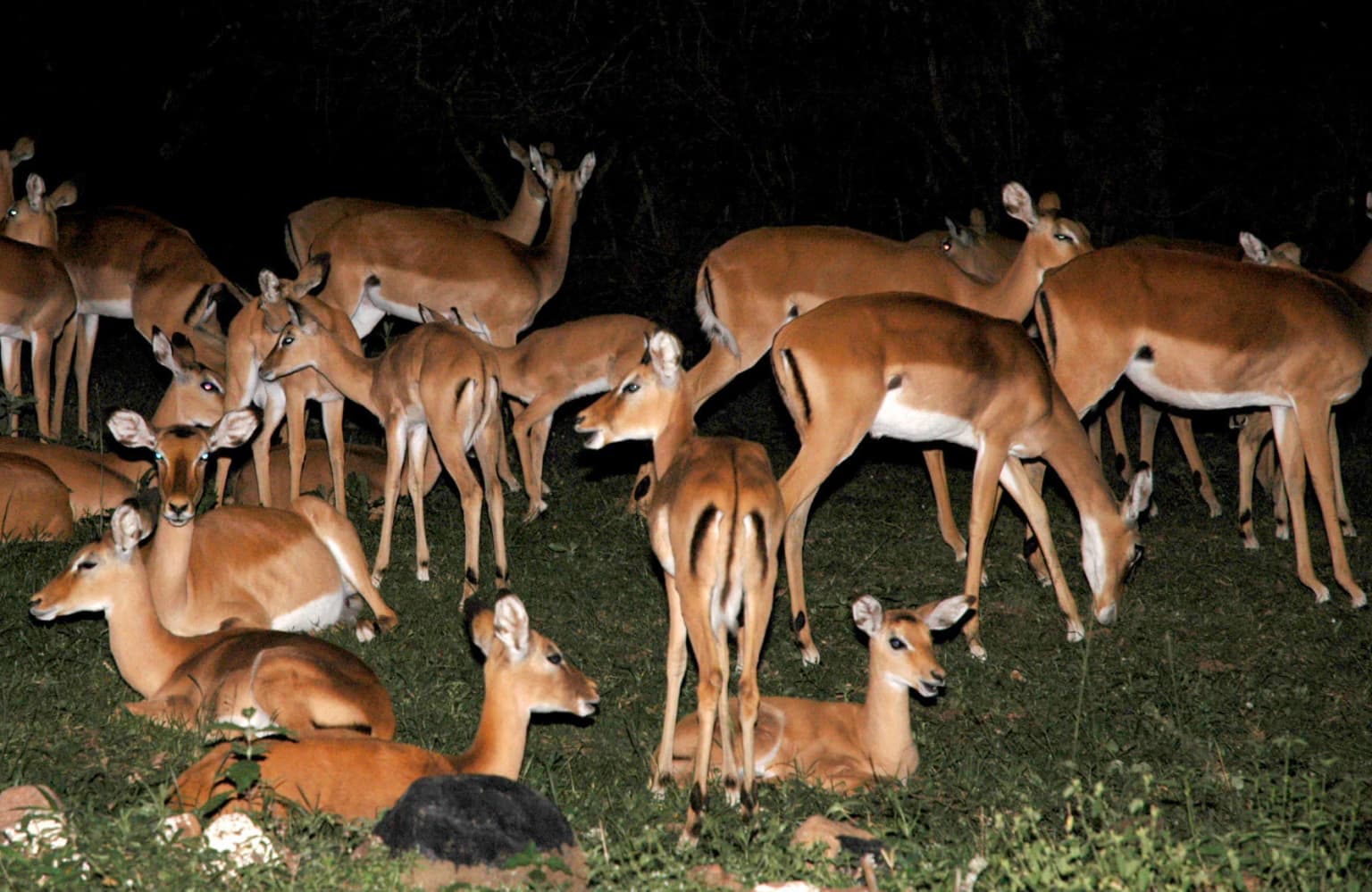
Lake Mburo National Park supports a diverse mammalian fauna characteristic of East African savanna ecosystems. The park is known for its populations of zebra, which represent one of the few reliable locations in Uganda to observe these distinctive animals. Other prominent herbivores include impala, common eland, African buffalo, and warthog, which can be observed throughout the park's grasslands and woodland edges. The park hosts substantial populations of hippopotamus in Lake Mburo, where these large mammals can be observed resting in the water during the day and grazing at night. A population of Rothschild's giraffes was established in the park through translocation in 2015, adding to the diversity of large mammals. Predatory species include leopard, hyena, and smaller carnivores such as genet, African civet, jackals, and serval. The park historically supported lions, but these were eliminated by local communities in the 1980s. A single lion appeared in the park in 2015, having presumably migrated from Tanzania's Kagera Game Reserve, but was ultimately removed after attacking local residents.
Lake Mburo National Park conservation status and protection priorities
Lake Mburo National Park holds significant conservation value as both a national park and a Ramsar-designated wetland. The park's designation as a Ramsar Wetland in 2006 recognizes the international importance of the Lake Mburo-Nakivali Wetland System and commits Uganda to maintaining the ecological character of this wetland habitat. The park functions as an Important Bird Area, supporting populations of waterbird species and contributing to regional biodiversity conservation. Conservation challenges include habitat changes driven by the invasive Acacia hockii, which has transformed former grasslands and affected wildlife distribution. The expansion of woody vegetation has pushed some wildlife onto neighboring private lands, creating human-wildlife conflict issues. Management strategies have included controlled hunting programs, community tourism initiatives, and habitat management efforts, though balancing conservation objectives with community needs remains an ongoing challenge.
Lake Mburo National Park cultural meaning and human context
The area surrounding Lake Mburo has been inhabited by the Banyankole Bahima, a pastoralist community whose traditional lifestyle centers on herding Ankole cattle. The park contains sites of cultural significance to the Banyankole people, including Rubanga, where traditional religious sacrifices were performed, and Ruroko, associated with the Bachwezi, a semi-mythical group in local tradition. Kigarama historically served as a location for servants of the king. The establishment of the national park in 1983 resulted in the displacement of pastoral communities from their traditional grazing lands, a process that created lasting tensions between conservation objectives and local livelihoods. The historical relationship between the Banyankole and the land predates the protected area designation by centuries, and the cultural landscape remains intertwined with the park's present-day identity.
Top sights and standout views in Lake Mburo National Park
Lake Mburo National Park offers a distinctive Ugandan safari experience characterized by accessible savanna wildlife viewing around a central lake ecosystem. The park provides one of the best opportunities in Uganda to observe zebra in their natural habitat, alongside populations of impala, eland, buffalo, and hippos. The introduction of Rothschild's giraffes in 2015 added a notable species to the park's fauna. Bird enthusiasts can explore over 300 species in varied habitats ranging from open water to woodland and grassland. The park's compact size allows for efficient wildlife viewing, while its proximity to Mbarara makes it accessible for shorter visits. The Ramsar-designated wetland provides international recognition of the area's ecological significance.
Best time to visit Lake Mburo National Park
Lake Mburo National Park can be visited throughout the year, though the dry seasons from December to February and June to August typically offer more comfortable conditions for wildlife viewing. During dry periods, wildlife tends to concentrate around the lake and remaining water sources, making animals easier to observe. The wet seasons bring lush green landscapes and excellent birdwatching opportunities, with migratory species present. The park's relatively flat terrain and smaller size compared to larger East African reserves make it suitable for game drives and nature walks that can be enjoyed in any season. Visitors should be aware that the park's accessibility also means it can be quite busy during peak tourist seasons, particularly around holidays.