

Mori Atlas logo
Protected landscapeLake Mead National Recreation Area

A vast protected landscape spanning the convergence of three North American desert ecosystems.

Lake Mead National Recreation Area: Exploring Desert Landscapes and Reservoir Geography

Lake Mead National Recreation Area serves as a pivotal protected landscape in the American Southwest, defined by the engineered waters of Lake Mead and Lake Mohave within the Colorado River corridor. This expansive territory captures a rare meeting point where the Mojave, Great Basin, and Sonoran deserts intersect, creating a complex mosaic of volcanic rock, arid basins, and shoreline topography. Beyond its reservoirs, the area encompasses rugged wilderness, diverse plant communities, and deep canyon stretches that trace the geological history of the region.

desert lakesColorado River corridorMojave DesertSonoran DesertGreat Basin Desertreservoir recreation
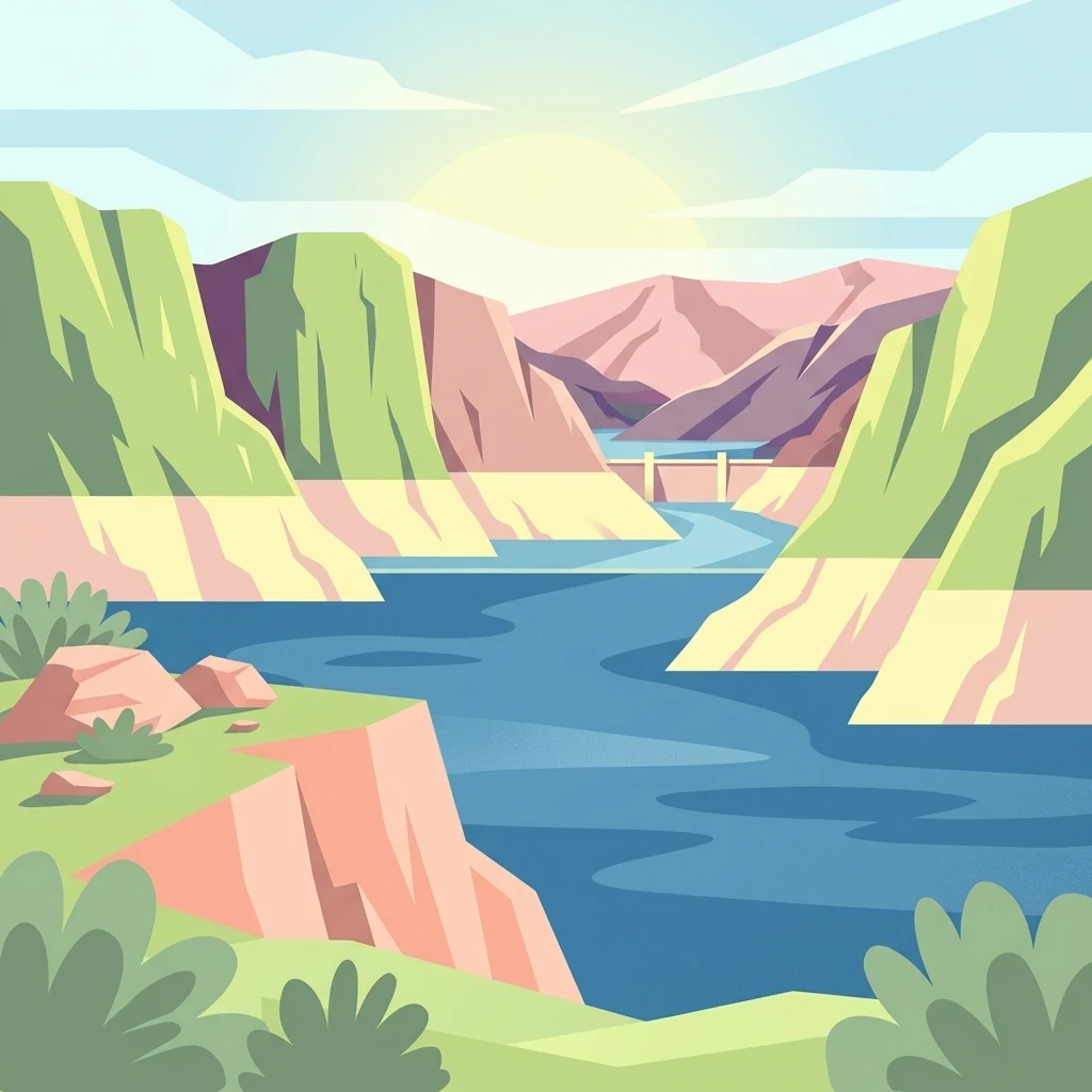
A flat-style vector illustration depicting a wide river flowing between rocky canyon cliffs with a concrete dam visible in the distance under a sunlit sky.

Lake Mead National Recreation Area

Protected landscape

Park overview

Structured park overview, official facts, and landscape profile for Lake Mead National Recreation Area

Lake Mead National Recreation Area park facts, protected area profile, and essential visitor context

Review the core facts for Lake Mead National Recreation Area, including designation, size, terrain, visitor scale, habitats, and operating context in one park-focused overview.

About Lake Mead National Recreation Area

Lake Mead National Recreation Area is one of the most geographically expansive units in the U.S. national park system, following the lower Colorado River through a corridor of reservoirs, canyons, badlands, and desert basins. While many visitors associate it primarily with Lake Mead itself, the recreation area actually encompasses a remarkably diverse landscape shaped by both tectonic geology and engineered water management.

The recreation area lies at a biogeographic crossroads. Three of the four major North American deserts, the Mojave, the Great Basin, and the Sonoran, intersect within Lake Mead NRA, creating transition zones where creosote bush flats meet Joshua tree forest, where cactus-studded bajadas blend into saltbush playas, and where dark volcanic outcrops rise above pale sedimentary slopes. This convergence is not merely a curiosity; it results in unusually high plant diversity and a wide range of habitat types within a relatively compact protected boundary.

Equally important is the recreation area's water-centered identity. Lake Mead, formed by Hoover Dam, and Lake Mohave, formed by Davis Dam, give the park more than 750 miles of reservoir shoreline. These lakes are central to the recreation experience, supporting boating, fishing, swimming, and houseboating, while also creating microclimates along their shorelines that support riparian vegetation and concentrated wildlife activity. Beyond the lakes, river segments, desert washes, and side canyons extend the park's ecological footprint deep into the surrounding arid land.

The recreation area is also notable for its proximity to one of the fastest-growing urban regions in the United States. With Las Vegas and Boulder City nearby, Lake Mead NRA serves as both a heavily used outdoor playground and a significant wildland refuge. Its management balances intensive recreational use in developed zones with wilderness preservation in quieter backcountry areas, nine of which are formally designated under the National Wilderness Preservation System.

Culturally and historically, the area carries layers of significance. The Colorado River corridor here has supported human activity for thousands of years, and the recreation area contains extensive archaeological sites, historic structures, and traditional cultural properties. More recent history, including the construction of Hoover Dam and the founding of Boulder City, continues to shape the modern visitor experience and the park's interpretive identity.

Quick facts and research context for Lake Mead National Recreation Area

Lake Mead National Recreation Area is administered by the National Park Service and spans parts of Clark County, Nevada and Mohave County, Arizona, with Boulder City and Las Vegas as the nearest major cities. It was originally protected as a bird refuge in 1933 and formally established as Boulder Dam Recreation Area in 1936, before being renamed and expanded to become the first designated National Recreation Area in the United States.

Its core features are two reservoirs backed by major twentieth-century dams: Lake Mead behind Hoover Dam and Lake Mohave behind Davis Dam. The recreation area covers more than 1.4 million acres of land and water, includes nine designated wilderness areas in its Nevada portion, and encompasses segments of three major North American deserts.

Protection and recognition

Documented conservation records, management frameworks, and official recognition data

Lake Mead National Recreation Area Protection Status and Official Management Scope

Lake Mead National Recreation Area maintains a mixed protection scope governed by established conservation frameworks and management guidelines. Structured records track available designation details and international recognition sources to support comprehensive park analysis.

Protection details

Protection scope
Mixed
Transboundary protection
No
Park context

Deeper park guide and search-rich context for Lake Mead National Recreation Area

Lake Mead National Recreation Area history, landscape, wildlife, and travel context

Explore Lake Mead National Recreation Area through its history, landscape character, ecosystems, wildlife, conservation priorities, cultural context, and seasonal travel timing in a structured park guide built for atlas discovery and search intent.

Why Lake Mead National Recreation Area stands out

Lake Mead NRA is best known for the convergence of three North American deserts within a single protected landscape, combined with the engineered waters of Lake Mead and Lake Mohave. The recreation area showcases a striking interface between large desert reservoirs and rugged canyon and basin terrain, offering one of the few places in the United States where Mojave, Great Basin, and Sonoran desert ecosystems meet. It is also well known for its association with two major dams of the American West. Hoover Dam and Davis Dam define the recreation area's reservoirs and shoreline character, while the surrounding canyons, volcanic remnants, bajadas, and washes define its terrestrial identity. The combination of accessible water-based recreation and wild desert surroundings gives Lake Mead NRA a distinct dual character that few other park units share.
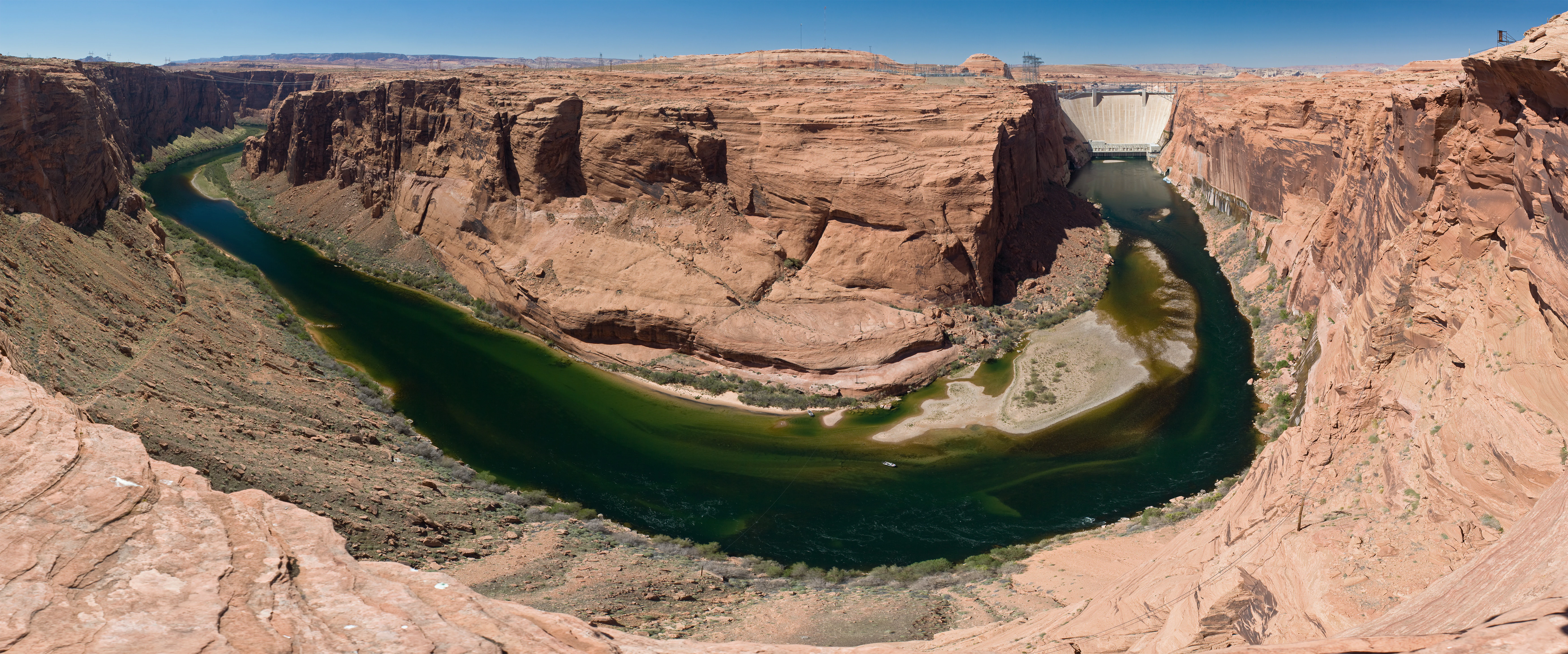
Panoramic view of a deep canyon with reddish rock walls containing a winding green river, with a large dam visible in the distance.
A wide view of the Colorado River winding through the desert canyon near the Glen Canyon Dam.

Lake Mead National Recreation Area history and protected-area timeline

The history of Lake Mead National Recreation Area is closely tied to the transformation of the Colorado River by large-scale water infrastructure and to evolving federal approaches to recreation and conservation.

Efforts to protect the lands around what would become Lake Mead began in 1933, when the area surrounding the future reservoir was designated as a bird refuge. Within a few years, this protective status gave way to a recreation-oriented designation. In 1936, with Lake Mead still filling behind Hoover Dam, the surrounding landscape was formally established as Boulder Dam Recreation Area. The name reflected the dam's original name and recognized the recreational potential of the new reservoir and its desert surroundings.

Lake Mead itself began forming in 1935, shortly before Hoover Dam was completed, and the recreation area quickly became one of the most popular outdoor destinations in the American Southwest. In 1947, the unit was renamed Lake Mead Recreation Area, reflecting both its continued growth in visitation and its expanding identity beyond the Boulder Dam era.

A major expansion came in 1964, when the area was enlarged to include Lake Mohave, the reservoir created by Davis Dam further downstream. This expansion transformed the recreation area into a multi-reservoir, multi-dam corridor along the lower Colorado River and prompted Congress to redesignate it as the first official National Recreation Area in the national park system.

In 2000, a portion of the recreation area was separately designated as Grand Canyon-Parashant National Monument, highlighting the conservation significance of the park's western reaches. Today, Lake Mead NRA remains a landmark in American conservation history as the prototype for the National Recreation Area concept that has since been applied to many other sites across the country.

Lake Mead National Recreation Area landscape and geographic character

The landscape of Lake Mead National Recreation Area is defined by the tension between vast open desert and the long, narrow ribbons of reservoir water that wind through it. The Colorado River corridor cuts deep into the desert plateau, exposing layered sedimentary rocks, volcanic flows, and colorful badlands that shape the area's iconic scenery.

Lake Mead is the larger and more topographically varied of the two reservoirs, sprawling through basins and canyons with finger-like arms that extend dozens of miles into the surrounding mountains. Its shoreline alternates between steep rocky cliffs, broad sandy beaches, narrow slot-canyon inlets, and gentle desert slopes. Notable surrounding features include the Muddy Mountains, the Virgin Mountains, and the rugged desert approaches to the western reaches near Grand Wash Cliffs.

Lake Mohave, downstream of Lake Mead and separated from it by the narrow Black Canyon reach of the Colorado, sits in a more confined canyon setting. Its shoreline tends to be steeper and more dramatic, framed by dark cliffs that suit its calmer, more secluded atmosphere. Where the two lakes meet the river between Hoover Dam and Davis Dam, the Black Canyon stretch offers some of the most visually striking reservoir scenery in the entire recreation area.

Beyond the lakes, the desert landscape is shaped by long-lasting geological processes. Volcanic remnants, uplifted ranges, dry washes, and broad bajada slopes create a varied topography that breaks up the otherwise austere desert vistas. Across the whole recreation area, the interplay of rock, water, and sand defines the visual identity of Lake Mead NRA.
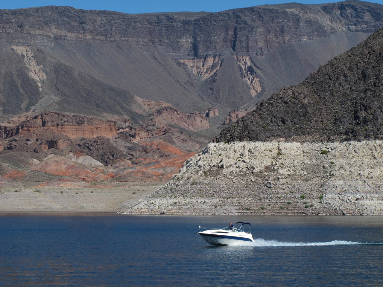
A small white motorboat creating a wake while traveling across dark blue water in front of barren, rocky desert cliffs.
A motorboat cruising on the waters of Lake Mead, surrounded by arid desert cliffs.

Lake Mead National Recreation Area ecosystems, habitats, and plant life

Lake Mead National Recreation Area lies at one of the richest desert ecological crossroads in North America. The convergence of the Mojave, Great Basin, and Sonoran deserts within a single protected area produces remarkable habitat diversity for an arid-land park. Plants and animals typical of all three deserts overlap and transition here, giving the recreation area a uniquely mixed biological character.

Vegetation in the recreation area reflects this desert overlap. Creosote bush and white bursage dominate the hotter, lower-elevation areas associated with the Mojave and Sonoran deserts, while Joshua trees and other Mojave indicators appear on suitable slopes. Blackbrush and other Great Basin-associated species occupy higher and colder terrain. In total, the park supports a large and varied flora for a desert unit, transitioning gradually from one ecological zone to another across relatively short distances.

Riparian habitats line the lakes, the Colorado River, and many of the larger desert washes, sharply contrasting with the surrounding arid land. Cottonwoods, willows, mesquite, and other water-loving trees form narrow green corridors that concentrate wildlife activity and provide critical shade in an otherwise exposed landscape. These riparian zones, though limited in total area, are disproportionately important to the park's overall ecological function.

Wildlife in Lake Mead NRA is shaped by this contrast between harsh desert and life-giving water. Desert mammals roam the backcountry, raptors patrol the canyon walls, and reptiles occupy rocky and sandy habitats across the area, while the lakes, rivers, and riparian corridors support aquatic species, waterbirds, and an unusually dense concentration of birdlife for a desert setting.
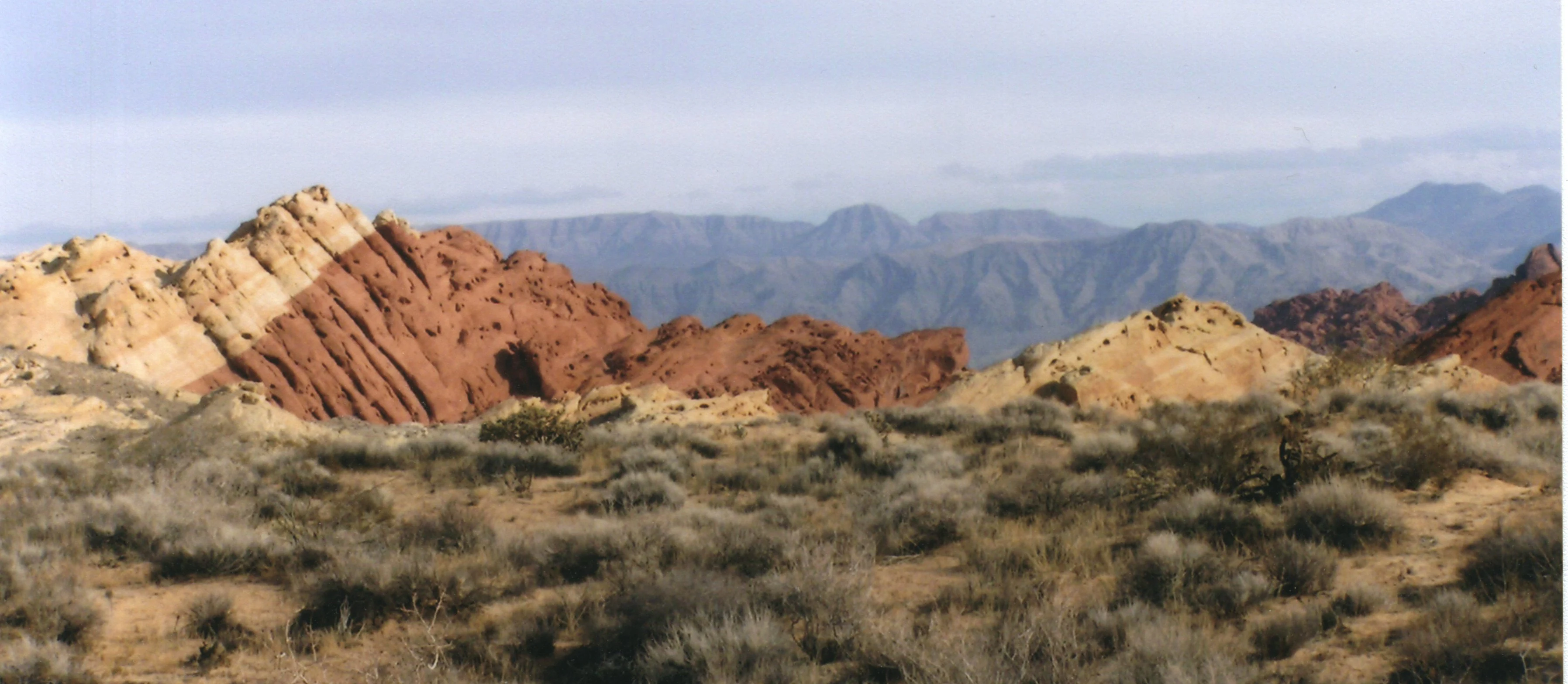
A landscape view showing prominent red and tan sandstone rock formations set against a desert scrub foreground and distant blue-toned mountains.
Red sandstone formations near the Redstone area of Lake Mead National Recreation Area.

Lake Mead National Recreation Area wildlife and species highlights

Lake Mead NRA's wildlife profile reflects its unusual combination of desert and aquatic environments. The recreation area supports a high number of mammal, bird, reptile, and fish species relative to its arid setting, largely because the lakes and riparian corridors provide resources that pure desert landscapes cannot.

Bighorn sheep are among the most iconic terrestrial animals in the recreation area, often seen on rugged slopes and canyon rims. Mule deer, coyotes, bobcats, and kit foxes are also present across the backcountry, while desert tortoise populations represent one of the more sensitive reptile species in the area. Lizards and snakes are common throughout the rocky and sandy desert habitats.

Birdlife is particularly diverse thanks to the lakes and riparian zones. Waterbirds, shorebirds, and raptors all have important habitat here, and the recreation area functions as a significant stopover and wintering area along migration routes. The lakes themselves support large populations of fish and attract fish-eating birds year-round.

The lakes are central to the recreation area's fishing and aquatic wildlife. Striped bass, largemouth bass, catfish, crappie, bluegill, and rainbow trout are among the notable sport fish present, reflecting decades of reservoir management. One of the park's most significant species stories is its role as a refuge for the relict leopard frog, a rare amphibian now believed to survive only in this area, underscoring the conservation importance of the water resources and surrounding desert habitats.

Lake Mead National Recreation Area conservation status and protection priorities

Lake Mead National Recreation Area carries substantial conservation significance not only as protected public land but also as a critical refuge in a heavily developed and water-stressed region. The reservoirs and surrounding desert support habitats for numerous rare, sensitive, and range-restricted species, making the recreation area an important anchor for biodiversity in the lower Colorado River region.

The convergence of three North American deserts within a single protected boundary gives the recreation area a unique conservation value. Protecting transition zones between major desert ecosystems preserves ecological processes and genetic exchanges that would otherwise be vulnerable to fragmentation, climate stress, and development pressure, particularly in a region where Las Vegas and other urban centers continue to expand.

Water itself is a central conservation concern. Lake Mead and Lake Mohave are heavily affected by broader Colorado River water allocation issues, and the recreation area's ecological health is closely tied to reservoir levels. The emergence of the ghost town of St. Thomas as lake levels have dropped is a visible reminder of the dynamic relationship between water levels, human history, and ecological conditions in the park.

Nine designated wilderness areas within the Nevada portion of Lake Mead NRA provide additional protection for fragile desert and canyon ecosystems, limiting development and preserving large tracts of relatively undisturbed habitat. These wilderness areas, together with the broader recreation area, form a key component of regional conservation networks connecting to Grand Canyon National Park, Grand Canyon-Parashant National Monument, and surrounding Bureau of Land Management lands.

Lake Mead National Recreation Area cultural meaning and human context

The lower Colorado River corridor has been inhabited and traveled for thousands of years, and Lake Mead NRA preserves a rich cultural landscape alongside its natural settings. The recreation area contains a substantial number of archaeological sites, historic structures, and traditional cultural properties that reflect both Indigenous presence and more recent settler history.

The area's pre-dam history includes the now-submerged town of St. Thomas, Nevada, founded by Mormon settlers in the late nineteenth century and later inundated by the rising waters of Lake Mead. As reservoir levels have receded in recent decades, the ghost town has reemerged and become a unique cultural attraction within the recreation area, accessible via a short trail near Overton.

The construction of Hoover Dam and, later, Davis Dam transformed the region both physically and culturally, creating the reservoirs that define the park today and supporting the growth of nearby communities such as Boulder City. These engineering achievements remain central to the recreation area's identity and continue to shape how visitors experience the landscape, the lake shorelines, and the broader history of water development in the American West.

Top sights and standout views in Lake Mead National Recreation Area

Lake Mead NRA stands out as a rare landscape where engineered water and wild desert coexist across an enormous protected footprint. The recreation area's most distinctive quality is the junction of three major North American deserts within a single boundary, combined with two large reservoirs and the rugged canyon scenery of the lower Colorado River.

Other notable highlights include the recreation area's collection of nine designated wilderness areas, its status as the first official National Recreation Area in the United States, its significance as habitat for the relict leopard frog, and its layered cultural history ranging from ancient Indigenous presence to the modern reemergence of the ghost town of St. Thomas. The combination of close urban access from Las Vegas and Boulder City with extensive backcountry wilderness makes Lake Mead NRA unusually versatile among units in the national park system.

Best time to visit Lake Mead National Recreation Area

Lake Mead NRA's character shifts meaningfully with the seasons, and the best time to visit depends largely on what kind of experience a traveler is seeking. Spring and fall generally offer the most comfortable conditions for exploring both the lakes and the surrounding desert. Temperatures are milder, the desert vegetation becomes more visible and active, and wildlife viewing opportunities increase as animals concentrate near water sources.

Summer brings intense heat to the open desert, but it is also the peak season for water-based recreation on Lake Mead and Lake Mohave, when the warm reservoir temperatures draw large numbers of visitors for swimming, boating, and houseboating. Winter is the mildest time in terms of temperatures and can be ideal for hiking, sightseeing, and exploring the higher elevations of the recreation area, though some services and water levels may vary. The recreation area's high-elevation and low-elevation terrain mean that conditions can differ significantly between Lake Mead and Lake Mohave, so visitors planning multi-area trips should be prepared for changing weather across the corridor.
Monthly climate preview

Long-term monthly temperature and precipitation rhythm for Lake Mead National Recreation Area

Lake Mead National Recreation Area Climate Normals, Temperature and Precipitation

Representative coordinate records show measured monthly averages ranging from cooler winter lows to high summer peak temperatures alongside varied precipitation totals. Reviewing the complete twelve-month climatology profile provides deeper insight into long-term annual environmental patterns across this protected area.
Annual mean20 °C
7 °C33 °C
Jan
Feb10°
Mar14°
Apr18°
May24°
Jun30°
Jul33°
Aug32°
Sep28°
Oct20°
Nov12°
Dec
Warmest month
July

33 °C

Coolest month
December

7 °C

Wettest month
February

1 mm/day

Driest month
June

0.1 mm/day

Park location guide

Geography guide, regional context, and park location map for Lake Mead National Recreation Area

Lake Mead National Recreation Area park geography, regions, and map view in United States of America

Understand where Lake Mead National Recreation Area sits in United States of America through a broader geographic reading of the surrounding landscape, nearby location context, and its mapped position within the national park landscape.

How Lake Mead National Recreation Area fits into United States of America

The United States of America is a federal presidential republic and one of the world's largest countries by area and population. It consists of 50 states across a vast territory spanning multiple time zones, with its capital in Washington, D.C. and largest city in New York City. The nation has a diverse economy, influential political system, and significant cultural and military presence globally.

Wider geography shaping Lake Mead National Recreation Area in United States of America

The United States occupies a vast territory in North America, bordered by Canada to the north and Mexico to the south. The 48 contiguous states stretch from the Atlantic to the Pacific Ocean, while Alaska occupies the northwestern region and Hawaii is an archipelago in the Pacific. The country encompasses diverse terrain including the Rocky Mountains, Appalachian Mountains, Great Plains, and extensive river systems.

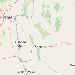
Map view of Lake Mead National Recreation Area

Use this park location map to pinpoint Lake Mead National Recreation Area in United States of America, understand its exact geographic position, and read its mapped placement within the surrounding landscape more clearly.

Pigeon | © OpenStreetMap contributors

Location context for Lake Mead National Recreation Area

ArizonaNevada
Natural feature types

Explore the Natural Features of Lake Mead National Recreation Area

Access the comprehensive atlas of named geographic and natural features associated with Lake Mead National Recreation Area. Use these structured records to trace canyon systems, reservoir geography, and geological landmarks identified by MoriAtlas across this complex desert landscape.
Recorded earthquake history

Explore Historical Earthquake Records for Lake Mead National Recreation Area

Browse the historical catalogue of seismic events recorded in the vicinity of Lake Mead National Recreation Area. This collection provides clear, event-specific data on magnitude and epicentre distance, allowing for a better understanding of the seismic history of this unique desert landscape through the MoriAtlas record.

Lake Mead National Recreation Area Earthquake History

Catalogued events

76 events

Strongest magnitude

Magnitude 3.9

Most recent event

Jun 4, 2026

This history includes earthquakes recorded inside the park or within 50 km of its borders

Visual reference of desert reservoirs, canyon terrain, and protected arid habitats.

Lake Mead National Recreation Area Photos and Desert Landscape Scenery

Examine detailed photographs showcasing the striking convergence of three North American deserts and expansive reservoir shorelines across the protected landscape. Photographic records reveal the rugged geological formations, arid habitats, and dramatic water corridors defining the environment.

Panoramic view of a deep canyon with reddish rock walls containing a winding green river, with a large dam visible in the distance.

A wide landscape photograph showing deep blue water of Lake Mead framed by dark, rocky canyon walls, with a distinct light colored 'bathtub ring' mineral deposit visible along the shoreline.

A small white motorboat creating a wake while traveling across dark blue water in front of barren, rocky desert cliffs.

A landscape view showing prominent red and tan sandstone rock formations set against a desert scrub foreground and distant blue-toned mountains.

Park atlas

Compare regional desert reserves, canyon networks, and adjacent protected terrain

Parks Near Lake Mead National Recreation Area and Related Protected Landscapes

Browsing nearby national parks and regional protected areas helps expand the geographic context established by Lake Mead National Recreation Area. Comparing adjacent desert terrain and river corridors reveals broader ecological patterns across the American Southwest.
National parkArizona
Park boundaries overlap#1 closest

East

Grand Canyon National Park: Arizona National Park Protected Landscape & Geography

Explore mapped boundaries and regional atlas context.

Grand Canyon National Park stands as a premier national park, showcasing a unique protected landscape within Arizona's diverse geography. This detailed entry focuses on the park's specific geographic identity, its mapped boundaries, and its significance within the regional atlas. Discover the contours of this protected area and its place in the natural terrain of the American Southwest.

Area
4,926.08 km²
Established
1919
IUCN
II
Visitors
4.9M annual
Wildlife reserveNevada
About 0.5 km away#2 closest

West

Jimbilnan Wilderness: Geographic Overview and Protected Desert Landscape in Nevada

Mapping the canyons, washes, and plateaus of the Black Mountains

Jimbilnan Wilderness offers a dense mosaic of Mojave Desert habitats within a compact protected footprint. Located in Clark County, this Nevada wildlife reserve features a transition from deep, rocky canyons carved into the Black Mountains to wide desert washes and benches near Lake Mead. The area is notable for its botanical diversity, including rare milkvetch and buckwheat, serving as a critical link between upland desert systems and the lacustrine environment of the reservoir.

Area
76.4 km²
Established
2002
IUCN
Ib
Relief
Mountain
Wildlife reserveClark County
About 1.1 km away#3 closest

East

Jumbo Springs Wilderness: Geographic Profile and Protected Landscape Atlas

A rugged desert preserve in Clark County, Nevada

Jumbo Springs Wilderness preserves a dense concentration of desert geology within a compact footprint. Users can analyze the protected boundaries, which feature Precambrian metamorphic formations and granitic domes that rise above arid drainages. This area functions as a critical desert refuge near the Lake Mead reservoir, providing a distinct look at the transition between rocky mountain slopes and water-influenced desert microhabitats.

Area
18.74 km²
Established
2002
IUCN
Ib
Relief
Upland
Wildlife reserveNevada
About 4.7 km away#4 closest

South

Ireteba Peaks Wilderness: Protected Desert Mountains and Lake Mohave Reservoir Shoreline

Mapping the Eldorado Mountains within southern Nevada desert protected areas.

Spanning the southern Eldorado Mountains and the northern shores of Lake Mohave, Ireteba Peaks Wilderness represents a critical Mojave Desert protected area. This landscape integrates rugged, rocky ridgelines with arid desert slopes and reservoir inlets. Its geographic character, shaped by both federal wilderness designation and proximity to the Avi Kwa Ame National Monument, preserves a vital slice of Nevada desert terrain and native ecological habitat.

Area
132.51 km²
Established
2002
IUCN
Ib
Relief
Mountain
A horizontal watercolor painting depicting soft desert hills in shades of green, yellow, and soft pink.
Wildlife reserveClark County
About 6.9 km away#5 closest

North

Muddy Mountains Wilderness: Geographic Atlas and Protected Desert Landscape Map

Exploration of sandstone terrain and Clark County topography.

Navigate the complex desert geography of the Muddy Mountains Wilderness, a protected area characterized by its vivid red cliffs, ancient cross-bedded sandstone, and steep elevation gains. This atlas entry provides essential context on the wilderness boundaries, regional landscape patterns, and environmental features that define this significant Mojave Desert refuge.

Area
194.87 km²
Established
2002
Relief
Mountain
Water
Minor water
Wildlife reserveArizona
10 km away#6 closest

South

Mount Nutt Wilderness: Mapping the Volcanic Canyons and Desert Landscapes of Arizona

A protected wilderness area in the central Black Mountains

Mount Nutt Wilderness offers a dramatic look at high desert topography, characterized by fortress-like volcanic formations and deeply incised canyons. This protected area in northwestern Arizona provides essential habitat for desert bighorn sheep while showcasing the contrast between sun-baked mesas and lush, spring-fed riparian zones.

Area
114 km²
Established
1990
IUCN
Ib
Water
Minor water
Wildlife reserveArizona
About 33 km away#7 closest

Southeast

Mount Tipton Wilderness: Protected Mountain Geography in Northwestern Arizona

High desert ridgelines and summit forest ecosystems

Mount Tipton Wilderness protects a striking segment of the Cerbat Mountains, characterized by its elevation-driven transition from arid desert lowlands to cooler, forested peaks. This rugged Arizona landscape features narrow spine ridges and the notable rock formations of the Cerbat Pinnacles, offering a preserved backcountry environment for those exploring the region's mountain geology and desert ecosystems.

Area
124.5 km²
Established
1990
IUCN
Ib
Relief
Mountain
A watercolor painting showing soft green hills, distant pink-hued mountains, and a pale blue lake in a serene, stylized landscape.
Protected landscapeNevada
50 km away#8 closest

Northwest

Humboldt, Toiyabe National Forest: Protected Landscape and Regional Mountain Geography

A vast network of Nevada mountain ranges and alpine wilderness

Humboldt, Toiyabe National Forest serves as a defining public land entity across Nevada and eastern California. As the largest national forest in the contiguous United States, it preserves a striking collection of isolated mountain ranges, including the Ruby Mountains and the rugged Jarbidge wilderness, within a broader basin-and-range landscape. Examine the boundaries and terrain that characterize this complex, high-desert ecosystem.

Area
25,454 km²
Established
1908
Relief
Mountain
Access
Easy access

Common questions about visiting, size, designation, and location context for Lake Mead National Recreation Area

Lake Mead National Recreation Area FAQs for park facts, access, geography, and protected area context

Find quick answers about Lake Mead National Recreation Area, including protected-area facts, park geography, trail and visitor context, and how the park fits into its surrounding country and regional landscape.
MoriAtlas Explorer

Continue Your Protected Areas Search Across the Global Atlas

Deepen your exploration by continuing the structured search for national parks and protected areas worldwide. Utilize the comprehensive filtering capabilities to compare different conservation landscapes and refine your understanding of global park geography. Discover more about the distribution and characteristics of protected natural areas.

Global natural geography
