
Why Landstuhler Bruch stands out
The Landstuhler Bruch is best known as a former peatland basin that has been progressively drained and reclaimed, yet still preserves pockets of genuine wetland habitat. Its Geisweiher near Kindsbach stands out as a small but ecologically rich refuge where peat-cutting history meets active conservation, hosting sundews, reed beds, amphibians, and waterbirds in a landscape otherwise shaped by agricultural use. The basin is also notable as the setting of one of the few heron breeding colonies in the Westpfalz and as a reintroduction area for the white stork. The combination of cultural memory, peat-cutting heritage, and surviving bog flora gives it a distinctive identity among Palatinate lowland landscapes.
Landstuhler Bruch history and protected-area timeline
The Landstuhler Bruch has a long history of human interaction, beginning with the Romans, who built a road along its northern margin linking the garrisons of Metz with those of Mainz and Worms. This road, later known as the Königsstrasse and eventually the Kaiserstrasse, passed through what would become the towns of Homburg, Landstuhl, and Kaiserslautern, anchoring a corridor of settlement that has defined the region ever since.
By around the year 1800 the basin still functioned as a vast swamp that could only be crossed on log causeways, with boats needed during the spring floods. Toward the end of the eighteenth century, peat cutting began, beginning the transformation of the wetland. Over the following centuries, the combination of peat extraction and subsequent drainage works steadily lowered the groundwater table. The change was so profound that the basin, despite its position on the windward side of the well-watered Palatinate Forest, now presents itself as a comparatively dry plain.
Formal recognition came on 13 April 1985 when the area was designated a protected landscape. Conservation strategies have since evolved to address the consequences of historical drainage, including the creation of artificial shallow-water habitats like the Kranichwoog, designed to compensate for species losses linked to the lowered water table. The Geisweiher near Kindsbach, preserved as a near-natural site since the early nineteenth century, remains a living reminder of the basin's former bog character.
Landstuhler Bruch landscape and geographic character
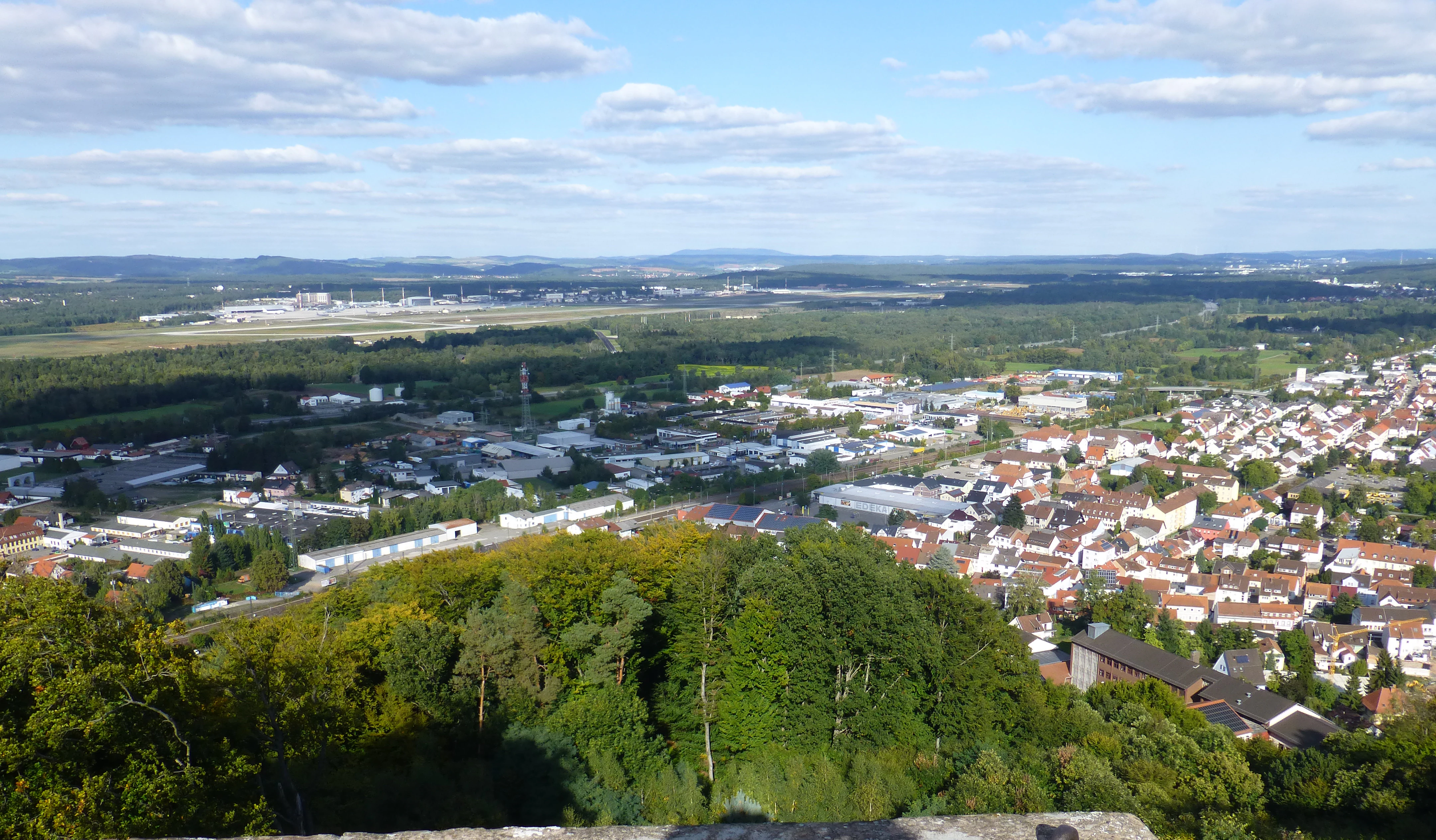
The Landstuhler Bruch is a long, gentle depression stretching about 20 kilometers in length and reaching a maximum width of around 7 kilometers. It runs from the area around Hauptstuhl in the southwest, past Spesbach, Ramstein-Miesenbach, and Landstuhl, toward Kaiserslautern in the northeast. Elevations within the basin are modest, ranging from about 223 meters above sea level in the far west near Hütschenhausen to around 267 meters near Siegelbach to the east.
To the north, the basin transitions gradually into the rolling Nordpfälzer Bergland. To the south, in contrast, the Sickinger Höhe rises steeply from the lowland, presenting a prominent escarpment with roughly 200 meters of sudden relief. This sharp southern edge is one of the most visually distinctive features of the wider Westpfalz landscape, contrasting the flatness of the Bruch with the elevated forested terrain beyond.
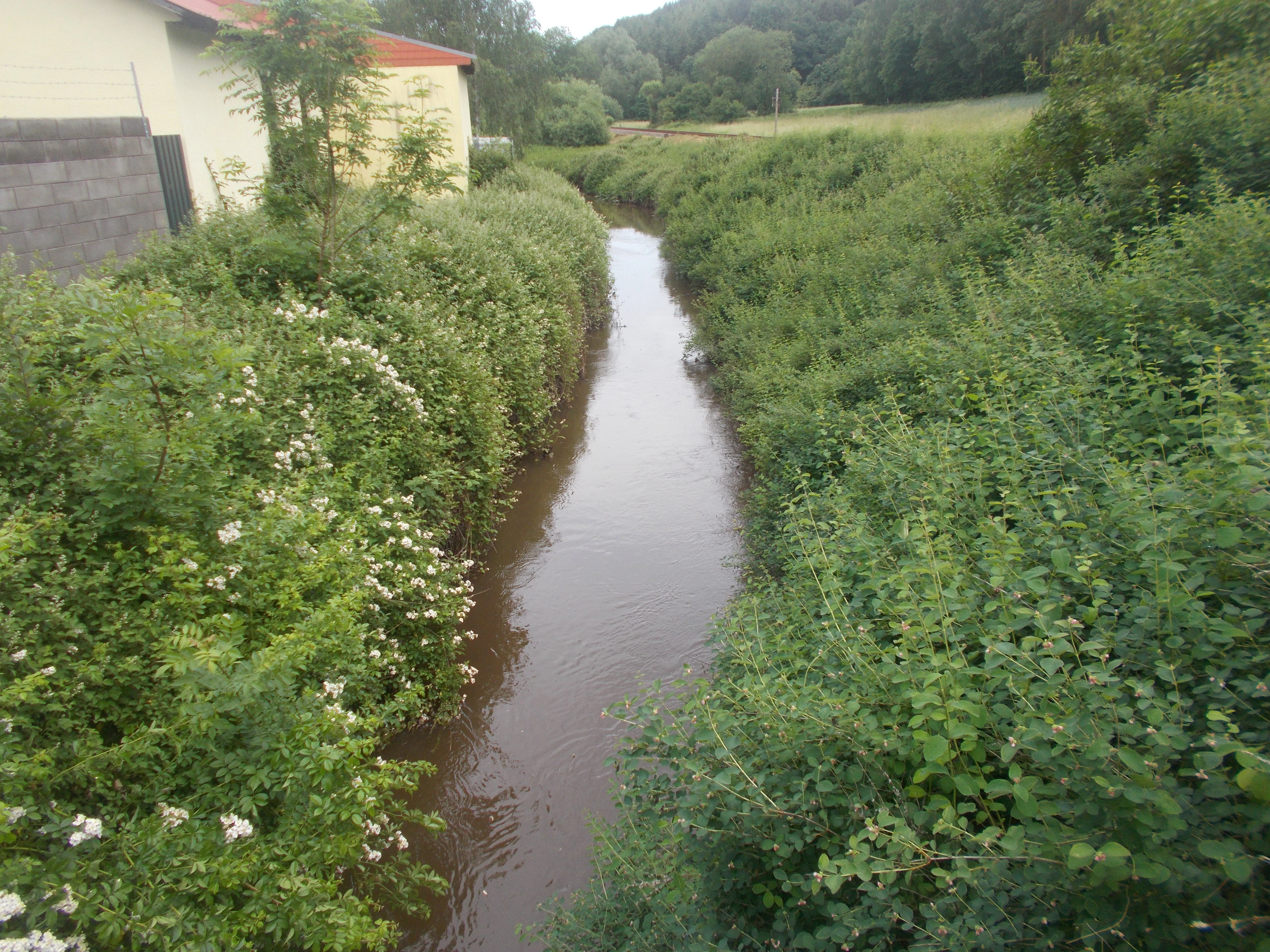
Hydrologically, the basin is defined by a network of small waterways. The Glan river drains the western portion, while the 20-kilometer Mohrbach, which rises near the Moordamm-Mühle, drains the central section before joining the Glan at Niedermohr. In the east, smaller streams flow into the Lauter, regionally also known as the Waldlauter. Although centuries of drainage have reduced the visible wetland character, the basin still retains wet hollows, surviving moors, and restored shallow water features that mark its former identity as a moorland.
Landstuhler Bruch ecosystems, habitats, and plant life
Despite its largely reclaimed appearance, the Landstuhler Bruch preserves a meaningful variety of wetland-related habitats. These include residual reed beds, alder swamp forests, sedge meadows, and other moisture-dependent plant communities. The Geisweiher near Kindsbach, maintained as a near-natural refuge since the early nineteenth century, hosts a notably diverse flora for such a small area, including sundews, carnivorous plants that rely on the open, nutrient-poor conditions historically maintained by peat cutting.
Beyond the Geisweiher, scattered nature and landscape protection areas throughout the basin contribute to a fragmented but ecologically valuable network. The presence of the Kranichwoog, an artificially created area with two shallow ponds south of Hütschenhausen, reflects ongoing efforts to recreate habitat conditions for species affected by historical drainage.
The combination of these protected pockets means that, even within a largely agricultural and infrastructural landscape, the basin still functions as a refuge for moisture-dependent plant communities and a key node for regional wetland biodiversity within the St. Ingbert-Kaiserslautern lowland.
Landstuhler Bruch wildlife and species highlights
The Landstuhler Bruch hosts a distinctive bird community tied closely to its remaining wetland features. Among its characteristic species are the grey heron, for which the area holds the only known breeding colony in the Westpfalz, as well as the reintroduced white stork. Songbirds and waterbirds such as the water rail, moorhen, lapwing, mallard, reed bunting, reed warbler, and kingfisher are also regularly associated with the basin's protected habitats.
Mammal life in the basin reflects its mix of open farmland, scrub, and remnant wet woodland. Wild boar, roe deer, hares, polecats, red foxes, muskrats, water voles, and water shrews are present, some in considerable numbers. The presence of amphibians and a range of wetland birds highlights how, even after centuries of drainage, the basin retains enough ecological structure to support a broad community of fauna tied to wet habitats.
Landstuhler Bruch conservation status and protection priorities
The conservation significance of the Landstuhler Bruch lies in its role as one of the few larger lowland basins in the Palatinate that still preserves meaningful wetland habitat, despite centuries of peat cutting and drainage. Its formal status as a protected landscape under IUCN Category V, established in 1985, reflects the importance of maintaining its mixed land use, scenery, and ecological functions at a regional scale.
At the European level, a 2152-hectare non-contiguous portion of the area is designated as a Fauna-Flora-Habitat site under the Natura 2000 directive. The objectives of this designation center on preserving and developing remaining reed beds, alder swamp forests, sedge meadows, and other moisture-dependent biotopes that have survived the broader drainage of the basin.
Restoration and habitat creation also play a key role. The Kranichwoog shallow-water ponds south of Hütschenhausen were specifically designed to compensate for wildlife losses associated with the lowered groundwater table, while long-standing sites like the Geisweiher continue to demonstrate how carefully preserved fragments can sustain rare flora and fauna. Together, these efforts make the Landstuhler Bruch an example of conservation work that consciously engages with a heavily human-modified landscape.
Landstuhler Bruch cultural meaning and human context
The Landstuhler Bruch is deeply embedded in the cultural geography of the Westpfalz. Its margins once carried an ancient Roman road that later became the Kaiserstrasse, linking Metz with Mainz and Worms and shaping the pattern of towns that still line the basin today, including Homburg, Landstuhl, and Kaiserslautern. Medieval fortifications such as the Burg Nanstein rise above the basin, adding a layer of knightly and dynastic history to the surrounding terrain.
Traditional peat cutting, practiced here since the late eighteenth century, gave rise to a distinct local heritage. Reminders of this past, like the elevated peat cutter's hut near the Geisweiher, continue to mark the relationship between the local population and the wetland landscape. Today, the basin is also a stage for modern geopolitical history: the Ramstein Air Base, located in its eastern portion, is the largest United States Air Force installation outside the United States and serves as the headquarters of United States Air Forces in Europe.
Top sights and standout views in Landstuhler Bruch
The Landstuhler Bruch stands out for the contrast between its drained agricultural plain character and the surviving wetland pockets that give it enduring ecological value. The Geisweiher nature reserve near Kindsbach is one of its signature sites, combining patchy bog flora, including sundews, with habitats for amphibians and waterbirds along a trail network accessible from Forsthaus Kindsbach.
Equally distinctive is the presence of the Westpfalz's only known grey heron breeding colony and the successful reintroduction of the white stork within the basin's protected landscape framework. The combination of Natura 2000 designation, targeted habitat creation at the Kranichwoog, and the area's long cultural memory, from Roman roads to peat-cutting huts, makes the Landstuhler Bruch a quietly rich layer of the Palatinate's natural and historical landscape.
Best time to visit Landstuhler Bruch
The Landstuhler Bruch is best experienced in the warmer months, when the vegetation along the Geisweiher and the wetland edges is most active and the birdlife of the basin is most visible. Spring and early summer are particularly rewarding for those interested in wetland birds, including herons, lapwings, and reed warblers, while late spring through summer brings the most diverse display of bog flora.
Winter visits offer a quieter, more open impression of the basin's flat character, with the southern escarpment of the Sickinger Höhe standing out more starkly against the lowlands. Regardless of season, the area is largely rural and agricultural, so visitors planning to explore the protected sites should expect to walk or cycle along marked paths rather than rely on dense visitor infrastructure.