
Mori Atlas logo
Nature reserveLerchenberg und Kernesbellen von Darmstadt-Eberstadt

Analyzing the inland dune habitats and sand grassland terrain of this Hessian protected area.

Lerchenberg und Kernesbellen von Darmstadt-Eberstadt Nature Reserve and Protected Landscape Geography

(Naturschutzgebiet Lerchenberg und Kernesbellen von Darmstadt-Eberstadt)

The Lerchenberg und Kernesbellen von Darmstadt-Eberstadt nature reserve represents a vital mosaic of inland dune ecosystems situated on the northern Upper Rhine Plain in Hessen. This protected area preserves rare calcareous sand pine forests, xerothermic dry grasslands, and traditional orchard meadows that define the local terrain. Understanding the geomorphological connection to neighboring dune complexes provides essential context for the ecological character of this distinct habitat corridor.

inland dunessand grasslanddry grasslandcalcareous sand pine forestorchard meadowsxerothermic habitats
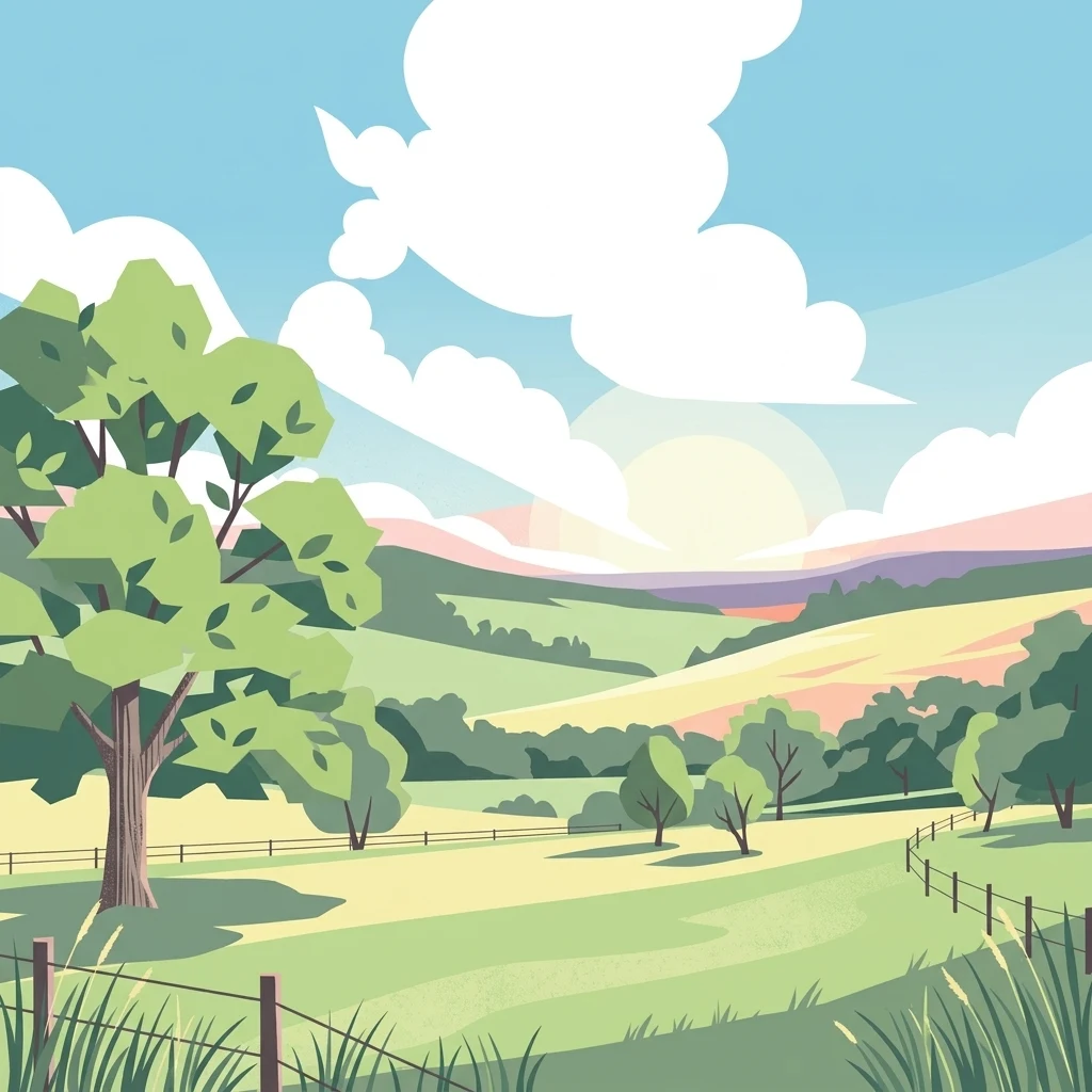
A flat digital illustration showing a rolling green landscape with trees, wire fences, and fluffy white clouds under a blue sky.

Lerchenberg und Kernesbellen von Darmstadt-Eberstadt

Nature reserve

Park overview

Structured park overview, official facts, and landscape profile for Lerchenberg und Kernesbellen von Darmstadt-Eberstadt

Lerchenberg und Kernesbellen von Darmstadt-Eberstadt park facts, protected area profile, and essential visitor context

Review the core facts for Lerchenberg und Kernesbellen von Darmstadt-Eberstadt, including designation, size, terrain, visitor scale, habitats, and operating context in one park-focused overview.

About Lerchenberg und Kernesbellen von Darmstadt-Eberstadt

Lerchenberg und Kernesbellen von Darmstadt-Eberstadt is a compact yet ecologically rich protected landscape situated at the southern edge of the Darmstadt-Eberstadt district in the German state of Hesse. Although it covers only slightly more than 17 hectares, the reserve carries disproportionate significance because it preserves habitats that have become rare across central Europe: open sand dunes, species-rich dry grasslands, light pine forests on calcareous sandy soils, and traditional orchard meadows.

The reserve sits within the larger inland dune system of the northern Upper Rhine Plain, a region shaped by aeolian sand deposits that have produced a chain of surviving dune relics and associated sandy habitats. Lerchenberg and Kernesbellen are essentially part of this larger sandy landscape complex, directly linked to the Brömster dune northeast of the site. Together, these areas form one of the most important inland sand habitat networks in Hesse.

Ecologically, the reserve is defined by a mosaic of dry and semi-dry habitats. Pine mixture woodland (Kiefernmischwald) on calcareous sands, broom-grass steppe grassland (Pfriemengras-Steppenrasen), loose silver-grass dry grassland (Silbergras-Trockenrasen), and xerothermic broom-grass dry grassland all occur within the small footprint of the protected area. These habitats are accompanied by orchard meadows, a traditional land-use element that continues to shape the open, park-like character of portions of the site and supports additional biodiversity.

The reserve's formal protection history reflects the increasing recognition of these sand habitats. Designated as a Naturschutzgebiet in 1995, it was later included as an FFH area in 2000, aligning its national protection with the European Natura 2000 network and emphasizing its value for threatened habitat types listed under the EU Habitats Directive. The site's designation explicitly aims not only at protecting individual species but also at maintaining landscape connectivity with the neighboring Brömster reserve, reinforcing its role as a node within a broader sandy-habitat corridor.

Today, Lerchenberg und Kernesbellen von Darmstadt-Eberstadt is one of several closely related Darmstadt dune and dry-grassland reserves, alongside sites such as Düne am Ulvenberg, Griesheimer Düne, and the streuobst-dominated areas of Eberstadt and Prinzenberg. Within this local network, the reserve stands out for its combination of pine forest, exposed sand grassland, and long continuity of protection, making it a key reference site for inland dune conservation in southern Hesse.

Quick facts and research context for Lerchenberg und Kernesbellen von Darmstadt-Eberstadt

Lerchenberg und Kernesbellen von Darmstadt-Eberstadt is a German nature reserve (Naturschutzgebiet) and a designated FFH (Habitats Directive) site situated in the southern part of the Darmstadt-Eberstadt district in Hesse. The reserve became legally protected in 1995 and was designated as an FFH area in 2000, placing it within the European Natura 2000 ecological network. It covers about 17.19 hectares and is classified under IUCN Category IV as a habitat and species management area.

The reserve lies within the inland dune landscape of the northern Upper Rhine Plain, forming a landscape continuum with the neighboring Brömster dune. Its vegetation combines light calcareous sand pine forest, broom-grass steppe vegetation, loose silver-grass dry grassland, xerothermic broom-grass dry grassland, and orchard meadows, supporting a notable concentration of endangered species in a small area.

Protection and recognition

Examining documented international recognition and Natura 2000 protected area designations.

Lerchenberg und Kernesbellen von Darmstadt-Eberstadt Protection Status and Designation Records

Lerchenberg und Kernesbellen von Darmstadt-Eberstadt maintains verified conservation records including established Natura 2000 recognition. Structured registry data outlines the official protection framework governing this protected area.
Park context

Deeper park guide and search-rich context for Lerchenberg und Kernesbellen von Darmstadt-Eberstadt

Lerchenberg und Kernesbellen von Darmstadt-Eberstadt history, landscape, wildlife, and travel context

Explore Lerchenberg und Kernesbellen von Darmstadt-Eberstadt through its history, landscape character, ecosystems, wildlife, conservation priorities, cultural context, and seasonal travel timing in a structured park guide built for atlas discovery and search intent.

Why Lerchenberg und Kernesbellen von Darmstadt-Eberstadt stands out

The reserve is best known for preserving a fine example of the inland dune and sand grassland ecosystems of the northern Upper Rhine Plain. Its open, light calcareous sand pine forests and xerothermic dry grasslands are the signature features of the site, providing habitat for many threatened and regionally rare plants and animals that depend on sandy, nutrient-poor substrates and warm microclimates. It is also recognized for its close ecological connection to the Brömster dune, a nearby inland dune that forms a contiguous sand landscape with Lerchenberg and Kernesbellen. The combination of sand dune relicts, dry grassland communities, and traditional orchard meadows gives the reserve a layered ecological identity distinct within the Darmstadt protected-area system.
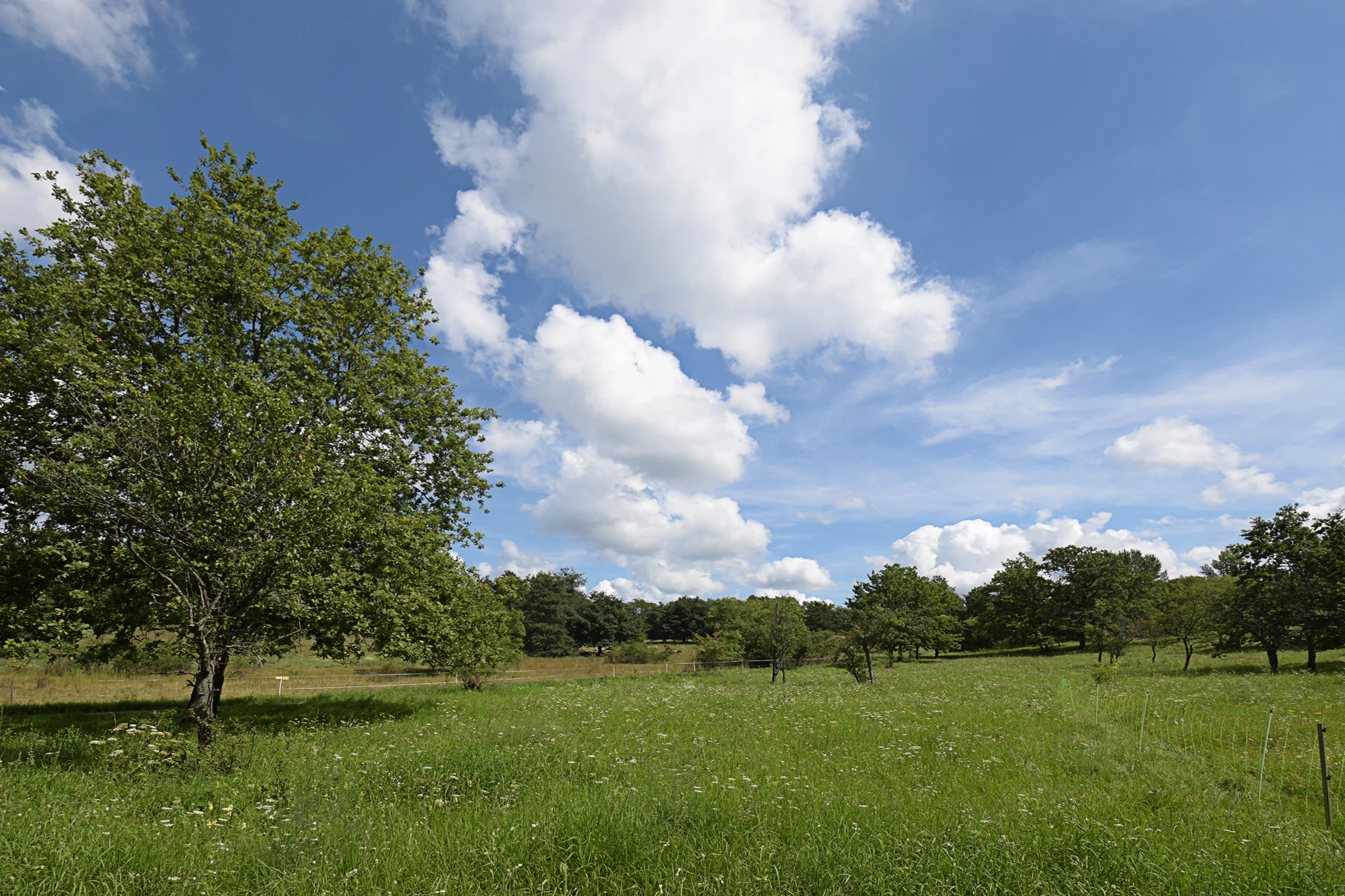
A wide, grassy meadow dotted with deciduous trees under a bright blue sky with white clouds.
A grassy meadow with scattered trees in the Kernesbellen nature reserve.

Lerchenberg und Kernesbellen von Darmstadt-Eberstadt history and protected-area timeline

The protection history of Lerchenberg und Kernesbellen von Darmstadt-Eberstadt begins in 1995, when the area was formally designated as a Naturschutzgebiet under Hessian nature conservation law. This designation recognized the long-standing ecological value of the site's sand habitats and orchard meadows, which had already survived as relicts of the historic Upper Rhine Plain landscape shaped by inland dune formation.

A second major milestone came in 2000, when the reserve was additionally designated as a Fauna-Flora-Habitat (FFH) area, integrating it into the European Natura 2000 network. This step extended the site's legal framework beyond national protections and tied its management to the conservation goals of the EU Habitats Directive.

The reserve's name itself carries a long history. The Kernesbellen area is documented in historical Hessian place-name records as early as 1489, where it appears as 'im Kornneess Bolle'. Later forms include 'in kernes bellen' (1542), 'in Kernessbellen' (1623), and 'Kernes Boellen' (1781). The Lerchenberg portion is documented from 1688 onward as 'Am Lerchensberg'. These historical names reflect centuries of agricultural and cultural use of the sandy soils, including vineyard cultivation in earlier centuries that has since given way to orchard meadows and protected dry habitats.

Lerchenberg und Kernesbellen von Darmstadt-Eberstadt landscape and geographic character

The landscape of Lerchenberg und Kernesbellen is shaped by the aeolian sand deposits of the northern Upper Rhine Plain. The reserve lies within a broader inland dune complex, physically linked to the Brömster dune that sits adjacent to the protected area. These sandy substrates are the foundation of the site's distinctive terrain, producing light, dry soils that support only sparse vegetation and create the warm microclimates that favor specialized dry-grassland species.

The topography is gently undulating rather than dramatic, reflecting the eroded character of ancient inland dunes. Open sandy areas, light pine stands on calcareous sand, and patches of orchard meadow alternate across the small reserve, creating a varied, park-like mosaic rather than continuous forest cover. The combination of exposed sand patches, dry grassland, and scattered pines gives the landscape a notably open, sun-warmed character compared with the more typical woodland landscapes of the surrounding region.

Lerchenberg und Kernesbellen von Darmstadt-Eberstadt ecosystems, habitats, and plant life

Ecologically, the reserve represents a textbook example of the inland sand habitat complex of the northern Upper Rhine Plain. The vegetation can be divided into several distinct units: pine mixture woodland on sandy soils; broom-grass steppe grassland; loose silver-grass dry grassland; and xerothermic broom-grass dry grassland. Each of these vegetation types reflects slightly different moisture, nutrient, and microclimate conditions across the sand deposits.

The light, species-rich calcareous sand pine forests and the associated Filzscharten-Blauschillergras communities are particularly important for the reserve's biodiversity. Together with the xerothermic dry grasslands and the streuobst orchards, they create a layered habitat structure supporting thermophilic and dry-adapted plants, insects, and other fauna. This mosaic of open and semi-open habitats on sandy soil is the defining nature of the site, and the reason the reserve harbors so many threatened species in such a small area.

Lerchenberg und Kernesbellen von Darmstadt-Eberstadt wildlife and species highlights

The wildlife significance of Lerchenberg und Kernesbellen lies less in large mammals and more in the specialized fauna associated with dry, sandy, and warm microclimates. The combination of dry grassland, open sand patches, light pine woodland, and orchard meadows provides habitats for numerous rare and endangered invertebrates, as well as for plant species adapted to xerothermic conditions.

Many of the plant and animal species recorded in the reserve are classified as endangered or threatened, reflecting the scarcity of these inland dune habitats across central Europe. The site's proximity and ecological continuity with the neighboring Brömster reserve further strengthen the wildlife value of the area by creating a larger functional habitat complex for sand-specialist species.

Lerchenberg und Kernesbellen von Darmstadt-Eberstadt conservation status and protection priorities

From a conservation perspective, the reserve is significant as a surviving fragment of the inland dune and sand grassland landscape of the northern Upper Rhine Plain, one of the most threatened habitat types in central Europe. Its designation since 1995 as a Naturschutzgebiet and its inclusion since 2000 in the Natura 2000 network reflect both national and European recognition of its importance.

Beyond the direct protection of individual species, the reserve's conservation goals explicitly include the ecological linkage with the neighboring Brömster bei Darmstadt-Eberstadt reserve, making it a key element in a larger strategy of protecting sandy habitat complexes near Darmstadt. Within this local network of dune and orchard meadow reserves, Lerchenberg und Kernesbellen plays a central role in maintaining landscape connectivity, species populations, and the long-term survival of inland dune habitats in Hesse.

Lerchenberg und Kernesbellen von Darmstadt-Eberstadt cultural meaning and human context

The reserve's cultural context is closely tied to the historical agricultural use of sandy soils in the Darmstadt-Eberstadt region. Historical place names dating back to the late 15th century show that the sandy sites of Kernesbellen were cultivated, including the planting of vineyards on the poor soils during earlier centuries. Over time, vineyards gave way to traditional orchard meadows (Streuobstwiesen), which today remain an integral part of the reserve's landscape and its cultural identity.

The preservation of orchard meadows within the protected area reflects the broader Hessian tradition of combining agricultural use with biodiversity conservation, and adds a cultural-historical layer to a site whose primary value is ecological. The continuity of place-name use from the medieval period to the present also gives the reserve a strong sense of local identity, with the names Lerchenberg and Kernesbellen still anchoring the site within the Darmstadt-Eberstadt community.

Top sights and standout views in Lerchenberg und Kernesbellen von Darmstadt-Eberstadt

Lerchenberg und Kernesbellen von Darmstadt-Eberstadt stands out as a compact but unusually rich inland dune reserve on the edge of the Upper Rhine Plain. Its tightly interwoven mosaic of calcareous sand pine forest, xerothermic dry grassland, and orchard meadow makes it a strong representative of a habitat type that has become rare across central Europe. Its direct ecological linkage to the adjacent Brömster dune strengthens its value as part of a larger sandy-habitat corridor.

The reserve also offers a compelling combination of natural and cultural heritage. Centuries of documented land use, recorded in Hessian place-name records since 1489, meet modern European conservation designations, creating a site where medieval vineyard landscapes, traditional orchard meadows, and protected dry grassland communities all coexist within a single protected area.

Best time to visit Lerchenberg und Kernesbellen von Darmstadt-Eberstadt

The reserve can be visited year-round as a quiet, low-key natural area typical of small German Naturschutzgebiete. Late spring and early summer are particularly favorable for observing the sand grassland communities in bloom, when dry-grassland species, and the wildflowers and herbs of the orchard meadows, are most visible. Early morning or late afternoon visits in warmer months also offer the best chance to encounter the insect and reptile activity typical of xerothermic sandy habitats.

In autumn, the orchard meadows provide seasonal character and color, while winter visits can offer clear views across the open sand and pine landscape. Visitors should respect the area's protected status and stay on designated paths, as the small size and sensitivity of the habitats mean disturbance can have an outsized impact compared with larger reserves.

Monthly climate preview

Long-term monthly temperature averages and precipitation patterns measured at a representative coordinate

Climate Normals and Annual Temperature Rhythm for Lerchenberg und Kernesbellen von Darmstadt-Eberstadt

Historical climate records for Lerchenberg und Kernesbellen von Darmstadt-Eberstadt show marked temperature variations alongside steady daily precipitation measurements across the twelve-month cycle. Analyzing the complete monthly meteorological profile provides detailed long-term averages for thermal ranges and precipitation distribution.
Annual mean10 °C
0 °C21 °C
Jan
Feb
Mar
Apr10°
May14°
Jun18°
Jul21°
Aug20°
Sep15°
Oct10°
Nov
Dec
Warmest month
July

20.6 °C

Coolest month
January

0.2 °C

Wettest month
July

2.2 mm/day

Driest month
April

1.4 mm/day

Park location guide

Geography guide, regional context, and park location map for Lerchenberg und Kernesbellen von Darmstadt-Eberstadt

Lerchenberg und Kernesbellen von Darmstadt-Eberstadt park geography, regions, and map view in Germany

Understand where Lerchenberg und Kernesbellen von Darmstadt-Eberstadt sits in Germany through a broader geographic reading of the surrounding landscape, nearby location context, and its mapped position within the national park landscape.

How Lerchenberg und Kernesbellen von Darmstadt-Eberstadt fits into Germany

Germany is a federal republic in Western and Central Europe with a population of over 83 million across sixteen constituent states. It is Europe's largest economy by nominal GDP and a major global exporter and importer. The capital is Berlin, and the country borders Denmark, Poland, Czech Republic, Austria, Switzerland, France, Luxembourg, Belgium, and the Netherlands.

Wider geography shaping Lerchenberg und Kernesbellen von Darmstadt-Eberstadt in Germany

Germany is located in Western and Central Europe, spanning 357,022 km². It borders Denmark to the north, Poland and the Czech Republic to the east, Austria and Switzerland to the south, and France, Luxembourg, Belgium, and the Netherlands to the west. The country has coastlines on the Baltic Sea and North Sea to the north, with the Alps located in the southern region.

Map view of Lerchenberg und Kernesbellen von Darmstadt-Eberstadt

Use this park location map to pinpoint Lerchenberg und Kernesbellen von Darmstadt-Eberstadt in Germany, understand its exact geographic position, and read its mapped placement within the surrounding landscape more clearly.

Pigeon | © OpenStreetMap contributors

Location context for Lerchenberg und Kernesbellen von Darmstadt-Eberstadt

Hessen
Recorded earthquake history

Explore Historical Earthquake Records for Lerchenberg und Kernesbellen von Darmstadt-Eberstadt

Examine the seismic history of Lerchenberg und Kernesbellen von Darmstadt-Eberstadt through an extensive collection of recorded earthquake data. MoriAtlas provides these records to support geographical understanding of the region, detailing past seismic events, magnitudes, and their proximity to the reserve.

Lerchenberg und Kernesbellen von Darmstadt-Eberstadt Earthquake History

Catalogued events

22 events

Strongest magnitude

Magnitude 3.8

Most recent event

May 17, 2014

This history includes earthquakes recorded inside the park or within 50 km of its borders

Explore protected inland dunes, sand grassland habitats, and light pine forests.

Visualizing Lerchenberg und Kernesbellen von Darmstadt-Eberstadt Photos and Scenery

Visual records illustrate the rare inland dune habitats and xerothermic dry grasslands that characterize Lerchenberg und Kernesbellen von Darmstadt-Eberstadt. Detailed photography reveals the varied terrain, sandy substrates, and open orchard meadows preserved across this protected landscape.

A wide, grassy meadow dotted with deciduous trees under a bright blue sky with white clouds.

A gentle grassy slope with scattered trees and an orchard meadow setting, featuring a nature reserve sign on a post in the foreground.

Park atlas

Compare adjacent inland dune reserves and protected landscapes across the Upper Rhine Plain

Explore Parks Near Lerchenberg und Kernesbellen von Darmstadt-Eberstadt

Continue browsing other protected areas linked to the inland dune network surrounding Lerchenberg und Kernesbellen von Darmstadt-Eberstadt. Expand regional comparison across related sand grassland reserves and connected conservation corridors in Hesse.
A pale, soft-toned watercolor painting showing rolling green and golden dunes under a light, hazy sky.
Nature reserveHessen
0.9 km away#1 closest

West

Düne am Ulvenberg von Darmstadt-Eberstadt: Inland Sand Dune Protected Area Geography

A rare Pleistocene dune ecosystem in the Hessen region.

Düne am Ulvenberg von Darmstadt-Eberstadt represents a critical inland dune fragment within the Upper Rhine Graben. This nature reserve provides essential habitat for sand-dwelling flora in a setting defined by its open, dry sandy flats, pine woodland, and specialized steppe-like turf that persists as a unique geological legacy.

Area
0.089 km²
Established
1991
IUCN
IV
A horizontal watercolor painting showing a soft, impressionistic landscape with rolling hills, sparse trees, and pale green and pink tones on a white background.
Nature reserveHesse
About 3.4 km away#2 closest

South

Kalksandkiefernwald bei Bickenbach, Pfungstadt und Seeheim-Jugenheim Protected Area Atlas

A rare calcareous sand pine forest in the Hessian Rhine plain

Located in the Darmstadt-Dieburg district, this reserve protects an airy, light-filled woodland on calcareous sandy ground. The terrain is defined by its gentle undulations and historical woodland grazing traces, offering a unique look at forest management in the Rhine plain. Explore the distribution of its two distinct sections, including the specialized sand grass vegetation found along its managed utility corridors.

Area
0.874 km²
Established
1996
IUCN
IV
Relief
Lowland
A horizontal watercolor painting depicting a calm lake with grassy banks, reeds, and a soft, hazy treeline in the background against a pale sky.
Nature reserveHessen
About 3.6 km away#3 closest

North

Bessunger Kiesgrube Nature Reserve: A Detailed Look at the Hessen Protected Landscape

Examining post-industrial geography and forest recovery

The Bessunger Kiesgrube is a designated nature reserve located in Hessen, Germany. Once a centuries-old gravel extraction site, the area now features a groundwater-fed lake bordered by steep rocky banks and dense, naturally regenerated woodland. This site provides a clear case study of ecological recovery on the edge of urban development, offering insight into the geological and environmental legacy of the region.

Area
0.118 km²
Established
1978
Relief
Lowland
Climate
Temperate
A watercolor landscape illustration showing a winding stream, marsh grasses, and trees with soft rolling hills in the background, set against a pale background.
Nature reserveHessen
About 6.1 km away#4 closest

Southwest

Pfungstädter Moor Nature Reserve: Hessian Wetland and Ancient River Landscape

Protected wetland area in the Hessian Rhine plain

This nature reserve encompasses a rare silted-up segment of the ancient Neckar river, forming a complex of reed beds, alder carr, and peat bog habitats. Managed through creative restoration techniques that lift Rhine water into the moor, the landscape remains a vital ecological sanctuary in the heart of Hesse, standing in sharp contrast to the surrounding agricultural terrain.

Area
0.97 km²
Established
1955
IUCN
IV
Relief
Lowland
A horizontal watercolor illustration of a soft, hazy landscape featuring light pink blooming trees in a green field, with rolling, misty purple and brown hills in the background.
Nature reserveHesse
About 6.6 km away#5 closest

South

Fuchswiese bei Stettbach: Mapped Nature Reserve and Protected Meadow Landscape in Hesse

Exploring the ecological boundaries of a specialized wet meadow reserve in southern Hesse

Fuchswiese bei Stettbach is a dedicated nature reserve serving as a critical habitat for threatened meadow butterfly species. Located in the Darmstadt-Dieburg district of Hesse, this protected area preserves wet meadow vegetation amidst the northern Odenwald fringe. The site offers a focused view into how small, carefully managed landscapes contribute to the broader ecological health and regional geography of central Germany.

Area
0.03 km²
Established
2010
A watercolor painting showing a soft, stylized landscape of green meadows, sparse trees, and distant rolling hills against a white background.
Nature reserveHesse
8.2 km away#6 closest

Southwest

Im Dulbaum bei Alsbach Nature Reserve: Mapped Inland Dunes and Grassland Geography

A vital protected sandy terrain in the Hessian Rhine Plain

Im Dulbaum bei Alsbach protects a remnant of the historic Rhine graben sand dune belt in southern Hesse. This nature reserve provides essential habitat connectivity for heat-loving species through its distinct calcareous sand grasslands and former quarry terrain, offering a look into the region's complex ecological history.

Area
0.092 km²
Established
1994
IUCN
IV
Relief
Lowland
Watercolor painting of a rolling wetland landscape featuring green fields, soft hills in the background, and marshy foreground vegetation.
Nature reserveHessen
About 8.2 km away#7 closest

Northeast

Scheftheimer Wiesen Nature Reserve: Geographic Overview and Protected Landscape Mapping

Hessen wetland ecosystems and prehistoric heritage sites

Situated along the Ruthsenbach stream in Hessen, Scheftheimer Wiesen is a 166-hectare nature reserve known for its recovery of wet meadow habitats after decades of agricultural use. The area integrates natural terrain with cultural heritage, featuring reconstructed granite menhirs and historic burial mounds within a broader forest-framed environment near Darmstadt.

Area
1.661 km²
Established
1993
IUCN
IV
Relief
Lowland
A soft, delicate watercolor painting depicting a meandering river flowing through a lush, grassy wetland landscape with rolling hills in the background.
Nature reserveHessen
About 8.6 km away#8 closest

Southwest

Altneckarlachen von Alsbach, Hähnlein und Bickenbach: Protected Wetland and River Geography

A rare mosaic of prehistoric river loops in the Hessian Rhine plain

Altneckarlachen von Alsbach, Hähnlein und Bickenbach protects a unique sequence of prehistoric Neckar meanders featuring shallow water zones, reed belts, and black-alder swamp forest. This nature reserve in the Darmstadt-Dieburg district remains a critical wetland sanctuary, preserving a vital ecological cross-section of the ancient Rhine-Neckar landscape and its associated peatland soils.

Area
0.892 km²
Established
1990
IUCN
IV
Relief
Lowland

Common questions about visiting, size, designation, and location context for Lerchenberg und Kernesbellen von Darmstadt-Eberstadt

Lerchenberg und Kernesbellen von Darmstadt-Eberstadt FAQs for park facts, access, geography, and protected area context

Find quick answers about Lerchenberg und Kernesbellen von Darmstadt-Eberstadt, including protected-area facts, park geography, trail and visitor context, and how the park fits into its surrounding country and regional landscape.
MoriAtlas Explorer

Continue Your Protected Areas Search Across the Global Atlas

Deepen your exploration by continuing the structured search for national parks and protected areas worldwide. Utilize the comprehensive filtering capabilities to compare different conservation landscapes and refine your understanding of global park geography. Discover more about the distribution and characteristics of protected natural areas.

Global natural geography