

Mori Atlas logo
National parkMaduru Oya National Park

Discover the geographic boundaries and atlas context of this key national park.

Maduru Oya National Park: Sri Lanka's Mapped Protected Landscape in Eastern Province

Maduru Oya National Park stands as a protected landscape within Sri Lanka's Eastern Province, offering a vital point for geographic and atlas exploration. This national park serves as a cornerstone for understanding the distribution and mapping of conservation areas across the region. Users can delve into its specific protected boundaries, examine its position within the broader natural terrain of Eastern Province, and utilize its detailed geographic data for comprehensive landscape context.

dry zone forestselephant sanctuarywetland reservesindigenous heritagearchaeological sitesMahaweli development

Maduru Oya National Park

National park

Park overview

Structured park overview, official facts, and landscape profile for Maduru Oya National Park

Maduru Oya National Park park facts, protected area profile, and essential visitor context

Review the core facts for Maduru Oya National Park, including designation, size, terrain, visitor scale, habitats, and operating context in one park-focused overview.

About Maduru Oya National Park

Maduru Oya National Park represents one of Sri Lanka's most ecologically and culturally significant protected areas. Established on 9 November 1983, the park was created as part of the Mahaweli Development Project, a major hydroelectric and irrigation initiative that transformed much of Sri Lanka's interior. The park's strategic importance extends beyond wildlife conservation to encompass watershed protection, serving as the catchment for the Maduru Oya Reservoir and four additional reservoirs within its boundaries. These water bodies comprise approximately 15 percent of the total park area and form the lifeblood of the surrounding ecosystem, providing critical hydration for wildlife during the dry season and supporting rich aquatic bird communities. The park's location in the dry zone places it within a climatic regime dominated by the north-east monsoon from October to February, with overall evapotranspiration rates typically exceeding precipitation levels throughout much of the year. This environmental pressure makes the reservoir systems and their riparian corridors especially vital for maintaining ecological function. The park's terrain is characterised by a mature, mantled, and undulating peneplain formed through the degradation of Precambrian rock, with prominent erosion-resistant outcrops and ridges creating visual variety. The southwestern boundary features an imposing eight-kilometre range of rocky mountains that adds dramatic relief to the otherwise gently rolling landscape. Soils are predominantly red earth, relatively fertile but highly susceptible to erosion, a characteristic that has shaped both historical land use patterns and contemporary conservation challenges.

Quick facts and research context for Maduru Oya National Park

Maduru Oya National Park occupies 58,850 hectares in the Eastern and Uva Provinces of Sri Lanka, established in 1983 as part of the Mahaweli Development Project. The park functions as a catchment area for five reservoirs and supports a population of approximately 150 to 200 Asian elephants. It lies entirely within Sri Lanka's dry zone, receiving a mean annual rainfall of 1,650 millimetres with temperatures averaging around 27°C. The park features a mature undulating peneplain landscape with an 8-kilometre rocky mountain range in the southwest, and contains important archaeological sites including ancient Buddhist ruins and Brahmi inscriptions dating to the first through third centuries AD. The Vedda community living within the park represents one of the last indigenous populations in Sri Lanka.

Protection and recognition

Documenting terrestrial conservation boundaries and official designation history since 1983

Maduru Oya National Park Protection Status and Designation History

Map-based database records trace the terrestrial boundaries established for Maduru Oya National Park during its official designation in 1983. Verifying official protection parameters provides critical geographic context for studying Sri Lankan conservation frameworks.

Protection details

Protection scope
Terrestrial
Designated year
1983
Park context

Deeper park guide and search-rich context for Maduru Oya National Park

Maduru Oya National Park history, landscape, wildlife, and travel context

Explore Maduru Oya National Park through its history, landscape character, ecosystems, wildlife, conservation priorities, cultural context, and seasonal travel timing in a structured park guide built for atlas discovery and search intent.

Why Maduru Oya National Park stands out

Maduru Oya National Park is best known for its role as a primary elephant sanctuary in Sri Lanka's dry zone, with a population of 150 to 200 individuals. The park is distinguished by its network of five reservoirs that serve both wildlife needs and catchment functions for the broader Mahaweli development system. Its archaeological significance is noteworthy, with ancient Buddhist ruins, temples, and early Brahmi inscriptions distributed across sites like Henanigala, Kudawila, and Gurukumbura. The presence of the Vedda people, Sri Lanka's indigenous inhabitants, adds a unique cultural dimension that few other protected areas in the country can claim.

Maduru Oya National Park history and protected-area timeline

Maduru Oya National Park was established as one of four national parks designated under the Mahaweli Development Programme, alongside Wasgamuwa National Park, Flood Plains National Park, and Somawathiya National Park. This designation reflected the Sri Lankan government's recognition that large-scale development projects required parallel conservation measures to protect wildlife habitats and ecological corridors. Prior to the park's formal establishment, the area had been inhabited by Vedda communities for generations, with villages at Kandeganwela, Kotatalawa, Dambana, and other locations. The history of human settlement in the region extends much further back, as evidenced by archaeological discoveries within the park boundaries. An ancient sluice discovered in the 1980s on the old ruptured earthen bund of the Maduru Oya revealed sophisticated hydraulic engineering dating to before the sixth century BC. This stone and brick structure measures approximately 30 feet high, 30 feet wide, and 219 feet long, representing one of the earliest examples of water management infrastructure in Sri Lanka. Buddhist ruins including shrines, temples, dagobas, statues, and hermitages are found throughout the park at sites such as Henanigala, Kudawila, Gurukumbura, Ulketangoda, and Werapokuna, spanning various periods of Sri Lankan history. Early Brahmi inscriptions from the first to third century AD have been recorded at Kandegamakanda, indicating continuous human presence and cultural activity in the area over two millennia. The Vedda people, believed to be descended from King Vijaya and Queen Kuveni, were living in Sri Lanka well before the arrival of the Sinhalese from India in 543 BC. Their traditional lifestyle as hunters and gatherers has increasingly given way to small-scale cultivation, though communities in Dambana have preserved elements of their cultural practices to this day.

Maduru Oya National Park landscape and geographic character

The physical landscape of Maduru Oya National Park presents a distinctive dry zone terrain shaped by geological processes spanning hundreds of millions of years. The underlying bedrock consists of Precambrian rock that has undergone extensive weathering to create the characteristic mature, mantled, and undulating peneplain that dominates most of the park. This gently rolling terrain is punctuated by numerous prominent remnants of erosion, including rock outcrops and ridges that rise above the general land surface. The most striking topographic feature is the eight-kilometre long range of rocky mountains situated in the south-western portion of the park, providing a dramatic backdrop and creating diverse microhabitats on its slopes and among its boulder fields. The geological regime includes alluvium deposits in the valley floors and Miocene limestone formations in certain areas, adding geological diversity to the landscape. The predominant soil type is red earth, which is relatively fertile but highly susceptible to erosion when vegetation cover is disturbed. Water systems form a significant component of the landscape, comprising approximately 15 percent of the total land area. Five major reservoirs, including Maduru Oya, Ulhitiya, Ratkinda, NDK, and Henanigala reservoirs, are distributed across the park together with tributaries of the Mahaweli and Maduru Oya rivers. The Maduru Oya Dam and its reservoir create a central aquatic feature surrounded by parkland maintained by periodic fires. The landscape transitions from dense forest in some areas to vast stretches of open plains dominated by grasses, reflecting the historical impact of shifting cultivation and the subsequent regeneration of secondary forest. Exotic teak plantations have been established in the north-eastern region, introducing a non-native element to the vegetation mosaic.

Maduru Oya National Park ecosystems, habitats, and plant life

The ecological character of Maduru Oya National Park is defined by its position in Sri Lanka's dry zone, where tropical dry mixed evergreen forests represent the climax vegetation community. These forests are characterised by a distinctive assemblage of tree species including Drypetes sepiaria, Chloroxylon swietenia, Manilkara hexandra, Pterospermum canescens, wood apple (Feronia limonia), Cassia fistula, and Dimorphocalyx glabellus. However, the park's forest cover has been significantly altered by historical shifting cultivation, resulting in extensive areas of secondary forest and open grassland. The herbaceous stage that follows disturbance is succeeded by shrubs and thickets dominated by species such as Trema orientalis, with Pterospermum canescens, Drypetes sepiaria, and Manilkara hexandra being among the first trees to colonise recovering areas. A rare and botanically significant discovery is Vatica obscura, the only Dipterocarpaceae species known to occur in Sri Lanka's dry zone, found in limited locations along the banks of the Maduru Oya and Gallodai Aru. The park's southern boundary approaches the intermediate zone, creating a subtle ecological transition. The reservoir margins support different vegetation communities, with numerous woody plants occurring around the water bodies and the invasive floating weed Salvinia molesta creating management challenges in the Maduru Oya Reservoir. The climate is dominated by the north-east monsoon system from October to February, with a mean annual rainfall of approximately 1,650 millimetres and mean annual temperature of about 27°C, conditions where evapotranspiration typically exceeds precipitation.

Maduru Oya National Park wildlife and species highlights

The wildlife community of Maduru Oya National Park is notable for its richness and the presence of several endemic species. The park's mammalian fauna is dominated by the Asian elephant (Elephas maximus), with population estimates of 150 to 200 individuals both before the park's establishment and in recent surveys, indicating relatively stable numbers over decades. Threatened mammal species include the sloth bear (Melursus ursinus), leopard (Panthera pardus), and water buffalo (Bubalus bubalis), all of which face conservation challenges across their ranges. Primate diversity includes the endemic toque monkey (Macaca sinica) and the common langur (Presbytis entellus). Other mammals recorded in the park include golden jackal (Canis aureus), fishing cat (Felis viverrina), wild boar (Sus scrofa), Indian muntjac (Muntiacus muntjak), spotted deer (Cervus axis), and sambar (Cervus unicolor). Small mammals such as Indian crested porcupine (Hystrix indica), black-naped hare (Lepus nigricollis), Indian pangolin (Manis crassicaudata), various squirrels, rats, and mice are also present, along with European otter (Lutra lutra). The grey slender loris (Loris lydekkerianus) has been recorded as one of the park's notable inhabitants. The avian community is exceptionally diverse, with aquatic birds including painted stork (Mycteria leucocephala), white-bellied sea eagle (Haliaeetus leucogaster), grey pelican (Pelecanus philippensis), great cormorant (Phalacrocorax carbo), little cormorant (P. niger), Oriental darter (Anhinga melanogaster), Asian openbill (Anastomus oscitans), black-headed ibis (Threskiornis melanocephalus), and Eurasian spoonbill (Platalea leucorodia). Forest bird species include the endemic Sri Lanka junglefowl (Gallus lafayetii), the rare broad-billed roller (Eurystomus glaucurus), common tailorbird (Orthotomus sutorius), shama (Copsychus malabaricus), black-hooded oriole (Oriolus xanthornus), brown-capped pygmy woodpecker (Yungipicus nanus), and red-faced malkoha (Phaenicophaeus pyrrhocephalus). Reptiles include Indian star tortoise (Geochelone elegans), common monitor (Varanus bengalensis), water monitor (Varanus salvator), black-tailed python (Python molurus), krait species (Bungarus spp.), common cobra (Naja naja), mugger crocodile (Crocodylus palustris), and estuarine crocodile (Crocodylus porosus). The reservoirs support fish populations including barbs (Barbus spp.), giant gourami (Osphronemus goramy), snakeheads (Channa spp.), catfish (Siluriformes), and introduced tilapia (Oreochromis mossambicus).

Maduru Oya National Park conservation status and protection priorities

Maduru Oya National Park faces several significant conservation challenges that require ongoing management attention. Encroachment of wetland areas, poaching, and illegal timber felling represent serious threats to the park's ecological integrity. The invasion of alien species, particularly Lantana camara, has spread throughout the park and competes with native vegetation. The Nilgala jungle corridor has been proposed to link Maduru Oya National Park with Gal Oya National Park, creating a more contiguous wildlife habitat that would facilitate elephant movement and genetic exchange between populations. Unplanned colonisation of land within the park by persons seeking land deeds under the Mahaweli development project has caused considerable disturbance to wildlife, though approximately 1,500 squatters have been resettled in established Mahaweli settlements. The relocation of Vedda people from several villages to Henanigala has been widely publicised and represents a complex intersection of conservation and indigenous rights. Conflicts between wildlife and settlers in areas bordering the development zone are ongoing, as elephants and wild boars raid crops while cattle and domesticated animals trespass into the park. Construction of dams, tunnels, and roads has caused fragmentation of landscapes in some villages. The Maduru Oya Reservoir faces challenges from the harmful floating weed Salvinia molesta, which affects water quality and aquatic ecosystem function. The park's role as a catchment for five reservoirs gives it added importance in terms of watershed protection and downstream water security.

Maduru Oya National Park cultural meaning and human context

Maduru Oya National Park contains living cultural heritage that distinguishes it from most other protected areas in Sri Lanka. The Vedda people, Sri Lanka's indigenous ethnic group numbering less than a thousand individuals, reside in villages within the park boundary at locations including Kandeganwela, Kotatalawa, Dambana, and Henanigala. The Veddas are traditionally hunters and gatherers who have increasingly relied on small-scale cultivation for their livelihood. They are believed to be descended from King Vijaya and Queen Kuveni, the legendary first human inhabitants of Sri Lanka according to traditional narratives, and lived in the island long before the arrival of the Sinhalese people from India in 543 BC. The community in Dambana has preserved aspects of their traditional lifestyle to a notable degree, though pressures from development and conservation policies have altered their relationship with the land. The temple of Mahiyangana, of great importance to the Veddas, is situated outside the park but maintains cultural connections to the communities within the protected area. Archaeological evidence of long-term human presence includes Buddhist ruins at multiple sites within the park, with shrines, temples, dagobas, statues, and hermitages at Henanigala, Kudawila, Gurukumbura, Ulketangoda, and Werapokuna spanning various periods of Sri Lankan history. Early Brahmi inscriptions from the first to third century AD discovered at Kandegamakanda provide physical evidence of literate communities in the area nearly two thousand years ago.

Top sights and standout views in Maduru Oya National Park

Maduru Oya National Park offers a distinctive combination of dry zone wilderness, significant elephant populations, ancient archaeological sites, and living indigenous heritage. The park's five reservoirs create a network of wetland habitats that support exceptional birdlife and provide crucial water sources during the dry season. The eight-kilometre rocky mountain range in the southwest provides dramatic topographical variation and scenic views. Archaeological sites with Buddhist ruins and early Brahmi inscriptions demonstrate millennia of human presence and cultural continuity. The presence of Vedda communities represents a living cultural heritage that connects the park to Sri Lanka's deepest historical roots. The park's role in the Mahaweli system gives it strategic importance beyond conservation, as the catchments it protects supply water for irrigation and hydroelectric power that serve broader national development goals.

Best time to visit Maduru Oya National Park

The optimal time to visit Maduru Oya National Park aligns with the northeast monsoon season from October to February, when rainfall replenishes the reservoirs and surrounding landscape becomes lush and green. This period offers the best wildlife viewing opportunities as animals congregate around the water sources, and the cooler temperatures make outdoor exploration more comfortable. The dry season from March to September can still be rewarding, particularly for birdwatching when water bodies shrink and concentrate avian activity, though daytime temperatures can be high and vegetation may appear more parched. Visitors interested in witnessing the park's cultural heritage should be aware that access to certain areas where Vedda communities reside may require special permissions or arrangements through the Department of Wildlife Conservation.
Monthly climate preview

Long-term monthly averages for temperature and precipitation patterns

Maduru Oya National Park Climate Normals and Annual Temperature Rhythm

Representative point records for Maduru Oya National Park track measured monthly temperature variations alongside shifting precipitation averages from 1991 to 2020. Examining the complete twelve-month dataset clarifies the long-term climatological rhythm recorded across the representative coordinate.
Annual mean27 °C
24 °C28 °C
Jan24°
Feb25°
Mar26°
Apr28°
May28°
Jun28°
Jul28°
Aug28°
Sep28°
Oct27°
Nov25°
Dec24°
Warmest month
May

28.3 °C

Coolest month
January

23.9 °C

Wettest month
November

9 mm/day

Driest month
July

1.2 mm/day

Park location guide

Geography guide, regional context, and park location map for Maduru Oya National Park

Maduru Oya National Park park geography, regions, and map view in Sri Lanka

Understand where Maduru Oya National Park sits in Sri Lanka through a broader geographic reading of the surrounding landscape, nearby location context, and its mapped position within the national park landscape.

How Maduru Oya National Park fits into Sri Lanka

Sri Lanka is a tropical island nation in South Asia with a recorded history spanning over 3,000 years. Formerly known as Ceylon, it became independent in 1948 and adopted its current constitutional name in 1972. The country features diverse geography ranging from coastal plains to mountainous highlands and maintains a population exceeding 22 million.

Wider geography shaping Maduru Oya National Park in Sri Lanka

Sri Lanka is an island nation in the Indian Ocean, positioned southwest of the Bay of Bengal. It is separated from India by the Gulf of Mannar and Palk Strait to the northwest. The island has a pear-like shape with diverse terrain including coastal plains, central highlands, and river valleys.

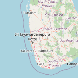
Map view of Maduru Oya National Park

Use this park location map to pinpoint Maduru Oya National Park in Sri Lanka, understand its exact geographic position, and read its mapped placement within the surrounding landscape more clearly.

Pigeon | © OpenStreetMap contributors

Location context for Maduru Oya National Park

Eastern ProvinceUva Province
Park atlas

Trace the regional spread of protected areas, comparing landscapes and conservation efforts near Maduru Oya National Park.

Parks Near Maduru Oya National Park: Explore Protected Areas in Sri Lanka's Dry Zone

After exploring Maduru Oya National Park, discover other national parks and protected areas, mapping the regional spread of conservation landscapes across Sri Lanka's dry zone. Compare their distinct geographic features, elephant habitats, and cultural heritage, understanding their connected role within the broader regional ecosystem.
National parkCentral Province
11 km away#1 closest

Northwest

Wasgamuwa National Park: A National Park in Central Province for Geographic Exploration

Mapped protected boundaries and landscape context.

Wasgamuwa National Park is a significant national park located in Sri Lanka's Central Province, offering valuable data for atlas exploration and geographic understanding. This protected area's mapped boundaries and regional setting within Central Province provide essential context for researchers and explorers focused on conservation landscapes. Discover the park's unique geographic identity and its contribution to the regional atlas, highlighting its role as a structured natural landscape.

Area
393.22 km²
Established
1984
IUCN
II
Relief
Upland
National parkNorth Central Province
19 km away#2 closest

North

Flood Plains National Park: Sri Lanka's Vital Wetland and Elephant Corridor

Mapping the geography of its unique villus system and Mahaweli River flood plain.

Flood Plains National Park stands as a paramount protected wetland ecosystem in Sri Lanka's North Central Province, critically important as an elephant corridor along the Mahaweli River. The park's landscape is defined by its unique villus system, shallow swampy depressions that support extraordinary biodiversity and serve as vital feeding grounds for Asian elephants and migratory waterfowl. Understanding the mapped park boundaries and its regional geographic context reveals its significance in landscape-level conservation efforts within the Mahaweli basin.

Area
173.5 km²
Established
1984
IUCN
II
Relief
Lowland
National parkUva Province
22 km away#3 closest

Southeast

Gal Oya National Park: Protected Landscape and Reservoir Geography in Uva Province

Explore savannah grasslands, elephant populations, and mapped terrain.

Gal Oya National Park presents a unique protected landscape within Uva Province, Sri Lanka. This national park is defined by its broad savannah grasslands, known as thalawa, interspersed with forested hills and the vast Senanayake Samudraya reservoir. Its varied topography, from lowlands to mountain peaks, offers a rich canvas for geographic exploration and understanding protected-area dynamics. The park's consistent visibility of elephant populations across these diverse terrains makes it a key site for wildlife observation within Sri Lanka's atlas of natural heritage.

Area
259 km²
Established
1954
IUCN
II
Relief
Mountain
National parkNorth Central Province
30 km away#4 closest

Northwest

Angammedilla National Park: Protecting the Watershed for Parakrama Samudra in North Central Province

Mapped dry evergreen forests and mountainous terrain boundaries.

Angammedilla National Park is a national park in Sri Lanka's North Central Province renowned for its pivotal role in safeguarding the drainage basin for the large Parakrama Samudra reservoir. This protected landscape features significant dry evergreen forest ecosystems and mountainous terrain, contributing to the region's ecological stability and wildlife habitats. Its establishment highlights a commitment to preserving vital natural resources and understanding the complex interplay between protected areas and regional geography.

Area
75.29 km²
Established
2006
IUCN
II
Relief
Mountain
National parkSri Lanka
41 km away#5 closest

North

Somawathiya National Park: A Sri Lankan National Park Protected Landscape

Explore its mapped boundaries and regional geography.

Delve into the geographic identity of Somawathiya National Park, a designated national park within Sri Lanka. This entry provides atlas-level insights into its protected landscape, mapped terrain, and the specific natural area context it offers. Understand Somawathiya National Park's place in the Sri Lankan geography for structured discovery, focusing on its protected status and mapped features without travel logistics.

Area
376.455 km²
Established
1986
IUCN
II
Relief
Lowland
National parkNorth Central Province
43 km away#6 closest

Northwest

Minneriya National Park: A Protected National Park in North Central Province

Explore mapped boundaries and regional landscape context.

Minneriya National Park is a designated national park offering unique protected landscape exploration within Sri Lanka's North Central Province. This entry provides structured data crucial for understanding the park's geographic features, its defined boundaries, and its significance as a protected area. Dive into the atlas context that illuminates the natural terrain and regional setting of Minneriya National Park.

Area
88.894 km²
Established
1997
IUCN
II
Relief
Mixed relief
National parkNorth Central Province
52 km away#7 closest

North

Kaudulla National Park: Sri Lanka's Protected National Park Geography

Mapped landscape and regional context for Kaudulla National Park.

Kaudulla National Park stands as a protected national park offering valuable geographic insights for atlas explorers. This page details the park's location within the North Central Province, providing context on its mapped terrain and protected area status. Users can delve into the structured geographic data associated with Kaudulla National Park, enhancing their understanding of Sri Lanka's conservation landscapes.

Area
69 km²
Established
2002
IUCN
II
Visitors
10K annual
National parkCentral Province
About 58 km away#8 closest

Southwest

Galways Land National Park: A Protected Landscape within Central Province, Sri Lanka

Explore the mapped geography and protected area context of this national park.

Galways Land National Park is a designated national park within the Central Province of Sri Lanka, offering a distinct focus for geographic exploration. This entry provides specific details on its protected landscape characteristics and its place within the regional atlas. Users can examine the mapped boundaries and understand the natural terrain that defines this conservation area. Discover the unique geographic identity of Galways Land National Park and its contribution to the protected areas network.

Area
0.27 km²
Established
2006
IUCN
II
Relief
Mountain

Common questions about visiting, size, designation, and location context for Maduru Oya National Park

Maduru Oya National Park FAQs for park facts, access, geography, and protected area context

Find quick answers about Maduru Oya National Park, including protected-area facts, park geography, trail and visitor context, and how the park fits into its surrounding country and regional landscape.
MoriAtlas Explorer

Continue Your Protected Areas Search Across the Global Atlas

Deepen your exploration by continuing the structured search for national parks and protected areas worldwide. Utilize the comprehensive filtering capabilities to compare different conservation landscapes and refine your understanding of global park geography. Discover more about the distribution and characteristics of protected natural areas.

Global natural geography