Mori Atlas logo
National parkMbam Djerem National Park

Discover the geographic scope and protected landscape context of Mbam Djerem National Park.

Mbam Djerem National Park: National Park Identity and Mapped Protected Area in Cameroon

(Mbam et Djerem National Park)

Mbam Djerem National Park stands as a significant protected area within Cameroon, representing a key component of the nation's conservation landscape. This page delves into its identity as a national park, focusing on its mapped boundaries and its place within the broader geographic framework of Central Africa. Users can explore the structured data and visual representation of Mbam Djerem National Park, understanding its role as a distinct protected entity within the atlas.

Tropical forestSavanna ecosystemEcological transition zoneCentral AfricaWildlife conservationPrimate habitat

Mbam Djerem National Park

National park

Park overview

Structured park overview, official facts, and landscape profile for Mbam Djerem National Park

Mbam Djerem National Park park facts, protected area profile, and essential visitor context

Review the core facts for Mbam Djerem National Park, including designation, size, terrain, visitor scale, habitats, and operating context in one park-focused overview.

About Mbam Djerem National Park

Mbam Djerem National Park represents one of Central Africa's most significant conservation achievements of the late twentieth century, established in 2000 to protect a remarkable ecological transition zone in the heart of Cameroon. The park's defining characteristic is its position at the confluence of two major vegetation realms, with approximately half of its area covered by lowland tropical forest and the other half by Sudano-Guinean savanna, separated by a wide and ecologically rich ecotone. This geographic position gives the park the highest habitat diversity of any protected area in Cameroon, encompassing gallery forests along rivers, closed-canopy rainforests in eastern sections, transitional forests, and savanna ranging from almost completely closed woodland through bush savanna to open seasonally flooded grasslands adjacent to major waterways. The upper Sanaga basin, with the Djerem River as its lifeblood, waters the entire park and contributes significantly to its ecological richness. Visitors standing on any hilltop within the park can observe ridge after ridge fading into the distance, some forested and others savanna-covered, with every valley containing the distinctive green strip of gallery forest following watercourses. The Djerem River, navigable throughout the park's extent, historically provided the main access route from the Chad border over a thousand kilometers away, though the modern CamRail railway now carries most traffic along the eastern boundary.

Quick facts and research context for Mbam Djerem National Park

Mbam Djerem National Park covers 4,234.78 square kilometers in central Cameroon, created in January 2000 as a Category II protected area under IUCN guidelines. The park is bisected by the Djerem River, which remains navigable throughout its length within the park boundaries, providing access from northern savanna regions into the heart of the forest zone. The park sits within the Northern Congolian forest-savanna mosaic, a biogeographical zone representing the northern fringe of Central African rainforests where forest tendrils extend into the great northern savannas. The park contains no permanent villages within its boundaries, though it experiences seasonal cattle grazing in northern grasslands and is traversed by the CamRail railway along its eastern edge. The area has been the subject of multiple major ecological surveys since its establishment, documenting exceptional habitat diversity across gallery forests, transitional forests, rainforests, and savanna types ranging from closed woodland to seasonally flooded grasslands.

Protection and recognition

Understanding terrestrial protection frameworks and documented management scopes for regional conservation.

Mbam Djerem National Park: Official Protected Area Designation and Profile

Geographic profiles of Mbam Djerem National Park offer verified data regarding its formal terrestrial designation and documented management boundaries. Reviewing official conservation records helps researchers trace global park databases and map regional protection networks accurately without relying on unverified sources.

Protection details

Protection scope
Terrestrial
Transboundary protection
No
Park context

Deeper park guide and search-rich context for Mbam Djerem National Park

Mbam Djerem National Park history, landscape, wildlife, and travel context

Explore Mbam Djerem National Park through its history, landscape character, ecosystems, wildlife, conservation priorities, cultural context, and seasonal travel timing in a structured park guide built for atlas discovery and search intent.

Why Mbam Djerem National Park stands out

Mbam Djerem is best known for its extraordinary habitat diversity arising from its position at the forest-savanna boundary, making it the most ecologically varied protected area in Cameroon. The park supports a remarkable mixing of wildlife species from both forest and savanna ecosystems, with large mammals including elephants, buffalo, waterbuck, and kob occurring alongside forest species such as red river hogs, crested mona monkeys, and chimpanzee populations. The park hosts at least ten primate species and over 360 bird species, including the Bamenda Apalis, a bird previously thought restricted to distant highlands. The park's gallery forests, which thread along every watercourse, create a distinctive landscape where forest and savanna species can be observed within meters of each other. The navigable Djerem River provides unique access into the park's interior, while the presence of a spectacular waterfall adds to the park's notable features.

Mbam Djerem National Park history and protected-area timeline

Mbam Djerem National Park was established in January 2000 as a formal protected area, representing the culmination of growing recognition of the region's exceptional ecological significance during the late 1990s. Prior to establishment, the area had experienced significant human activity, including historical relocations of communities during the colonial period to a road along the western boundary that once served as the main route from Cameroon to Chad. The park was created in response to increasing threats from commercial hunting and the need to preserve the remarkable biodiversity at the forest-savanna boundary. Initial surveys began in March 2000, with the first ecological assessment covering the eastern half of the park and revealing surprising discoveries about forest expansion in areas that older maps indicated should have been savanna. The discovery that large areas had transformed from grassland and bush savanna to closed-canopy forest within forty years, based on interviews with elderly local residents, demonstrated the dynamic nature of Central African forest cycles. Conservation surveys conducted by the Wildlife Conservation Society and BirdLife International throughout 2000 established the scientific baseline for the park's ecological value, documenting large mammals, birds, bats, small mammals, and assessing human use patterns.

Mbam Djerem National Park landscape and geographic character

The landscape of Mbam Djerem National Park is defined by its dramatic topographic variation and the sharp ecological transitions created by its position at the forest-savanna boundary. Rolling hills with commanding views characterize the terrain, where from any elevated vantage point one can see ridge after ridge disappearing into the distance, each slope either cloaked in forest or covered by savanna vegetation. The valley floors are marked by the distinctive gallery forests that follow every river and stream, creating ribbons of dense evergreen vegetation that contrast sharply with the surrounding savanna. The eastern portions of the park contain closed-canopy lowland rainforests, while the landscape transitions through various stages of transitional forest and woodland savanna toward the north. The Djerem River, the park's main watercourse, flows through the landscape and is navigable throughout its length within the park, allowing access from the northern savannas into the heart of the forested zones. The park contains a spectacular waterfall along one of its rivers, adding to the scenic diversity of the landscape. Seasonally flooded grasslands occur adjacent to major rivers, creating additional habitat variation across the protected area.

Mbam Djerem National Park ecosystems, habitats, and plant life

The ecological richness of Mbam Djerem stems from its position within the Northern Congolian forest-savanna mosaic, a biogeographical zone representing the northern fringe of the Congolian rainforests where forest ecosystems extend as gallery tendrils into the vast savannas of northern Cameroon and its neighboring countries. This zone is recognized as globally significant because it contains representatives of both forest and savanna flora and fauna and has been identified as an area where biological processes may drive speciation as populations adapt to the varying conditions. The park encompasses an extraordinary range of habitat types including gallery forests along all watercourses, extensive lowland tropical rainforests in eastern sections, transitional forests of mixed character, and diverse savanna types ranging from almost completely closed woodland to bush savanna and open seasonally flooded grasslands. This habitat diversity is reflected in the species assemblages found within the park, where true forest species and true savanna species occur in close proximity, sometimes within meters of each other. The ecological surveys conducted since the park's establishment have confirmed that this transitional zone supports exceptional biodiversity across multiple taxonomic groups.

Mbam Djerem National Park wildlife and species highlights

Mbam Djerem National Park supports an exceptional diversity of wildlife that reflects its unique position at the forest-savanna boundary. The large mammal fauna includes populations of elephants, primarily found in the south-central regions, along with African buffalo, waterbuck, kob, and various antelope species including bongo and sitatunga. The park supports all three pig species found in Africa, with red river hog, warthog, and giant forest hog all present, while hippos occur at multiple sites along the Djerem River. The primate population is particularly noteworthy, with at least ten species confirmed including chimpanzee, crested mona monkey, putty-nosed monkey, and olive baboon. The ungulate diversity is exceptional, with forest-savanna mosaic species such as bushbuck and yellow-backed duiker occurring alongside true savanna forms. The bird fauna numbers at least 360 species, with both true savanna species such as brown-rumped bunting, black-bellied firefinch, and brubru, and true forest species including several hornbill species, red-tailed bristlebill, and the notable Bamenda Apalis, which was discovered to be more widespread in this region than previously understood. The wildlife exhibits a remarkable mixing of forest and savanna forms that creates extraordinary ecological diversity within a relatively confined area.

Mbam Djerem National Park conservation status and protection priorities

Mbam Djerem National Park is recognized as containing a representative sample of the habitat diversity that defines the ecotone region of Cameroon and neighboring countries, making it globally significant for conservation. The large mammal fauna, now almost extinct across West Africa, remains present here though under significant threat from commercial bushmeat hunting and occasional ivory poaching. The primary conservation challenges include intensive hunting using wire snares targeting larger ungulates and gun hunting for meat destined for distant urban markets in Yaoundé and Bertoua. Local communities surrounding the park have limited economic alternatives to hunting, as agricultural returns are substantially lower than income from selling bushmeat. The CamRail railway running along the eastern boundary has become a major conduit for the bushmeat trade, funnelling wild animal products from the park's interior to populous centers. Seasonal cattle grazing also occurs in the more open northern grasslands. Conservation efforts focus on managing these threats while maintaining the ecological integrity of one of Central Africa's most important transitional ecosystems.

Mbam Djerem National Park cultural meaning and human context

While Mbam Djerem National Park contains no permanent villages within its boundaries today, the area has a history of human occupation and use that shaped its current configuration. During the colonial era, communities that previously lived within what is now the park were relocated to a road along the western boundary, which historically served as the main route from the Cameroon border to Chad over a thousand kilometers away. Elderly local residents from villages west of the park recall the area from forty years ago as grassland and bush with gallery forests along rivers, indicating significant landscape transformation since that time. The park is situated in the central highlands of Cameroon, a region with historical significance in the broader Central African context. The CamRail railway that runs along the eastern boundary connects the northern city of Garoua to the capital Yaoundé and represents important transportation infrastructure that also influences the park's management challenges.

Top sights and standout views in Mbam Djerem National Park

Mbam Djerem National Park stands as Cameroon's most ecologically diverse protected area, where the extraordinary mixing of forest and savanna species creates unique wildlife observation opportunities within a single landscape. The navigable Djerem River provides exceptional access into the park's interior, while the presence of a spectacular waterfall adds to the park's scenic attractions. The gallery forests threading through every valley create a visually distinctive landscape where forest primates and savanna ungulates can be observed in close proximity. The park supports at least ten primate species including chimpanzee populations and over 360 bird species, with the Bamenda Apalis representing a particularly notable finding. The park's position in the Northern Congolian forest-savanna mosaic marks it as globally significant for understanding ecological transitions and potential speciation processes.

Best time to visit Mbam Djerem National Park

The optimal time to visit Mbam Djerem National Park depends on what visitors hope to experience, though the dry season from November to May generally offers easier access and wildlife viewing opportunities. During the dry season, bushfires reduce savanna grasses to ash and rivers and swampy valleys dry up completely, concentrating large mammals near the remaining water sources along the major rivers. This seasonal drying creates more favorable conditions for observing elephants, buffalo, waterbuck, and other wildlife that must remain near permanent water sources. However, visitors should be aware that the dry season also means the landscape loses much of its green character, particularly in savanna areas. The wet season brings renewed vegetation and greener landscapes but can make some areas more difficult to access. The park's dynamic forest cycles mean that the boundary between forest and savanna shifts over decades in response to long-term climatic patterns, creating a landscape that is inherently changeable.

Monthly climate preview

Track long-term representative temperature and precipitation averages across the year

Mbam Djerem National Park Climate Normals and Annual Temperature Rhythm

Mbam Djerem National Park experiences a measured annual cycle of shifting monthly temperatures and precipitation rates based on historical coordinate data. Examining the complete twelve-month climate profile reveals deeper baseline patterns across the protected landscape.
Annual mean23 °C
21 °C26 °C
Jan22°
Feb24°
Mar26°
Apr25°
May24°
Jun23°
Jul22°
Aug22°
Sep22°
Oct22°
Nov22°
Dec21°
Warmest month
March

25.8 °C

Coolest month
December

21.3 °C

Wettest month
September

8.7 mm/day

Driest month
January

0.1 mm/day

Park location guide

Geography guide, regional context, and park location map for Mbam Djerem National Park

Mbam Djerem National Park park geography, regions, and map view in Cameroon

Understand where Mbam Djerem National Park sits in Cameroon through a broader geographic reading of the surrounding landscape, nearby location context, and its mapped position within the national park landscape.

How Mbam Djerem National Park fits into Cameroon

Cameroon is a Central African country spanning coastal, highland, and forest regions. It has a population of nearly 31 million people who speak 250 native languages alongside English and French as official languages. The country gained independence from France in 1960 and unified with British Southern Cameroons in 1961.

Wider geography shaping Mbam Djerem National Park in Cameroon

Cameroon is located in Central Africa, bordering Nigeria and Chad to the west and north, the Central African Republic to the east, and Equatorial Guinea, Gabon, and the Republic of the Congo to the south. The country has a coastline on the Bight of Biafra, part of the Gulf of Guinea. Terrain includes coastal plains, mountainous highlands (including Mount Cameroon), plateaus, and dense rainforest regions.

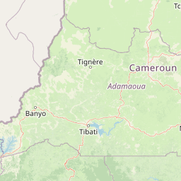
Map view of Mbam Djerem National Park

Use this park location map to pinpoint Mbam Djerem National Park in Cameroon, understand its exact geographic position, and read its mapped placement within the surrounding landscape more clearly.

Pigeon | © OpenStreetMap contributors
Recorded earthquake history

Explore the Seismic Record Associated with Mbam Djerem National Park

Consult the historical catalogue of seismic events near Mbam Djerem National Park to review recorded activity in the region. MoriAtlas aggregates USGS data to help observers identify patterns in local earthquake occurrences, depths, and magnitudes across the central Cameroon highlands.

Mbam Djerem National Park Earthquake History

Catalogued events

1 event

Strongest magnitude

Magnitude 4.9

Most recent event

Jan 26, 1987

This history includes earthquakes recorded inside the park or within 50 km of its borders

Park atlas

Trace contiguous protected landscapes and compare regional park geography across Central Africa's unique forest-savanna mosaic.

Explore National Parks and Protected Areas Near Mbam Djerem National Park

Explore additional national parks and protected areas that share geographic context or ecological features with Mbam Djerem National Park, tracing a wider network of conservation landscapes across Central Africa. Comparing these sites offers valuable insights into regional biodiversity patterns, habitat connectivity, and the varied terrain of the forest-savanna transition zone.
National parkCameroon
Mapped location lies within the park boundary#1 closest

Southeast

Mbam et Djerem National Park: Cameroon's National Park for Mapped Landscape Exploration

Discover Protected Area Geography and Regional Context

Delve into Mbam et Djerem National Park, a designated national park within Cameroon. This entry provides foundational details for understanding its role as a protected landscape. Focus is placed on its geographic setting, mapped boundaries, and contribution to the atlas of protected areas in Central Africa, offering a clear starting point for detailed exploration.

Area
4,234.78 km²
Established
2000
Relief
Mixed relief
Scope
Terrestrial
National parkCameroon
24 km away#2 closest

Southeast

Deng Deng National Park: Protected Landscape & Gorilla Habitat in East Cameroon

Discover the mapped geography and conservation significance of this national park.

Deng Deng National Park in Cameroon's East Region offers a unique glimpse into the Northern Congolian forest-savanna mosaic ecoregion. Spanning about 683 square kilometers and shaped by the Sanaga River, it is critically important as the northernmost known habitat for western lowland gorillas. Its diverse terrain supports not only gorillas but also elephants, chimpanzees, and pangolins, highlighting its role in Central African biodiversity and regional landscape context.

Area
682.64 km²
Established
2010
IUCN
II
Climate
Tropical
National parkCentre Region
About 94 km away#3 closest

Southwest

Mpem and Djim National Park: Protected Landscape and Regional Geographic Atlas

Explore the mapped terrain and protected boundaries of this national park.

Mpem and Djim National Park is a protected natural area situated within Cameroon's Centre Region. This detail entry provides an atlas-focused view, emphasizing the park's protected landscape characteristics and its position within the regional geography. Understand the mapped context and discover the identity of Mpem and Djim National Park as a key protected area.

Area
974.8 km²
Established
2004
IUCN
II
Relief
Upland
National parkTaraba State
125 km away#4 closest

Northwest

Gashaka Gumti National Park: A Deep Dive into Nigeria's Largest Protected Geographic Territory

Mapping the rugged terrain and ecological zones of Taraba State

Spanning over 6,000 square kilometers, Gashaka Gumti National Park is a massive protected expanse that defines the geographic character of northeastern Nigeria. The park integrates diverse environmental zones, including expansive savanna plains and the dramatic slopes of the Chappal Waddi mountain range. This protected area acts as a crucial node for regional biodiversity and remains a central feature in the mapped geography of Taraba State, offering a rare look at Nigeria's vertical landscape transition.

Area
6,402 km²
Established
1991
IUCN
II
Visitors
445 annual
National parkNigeria
About 172 km away#5 closest

Northwest

Gashaka-Gumti National Park: Geography and Protected Landscape Atlas of Nigeria

Explore mountain peaks, savanna plains, and watershed ecosystems

Gashaka-Gumti National Park serves as a centerpiece of Nigerian conservation, covering an expansive range of topographical features. This protected area connects the West African savanna zone with Central African highland ecosystems, creating a unique environment defined by deep river gorges, high-altitude ridges, and vital forest corridors that define the regional geography.

Area
6,402 km²
Established
1991
Relief
Mixed relief
Climate
Subtropical
National parkCameroon
185 km away#6 closest

North

Faro National Park: Central Africa's Largest Hippo Population within Sudano-Sahelian Protected Landscape

Explore mapped boundaries and regional geography of this vital national park.

Faro National Park stands as a critical protected area within Cameroon, celebrated for its immense hippopotamus population and its role in conserving large mammals across the Sudano-Sahelian zone. The park's landscape comprises undulating savanna plains, river valleys, and elevated hilltops, offering a diverse geographic context for conservation. Its inclusion in a transboundary protected network highlights its importance for regional landscape mapping and ecological continuity. Understanding Faro National Park involves appreciating its unique habitat mosaic and its contribution to the protected areas atlas.

Area
3,418 km²
Established
1989
IUCN
II
Relief
Upland
Watercolor illustration of a landscape with rolling hills, a winding river, and varied terrain in soft colors
National parkBénoué Department
206 km away#7 closest

Northeast

Bénoué National Park: Protected Landscape Atlas in Bénoué Department, Cameroon

Explore savanna woodland, riparian ecosystems, and geographic context.

Bénoué National Park is a vast protected landscape in Cameroon, defined by its Sudanian savanna woodland and significant frontage along the Bénoué River. Recognized as a UNESCO Biosphere Reserve, it offers critical insights into regional geography, habitat diversity, and the broader atlas of conservation lands in West Africa. Users can explore its varied terrain, from riverine zones to higher massifs, gaining a detailed understanding of this important protected area.

Area
1,800 km²
Established
1968
IUCN
II
Relief
Mixed relief
National parkNorth-West Region
About 267 km away#8 closest

West

Kimbi-Fungom National Park: Mapping Protected Forest and Watershed Geography

Essential habitats in Cameroon's North-West Region

Kimbi-Fungom National Park offers a distinct geographic profile, bridging the Bamboutos Mountains with low-lying savanna mosaics and riverine wetlands. This protected landscape is fundamental for the conservation of rare primate communities and the regulation of the Katsina Ala River, which feeds major water infrastructure. Gain insight into the terrain characteristics and ecological boundaries of this significant protected area through detailed mapping and regional context.

Area
657 km²
Established
2015
Relief
Mountain
Climate
Tropical

Common questions about visiting, size, designation, and location context for Mbam Djerem National Park

Mbam Djerem National Park FAQs for park facts, access, geography, and protected area context

Find quick answers about Mbam Djerem National Park, including protected-area facts, park geography, trail and visitor context, and how the park fits into its surrounding country and regional landscape.
MoriAtlas Explorer

Continue Your Protected Areas Search Across the Global Atlas

Deepen your exploration by continuing the structured search for national parks and protected areas worldwide. Utilize the comprehensive filtering capabilities to compare different conservation landscapes and refine your understanding of global park geography. Discover more about the distribution and characteristics of protected natural areas.

Global natural geography