Mori Atlas logo
National parkMontagne d'Ambre National Park

A detailed look at the volcanic massif and montane landscape within the Diana Region of Madagascar

Montagne d'Ambre National Park: Exploring the Volcanic Geography and Rainforest Boundaries

Montagne d'Ambre National Park stands as a critical protected area centered on the volcanic Mount Ambohitra, rising significantly above the surrounding northern Madagascan dry lowlands. This atlas entry details the park's basaltic terrain, complex river systems, and misty rainforest ecosystems. Users can examine the geographic boundaries of this isolated massif to understand its role within the wider landscape context of Madagascar, characterized by crater lakes, dramatic waterfalls, and dense high-altitude flora.

Montane RainforestEndemic SpeciesVolcanic LandscapeLemur HabitatBirdwatchingWaterfalls

Montagne d'Ambre National Park

National park

Park overview

Structured park overview, official facts, and landscape profile for Montagne d'Ambre National Park

Montagne d'Ambre National Park park facts, protected area profile, and essential visitor context

Review the core facts for Montagne d'Ambre National Park, including designation, size, terrain, visitor scale, habitats, and operating context in one park-focused overview.

About Montagne d'Ambre National Park

Montagne d'Ambre National Park represents one of Madagascar's premier protected areas and a critical stronghold for the island's extraordinary biodiversity. The park's volcanic origins have created a unique mountain environment that captures moisture from the Indian Ocean, supporting lush montane rainforest at elevations where the surrounding landscape transitions to dry forest and semi-desert. This ecological island effect has allowed countless species to evolve in isolation, resulting in extraordinarily high levels of endemism across all taxonomic groups. The park's accessibility from Antsiranana, with regular bush taxi service to the gateway village of Joffreville, makes it a popular destination for visitors seeking to experience Madagascar's unique wildlife and landscapes. The combination of dramatic waterfalls, crater lakes, pristine forest, and remarkable species diversity makes Montagne d'Ambre a flagship conservation area for northern Madagascar.

Quick facts and research context for Montagne d'Ambre National Park

Located approximately 1,000 kilometers north of the capital Antananarivo, Montagne d'Ambre sits in the northern highlands of Madagascar as an isolated rainforest island surrounded by dry forests and semi-desert. The park features spectacular waterfalls, several crater lakes, and numerous rivers and streams that serve as a critical water catchment area for the nearby city of Antsiranana. Annual rainfall within the park reaches 3,585 millimeters, dramatically higher than the 1,000 millimeters received in the surrounding lowland areas. The park is managed by Madagascar National Parks (PNM-ANGAP) and remains one of the most accessible protected areas in northern Madagascar.

Protection and recognition

Explore documented protection status and official recognition data for Montagne d'Ambre National Park

Montagne d'Ambre National Park Protection Status and Designation Records

Montagne d'Ambre National Park protection status details compile available administrative records and conservation designations in one structured overview. Regional conservation frameworks and official governance parameters help visitors evaluate the protected landscape.

Protection details

Transboundary protection
No
Park context

Deeper park guide and search-rich context for Montagne d'Ambre National Park

Montagne d'Ambre National Park history, landscape, wildlife, and travel context

Explore Montagne d'Ambre National Park through its history, landscape character, ecosystems, wildlife, conservation priorities, cultural context, and seasonal travel timing in a structured park guide built for atlas discovery and search intent.

Why Montagne d'Ambre National Park stands out

Montagne d'Ambre is best known for its montane rainforest ecosystem teeming with endemic species, dramatic volcanic landscape with waterfalls and crater lakes, and exceptional concentrations of Madagascar's unique wildlife. The park harbors eight species of lemurs, the ring-tailed mongoose, and the Malagasy civet, alongside thirty-five bird species found nowhere else on Earth, including the Amber Mountain rock thrush, which is known only from this massif. The park also shelters the Amber Mountain leaf chameleon, one of the smallest reptiles in the world, and supports over thirty-five species of frogs.

Montagne d'Ambre National Park history and protected-area timeline

Montagne d'Ambre was established as a national park on 28 October 1958, making it one of Madagascar's oldest protected areas. The park's creation reflected growing recognition of the island's unique biodiversity and the need to protect its endemic species from habitat loss and exploitation. Management of the park falls under Madagascar National Parks, known by its French acronym PNM-ANGAP, the national body responsible for managing the island's protected area network. The park's establishment also acknowledged the importance of the mountain as a water catchment area serving the needs of Antsiranana and surrounding communities. Over the decades, Montagne d'Ambre has remained a cornerstone of Madagascar's conservation estate, continuing to protect the island's montane rainforest heritage.

Montagne d'Ambre National Park landscape and geographic character

The park is centered on Mount Ambohitra, an isolated volcanic massif rising from the dry northern Madagascar lowlands. The underlying geology consists primarily of basaltic rock, forming a dramatic mountain landscape that stands in stark contrast to the surrounding semi-desert terrain. The park features spectacular waterfalls where streams cascade over volcanic cliffs, several volcanic crater lakes, and an extensive network of rivers and streams that descend the mountain slopes. The dramatic elevation change from the surrounding dry lowlands to the misty mountain summit creates diverse microhabitats and contributes to the park's remarkable biodiversity. The landscape supports dense montane rainforest in the higher elevations, with trees reaching heights of forty meters and featuring abundant lianas, orchids, and ferns.

Montagne d'Ambre National Park ecosystems, habitats, and plant life

The park's montane rainforest represents one of the most significant remaining blocks of this habitat type in northern Madagascar. The forest is isolated from other rainforest areas by the surrounding dry deciduous forests, creating an island of humid forest in a sea of drier vegetation. Over one thousand species of plants have been recorded within the park, including numerous orchid and fern species. The forest structure features towering trees covered in lianas, with the bird's-nest fern (Asplenium nidus) common on branch crotches. Plantations of Eucalyptus, exotic conifers, pines, and Araucaria occur in some areas, alongside the invasive Lantana camara. The dramatic difference in annual rainfall between the park and surrounding areas creates a unique ecological island that supports species unable to survive in the surrounding dry environments.

Montagne d'Ambre National Park wildlife and species highlights

Montagne d'Ambre supports an exceptional concentration of Madagascar's endemic wildlife. The park's twenty-five mammal species include eight species of lemurs, representing various groups from diurnal sifakas to nocturnal mouse lemurs. Notable among the park's mammals are the ring-tailed mongoose (Galidia elegans) and the Malagasy civet (Fossa fossana), both endemic to the island. The park's bird fauna includes seventy-five species, of which thirty-five are endemic to Madagascar, with the Amber Mountain rock thrush (Monticola sharpei erythronotus) known only from this specific massif. Reptiles are exceptionally diverse, with fifty-nine species recorded, including the remarkable Amber Mountain leaf chameleon (Brookesia tuberculata), one of the world's smallest reptiles. The park also supports thirty-five species of frogs, contributing to its reputation as a biodiversity hotspot.

Montagne d'Ambre National Park conservation status and protection priorities

Montagne d'Ambre represents a critical conservation priority as one of the last significant blocks of montane rainforest in northern Madagascar. The park's isolation has allowed endemic species to evolve in relative safety, though the surrounding landscape faces pressures from deforestation and habitat fragmentation. The park's designation as an IUCN Category II protected area reflects its primary purpose of conserving natural ecosystems while allowing for sustainable tourism and environmental education. As a water catchment area for Antsiranana, the park provides essential ecosystem services beyond its biodiversity value. The presence of numerous endemic species, some known only from this mountain, underscores the global conservation significance of Montagne d'Ambre.

Montagne d'Ambre National Park cultural meaning and human context

The area in and around Montagne d'Ambre is home to the Sakalava and Antankarana peoples, whose traditional territories encompass the mountain and surrounding landscape. The gateway village of Joffreville serves as the primary access point for visitors entering the park, offering basic visitor facilities including accommodation. These communities have long histories of interaction with the mountain landscape, though the establishment of the national park created new frameworks for managing human activities within the area. The park's name itself reflects local natural history, derived from deposits of copal, a soft form of amber, found in the area and historically collected by local communities.

Top sights and standout views in Montagne d'Ambre National Park

The park's most remarkable features include its exceptional biodiversity with species found nowhere else on Earth, the dramatic volcanic landscape with cascading waterfalls and crater lakes, the accessible montane rainforest experience, and the opportunity to observe multiple lemur species in their natural habitat. The Amber Mountain rock thrush and the tiny leaf chameleon represent particularly notable species attractions. The dramatic contrast between the lush mountain environment and the surrounding dry landscape creates a visually striking setting that distinguishes this park from other Madagascan protected areas. The relatively easy access from Antsiranana and available visitor infrastructure make these wilderness experiences achievable for a broader range of visitors.

Best time to visit Montagne d'Ambre National Park

The optimal period to visit Montagne d'Ambre falls during the dry season from April to October, when lower rainfall makes trails more accessible and wildlife viewing conditions are generally favorable. The cooler months from June to August offer particularly comfortable conditions for hiking through the montane forest. During the wet season from November to March, heavy rainfall can make trails slippery and some paths difficult to traverse, though the forest becomes even more lush and waterfalls reach their peak flow. The park's high elevation relative to the surrounding lowlands means conditions can be cooler than expected, particularly in the mornings when mist often envelops the forest.
Monthly climate preview

Long-term representative temperature and precipitation patterns across the year

Montagne d'Ambre National Park Climate Normals and Weather by Month

Representative coordinate records show measured monthly temperature and precipitation variations throughout the year at Montagne d'Ambre National Park. Examining the complete twelve-month climatology profile provides deeper insight into long-term environmental rhythms.
Annual mean25 °C
23 °C27 °C
Jan26°
Feb26°
Mar26°
Apr26°
May25°
Jun24°
Jul23°
Aug23°
Sep24°
Oct25°
Nov26°
Dec27°
Warmest month
December

26.7 °C

Coolest month
July

22.8 °C

Wettest month
January

8.1 mm/day

Driest month
September

0.5 mm/day

Park location guide

Geography guide, regional context, and park location map for Montagne d'Ambre National Park

Montagne d'Ambre National Park park geography, regions, and map view in Madagascar

Understand where Montagne d'Ambre National Park sits in Madagascar through a broader geographic reading of the surrounding landscape, nearby location context, and its mapped position within the national park landscape.

How Montagne d'Ambre National Park fits into Madagascar

Madagascar is an island nation in the Indian Ocean, positioned off the southeastern coast of Africa. As the world's fourth-largest island and second-largest island country, it stands out for its exceptional biodiversity, over 90% of its wildlife is endemic, making it one of 17 megadiverse countries. The population is approximately 32 million, with Antananarivo as both the capital and largest city.

Wider geography shaping Montagne d'Ambre National Park in Madagascar

Madagascar lies in the Indian Ocean off the southeastern coast of Africa, separated from the mainland by the Mozambique Channel. The island is situated approximately 400 km from the African continent. As the world's fourth-largest island, it also includes numerous smaller peripheral islands.

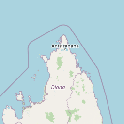
Map view of Montagne d'Ambre National Park

Use this park location map to pinpoint Montagne d'Ambre National Park in Madagascar, understand its exact geographic position, and read its mapped placement within the surrounding landscape more clearly.

Pigeon | © OpenStreetMap contributors

Location context for Montagne d'Ambre National Park

Antsiranana
Park atlas

Trace surrounding regional geography and connected conservation areas across northern Madagascar

Other Parks Near Montagne d'Ambre National Park and Protected Landscapes to Compare

Continue exploring protected areas near Montagne d'Ambre National Park by comparing adjacent volcanic massifs and regional forest reserves. Broadening the geographic scope helps connect isolated tropical rainforest ecosystems with wider regional terrain data.
National parkDiana Region
Mapped park locations coincide#1 closest

Montagne d'Ambre National Park: Volcanic Landscapes and Rainforest Geography in Diana Region

Isolated montane ecosystems and volcanic mountain terrain

Montagne d'Ambre National Park forms a distinct volcanic massif in northern Madagascar, sheltering an isolated montane rainforest within the drier Diana Region. The protected area features a network of crater lakes and waterfalls, providing a crucial water catchment for the regional capital. Its unique terrain and dense humid forests act as a natural island for endemic species, creating a sharp contrast with the surrounding semi-arid landscape.

Area
182 km²
Established
1958
IUCN
II
Relief
Mountain
Nature reserveDiana Region
About 25 km away#2 closest

Southwest

Ankarana Special Reserve: A Detailed Geographic Atlas of the Diana Region's Limestone Plateau

Mapping the karst landscape, subterranean rivers, and cliff formations.

Examine the rugged topography of Ankarana Special Reserve, featuring a 25-kilometre-long cliff known as the Wall of Ankarana and 100 kilometres of mapped cave passages. This protected area offers deep insight into Madagascar's geological history and rare endemic lemur habitats within its dense, jagged tsingy ridges.

Area
182 km²
Established
1956
IUCN
IV
Relief
Upland
Wildlife reserveDiana
About 31 km away#3 closest

East

Réserve spéciale d'Analamerana: Mapped Geography and Protected Karst Ecosystems

Northern Madagascar wilderness and dry forest topography

Navigate the rugged limestone corridors and canyon networks of Réserve spéciale d'Analamerana. This protected area showcases a distinctive dry forest landscape shaped by seasonal tropical climates and serves as a critical habitat for rare endemic species within the Diana region.

Area
347 km²
Established
1956
IUCN
IV
Relief
Upland
National parkDiana Region
About 42 km away#4 closest

North

Nosy Hara National Park: Mapped Protected Landscape and Regional Geographic Context

Atlas exploration of national park boundaries and natural terrain.

Nosy Hara National Park is a designated national park situated within the Diana Region of Madagascar. This entry provides detailed geographic information, focusing on the park's mapped boundaries and its role as a protected landscape. Explore the unique regional geography and understand how this protected area contributes to the broader atlas of natural landscapes.

Area
2.7 km²
Relief
Lowland
Climate
Tropical
Access
Access unknown
National parkMadagascar
About 127 km away#5 closest

Southwest

Lokobe National Park: Madagascar's Protected Natural Landscape and Geographic Context

Explore mapped boundaries and regional park geography.

Lokobe National Park is a protected national park situated within Madagascar, an island country recognized globally for its exceptional biodiversity and unique ecosystems. This page offers a detailed, atlas-oriented perspective on Lokobe National Park, focusing on its designation as a protected area, its specific geographic location, and the natural landscape features that define its territory. Users can explore the park's mapped boundaries and understand its contribution to Madagascar's remarkable natural heritage.

Area
15.23 km²
Established
1927
IUCN
II
Climate
Tropical
National parkMadagascar
About 140 km away#6 closest

Southwest

Nosy Tanikely National Park: Madagascar National Park & Protected Landscape Identity

Mapped geography and regional park context in Madagascar.

Nosy Tanikely National Park is a designated national park in Madagascar, offering a focused entry point for understanding protected land geography. As a key entity within the island's conservation landscape, it provides valuable context for exploring mapped park boundaries and regional geographic features. Discover how this protected area contributes to the broader atlas of Madagascar's natural heritage.

Area
3.41 km²
Established
2011
Relief
Lowland
Climate
Tropical
Nature reserveDiana
About 155 km away#7 closest

South

Réserve naturelle intégrale de Tsaratanana: Highland Massif and Protected Mountain Terrain

High-altitude geography in the Diana region of northern Madagascar

Spanning tens of thousands of hectares, the Réserve naturelle intégrale de Tsaratanana protects the highest mountain terrain in Madagascar. The landscape is defined by the crystalline Vohibory massif, creating a complex topography of deep valleys and dramatic elevation gradients that support endemic primate habitats and montane forest ecosystems.

Area
486.22 km²
Established
1927
IUCN
Ia
Wildlife reserveDiana
About 180 km away#8 closest

Southwest

Manongarivo Special Reserve: Protected Wildlife and River Landscapes in Northern Madagascar

Examining the humid forest terrain and geographic boundaries of the Diana region

Located in the Diana region, Manongarivo Special Reserve serves as a critical protected area within the northern humid rainforest system of Madagascar. The territory is defined by steep forested hills, narrow river valleys, and diverse ecological niches. By analyzing its specific topographic markers and river systems, this entry details the natural landscape and protected status of this significant biodiversity reserve.

Area
327.35 km²
Established
1956
IUCN
IV
Climate
Tropical

Common questions about visiting, size, designation, and location context for Montagne d'Ambre National Park

Montagne d'Ambre National Park FAQs for park facts, access, geography, and protected area context

Find quick answers about Montagne d'Ambre National Park, including protected-area facts, park geography, trail and visitor context, and how the park fits into its surrounding country and regional landscape.
MoriAtlas Explorer

Continue Your Protected Areas Search Across the Global Atlas

Deepen your exploration by continuing the structured search for national parks and protected areas worldwide. Utilize the comprehensive filtering capabilities to compare different conservation landscapes and refine your understanding of global park geography. Discover more about the distribution and characteristics of protected natural areas.

Global natural geography