
Mori Atlas logo
Wildlife reserveMount Nebo Wilderness

Tracing the dramatic ridgelines, subalpine forests, and alpine terrain of this central Utah wilderness area

Mount Nebo Wilderness: Mapping the Protected Landscapes of the Southern Wasatch Range, Utah

Mount Nebo Wilderness encompasses the southernmost reaches of the Wasatch Range in central Utah, defined by the towering twin summits of Mount Nebo and its expansive east-side bench trail. This protected landscape preserves a unique transition between alpine ridgelines, subalpine forests, and the colorful, eroded badlands of the Devil's Kitchen. Geographic exploration reveals a complex terrain of steep canyons and high meadows that overlook the expansive Utah Valley and the broader Great Basin plateau.

wasatch-rangesubalpine-forestalpine-ridgelinessummit-hikingscenic-bywaynational-forest
A stylized digital illustration of a cascading waterfall flowing down tiered cliffs between pine trees, with snow-capped mountains in the background under a pale sun.

Mount Nebo Wilderness

Wildlife reserve

Park overview

Structured park overview, official facts, and landscape profile for Mount Nebo Wilderness

Mount Nebo Wilderness park facts, protected area profile, and essential visitor context

Review the core facts for Mount Nebo Wilderness, including designation, size, terrain, visitor scale, habitats, and operating context in one park-focused overview.

About Mount Nebo Wilderness

Mount Nebo Wilderness is a protected backcountry area within the Uinta National Forest, set on the southern margin of the Wasatch Range in central Utah. The wilderness is organized around Mount Nebo, whose twin summits, the north peak at 11,933 feet and the south peak at 11,882 feet, dominate the surrounding landscape. The high point of Utah County, Mount Nebo is one of the rare American peaks classified as an ultra, with more than 1,500 meters of topographic prominence, giving the mountain an unusually isolated and visually commanding profile above Utah Valley and the Great Basin to the west.

The wilderness preserves a vertical slice of the central Wasatch, transitioning from lower foothill slopes up through coniferous forest, subalpine meadow, and rocky alpine terrain. Snow typically persists on the mountain from mid-October through July, emphasizing how high and exposed these landscapes are relative to the populated valleys below. The eastern flanks of the wilderness drop toward the towns of Nephi and Mona in Juab Valley, while the western slopes face Payson and the larger Provo-area communities along Utah Valley's southern edge.

Recreation in the wilderness is built around its trail network. A substantial trail climbs to the southern summit from either side of the mountain, while a separate route reaches the northern summit from the northeast. The bench trail traces the mountain's east face at roughly 9,000 feet, offering a long traverse through the heart of the wilderness. Although the routes are demanding, they are popular with hikers, and the byway below provides easier roadside access to trailheads, viewpoints, and short walks such as the one leading into the Devil's Kitchen formation.

Quick facts and research context for Mount Nebo Wilderness

Mount Nebo Wilderness lies in the Uinta National Forest and spans the divide between Juab and Utah counties in central Utah. It is named after and centered on Mount Nebo, the highest and southernmost peak of the Wasatch Range, with a northern summit near 11,933 feet and a southern summit near 11,882 feet. Mount Nebo qualifies as an ultra-prominent peak, with prominent topographic rise exceeding 4,900 feet, and is the county high point of Utah County. The wilderness is traversed by the Mount Nebo Scenic Byway, a federal National Scenic Byway linking Payson and Nephi via Interstate 15.

Protection and recognition

Examine terrestrial protection metrics and official designation scope for Mount Nebo Wilderness.

Mount Nebo Wilderness Protection Status and International Recognition

Mount Nebo Wilderness maintains a documented terrestrial protection scope without imported international recognition sources. Reviewing these verified facts provides clear insight into the official conservation boundaries and administrative status surrounding the terrain.

Protection details

Protection scope
Terrestrial
Transboundary protection
No
Park context

Deeper park guide and search-rich context for Mount Nebo Wilderness

Mount Nebo Wilderness history, landscape, wildlife, and travel context

Explore Mount Nebo Wilderness through its history, landscape character, ecosystems, wildlife, conservation priorities, cultural context, and seasonal travel timing in a structured park guide built for atlas discovery and search intent.

Why Mount Nebo Wilderness stands out

Mount Nebo Wilderness is best known for anchoring the dramatic southern terminus of the Wasatch Range and for the commanding views of Utah Valley, Utah Lake, and the surrounding high plateaus from its ridgelines. The wilderness's defining features are the twin high summits of Mount Nebo, a long east-side bench trail roughly at 9,000 feet, and access through the Mount Nebo Scenic Byway. A short walk from the byway leads to the Devil's Kitchen, a colorful badland area often compared to a miniature Bryce Canyon, which has become one of the area's signature attractions.
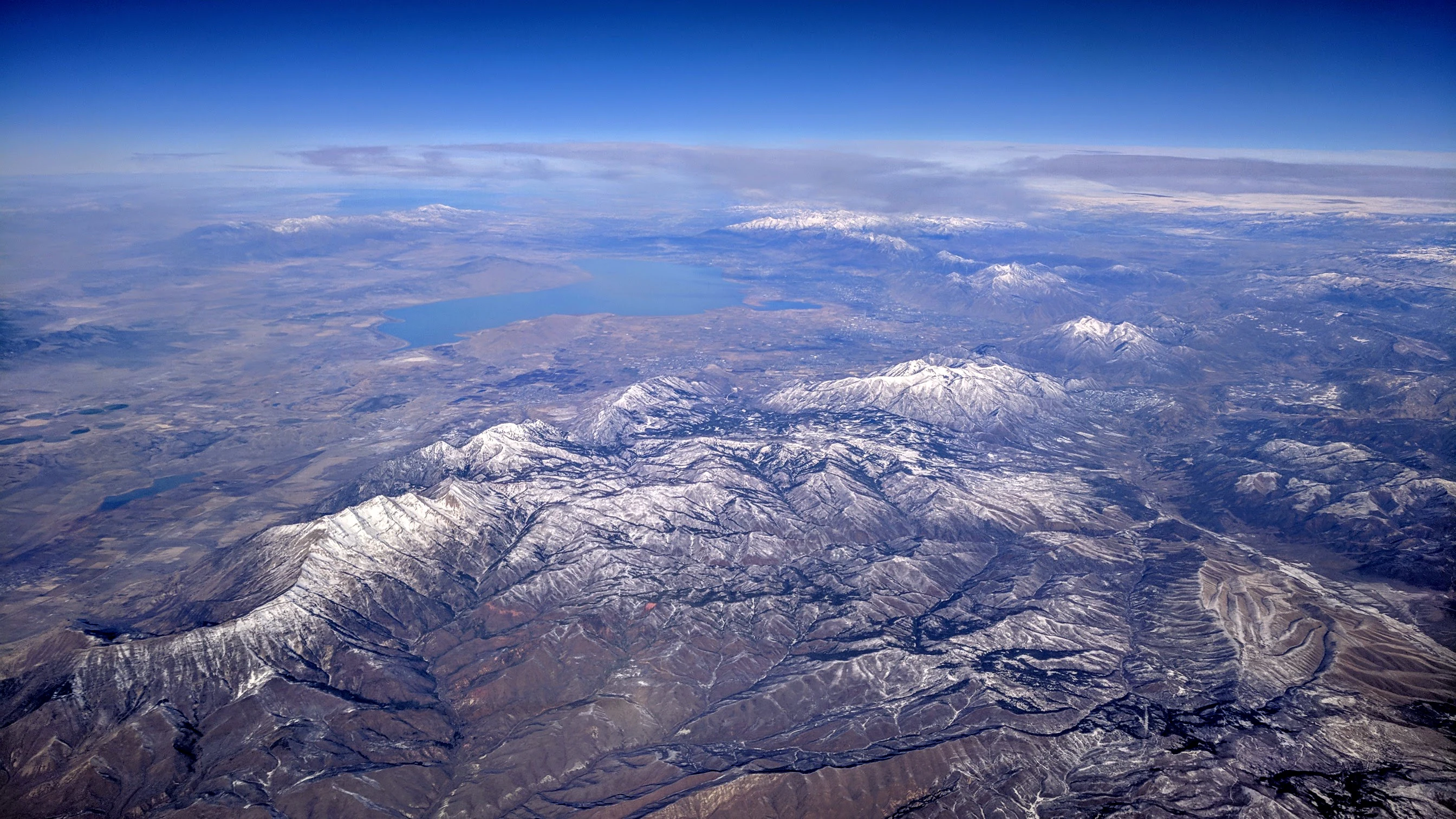
A wide aerial view of snowy mountain peaks, specifically Mount Nebo, with a large lake reflecting the sky in the background.
Aerial view of Mount Nebo and the surrounding Wasatch Range, with Utah Lake visible in the distance.

Mount Nebo Wilderness history and protected-area timeline

The mountain that gives the wilderness its name was first ascended in 1869 and has been a prominent landmark of the southern Wasatch since the early settlement of Utah Valley. Early surveys recorded the southern peak as the higher of Mount Nebo's two summits, but a resurvey in the 1970s established that the northern peak is in fact the taller of the two.

The Mount Nebo Scenic Byway, which crosses the wilderness area, was designated as a federal National Scenic Byway, formalizing the corridor as a nationally recognized scenic route. The byway leaves Interstate 15 at Payson, climbs through the wilderness to elevations above 9,000 feet, and rejoins the interstate near Nephi. Within the Uinta National Forest framework, the surrounding lands were given wilderness status to protect their high-elevation Forest, trail systems, and scenic qualities, with Devi's Kitchen and similar formations becoming established roadside and trail destinations along the route.

Mount Nebo Wilderness landscape and geographic character

Mount Nebo Wilderness occupies a dramatic piece of the southern Wasatch Range, where the Wasatch meets the higher plateaus and basins of central Utah. The defining landform is Mount Nebo itself, a twin-summited peak whose northern summit reaches 11,933 feet and whose southern summit reaches 11,882 feet. A long east-side bench runs along the mountain's eastern flank at roughly 9,000 feet, separating the steep upper slopes from the canyon drainages below and providing one of the wilderness's signature walking corridors.

From the ridgelines and high slopes of the wilderness, the landscape opens onto sweeping views of Utah Valley to the north, including the broad surface of Utah Lake and the long spine of the northern Wasatch Range rising beyond it. To the south and west, the terrain falls away toward the Great Basin, with distant horizons that on clear days stretch toward the Great Salt Lake. The slopes themselves combine subalpine forest, exposed rocky ridges, and deeply cut canyons, while the colorful rock formations around the Devil's Kitchen add a badland-like texture that contrasts with the greener forested slopes higher up.
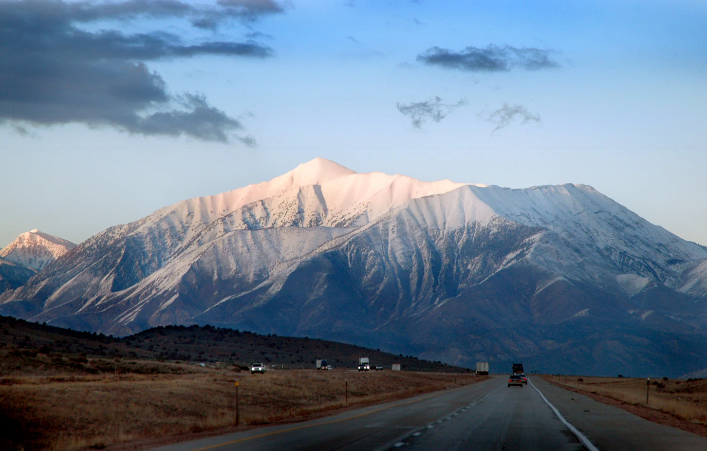
A wide, eye level shot of a large, snow dusted mountain peak rising above a desert landscape with a highway in the foreground.
Mount Nebo, the highest peak in the Wasatch Range, viewed from the highway.

Mount Nebo Wilderness ecosystems, habitats, and plant life

Ecologically, Mount Nebo Wilderness spans a clear elevation gradient that makes a relatively compact area surprisingly diverse. Lower slopes support dry-conifer and woodland communities typical of the southern Wasatch foothills, transitioning upward into dense coniferous Forest that dominates the mid-elevations. Above roughly 9,000 feet, the bench trail and surrounding ridges run through subalpine terrain characterized by open Forest, meadow openings, and rocky exposures, consistent with the mountain's subalpine climate classification.

Snow cover is a defining ecological feature of the wilderness. The high slopes are typically snow-covered from mid-October into July, shaping both the growing season for plants and the seasonal rhythm of animal life along the trails. The combination of cold winters, deep snowpack, and exposed ridges creates conditions intermediate between the moist Wasatch core to the north and the drier high plateaus to the south, giving Mount Nebo a transitional ecological character within the broader central Utah landscape.
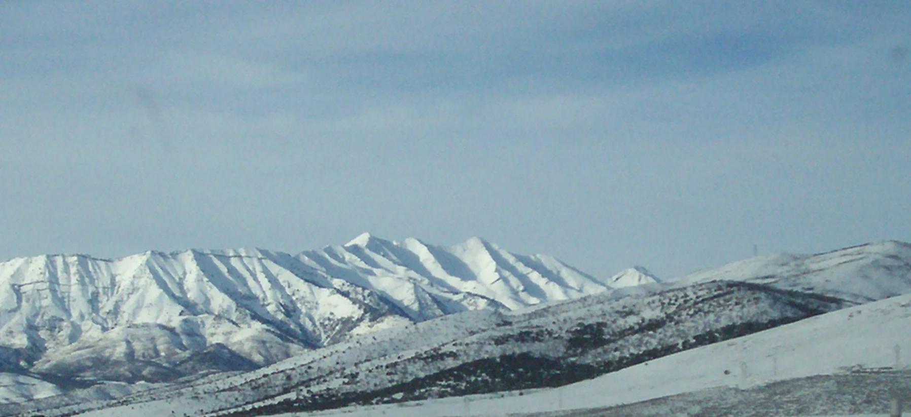
A wide, horizontal view of snow-covered mountain peaks under a clear, pale blue sky.
A view of the snow-covered slopes of Mount Nebo in the Wasatch Range.

Mount Nebo Wilderness wildlife and species highlights

The wilderness supports wildlife communities typical of the high southern Wasatch, where forested slopes, subalpine meadows, and rocky ridgelines create a mosaic of habitats. The mix of dense Forest cover and open bench country provides habitat for deer and other ungulates that move seasonally between summer ranges on the high slopes and winter ranges lower in the canyons. Predators and smaller mammals associated with subalpine Forests elsewhere in the Wasatch are part of the same environmental setting.

Raptors commonly use the open ridgelines and cliff faces around the mountain for hunting and nesting, taking advantage of the strong updrafts along the Wasatch front. Songbirds and other montane species occupy the Forest and meadow zones along the bench trail, while the mosaic of habitats around the Devil's Kitchen and similar formations adds drier-site species to the mix. Snowpack lasting well into summer is an important factor shaping both the seasonal activity patterns of these animals and the timing of wildlife viewing along the byway and trailheads.

Mount Nebo Wilderness conservation status and protection priorities

The wilderness designation of Mount Nebo protects a high-elevation core area within the Uinta National Forest, preserving one of the most visually prominent sections of the southern Wasatch Range. The designation is intended to maintain the wilderness's natural character, retain its trail systems, and safeguard subalpine forests, alpine ridgelines, and associated wildlife habitat against development and incompatible uses. The presence of Mount Nebo as an ultra-prominent peak, combined with the area's role as the visual backdrop for much of Utah Valley, gives the wilderness a particular conservation significance beyond its size.

The Mount Nebo Scenic Byway's federal National Scenic Byway designation adds an additional layer of recognition, tying the wilderness to a broader commitment to landscape-scale conservation along this section of the Wasatch front. Together, the wilderness and byway reflect an effort to balance heavy recreational use, including hiking and scenic driving, with the protection of Forest, watershed, and scenic resources that define the southern Wasatch landscape.

Mount Nebo Wilderness cultural meaning and human context

Mount Nebo takes its name from the biblical Mount Nebo in Jordan, identified as the place from which Moses viewed the promised land. That naming reflects the broader pattern of biblical place names applied across the Utah landscape by nineteenth-century settlers and gives the mountain a distinct regional identity within central Utah. The wilderness and its byway lie between the historic communities of Payson, Nephi, and Mona, towns whose agricultural history is closely tied to the water and weather that flow down from the Wasatch slopes above.

Local riding and hiking culture has long traditions here, with old-time horsemen regarding the canyons of Mount Nebo as especially demanding. The area's accessible but strenuous terrain has shaped a regional outdoor culture that combines serious summit hiking, scenic driving on the byway, and short visits to roadside features such as the Devil's Kitchen, while keeping close ties to the small valley towns that serve as gateways.

Top sights and standout views in Mount Nebo Wilderness

Mount Nebo Wilderness combines alpine-scale scenery with highly accessible roadside recreation along the Mount Nebo Scenic Byway. The wilderness's ultra-prominent twin summits dominate the southern Wasatch skyline, while the bench trail at roughly 9,000 feet offers a long forest-and-meadow traverse across the east side of the mountain. The short walk to the Devil's Kitchen, with its colorful rock formations often compared to a miniature Bryce Canyon, gives visitors a compact but visually striking introduction to the area.

Best time to visit Mount Nebo Wilderness

Summer and early autumn are the most practical times to experience Mount Nebo Wilderness at its full range. By mid-summer the snow has typically retreated from the trails, the subalpine Forest is fully accessible, and the bench trail at roughly 9,000 feet is most comfortable for hiking. Late summer and early fall also tend to bring clearer air and sharper views across Utah Valley and out toward the Great Basin, while autumn adds color to the surrounding Forest.

Monthly climate preview

Long-term monthly temperature and precipitation data for Mount Nebo Wilderness

Mount Nebo Wilderness Climate Normals and Annual Temperature Patterns

Representative coordinates record measured monthly averages from freezing winter lows to warm summer highs alongside shifting precipitation rates. Examining the full twelve-month profile provides complete historical context for long-term climate normals across the terrain.
Annual mean9 °C
-3 °C24 °C
Jan-3°
Feb-1°
Mar
Apr
May13°
Jun19°
Jul24°
Aug23°
Sep17°
Oct
Nov
Dec-3°
Warmest month
July

24.1 °C

Coolest month
December

-3.5 °C

Wettest month
January

1.7 mm/day

Driest month
July

0.7 mm/day

Park location guide

Geography guide, regional context, and park location map for Mount Nebo Wilderness

Mount Nebo Wilderness park geography, regions, and map view in United States of America

Understand where Mount Nebo Wilderness sits in United States of America through a broader geographic reading of the surrounding landscape, nearby location context, and its mapped position within the national park landscape.

How Mount Nebo Wilderness fits into United States of America

The United States of America is a federal presidential republic and one of the world's largest countries by area and population. It consists of 50 states across a vast territory spanning multiple time zones, with its capital in Washington, D.C. and largest city in New York City. The nation has a diverse economy, influential political system, and significant cultural and military presence globally.

Wider geography shaping Mount Nebo Wilderness in United States of America

The United States occupies a vast territory in North America, bordered by Canada to the north and Mexico to the south. The 48 contiguous states stretch from the Atlantic to the Pacific Ocean, while Alaska occupies the northwestern region and Hawaii is an archipelago in the Pacific. The country encompasses diverse terrain including the Rocky Mountains, Appalachian Mountains, Great Plains, and extensive river systems.

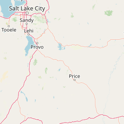
Map view of Mount Nebo Wilderness

Use this park location map to pinpoint Mount Nebo Wilderness in United States of America, understand its exact geographic position, and read its mapped placement within the surrounding landscape more clearly.

Pigeon | © OpenStreetMap contributors

Location context for Mount Nebo Wilderness

Utah

Visualizing alpine ridges, subalpine forests, and rugged protected terrain

Mount Nebo Wilderness Photos and Landscape Scenery Exploration

Examine detailed photographs capturing the towering alpine summits, steep canyons, and high meadows of Mount Nebo Wilderness. Visual records reveal the complex topography and diverse habitats defining this protected southern Wasatch landscape.

A wide aerial view of snowy mountain peaks, specifically Mount Nebo, with a large lake reflecting the sky in the background.

A wide, panoramic view of a large, snow-dusted mountain range under a clear blue sky, seen from a high vantage point with a small interpretive sign in the foreground.

A wide, eye level shot of a large, snow dusted mountain peak rising above a desert landscape with a highway in the foreground.

A wide, horizontal view of snow-covered mountain peaks under a clear, pale blue sky.

Park atlas

Compare adjacent mountain landscapes and regional protected areas across central Utah

Explore Parks Near Mount Nebo Wilderness and Surrounding Protected Areas

Visitors exploring Mount Nebo Wilderness can browse other parks and protected areas located throughout the surrounding mountain terrain. Comparing adjacent reserves reveals the broader geographic spread of regional wildlands and mountain habitats.
A watercolor painting showing a panoramic view of rolling green mountains with a winding stream through a forested valley.
Protected landscapeUtah
About 12 km away#1 closest

Southeast

Manti, La Sal National Forest: Geographic Overview of Utah's Mountain and Canyon Landscapes

Mapped protected forest boundaries across the Colorado Plateau

Spanning over one million acres, Manti, La Sal National Forest defines a critical segment of Utah geography. This protected landscape encompasses diverse terrain including subalpine mountains, aspen-rich uplands, and deep canyon networks. Use this atlas to examine the distinct environmental characteristics that separate the northern forested plateaus from the southern wilderness canyons.

Area
5,143.09 km²
Established
1950
IUCN
V
Visitors
900K annual
A soft watercolor illustration depicting layered green hills in the foreground with faint mountain outlines in the background against a white background.
Wildlife reserveUtah
About 59 km away#2 closest

North

Mount Timpanogos Wilderness: Mapping the Protected Alpine Landscape and High Wasatch Terrain

An iconic Utah protected area within the northern Wasatch Range.

Mount Timpanogos Wilderness preserves a dramatic segment of the Wasatch Range, centering on an iconic summit that rises above glacial basins and forested slopes. This protected area offers a distinct study of alpine geology, featuring high-altitude cirques, steep ridges, and the prominent presence of Emerald Lake. As a critical piece of Utah wilderness, it anchors the skyline above the urban corridor, providing a concentrated look at regional mountain ecosystems and rugged natural terrain.

Area
42.56 km²
Established
1984
IUCN
Ib
Relief
Mountain
Wildlife reserveUtah
About 68 km away#3 closest

North

Lone Peak Wilderness: Protected Alpine Geography and Wasatch Range Map Insights

Rugged glacial terrain and granite summits in Northern Utah

Lone Peak Wilderness represents a dramatic intersection of high-mountain wilderness and urban geography. Rising from the Salt Lake and Utah Valleys, its alpine terrain features jagged granite peaks, persistent snowfields, and steep glacial canyons. This protected landscape remains a critical reference for understanding the ecological and topographical character of the central Wasatch Range and Utah's wilderness preservation history.

Area
121.76 km²
Established
1978
IUCN
Ib
Relief
Mountain
A pale watercolor painting showing a wide, panoramic view of layered mountains with light green and muted red hills in the foreground and clusters of pine trees.
Wildlife reserveUtah
About 93 km away#4 closest

North

Mount Olympus Wilderness: Geographic Overview of the Iconic Wasatch Range Protected Landscape

Steep granite massif and alpine terrain in northern Utah

Explore the distinct topography of Mount Olympus Wilderness, a protected sanctuary in Utah featuring soaring granite outcrops and deep drainage systems. The park is anchored by a recognizable twin-peak silhouette that rises abruptly from the Salt Lake Valley, encompassing high alpine ridges and one of the deepest known cave systems in the United States within its rugged forested boundaries.

Access
Easy access
National parkUtah
About 147 km away#5 closest

South

Capitol Reef National Park: Utah National Park Protected Landscape and Geography

Explore Capitol Reef National Park's mapped terrain and boundaries.

Delve into the protected landscape and geographic identity of Capitol Reef National Park, a key national park in Utah. This resource provides detailed context on its mapped terrain and regional setting, supporting a structured understanding of protected areas for atlas exploration. Discover the specific geographic features and park boundaries that define this protected natural area.

Area
978.95 km²
Established
1971
IUCN
II
Visitors
1.4M annual
National parkUtah
About 201 km away#6 closest

Southeast

Canyonlands National Park: A Mapped Protected Landscape in Utah's Geography

Explore its vast geography and protected area boundaries.

Canyonlands National Park stands as a significant protected entity within the state of Utah, characterized by its immense scale and dramatic geological formations. This page facilitates an atlas-style exploration of its terrain, emphasizing its mapped boundaries and its crucial role as a protected landscape. Gain a deeper appreciation for its unique geographic setting and its place within the broader regional context.

Area
1,366.21 km²
Established
1964
IUCN
II
Visitors
818.5K annual
Protected landscapeUnited States of America
About 204 km away#7 closest

North

Wasatch-Cache National Forest Protected Area: Geography, Mountains, and Wilderness Mapping

Analyzing high-mountain terrain and watershed connectivity across the Intermountain West

Wasatch-Cache National Forest serves as a major ecological anchor in the United States. Its territory encompasses the iconic Wasatch Range, extensive designated wilderness zones, and alpine basins. The region provides critical watershed protection and supports diverse high-altitude ecosystems, from narrow, dissected ridges to broad, glaciated terrain throughout northern Utah and surrounding areas.

Area
6,504.01 km²
Established
1906
Relief
Mountain
Access
Easy access
A watercolor painting showing soft green hills, distant pink-hued mountains, and a pale blue lake in a serene, stylized landscape.
Protected landscapeNevada
About 206 km away#8 closest

West

Humboldt, Toiyabe National Forest: Protected Landscape and Regional Mountain Geography

A vast network of Nevada mountain ranges and alpine wilderness

Humboldt, Toiyabe National Forest serves as a defining public land entity across Nevada and eastern California. As the largest national forest in the contiguous United States, it preserves a striking collection of isolated mountain ranges, including the Ruby Mountains and the rugged Jarbidge wilderness, within a broader basin-and-range landscape. Examine the boundaries and terrain that characterize this complex, high-desert ecosystem.

Area
25,454 km²
Established
1908
Relief
Mountain
Access
Easy access

Common questions about visiting, size, designation, and location context for Mount Nebo Wilderness

Mount Nebo Wilderness FAQs for park facts, access, geography, and protected area context

Find quick answers about Mount Nebo Wilderness, including protected-area facts, park geography, trail and visitor context, and how the park fits into its surrounding country and regional landscape.
MoriAtlas Explorer

Continue Your Protected Areas Search Across the Global Atlas

Deepen your exploration by continuing the structured search for national parks and protected areas worldwide. Utilize the comprehensive filtering capabilities to compare different conservation landscapes and refine your understanding of global park geography. Discover more about the distribution and characteristics of protected natural areas.

Global natural geography