Mori Atlas logo
Protected landscapeNaturpark Holsteinische Schweiz

A detailed geographic exploration of moraine hills, lake networks, and hedgerow mosaics in northern Germany.

Naturpark Holsteinische Schweiz: Mapping the Protected Glacial Landscapes of Schleswig-Holstein

Naturpark Holsteinische Schweiz serves as a primary protected area within the German state of Schleswig-Holstein, covering roughly 75,000 hectares of diverse post-glacial terrain. This geographic index tracks the park's dense network of over two hundred lakes, including the Großer Plöner See, alongside extensive deciduous forests, peatlands, and traditional Knick hedgerow systems. By mapping these interconnected habitats, the platform provides clear insight into the regional importance of this glacial landscape and its role in northern Germany's ecological framework.

nature parklake districtglacial landscapemorainedeciduous forestbeech forest

Naturpark Holsteinische Schweiz

Protected landscape

Park overview

Structured park overview, official facts, and landscape profile for Naturpark Holsteinische Schweiz

Naturpark Holsteinische Schweiz park facts, protected area profile, and essential visitor context

Review the core facts for Naturpark Holsteinische Schweiz, including designation, size, terrain, visitor scale, habitats, and operating context in one park-focused overview.

About Naturpark Holsteinische Schweiz

Naturpark Holsteinische Schweiz is the largest of the six designated nature parks in the German state of Schleswig-Holstein. It is administered by the association Verein Naturpark Holsteinische Schweiz, which was founded in 1986 and whose members include the affected districts, municipalities, and cities within the park. The protected area covers around 75,328 hectares and extends across parts of the Ostholstein, Plön, and Segeberg districts in eastern Schleswig-Holstein, placing it firmly within the broader cultural and tourist region known as the Holsteinische Schweiz.

At its geographic core, the park stretches roughly from the Selenter See in the north to Bad Segeberg in the south, and from Ascheberg on the western shore of the Großer Plöner See in the west to Schönwalde near the Bungsberg, Schleswig-Holstein's highest natural point, in the east. Three towns, Plön, Eutin, and parts of Bad Segeberg, lie within its boundaries, while the rest of the territory is formed by dozens of small rural communities. The towns of Plön and Eutin in particular lend the park a long cultural and historical backdrop as old centers of Holstein life.

The defining identity of the park is its glacial landscape. During the Weichselian ice age, advancing and retreating ice masses and their meltwater shaped two characteristic elements that continue to define the area: a system of low hills and a network of lakes. Much of the sand carried by glacial meltwater is still quarried today around Damsdorf and Tensfeld. Roughly two-thirds of the present area is used agriculturally, mostly as cropland, while forests cover about 16 percent and grassland about 12 percent. Despite this intensive use, the long-term character of the region remains one of mixed, lake-rich countryside closely tied to its ice-age origins.

Quick facts and research context for Naturpark Holsteinische Schweiz

Naturpark Holsteinische Schweiz lies in eastern Schleswig-Holstein in northern Germany and is the largest of the six nature parks in the state. Its territory falls within the districts of Ostholstein, Plön, and Segeberg, and includes the towns of Plön, Eutin, and parts of Bad Segeberg, together with many smaller rural communities.

The landscape is shaped by the Weichselian ice age, producing a mosaic of hills, lakes, meltwater channels, beech-dominated forests, hedgerows, peatlands, and agricultural land. About two-thirds of the area is used for agriculture, predominantly as arable land, while roughly 16 percent is forested and about 12 percent is grassland.

Protection and recognition

Examine documented terrestrial conservation frameworks and administrative scope.

Naturpark Holsteinische Schweiz Protection Status and Terrestrial Designation

Naturpark Holsteinische Schweiz maintains a documented terrestrial protection status within its regional landscape. Structured records outline the core conservation framework and management scope without additional international designations.

Protection details

Protection scope
Terrestrial
Transboundary protection
No
Park context

Deeper park guide and search-rich context for Naturpark Holsteinische Schweiz

Naturpark Holsteinische Schweiz history, landscape, wildlife, and travel context

Explore Naturpark Holsteinische Schweiz through its history, landscape character, ecosystems, wildlife, conservation priorities, cultural context, and seasonal travel timing in a structured park guide built for atlas discovery and search intent.

Why Naturpark Holsteinische Schweiz stands out

The park is especially known for its remarkable density of lakes, including the Großer Plöner See, which is the largest, deepest, and most island-rich lake in Schleswig-Holstein and is internationally important for waterbirds. Several of the state's most nutrient-poor lakes greater than 50 hectares, including the Suhrer See, Schöhsee, Stocksee, Schluensee, and Selenter See, lie within the park. It is also recognized for its characteristic combination of glacial landforms, traditional Knick hedgerows, deciduous beech forests, and restored peatlands such as the Tarbeker Moor. The park's distinctive mix of lakes, hills, and mosaic farmland makes it a defining landscape of the broader Holsteinische Schweiz holiday region.

Naturpark Holsteinische Schweiz history and protected-area timeline

The Naturpark Holsteinische Schweiz was established through the founding of the supporting association Verein Naturpark Holsteinische Schweiz in 1986. Its members are the districts, municipalities, and cities within the park area, making it a cooperatively run cross-district protected landscape rather than a single-site reserve.

Some of the most significant conservation chapters within the park relate to its peatlands. The Tarbeker Moor, until the twentieth century part of a much larger raised bog formed in a glacial meltwater channel, was drained and partially cultivated before industrial peat extraction began in the 1950s and continued on a large scale until the late 1980s. After extraction ended, the area was deliberately allowed to develop back into a growing, peat-producing moor for nature conservation rather than being converted back to farmland. The most important step was raising the water table again, a measure that has since allowed many bog-specific and fen-specific species to return, including 57 documented breeding bird species.

In the Heidmoor near Seedorf, rewetting measures and the establishment of large-scale, low-intensity cattle grazing have rebuilt open wet habitat for meadow-breeding birds. Across the park, the association has also worked to maintain the traditional Knick hedgerow network, encourage semi-open grazing landscapes using hardy old cattle and horse breeds, and set aside areas of natural forest, such as the Dodauer Forst and the area around the Ukleisee, where woodland communities can develop without human intervention.

Naturpark Holsteinische Schweiz landscape and geographic character

The landscape of Naturpark Holsteinische Schweiz is a textbook example of a young moraine region. The Weichselian glaciation left behind a patchwork of low hills and broad meltwater channels, in some of which rivers and streams still flow today. The hills and the lake basins together create the characteristic alternation of elevated ridges and water-filled depressions that defines the Holsteinische Schweiz region as a whole.

Water is the most visible element of the scenery. The park encompasses roughly 200 lakes and a dense network of flowing waters. The 68-kilometer Schwentine rises in the Bungsberg area, threads its way through numerous lakes in deeply incised stream gorges, and eventually reaches the Kieler Förde. The largest single body of water is the Großer Plöner See, with nearly 3,000 hectares, which is also the deepest and most island-rich lake in Schleswig-Holstein. Other notable lakes include the Selenter See, the Suhrer See, the Schöhsee, the Stocksee, and the Schluensee, the last five of which are also the state's most nutrient-poor lakes in the size class above 50 hectares.

Land use has shaped the rest of the scenery. Around two-thirds of the park is farmland, mostly cropland, while the remaining open countryside is a checkerboard of meadows, Knick hedgerows, and small woodlands. Forest covers about 16 percent of the area, distributed across the Bungsberg area, the Dodauer Forst, and other wooded ridges that break up the agricultural plain. The highest point in the park region, the Bungsberg, anchors the eastern edge of the landscape and offers some of the most sweeping views across the lake country.

Naturpark Holsteinische Schweiz ecosystems, habitats, and plant life

Ecologically, the park is defined by a closely woven mosaic of aquatic, wetland, woodland, and cultural habitats. Its roughly 200 lakes range from large, biologically productive waters like the Großer Plöner See to small, nutrient-poor forest and kettle lakes, providing a remarkable gradient of freshwater conditions within a relatively small area. Glacial meltwater channels host streams and bogs, while peatlands such as the Tarbeker Moor and the Heidmoor carry the ecological imprint of the last ice age.

The forests of the park cover roughly 16 percent of the area, an unusually high figure for the region, and are dominated by European beech. Oak, ash, sycamore and Norway maple, small-leaved lime, hornbeam, and birch occur in smaller proportions, and overall the share of broadleaf forest is significantly higher than that of coniferous forest. Spring-flowering woodland species such as wood anemone, hollow corydalis, and cowslip appear in many stands. On periodically flooded sites along the larger lakes, alder-dominated swamp forests have developed, including notable stands near the Prinzeninsel and around the small islands in the Großer Plöner See. Designated natural forest areas, where woodland can develop without human intervention, exist in the Dodauer Forst and around the Ukleisee.

Outside the forests, the park's traditional cultural landscape supports its own rich ecology. Knicks, the regionally characteristic hedgerows, host an estimated 7,000 animal species, mostly insects, which in turn feed a wide community of songbirds, small mammals, and the hazel dormouse. Semi-open grazing landscapes, in which hardy traditional cattle and horse breeds graze at low density, recreate a savanna-like mix of pasture, shrubs, and scattered trees in several parts of the park, including areas around the Großer Plöner See, the Barkauer See, the Middelburger Seen, and the Kasseedorfer Teiche nature reserve. Altogether, the interplay of water, woodland, bog, and traditionally managed farmland gives the park an unusually varied ecological profile for a region so heavily shaped by agriculture.

Naturpark Holsteinische Schweiz wildlife and species highlights

The park's wildlife profile is dominated by its importance for birds. The Großer Plöner See, with its many islands, is a habitat of international significance for breeding, roosting, and migrating birds. Greylag geese breed on the islands, and white-tailed eagles maintain nesting territories there. The five most nutrient-poor larger lakes host particularly sensitive waterbird communities. In the rewetted peatlands, meadow and bog-breeding species have returned in considerable numbers; the Heidmoor supports skylark, quail, whinchat, meadow pipit, curlew, and yellow wagtail, while the Tarbeker Moor has recorded 57 breeding bird species, including lapwing, garganey, red-necked grebe, little ringed plover, wood lark, and crane.

The Knick hedgerow network supports an additional layer of birdlife, including yellowhammer, lesser whitethroat, Eurasian blackcap, song thrush, European robin, chiffchaff, and dunnock, along with insectivorous mammals such as hedgehogs, common and pygmy shrews, and the hazel dormouse. Old overstorey trees in mature Knicks, especially large oaks, are ecological hotspots in their own right, with more than 400 animal species recorded on individual trees.

Larger and more charismatic species also feature prominently in the park's wildlife identity. The association has highlighted a wide range of them through its annual Naturpark-Tier des Jahres program, which since 2003 has focused public attention on species such as the white-tailed eagle, crane, Eurasian eagle-owl, red kite, European otter, kingfisher, grass snake, natterjack toad, and tree frog, as well as less conspicuous inhabitants such as the banded demoiselle, water shrew, and common shelduck. This long list underlines the variety of animal life that the region's forests, lakes, moors, hedgerows, and grasslands can support.

Naturpark Holsteinische Schweiz conservation status and protection priorities

The conservation significance of Naturpark Holsteinische Schweiz lies largely in maintaining a working cultural landscape that still contains the ecological traces of the last ice age. The park is not a single strict nature reserve but a large, multi-use landscape in which the protection of lakes, peatlands, hedgerows, and forests is balanced with agriculture, forestry, and local community life. At this scale, the park plays a crucial role in safeguarding the connectivity between habitats across three districts.

Two peatland restoration efforts stand out. The Tarbeker Moor, once heavily exploited for industrial peat extraction, has been deliberately converted back to a growing bog through rewetting, and now functions as a refuge for high-bog and low-bog species as well as for waterbirds. The Heidmoor has been restored through rewetting paired with extensive cattle grazing, creating wet meadow habitat for ground-nesting birds. Together, these projects demonstrate how former extraction and drainage sites can be brought back into ecological use.

Beyond peatlands, the park supports conservation in several other ways. The traditional Knick hedgerows are protected and maintained as wildlife corridors and refuges for thousands of species. Semi-open grazing landscapes with hardy traditional breeds are encouraged as a tool for maintaining biodiverse, structurally rich pasture. Natural forest reserves, such as the Dodauer Forst and the area around the Ukleisee, are set aside to allow woodland communities to evolve without human interference. The annual Naturpark-Tier des Jahres campaign links public attention to species-level conservation themes, ranging from keystone raptors such as the white-tailed eagle and red kite to amphibians, dragonflies, and bats.

Naturpark Holsteinische Schweiz cultural meaning and human context

The Holsteinische Schweiz, in both its broader regional sense and as a nature park, has long been a recognized holiday and recreation area in northern Germany. Its name evokes a comparison with Swiss landscapes, referring to the rolling hills and lake-dotted scenery of the young moraine. The park therefore sits at the heart of a regional identity that has historically combined small agricultural communities, market towns such as Plön and Eutin, and lake-based summer recreation.

The Knicks are perhaps the most visible expression of the region's cultural landscape. These traditional hedgerows, formed by centuries of field clearance and management, are not only ecological features but also a recognized part of Schleswig-Holstein's agricultural heritage, shaping how the land is divided and used. Their maintenance within the park is therefore both a cultural and an ecological act.

The towns of Plön and Eutin also contribute a deeper historical and cultural layer. As former residences and seats of Holstein nobility, and as centers of schooling and culture, they link the park's natural landscape to a longer story of how the region has been shaped, inhabited, and enjoyed over the centuries. The supporting association itself, with members drawn from the districts, municipalities, and cities of the park, reflects a model of conservation governance that is embedded in local civic life.

Top sights and standout views in Naturpark Holsteinische Schweiz

Naturpark Holsteinische Schweiz is anchored by the Großer Plöner See, the largest, deepest, and most island-rich lake in Schleswig-Holstein and a site of international importance for breeding and migrating birds. Several of the state's cleanest and most nutrient-poor larger lakes, including the Suhrer See, Schöhsee, Stocksee, Schluensee, and Selenter See, also lie within its borders.

Equally distinctive are its restored peatlands. The Tarbeker Moor, once an industrial peat-extraction site, is now a rewetted bog with 57 recorded breeding bird species, while the Heidmoor combines rewetting with extensive cattle grazing to maintain wet meadow habitat. The traditional Knick hedgerow landscape, running through roughly two-thirds of the park's agricultural land, gives the countryside its finely textured appearance and supports thousands of species.

The park is also notable for its network of protected and semi-natural habitats: natural forest reserves in the Dodauer Forst and around the Ukleisee, semi-open grazing landscapes managed with hardy traditional breeds, and the iconic Bungsberg at the eastern edge. Together, these features make the park a compact showcase of the lake, hill, and hedgerow country that defines eastern Schleswig-Holstein.

Best time to visit Naturpark Holsteinische Schweiz

Spring is a particularly rewarding time to experience the park's deciduous forests, when wood anemones, hollow corydalis, and cowslip create a rich ground layer beneath the beech canopy. Late spring and early summer also bring active bird life to meadows, hedgerows, and lake edges, with breeding waterbirds on the larger lakes and ground-nesting species in the wet peatland areas.

Summer is the traditional season for lake-based recreation in the Holsteinische Schweiz, when boat trips on the Großer Plöner See and walks along lake-shore and stream-gorge paths are most inviting. Autumn offers quieter conditions, colorful deciduous woodland, and good opportunities for observing wetland and meadow wildlife, while winter highlights the stark glacial landforms, frozen lake fringes, and open skies over the surrounding countryside. Across all seasons, the combination of low light, water surfaces, and gently rolling terrain gives the park a calm, distinctly northern character.

Monthly climate preview

Long-term representative point measurements of monthly temperature and precipitation patterns

Naturpark Holsteinische Schweiz Climate Normals and Annual Temperature Rhythm

Naturpark Holsteinische Schweiz exhibits a measured annual temperature range from sub-zero winter minimums to warm summer maximums alongside steady daily precipitation averages. Examining the complete twelve-month record reveals detailed long-term climate normals across each recorded sampling period.
Annual mean9 °C
1 °C18 °C
Jan
Feb
Mar
Apr
May12°
Jun15°
Jul18°
Aug18°
Sep14°
Oct
Nov
Dec
Warmest month
July

17.8 °C

Coolest month
January

0.5 °C

Wettest month
July

2.4 mm/day

Driest month
April

1.3 mm/day

Park location guide

Geography guide, regional context, and park location map for Naturpark Holsteinische Schweiz

Naturpark Holsteinische Schweiz park geography, regions, and map view in Germany

Understand where Naturpark Holsteinische Schweiz sits in Germany through a broader geographic reading of the surrounding landscape, nearby location context, and its mapped position within the national park landscape.

How Naturpark Holsteinische Schweiz fits into Germany

Germany is a federal republic in Western and Central Europe with a population of over 83 million across sixteen constituent states. It is Europe's largest economy by nominal GDP and a major global exporter and importer. The capital is Berlin, and the country borders Denmark, Poland, Czech Republic, Austria, Switzerland, France, Luxembourg, Belgium, and the Netherlands.

Wider geography shaping Naturpark Holsteinische Schweiz in Germany

Germany is located in Western and Central Europe, spanning 357,022 km². It borders Denmark to the north, Poland and the Czech Republic to the east, Austria and Switzerland to the south, and France, Luxembourg, Belgium, and the Netherlands to the west. The country has coastlines on the Baltic Sea and North Sea to the north, with the Alps located in the southern region.

Map view of Naturpark Holsteinische Schweiz

Use this park location map to pinpoint Naturpark Holsteinische Schweiz in Germany, understand its exact geographic position, and read its mapped placement within the surrounding landscape more clearly.

Pigeon | © OpenStreetMap contributors

Location context for Naturpark Holsteinische Schweiz

Schleswig-Holstein
Park atlas

Compare regional glacial lake districts and connected natural habitats across northern Germany.

Explore Parks Near Naturpark Holsteinische Schweiz and Surrounding Protected Landscapes

Continue browsing other parks near Naturpark Holsteinische Schweiz to examine similar post-glacial lake basins and rolling moraine terrain. Comparing adjacent protected landscapes reveals the broader ecological patterns shaping northern German regional geography.
Nature reserveSchleswig-Holstein
About 17 km away#1 closest

Southwest

Tarbeker Moor Nature Reserve and Glacial Peatland Basin Geography

A restored wetland landscape in Schleswig-Holstein, Germany

Tarbeker Moor functions as a crucial nature reserve that showcases the successful rewetting of a former industrial peatland. Located in a shallow glacial meltwater channel north of Bad Segeberg, the park offers a distinct study in landscape recovery, featuring a dense mosaic of open water, floating vegetation, and diverse amphibian habitats.

Area
1.31 km²
Established
2004
Natural monumentSchleswig-Holstein
About 25 km away#2 closest

Southwest

Kalkberghöhle Natural Monument: Geological Profile and Protected Karst Landscape in Schleswig-Holstein

Mapping a unique gypsum cave and biological refuge

Located in Bad Segeberg, Kalkberghöhle represents a significant karst formation emerging from the young moraine landscape of northern Germany. The site showcases a rare phreatic gypsum cavern morphology and serves as one of the most vital subterranean bat hibernation habitats in Europe. This protected natural monument offers a distinct look into the interaction between salt tectonics and glacial surface geology.

Established
1913
Visitors
42.2K annual
Relief
Upland
Climate
Temperate
Nature reserveSchleswig-Holstein
About 28 km away#3 closest

Northwest

Wald nordwestlich Boksee Nature Reserve: Geographic Atlas and Protected Landscape Mapping

Ancient deciduous woodland within the Schleswig-Holstein moraine region

Wald nordwestlich Boksee stands as a protected nature reserve representative of Central European beech and oak ecosystems. Situated in the Plön district of Schleswig-Holstein, the site offers a detailed look at glacial moraine landscapes, historic boundary embankments, and the ecological management of ancient woodland habitats. This overview provides mapping context and structural insights into the forest's role within the local biodiversity corridor.

Area
0.25 km²
Established
2004
Relief
Upland
Climate
Temperate
Watercolor painting of a wide landscape with green fields, rolling hills, and trees with pink and green foliage.
Protected areaSchleswig-Holstein
About 34 km away#4 closest

Southwest

Leezener Au Protected Area: Glacial Tunnel Valley Geography and Habitat Conservation in Schleswig-Holstein

A mapped overview of glacial river corridors and riparian restoration

Discover the geographic essence of the Leezener Au, a protected river corridor shaped by Ice Age glacial activity in Schleswig-Holstein. This area preserves a mosaic of lowland peat, wet meadows, and forested slopes that serve as a crucial habitat link in the regional Trave river basin.

Established
2005
Relief
Lowland
Climate
Temperate
Scope
Terrestrial
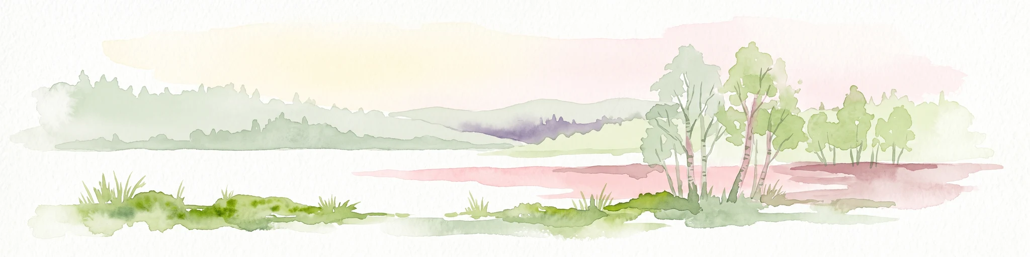
A watercolor painting showing a soft, panoramic landscape with rolling hills in the background, a small stream winding through a grassy foreground, and a cluster of trees on the right.
Nature reserveSchleswig-Holstein
About 39 km away#5 closest

South

Kannenbruch Nature Reserve in Schleswig-Holstein: A Regional Atlas of Protected Woodland Geography

Mapping the radial forestry lanes and bog-forest ecosystems

Kannenbruch represents a distinctive intersection of cultural history and natural succession within Schleswig-Holstein. The reserve protects a waterlogged, low-lying bog-forest characterized by its deliberate, star-shaped layout of radiating forestry lanes. This structured landscape provides a window into Biedermeier-era spatial planning while supporting a rich diversity of spring-flowering geophytes on its damp, heavy soils.

Area
0.25 km²
Established
1995
Relief
Lowland
Climate
Temperate
A horizontal watercolor painting depicting a soft, ethereal landscape with green trees on the left and right, a winding stream in the center, and pale rolling hills in the background against a light, misty sky.
Nature reserveSchleswig-Holstein
About 40 km away#6 closest

West

FFH-Gebiet Wennebeker Moor und Langwedel Nature Reserve: Geographic and Landscape Atlas

Protected mire and heathland complex in Schleswig-Holstein

The FFH-Gebiet Wennebeker Moor und Langwedel nature reserve encompasses a complex mosaic of wet and dry heath, quaking bogs, and Nardus grasslands. This site is distinguished by its unique integration of conservation obligations with active military land use, creating a rare habitat environment within a gently rolling morainal landscape.

Area
2.3 km²
Established
2004
Relief
Lowland
Climate
Temperate
Nature reserveSchleswig-Holstein
About 48 km away#7 closest

West

Wälder der nördlichen Itzehoer Geest: Protected Area and Forest Landscape Atlas

Natura 2000 ancient woodland in Schleswig-Holstein

Explore the geography of Wälder der nördlichen Itzehoer Geest, featuring four historical forest tracts across glacial moraines. This protected area highlights Atlantic acid beech forests and floodplain habitats, preserving centuries-old woodland continuity within the broader Schleswig-Holstein landscape.

Area
7.11 km²
Established
2004
Relief
Upland
Climate
Temperate
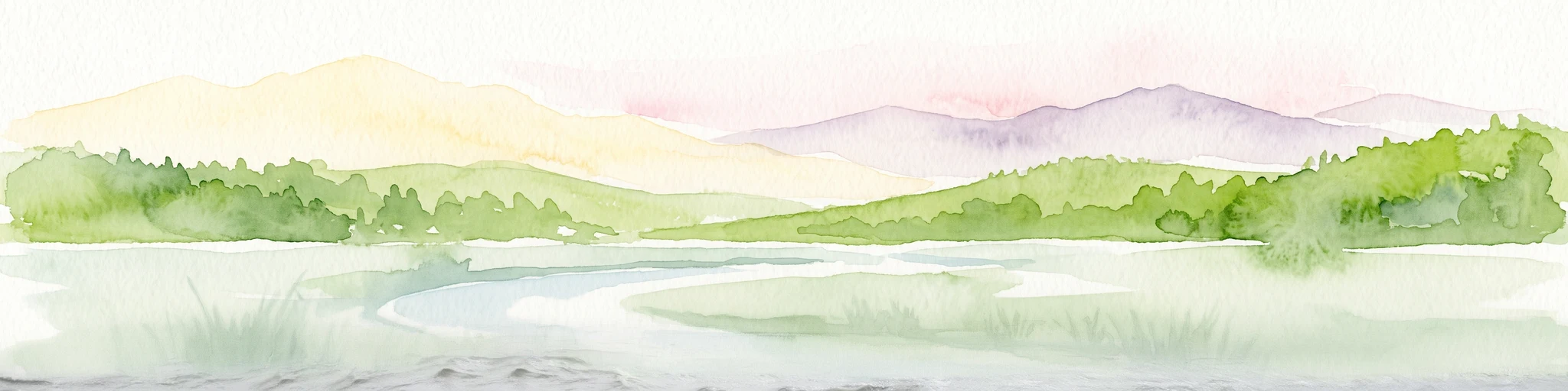
A watercolor painting showing a soft panoramic view of green hills and a winding stream, with distant pale mountains in the background.
Nature reserveSchleswig-Holstein
About 51 km away#8 closest

West

FFH-Gebiet Wehrau und Mühlenau Nature Reserve and River Corridor Geography

Protected riparian habitat in Schleswig-Holstein

Spanning over 246 hectares, this nature reserve protects a vital sequence of lowland streams, including the Mühlenau and Wehrau rivers. The area serves as an important refuge for rare mollusk species and aquatic wildlife, while preserving the integrity of a glacial tunnel valley geotope. This structured map view highlights the connectivity of wetlands, forests, and stream habitats that define the local landscape.

Area
2.46 km²
Established
2004
Relief
Lowland
Climate
Temperate

Common questions about visiting, size, designation, and location context for Naturpark Holsteinische Schweiz

Naturpark Holsteinische Schweiz FAQs for park facts, access, geography, and protected area context

Find quick answers about Naturpark Holsteinische Schweiz, including protected-area facts, park geography, trail and visitor context, and how the park fits into its surrounding country and regional landscape.
MoriAtlas Explorer

Continue Your Protected Areas Search Across the Global Atlas

Deepen your exploration by continuing the structured search for national parks and protected areas worldwide. Utilize the comprehensive filtering capabilities to compare different conservation landscapes and refine your understanding of global park geography. Discover more about the distribution and characteristics of protected natural areas.

Global natural geography