
Mori Atlas logo
Protected landscapeNaturpark Kyffhäuser

Explore the geological ridges, saline meadows, and wetland habitats of this central German nature park.

Naturpark Kyffhäuser: A Protected Landscape of Contrasting Terrains and Regional Geography

Naturpark Kyffhäuser in Thuringia serves as a vital protected landscape, defined by its striking juxtaposition of dry gypsum karst massifs and significant wetland reservoirs. The area encompasses the distinct Kyffhäuser massif along with the Hainleite and Windleite ridges, creating a complex terrain that supports rare steppe-like vegetation and inland salt meadows. Beyond the arid slopes, the Kelbra reservoir provides a critical haven for migratory waterbirds within the Unstrut river system.

nature parkThuringiagypsum karststeppe landscapesaline meadowsRamsar wetland
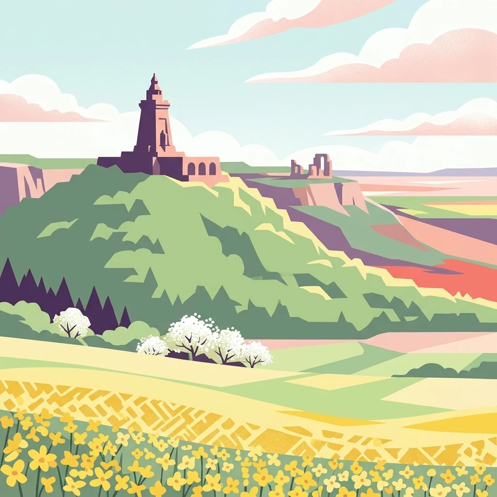
A vibrant graphic illustration showing the Kyffhäuser Monument on a green hill with yellow flower fields in the foreground.

Naturpark Kyffhäuser

Protected landscape

Park overview

Structured park overview, official facts, and landscape profile for Naturpark Kyffhäuser

Naturpark Kyffhäuser park facts, protected area profile, and essential visitor context

Review the core facts for Naturpark Kyffhäuser, including designation, size, terrain, visitor scale, habitats, and operating context in one park-focused overview.

About Naturpark Kyffhäuser

Naturpark Kyffhäuser is a Thuringian nature park that belongs to the broader system of German Naturparke, areas set aside to protect and present characteristic cultural landscapes rather than strict wilderness reserves. The park brings together a cluster of low mountain ranges and ridge landscapes in the northern part of Thuringia, framed by major regional lowlands: the Goldene Aue to the north and the Thuringian Basin to the south.

The heart of the park is the Kyffhäuser, a compact massif that rises abruptly between the flat agricultural plain of the Goldene Aue and the rolling terrain leading toward the Thuringian Basin. To the west of the Kyffhäuser lie the Windleite, and to the east the Hainleite, two long wooded ridge systems that together form a substantial part of the park's territory. These landscapes differ remarkably in geology, soil, and climate despite their proximity, which is one of the principal reasons the area was designated as a nature park.

The surrounding settlements give the park a strong cultural and historical layer. Sondershausen, the largest town within the park, is historically associated with the principality of Schwarzburg-Sondershausen and is known for its castle and caves. Bad Frankenhausen, another central town, is famous for the Kyffhäuser Monument above it as well as for its historical association with the Peasants' War and Thomas Müntzer. To the north, the small town of Kelbra lies beside the reservoir of the same name, while Auleben, Hamma, and Tilleda add smaller historic villages along the northern edge. The southeastern fringe includes Oldisleben and Sachsenburg, both directly associated with the Unstrut river.

The park is also a hub for regionally significant nature conservation work. A LIFE project has supported scientific study of the park's inland salt sites, while the Ramsar designation at Kelbra places the park within an international framework for the protection of migratory waterbirds. Geo-information facilities, including a centre near the Barbarossa Cave, help connect visitors to the region's geology as well as its wider landscape.

Quick facts and research context for Naturpark Kyffhäuser

Naturpark Kyffhäuser lies in northern Thuringia, south of the Harz mountains and just south of the Goldene Aue, with the Thuringian Basin to its south. The park has a total area of about 305 square kilometers and combines the Kyffhäuser range, the Windleite, and the Hainleite.

The entire park is part of the Unstrut catchment area, with the Wipper passing through the centre and the Unstrut itself defining part of the southeastern edge. Key natural landmarks include the gypsum-steppe slopes on the southern side of the Kyffhäuser, inland salt meadows fed by saline springs, and the Kelbra reservoir, which has been protected under the Ramsar Convention since 1978 as a refuge of international importance for birds.

Protection and recognition

Terrestrial conservation framework and official protected area designation metrics

Naturpark Kyffhäuser Protection Status and International Recognition

Naturpark Kyffhäuser maintains a documented terrestrial protection scope within regional conservation networks. Structured records compile the official designation history, management scope, and international recognition details for this protected area.

Protection details

Protection scope
Terrestrial
Transboundary protection
No
Park context

Deeper park guide and search-rich context for Naturpark Kyffhäuser

Naturpark Kyffhäuser history, landscape, wildlife, and travel context

Explore Naturpark Kyffhäuser through its history, landscape character, ecosystems, wildlife, conservation priorities, cultural context, and seasonal travel timing in a structured park guide built for atlas discovery and search intent.

Why Naturpark Kyffhäuser stands out

Naturpark Kyffhäuser is especially known for two strikingly different natural phenomena that sit within a relatively small area. The first is the unusual gypsum karst landscape on the southern edge of the Kyffhäuser, where white gypsum slopes and a dry, warm microclimate support a steppe-like vegetation community more characteristic of southeastern Europe, including distinctive plants such as the spring pheasant's eye and the Kyffhäuser feather grass. The second defining feature is the Kelbra reservoir at the northern edge of the park. Designated under the Ramsar Convention in 1978, it is recognized internationally as a refuge for waterbirds, waders, and raptors, and during migration it has become one of the most important crane stopover sites in central Germany, regularly hosting tens of thousands of birds. The park is also notable for unusual inland saline habitats fed by salt springs, which allow coastal plant species to grow far from the sea.
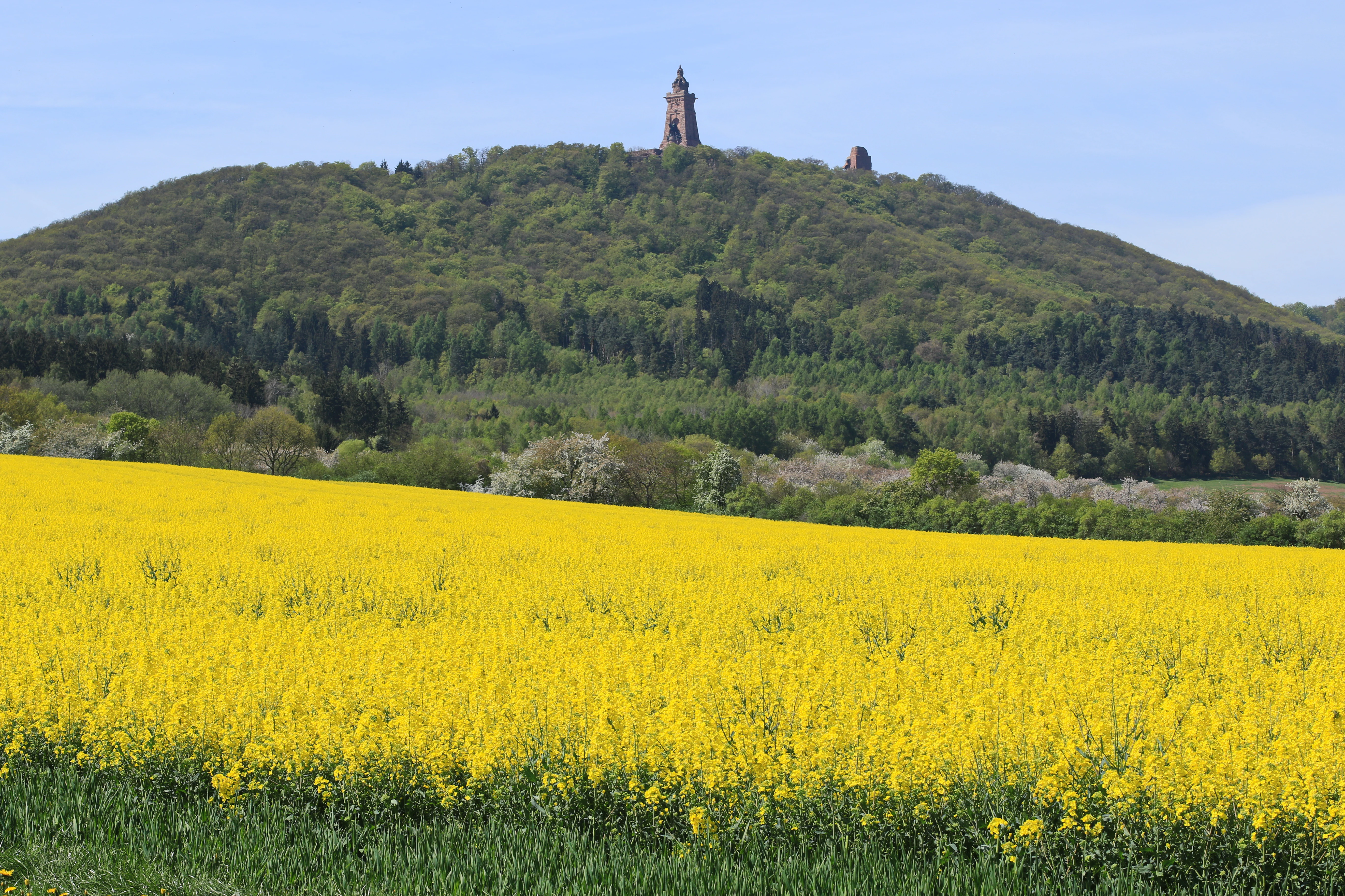
A wide view of a bright yellow rapeseed field in the foreground, with a forested hill containing a tall stone monument in the distance.
Spring landscape featuring a blooming rapeseed field with the Kyffhäuser Monument on the hill in the background.

Naturpark Kyffhäuser history and protected-area timeline

The Naturpark Kyffhäuser has its roots in Germany's broader postwar tradition of establishing Naturparke to protect and interpret characteristic cultural landscapes. Like other Thuringian nature parks, it reflects the recognition that the region's low mountain ranges, dry slopes, and associated lowlands host a combination of geology, vegetation, and human history that benefits from coordinated stewardship rather than independent local efforts.

A landmark moment in the park's modern identity came in 1978, when the Kelbra reservoir at its northern edge was designated under the Ramsar Convention as a wetland of international importance. That designation formalized the site's role as a refuge for waterbirds and confirmed its place within an international conservation framework.

In more recent decades, conservation work in the park has been strengthened by a LIFE project that focused on the inland salt habitats fed by saline springs. This project brought scientific monitoring and habitat management to a feature that is rare in central Europe and contributed to a broader European effort to understand and preserve continental saline ecosystems.

The cultural history of the surrounding landscape is much older than the nature park designation itself. The Kyffhäuser massif carries deep layers of German myth and history, most famously embodied in the Kyffhäuser Monument, which commemorates Emperor Frederick Barbarossa and was inaugurated in the late nineteenth century. Bad Frankenhausen and the broader Kyffhäuser region are also remembered as the site of the decisive battle of the German Peasants' War in 1525.

Naturpark Kyffhäuser landscape and geographic character

The landscape of Naturpark Kyffhäuser is shaped by a striking juxtaposition of flat lowlands and strongly dissected ridges. To the north lies the Goldene Aue, a wide, fertile agricultural plain along the Helme and toward the southern Harz foreland. To the south, the terrain steps down into the broader Thuringian Basin. Between these two lowlands rise the three defining uplands of the park.

The Kyffhäuser itself is the most dramatic of these. It is a compact massif whose southern flank breaks into bright white gypsum slopes. These slopes are unusually dry and warm, creating conditions that have produced a steppe-like character rarely seen elsewhere in central Germany. Toward the summit of the massif, the landscape gives way to rocky outcrops and forested upper slopes, and the entire massif stands visible from the surrounding plains as a distinct landmark.

West and east of the Kyffhäuser extend the Windleite and the Hainleite, two long, narrow ridges with their own geological makeup. Their slopes tend to be more wooded and more continuous than those of the Kyffhäuser, forming a gentler but still clearly defined ridgeline landscape. Between these ridges lie smaller valleys and brook systems, including those of the Badraer Bach and other small tributaries, as well as the broader course of the Wipper, which crosses the park on its way toward the Unstrut.

In the north of the park, the open landscape of the Goldene Aue is interrupted by the broad water surface of the Kelbra reservoir. This artificial lake has reshaped the immediate scenery into an open, low-lying wetland setting, contrasting strongly with the enclosing ridges and steppe habitats to the south.
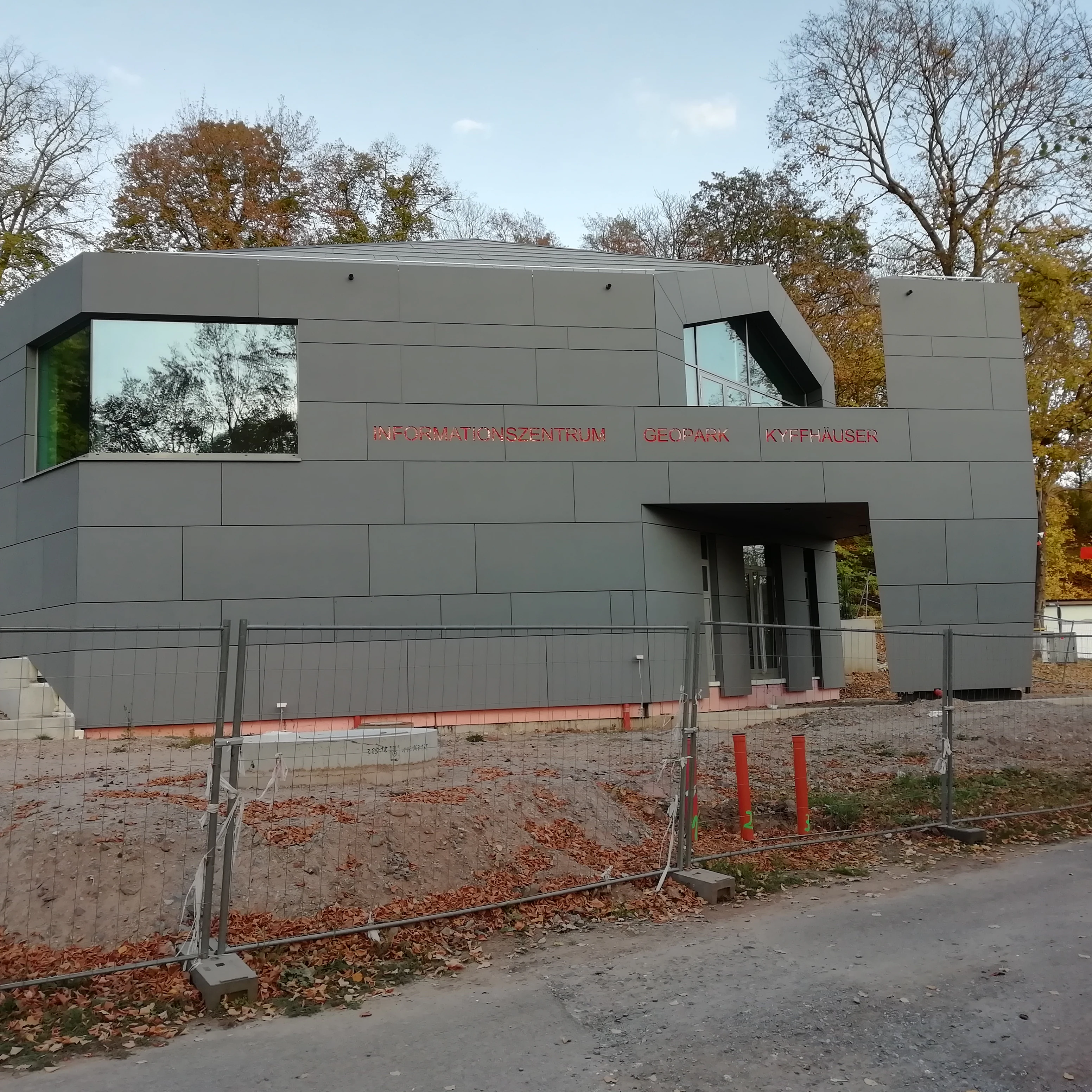
A modern, grey-paneled building with large geometric windows serves as the visitor information center for the Barbarossahöhle, viewed from across a gravel area with construction fencing.
The visitor center at Barbarossahöhle in Naturpark Kyffhäuser.

Naturpark Kyffhäuser ecosystems, habitats, and plant life

The nature of the park reflects the unusual coexistence of dry, steppe-like uplands and wet, lowland reservoir ecosystems within a small geographic area. On the southern gypsum slopes of the Kyffhäuser, the combination of permeable substrate and a dry, warm microclimate has produced a steppe vegetation community more typical of the Pannonian and Pontic regions. Species such as the spring pheasant's eye and the Kyffhäuser feather grass are emblematic of this habitat type.

Alongside the steppe vegetation, the park preserves an unusual saline flora. Salt-bearing springs feed small inland saline meadows where plants more commonly associated with coastal saltmarshes, including the sea aster, can survive far from the sea. A specific LIFE project has supported scientific monitoring and conservation of these rare inland salt habitats.

The northern part of the park, dominated by the Kelbra reservoir, has an entirely different ecological profile. The open water, surrounding shallow zones, and adjacent agricultural and grassland areas create habitat for waterbirds, waders, and reed-dwelling species. Together, the dry slopes, saline meadows, and reservoir form an ecological mosaic that gives the park an unusually broad habitat range relative to its size.

Naturpark Kyffhäuser wildlife and species highlights

The park has become particularly well known for its birds, especially around the Kelbra reservoir in the north. Through much of the year, this wetland area supports a wide range of dabbling ducks such as mallard, teal, and pochard, as well as grebes including great crested, little, and black-necked grebes. Waders such as lapwing, snipe, redshank, and curlew are also regular visitors, along with rails, coots, mute swans, and black-headed gulls.

The reservoir also attracts significant populations of larger and more conspicuous waterbirds. Bitterns, including both little and great bitterns, have been recorded in the reed zones, while raptors such as white-tailed eagle, osprey, peregrine falcon, and cormorant are also present. This combination of prey-rich waterbodies and surrounding open land creates ideal conditions for these species.

During the migration seasons, the wildlife importance of the park peaks dramatically. The Kelbra reservoir has become a major stopover site for cranes, with peak roost counts reaching tens of thousands of birds. Large flocks of larks and finches also pass through the area during migration, turning the northern part of the park into one of the more important bird passage areas in central Germany.

Naturpark Kyffhäuser conservation status and protection priorities

Naturpark Kyffhäuser carries multiple layers of conservation significance. At its heart is the Ramsar designation of the Kelbra reservoir, recognized internationally since 1978 as a refuge of importance for migratory and resident waterbirds. This designation links the park directly to global efforts to protect wetland habitats and the species that depend on them.

Beyond the wetland, the park protects rare dryland and saline ecosystems. The gypsum-steppe slopes of the southern Kyffhäuser preserve a vegetation type that is uncommon in central Europe and requires ongoing management to prevent scrub encroachment. The inland salt sites, supported by saline springs, have been the focus of a dedicated LIFE project that brought scientific study and habitat management to these rare continental saline environments.

Taken together, the park's conservation value lies in the way it links three very different habitat systems: the internationally protected wetland at Kelbra, the steppe-like gypsum hills of the Kyffhäuser, and the fragile inland saline meadows. This combination means the park contributes not only to local biodiversity but also to the preservation of habitat types that are rare across Germany and beyond.

Naturpark Kyffhäuser cultural meaning and human context

The cultural context of the park is unusually rich for an area of its size. The Kyffhäuser massif has long been a powerful symbol in German historical memory, long associated in legend with the sleeping Emperor Barbarossa and crowned in 1896 with the Kyffhäuser Monument, a massive memorial combining an imperial statue with elements of the imperial crown. Today the monument dominates views across the park and stands as one of its most recognizable cultural landmarks.

The surrounding towns carry their own historical weight. Sondershausen, in the centre of the park, was the seat of the principality of Schwarzburg-Sondershausen and is known for its rococo castle interiors and the nearby Barbarossa Cave, a former gypsum mine now developed as a show cave. Bad Frankenhausen, on the eastern side of the park, is remembered as the site of the decisive battle of the German Peasants' War in 1525, when reformer Thomas Müntzer and the rebel forces were defeated. A panoramic painting in the town commemorates this event.

Smaller villages, including Auleben, Hamma, Sittendorf, Tilleda, and the communities of Kyffhäuserland, reflect the long agricultural history of the Goldene Aue and the older settlement patterns along the edges of the ridges. In the southeast, Oldisleben and Sachsenburg are closely associated with the course of the Unstrut and with regional medieval and early modern history.

Top sights and standout views in Naturpark Kyffhäuser

Naturpark Kyffhäuser offers a rare concentration of contrasting landscapes within a compact area, which is the source of much of its identity. The white gypsum slopes of the southern Kyffhäuser, the steppe vegetation that grows on them, and the inland salt meadows fed by saline springs form a distinctive terrestrial habitat complex.

Alongside this dryland character, the park contains the Ramsar-protected Kelbra reservoir, an internationally important wetland that during migration hosts tens of thousands of cranes and supports significant populations of waterbirds, waders, and raptors. Cultural anchors such as the Kyffhäuser Monument, Sondershausen, Bad Frankenhausen, and the Barbarossa Cave connect the natural highlights of the park to centuries of regional history.

Best time to visit Naturpark Kyffhäuser

The character of a visit to Naturpark Kyffhäuser shifts significantly with the seasons. Spring is especially rewarding for the steppe flora on the gypsum slopes of the southern Kyffhäuser, when characteristic flowers such as the spring pheasant's eye come into bloom, and when migratory bird activity around the Kelbra reservoir begins to intensify.

Late summer and early autumn normally represent the peak of the bird migration story, with the largest crane gatherings at Kelbra and increased passage of larks and finches across the surrounding fields. Winter brings a quieter atmosphere, with frost often visible on the white gypsum hills and the ridges of the Windleite and Hainleite, offering clearer long-distance views across the Goldene Aue and the Thuringian Basin. In all seasons, the compact geography of the park means that visitors can move between the steppe slopes, the cultural towns, and the reservoir within a single day.

Monthly climate preview

Long-term monthly temperature ranges and precipitation patterns measured at representative coordinates

Naturpark Kyffhäuser Climate Normals, Annual Temperature and Precipitation Records

Representative coordinates record annual temperatures spanning from sub-zero winter minimums to warm summer maximums alongside consistent monthly precipitation distribution. Examining the full monthly data profile reveals detailed thermal fluctuations and precipitation metrics across the protected landscape.
Annual mean9 °C
-1 °C19 °C
Jan-1°
Feb
Mar
Apr
May13°
Jun17°
Jul19°
Aug19°
Sep14°
Oct
Nov
Dec
Warmest month
July

18.9 °C

Coolest month
January

-0.9 °C

Wettest month
July

2.4 mm/day

Driest month
February

1.2 mm/day

Park location guide

Geography guide, regional context, and park location map for Naturpark Kyffhäuser

Naturpark Kyffhäuser park geography, regions, and map view in Germany

Understand where Naturpark Kyffhäuser sits in Germany through a broader geographic reading of the surrounding landscape, nearby location context, and its mapped position within the national park landscape.

How Naturpark Kyffhäuser fits into Germany

Germany is a federal republic in Western and Central Europe with a population of over 83 million across sixteen constituent states. It is Europe's largest economy by nominal GDP and a major global exporter and importer. The capital is Berlin, and the country borders Denmark, Poland, Czech Republic, Austria, Switzerland, France, Luxembourg, Belgium, and the Netherlands.

Wider geography shaping Naturpark Kyffhäuser in Germany

Germany is located in Western and Central Europe, spanning 357,022 km². It borders Denmark to the north, Poland and the Czech Republic to the east, Austria and Switzerland to the south, and France, Luxembourg, Belgium, and the Netherlands to the west. The country has coastlines on the Baltic Sea and North Sea to the north, with the Alps located in the southern region.

Map view of Naturpark Kyffhäuser

Use this park location map to pinpoint Naturpark Kyffhäuser in Germany, understand its exact geographic position, and read its mapped placement within the surrounding landscape more clearly.

Pigeon | © OpenStreetMap contributors

Location context for Naturpark Kyffhäuser

Thuringia

Visual reference for gypsum karst ridges, steppe habitats, and wetland reserves

Naturpark Kyffhäuser Photos and Landscape Scenery Visual Exploration

Visual records capture the distinctive topography of Naturpark Kyffhäuser, featuring bright white gypsum slopes, wooded ridges, and open wetland reserves. Examining these protected landscapes reveals the dramatic contrast between dry steppe terrain and migratory bird habitats across the region.

A wide view of a bright yellow rapeseed field in the foreground, with a forested hill containing a tall stone monument in the distance.

Wide landscape shot of green, forested hills under a blue sky, with a tall telecommunications tower visible on a distant ridge.

A modern, grey-paneled building with large geometric windows serves as the visitor information center for the Barbarossahöhle, viewed from across a gravel area with construction fencing.

Park atlas

Compare adjacent ridge landscapes, wetland reserves, and regional conservation areas.

Other Parks Near Naturpark Kyffhaeuser and Surrounding Regional Protected Areas

Browse protected areas and natural reserves located near Naturpark Kyffhaeuser to compare regional ridge terrain and wetland habitats. Expanding the geographic view helps connect individual massifs with broader conservation landscapes across central Germany.
Nature reserveThuringia
About 4.6 km away#1 closest

South

Wipperdurchbruch Nature Reserve: Geographic Map and Protected Landscape Overview

Examining the Muschelkalk gorge and Hainleite ridge in Thuringia

Understand the protected geography of Wipperdurchbruch, a narrow breakthrough valley in the northern Thuringian hill country. This detailed entry maps the interplay between the meandering river, steep calcareous slopes, and ancient archaeological hilltops, defining its role within the wider regional conservation network of the Hainleite ridge.

Area
6.316 km²
Relief
Mountain
Climate
Temperate
Access
Access unknown
A horizontal watercolor painting depicting rolling green hills and a dense forest canopy against a soft, light background.
Nature reserveThuringia
About 21 km away#2 closest

Northwest

Alter Stolberg Nature Reserve: Mapping the Karst Landscapes of the South Harz

A study of Zechstein geology and forested ridge geography in Thuringia

The Alter Stolberg serves as a primary example of karst topography within the South Harz Zechstein Belt, offering a compact and heavily wooded plateau landscape. This protected area includes distinct geological features like the Heimkehle gypsum cave and historical medieval ruins, illustrating the integration of natural processes and cultural history in central Germany. Explore the geographic boundaries and terrain characteristics that define this essential protected area.

Area
6.233 km²
Established
1961
IUCN
IV
Relief
Upland
Nature reserveThuringia
About 23 km away#3 closest

West

Wöbelsburg Nature Reserve: Protected Plateau Landscapes and Geography in Thuringia, Germany

Mapped shell limestone escarpment and Iron Age hillfort site.

Wöbelsburg offers a focused look at the rugged Muschelkalk terrain characteristic of the northwestern Hainleite. As a protected nature reserve, the site features a prominent mountain spur that drops steeply toward the Wipper lowland, providing a clear example of geological undercutting and plateau formation in central Germany.

Area
0.659 km²
Established
1961
Relief
Upland
Water
Minor water
A soft watercolor painting of layered green hills and forest under a pale sky, with a faded white background.
Protected landscapeThuringia
About 24 km away#4 closest

Southeast

Hohe Schrecke: Protected Landscape Map and Geographic Overview of Thuringian Woodlands

Mapped beech forest ridges and central German terrain.

Hohe Schrecke is a low mountain ridge in central Germany defined by expansive, unfragmented beech forests and sandstone-based topography. The area features a coherent mosaic of mature woodland, stream-cut valleys, and dry grasslands. This overview provides a structured look at the park boundaries and regional geographic context that define this protected landscape in Thuringia.

Area
42.5 km²
Established
2004
Relief
Mountain
Climate
Temperate
Nature reserveThuringia
About 24 km away#5 closest

Southwest

Großer Horn Nature Reserve: Protected Forest Geography and Mapped Landscape Context

A vital woodland reference site in the Thuringian Basin.

Großer Horn is a long-standing nature reserve located in northern Thuringia, notable for its strict totalreservat core and diverse forest composition. The protected area features an intricate soil mosaic of loess loam and limestone, supporting distinct oak and beech forest communities. This isolated habitat island provides essential insight into the ecological character of the subcontinental forest transition zone.

Area
0.159 km²
Established
1961
Relief
Upland
Climate
Temperate
A soft watercolor illustration showing a panoramic view of rolling green hills, trees, and soft-toned landscape features on a plain white background.
Nature reserveThuringia
About 25 km away#6 closest

Northwest

Rüdigsdorfer Schweiz: Protected Gypsum Karst Nature Reserve in Thuringia, Germany

A rare mapped landscape of karst sinkholes and dry valleys.

Rüdigsdorfer Schweiz stands as a critical protected area in Thuringia, known for its intact gypsum karst terrain. This landscape of gentle hills, earth collapses, and soluble rock formations serves as a vital ecological anchor in the Harz foothills. Explore the geography of this nature reserve to understand its layered protection and the distinctive geological history carved into its irregular surface.

Area
3.006 km²
Established
1997
IUCN
IV
A watercolor painting depicting a soft, rolling landscape with purple hills in the distance, green plains with clusters of trees in the middle, and pink wildflowers in the foreground.
Nature reserveKyffhäuserkreis
About 26 km away#7 closest

East

Bottendorfer Hügel Nature Reserve: Mapped Geography and Protected Ridge Landscape

A rare steppe-grassland protected area in Kyffhäuserkreis, Thuringia

Discover the unique geography of the Bottendorfer Hügel, a compact gypsum-based cuesta ridge characterized by its open, tree-less steppe grasslands. Located in the Kyffhäuserkreis district, this nature reserve is recognized for its specialized heavy-metal-adapted plant communities and distinctive geological profile situated between the broader forested sandstone highland landscapes.

Area
1.316 km²
Relief
Upland
Climate
Temperate
Access
Easy access
Nature reserveThuringia
About 26 km away#8 closest

West

Westliche Hainleite Nature Reserve: Mapping the Protected Ridgeline Landscapes of Northern Thuringia

A study of forest escarpments, erosional valleys, and Natura 2000 ecological connectivity

Westliche Hainleite is a protected nature reserve in Thuringia defined by its steep ridgeline escarpments and transitionary geography between the Hainleite range and the Dün hills. This area preserves a mosaic of woodland, cliff, and slope habitats, maintaining essential ecological continuity across the northern German hill country. Its topography is characterized by deep erosional gullies and named summits like Der Berg, which create a distinctive vertical profile within the regional landscape.

Area
9.459 km²
Established
2004
IUCN
IV

Common questions about visiting, size, designation, and location context for Naturpark Kyffhäuser

Naturpark Kyffhäuser FAQs for park facts, access, geography, and protected area context

Find quick answers about Naturpark Kyffhäuser, including protected-area facts, park geography, trail and visitor context, and how the park fits into its surrounding country and regional landscape.
MoriAtlas Explorer

Continue Your Protected Areas Search Across the Global Atlas

Deepen your exploration by continuing the structured search for national parks and protected areas worldwide. Utilize the comprehensive filtering capabilities to compare different conservation landscapes and refine your understanding of global park geography. Discover more about the distribution and characteristics of protected natural areas.

Global natural geography