

Why Palau National Marine Sanctuary stands out
The Palau National Marine Sanctuary is best known for its enormous marine footprint, which ranks among the largest protected areas in the world, and for its strong no-take zoning model that closes the vast majority of its waters to commercial fishing and mining. It is also recognized internationally as a flagship Pacific island conservation framework, frequently cited as a model for ambitious, nationally driven marine protection at a scale large enough to safeguard entire ocean ecosystems rather than just localized reef patches.
Palau National Marine Sanctuary history and protected-area timeline
The Palau National Marine Sanctuary was established in 2015 by the government of Palau, then led by President Thomas Remengesau Jr. Its creation marked a major step in the country's broader marine conservation trajectory, formalizing large-scale protection for Palau's surrounding ocean environment through national legislation.
A defining feature of the sanctuary's rollout was the structured transition toward full protection. Rather than closing extractive uses immediately, the government adopted a five-year phase-out plan, with the full no-take regime coming into effect in 2020. This approach allowed the policy to be implemented gradually while signaling a clear long-term destination of comprehensive marine protection across most of the designated zone.
After its establishment, the sanctuary became a recognized reference point at international forums, including being cited at the United Nations Ocean Conference as one of the world's most ambitious ocean conservation initiatives. However, its size and ambition have also created political attention within Palau itself: proposals surfaced in 2021 and 2024 under subsequent administrations to reduce the total size of the protected area, driven in part by economic concerns associated with restricting commercial fishing activity across such a broad expanse of ocean.
Palau National Marine Sanctuary landscape and geographic character
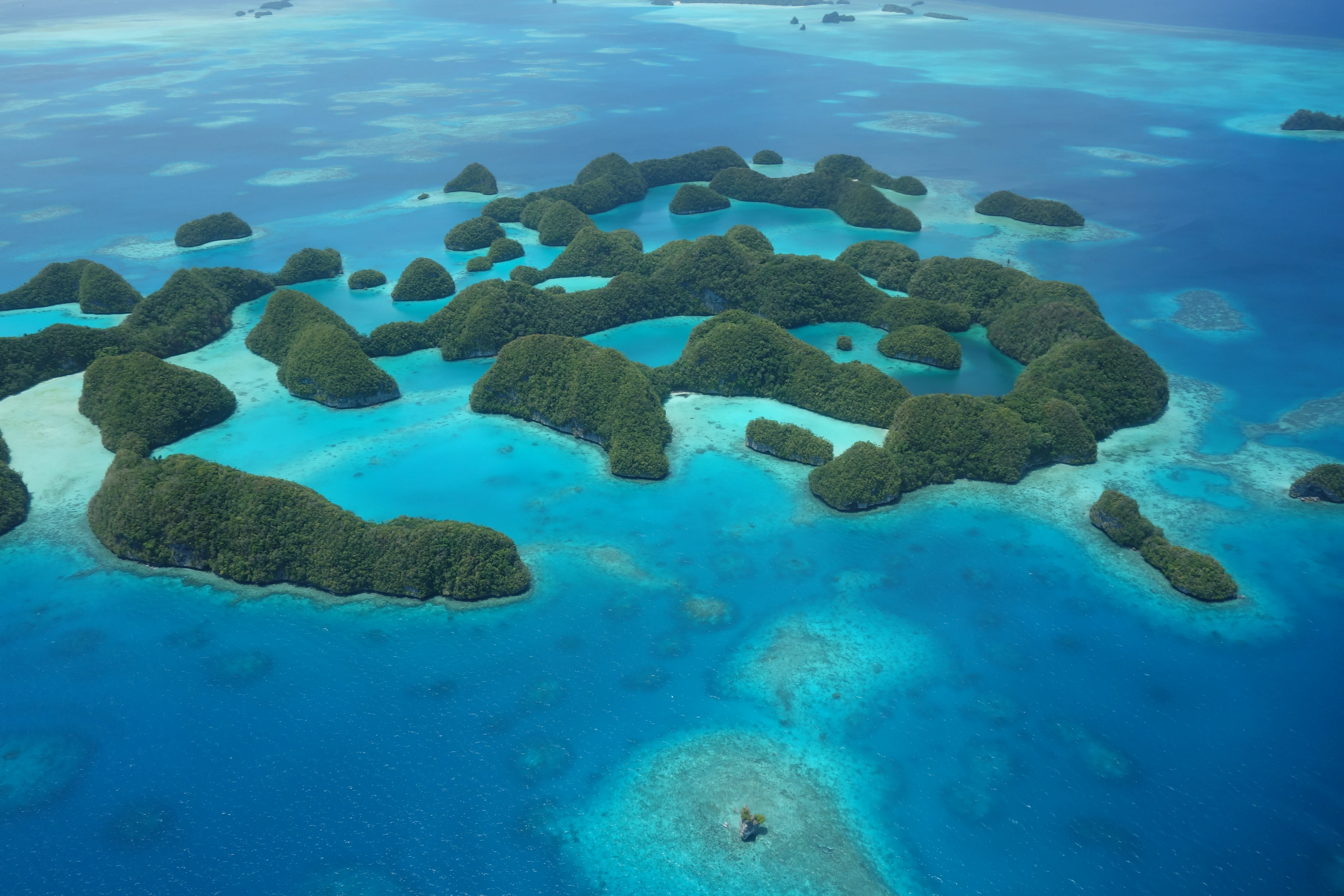
The Palau National Marine Sanctuary covers a marine area of more than 500,000 square kilometers centered on the waters around the Republic of Palau, an island nation in the western Pacific Ocean. The country's archipelago lies within Micronesia, and its surrounding seas are characterized by tropical Pacific waters with reef, pelagic, and deep-ocean environments extending outward from the islands.
Because the sanctuary is primarily an oceanic designation, its 'landscape' is a marine one. It encompasses a continuous gradient of undersea environments, from shallow coral reef ecosystems adjacent to Palau's islands into deeper offshore waters that include pelagic zones used by larger marine species. The enormous scale of the protected area means that it stretches well beyond the immediate reef fringes, covering extensive open ocean that is ecologically connected to the islands themselves.
This vast spatial extent is itself a defining physical feature of the sanctuary: the protected zone dwarfs Palau's land area many times over, making the surrounding ocean the primary geographic subject of the park rather than terrestrial terrain.
Palau National Marine Sanctuary ecosystems, habitats, and plant life
The ecological value of the Palau National Marine Sanctuary lies in its inclusion of tropical Pacific marine ecosystems surrounding Palau, ranging from coral reef systems along the archipelago to wide pelagic and deep-water habitats further offshore. The combination of reef and open-ocean environments within a single nationally protected framework gives the sanctuary ecological breadth that is unusual even among large marine protected areas elsewhere in the world.
By placing the majority of these waters under no-take protection, the sanctuary aims to maintain the ecological processes of reef systems, support healthy fish stocks, and safeguard broader marine biodiversity from the pressures of commercial extraction. The protected oceans of Palau function as a continuous ecological system in which reef-dependent species, pelagic species, and deeper marine environments are connected, rather than as isolated conservation patches.
Palau National Marine Sanctuary conservation status and protection priorities
The Palau National Marine Sanctuary represents one of the most ambitious nationally driven ocean conservation initiatives of the 21st century, both in spatial scale and in the strictness of its core protections. Its no-take component, covering approximately 80 percent of the sanctuary, removes commercial fishing and marine mining as pressures across an enormous area of tropical Pacific ocean.
The sanctuary's conservation logic reflects a systems-level view of marine protection. Instead of fragmenting conservation effort across scattered patches, Palau consolidated protection across the vast majority of its national waters, allowing ecological processes to function across entire migratory ranges, reef networks, and ocean gradients. Active enforcement through rangers and Marine Law Enforcement boats reinforces the sanctuary's on-the-water integrity rather than treating it as a purely symbolic designation.
Internationally, the sanctuary has been cited at high-profile venues such as the United Nations Ocean Conference as a leading example of large-scale ocean stewardship. At the same time, domestic political debate, including proposals to shrink the sanctuary in 2021 and 2024, illustrates the ongoing tension between the sanctuary's long-term conservation value and the short-term economic considerations tied to commercial fishing access.
Palau National Marine Sanctuary cultural meaning and human context
Palau is a Pacific island nation whose identity, economy, and daily life are closely tied to the sea, and the Palau National Marine Sanctuary reflects that relationship at the policy level. By reserving the majority of national waters for full protection while still allowing domestic fisheries within a smaller portion, the sanctuary reflects an effort to balance modern conservation frameworks with the country's traditions of local, subsistence-oriented ocean use.
The sanctuary also represents a strong expression of national sovereignty over marine space. For a small island state, asserting stewardship over hundreds of thousands of square kilometers of ocean is itself a cultural and political statement about the role of the sea in Palauan society.
Top sights and standout views in Palau National Marine Sanctuary
The most striking features of the Palau National Marine Sanctuary are its extraordinary size, its strong no-take zoning across roughly 80 percent of the marine estate, and its role as a globally recognized model of island-led ocean conservation. Implementation began in 2015 and reached full protection in 2020 after a carefully managed five-year transition, giving the sanctuary both immediate international visibility and a credible long-term enforcement structure.
Equally important is the sanctuary's identity as a national symbol. Few protected areas anywhere combine such an immense geographic footprint with such a clear institutional story: a small Pacific island nation committing the overwhelming majority of its surrounding ocean to long-term ecological protection.
Best time to visit Palau National Marine Sanctuary
The Palau National Marine Sanctuary is a national-scale ocean designation rather than a single land-based park with controlled access, so visit timing is shaped less by park operating seasons and more by broader conditions across Palau's marine environment. Calm, dry-season conditions typically favor reef visibility, snorkeling, and diving throughout the archipelago, while wetter periods can affect surface conditions and underwater clarity.
Because the sanctuary's significance is fundamentally ecological, the most meaningful 'timing' consideration is recognizing that its protections are designed to function year-round, sustaining reef health, pelagic ecosystems, and breeding habitats across seasons rather than being tied to a narrow visitor window.