
Mori Atlas logo
Protected landscapePřírodní park Doubrava

A linear protected corridor defined by riverine woodlands, historic dam structures, and unique hydraulic engineering sites.

Přírodní park Doubrava: Navigating the Doubrava River Valley Protected Landscape in Pardubický kraj

Přírodní park Doubrava stretches across an elongated north-to-south corridor following the Doubrava River through the Pardubický kraj. This protected landscape blends natural riverine forest and rocky banks with technical heritage, including the rubble-stone Pařížov reservoir dam and a notable artificial water diversion tunnel. Situated in the transition zone between the Bohemian-Moravian Highlands and the Iron Mountains, the park preserves a vital ecological artery for species such as the European otter and fire salamander.

river valleyriverine forestreservoirdamtechnical monumentwater tunnel
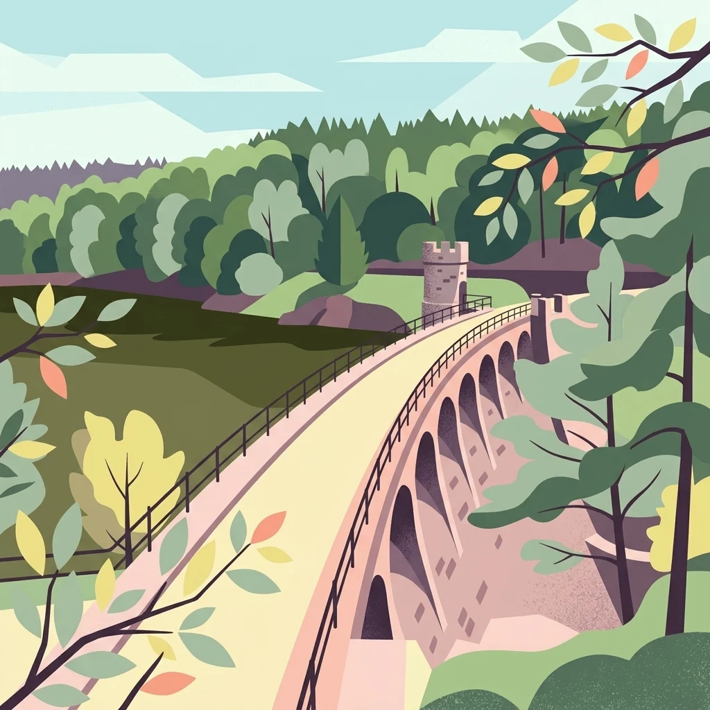
A stylized digital illustration of a stone dam with multiple arches, surrounded by green forests and a river, typical of the landscape in Přírodní park Doubrava.

Přírodní park Doubrava

Protected landscape

Park overview

Structured park overview, official facts, and landscape profile for Přírodní park Doubrava

Přírodní park Doubrava park facts, protected area profile, and essential visitor context

Review the core facts for Přírodní park Doubrava, including designation, size, terrain, visitor scale, habitats, and operating context in one park-focused overview.

About Přírodní park Doubrava

Přírodní park Doubrava is a protected nature park in the central Czech Republic, formally designated on 14 November 1998 by the Chrudim District Office. It lies within the Pardubice Region and follows the upper valley of the Doubrava River, one of the characteristic streams of the Bohemian-Moravian Highlands transition area. Although officially listed at around 65 hectares, the protected area is sometimes described as covering close to 426 hectares, reflecting different interpretations of its boundary and buffer zones.

The geography of the park is strongly shaped by the river itself. The park has an elongated form that stretches from north to south, with the town of Ronov nad Doubravou near its northern limit and the village of Spačice anchoring the southern end. The eastern boundary touches the town of Třemošnice, while the Doubrava River flows through the protected area from south to north. This linear river-valley setting gives the park its clear identity as a corridor of natural landscape embedded within otherwise settled Bohemian countryside.

The most recognizable landmark within the park is the Pařížov reservoir and its dam. Built from quarry stone, the dam is classed as a technical monument and represents an important piece of historical water engineering in the region. Adding further character to the river corridor is the artificial water tunnel carrying the Doubrava between Mladotice and Ronov nad Doubravou. Together, these structures illustrate how the park blends natural river-valley scenery with historically significant human interventions in the landscape.

Ecologically, the protected area preserves a stretch of riverine forest, rocky banks, and wet habitats along the Doubrava. It supports plants such as the alpine rose (Rosa pendulina), the oxlip (Primula elatior), wood spurge (Euphorbia amygdaloides), peach-leaved bellflower (Campanula persicifolia), and tuberous comfrey (Symphytum tuberosum). The park's wildlife includes river-associated birds such as the common kingfisher (Alcedo atthis), the grey wagtail (Motacilla cinerea), and the white-throated dipper (Cinclus cinclus), as well as woodland species like the stock dove (Columba oenas) and the black woodpecker (Dryocopus martius). Notable amphibians and mammals present in the area include the fire salamander (Salamandra salamandra) and the European otter (Lutra lutra), which underscore the ecological value of the river for larger predators as well.

In regional terms, Přírodní park Doubrava serves as a compact but meaningful nature reserve within the transition zone between the highlands and the Iron Mountains foothills. Its combination of riverine habitat, rocky terrain, reservoir heritage, and tunnel engineering gives the park a distinctive character that goes beyond the typical small Czech nature park and supports both ecological conservation and appreciation of cultural-industrial landscape features.

Quick facts and research context for Přírodní park Doubrava

Přírodní park Doubrava is a Czech nature park located in the Chrudim district of the Pardubice Region and was established on 14 November 1998 by the former Chrudim District Office. Its official area is approximately 65 hectares, although some sources cite a larger figure of around 426 hectares. The park follows the valley of the Doubrava River between Ronov nad Doubravou in the north and Spačice in the south, with its eastern edge touching the town of Třemošnice.

Protection and recognition

Examine terrestrial protection details and official designation records for Přírodní park Doubrava.

Přírodní park Doubrava Protection Status and Conservation Records

Comprehensive conservation data outlines the documented terrestrial protection status and management scope for Přírodní park Doubrava. Structured records compile available designation metrics and official international recognition details without external attribution.

Protection details

Protection scope
Terrestrial
Transboundary protection
No
Park context

Deeper park guide and search-rich context for Přírodní park Doubrava

Přírodní park Doubrava history, landscape, wildlife, and travel context

Explore Přírodní park Doubrava through its history, landscape character, ecosystems, wildlife, conservation priorities, cultural context, and seasonal travel timing in a structured park guide built for atlas discovery and search intent.

Why Přírodní park Doubrava stands out

Přírodní park Doubrava is best known for the Doubrava River valley that runs through its entire length and for the Pařížov reservoir, whose rubble-stone dam is recognized as a technical monument. The unusual artificial water tunnel between Mladotice and Ronov nad Doubravou adds an additional layer of engineering heritage to an otherwise natural river-valley landscape. The park is also notable for combining riverine woodland, rocky riverbanks, and a relatively modest protected footprint into a coherent ecological corridor in central Bohemia.
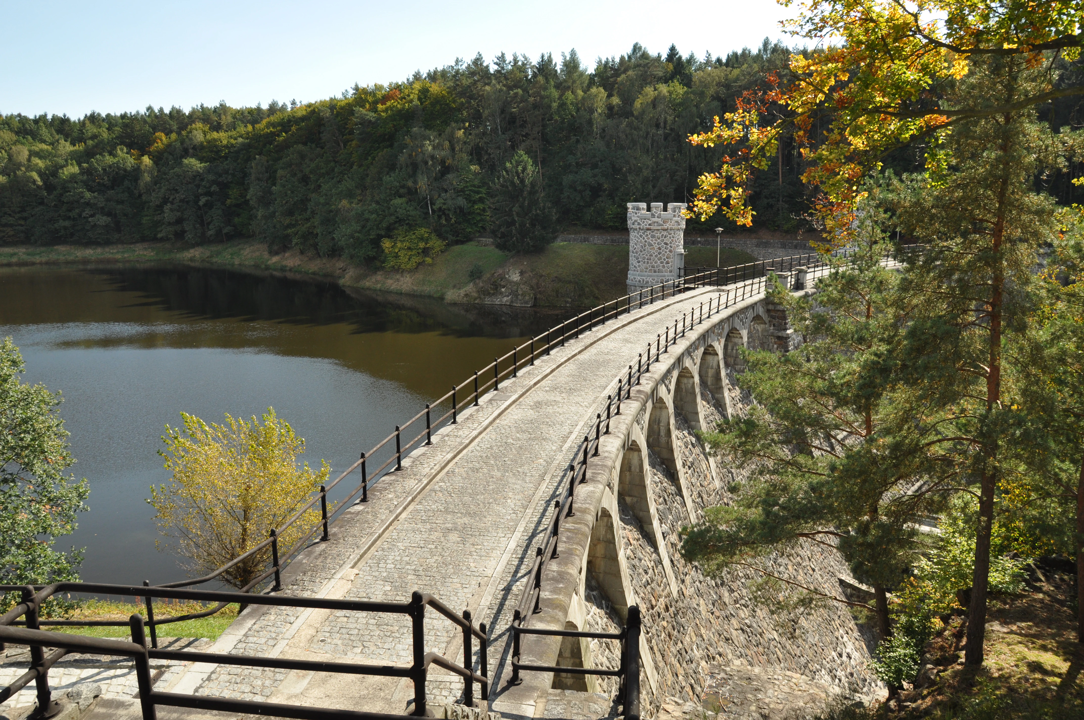
A wide angle view of the Pařížov dam, featuring a curved stone wall with arched supports and a crenelated tower, set within a forested valley with a calm reservoir on the left.
The historic Pařížov dam, an iconic stone structure spanning the Doubrava river valley.

Přírodní park Doubrava history and protected-area timeline

Přírodní park Doubrava was formally established on 14 November 1998, when it was declared by the Chrudim District Office within what is now the Pardubice Region of the Czech Republic. Its designation as a 'přírodní park' placed it into the Czech category of larger landscape-scale protected areas, intended to safeguard coherent tracts of countryside rather than small isolated sites.

The natural setting of the park long predates its formal protection. The Doubrava River valley, with its rocky stretches, riparian woodland, and reservoir infrastructure, has been a working part of the regional landscape for generations, with the quarry-stone Pařížov dam standing out as a notable heritage structure. The artificial water tunnel between Mladotice and Ronov nad Doubravou, which routes a section of the river underground, is another legacy of older water-management engineering in the valley.

The 1998 designation reflects a recognition that this combination of river-valley scenery, biodiversity, and historical engineering features deserved coordinated protection. By aligning the protected boundary with the river corridor between Ronov nad Doubravou, Spačice, and the edges of Třemošnice, the authorities created a park whose identity is inseparable from the Doubrava River itself.

Přírodní park Doubrava landscape and geographic character

The landscape of Přírodní park Doubrava is defined by the valley of the Doubrava River, which runs through the entire protected area from south to north. The park has an elongated, stretched shape following this valley corridor, lending it a strongly linear character rather than a compact protected core. The northern end of the park is framed by the town of Ronov nad Doubravou, the southern end by the village of Spačice, and the eastern edge touches the town of Třemošnice.

A central feature of the park's terrain is the Pařížov reservoir, with its dam built from quarry stone. This reservoir, recognized as a technical monument, modifies the natural river profile and introduces calm water, rocky dam faces, and controlled water levels into the valley. Below and above the reservoir, the river continues through a mix of natural channels, rocky banks, and riparian vegetation.

The hydrological landscape of the park is further enriched by an artificial water tunnel that carries the Doubrava between Mladotice and Ronov nad Doubravou. This underground diversion is an unusual topographic feature for a protected area, giving the valley a distinctive blend of natural and engineered scenery. In broader terms, the park fits into the transitional terrain between the Bohemian-Moravian Highlands and the Iron Mountains foothills, a setting that lends the relatively small protected area a varied relief of slopes, valley floors, and elevated viewpoints typical of central Bohemian river landscapes.

Přírodní park Doubrava ecosystems, habitats, and plant life

Přírodní park Doubrava protects a coherent stretch of riverine ecosystem along the Doubrava River. Because the valley is long and narrow, the nature of the protected area is closely tied to the river corridor itself, including its banks, riparian forests, and the surroundings of the Pařížov reservoir. Habitats here range from fast-flowing rocky sections to calmer reservoir margins, supporting a varied mix of streamside and aquatic-edge species.

The forest habitats within the park blend into the broader wooded landscape of the Iron Mountains foothills, with slopes and valley sides providing transition zones between closed woodland and open river banks. Under this regime, both moisture-loving streamside vegetation and drier woodland species can coexist along a relatively short stretch of valley.

The flora reflects this mixed riverine and woodland setting. Characteristic plant species documented for the park include the alpine rose (Rosa pendulina), the oxlip (Primula elatior), wood spurge (Euphorbia amygdaloides), peach-leaved bellflower (Campanula persicifolia), and tuberous comfrey (Symphytum tuberosum). These species illustrate the park's role in supporting broadleaf and mixed forest plants associated with central Bohemian river valleys.

Přírodní park Doubrava wildlife and species highlights

The wildlife of Přírodní park Doubrava is shaped strongly by the presence of the Doubrava River and the Pařížov reservoir, which together create a continuous water-based habitat running through the park. Aquatic and waterside species dominate the animal community along this corridor.

Birds are particularly visible in the park. The common kingfisher (Alcedo atthis), grey wagtail (Motacilla cinerea), and white-throated dipper (Cinclus cinclus) are linked closely to the river and reservoir margins, where they hunt for fish and invertebrates. The stock dove (Columba oenas) and the black woodpecker (Dryocopus martius), both cavity-nesting species, extend the bird life into the surrounding woodland.

Among non-avian wildlife, the fire salamander (Salamandra salamandra) inhabits the damp sections of the valley, particularly in shaded, moist woodland and near seeps. More striking is the presence of the European otter (Lutra lutra), a mammal strongly associated with clean, fish-rich rivers and an indicator of good water quality. The otter's occurrence gives Přírodní park Doubrava particular ecological significance relative to its small size, demonstrating that even a narrow protected corridor can support a notable predator if the riverine system remains healthy.

Přírodní park Doubrava conservation status and protection priorities

Přírodní park Doubrava has conservation value that exceeds its small official footprint of about 65 hectares. As a nature park ('přírodní park') under Czech protected-area categories, it was designated to preserve a coherent landscape-scale corridor rather than a small isolated reserve, and its alignment with the Doubrava River ensures that the protection covers not just a single habitat patch but an entire connected ecological axis.

The park's conservation role is reinforced by its inclusion of the Pařížov reservoir and the surrounding river and woodland habitats. Protecting this stretch of the river helps maintain water quality, riparian vegetation continuity, and habitat conditions for sensitive species such as the European otter and the fire salamander, both of which depend on relatively undisturbed watercourses and adjacent forest cover.

The presence of these species suggests that the protected area contributes meaningfully to biodiversity conservation in the Chrudim district and within the broader Pardubice Region. By linking habitats along several kilometers of river valley, the park also serves as a nature corridor in a generally agricultural and settled part of Bohemia, supporting wildlife movement between upstream and downstream river sections.

Přírodní park Doubrava cultural meaning and human context

The cultural context of Přírodní park Doubrava is closely tied to the long history of human management of the Doubrava River. The park is not just a natural landscape; it also preserves testimonies to historical engineering, particularly the quarry-stone Pařížov dam, which is recognized as a technical monument. This dam represents a chapter in regional water management heritage and shows how the valley has long been shaped by human intervention alongside natural river processes.

A more unusual cultural element is the artificial water tunnel carrying the Doubrava between Mladotice and Ronov nad Doubravou. Such engineered river diversions are uncommon in protected natural areas, and they highlight the layered relationship between local communities and the Doubrava River, where flood control, water supply, and landscape modification have coexisted with traditional rural land use for generations. Settlements like Ronov nad Doubravou, Spačice, and Třemošnice frame the park, giving it a strong sense of being embedded within Central Bohemian rural and small-town heritage rather than isolated as a wilderness.

Top sights and standout views in Přírodní park Doubrava

A defining strength of Přírodní park Doubrava is its status as a long, narrow protected corridor along an entire stretch of the Doubrava River rather than a compact zone. Within this corridor, the Pařížov reservoir and its quarry-stone dam stand out as both an ecological and a historical anchor, while the artificial water tunnel between Mladotice and Ronov nad Doubravou adds an unusual piece of river-engineering heritage. Ecologically, the combination of riverine woodland, rocky banks, and clean water supports an unusually rich set of species for such a small park, including the European otter, the fire salamander, and characteristic riverside birds such as the common kingfisher and the white-throated dipper.

Best time to visit Přírodní park Doubrava

Přírodní park Doubrava is best appreciated in late spring and early summer, when the riverine vegetation of the Doubrava valley is in full leaf, water levels in the Pařížov reservoir are typically favorable, and riverside birds such as kingfishers, wagtails, and dippers are most active along the banks. Early autumn can also be rewarding, as cooler, stable weather conditions and lower water levels make both riverbank wildlife and the historic quarry-stone dam more visible, while the woodlands around the valley take on richer seasonal color. Winter visits, while less colorful, can offer quiet walks along the river and clear views of the park's valley topography under frost or snow.


Monthly climate preview

Long-term representative monthly temperature and precipitation patterns across the protected landscape

Přírodní park Doubrava Climate Normals, Temperature, and Precipitation Rhythm

Representative coordinates record measured monthly temperature swings and precipitation rates across the landscape from 1991 to 2020. Examining the full twelve-month profile provides complete historical averages for researchers analyzing local environmental rhythms.
Annual mean8 °C
-3 °C20 °C
Jan-3°
Feb-1°
Mar
Apr
May13°
Jun17°
Jul20°
Aug19°
Sep14°
Oct
Nov
Dec-1°
Warmest month
July

19.6 °C

Coolest month
January

-2.8 °C

Wettest month
July

2.8 mm/day

Driest month
April

1.2 mm/day

Park location guide

Geography guide, regional context, and park location map for Přírodní park Doubrava

Přírodní park Doubrava park geography, regions, and map view in Czechia

Understand where Přírodní park Doubrava sits in Czechia through a broader geographic reading of the surrounding landscape, nearby location context, and its mapped position within the national park landscape.

How Přírodní park Doubrava fits into Czechia

Czech Republic is a landlocked Central European country with a population of approximately 10.9 million people. The nation was established as an independent state on January 1, 1993, following the dissolution of Czechoslovakia. Its capital and largest city is Prague, with other major urban centers including Brno, Ostrava, Plzeň, and Liberec.

Wider geography shaping Přírodní park Doubrava in Czechia

The Czech Republic is a landlocked country in Central Europe. It is bordered by Germany to the west, Austria to the south, Poland to the northeast, and Slovakia to the southeast. The landscape is predominantly hilly, with the territory covering 78,871 square kilometers.

Map view of Přírodní park Doubrava

Use this park location map to pinpoint Přírodní park Doubrava in Czechia, understand its exact geographic position, and read its mapped placement within the surrounding landscape more clearly.

Pigeon | © OpenStreetMap contributors

Location context for Přírodní park Doubrava

Pardubický kraj

Examine the riverine valley terrain, stone dam architecture, and forest habitats across the protected corridor.

Přírodní park Doubrava Photos and Landscape Scenery Visual Explorer

Visual records capture the linear river valley terrain, rocky reservoir banks, and riparian woodlands that define the protected landscape. Examining actual park photography helps researchers understand the diverse topography, hydrological features, and natural habitats found throughout the region.

A wide angle view of the Pařížov dam, featuring a curved stone wall with arched supports and a crenelated tower, set within a forested valley with a calm reservoir on the left.

Park atlas

Compare adjacent river valleys and regional protected landscapes across the central Czech Republic

Other Parks Near Přírodní park Doubrava and Surrounding Protected Areas

Browsing other parks near Přírodní park Doubrava reveals connected river corridors, transitional highlands, and regional protected landscapes across central Bohemia. Continuing into adjacent protected areas provides broader geographic context for comparing valley terrain, riverine habitats, and local conservation settings.
An illustrative style digital painting of a tranquil park scene with a lake in the foreground, a path along the bank, and mountains in the distance, depicted with a muted, pastel-toned color palette.
Protected landscapeChrudim District
About 12 km away#1 closest

Northeast

Přírodní park Heřmanův Městec: Geographic Profile and Protected Landscape Boundaries

Tracing the elevation transitions of the Chrudim District foothills

This protected landscape in the Chrudim District merges man-made baroque vistas with natural oak woodlands. The park terrain rises over 100 metres from water-side flats to forested ridges, providing a distinct study in regional geology and calcareous soil habitats that support rare beetle and bat populations.

Area
3.41 km²
Established
1996
Relief
Mixed relief
Climate
Temperate
A soft watercolor illustration of a winding stream flowing through green meadows and trees with distant low hills in the background.
Natural monumentPardubice Region
About 18 km away#2 closest

North

Meandry Struhy Natural Monument: A Case Study in Elbe Lowland Stream Geography

Riparian forests and winding stream channels in Pardubice Region.

Meandry Struhy stands as a significant natural monument in the Pardubice Region, protecting the unique geomorphology of a freely meandering stream. The area provides a rare look at undisturbed riparian galleries, floodplain forests, and vital nesting habitats for lowland bird species. This protected landscape offers a clear view into the ecological processes of the Elbe lowlands, where natural watercourse behavior continues to shape the local environment.

Area
0.402 km²
Established
1980
IUCN
IV
Relief
Lowland
A soft watercolor painting showing a quiet pond landscape with grassy banks, reeds, and distant trees against a pale background.
Nature reservePardubický kraj
About 28 km away#3 closest

East

Ratajské rybníky Protected Nature Reserve: Highland Wetland Geography and Mapped Boundaries

A core wetland refuge for rare flora and fauna in the Pardubický kraj region

The Ratajské rybníky reserve represents a vital highland wetland ecosystem characterized by its three connected fishponds and surrounding quaking bogs. This mapped protected area provides an essential habitat for endangered butterfly populations, the rare moss Hamatocaulis vernicosus, and dense amphibian breeding grounds, set against the backdrop of the forested Železné hory mountain ridge.

Established
1990
IUCN
IV
Relief
Upland
Climate
Temperate
Natural monumentKrálovéhradecký kraj
About 34 km away#4 closest

North

Víno Natural Monument: Mapped Protected Landscapes and Geographic Overview

Protected oak and hornbeam forest in eastern Bohemia

Víno Natural Monument is a significant protected area within the Královéhradecký kraj region, focused on the conservation of century-old broadleaf woodland. This location preserves essential deadwood microhabitats and diverse plant species, offering a clear example of lowland forest ecology integrated into the cultivated landscape of eastern Bohemia.

Area
0.725 km²
Established
2013
IUCN
III
Relief
Lowland
A soft watercolor painting of a serene landscape featuring a calm lake surrounded by trees and gentle rolling hills in the background.
Natural monumentKraj Vysočina
About 39 km away#5 closest

Southeast

Rozštípená skála Natural Monument: Geological Mapping of the Vysočina Gneiss Outcrops

Protected rocky terrain in the Bohemian-Moravian Highlands

Rozštípená skála features a striking gneiss cliff formation split by long weathered fissures. Located in the Vysočina Region, this natural monument provides a focal point for understanding the geological patterns and river valley landscapes that define the mid-altitude terrain of the Czech Republic.

Area
0.008 km²
Established
1974
IUCN
III
Relief
Upland
Watercolor painting of a peaceful wetland landscape with a winding stream, soft rolling hills in the background, and wild meadow vegetation in the foreground.
Natural monumentKrálovéhradecký kraj
About 40 km away#6 closest

Northeast

Roudnička a Datlík Natural Monument: Wetland Geography and Protected Landscape Context

A vital ecological refuge within the Královéhradecký landscape.

Roudnička a Datlík protects a rare wetland mosaic of fishponds, reedbeds, and purple moor-grass meadows on the edge of the East Bohemian table. This natural monument remains a key site for regional conservation management, supporting a variety of orchids and waterbirds within an urban-fringe environment. Explore the site's mapped boundaries and its role in protecting lowland biodiversity.

Area
0.297 km²
Established
1988
IUCN
IV
Relief
Lowland
A watercolor painting showing a soft landscape of rolling hills, grassy meadows, and patches of vegetation in a pastel color palette.
Natural monumentKraj Vysočina
About 42 km away#7 closest

Southeast

Sklenské louky Natural Monument: Wetland Landscapes in Kraj Vysočina

Highland geography and protected peatland habitats

Sklenské louky functions as a concentrated nature monument within the Kraj Vysočina region, preserving vital moisture-loving vegetation and peat-based ecosystems. The terrain features a characteristic mix of open meadows and spruce groupings, illustrating the diverse landscape character of the Bohemian-Moravian Highlands. This protected area provides a clear view into the region's unique upland hydrological and botanical patterns.

Area
0.063 km²
Established
1985
IUCN
IV
Relief
Upland
Watercolor painting of a landscape featuring soft green hills, coniferous trees, and low-lying wetland vegetation in shades of pink and green.
Nature reserveKrálovéhradecký kraj
About 43 km away#8 closest

Northeast

Na Plachtě 3 Nature Reserve: Mapped Protected Landscapes in the Královéhradecký kraj

Explore the diverse sandy habitats and protected terrain of this Czech natural monument

Na Plachtě 3 represents a critical protected enclave in the Královéhradecký kraj, characterized by its mosaic of dry heaths, open sand patches, and peat meadows. This lowland site provides essential hibernation grounds for amphibians and invertebrates, maintaining a rich biological profile that contrasts with the urban-adjacent geography of Hradec Králové. Analyze its protected boundaries, geological history, and early successional landscape character through detailed mapping.

Area
0.17 km²
Established
2012
IUCN
IV
Relief
Lowland

Common questions about visiting, size, designation, and location context for Přírodní park Doubrava

Přírodní park Doubrava FAQs for park facts, access, geography, and protected area context

Find quick answers about Přírodní park Doubrava, including protected-area facts, park geography, trail and visitor context, and how the park fits into its surrounding country and regional landscape.
MoriAtlas Explorer

Continue Your Protected Areas Search Across the Global Atlas

Deepen your exploration by continuing the structured search for national parks and protected areas worldwide. Utilize the comprehensive filtering capabilities to compare different conservation landscapes and refine your understanding of global park geography. Discover more about the distribution and characteristics of protected natural areas.

Global natural geography