


Why Punta Laguna stands out
Punta Laguna is most widely recognized as a protected sanctuary for spider monkeys (Ateles) and howler monkeys (Alouatta) in the heart of the Yucatán Peninsula's tropical forest. The reserve's habituated primate populations, particularly the curious spider monkeys that approach visitors, are among its defining attractions. Beyond its wildlife role, Punta Laguna is also notable for the surrounding Maya archaeological zone, which features more than 200 structures built in the East Coast architectural style associated with sites such as Tulum, El Meco, and Playa del Carmen. The combination of a living rainforest ecosystem, an active primate conservation site, and a layered Maya cultural landscape makes Punta Laguna a distinctive, multi-dimensional reserve within the Maya region.
Punta Laguna history and protected-area timeline
Although the lagoon and its surroundings are best known today as a wildlife reserve, the Punta Laguna area carries a long human history layered into the landscape. The archaeological zone around the lagoon was occupied over an extended span of Maya history, roughly from 300 BCE to about 1500 CE, covering the Preclassic, Classic, and Postclassic periods. The scale of this traces to more than 200 structures distributed around the lagoon, suggesting that Punta Laguna was a meaningful settlement within the regional Maya network rather than a marginal outpost.
The surviving architecture shows strong similarities to the East Coast style associated with Maya coastal sites such as Cancún, El Meco, Playa del Carmen, and Tulum. This stylistic link places Punta Laguna within a broader cultural geography of the eastern Yucatán, even though the lagoon itself lies inland among forested lowlands rather than directly on the Caribbean coast. The site also incorporates a cenote used for ritual purposes and at least two caves, which were typical elements of Maya ceremonial and hydrological systems.
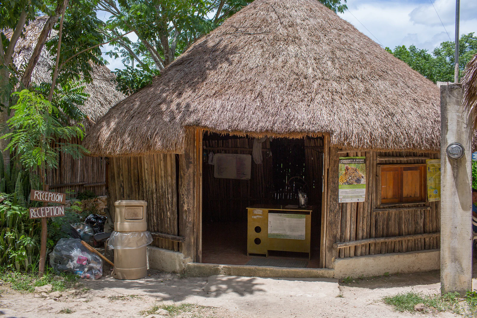
In more recent decades, the area has been re-envisioned as a nature reserve and community-led tourism destination. The Najil Tucha cooperative emerged as the organizing body for conservation and visitor activities, helping to position Punta Laguna as a primate sanctuary and a focal point for research and local stewardship. Scientific work in biology, geology, and archaeology has drawn researchers to the site, transforming the historic Maya landscape into a place where natural and cultural heritage are actively studied alongside one another.
Punta Laguna landscape and geographic character
The landscape of Punta Laguna is shaped by a long, narrow freshwater lagoon that runs roughly southeast to northwest, flanked by tropical forest typical of the Yucatán Peninsula. With dimensions of approximately 1.9 kilometers by 750 meters, the lagoon acts as the central feature around which the surrounding terrain is organized, both ecologically and culturally. The younger geological characteristic of the Yucatán is evident in the presence of a cenote and caves, which are typical of a karst landscape shaped by the dissolution of limestone over time.
Surrounding the lagoon, the terrain rises gently into forested ridges and plateaus that support continuous tree cover. This dense canopy provides the structural backdrop for primate life in the canopy as well as the visually striking setting for the archaeological structures scattered around the water's edge. The Maya architects who built here adapted their constructions to the irregular shoreline, with buildings positioned to take advantage of views over the water and access to the cenote.
From a broader geographic perspective, Punta Laguna lies near the transition zone between Quintana Roo and Yucatán, in the interior rather than directly on the coast. Its proximity to Cobá, one of the major Maya sites of the region, places it within a corridor of forested reserves and archaeological zones that together characterize the interior Maya landscape. The combination of open water, closed-canopy forest, sinkholes, and modest topographic relief gives the reserve a layered and visually distinctive character, even within a generally flat regional setting.
Punta Laguna ecosystems, habitats, and plant life
Punta Laguna's natural setting is defined by tropical lowland forest typical of the Yucatán Peninsula, with the lagoon itself acting as both a freshwater anchor and a magnet for wildlife. The continuous canopy around the lagoon supports a rich community of trees and associated vegetation that in turn supports the reserve's mammal and bird populations. The karst geology of the peninsula is reflected in the cenote and cave systems that interrupt the forest floor, each forming its own micro-habitat for species adapted to these distinctive environments.
The forest around Punta Laguna has been preserved as an interconnected habitat block rather than a fragmented patchwork, which is significant for primates that require large home ranges and continuous canopy to thrive. Combined with the protected status of the reserve and the active presence of the community cooperative, this continuity contributes to the area's role as a refuge for sensitive wildlife species in a region where forest cover has been under pressure from agriculture and development.
The combination of lagoon, seasonal water table, caves, cenote, and mature forest creates overlapping habitat zones across a relatively small footprint. This ecological diversity within a compact reserve is one of the defining natural features of Punta Laguna, supporting a more complex web of life than its modest size would suggest.
Punta Laguna wildlife and species highlights
Wildlife is at the heart of Punta Laguna's identity. The reserve is best known for its populations of spider monkeys (Ateles) and howler monkeys (Alouatta, locally called saraguatos), both of which are prominent canopy species of the Yucatán's tropical forests. Punta Laguna hosts hundreds of monkey family groups, and many of the spider monkeys in particular are habituated to human presence, regularly approaching visitors along the forest trails and providing unusually close wildlife encounters.
The howler monkeys tend to be shyer and more reserved than the spider monkeys, often staying higher in the canopy and keeping a greater distance from people. The contrast between these two species is one of the more interesting features of a visit to Punta Laguna: the bold curiosity of the spider monkeys alongside the quieter, more cautious character of the howlers. Together, they illustrate the broader primate diversity of the Mesoamerican forest belt and underscore the reserve's reputation as a primate sanctuary.
Beyond primates, the lagoon, caves, and forest support a broader community of mammals, birds, reptiles, and amphibians typical of the Yucatán's interior forests. The combination of water, cenote, caves, and closed-canopy habitat creates favorable conditions for both residents and seasonal visitors, reinforcing Punta Laguna's value as a living wildlife refuge. Long-term biological research at the site has helped deepen understanding of these populations and their ecological needs.
Punta Laguna conservation status and protection priorities
Punta Laguna matters from a conservation perspective because it protects a functioning block of tropical forest and its associated primate populations, including spider monkeys and howler monkeys that face regional pressures from habitat loss across the Yucatán Peninsula. The reserve's relatively intact canopy provides the kind of continuous habitat that wide-ranging primates need, which is increasingly rare in landscapes fragmented by agriculture and development.
The community-based management model, anchored by the Najil Tucha cooperative, is central to the reserve's conservation character. Local stewardship offers both economic incentives for protecting the forest and a framework for regulating how visitors interact with wildlife. Habituation of spider monkeys has occurred within this managed context, allowing wildlife observation while still prioritizing animal welfare and forest integrity.
Punta Laguna has also functioned as a long-term research site, hosting scientific studies in biology, primate behavior, geology, and archaeology. This research dimension adds value beyond tourism: it produces knowledge that informs how the reserve is understood and managed, and it places Punta Laguna within a wider network of biological and cultural investigation across the Maya region. As a sanctuary, a research site, and a community-led tourism destination, the reserve represents an integrated approach to conservation in southeastern Mexico.
Punta Laguna cultural meaning and human context
Punta Laguna sits within the cultural landscape of the contemporary Maya region, where living communities maintain connections to the archaeological heritage that surrounds them. The site's Maya name, Otoch Ma'ax Yetel Kooh, translates roughly to 'the house of the monkey and the puma,' a phrase that ties the natural and cultural identities of the place together in a single expression. The lagoon's importance to the living Maya community is reflected in the role of the Najil Tucha cooperative, which organizes both tourism and interpretive activities.
The archaeological setting reinforces this cultural layer. The reserve's more than 200 structures, the ritual cenote, and the caves reflect continuous Maya occupation from the Preclassic through the Postclassic periods. Architectural parallels with East Coast style sites such as Tulum, El Meco, and Playa del Carmen link Punta Laguna to a wider network of Maya settlement along the eastern Yucatán, even though the lagoon itself lies inland.
The community cooperative's on-site museum collects objects and information related to both wildlife and traditional Maya lifeways, providing visitors with context about how local communities have historically interacted with the forest, the lagoon, and the archaeological remains. This combination of contemporary Maya community presence and ancient Maya archaeology gives Punta Laguna a cultural dimension that complements its ecological importance.
Top sights and standout views in Punta Laguna
One of Punta Laguna's standout features is its extraordinary proximity to habituated spider monkeys, which often approach visitors along the forest trails and create close-range wildlife encounters rarely possible at other sites in the region. The presence of howler monkeys adds a second distinctive primate dimension, allowing visitors to compare two important Yucatán species within the same forest setting.
Equally notable is the reserve's archaeological scope: more than 200 Maya structures span the Preclassic, Classic, and Postclassic periods and share stylistic links with the East Coast architectural tradition represented by Tulum, El Meco, and similar sites. The ritual cenote and cave systems extend the cultural significance of the reserve beyond its architecture.
The community-based management model through the Najil Tucha cooperative ties these natural and cultural highlights together through local stewardship, an on-site museum, and guided experiences. The result is a reserve where forest conservation, primate observation, Maya heritage, and community-led tourism come together in a compact and accessible package.
Best time to visit Punta Laguna
Punta Laguna's appeal shifts meaningfully with the seasons of the Yucatán Peninsula, and visiting at different times offers different experiences. The dry season generally brings clearer skies, easier walking conditions on forest trails, and more comfortable temperatures for moving between the lagoon, the archaeological structures, and the cenote. Visibility tends to be strong enough to enjoy panoramic views over the lagoon and surrounding canopy.
The wetter months transform the forest into a more lush and densely green environment, with fuller foliage and more active surface water. Bird activity and general animal movement often increase during transitions into and out of the rainy season, and the forest can feel especially alive. Spider monkeys and howler monkeys are present year-round, so primate encounters remain a central feature of any visit, though their behavior and visibility patterns can shift with the seasons and food availability.
Cooler months tend to be the most comfortable for extended walking and outdoor interpretation, while wetter months reward visitors who prioritize lush forest scenery and wildlife observation. Planning around the dry season is often favored for combining the lagoon, archaeological walking, and outdoor activities; planning around the wet season can offer richer forest atmosphere and more dynamic wildlife viewing.