
Mori Atlas logo
National parkQumran National Park

Understand the mapped terrain and regional context of this significant national park in Israel.

Qumran National Park: Exploring Israel's Protected Landscape and Geographic Identity

Qumran National Park stands as a notable protected area within Israel, offering a unique lens for geographic discovery. This page provides an atlas-centered view of the park, detailing its mapped boundaries and landscape character. Users can explore how Qumran National Park fits into the broader geography of the region and understand its identity as a national park within the Israeli context.

Archaeological siteDead Sea regionAncient ruinsJewish historySecond Temple periodWest Bank
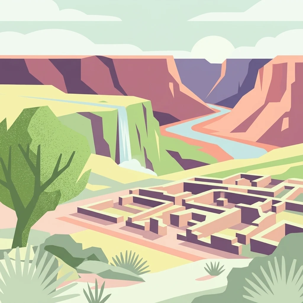
Stylized illustration of ancient stone ruins surrounded by a canyon, river, and waterfall

Qumran National Park

National park

Park overview

Structured park overview, official facts, and landscape profile for Qumran National Park

Qumran National Park park facts, protected area profile, and essential visitor context
Review the core facts for Qumran National Park, including designation, size, terrain, visitor scale, habitats, and operating context in one park-focused overview.

About Qumran National Park

Qumran National Park encompasses the archaeological remains of a settlement that played a central role in one of archaeology's greatest discoveries. The ruins sit on a plateau overlooking the Dead Sea, an environment that is stark, arid, and yet historically vital as a crossroads for trade and religious movement. The main building complex includes a two-story structure with a central courtyard and defensive tower on its northwestern corner, along with secondary buildings to the west. Perhaps most remarkable is the sophisticated water system that supplied water to multiple stepped cisterns throughout the settlement, with channels and aqueducts collecting rainwater from the surrounding wadis. This engineering feat was essential for survival in the desert environment. The discovery of inkwells,写作 benches, and over a thousand ceramic items in what was interpreted as a dining hall and pantry further supports the scholarly consensus that this was an intentional community with shared daily practices. Today, visitors can walk through the excavated ruins, view the cave openings in the nearby cliffs, and appreciate the historical significance of a site that has reshaped understanding of ancient Jewish history and early Christianity.

Quick facts and research context for Qumran National Park

Qumran National Park is located on a dry marl plateau about 1.5 kilometers from the Dead Sea shore, approximately 10 kilometers south of Jericho. The settlement was constructed during the Hasmonean period between 134 and 104 BCE under John Hyrcanus. The site features an elaborate water management system with multiple stepped cisterns, indicating sophisticated engineering for water collection and storage in this arid environment. Nearly 900 Dead Sea Scrolls were discovered in caves surrounding the settlement between 1947 and 1956. The site is managed by the Israel Nature and Parks Authority and remains one of the most studied archaeological locations in the Middle East.

Park context

Deeper park guide and search-rich context for Qumran National Park

Qumran National Park history, landscape, wildlife, and travel context
Explore Qumran National Park through its history, landscape character, ecosystems, wildlife, conservation priorities, cultural context, and seasonal travel timing in a structured park guide built for atlas discovery and search intent.

Why Qumran National Park stands out

Qumran is best known worldwide as the ancient settlement nearest to the caves where the Dead Sea Scrolls were hidden. The discovery of these scrolls, beginning in 1947, revolutionized understanding of Jewish history, biblical texts, and the diversity of religious thought in the Second Temple period. The site itself contains the ruins of what scholars believe was a sectarian Jewish community, complete with residential quarters, meeting halls, ritual baths, and a possible scriptorium where some of the scrolls may have been written or copied. The extensive cemetery with over a thousand tombs provides additional evidence of the community that lived here. The location offers a unique window into a pivotal era in religious and cultural history.
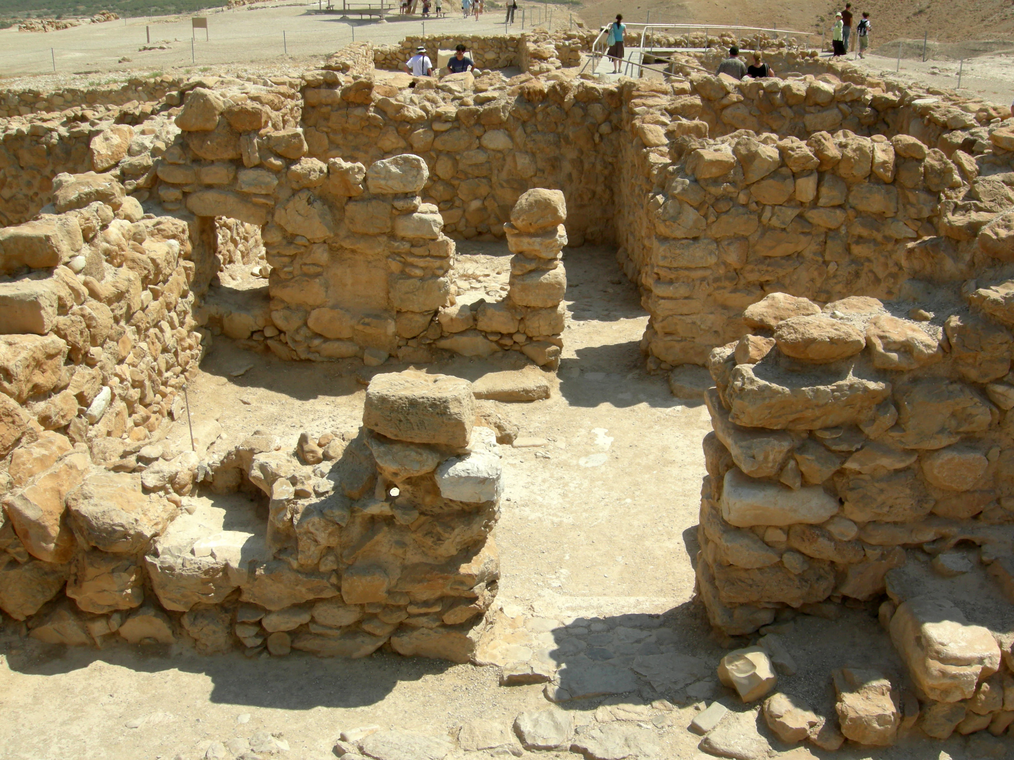
Stone ruins of ancient living quarters with open courtyards and walls in Qumran National Park
Ancient stone ruins of living quarters at Qumran National Park

Qumran National Park history and protected-area timeline

The history of Qumran spans several distinct periods of occupation and scholarly interpretation. The settlement was originally constructed during the Hasmonean dynasty under John Hyrcanus between 134 and 104 BCE, or possibly slightly later. The site was inhabited for most of the period until 68 CE when it was destroyed during the First Jewish-Roman War, possibly continuing until 73 CE. After destruction, the site was later used by Jewish rebels during the Bar Kokhba revolt. The principal excavations at Qumran were conducted by Roland de Vaux between 1951 and 1956, revealing the architectural remains that have been the subject of intense scholarly debate ever since. Since the 1967 Six-Day War, Qumran has been managed by the Israel Nature and Parks Authority. The discovery of the first Dead Sea Scrolls by Bedouins of the Ta'amireh tribe in 1947 led to the systematic archaeological investigation that continues to yield new insights. Various scholarly interpretations have proposed the site was a sectarian religious settlement, a Hasmonean fortress later repurposed, a wealthy Roman villa, or a commercial trading center, with the sectarian Essenic interpretation remaining the most widely accepted.

Qumran National Park landscape and geographic character

Qumran sits on a dry marl plateau approximately 1.5 kilometers from the northwestern shore of the Dead Sea, in a landscape defined by extreme aridity and dramatic topographical contrasts. The plateau overlooks the deep blue waters of the Dead Sea, which lies in a rift valley nearly 430 meters below sea level. The surrounding terrain is characterized by desert cliffs and the Wadi Qumran, a normally dry torrent channel that becomes a raging flood during rare rainstorms. The marl soil composition of the plateau created specific challenges for the ancient inhabitants, particularly regarding water availability, which they addressed through their elaborate cistern and aqueduct system. The nearby desert cliffs contain the caves where the Dead Sea Scrolls were hidden, their dark openings visible from the settlement below. This stark, dramatic setting against the backdrop of the Dead Sea and the Judean desert hills creates a powerful sense of ancient isolation and spiritual intensity.
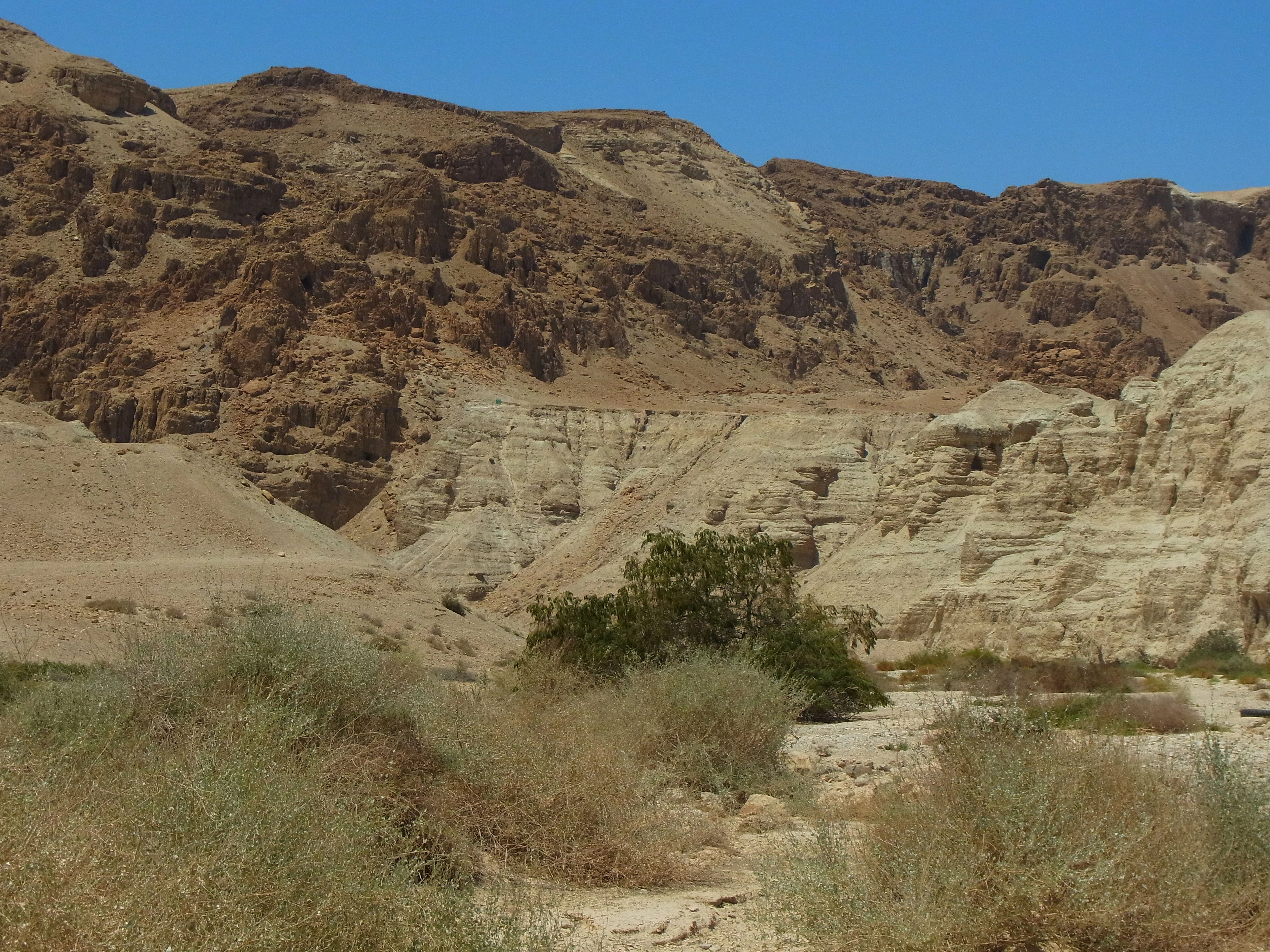
Rocky desert terrain with layered cliffs and dry vegetation under clear blue sky
Rocky desert landscape with layered cliffs and sparse vegetation in Qumran National Park

Qumran National Park ecosystems, habitats, and plant life

While Qumran is primarily an archaeological site, the national park encompasses an ecosystem characteristic of the Dead Sea desert corridor. The arid plateau and surrounding desert support minimal vegetation adapted to extreme salinity and aridity. The Dead Sea region represents one of the lowest and saltiest bodies of water on Earth, creating a unique environmental setting. The nearby Ein Feshkha springs, though not within the national park proper, provide a contrasting wetland habitat where date palms and papyrus grow. The area experiences an extremely hot and dry climate typical of the Jordan Rift Valley, with temperatures often exceeding 40 degrees Celsius in summer. The stark contrast between the barren marl plateau and the life-giving springs illustrates the ecological boundaries that shaped human settlement patterns in this region throughout history.
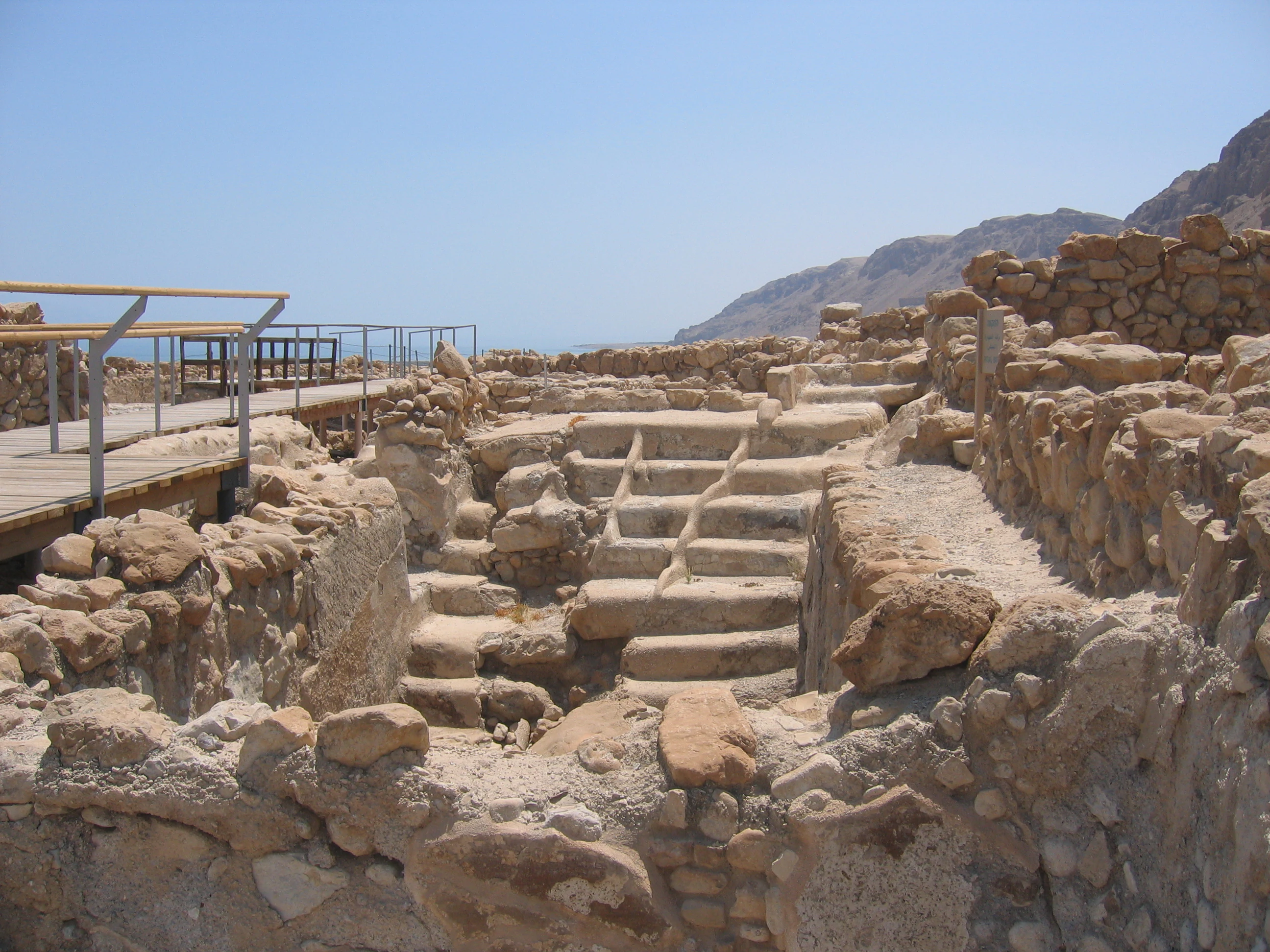
Stone ritual bath structure with steps surrounded by ancient stone walls, wooden walkway with railings, mountains and Dead Sea visible in background
Ancient stone miqveh (ritual bath) at Qumran National Park with surrounding stone walls and wooden walkway

Qumran National Park wildlife and species highlights

The wildlife around Qumran National Park is typical of desert and wetland margins in the Dead Sea region. Desert reptiles, including various lizard species, can be observed among the ruins and surrounding terrain. Migratory birds occasionally use the Dead Sea shoreline as a corridor during seasonal movements. The more lush vegetation near the Ein Feshkha springs to the north supports a different community of birds and insects. However, the primary focus of the national park remains the archaeological significance rather than wildlife observation, and the arid plateau environment does not support diverse wildlife populations.
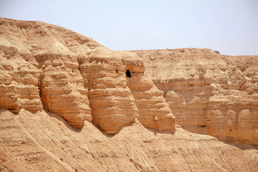
Rocky desert cliffs with visible cave openings at Qumran National Park
Caves on the rocky cliffs of Qumran National Park

Qumran National Park conservation status and protection priorities

Qumran National Park serves as a protected area for one of the most significant archaeological sites in the Middle East. The Israel Nature and Parks Authority maintains the site, preserving the ancient ruins while facilitating public access and educational interpretation. Conservation efforts focus on stabilizing structures, protecting artifacts, and managing visitor impact on the fragile archaeological remains. The site's protection extends to the surrounding landscape and cave openings that are integral to understanding the context of the Dead Sea Scrolls discovery. The national park status ensures that this irreplaceable window into Second Temple period Judaism remains accessible for future study and public appreciation.

Qumran National Park cultural meaning and human context

Qumran holds profound significance in the context of Jewish religious history and the development of early Christianity. The settlement is most commonly associated with the Essenes, a Jewish sect described by ancient writers including Pliny the Elder, Philo, and Flavius Josephus as living apart from mainstream society in the desert, practicing ritual purity, and awaiting divine intervention. The hundreds of scrolls found in the nearby caves represent texts ranging from biblical manuscripts to community rules, apocalyptic literature, and liturgical texts, offering unprecedented insight into the diversity of Jewish thought in the Second Temple period. Some scholars see connections between Qumran and early Christian traditions, with suggestions that John the Baptist may have been associated with the area. The site provides tangible archaeological evidence for understanding the historical and religious environment in which both Rabbinic Judaism and Christianity emerged.
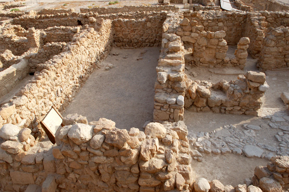
Stone ruins of ancient structures with walls and foundations in a desert setting, including a signboard
Ancient stone ruins of the scriptorium at Qumran Locus 30

Top sights and standout views in Qumran National Park

The archaeological ruins at Qumran National Park offer visitors the opportunity to explore an ancient Jewish settlement with remarkable preservation of architectural features and water systems. The central building with its defensive tower, the suspected scriptorium where inkwells were found, the large dining hall, and the extensive water cisterns all provide tangible connections to the community that lived here. The dramatic setting on the plateau overlooking the Dead Sea creates a memorable visitor experience. The proximity to the cave openings in the nearby cliffs where the Dead Sea Scrolls were hidden adds layers of historical significance that few other archaeological sites can match. Interpretive displays and guided paths help visitors understand the complex history of the site and its place in one of the 20th century's most important archaeological discoveries.
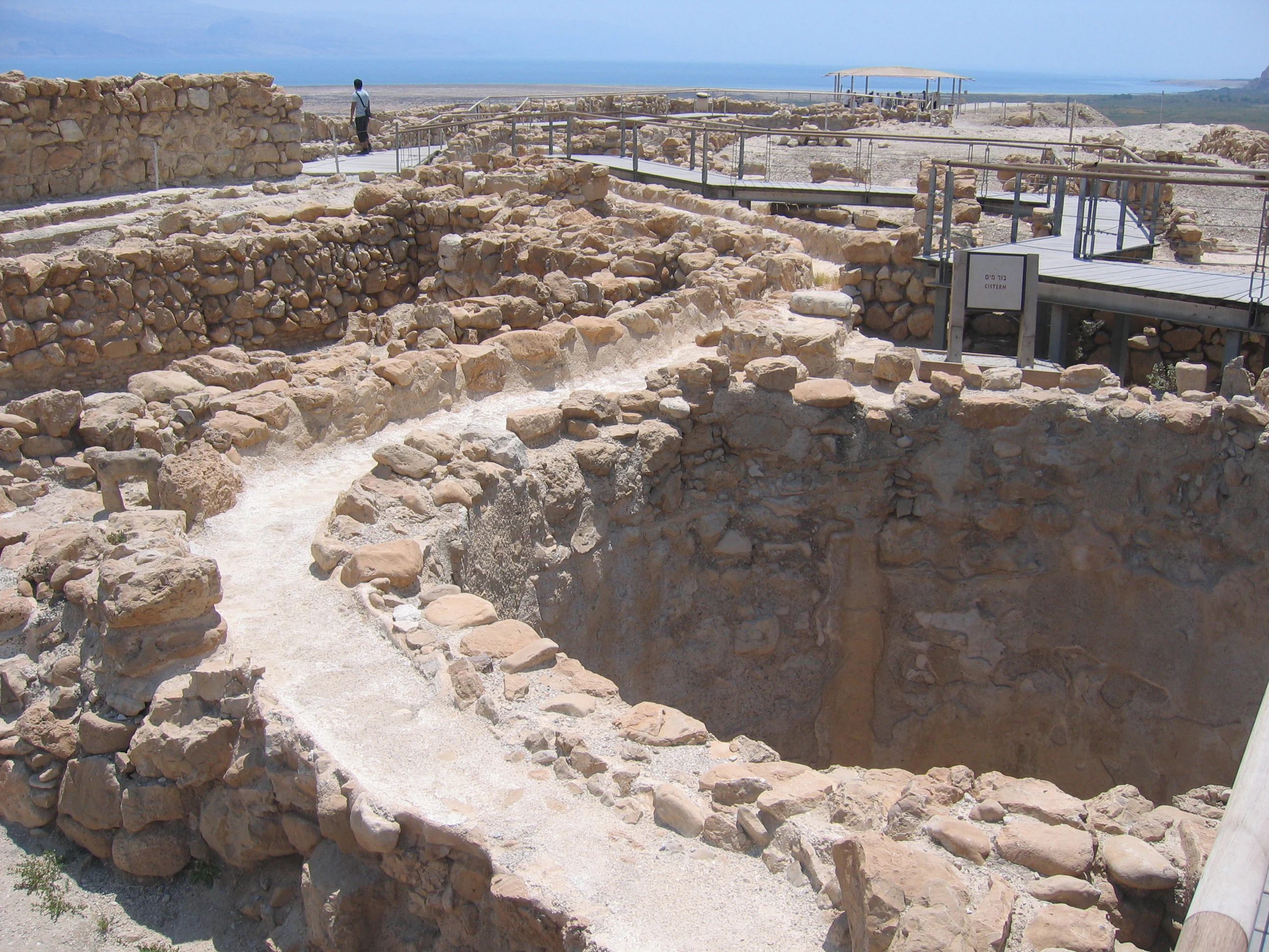
Stone cistern structure with surrounding ancient ruins and a person standing in the background
Iron Age cistern (locus 110) within Qumran National Park

Best time to visit Qumran National Park

The optimal time to visit Qumran National Park is during the cooler months from October through April, when temperatures are more comfortable for exploring the outdoor site. Summer temperatures in the Dead Sea region can exceed 40 degrees Celsius, making extended outdoor activity uncomfortable and potentially dangerous. Winter months offer mild daytime temperatures but can occasionally bring rain that may affect access. Early morning visits are advisable to avoid the strongest sun and to experience the site when it is less crowded. The Dead Sea region is sunny virtually year-round, so visitors should plan for sun protection regardless of the season. The park can be combined with visits to other nearby sites including Jericho, the Dead Sea shoreline, and other national parks in the region.
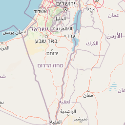

Park location guide

Geography guide, regional context, and park location map for Qumran National Park

Qumran National Park park geography, regions, and map view in Israel
Understand where Qumran National Park sits in Israel through a broader geographic reading of the surrounding landscape, nearby location context, and its mapped position within the national park landscape.

How Qumran National Park fits into Israel

Israel is a parliamentary republic in the Southern Levant, established in 1948 as a Jewish homeland. It borders Lebanon, Syria, Jordan, and Egypt, with Mediterranean coastline and access to the Red Sea. Jerusalem is the capital, though its status is contested, while Tel Aviv is the largest urban area. The country has a high-income economy with strong technology and innovation sectors.

Wider geography shaping Qumran National Park in Israel

Israel occupies the Southern Levant region of West Asia. It is bordered by Lebanon to the north, Syria to the northeast, Jordan to the east, and Egypt to the southwest. The western coast lies on the Mediterranean Sea, while the southern tip reaches the Red Sea. The eastern border includes the Dead Sea, Earth's lowest point. The country occupies the West Bank, Gaza Strip, and Golan Heights.

Visual Atlas of Qumran's Arid Terrain, Archaeological Remains, and Striking Dead Sea Views

Qumran National Park Photos: Explore Ancient Landscapes and Dead Sea Scenery
Browse Qumran National Park imagery to understand its unique desert landscape, the ancient archaeological ruins, and the stark beauty of the Dead Sea region. These photographs provide essential visual context for appreciating the park's dramatic geographical setting on a marl plateau and the remote environment where the Dead Sea Scrolls were discovered.

Stone ruins of ancient living quarters with open courtyards and walls in Qumran National Park

Desert landscape with rocky cliffs, sandy terrain, and the Dead Sea visible in the distance

Rocky desert terrain with layered cliffs and dry vegetation under clear blue sky

Stone ritual bath structure with steps surrounded by ancient stone walls, wooden walkway with railings, mountains and Dead Sea visible in background

Rocky desert cliffs with visible cave openings at Qumran National Park

Stone-walled archaeological room with two stone structures in a sandy area within Qumran National Park

Stone ruins of ancient structures with walls and foundations in a desert setting, including a signboard

Stone cistern structure with surrounding ancient ruins and a person standing in the background

Stone steps descending into a rectangular ancient pool with stone walls, wooden railing on the right, and desert landscape in the background

A rocky desert landscape with layered sedimentary rock formations and caves

Black and white photograph showing ancient stone ruins with a wooden boardwalk, several people walking, and desert terrain in the background

Stone ruins and dry landscape with mountains in the background

Common questions about visiting, size, designation, and location context for Qumran National Park

Qumran National Park FAQs for park facts, access, geography, and protected area context
Find quick answers about Qumran National Park, including protected-area facts, park geography, trail and visitor context, and how the park fits into its surrounding country and regional landscape.
MoriAtlas Explorer

Continue Your Protected Areas Search Across the Global Atlas

Deepen your exploration by continuing the structured search for national parks and protected areas worldwide. Utilize the comprehensive filtering capabilities to compare different conservation landscapes and refine your understanding of global park geography. Discover more about the distribution and characteristics of protected natural areas.

Global natural geography