
Mori Atlas logo
Regional parkRegionaler Naturpark Thal

Mapping the forest ecosystems, pastoral ridges, and deep mountain valleys of the Jura range

Regionaler Naturpark Thal: A Comprehensive Geographic Atlas of Switzerland's Protected Jura Landscapes

(Regionale Naturpark Thal)

Regionaler Naturpark Thal represents a significant protected area within the canton of Solothurn, Switzerland, spanning the distinct topography of the eastern Jura chain. This geographic entity showcases a balanced landscape where managed pastures, dry meadows, and mixed beech and pine forests define the regional character. The park serves as a vital corridor for biodiversity, including unique habitat features such as deep klus valley incisions and important bird migration routes along the mountain ridges.

Jura landscaperegional nature parkmixed forestsdry meadowspastoral landscapesheadwater streams
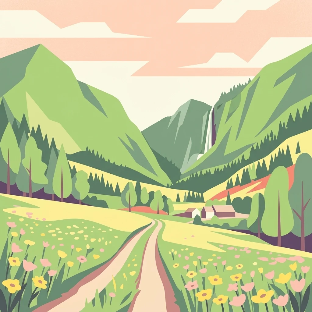
A flat-style digital illustration showing a dirt trail leading through a meadow filled with yellow and pink wildflowers toward mountains, a forest, and a distant waterfall.

Regionaler Naturpark Thal

Regional park

Park overview

Structured park overview, official facts, and landscape profile for Regionale Naturpark Thal

Regionale Naturpark Thal park facts, protected area profile, and essential visitor context

Review the core facts for Regionale Naturpark Thal, including designation, size, terrain, visitor scale, habitats, and operating context in one park-focused overview.

About Regionale Naturpark Thal

Regionale Naturpark Thal is a regional nature park of national significance in Switzerland, stretching across the entire Thal district of the canton of Solothurn. It covers eight municipalities: Welschenrohr-Gänsbrunnen, Herbetswil, Aedermannsdorf, Matzendorf, Laupersdorf, Balsthal, Mümliswil-Ramiswil, and Holderbank. The park's identity is closely tied to the eastern Jura chain, a mountain range that here rises with rounded ridges and broad plateaus rather than with sharp alpine summits. Its setting between the Swiss plateau to the north and the higher Jura ranges to the south gives the park a transitional character, blending lowland accessibility with upland landscapes.

What distinguishes the park most is the way its landscape has been shaped over centuries by extensive agriculture. The high pastures of the Jura are grazed by cattle, which has preserved open dry meadows rich in plant species. Forests of beech, mixed fir-beech stands, and pine cover long stretches of the slopes, while narrow valley notches and stream cuttings give the terrain additional relief. The Dünnern river, whose upper course runs through the park along with its tributary the Augstbach, supports near-natural headwater reaches that anchor aquatic and riparian biodiversity.

The park's importance extends beyond scenery. It protects breeding habitat for rare forest birds, offers open-country habitat for species such as the woodlark, and holds strong populations of mammals that depend on the mix of forest and pasture, including lynx, chamois, red deer, and wild boar. In addition, the European bison reintroduction project east of Welschenrohr has added a new dimension to the park, transforming part of the area into an active site for rewilding research, public engagement, and the European bison conservation breeding program. The combination of traditional landscape, ecological diversity, and innovative wildlife management gives the park a distinctive profile among Switzerland's regional nature parks.

Quick facts and research context for Regionale Naturpark Thal

Regionale Naturpark Thal lies entirely within the canton of Solothurn in northwestern Switzerland and covers approximately 139 square kilometers across eight municipalities. The park was formally established as a park of national significance and follows the natural shape of the Thal district, with the town of Balsthal serving as a nearby urban reference point. Its protected status is linked to Switzerland's broader framework for landscapes and natural monuments of national importance, and several nationally inventoried landscape objects fall partly within its boundaries.

The park is built around the eastern Jura chain and is dominated by pasture and forest rather than high alpine terrain. It protects extensive dry meadows, mixed mountain forests, near-natural headwater streams, and a series of nationally designated landscapes including the Weissenstein, the Belchen-Passwang area, and the Ravellenflue. Its wildlife value is reflected in breeding populations of eagle-owls, woodcocks, and possibly capercaillie, in healthy lynx densities, and in a growing free-ranging herd of European bison.

Protection and recognition

Examine the terrestrial protection scope and recorded designation history.

Regionaler Naturpark Thal Protection Status and Designated Area Record

Regionaler Naturpark Thal maintains a documented terrestrial protection scope within its regional conservation framework. Systematic records outline the management designation parameters and international recognition status associated with the protected landscape.

Protection details

Protection scope
Terrestrial
Transboundary protection
No
Park context

Deeper park guide and search-rich context for Regionale Naturpark Thal

Regionale Naturpark Thal history, landscape, wildlife, and travel context

Explore Regionale Naturpark Thal through its history, landscape character, ecosystems, wildlife, conservation priorities, cultural context, and seasonal travel timing in a structured park guide built for atlas discovery and search intent.

Why Regionale Naturpark Thal stands out

Regionale Naturpark Thal is best known for its gentle, agriculturally shaped eastern Jura landscape, where extensive cattle pastures, dry meadows, and mixed beech and pine forests define the scenery. It is also recognized for protecting headwater streams and forest habitats that hold breeding populations of rare woodland birds such as the eagle-owl and woodcock, as well as for hosting a European bison reintroduction project based near Welschenrohr.
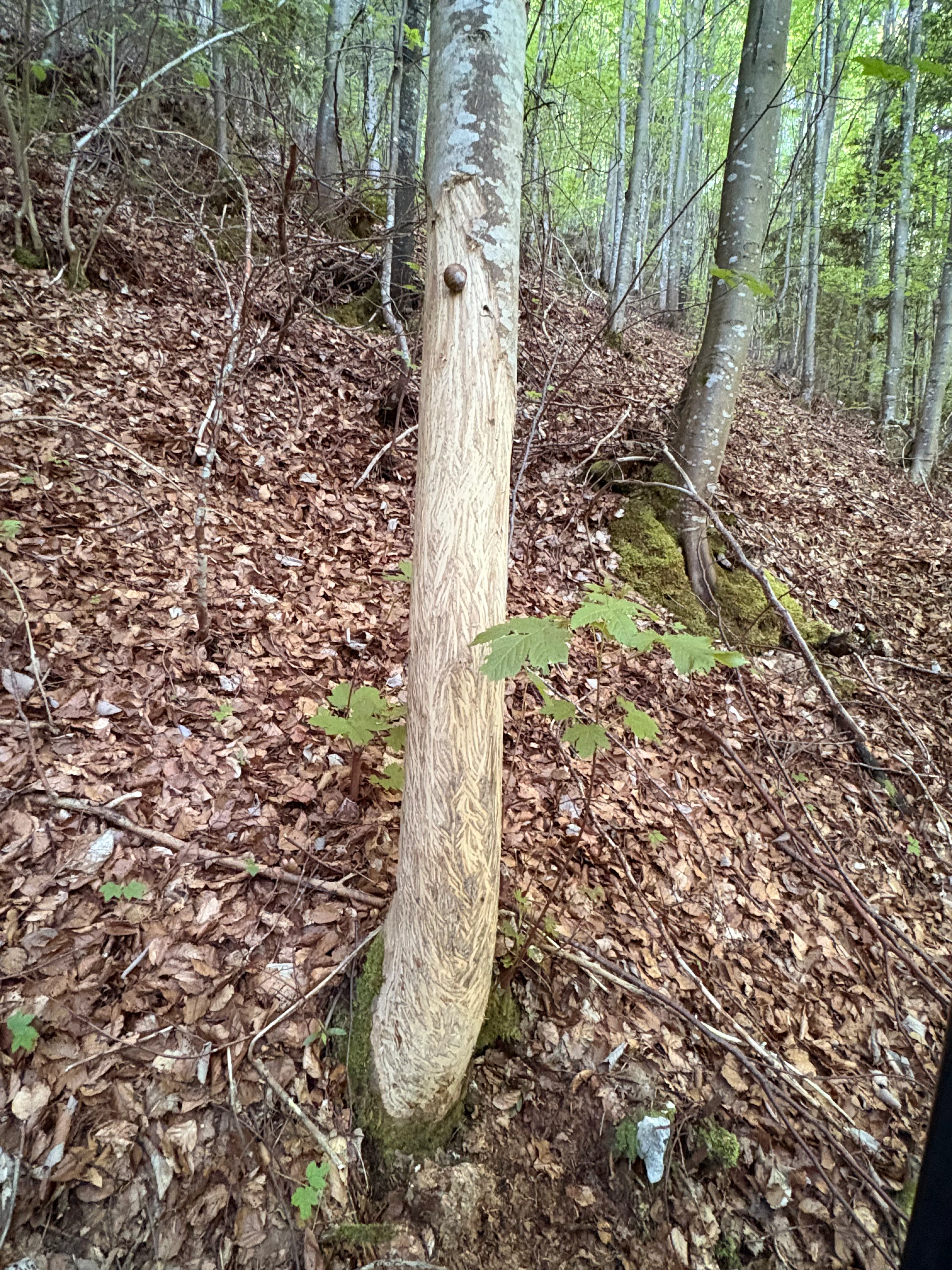
A close up of a tree trunk with smooth, worn bark where bison have rubbed against it, situated in a forest with a leafy, sloped ground.
A tree trunk in the forest shows evidence of being rubbed by bison.

Regionale Naturpark Thal history and protected-area timeline

The Regionale Naturpark Thal was formally established as a Swiss park of national significance in 2009, building on the long-standing rural and natural identity of the Thal district in canton Solothurn. Its creation reflected a broader Swiss policy of designating regional nature parks to preserve intact cultural landscapes, support regional economies, and protect natural heritage outside strict wilderness reserves. The park's boundaries were drawn to follow the full extent of the Thal district, ensuring that conservation efforts could be coordinated across all eight constituent municipalities.

A defining development came in the early 2020s with the launch of the European bison reintroduction project near Welschenrohr. Discussions about returning bison to the Jura, where they had historically lived before being extirpated centuries ago, had been ongoing for years. In early 2020 the construction of a fence around a 50-hectare enclosure was approved, and in autumn 2022 the first bison arrived from the Wildnispark Zürich. The herd has since grown through natural reproduction, the enclosure has been expanded to roughly 100 hectares, and the project has become an internationally coordinated effort supported by the European Bison Friends Society and the European Endangered Species Programme.

The park's evolution also reflects Switzerland's system of nationally inventoried landscapes. Sections of three federal landscape inventory areas fall within the park: the Weissenstein area, the Belchen-Passwang area, and the Ravellenflue with its associated cliffs near Oensingen. This layered recognition, from regional park status to federal landscape protection, has shaped how the park is managed, conserved, and connected to Switzerland's wider framework of natural heritage.

Regionale Naturpark Thal landscape and geographic character

The landscape of the Regionale Naturpark Thal follows the eastern Jura chain, a long mountain belt whose ridges and plateaus were formed by the folding of limestone and related rocks. The result is a relatively gentle, rolling mountain landscape where valleys cut deeply between parallel ridges and isolated cliffs rise from forested slopes. The terrain lacks the high peaks of the Alps further south but gains character from its narrow gorges, open plateaus, and clear transitions between forest, pasture, and valley farmland.

A hallmark of the local scenery is the klus, a steep-sided valley notch typical of the Jura. These abrupt valley incisions, often formed where water has cut through softer rock layers between harder ridges, give the park its most distinctive topographic features and create a sense of compactness to the broader mountain landscape. Combined with the alternation of forested slopes and open high pastures, they shape the visual rhythm of the park.

The land cover reflects this setting. Beech forests dominate warmer and more sheltered slopes, fir-beech forests occupy middle elevations, and pine forests hold their own on drier, rockier exposures. Above and between these forests lie extensive cattle pastures with their associated dry meadows, while the valley floor between Balsthal and Herbetswil forms the most agriculturally used section of the park. Together these elements create a patchwork landscape that is varied yet visually coherent.
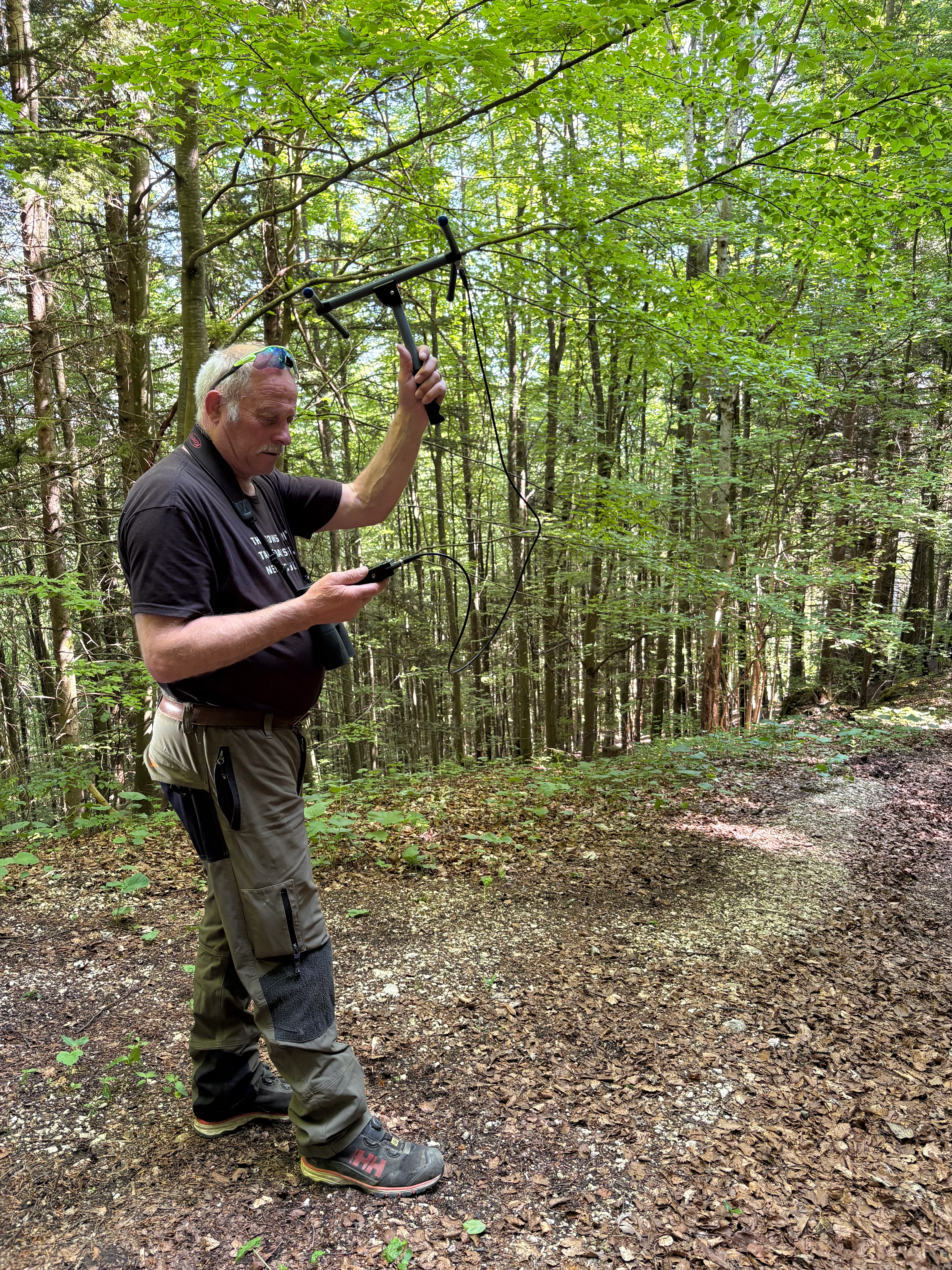
A man standing in a forest clearing holds a Yagi telemetry antenna aloft in one hand while looking at a handheld tracking device in the other.
A park official using a telemetry antenna to track wildlife in the forest.

Regionale Naturpark Thal ecosystems, habitats, and plant life

Ecologically, the Regionale Naturpark Thal sits at the meeting point between lowland Swiss ecosystems and the upland habitats of the Jura. Its forests form one of the park's most important natural assets. Beech, mixed fir-beech, and pine forests occupy large continuous areas and provide habitat for species-rich woodland communities. These forests are not only diverse in tree composition but also structurally complex, with old trees, deadwood, and a mosaic of light conditions that support a wide range of associated flora and fauna.

Open habitats are equally significant. Extensive cattle pastures on the Jura heights maintain a network of dry meadows and grazed grasslands, which are among the most species-rich habitats in Switzerland for wild plants and insects. These open areas, together with transitional zones at forest edges, sustain grassland birds and the small mammals that in turn feed larger predators. The diversity of habitats within a relatively compact area is one of the park's defining ecological strengths.

The park's river systems add another dimension. The upper Dünnern and its tributary the Augstbach retain largely natural morphologies, especially in their upper reaches. These streams, together with their gravel beds, banks, and adjacent woodland, support aquatic species such as brown trout and bullhead, and birds like the white-throated dipper that rely on clean, flowing water. The combination of forest, pasture, freshwater, and rocky terrain gives the park a layered ecological structure typical of the eastern Jura.
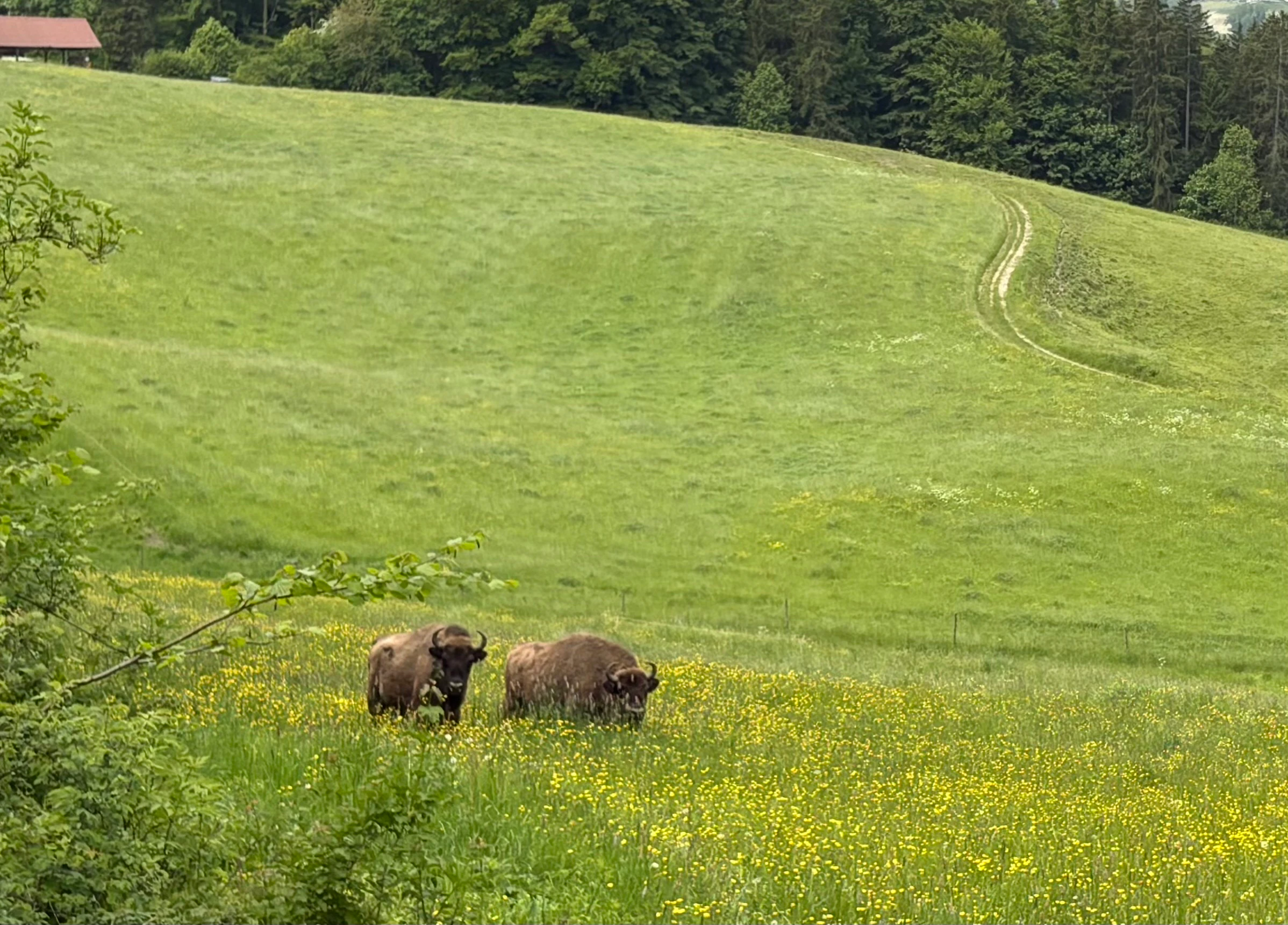
Two European bison grazing in a lush green meadow with a dirt path winding up a hill in the background.
European bison grazing in a meadow at Regionaler Naturpark Thal.

Regionale Naturpark Thal wildlife and species highlights

Wildlife in the Regionale Naturpark Thal reflects the diversity of its habitats, with forest, grassland, stream, and cliff environments all contributing to a rich fauna. The forests harbor rare and characteristic woodland birds. Eagle-owls breed in the larger wooded areas, while woodcocks are present in damp forest stands. The park may still host a small number of capercaillie, a species that has declined strongly elsewhere in Switzerland. Smaller predators and other mammals, including foxes, badgers, pine martens, and stoats, are widely distributed across these wooded landscapes.

Open country supports its own specialist wildlife. The woodlark breeds on the broad, open ridges, particularly in the northern part of the park, where the combination of low vegetation, scattered shrubs, and bare ground suits its nesting habits. Large pastures also support high rodent populations, which in turn attract several species of birds of prey that hunt across the open terrain. Roe deer are common throughout the park, while chamois colonies live along the rocky bands of the higher ridges, and wild boar are present though rarely seen.

Larger predators are a notable presence. The European lynx reaches some of its highest population densities in Switzerland within the park, preying on the abundant roe deer and chamois. Red deer, once rare, are now occasionally recorded, indicating ongoing changes in the wider Jura ecosystem. The rivers and streams add brown trout, bullhead, and white-throated dippers to the wildlife inventory, while the bird ringing station on the Subigerberg above Gänsbrunnen highlights the importance of the park along a key migratory route. The bison herd near Welschenrohr has introduced a new and deeply symbolic wildlife element to the park, contributing to European conservation breeding efforts while allowing observation of these animals in a semi-natural Jura setting.
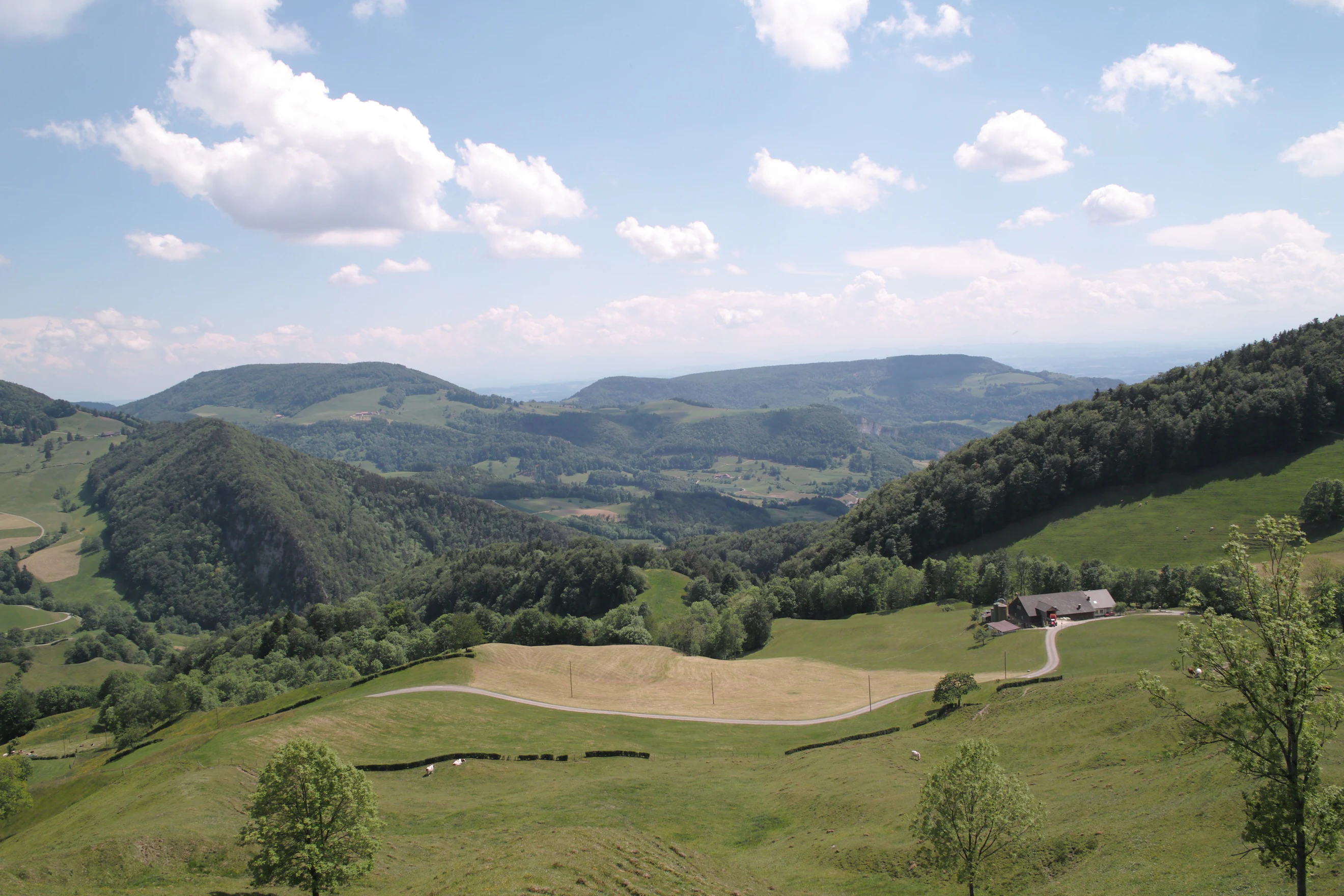
Wide view of a green Jura mountain landscape with meadows, forests, and a rural building under a blue sky with white clouds.
A view of the rolling hills and agricultural landscape in Regionaler Naturpark Thal near Mümliswil-Ramiswil.

Regionale Naturpark Thal conservation status and protection priorities

The Regionale Naturpark Thal is recognized as a park of national significance under Switzerland's federal framework for nature and heritage protection, and its conservation mandate is closely tied to preserving an intact cultural and natural landscape. Rather than setting aside strict wilderness, the park takes a regional approach that combines habitat protection with sustainable agriculture, recognizing that the extensive pastures, dry meadows, and forest ecosystems of the eastern Jura depend on continued traditional management.

A core part of the park's conservation role is the protection of nationally inventoried landscapes. Three federal landscape inventory areas lie partly within its boundaries: the Weissenstein area, the Belchen-Passwang area, and the Ravellenflue with its associated cliffs near Oensingen. These designations add a higher level of protection to already sensitive landscapes and link the regional park's efforts to Switzerland's national strategy for landscape preservation.

The park also plays an active role in species and habitat conservation. Its forests, headwater streams, and dry meadows provide essential habitat for rare woodland birds, fish, and aquatic mammals, and its open pastures support healthy populations of small mammals and the predators that depend on them. The European bison reintroduction project has added a new dimension to this work, linking the park with international conservation breeding programs and serving as a long-term research project on whether bison can live freely in the Jura. Through these layers of protection and active management, the park contributes to both the conservation of Switzerland's natural heritage and the broader recovery of once-lost European species.

Regionale Naturpark Thal cultural meaning and human context

The Regionale Naturpark Thal is deeply rooted in the rural identity of the Thal district, a region where farming, forestry, and small village life have shaped the land for centuries. The park encompasses communities such as Welschenrohr-Gänsbrunnen, Herbetswil, Aedermannsdorf, Matzendorf, Laupersdorf, Balsthal, Mümliswil-Ramiswil, and Holderbank, each contributing to the cultural fabric of the district. Cattle grazing on the high pastures, haymaking on the slopes, and small-scale forestry remain everyday activities that sustain both the local economy and the characteristic appearance of the landscape.

This link between agriculture and landscape is central to the park's cultural identity. The dry meadows, open wood pastures, and diverse forest types are not purely natural features; they are products of long-standing human management. By supporting regional products, traditional farming practices, and rural tourism, the park helps maintain the social and economic structure that has kept this cultural landscape alive. Local involvement, through initiatives such as the bison ranger based at the Sollmatt farm near the bison enclosure, also reflects how closely the park's identity is tied to its resident communities.

Top sights and standout views in Regionale Naturpark Thal

Among the park's strongest points of distinction are the nationally inventoried landscapes of the Weissenstein, the Belchen-Passwang area, and the Ravellenflue, which together give the park protected status at multiple levels.

Equally distinctive is the European bison project near Welschenrohr, where a growing free-ranging herd is being studied as part of an international effort to reintroduce the species to the Jura, combined with the park's role along a major bird migration route at the Subigerberg bird ringing station, and the unusually high density of lynx supported by healthy populations of roe deer and chamois.

Best time to visit Regionale Naturpark Thal

The park's appeal shifts clearly with the seasons. Spring brings fresh green growth to the broadleaf and conifer forests and the return of breeding birds across the pastures and ridges, making the woodlands and meadow edges particularly rewarding for walking and wildlife observation. Summer offers the most settled conditions for long hikes and cycling routes across the open Jura plateaus, when the dry meadows are at their most colorful and the headwater streams of the Dünnern and Augstbach run clear and cool.

Autumn transforms the beech and mixed forests into a vivid display of color and is a strong season for observing forest wildlife, while also being a notable time along the bird migration route over the Subigerberg. Winter brings a quieter character, with snow often settling on the higher ridges and giving the klus valleys and forested slopes a more austere but striking appearance. Across the year, the changing use of the high pastures between grazing seasons and rest periods also subtly alters the rhythm and openness of the scenery.

Monthly climate preview

Long-term monthly temperature and precipitation patterns recorded at representative park coordinates

Regionaler Naturpark Thal Climate Normals and Annual Temperature Rhythm

Representative coordinate records show average monthly temperatures ranging from sub-zero winter minimums to warm summer maximums alongside consistent year-round precipitation. Examining the complete twelve-month climatology dataset reveals detailed long-term averages for tracking annual weather variation across the protected landscape.
Annual mean9 °C
-1 °C18 °C
Jan-1°
Feb
Mar
Apr
May13°
Jun16°
Jul18°
Aug18°
Sep14°
Oct
Nov
Dec
Warmest month
July

18.2 °C

Coolest month
January

-0.6 °C

Wettest month
May

3.7 mm/day

Driest month
February

2.2 mm/day

Park location guide

Geography guide, regional context, and park location map for Regionale Naturpark Thal

Regionale Naturpark Thal park geography, regions, and map view in Switzerland

Understand where Regionale Naturpark Thal sits in Switzerland through a broader geographic reading of the surrounding landscape, nearby location context, and its mapped position within the national park landscape.

How Regionale Naturpark Thal fits into Switzerland

Switzerland is a landlocked federal republic in Central Europe comprising 26 cantons, with Bern as the federal city and Zurich as the largest city. The country features the Swiss Alps, Swiss Plateau, and Jura Mountains, with German, French, Italian, and Romansh as official languages. It is noted for its political neutrality, direct democracy traditions, and strong economy.

Wider geography shaping Regionale Naturpark Thal in Switzerland

Switzerland is located in Central Europe at the intersection of Western and Southern Europe. It is bordered by Germany to the north, France to the west, Austria and Liechtenstein to the east, and Italy to the south. The country is geographically divided among the Swiss Alps (covering most of the territory), the Swiss Plateau (where most of the population resides), and the Jura Mountains. Switzerland is landlocked.

Map view of Regionale Naturpark Thal

Use this park location map to pinpoint Regionale Naturpark Thal in Switzerland, understand its exact geographic position, and read its mapped placement within the surrounding landscape more clearly.

Pigeon | © OpenStreetMap contributors

Location context for Regionale Naturpark Thal

Solothurn

Visualizing the eastern Jura terrain, mixed forests, and protected habitats of Switzerland

Regionaler Naturpark Thal Photos and Landscape Scenery

Photographic records reveal the rolling mountain terrain, steep valley notches, and pastoral mosaic defining the regional protected area. Visual documentation helps researchers and visitors analyze elevation changes, forest cover, and ecological boundaries across the Jura highlands.

A close up of a tree trunk with smooth, worn bark where bison have rubbed against it, situated in a forest with a leafy, sloped ground.

A dirt track winds through a lush, green, flowery meadow, leading toward a farmhouse set at the edge of a forest in a hilly valley under a clear blue sky.

A man standing in a forest clearing holds a Yagi telemetry antenna aloft in one hand while looking at a handheld tracking device in the other.

Two European bison grazing in a lush green meadow with a dirt path winding up a hill in the background.

Wide view of a green Jura mountain landscape with meadows, forests, and a rural building under a blue sky with white clouds.

Park atlas

Compare surrounding mountain terrain and related regional nature reserves

Parks Near Regionaler Naturpark Thal and Connected Jura Protected Landscapes

Visitors exploring Regionaler Naturpark Thal can examine adjacent protected areas across the eastern Jura range to study matching ridge topography and forest ecosystems. Expanding the geographic scope reveals how neighboring conservation zones preserve similar pastoral valleys and highland habitats.
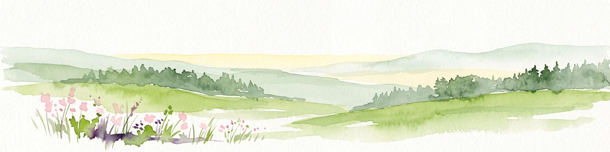
A horizontal watercolor painting of a winding river flowing through green rolling hills and wooded areas, with soft-colored mountain silhouettes in the background.
Protected landscapeSwitzerland
About 12 km away#1 closest

Southeast

Aareknie Wolfwil-Wynau: Geographic Profile of a Swiss Protected River Landscape

Mapping dynamic river bends and lowland floodplains in the Swiss Mittelland.

Aareknie Wolfwil-Wynau preserves a rare, non-engineered river reach where the Aare cuts through molasse rock. The area is defined by its active gravel bars, rapids, and federally protected floodplain habitats. This site provides a critical look at how lowland river ecosystems function alongside historic cultural landmarks like the medieval church at Wynau.

Area
1.1 km²
Established
1996
Relief
Lowland
Climate
Temperate
A soft watercolor painting depicting a calm river winding through a green, hazy floodplain environment.
Nature reserveSolothurn
About 23 km away#2 closest

Southwest

Naturschutzgebiet Aare bei Altreu: Protecting Aare Valley Floodplains and Alluvial Forest

Riverine meander habitat in the Solothurn canton landscape.

Naturschutzgebiet Aare bei Altreu serves as a vital refuge for floodplain flora and fauna, standing out for its intact meander loops and silver willow gallery forests. Located in the Solothurn region, this protected area preserves a rare stretch of the Aare river ecosystem that contrasts sharply with adjacent canalized banks. Studying its terrain reveals the importance of alluvial corridors in maintaining wetland connectivity within the Swiss Mittelland.

Area
0.205 km²
Established
1992
IUCN
IV
Relief
Lowland
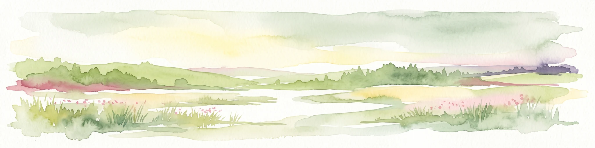
A watercolor painting showing a panoramic view of green rolling hills and wooded ridges under a soft light.
Regional parkAargau
About 34 km away#3 closest

Northeast

Jurapark Aargau: Geographic Overview of a Swiss Regional Nature Park and Jura Landscapes

Protected Jura mountain terrain and regional landscape mapping

Located in northern Switzerland, Jurapark Aargau encompasses a vast, connected perimeter defined by the interaction of tabular limestone plateaus and dramatic folded mountain ridges. This regional nature park serves as an essential refugium for native flora, preserving ancient geological history through fossil-rich sediments, steep escarpments, and traditional rural land use that persists between the Aargau, Zurich, and Basel regions.

Area
299 km²
Established
2012
Relief
Mountain
Climate
Temperate
A horizontal watercolor illustration showing a winding river through a flat, green landscape with distant hills under a soft pink and yellow sky.
Nature reserveHaut-Rhin
About 35 km away#4 closest

North

Réserve naturelle nationale de la Petite Camargue alsacienne: Protected Rhine Floodplain Geography

A unique wetland and alluvial forest habitat in Haut-Rhin

Investigate the geographic significance of the Réserve naturelle nationale de la Petite Camargue alsacienne. This site acts as a protected reference for Upper Rhine floodplain ecology, showcasing a rare intersection of relict river meanders, marshy depressions, and diverse vegetation types near the French, Swiss, and German borders.

Area
9.04 km²
Established
1982
IUCN
IV
Relief
Lowland
A watercolor painting showing a soft, impressionistic landscape with rolling green hills, forest patches, and pale distant mountains under a light sky.
Protected landscapeBaden-Württemberg
About 35 km away#5 closest

Northeast

Obersäckingen Protected Landscape: Regional Geography and Map Context in Baden-Württemberg

A preserved mosaic of southern Black Forest meadows and mixed woodland habitats

Located in the Waldshut district, the Obersäckingen protected landscape showcases a balanced environmental mosaic of oat-grass meadows, hedgerows, and field copses. This area serves as a key piece of the regional conservation network, closely overlapping with the Murg zum Hochrhein Natura 2000 site to maintain the visual and ecological character of the southern Black Forest countryside.

Area
0.415 km²
Established
2004
IUCN
V
A horizontal watercolor painting depicting a landscape with soft rolling hills, green meadows, and wild grasses under a pale sky.
Nature reserveBaden-Württemberg
About 35 km away#6 closest

North

Dinkelberg und Röttler Wald: Geographic Overview of this Baden-Württemberg Nature Reserve

Protected karst landscapes and mature beech forest habitat

Uncover the ecological and physical geography of Dinkelberg und Röttler Wald, a protected area stretching across diverse limestone plateaus and sandstone slopes in Germany. This site offers a valuable look at managed cultural landscapes that bridge the gap between rural meadows and wild forest reserves, providing critical habitat for European bat populations and rare flora across its varied elevational zones.

Area
46.47 km²
Established
2015
Protected landscapeBaden-Württemberg
About 37 km away#7 closest

Northeast

Südwestlicher Dinkelberg Protected Landscape and Dinkelberg Plateau Geography

Karst terrain and forest habitats in Baden-Württemberg

Located in the Lörrach district, Südwestlicher Dinkelberg protects a diverse mix of ravine forests, dry grasslands, and mires. The area preserves essential ecological corridors within the Lörrach-Basel region, showcasing complex geological features such as stream sinks and dry valleys that define the plateau edge.

Area
13.89 km²
Established
2013
IUCN
V
Relief
Upland
A soft watercolor painting of rolling hills and distant mountains in light green and muted tones.
Biosphere reserveLucerne
About 42 km away#8 closest

South

Entlebuch Biosphere Reserve: Mapped Protected Landscapes in the Canton of Lucerne

Exploring karst formations and alpine wetland ecosystems

Entlebuch stands as a pioneering example of community-driven conservation in the Swiss Alps. This protected landscape encompasses extensive peatlands, forested slopes, and the iconic Schrattenfluh karst massif. Use this geographic entry to understand the regional topography and the spatial distribution of protected habitats throughout this central Swiss valley.

Area
397 km²
Established
2001
Relief
Mountain
Climate
Alpine

Common questions about visiting, size, designation, and location context for Regionale Naturpark Thal

Regionale Naturpark Thal FAQs for park facts, access, geography, and protected area context

Find quick answers about Regionale Naturpark Thal, including protected-area facts, park geography, trail and visitor context, and how the park fits into its surrounding country and regional landscape.
MoriAtlas Explorer

Continue Your Protected Areas Search Across the Global Atlas

Deepen your exploration by continuing the structured search for national parks and protected areas worldwide. Utilize the comprehensive filtering capabilities to compare different conservation landscapes and refine your understanding of global park geography. Discover more about the distribution and characteristics of protected natural areas.

Global natural geography