Mori Atlas logo
Protected landscapeRheinhessische Schweiz

Analyzing the forested ridges and porphyry rock formations of this unique upland region

Rheinhessische Schweiz: A Comprehensive Geographic Profile of the Protected Landscape

(Landschaftsschutzgebiet Rheinhessische Schweiz)

Rheinhessische Schweiz forms a distinct forested and rock-rich natural region within the North Palatine Uplands of Rhineland-Palatinate. This protected landscape encompasses a mosaic of dense woodland, narrow valleys, and dry rocky habitats formed by ancient volcanic porphyry. By examining the interplay between the Wiesener Randhöhen ridges and the Neubamberger Riegel outcrops, users can understand the complex geomorphology and conservation framework characterizing this compact, low mountain environment.

low mountain landscapeforested ridgedry heathlandporphyry rocksnature reserveslandscape protection area

Rheinhessische Schweiz

Protected landscape

Park overview

Structured park overview, official facts, and landscape profile for Rheinhessische Schweiz

Rheinhessische Schweiz park facts, protected area profile, and essential visitor context

Review the core facts for Rheinhessische Schweiz, including designation, size, terrain, visitor scale, habitats, and operating context in one park-focused overview.

About Rheinhessische Schweiz

Rheinhessische Schweiz is a natural landscape region in Rhineland-Palatinate, Germany, situated at the northeastern fringe of the North Palatine Uplands. The area rises gently above the surrounding lowlands of Rheinhessen and forms an important transitional zone between the uplands of the Palatinate and the rolling hill country of the Nahe and Rhine valleys. Although it is called Rheinhessische Schweiz, it is not an alpine or high-mountain region; instead, it is a patchwork of forested ridges, narrow valleys, and small villages that gives it a notably scenic character for this part of southwestern Germany.

The region is built largely from older volcanic rocks, in particular porphyry, combined with adjacent sedimentary sequences. These rocks have weathered into nutrient-poor, often acidic soils that support distinctive plant communities, including dry heathland on south-facing slopes and mixed deciduous forest on more mesic sites. The terrain is dissected by small streams such as the Wiesbach, the Finkenbach, and the Appelbach, which have carved narrow valleys and occasional breakthrough gorges. The Appelbach, for example, has cut a through-valley in the central-western part of the Neubamberger Riegel. These valleys, combined with rocky ridges, provide a varied micro-relief that contributes significantly to the area's ecological richness.

Administratively and ecologically, the Rheinhessische Schweiz is divided into two main natural sub-regions. The larger Wiesener Randhöhen cover about 30 square kilometers and form a heavily wooded ridge system with only small clearings around the villages of Nieder-Wiesen and Mörsfeld. The smaller Neubamberger Riegel covers about 9 square kilometers to the north and is more varied in surface character, with a porphyry quarry, partly forested slopes, and extensive heathland habitat. Although the natural sub-regions are clearly defined, the corresponding landscape protection area (Landschaftsschutzgebiet) was drawn more broadly in 1961 to include connecting corridors and nearby landscapes, bringing the protected total to roughly 67 square kilometers.

Beyond its scenic quality, the region has considerable conservation importance. The dry, rocky, and nutrient-poor habitats support rare plant and animal communities, and several strict nature reserves have been established within the broader landscape protection area. These include forested reserves such as Arenberg-Dreigemeindewald and rocky heath reserves such as Neu-Bamberger-Heide and Am Kahlenberg. The combination of broad landscape protection and strict reserve status within a relatively small area makes Rheinhessische Schweiz an interesting example of layered nature conservation in Rhineland-Palatinate.

Quick facts and research context for Rheinhessische Schweiz

Rheinhessische Schweiz is a natural landscape region, not a national park, located at the intersection of three districts in Rhineland-Palatinate: Alzey-Worms, Bad Kreuznach, and Donnersbergkreis. The broader protected landscape (Landschaftsschutzgebiet) was designated in 1961 and currently covers roughly 67.66 square kilometers, encompassing both predominantly forested upland areas and connecting corridors of open country. The protected area rests on nutrient-poor soils overlying older volcanic and sedimentary rocks, which support unusual plant communities such as heathland. Several nature reserves (Naturschutzgebiete), including the Arenberg-Dreigemeindewald and the Neu-Bamberger-Heide, lie within its borders.

Protection and recognition

Examine the documented conservation framework and international recognition data

Rheinhessische Schweiz Protection Status and Designated Terrestrial Scope

Rheinhessische Schweiz maintains a terrestrial protection scope grounded in verified designation records and structured administrative boundaries. Official conservation metrics and international recognition frameworks supply clear context for the protected landscape.

Protection details

Protection scope
Terrestrial
Transboundary protection
No
Park context

Deeper park guide and search-rich context for Rheinhessische Schweiz

Rheinhessische Schweiz history, landscape, wildlife, and travel context

Explore Rheinhessische Schweiz through its history, landscape character, ecosystems, wildlife, conservation priorities, cultural context, and seasonal travel timing in a structured park guide built for atlas discovery and search intent.

Why Rheinhessische Schweiz stands out

Rheinhessische Schweiz is best known for its combination of densely forested ridges, dramatic rocky outcrops, and nutrient-poor soils that host dry grassland and heathland ecosystems unusual for central Germany. The landscape is also notable for its unusual name, evoking Switzerland despite being a modest upland region, and for its strong conservation framework that has integrated both broad landscape protection and several smaller strict nature reserves since 1961. The contrast between the heavily wooded Wiesener Randhöhen and the more open, rock-rich Neubamberger Riegel gives the area a varied scenic and ecological character within a relatively compact area.

Rheinhessische Schweiz history and protected-area timeline

Rheinhessische Schweiz has a long-standing identity as a scenic landscape region within the broader cultural geography of Rheinhessen and the North Palatine Uplands. The protection history of the area as formally defined today begins in 1961, when a landscape protection area (Landschaftsschutzgebiet) under the name Rheinhessische Schweiz was established by regulation to safeguard both its scenic character and its recreational value for nearby communities. The original protection order was followed by an additional regulation in 1962 that refined the protected boundaries.

When the landscape protection area was first designated, it was not drawn strictly along natural sub-region boundaries but rather aligned with municipal borders to make administration more practical. As a result, the protected area includes the Donnersbergkreis portions of the Wiesener Randhöhen as well as additional corridors and landscapes, including the Kappelberg at the northeastern edge of the Bürgerwald natural sub-region and parts of the eastern Rheinhessisches Tafel- und Hügelland. This administrative design means that the current protected area is larger and somewhat more inclusive than the strict geological and ecological concept of the Rheinhessische Schweiz natural sub-region.

Over the decades since 1961, the conservation framework within the protected landscape has been progressively strengthened by the designation of several smaller strict nature reserves, particularly within the Neubamberger Riegel, where habitat rarity and ecological sensitivity are highest. These reserves, ranging from larger forested areas such as the Arenberg-Dreigemeindewald to small heathland sites such as Am Kahlenberg, reflect an evolving conservation approach that combines broad landscape-scale protection with targeted habitat-level safeguarding. The region's ecological profile, shaped by acid, nutrient-poor soils on porphyry and related rocks, has been a recurring justification for these layered protections.

Rheinhessische Schweiz landscape and geographic character

The landscape of the Rheinhessische Schweiz is shaped by a combination of forested ridges, narrow stream-cut valleys, rocky outcrops, and patches of heathland. The terrain is composed largely of older volcanic rocks, including porphyry, and adjacent sedimentary units, which erode slowly and produce thin, nutrient-poor soils. As a result, the region has a distinctly low-mountain character despite elevations that seldom exceed 360 meters.

The Wiesener Randhöhen sub-region is a long, heavily forested ridge that rises gently above the surrounding countryside. Apart from the villages of Nieder-Wiesen, Mörsfeld, and a few smaller clearings, the area is dominated by continuous woodland. The Wiesbach drains the eastern part of the ridge toward the northeast, while the Finkenbach drains the western flank, producing a system of small parallel valleys. The forest cover transitions in places to dry grassland and open slope habitats, particularly on the western and northwestern flanks, where soil conditions become even more limiting.

The Neubamberger Riegel is more varied in its surface expression. Although largely outside settlement areas and partly forested, it includes a porphyry quarry, several rocky ridges, and a through-valley carved by the Appelbach. The Eichelberg, the most prominent summit in the sub-region, rises to roughly 320 meters and is fully wooded, while the lower hills in the east, including the Horn, the Höll, and the Höllberg with its sub-ridges Ölberg and Haarberg, display open heathland and rocky vegetation on their slopes. The presence of porphyry outcrops, breakthrough valleys, and a mosaic of forest and open habitats gives the area a strikingly rugged appearance considering its modest elevation.

Rheinhessische Schweiz ecosystems, habitats, and plant life

The ecological identity of the Rheinhessische Schweiz is strongly shaped by its geology and soils. The underlying porphyry and related rocks weather into thin, acidic, nutrient-poor substrates that are unfavorable to intensive agriculture but exceptionally favorable to a suite of stress-adapted plant communities. This is most visible in the dry heathland areas on south-facing slopes of the Neubamberger Riegel, where low shrubs, grasses, and other light-demanding species dominate, contrasting sharply with the closed deciduous and mixed forests that cover most of the Wiesener Randhöhen.

The region sits at an ecological crossroads between the more continental uplands of the Palatinate and the warmer, drier lowlands of Rheinhessen. This transitional position, combined with strong local variation in slope, aspect, and soil depth, results in a relatively high habitat diversity within a compact area. Stream corridors along the Wiesbach, Finkenbach, and Appelbach add riparian elements, while rocky outcrops and former quarry walls provide specialized microhabitats for lichens, mosses, and rock-dwelling invertebrates.

The combination of large contiguous forest, dry open heath, and structurally varied rocky habitat has made the region attractive for layered conservation. Broad landscape protection through the Landschaftsschutzgebiet since 1961 has been supplemented by multiple smaller nature reserves targeting the most ecologically valuable areas, particularly the dry heath and rocky woodland habitats that are difficult to maintain elsewhere in the regional landscape.

Rheinhessische Schweiz wildlife and species highlights

While the available sources do not provide a detailed species inventory, the mosaic of habitats in Rheinhessische Schweiz supports a diverse wildlife community typical of low-mountain regions in southwestern Germany. The large, continuous deciduous and mixed forests of the Wiesener Randhöhen provide habitat for typical forest species such as red deer, roe deer, wild boar, and a range of smaller mammals, as well as for forest-interior breeding birds that depend on mature woodland structure.

The dry heathland and rocky habitats of the Neubamberger Riegel, in contrast, support more open-country species. These areas are particularly important for invertebrates and birds adapted to warm, dry, shrub-rich environments, which are increasingly rare elsewhere in the intensively used agricultural landscape of Rheinhessen. The strict nature reserves within the protected landscape, including small rocky and heath reserves such as Neu-Bamberger-Heide and Am Kahlenberg, are crucial refuges for these specialized open-habitat species, which would otherwise have limited secure habitat in the broader region.

The streams draining the area, although small, likely contribute to local biodiversity by providing habitat for aquatic invertebrates and amphibians. Overall, the wildlife value of the Rheinhessische Schweiz lies less in charismatic large mammals and more in the structural diversity of its habitats and the resulting richness of specialists, particularly among invertebrates, plants, and habitat-specific breeding birds associated with dry heath and rocky woodland.

Rheinhessische Schweiz conservation status and protection priorities

Conservation has been a defining feature of the Rheinhessische Schweiz since 1961, when the area was designated as a landscape protection area (Landschaftsschutzgebiet) under the name Rheinhessische Schweiz. This designation provides broad protection for the scenic and ecological character of the region and explicitly identifies it as a Naherholungsgebiet, or local recreation area, balancing landscape preservation with public access. The boundaries were deliberately drawn to encompass not only the core natural sub-regions but also connecting corridors and ecologically related fringe areas.

On top of this broad protection, the region hosts a striking concentration of strict nature reserves (Naturschutzgebiete). Although the area is relatively small, the Neubamberger Riegel alone contains multiple nature reserves, including the wooded reserves, the heathland, and the rocky sites. These reserves focus on the most ecologically sensitive habitats, particularly the dry heathland, the porphyry rock communities, and the more structured deciduous woodland. The combination of broad landscape-level protection with targeted reserve-level protection gives the region a layered conservation approach that is relatively unusual for this part of Germany.

The conservation significance of the region also lies in its rarity value within Rhineland-Palatinate as a whole. The acidic, nutrient-poor porphyry soils and dry slopes support plant communities that are uncommon in the surrounding agricultural lowlands of Rheinhessen and therefore have high regional conservation priority. Maintaining these communities depends heavily on active management to prevent scrub overgrowth of open habitats, a challenge shared with many low-mountain heathland landscapes in central Europe. The region's protected status since 1961 and its nested network of nature reserves reflect recognition of both its scenic and ecological importance within the wider North Palatine Uplands context.

Rheinhessische Schweiz cultural meaning and human context

Rheinhessische Schweiz occupies a distinct place in the regional cultural geography of southwestern Germany. The evocative name, literally "Rheinhessian Switzerland," reflects a pattern common in German-speaking regions where landscapes with unusual scenic character were compared with Alpine Switzerland. Unlike Alpine Switzerland, however, the region owes its distinctive appearance not to high mountains but to a dense mosaic of forested ridges, rocky outcrops, narrow valleys, and small historic villages typical of the cultural landscape of Rheinhessen and the North Palatinate.

The villages surrounding and within the region, including Mörsfeld, Nieder-Wiesen, Fürfeld, Neu-Bamberg, Siefersheim, and Wöllstein, are long-established rural settlements whose traditional land use has shaped the present-day pattern of woodland and open slopes. Local agriculture historically operated within the constraints imposed by the region's poor soils, leading to a landscape in which cultivation is limited, woodland is extensive, and specialized land uses such as viticulture and small-scale grazing have played important roles in the cultural fabric.

The region's identity is also tied to its proximity to the larger cultural landscapes of Rheinhessen and the Nahe valley. As a transition zone between the more continental North Palatine Uplands and the warmer Rheinhessen lowlands, it combines elements of both: forest-dominated traditions from the upland side and the agricultural and small-town cultural patterns more typical of Rheinhessen. This blend contributes to the area's longstanding appeal as a local recreation landscape, an identity that was formally recognized in the 1961 protection designation.

Top sights and standout views in Rheinhessische Schweiz

Rheinhessische Schweiz is distinguished above all by its compact concentration of forested ridges, rocky outcrops, and rare dry heathland habitats within a relatively small area. The region is unusual in central Germany for the way acidic porphyry soils and dry slopes produce heath and rock communities that would normally be associated with much larger or more remote landscapes. The 1961 landscape protection area overlays a strong scenic and recreational identity onto this ecological foundation.

Equally striking is the region's layered conservation structure. A broad landscape protection area, established in 1961, is complemented by multiple strict nature reserves, particularly within the compact Neubamberger Riegel sub-region. This combination produces a high density of protected sites within a single named landscape, making the area an instructive example of how broad and narrow conservation instruments can complement each other in Rhineland-Palatinate.

Best time to visit Rheinhessische Schweiz

Rheinhessische Schweiz is a low-mountain landscape at moderate elevation within the warmer climatic context of Rheinhessen, which means it can be enjoyed across much of the year. Spring brings fresh green foliage in the heavily wooded Wiesener Randhöhen and the early bloom of heath and grassland plants in the more open stretches of the Neubamberger Riegel. Summer offers the most vigorous display of dry heath and rocky slope vegetation and is the most active period for birds and insects in the open habitats, while the deciduous forests provide cool shade in the valleys and along the Wiesbach and Appelbach corridors.

Autumn is arguably the most visually distinctive season, as the mixed forests on the Wiesener Randhöhen turn color and contrast with the still-open heath surfaces of the Neubamberger Riegel. Winter, though less colorful, exposes the rocky topography and valley forms more clearly than at any other time, making it easier to appreciate the geological structure of the landscape. Because the region's appeal lies primarily in scenery, walking, and habitat observation rather than alpine recreation, its character varies meaningfully with season, but no season can be considered closed in the manner of a high-mountain park.

Monthly climate preview

Measured monthly temperature ranges and precipitation averages from NASA Power records

Rheinhessische Schweiz Climate Normals and Long Term Weather by Month

Representative coordinates record annual temperature extremes spanning sub zero winter minimums to warm summer maximums alongside steady precipitation rates. Detailed monthly datasets supply complete historical climate profiles for thorough terrain analysis.
Annual mean9 °C
0 °C20 °C
Jan
Feb
Mar
Apr
May13°
Jun17°
Jul20°
Aug19°
Sep15°
Oct
Nov
Dec
Warmest month
July

19.6 °C

Coolest month
January

-0.1 °C

Wettest month
July

2.2 mm/day

Driest month
April

1.5 mm/day

Park location guide

Geography guide, regional context, and park location map for Rheinhessische Schweiz

Rheinhessische Schweiz park geography, regions, and map view in Germany

Understand where Rheinhessische Schweiz sits in Germany through a broader geographic reading of the surrounding landscape, nearby location context, and its mapped position within the national park landscape.

How Rheinhessische Schweiz fits into Germany

Germany is a federal republic in Western and Central Europe with a population of over 83 million across sixteen constituent states. It is Europe's largest economy by nominal GDP and a major global exporter and importer. The capital is Berlin, and the country borders Denmark, Poland, Czech Republic, Austria, Switzerland, France, Luxembourg, Belgium, and the Netherlands.

Wider geography shaping Rheinhessische Schweiz in Germany

Germany is located in Western and Central Europe, spanning 357,022 km². It borders Denmark to the north, Poland and the Czech Republic to the east, Austria and Switzerland to the south, and France, Luxembourg, Belgium, and the Netherlands to the west. The country has coastlines on the Baltic Sea and North Sea to the north, with the Alps located in the southern region.

Map view of Rheinhessische Schweiz

Use this park location map to pinpoint Rheinhessische Schweiz in Germany, understand its exact geographic position, and read its mapped placement within the surrounding landscape more clearly.

Pigeon | © OpenStreetMap contributors

Location context for Rheinhessische Schweiz

Rhineland-Palatinate
Park atlas

Compare nearby upland ridges, forest reserves, and regional nature zones

Other Parks Near Rheinhessische Schweiz and Surrounding Protected Landscapes

Browse protected areas near Rheinhessische Schweiz to examine similar low mountain terrain, forested ridges, and rocky habitats across the region. Comparing adjacent nature reserves and landscape protection zones provides broader geographic context for central German uplands.
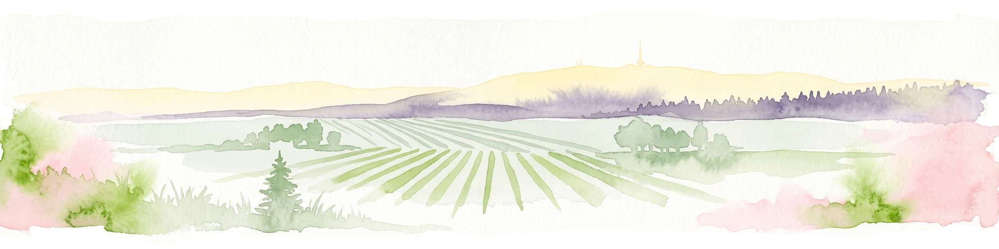
A soft watercolor painting depicting a rolling landscape with fields, a small forest edge, and a mountain peak in the background.
Protected areaRhineland-Palatinate
About 6.1 km away#1 closest

South

Donnersberg Protected Area: A Geographic Atlas of the Palatinate Region's Highest Massif

Geological landscapes, Celtic heritage sites, and forested mountain terrain.

The Donnersberg massif represents a critical point of geographic and archaeological interest in Rhineland-Palatinate. This protected area encompasses a 24-square-kilometer rhyolite cryptodome featuring high-altitude plateaus, a complex network of forest ecosystems, and well-preserved remnants of ancient Celtic fortifications. Its steep slopes and diverse rock formations offer a clear look at the geological and historical layering of the German landscape.

Area
24 km²
Relief
Mountain
Climate
Temperate
Access
Easy access
Nature reserveDonnersbergkreis
About 9.7 km away#2 closest

South

Steinbühl-Schäfergraben: A Protected Porphyry Quarry Landscape in Donnersbergkreis

Managed conservation grazing for open habitat biodiversity

Steinbühl-Schäfergraben represents a rare convergence of industrial history and conservation science, where an abandoned porphyry quarry has been transformed into a species-rich protected landscape. By employing year-round grazing with hardy livestock, the site retains its open, rocky character, contrasting with the surrounding woodlands of the Donnersbergkreis. This location provides essential insight into land reclamation and the development of open-terrain ecosystems on post-industrial ground.

Area
0.67 km²
Established
1998
Nature reserveDonnersbergkreis
About 9.7 km away#3 closest

Southwest

Langhöll-Falkenberg Nature Reserve and Protected Landscape in Donnersbergkreis

Mapping the ecological gradient of this North Palatine valley reserve.

Langhöll-Falkenberg represents a distinct protected zone where dry upland slopes meet moist valley floor environments. The reserve functions as an essential habitat mosaic, combining semi-dry grasslands with alder carr and spring-fed mires. This structured view examines the site topography and its role in regional conservation across the North Palatine uplands of Rhineland-Palatinate.

Area
1 km²
Established
1999
IUCN
IV
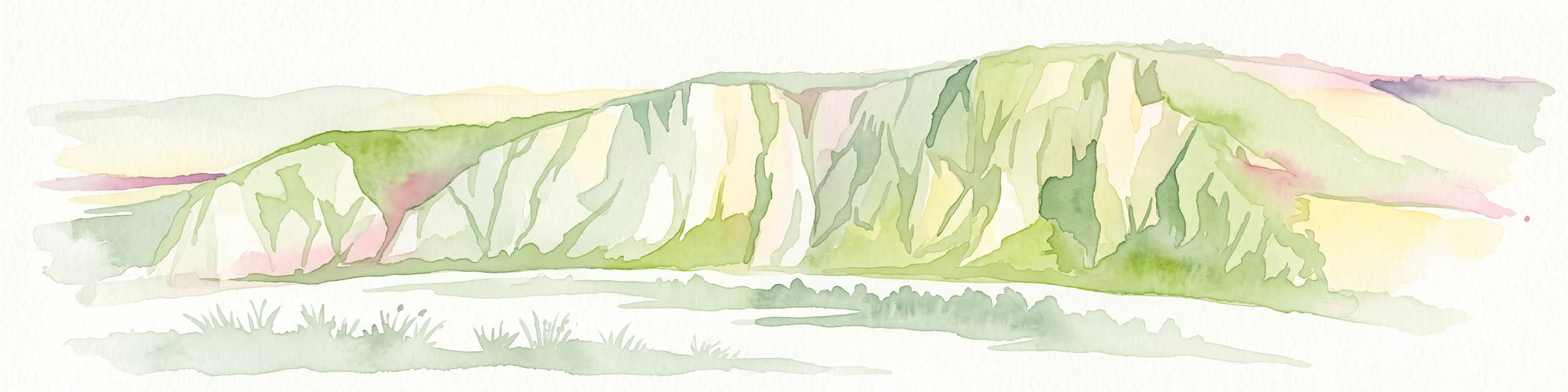
A horizontal watercolor painting depicting a wide, jagged rock cliff face with green hills, set against a plain background.
Nature reserveRheinland-Pfalz
About 10 km away#4 closest

Northwest

Rotenfels Nature Reserve: A Geographical Portrait of the Nahe Valley Rhyolite Cliff

Geological landscape and protected habitat in Rheinland-Pfalz.

The Rotenfels nature reserve is anchored by a massive 200 meter high rock wall formed from red rhyolite. This protected landscape is recognized for its vertical drop into the Nahe River valley, creating a distinct microclimate that supports specialized cliff vegetation and raptor habitats within a traditionally farmed viticultural region.

Area
0.91 km²
Established
1939
Relief
Mountain
Climate
Temperate
Nature reserveRheinland-Pfalz
About 16 km away#5 closest

South

Spendel-Wildenstein Nature Reserve: Protected Forest Boundaries and Regional Geography

Deciduous forest reference area in the Donnersbergkreis district

Discover the geographic and ecological structure of Spendel-Wildenstein, a 145-hectare protected forest area in Germany. This nature reserve serves as a crucial natural forest reference site, known for its layered woodland communities, including rare Montpellier maple-oak and maple-ash stands situated along the Wildensteiner Bach stream valley.

Area
1.45 km²
Established
1981
Nature reserveRheinland-Pfalz
About 17 km away#6 closest

East

Gau-Köngernheimer Ried Nature Reserve: Map and Protected Landscape Geography

A protected wetland mosaic in the Selz river valley of Rheinland-Pfalz

Gau-Köngernheimer Ried represents an ecologically vital nature reserve in the Alzey-Worms district. Its landscape is defined by a low-lying floodplain, featuring reed-fringed ditches, pollarded trees, and moist hay meadows that follow the course of the Selz river. The site functions as a key component of the regional habitat network within the agricultural landscape of southwestern Germany.

Area
0.29 km²
Established
1990
Relief
Lowland
Climate
Temperate
A soft, painterly watercolor illustration depicting a winding river flowing through a lush green valley with rolling hills in the background.
Nature reserveRheinland-Pfalz
About 18 km away#7 closest

East

Im Briehl/Schafwiese Nature Reserve: Selz River Floodplain and Wetland Geography

A restored riverine landscape in Rheinland-Pfalz

The Im Briehl/Schafwiese nature reserve is a protected fragment of the Selz river floodplain in Rheinland-Pfalz. This site is defined by its 2020 to 2021 renaturation, which replaced straight channels with a meandering course, creating a mosaic of damp meadows, reed beds, and still-water biotopes within an agricultural landscape.

Area
0.23 km²
Established
1990
Nature reserveDonnersbergkreis
About 19 km away#8 closest

South

Beutelfels Nature Reserve: Geographic Insights and Protected Landscape Mapping

A diverse forested landmark in the Donnersbergkreis district

Located in the Falkensteiner Berge range, Beutelfels represents a significant protected area within the German landscape. The reserve showcases a dense integration of maple-linden forests and open rocky outcrops, preserved as a dedicated forest reference plot. Discover the unique topography and ecological zoning that define this essential 59-hectare segment of the Nordpfälzer Bergland.

Area
0.59 km²
Established
1981
Relief
Mountain
Climate
Temperate

Common questions about visiting, size, designation, and location context for Rheinhessische Schweiz

Rheinhessische Schweiz FAQs for park facts, access, geography, and protected area context

Find quick answers about Rheinhessische Schweiz, including protected-area facts, park geography, trail and visitor context, and how the park fits into its surrounding country and regional landscape.
MoriAtlas Explorer

Continue Your Protected Areas Search Across the Global Atlas

Deepen your exploration by continuing the structured search for national parks and protected areas worldwide. Utilize the comprehensive filtering capabilities to compare different conservation landscapes and refine your understanding of global park geography. Discover more about the distribution and characteristics of protected natural areas.

Global natural geography