Mori Atlas logo
Protected areaSalar del Huasco National Park

Mapping the protected boundaries and natural terrain of this unique Chilean protected area.

Salar del Huasco National Park: Chile's Protected Landscape and Geographic Identity

(Parque Nacional Salar del Huasco)

Salar del Huasco National Park stands as a distinct protected area within Chile's expansive geography, offering a focal point for atlas-driven discovery. This page delves into the park's specific geographic setting and its importance as a mapped natural landscape. Users can explore the park's boundaries and understand its regional context, contributing to a broader appreciation of protected lands in South America.

desert wetlandssalt flat ecosystemflamingo habitathigh-altitude protected areaAtacama Desertbirdwatching

Salar del Huasco National Park

Protected area

Park overview

Structured park overview, official facts, and landscape profile for Salar del Huasco National Park

Salar del Huasco National Park park facts, protected area profile, and essential visitor context

Review the core facts for Salar del Huasco National Park, including designation, size, terrain, visitor scale, habitats, and operating context in one park-focused overview.

About Salar del Huasco National Park

Salar del Huasco National Park protects a remarkable ecological anomaly: a thriving wetland complex embedded within the most arid non-polar desert on Earth. The park's central feature is the Huasco salt flat, a basin where mineral-rich waters accumulate and evaporate, leaving behind a gleaming white crust of sodium chloride and other salts. Within this harsh mineral landscape, several lagoons maintain persistent water levels through groundwater seepage, creating islands of ecological productivity that support surprisingly diverse flora and fauna. The surrounding terrain consists of ancient alluvial fans and volcanic foothills that contribute mineral-laden sediments to the basin. This combination of extreme desert conditions and reliable water availability has produced an ecosystem of exceptional scientific and conservation value. The park provides protection for species that are found nowhere else, particularly the specialized invertebrates that thrive in the hypersaline lagoon waters and the bird populations that depend on these unique foraging grounds.

Quick facts and research context for Salar del Huasco National Park

Salar del Huasco National Park is located in the Atacama Desert at elevations between 2,300 and 3,000 meters above sea level. The protected area encompasses the Huasco salt flat and its associated wetland habitats, which are fed by underground aquifers and seasonal runoff. The park was established in 2010 and covers approximately 5,600 hectares. The lagoons within the salt flat maintain consistent water levels despite the surrounding desert environment, supporting rich ecological communities that depend on these rare aquatic resources.

Protection and recognition

Exploring documented conservation status and global wetland recognition across protected landscapes

Protection Status and Ramsar Recognition of Salar del Huasco National Park

Browse the official protection status and international ecological standing of Salar del Huasco National Park, featuring its designated Ramsar wetland status. Verified environmental records detail the formal conservation boundaries and international recognition of the high-altitude saline ecosystem.
Park context

Deeper park guide and search-rich context for Salar del Huasco National Park

Salar del Huasco National Park history, landscape, wildlife, and travel context

Explore Salar del Huasco National Park through its history, landscape character, ecosystems, wildlife, conservation priorities, cultural context, and seasonal travel timing in a structured park guide built for atlas discovery and search intent.

Why Salar del Huasco National Park stands out

Salar del Huasco is best known for its population of Andean flamingos, which congregate in large numbers around the park's lagoons to feed on brine shrimp and algae. The flamingos' pink plumage against the stark white salt crust and deep blue sky creates one of the most distinctive visual scenes in Chile's protected areas. The park also preserves one of the few remaining functional wetland ecosystems in the Atacama Desert, making it a critical oasis for migratory waterfowl and a living laboratory for studying how life persists in extreme aridity.

Salar del Huasco National Park history and protected-area timeline

Salar del Huasco National Park was established in 2010 as part of Chile's efforts to protect its most ecologically significant desert wetlands. The area had previously received informal protection as a private sanctuary, but formal designation as a national park ensured permanent conservation status and public access for educational and recreational purposes. The creation of the park reflected growing recognition that the Atacama's wetlands, though small in total area, represent disproportionately important biodiversity hotspots that support species populations far beyond their immediate geographic footprint. Prior to protection, the salt flat faced potential threats from mining interests and water extraction, making formal park status essential for long-term conservation.

Salar del Huasco National Park landscape and geographic character

The landscape of Salar del Huasco National Park presents a dramatic contrast between extreme aridity and surprising aquatic abundance. The salt flat itself covers a substantial area, its surface a brilliant white expanse of crystallized minerals that reflects intense sunlight with almost blinding intensity. Rising from the salt crust, the lagoons display waters ranging from pale turquoise to deeper blue-green, their colors influenced by the salinity and the populations of algae and microorganisms they contain. The surrounding terrain is characteristic of the pre-Andean depression, featuring gentle slopes covered in sparse desert vegetation, with distant volcanic peaks providing a dramatic backdrop. The horizon often shows the haze of the distant Pacific Ocean to the west, while to the east the higher Andes create a wall of mountains that separate the coastal desert from the altiplano beyond.

Salar del Huasco National Park ecosystems, habitats, and plant life

The ecological character of Salar del Huasco is defined by the presence of permanent water in an otherwise waterless landscape. The lagoons support complex food webs based on brine shrimp and phytoplankton, primary producers that thrive in the hypersaline conditions. These in turn support the park's internationally significant populations of waterfowl, with Andean flamingos being the most conspicuous inhabitants. The wetland margins support bulrush and saltgrass vegetation that provides cover for nesting birds and foraging habitat for mammals. The surrounding desert, despite its apparent barrenness, contains adapted plant communities including cushion plants and drought-deciduous shrubs that survive on the minimal moisture from fog and rare precipitation events.

Salar del Huasco National Park wildlife and species highlights

Salar del Huasco National Park supports remarkable wildlife populations that depend directly on the lagoon's aquatic resources. Andean flamingos are the park's flagship species, with hundreds of individuals present throughout the year, their distinctive pink coloration and graceful movements providing the park's most memorable wildlife encounters. The lagoons also host populations of Chilean flamingos and various migratory duck species, including cinnamon teal and speckled teal. Among the mammals, vicuña are regularly observed on the desert margins, their slender forms adapted to extracting moisture from the sparse vegetation they consume. Guanacos also range through the surrounding terrain, and the park supports populations of culpeo foxes and several small rodent species that have evolved to survive in the desert environment.

Salar del Huasco National Park conservation status and protection priorities

The protection of Salar del Huasco represents a significant achievement in conserving one of the Atacama Desert's most ecologically important wetland systems. The park's designation ensured the preservation of habitat that supports globally significant populations of Andean flamingos, a species whose conservation status makes every protected wetland area critical to its long-term survival. The park also preserves a unique desert wetland ecosystem that serves as a natural laboratory for understanding how biodiversity persists in extreme environments. Groundwater protection is essential to maintaining the lagoons, and the park's management focuses on monitoring water quality and quantity to ensure these critical habitats remain functional.

Salar del Huasco National Park cultural meaning and human context

The Huasco salt flat and surrounding lands have been used by local communities for generations, with the area historically supporting pastoral activities and small-scale extraction of salt and other minerals. The region around the park retains connections to the indigenous peoples of the Atacama, though much of the traditional cultural landscape has been transformed by modern development. The park provides opportunities for visitors to experience the cultural heritage of the Atacama while learning about the ecological significance of the desert wetlands.

Top sights and standout views in Salar del Huasco National Park

The most compelling highlight of Salar del Huasco National Park is the opportunity to observe large flocks of Andean flamingos in a setting of extraordinary visual drama, with white salt, blue water, and pink birds creating a scene unlike anywhere else on Earth. The park offers relatively uncrowded visitor experiences compared to more famous Chilean protected areas, allowing for more intimate wildlife observation. The contrast between the stark desert landscape and the vibrant wetland ecosystems provides a powerful demonstration of nature's adaptability and the importance of preserving unexpected ecological treasures.

Best time to visit Salar del Huasco National Park

The best time to visit Salar del Huasco National Park is during the austral summer months from November through March, when temperatures are warmest and conditions are most comfortable for outdoor exploration. During this period, the lagoons are typically at their fullest and wildlife activity is highest, with flamingos readily visible from the shore. The winter months bring colder temperatures and occasional fog, but also offer the dramatic sight of flamingos against moody desert skies. Year-round visits can be rewarding, though visitors should be prepared for the extreme aridity and strong sunlight regardless of season.
Monthly climate preview

Long-term temperature ranges and precipitation rhythm from representative park coordinates

Salar del Huasco National Park Climate Normals and Annual Weather Patterns

Salar del Huasco National Park exhibits measurable annual variations in temperature and precipitation across its high elevation sampling point. Examining the complete monthly climate normals reveals detailed long-term averages for sustained regional study.
Annual mean7 °C
3 °C10 °C
Jan10°
Feb
Mar
Apr
May
Jun
Jul
Aug
Sep
Oct
Nov
Dec
Warmest month
January

9.6 °C

Coolest month
July

3.3 °C

Wettest month
January

0.6 mm/day

Driest month
June

0 mm/day

Park location guide

Geography guide, regional context, and park location map for Salar del Huasco National Park

Salar del Huasco National Park park geography, regions, and map view in Chile

Understand where Salar del Huasco National Park sits in Chile through a broader geographic reading of the surrounding landscape, nearby location context, and its mapped position within the national park landscape.

How Salar del Huasco National Park fits into Chile

Chile is a presidential republic in western South America, extending as a narrow strip along the western edge of the continent between the Andes Mountains and the Pacific Ocean. It is the southernmost country in the world and the closest to Antarctica. The country is bordered by Peru, Bolivia, and Argentina, and administers several Pacific islands including Easter Island. Chile is a major copper producer and has a population of approximately 19.6 million.

Wider geography shaping Salar del Huasco National Park in Chile

Chile occupies a narrow strip of land along the western edge of South America, extending approximately 4,300 km north to south but only about 350 km east to west at its widest point. The country is sandwiched between the Andes Mountains to the east and the Pacific Ocean to the west. It shares borders with Peru to the north, Bolivia to the northeast, and Argentina to the east. Southern Chile borders the Drake Passage. Chile also administers several Pacific islands including Juan Fernández Islands, Isla Salas y Gómez, Desventuradas Islands, and Easter Island, plus the Chilean Antarctic Territory.

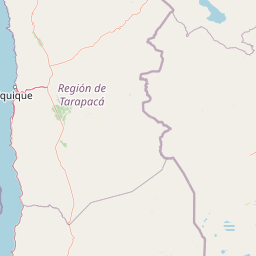
Map view of Salar del Huasco National Park

Use this park location map to pinpoint Salar del Huasco National Park in Chile, understand its exact geographic position, and read its mapped placement within the surrounding landscape more clearly.

Pigeon | © OpenStreetMap contributors
Park atlas

Trace the diverse protected landscapes surrounding Salar del Huasco National Park, mapping additional natural areas across Chile's arid north.

Discover Other National Parks Near Salar del Huasco, Exploring Chile's Atacama Protected Areas

After exploring Salar del Huasco National Park, continue your geographic journey by browsing other national parks and protected areas in Chile's Atacama region and beyond. Compare wetland ecosystems, high-altitude landscapes, and desert conservation efforts to understand the unique ecological spread across the northern Chilean territory.
National parkTarapacá Region
About 85 km away#1 closest

North

Volcán Isluga National Park: Protected Landscape Atlas and Geographic Context

Explore mapped boundaries and natural terrain in Tarapacá Region.

Volcán Isluga National Park stands as a distinct protected natural landscape in the Tarapacá Region of Chile. This MoriAtlas entry provides detailed insights into its geographic setting, mapped park boundaries, and the unique natural terrain it encompasses. It serves as a vital point for understanding the park's role within Chile's network of protected areas and its contribution to the regional geography.

Area
1,747 km²
Established
1967
IUCN
II
Relief
Mountain
Wildlife reservePotosí
About 205 km away#2 closest

Southeast

Reserva nacional de fauna andina Eduardo Abaroa: Protected Area and Andean Terrain Map

High-altitude volcanic landscapes and flamingo wetlands in Potosí, Bolivia.

The Reserva nacional de fauna andina Eduardo Abaroa represents one of the most distinctive protected landscapes in the Andes. Spanning across the Altiplano, the terrain encompasses geothermal geyser fields at Sol de Mañana, dramatic volcanic summits like Licancabur, and specialized mineral lagoons. This protected area offers a look at extreme environmental adaptation, where high-altitude desert formations meet rare, nutrient-rich wetlands that sustain significant populations of Andean, James's, and Chilean flamingos.

Area
7,147.45 km²
Established
1973
IUCN
IV
Visitors
152.9K annual
National parkArica-Parinacota Region
About 206 km away#3 closest

North

Lauca National Park: Mapped Volcanic Terrain and High-Altitude Protected Landscapes

Explore the geography of this Arica-Parinacota Region national park.

Lauca National Park is a significant protected area in Chile's Arica-Parinacota Region, offering a unique glimpse into the dramatic geography of the high Andes. Its landscape is characterized by imposing volcanic formations, including Parinacota Volcano, and expansive altiplano terrain. This national park serves as a vital protected landscape, inviting detailed exploration of its mapped boundaries, diverse ecosystems, and remarkable natural features for those interested in geographic context and conservation.

Area
1,379 km²
Established
1970
IUCN
II
Visitors
12.1K annual
National parkBolivia
About 224 km away#4 closest

North

Sajama National Park National Park: Bolivia's Mapped Protected Landscape for Geographic Exploration

Discover regional geography and mapped protected area context.

Sajama National Park represents a crucial protected area within the geography of Bolivia. This MoriAtlas entry focuses on its identity as a national park, detailing its mapped boundaries and its contribution to the regional atlas of protected lands. Understand the park's landscape context and its significance for geographic discovery within South America's diverse terrains.

Area
1,002 km²
Established
1939
IUCN
II
Relief
Mountain
Natural monumentSud Chichas
About 348 km away#5 closest

East

Área protegida municipal Ecoparque Encantado: Geographic Atlas and Natural Monument Overview

Mapped canyon landscapes and dry valley geography in the Sud Chichas province.

Analyze the topographic features of Área protegida municipal Ecoparque Encantado, a protected municipal monument in southern Bolivia. This area captures the dramatic transition between high-altitude puna grasslands and warm inter-Andean dry valleys. Learn about the geological history of the Tupiza Formation, the preservation of endemic vegetation, and the specific terrain dynamics that define this unique canyon-rich protected landscape.

Area
38.2 km²
Established
2015
IUCN
III
Relief
Mountain
Protected areaPotosí
About 388 km away#6 closest

Southeast

Pampa Tholar de las Vicuñas: Protected Andean Puna Landscapes and Geographic Overview

Integrated management area and high-altitude habitat in Potosí, Bolivia.

Pampa Tholar de las Vicuñas covers nearly 60,000 hectares of arid puna in the municipality of Villazón, representing a key intersection of biodiversity and local pastoral traditions. The area features a complex mosaic of piedmont slopes, rolling foothills, and seasonal water networks that provide essential habitat for the Andean condor and large vicuña populations. This protected landscape offers a unique look at high-altitude land management in the transitional zone between the Altiplano and the Eastern Cordillera.

Area
584.8 km²
Established
2018
Relief
Highland
Climate
Arid
National parkAntofagasta Region
About 388 km away#7 closest

Southwest

Morro Moreno National Park National Park: Mapped Landscape and Regional Geography in Antofagasta

Explore its protected boundaries and arid terrain.

Morro Moreno National Park represents a vital protected area within the northern Chilean landscape of the Antofagasta Region. This national park serves as a focal point for understanding the specific geography and mapped terrain characteristic of this arid zone. By examining Morro Moreno National Park, users gain insight into the distribution of protected lands and the unique natural context it provides for regional geographic study.

Area
73.14 km²
Established
2010
IUCN
II
Relief
Upland
Watercolor illustration showing a mountain range with green fields, a river, and soft pastel colors
National parkCochabamba Department
About 394 km away#8 closest

Northeast

Tunari National Park: Protected Landscape Atlas and Geographic Context

Mapped boundaries within Cochabamba Department's geography.

Tunari National Park represents a vital protected landscape within the Cochabamba Department of Bolivia. This page offers an atlas-centric exploration of the park's geographic boundaries, its relationship to the surrounding regional terrain, and its significance as a national park. Delve into the mapped context of Tunari National Park to understand its protected area status and its contribution to Bolivia's diverse geography.

Area
3,090 km²
Established
1992
IUCN
II
Relief
Mountain

Common questions about visiting, size, designation, and location context for Salar del Huasco National Park

Salar del Huasco National Park FAQs for park facts, access, geography, and protected area context

Find quick answers about Salar del Huasco National Park, including protected-area facts, park geography, trail and visitor context, and how the park fits into its surrounding country and regional landscape.
MoriAtlas Explorer

Continue Your Protected Areas Search Across the Global Atlas

Deepen your exploration by continuing the structured search for national parks and protected areas worldwide. Utilize the comprehensive filtering capabilities to compare different conservation landscapes and refine your understanding of global park geography. Discover more about the distribution and characteristics of protected natural areas.

Global natural geography