
Mori Atlas logo
Nature reserveSchönebecker Schlucht

Understanding the valley geography and floodplain terrain of this rare urban gorge landscape.

Schönebecker Schlucht Nature Reserve in Nordrhein-Westfalen: A Mapped Protected Area Overview

(Naturschutzgebiet Schönebecker Schlucht)

Schönebecker Schlucht represents a protected nature reserve in the Nordrhein-Westfalen region, defined by its steep-sided stream valleys and alder floodplain forests. This mapped area provides a dense ecosystem refuge, showcasing complex riparian habitats within a localized Ruhr valley setting. Explore the geographic relief and the structural boundaries of these forested ravines that form the heart of the surrounding Schönebecker Schweiz terrain.

urban nature reservestream valley gorgealder floodplain forestreedbedsriparian woodlandRuhr region
A flat-style digital illustration of a mountain valley featuring towering cliffs, a cascading waterfall, a river in the foreground, and pine trees.

Schönebecker Schlucht

Nature reserve

Park overview

Structured park overview, official facts, and landscape profile for Schönebecker Schlucht

Schönebecker Schlucht park facts, protected area profile, and essential visitor context

Review the core facts for Schönebecker Schlucht, including designation, size, terrain, visitor scale, habitats, and operating context in one park-focused overview.

About Schönebecker Schlucht

The Schönebecker Schlucht nature reserve sits in the northern Essen district of Schönebeck, in the heart of the Ruhr metropolitan area. It is one of three formally protected nature reserves in this part of the city and forms part of the so-called Schönebecker Schweiz, a broader corridor of steep stream valleys that lends the local scenery an almost alpine look by Ruhr standards. Despite its modest size, the reserve captures an unusually complete slice of the small-valley landscapes that historically characterized the northern edge of Essen.

The protected area follows two streams that run roughly west to east and join inside the reserve. The northern stream is the Schönebecke itself, the brook that gives the gorge its name. In their upper reaches both valleys are relatively shallow, but as they descend toward the east their slopes steepen, producing the narrow ravine sections that define the central character of the Schönebecker Schlucht. The gorges are largely wooded, and bridges span the streams where walking paths cross them.

Surrounded on most sides by housing, the reserve has become a green pocket within a dense urban fabric. To the west it links to other green areas along the headwaters of the valleys, while to the east the valley continues beyond the Heißener Straße into the Terrassenfriedhof, the terraced cemetery that forms a long green threshold between the reserve and neighboring districts. Several walking trails cross the reserve, generally bridging the streams rather than running along them, so that visitors experience the gorge as a continuous woodland corridor punctuated by small crossings.

What distinguishes the Schönebecker Schlucht from many other protected sites in the Ruhr region is the way it has preserved something resembling an old stream valley landscape inside a fully grown city. The reserve shows that even in a metropolitan area, near-natural stream systems, floodplain forests, and structurally complex valley slopes can survive if a tract of land is shielded from development pressure long enough.

Quick facts and research context for Schönebecker Schlucht

Schönebecker Schlucht is a nature reserve in Essen-Schönebeck, North Rhine-Westphalia, designated in 1989 and administered by the lower landscape authority of the city of Essen. Its official NRW identifier is E-002. The protected area covers approximately 9.28 hectares and is classified as an IUCN Category IV Habitat/Species Management Area.

The reserve consists of two parallel stream valleys that drain from west to east and merge within the protected area. The northern brook is the Schönebecke, which gives the gorge its name, while the southern brook shares the lower, steep-walled section. The habitat mosaic largely consists of alder floodplain woodland varied with poplars, reedbeds, willow scrub, moist fallow land, and a range of woody undergrowth on the steep slopes. The area's significance lies in the combination of near-natural streams, moist habitats, and floodplain forest, and in its role as a connecting element in the network of stream valleys with alluvial woodland in northern Essen.

Protection and recognition

Terrestrial conservation framework and international recognition data

Schönebecker Schlucht Protection Status and Designated Area Record

Schönebecker Schlucht maintains a recorded terrestrial protection scope within official global databases. Conservation records outline the administrative designation framework and associated status metrics.

Protection details

Protection scope
Terrestrial
Transboundary protection
No
WDPA ID
165454
Park context

Deeper park guide and search-rich context for Schönebecker Schlucht

Schönebecker Schlucht history, landscape, wildlife, and travel context

Explore Schönebecker Schlucht through its history, landscape character, ecosystems, wildlife, conservation priorities, cultural context, and seasonal travel timing in a structured park guide built for atlas discovery and search intent.

Why Schönebecker Schlucht stands out

Schönebecker Schlucht is best known for its urban gorge landscape, where two small forested stream valleys plunge into steep-sided ravines within an otherwise residential part of Essen. The reserve is valued as a rare example of near-natural alder floodplain forest pressing right up against a densely built cityscape. Its second strong claim to distinction lies in the unusual concentration of protected natural value within such a small footprint: reedbeds, willow scrub, moist fallow land, and structurally diverse brook-side forests coexist across only a few hectares. This makes the area a textbook case of small-scale but ecologically rich urban nature reserve in the Ruhr region.
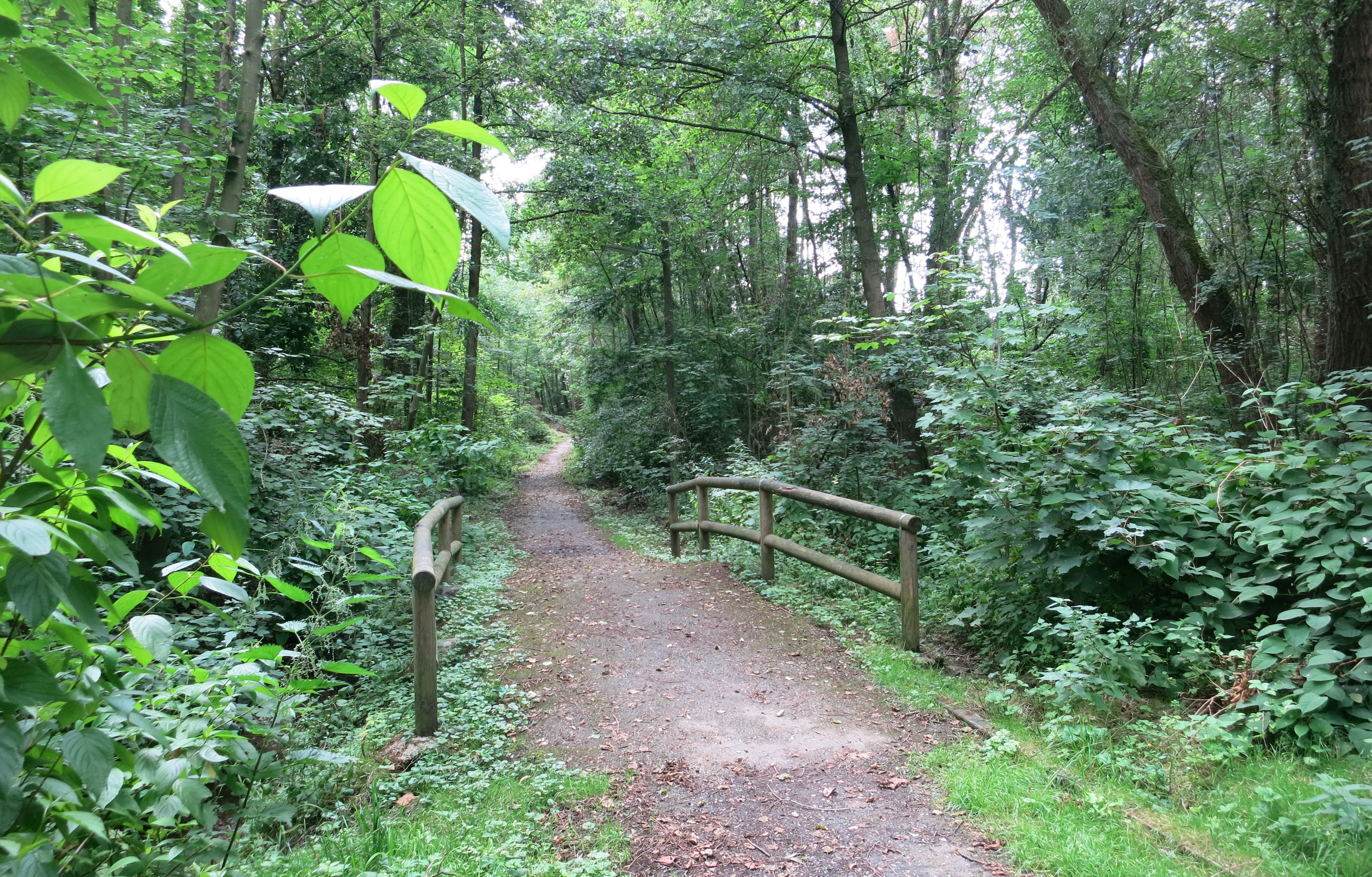
A dirt hiking path leads into a dense green forest, crossing over a small wooden bridge with simple railings.
A narrow dirt trail crossing a wooden pedestrian bridge in Schönebecker Schlucht.

Schönebecker Schlucht history and protected-area timeline

The Schönebecker Schlucht was formally designated as a nature reserve in 1989 and is administered by the lower landscape authority (Untere Landschaftsbehörde) of the city of Essen. Its NRW code E-002 places it among the longer-standing nature reserves of the region, and it has been integrated into the official NRW specialist information system on protected areas as well as the World Database on Protected Areas.

The reserve's history, however, is closely bound up with the broader development of the Schönebeck district, which evolved from scattered farmsteads in the nineteenth century into a dense urban neighborhood. This transformation brought roads, industrial premises, and housing into the immediate surroundings of the valley. In the 1960s and 1970s the gorge was even earmarked as the planned route of a new federal highway, the B 231; only the rising environmental awareness of the 1970s led to that road plan being dropped, effectively rescuing the valley from being paved over.

A second and more lasting chapter in the reserve's history came from a chemical works that had long occupied part of the Schönebecker Schlucht under older legal frameworks that no longer matched modern environmental and nature protection standards. Persistent press reports, headlined as a poison waste scandal and outdoor acid storage, slowly exposed environmental violations on the site. Despite repeated public complaints, it took more than a decade for the responsible company to be clearly identified. Because the firm lacked the resources to clean up the contaminated soil in the gorge, the remediation ultimately fell to the public purse.

The path from the environmental scandal through soil remediation to redevelopment stretched over more than thirty years. In 2012, after the cleanup, seven condominiums and eight terraced houses were built on the remediated lot along the Schönebecker Straße, a development widely described in local commentary as a long-running case where chemistry never quite reconciled with the surrounding landscape. These intertwined stories of road planning, industrial pollution, cleanup, and reverting land use give the Schönebecker Schlucht a notable urban-conservation history that goes far beyond a simple date of designation.

Schönebecker Schlucht landscape and geographic character

The landscape of the Schönebecker Schlucht is built around two parallel stream valleys that descend from west to east and then merge inside the reserve. The northern brook is the Schönebecke; the southern valley mirrors it from the south, and the two come together toward the eastern end of the protected area. In their upper, western sections the valleys are relatively gentle and open, but lower down the slopes steepen sharply, producing the narrow, near-canyonlike sections that justify the word Schlucht, or gorge, in the reserve's name.

Woodland defines the visual character of the area. The valley floors and lower slopes are cloaked in alder-dominated floodplain forest interspersed with poplars, while the steeper side walls carry a mix of woody undergrowth, bramble, and in places extensive stands of bracken. Bridges carry short walking paths across the streams, offering occasional framed views into the gorge and across to the opposite wooded wall. The terrain is small in scale but feels enclosed, giving visitors the impression of a forested cleft pressing into the surrounding city.

Outside the immediate valley, the landscape is strongly shaped by its urban setting. To the east, beyond the Heißener Straße, the valley continues into the terraced cemetery that extends the green corridor further into Essen. To the west, additional open green spaces tie into the upper ends of the two valleys, so the reserve functions as the central, protected link in a longer chain of valley greenery. The broader area is commonly referred to as the Schönebecker Schweiz, a name borrowed from more alpine landscapes and applied here because of the unusually steep, valley-rich relief within the Ruhr lowlands.
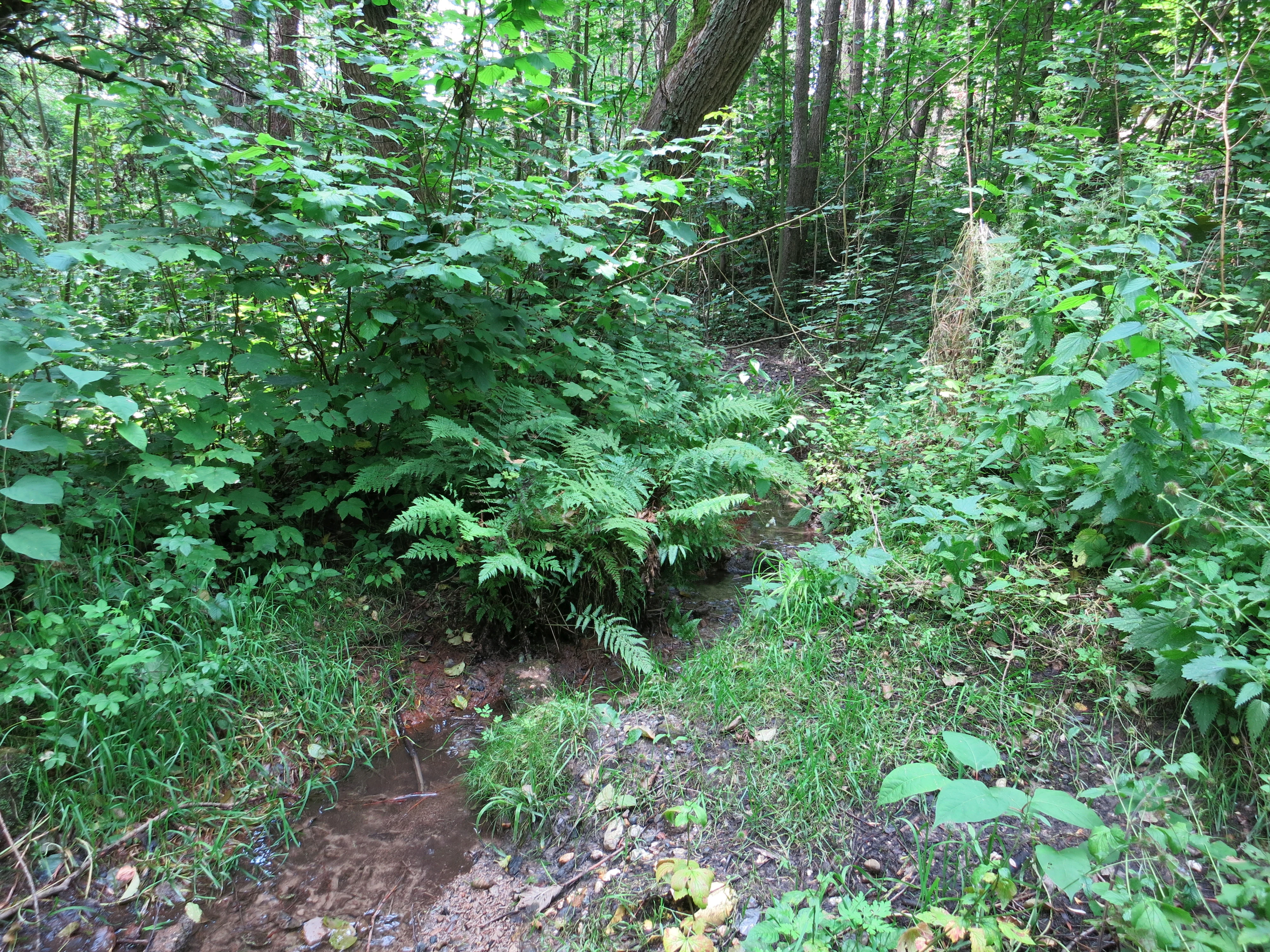
A small stream flows through dense green foliage and deciduous forest undergrowth.
A small, forested stream flowing through the Schönebecker Schlucht nature reserve.

Schönebecker Schlucht ecosystems, habitats, and plant life

Ecologically, the Schönebecker Schlucht is a small but richly structured mosaic built around a stream system. The cornerstone habitat is alder floodplain forest interspersed with poplars, which dominates much of the valley floor and lower slopes. This wet woodland is interspersed with reedbeds that established after parts of the northern brook valley were cleared and opened up to more light. On the steeper, drier slopes, woody undergrowth, bracken, and bramble add a different structural layer to the habitat mosaic.

At the confluence of the two brooks in the eastern part of the reserve, the habitat again shifts. Here the reserve holds a moist fallow area and a willow thicket, two habitats that depend directly on the influence of the streams. Together with the alder forest and reedbeds, they produce a chain of near-natural moist habitats along the watercourse. Officially, the reserve is valued above all for the combination of near-natural brooks, moist zones, and floodplain woodland within a single contiguous landscape, rather than for any single species or habitat.

A second strand of the ecological story is the reserve's role in the wider biotope network of northern Essen. Because stream valleys with alluvial woodland are scarce in a heavily urbanized region, the Schönebecker Schlucht serves as a connecting node in a network of similar brook valleys across the north of the city. Threats to this ecological fabric come mainly from invasive neophytes such as Himalayan balsam and Japanese knotweed, from nutrient enrichment at the edges of the reserve, and from trampling along paths.
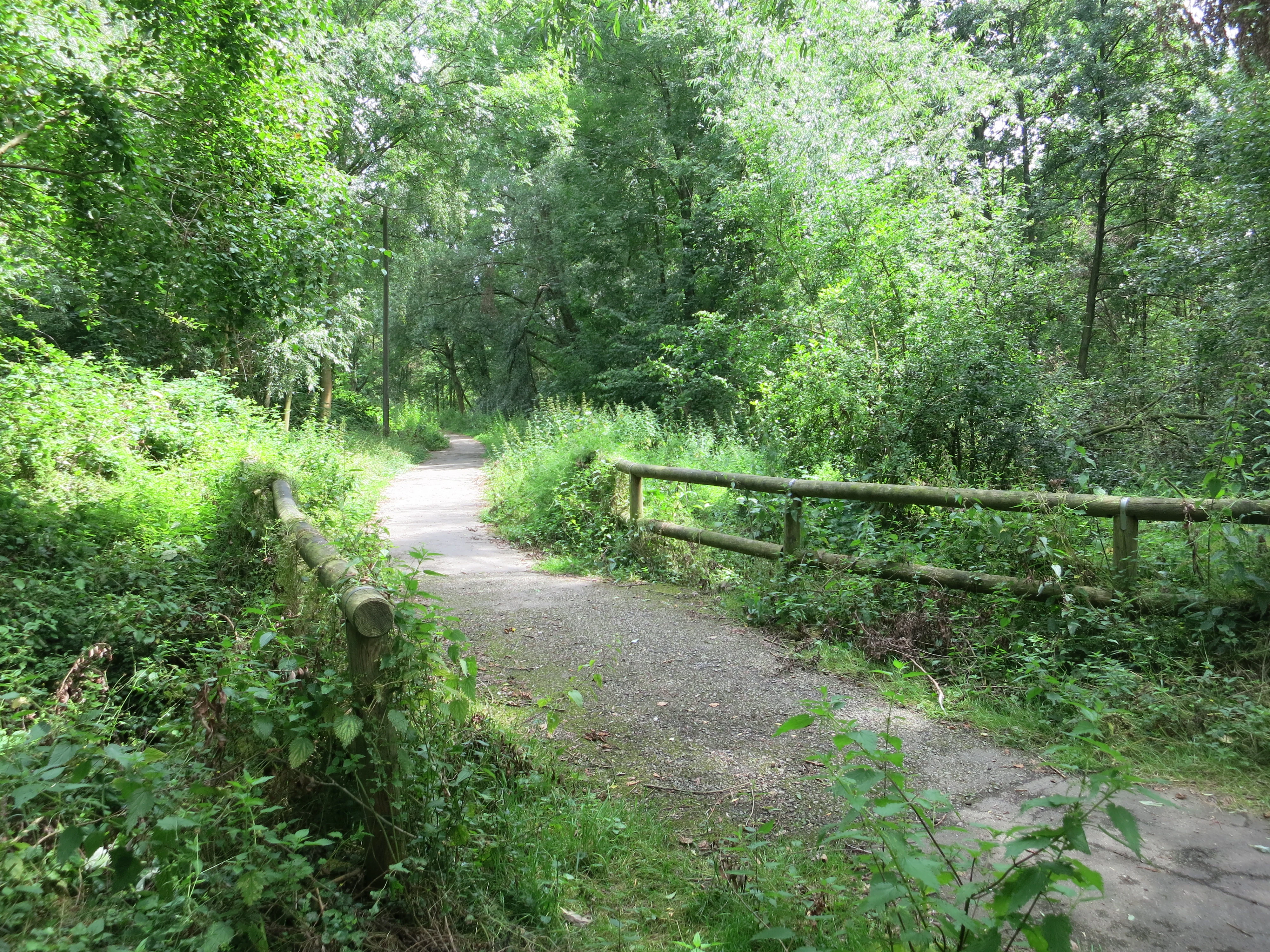
A gravel trail passes over a simple wooden footbridge in a lush, green forest.
A wooden footbridge crosses a small stream on a wooded walking path in Schönebecker Schlucht.

Schönebecker Schlucht wildlife and species highlights

The wildlife of the Schönebecker Schlucht is best understood through the habitats it supports rather than through any single charismatic species. The alder floodplain forest, reedbeds, moist fallow land, and willow thicket each create their own niches for invertebrates, amphibians, and birds typical of small Ruhr stream valleys. The combination of standing water in reedbeds, shaded pools along the brooks, and dead wood on the slopes gives the reserve relevance for amphibians, dragonflies, and the broader guild of wetland-associated invertebrates.

The streams themselves add a further dimension. Near-natural brooks of this kind can sustain native fish, aquatic insect communities, and species that depend on clean, shaded, well-structured watercourses. Deadwood along the streams, noted in the reserve's own documentation as a habitat feature, supports saproxylic insects and contributes to the structural diversity that woodland birds and small mammals use.

The most visible conservation concern in the reserve is not the absence of wildlife but the presence of invasive species. Himalayan balsam is documented in the area around the confluence of the two brooks, alongside other neophytes, and the reserve's own literature names the spread of such invasive plants alongside trampling pressure as a key threat to the long-term integrity of the habitat mosaic.
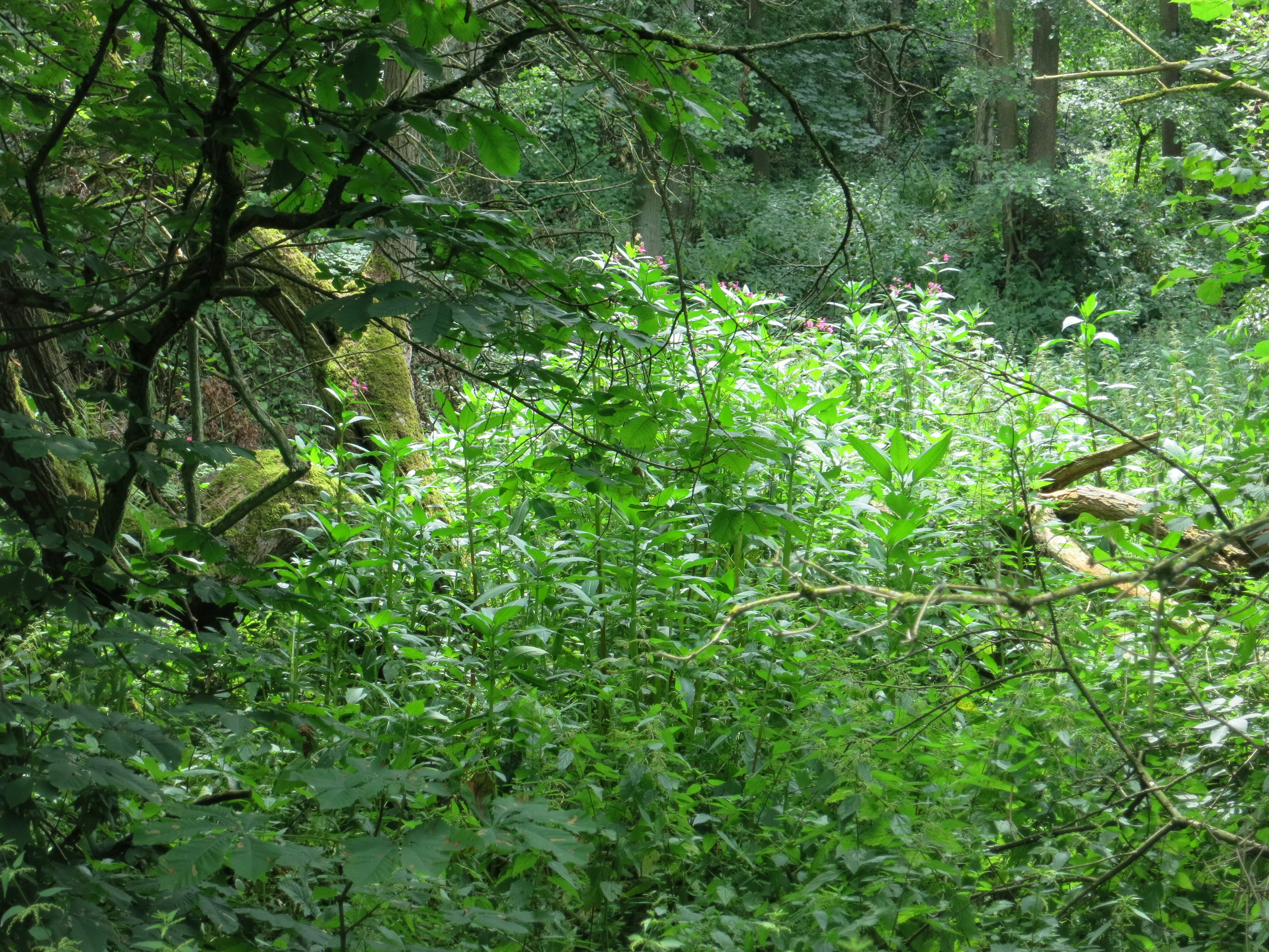
A close view of lush green undergrowth and forest vegetation surrounding fallen deadwood in a shaded woodland area.
Dense vegetation and deadwood within the Schönebecker Schlucht nature reserve.

Schönebecker Schlucht conservation status and protection priorities

Schönebecker Schlucht carries IUCN Category IV status as a Habitat/Species Management Area and is administered by the lower landscape authority of Essen under the code E-002. Its designation in 1989 formally recognized the combination of near-natural brooks, moist habitats, and floodplain forest as a coherent conservation object, rather than any single species or patch.

The reserve's stated conservation goal is the preservation of a stream system with floodplain woodland and reedbeds within a densely populated area. The use of the word Erhalt, or preservation, underlines that management here focuses on maintaining existing habitat structures and their ecological functions rather than converting the area to new uses. The reserve is recognized as part of the biotope network of alluvial brook valleys in northern Essen, giving it a role beyond its own boundaries.

Conservation management also has to wrestle with a long list of pressures. Invasive plant species such as Himalayan balsam and Japanese knotweed have established in parts of the reserve. Nutrient enrichment has been documented along the edges, where pressures from surrounding gardens and roads feed into the brooks. Trampling along paths adds another strain. These issues together are the main reason that the protected area continues to require active management rather than being left to drift on its own.

Schönebecker Schlucht cultural meaning and human context

The cultural context of the Schönebecker Schlucht is principally that of the Ruhr conurbation, where cities have grown up around older valleys and streams. The valley is sometimes called the Schönebecker Schweiz, a nickname borrowed from more mountainous regions and applied to a local stream-valley landscape whose relief feels sharper than typical Ruhr terrain. The name reflects the pride local residents take in the unusually steep, green character of the area.

Equally important is the long industrial shadow that hangs over the site. A chemical works once operated inside parts of the reserve under older legal frameworks that were incompatible with modern environmental and nature protection law. The repeated public controversies around waste handling and outdoor acid storage, the eventual exposure of the polluters, and the decades-long remediation that ended with new housing on the cleaned-up lot are part of the cultural memory attached to the gorge. This history, alongside the canceled B 231 highway project of the 1960s and 1970s, frames the reserve as a place where the relationship between industry, infrastructure, and urban nature has been actively contested for generations.

Best time to visit Schönebecker Schlucht

The Schönebecker Schlucht is best experienced when its deciduous trees are fully leafed out and the small stream valleys are running strongly, which in the climate of the Ruhr region typically means late spring through early autumn. In those months the wooded gorge feels most enclosed, the bridges over the brooks are surrounded by dense green, and the contrast with the surrounding housing is most visible. Bird and amphibian activity along the reedbeds and brook margins is also most noticeable in this period.

In winter, the slopes are bare and the relief of the two valleys and their steep lower walls can be read far more clearly. Late winter and early spring can be the best season for appreciating the structural shape of the gorge itself, though paths may be wetter and the wooded sections less visually lush. Visitors interested in quiet, atmospheric walks may prefer the cooler months, while those looking for the full green, near-alpine sense of the locally named Schönebecker Schweiz generally arrive later in the year.


Monthly climate preview

Long-term representative monthly temperature and precipitation rhythm

Schönebecker Schlucht Climate Normals and Annual Temperature Patterns

Representative coordinate records show measured monthly temperature variation alongside consistent precipitation values across the climatological reference period. Reviewing the complete twelve-month normals provides detailed context for long-term regional climate conditions.
Annual mean10 °C
1 °C19 °C
Jan
Feb
Mar
Apr
May13°
Jun16°
Jul19°
Aug18°
Sep15°
Oct10°
Nov
Dec
Warmest month
July

18.6 °C

Coolest month
January

1.5 °C

Wettest month
December

2.8 mm/day

Driest month
April

1.6 mm/day

Park location guide

Geography guide, regional context, and park location map for Schönebecker Schlucht

Schönebecker Schlucht park geography, regions, and map view in Germany

Understand where Schönebecker Schlucht sits in Germany through a broader geographic reading of the surrounding landscape, nearby location context, and its mapped position within the national park landscape.

How Schönebecker Schlucht fits into Germany

Germany is a federal republic in Western and Central Europe with a population of over 83 million across sixteen constituent states. It is Europe's largest economy by nominal GDP and a major global exporter and importer. The capital is Berlin, and the country borders Denmark, Poland, Czech Republic, Austria, Switzerland, France, Luxembourg, Belgium, and the Netherlands.

Wider geography shaping Schönebecker Schlucht in Germany

Germany is located in Western and Central Europe, spanning 357,022 km². It borders Denmark to the north, Poland and the Czech Republic to the east, Austria and Switzerland to the south, and France, Luxembourg, Belgium, and the Netherlands to the west. The country has coastlines on the Baltic Sea and North Sea to the north, with the Alps located in the southern region.

Map view of Schönebecker Schlucht

Use this park location map to pinpoint Schönebecker Schlucht in Germany, understand its exact geographic position, and read its mapped placement within the surrounding landscape more clearly.

Pigeon | © OpenStreetMap contributors

Location context for Schönebecker Schlucht

Nordrhein-Westfalen

Explore the steep wooded stream valleys, riparian habitats, and urban gorge terrain of Schönebecker Schlucht.

Schönebecker Schlucht Photos and Landscape Scenery Visual Archive

Examine detailed photographs capturing the wooded ravines, alder floodplain forests, and steep stream valleys of Schönebecker Schlucht. Visual records reveal how this compact urban nature reserve preserves complex riparian habitats and rugged terrain within a densely built city environment.

A dirt hiking path leads into a dense green forest, crossing over a small wooden bridge with simple railings.

A high angle view looking down into a dense, green deciduous forest gorge with a steep slope in the foreground and abundant trees.

A small stream flows through dense green foliage and deciduous forest undergrowth.

A gravel trail passes over a simple wooden footbridge in a lush, green forest.

A close view of lush green undergrowth and forest vegetation surrounding fallen deadwood in a shaded woodland area.

Park atlas

Compare regional stream valleys, urban nature reserves, and connected green corridors

Exploring Parks Near Schönebecker Schlucht and Surrounding Protected Areas

Browse other parks near Schönebecker Schlucht to compare similar urban nature reserves and protected riparian landscapes. Expanding the search across the surrounding region reveals connected valley habitats and regional park networks.
A soft watercolor painting of a valley scene featuring green hills in the distance, marshy vegetation, and a winding stream, rendered in light pink and green tones on a white background.
Nature reserveNordrhein-Westfalen
About 1.9 km away#1 closest

West

Hexbachtal Nature Reserve: Geography and Protected Landscape Analysis in Nordrhein-Westfalen

Essential green corridor and floodplain forest network

Hexbachtal serves as a crucial protected area and green corridor within the highly urbanized Ruhr region of Germany. The site features a diverse range of habitats including wet meadows, ancient floodplain forests, and a meandering stream system. Beyond its ecological function, the valley is recognized as a landmark of regional planning and successful landscape conservation, illustrating the interaction between natural floodplains and metropolitan growth.

Area
0.042 km²
Established
2005
IUCN
IV
Relief
Upland
A watercolor painting showing a soft, stylized forest landscape with rolling hills, evergreen trees, and grasses against a white background.
Nature reserveNorth Rhine-Westphalia
About 10 km away#2 closest

North

Köllnischer Wald: Geographic Analysis of a Protected Nature Reserve in North Rhine-Westphalia

Mapped broadleaf woodland and lowland forest geography.

Köllnischer Wald stands as a 188-hectare nature reserve in North Rhine-Westphalia, representing the largest near-natural broadleaf forest in the Westphalian plain. This site offers an insightful look into how forest ecosystems on diverse geological substrates adapt to anthropogenic shifts in hydrology and landscape management within industrialized areas.

Area
1.879 km²
Established
1988
IUCN
IV
Relief
Lowland
A soft watercolor painting of a serene river winding through a lush green valley with trees and ferns on the banks.
Nature reserveNordrhein-Westfalen
About 11 km away#3 closest

South

Naturschutzgebiet Oefter Tal: Protected Stream Valley and Forest Geography

Nature reserve in Nordrhein-Westfalen, Germany

The Naturschutzgebiet Oefter Tal protects a unique intersection of running water, spring-fed tributaries, and deciduous woodland. This site in the southern Essen district offers a detailed look at the brook systems and valley forests that define the lower Ruhr region, providing an essential refuge for native habitat connectivity.

Area
0.312 km²
Established
1992
IUCN
IV
Relief
Upland
A horizontal watercolor illustration of a calm stream flowing through a wetland with green trees and grasses along the banks.
Nature reserveNordrhein-Westfalen
About 14 km away#4 closest

Southwest

Hummelsbach Nature Reserve: Mapped Protected Brook and Floodplain Landscape in Nordrhein-Westfalen

Protected sandy stream and alder woodland mosaic

Located in the Mettmann district of Nordrhein-Westfalen, Hummelsbach preserves a near-natural sandy brook and alder floodplain forest. This reserve functions as an essential ecological bridge between rolling hill forests and lowland floodplains, providing a concentrated look at specialized habitats within a mosaic of meadows and wet woodland.

Area
0.13 km²
Established
1984
IUCN
IV
Nature reserveNordrhein-Westfalen
About 17 km away#5 closest

South

Hofermühle Süd Nature Reserve: Mapped Protected Landscapes and Quarry Geography

Examining limestone quarry terrain and riparian zones in Nordrhein-Westfalen.

Explore the distinct geology of Hofermühle Süd, where a reclaimed limestone quarry meets the meandering Anger creek. This protected nature reserve in Nordrhein-Westfalen provides a vital study in secondary succession, showcasing thin calcareous soils, rare flora, and essential wetland habitats within a small but topographically varied site.

Area
0.166 km²
Established
1984
IUCN
IV
Relief
Lowland
Nature reserveNorth Rhine-Westphalia
About 18 km away#6 closest

Northwest

Unterer Niederrhein Nature Reserve: Geographic Atlas and Floodplain Landscape Mapping

Riverine wetland ecosystems in North Rhine-Westphalia

Uncover the protected landscape of Unterer Niederrhein, an expansive bird protection area along the German Lower Rhine. The region features a mosaic of sand banks, oxbow lakes, and seasonally flooded grasslands, creating a highly interconnected riverine ecosystem that spans across the districts of Kleve and Wesel.

Area
258.094 km²
Established
1983
Relief
Lowland
Climate
Temperate
A watercolor illustration of a gentle winding stream flowing through a lush green valley at dawn or dusk.
Nature reserveNordrhein-Westfalen
About 20 km away#7 closest

South

Schwarzbachtal bei Götzenberg: Nature Reserve and Protected Landscape in North Rhine-Westphalia

Mapped stream valley, floodplain, and forest geography

Schwarzbachtal bei Götzenberg is an ecologically rich nature reserve located near Ratingen in the Mettmann district. The protected area features a well-preserved stretch of the Schwarzbach stream, old-growth beech stands, and complex wetland mosaics including reedbeds and ponds, providing essential habitat within a suburban landscape.

Area
0.54 km²
Established
1984
IUCN
IV
Relief
Lowland
A soft watercolor illustration depicting a winding river flowing through green meadows and forest clusters against a light sky background.
Nature reserveNorth Rhine-Westphalia
About 22 km away#8 closest

Southwest

Spey Nature Reserve: Protected Floodplain Geography and River Corridor in North Rhine-Westphalia

A detailed map of Rhine riverbank habitats and floodplain terrain

Spey Nature Reserve protects a characteristic slice of the Lower Rhine floodplain, featuring a layered landscape of softwood forest, river valley grasslands, and open shoreline. Situated within the Deichvorland between the cities of Krefeld and Meerbusch, this protected area serves as an essential ecological stepping stone and bird habitat. The reserve provides a valuable example of natural river processes preserved within the densely populated North Rhine-Westphalia region.

Area
1.06 km²
Established
1987
IUCN
IV
Relief
Lowland

Common questions about visiting, size, designation, and location context for Schönebecker Schlucht

Schönebecker Schlucht FAQs for park facts, access, geography, and protected area context

Find quick answers about Schönebecker Schlucht, including protected-area facts, park geography, trail and visitor context, and how the park fits into its surrounding country and regional landscape.
MoriAtlas Explorer

Continue Your Protected Areas Search Across the Global Atlas

Deepen your exploration by continuing the structured search for national parks and protected areas worldwide. Utilize the comprehensive filtering capabilities to compare different conservation landscapes and refine your understanding of global park geography. Discover more about the distribution and characteristics of protected natural areas.

Global natural geography