

Why Selous-Niassa Wildlife Corridor stands out
The corridor is best known for safeguarding the migratory routes of one of Africa's largest remaining elephant populations as they move between the Selous and Niassa reserves. Its vast miombo woodlands, riverine forests, and seasonal wetlands form a continuous ecological landscape that allows wide-ranging species to move, forage, and reproduce across national borders. It is also recognized as a pioneering example of transboundary conservation planning, combining formally protected areas with buffer zones, forest reserves, and community-managed lands into a single coordinated system. This integrated approach to managing wildlife movement, habitat connectivity, and human settlement pressure gives the Selous-Niassa corridor a distinctive identity in African conservation history.
Selous-Niassa Wildlife Corridor history and protected-area timeline
The Selous-Niassa Wildlife Corridor emerged from growing concern over the increasing isolation of the Selous Game Reserve and the Niassa National Reserve. As human populations expanded in southern Tanzania, the traditional migration routes of elephants and other large mammals became increasingly fragmented. Conservation planners recognized that without a continuous, protected land link between the two reserves, populations on either side of the border would become progressively cut off from each other.
In 2000, the Selous-Niassa Wildlife Corridor Project was launched to address this problem. The initiative aimed to assess where legal protection was needed along key migration routes, to establish sustainable-use quotas for different parts of the corridor, and to develop strategies for reducing conflicts between wildlife and local communities. The project envisioned a network of villages organized around a sustainable area that would be protected, managed, and used by local communities with the support of the regional government and wildlife authorities.
The corridor's development and management was led by the Wildlife Division of Tanzania's Ministry of Natural Resources and Tourism, with funding from the Global Environment Facility through a United Nations development programme. Implementation support was provided by the German technical cooperation agency Gesellschaft für Technische Zusammenarbeit International Services (GTZ-IS). The northern portion of the corridor was already partially protected through the Undendeule Forest Reserve and community conservation areas within the Selous buffer zone, while the southern portion, where miombo woodland meets the wetlands and riverine forests of the northern Rovuma tributaries, became the principal focus of the project.
Selous-Niassa Wildlife Corridor landscape and geographic character
The landscape of the Selous-Niassa Wildlife Corridor is dominated by the vast miombo woodlands that stretch across southeastern Tanzania and northern Mozambique. Miombo, a dry deciduous forest formation characterized by trees of the genera Brachystegia, Julbernardia, and Isinbergia, gives the region its distinctive seasonal character: dense and green during the rains, open and golden in the long dry season. This woodland forms the ecological backbone of the entire corridor.
Interspersed through the miombo are riverine forests and wetlands that follow the northern tributaries of the Rovuma River, whose waters ultimately mark the international boundary. These river corridors introduce a contrasting landscape of denser gallery forest, flooded grasslands, and seasonal marshes that break up the otherwise uniform dry woodland. The combination of dry miombo, wet drainage lines, and transitional vegetation creates a mosaic of habitats within a relatively narrow geographic band.
The corridor itself is envisioned as a strip roughly 30 to 40 kilometers wide extending east to west, and approximately 160 to 200 kilometers long from north to south. Its terrain is gently varied, shaped by drainage patterns rather than dramatic relief, and the visual character of the area transitions gradually from the dry interior woodlands of the Selous system in the north to the more river-influenced landscapes approaching the Rovuma in the south.
Selous-Niassa Wildlife Corridor ecosystems, habitats, and plant life
The Selous-Niassa Wildlife Corridor protects one of the largest and most ecologically coherent miombo woodland ecosystems in Africa. Miombo, a fire-adapted, deciduous woodland dominated by leguminous trees, supports a rich understory of grasses, herbs, and smaller woody plants that regenerate vigorously after seasonal burning. The result is a habitat of seasonal extremes, in which the landscape's productivity, leaf cover, and visibility for wildlife shift dramatically between wet and dry months.
A defining ecological feature of the corridor is its extensive wetland and riverine system. The northern tributaries of the Rovuma River carry seasonal water into the landscape, sustaining pockets of forest and seasonal floodplain that contrast sharply with the surrounding dry woodland. These wetter areas act as refuges during the dry season and provide critical resources for large herbivores, predators, and birdlife.
Within this mosaic, the corridor sustains communities typical of southern and eastern African miombo savannas, including grazing-dependent antelope species, mixed feeders, and predators that depend on healthy ungulate populations. Vegetation diversity ranges from open woodland and grass-dominated areas to denser thickets and closed-canopy riverine strips, allowing a broad cross-section of the regional fauna to use the corridor throughout the year.
Selous-Niassa Wildlife Corridor wildlife and species highlights
The Selous-Niassa Wildlife Corridor is renowned above all for its significance as an elephant landscape. During an aerial survey conducted in the dry season of 1998, the overall ecosystem supported an estimated 64,400 elephants, with the majority located on the Tanzanian side of the corridor. Today the population is believed to be considerably larger. The corridor's function as a continuous pathway allows these elephants to move between the Selous and Niassa reserves without being forced into increasingly human-dominated landscapes.
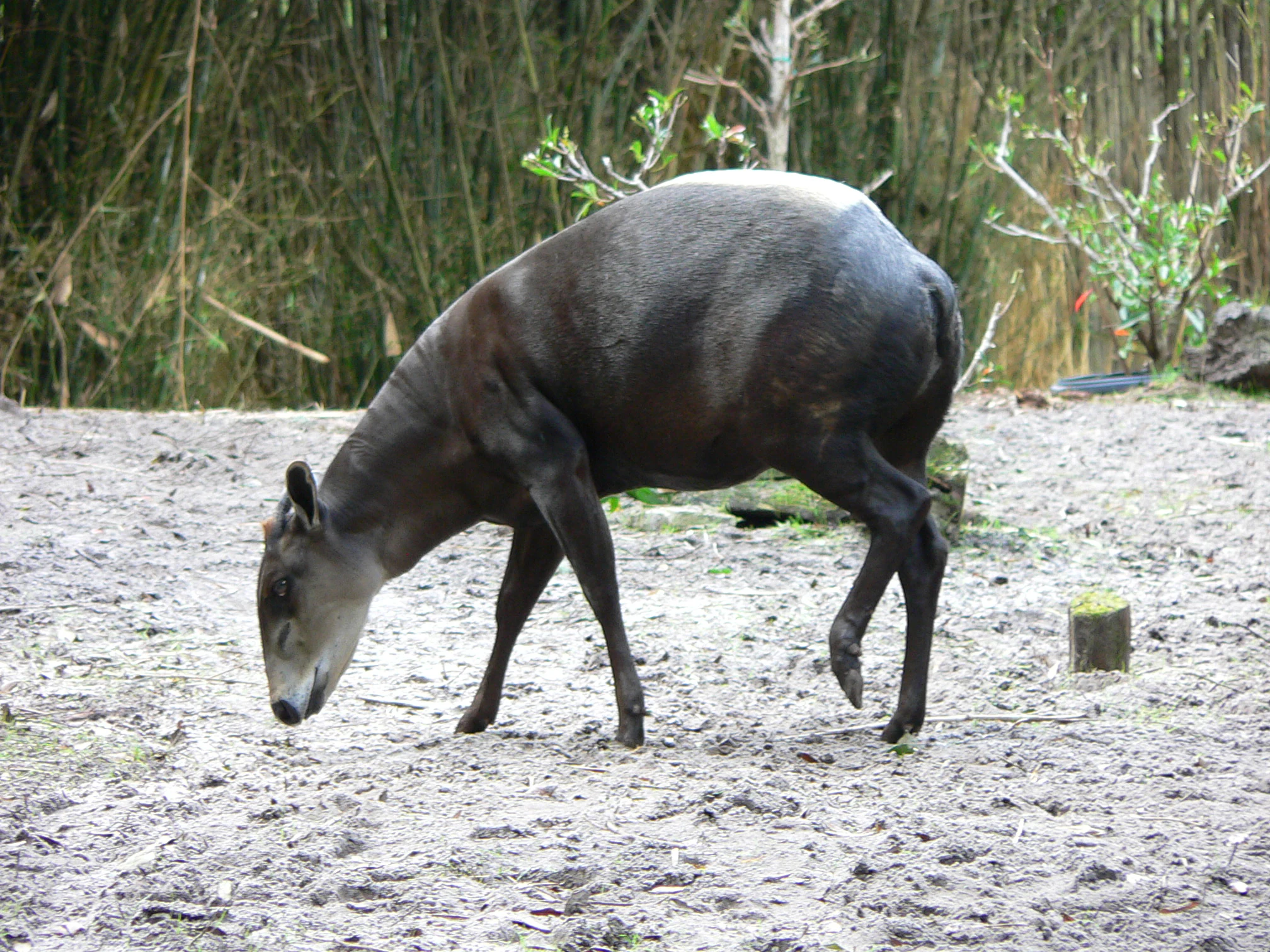
Beyond elephants, the corridor hosts a remarkable diversity of large mammals. Roosevelt's sable antelope populations of roughly 4,000 individuals have been documented within the system. Other ungulates include Lichtenstein's hartebeest, African buffalo, Niassa wildebeest, common eland, greater kudu, waterbuck, bushbuck, southern reedbuck, and a variety of duiker species grouped under the Cephalophinae subfamily. The presence of such a broad herbivore community underlines the corridor's value for sustaining migratory and resident populations alike.
Carnivores and other large animals are also well represented. African wild dogs, lions, leopards, spotted hyenas, Nile crocodiles, and hippopotamuses are all found within the corridor, supported by the diversity of habitats and the abundance of prey. Smaller mammals are present in considerable numbers, alongside a wide range of bird species, including forms that are endemic to the Tanzanian portion of the miombo belt. Together, this wildlife assemblage makes the corridor one of the most important strongholds for southern African biodiversity.
Selous-Niassa Wildlife Corridor conservation status and protection priorities
The Selous-Niassa Wildlife Corridor is fundamentally a conservation response to the problem of habitat fragmentation in one of Africa's most important wildlife regions. By protecting a continuous strip of miombo woodland and riverine habitat between two major reserves, the corridor defends the ecological connectivity that large mammals, especially elephants, require for seasonal movement, gene flow, and long-term population viability.
The corridor integrates several distinct protection categories into a single landscape framework. Strictly protected reserves, controlled hunting areas, national parks, forest reserves, and community conservation zones each play a role in maintaining wildlife habitats while accommodating the needs of local people. This zoning approach is intended to reduce conflict between conservation objectives and the livelihoods of communities living adjacent to or within the corridor, recognizing that effective conservation in such a densely populated region depends on sustainable land use outside core protected areas.
The corridor's conservation model has been widely cited as a pioneer of landscape-scale planning in Africa. By treating the Selous and Niassa reserves and the lands between them as a single ecological unit, the project has set a precedent for transboundary cooperation between Tanzania and Mozambique. Its long-term importance rests not only on the species it protects but also on demonstrating that large, contiguous wild ecosystems can be maintained even where national borders, increasing human populations, and competing land uses would otherwise drive them apart.
Selous-Niassa Wildlife Corridor cultural meaning and human context
The corridor passes through rural areas of southern Tanzania whose communities have long coexisted with the wildlife of the Selous ecosystem and its surrounds. Traditional livelihoods in the region have historically centered on subsistence agriculture, small-scale livestock keeping, fishing in the river systems, and selective use of forest resources. As human populations have grown, interactions with wildlife have become more frequent and more challenging, ranging from crop damage by elephants to the increasingly narrow space available for seasonal migrations.
The corridor's planning explicitly recognizes the role of these communities. The project vision involves a network of villages that are part of a sustainable area protected, managed, and used by local people with the assistance of government and wildlife authorities. Special emphasis is placed on maintaining local livelihoods alongside long-term conservation, reflecting an understanding that the future of the corridor depends on the cooperation of the people who live within and around it.
On the Mozambican side, the corridor connects to the Niassa Reserve, where community-based natural resource management programs have also become an important part of conservation policy. The cultural dimension of the corridor is therefore not a single backdrop but a central element of its design, weaving the needs and traditions of rural communities into the broader effort to keep this transboundary ecosystem intact.
Top sights and standout views in Selous-Niassa Wildlife Corridor
The Selous-Niassa Wildlife Corridor stands out as one of Africa's most ambitious transboundary conservation efforts, joining two great reserves across roughly 154,000 square kilometers of connected habitat. Its defining strength lies in protecting the migratory pathways of elephants and many other species as they move between the Selous and Niassa reserves, ensuring that the landscape remains ecologically whole despite the pressures of growing human populations.
Equally important is the corridor's integrated zoning design, which combines national parks, game reserves, controlled hunting areas, forest reserves, and community conservation lands into a coordinated system. This approach balances strict protection with sustainable human use, offering a workable model for landscape-level conservation in regions where protected areas alone cannot guarantee long-term connectivity. The corridor's ecological and conservation significance, combined with its pioneering governance structure, makes it a landmark in modern African conservation.
Best time to visit Selous-Niassa Wildlife Corridor
The dry season, generally extending from roughly June through October, is the most favorable period for observing wildlife in the Selous-Niassa corridor. During these months, vegetation thins, water sources become more concentrated, and large mammals including elephants, buffalo, and a variety of antelope species gather more predictably around remaining rivers, waterholes, and floodplains. Wildlife viewing and tracking conditions are at their best, and the dry miombo woodland is more open and easier to traverse.
The wet season, roughly from November through April, transforms the corridor into a much greener, denser landscape. Vegetation becomes thick and lush, birdlife is at its richest, and seasonal wetlands fill with water, creating attractive habitats for waterbirds and many other species. Travel conditions can be more demanding during this period, and large mammals are typically more dispersed. For visitors interested primarily in general scenery, birdwatching, and the lush character of the miombo, the wet season offers a very different but rewarding perspective on the corridor.