
Mori Atlas logo
Protected landscapeSindbjerg og Stovbjerg

A preserved twin summit landmark offering expansive panoramic views across the Gudenå tunnel valley

Sindbjerg og Stovbjerg: Glacial False Hills and Protected Heath Landscapes in Silkeborg Municipality

Rising as a distinctive twin-summit formation above the Gudenå tunnel valley, Sindbjerg og Stovbjerg serves as a prime example of glacial false hills within the Danish landscape. These heather-clad heights have been preserved through long-standing conservation efforts, maintaining an open heath environment that provides clear sightlines over the interconnected Silkeborg lake chain. The area stands as a central geographic landmark, showcasing the unique erosion patterns that shaped this region's terrain.

heathlandtwin hillsglacial landscapefalse hills (falske bakker)tunnel valleyGudenå valley
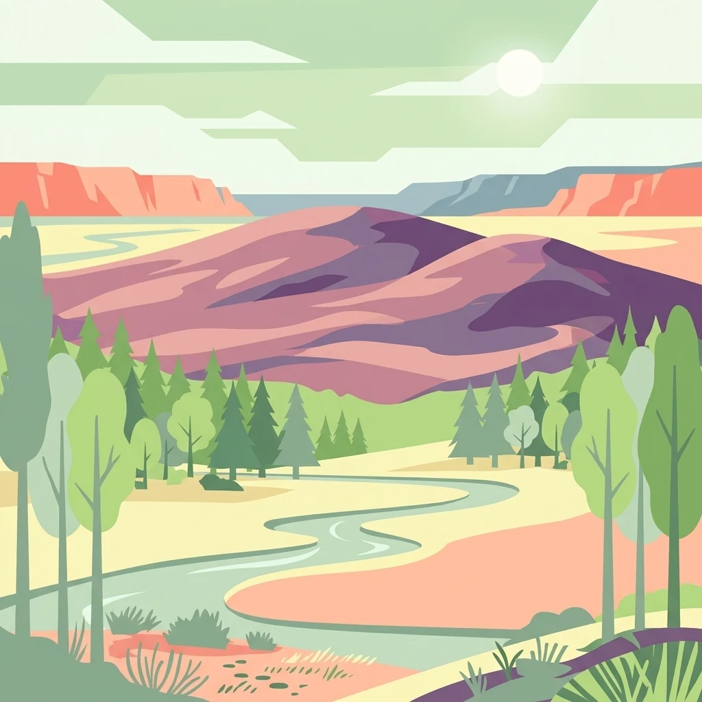
A flat, stylized illustration showing a landscape with purple rolling hills in the background, a winding river in the foreground, and pine-like trees.

Sindbjerg og Stovbjerg

Protected landscape

Park overview

Structured park overview, official facts, and landscape profile for Sindbjerg og Stovbjerg

Sindbjerg og Stovbjerg park facts, protected area profile, and essential visitor context

Review the core facts for Sindbjerg og Stovbjerg, including designation, size, terrain, visitor scale, habitats, and operating context in one park-focused overview.

About Sindbjerg og Stovbjerg

Sindbjerg og Stovbjerg is a compact but distinctive protected landscape in the heart of Jutland's Silkeborg lake district. The two heather-clad summits rise from Sejs Hede north of Borre Sø, between the village of Sejs and the regional center of Silkeborg. Although modest in absolute height, with Sindbjerg at about 103 meters and Stovbjerg at about 99 meters, their position above an ice-age tunnel valley gives them unusual visual prominence, making them visible from most of the surrounding highlands.

From the summits, sightlines stretch across much of central Denmark's most iconic lake scenery. To the south and southeast, the chain of lakes from Silkeborg to Himmelbjerget unfolds, while pieces of Brassø show to the west and the forested rise of Karoline Amalies Høj stands directly opposite. Borre Sø and Sønderskoven lie below to the south, and further east the route continues through the narrow Svejbæk passage and along the wooded ridge above Julsø to Himmelbjerget itself. The hills look down into the Gudenå tunnel valley as well, a deep meltwater-cut corridor where Denmark's longest river flows.

Beyond the views, the site is important as one of the older conservation landmarks of the Silkeborg area. The hills were secured by private servitude in 1919 to remain as open heath, with public conservation orders later extending protection to Sejs Hede as well. Today the area is appreciated both for its geology, its open heath vegetation, and its historical role in the local tourism landscape.

Quick facts and research context for Sindbjerg og Stovbjerg

Sindbjerg og Stovbjerg consists of two heather-covered summits standing approximately 400 meters apart, with Sindbjerg at about 103 meters and Stovbjerg at about 99 meters. The formation lies in Silkeborg Municipality, roughly five kilometers southeast of Silkeborg itself, immediately north of the village of Sejs and Borre Sø, within the wider Gudenå lake and river system of central Jutland.

The hills are legally protected as a preserved heath landscape, first secured through a private servitude registered in 1919 and later strengthened with public conservation orders covering the surrounding Sejs Hede in the 1940s. They are geologically classified as "false hills," scarps left standing when glacial ice and meltwater carved out the deep Gudenå tunnel valley around them. Together with Himmelbjerget and surrounding forest-ridge landscapes they form part of the classic Silkeborg lake-district scenery that has drawn visitors since the late 19th century.

Protection and recognition

Terrestrial conservation records and historical establishment details

Sindbjerg og Stovbjerg Protection Status and Designation History

Historical establishment records trace the terrestrial protection status of Sindbjerg og Stovbjerg back to nineteen nineteen. Official documentation outlines the designated management scope and historical preservation milestones established for the protected landscape.

Protection details

Protection scope
Terrestrial
Designated year
1919
Transboundary protection
No
Park context

Deeper park guide and search-rich context for Sindbjerg og Stovbjerg

Sindbjerg og Stovbjerg history, landscape, wildlife, and travel context

Explore Sindbjerg og Stovbjerg through its history, landscape character, ecosystems, wildlife, conservation priorities, cultural context, and seasonal travel timing in a structured park guide built for atlas discovery and search intent.

Why Sindbjerg og Stovbjerg stands out

Sindbjerg og Stovbjerg is best known for offering one of the most expansive panoramic viewpoints over the Silkeborg lake district, with sightlines extending across Borre Sø, the chain of lakes toward Himmelbjerget, and the forested ridges of Karoline Amalies Høj and Sønderskoven. The twin heath-topped summits have been a defining visual landmark in the area since the 19th century and were famously painted by the Danish artist Christian Zacho in 1909. The hills are also valued as a textbook example of glacial "false hill" (falske bakker) geomorphology, scarps that survived because the surrounding ice-age tunnel valley was deeply eroded around them. Their long conservation history, beginning with a private 1919 servitude meant to keep the area as open heath, has made them a symbolic landscape of early Danish nature protection near Silkeborg.
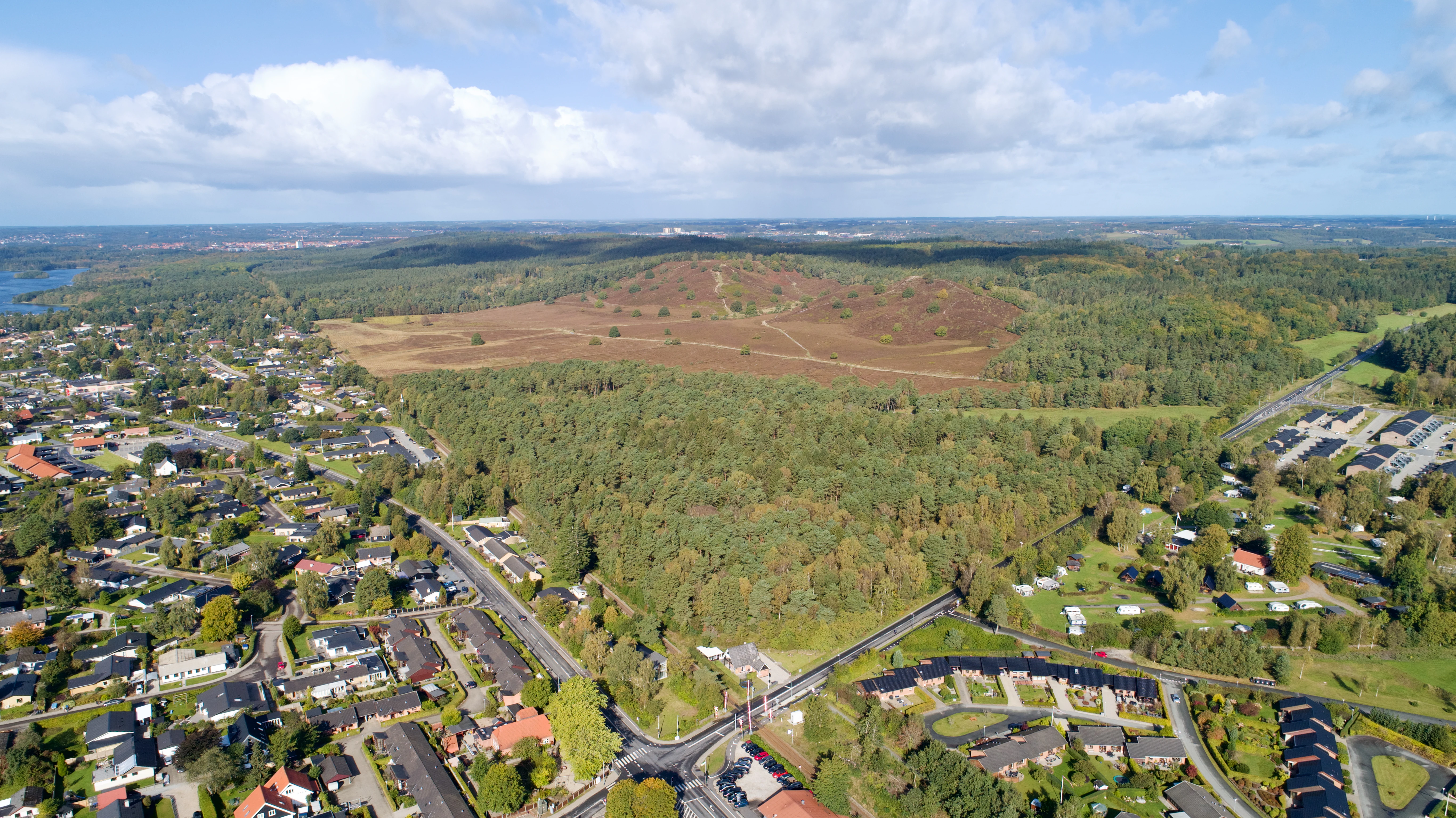
An aerial view showing a large, reddish-brown heather covered hill rising above a surrounding forest and a residential neighborhood.
Aerial view of the heather covered hills of Sindbjerg and Stovbjerg near Silkeborg, Denmark.

Sindbjerg og Stovbjerg history and protected-area timeline

The place names Sindbjerg and Stovbjerg first appear on maps from the late 18th century, recorded on the Royal Danish Academy of Sciences map of 1781 and on a land-reallocation map from 1795. They recur in A.L. Drewsen's 1850 diary about the Silkeborg area and on Mansa's map of Jutland from 1860. By 1886 the regional tourist guidebook "Himmelbjergegnen" was already describing the wide view from the summits, suggesting the hills were recognized as a scenic landmark well before they were formally protected.

The hills themselves were privately owned until 1910, when the holder, a smallholder named Johannes Madsen of Nyløkke, sold them for 800 kroner to the textile manufacturer Chr. Hammer and the newspaper editor Sophus Sørensen of Silkeborg Avis, who was also very active in the Silkeborg Turistforening. In 1919 the new owners registered a servitude ensuring the hills would "never be planted or cultivated, but should at all times lie as heather heights," and Sørensen, who became sole owner in 1923, personally kept the slopes clear of competing vegetation.

Public conservation arrived later. In 1943 the Silkeborg Turistforening asked for protection to be extended to the surrounding Sejs Hede to prevent summer-house development, and a formal protection order was finalized in 1947, when the land passed to the brothers Svend and Kaj Sørensen. Maintenance by the authorities was slow until parliamentary action in 1964 finally secured funding for active management. Burning of heather to renew young growth was permitted in 1969, worn footpaths were restored in 1974, and in 1985 the regional conservation office fenced the area for sheep grazing while keeping out free-roaming dogs. A memorial stone at the top of Sindbjerg commemorates Sophus Sørensen for his role in the original preservation, and his descendants later donated the benches found on the present-day summits.

Sindbjerg og Stovbjerg landscape and geographic character

The landscape of Sindbjerg og Stovbjerg is shaped by glacial forces acting in opposite directions. The two summits stand as what geomorphologists in this part of Denmark call "false hills," scarps that survived because the surrounding ice-age landscape was deeply eroded rather than built upward. The result is a compact pair of modest but visually striking heaths rising above the broader terrain.

The defining feature below them is the broad tunnel and meltwater valley of the Gudenå, a deeply carved corridor through which Denmark's longest river flows. From the summits this valley reads as a long, sweeping depression cutting across the view to the south and east, framed by the wooded heights above Borre Sø and Julsø. Borre Sø itself sits immediately south of the hills, while at the foot of Stovbjerg lies the open expanse of Sejs Hede.

Beyond the immediate surroundings the landscape opens into the wider Silkeborg lake district, with views extending over the lake chain toward Himmelbjerget, the dark forested rise of Karoline Amalies Høj, the Sønderskoven woodlands south of Borre Sø, and the narrow Svejbæk passage where the waters of Julsø squeeze through toward the Gudenå. Together these elements make the site one of the most commanding overlook points in central Jutland.
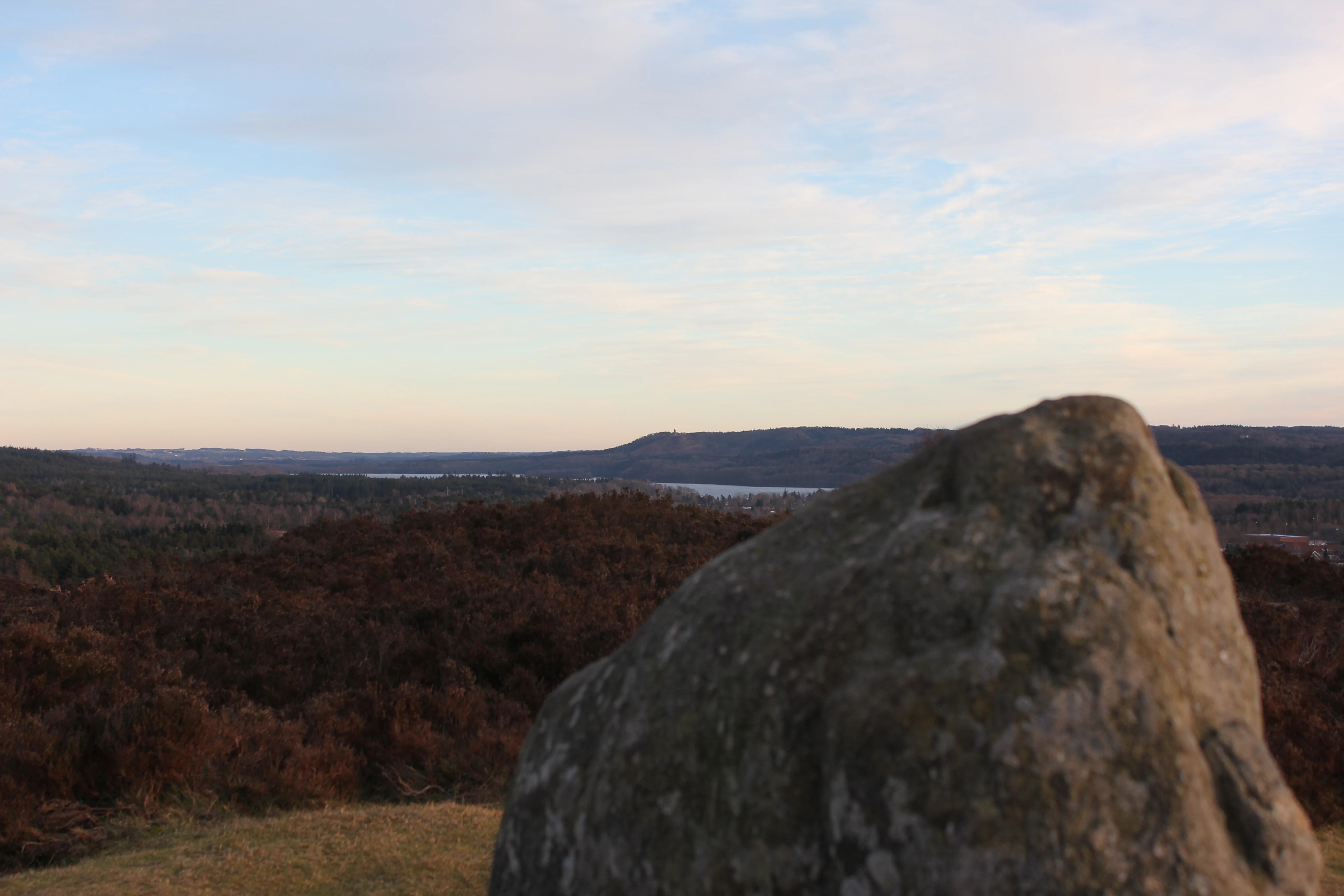
A large, weathered boulder sits in the foreground on a grassy hill, overlooking a rolling, dark-colored valley and a body of water under a pale evening sky.
Panoramic view from the hills of Sindbjerg towards the landscape and Himmelbjerget in the distance.

Sindbjerg og Stovbjerg ecosystems, habitats, and plant life

The vegetation of Sindbjerg og Stovbjerg is dominated by classic Danish inland heath. Heather (hedelyng) covers the summits, with supporting communities of crowberry (revling), lingonberry (tyttebær), tormentil, broom (gyvel), and common juniper (ene) scattered across the open ground. Patches of aspen (bævreasp), wavy hair-grass (bølget bunke), and a diverse assemblage of mosses and lichens add to the heath mosaic.

Management has been central to keeping this heath character intact. The original 1919 servitude was specifically designed to prevent the area from being planted with trees or cultivated, and periodic heather burning, permitted formally from 1969, has been used to encourage fresh young vegetation. More recent management has introduced sheep grazing within fenced sections to maintain the open landscape and protect it from encroachment. The result is a preserved fragment of open heath that contrasts sharply with the forested ridges and lake margins surrounding it.
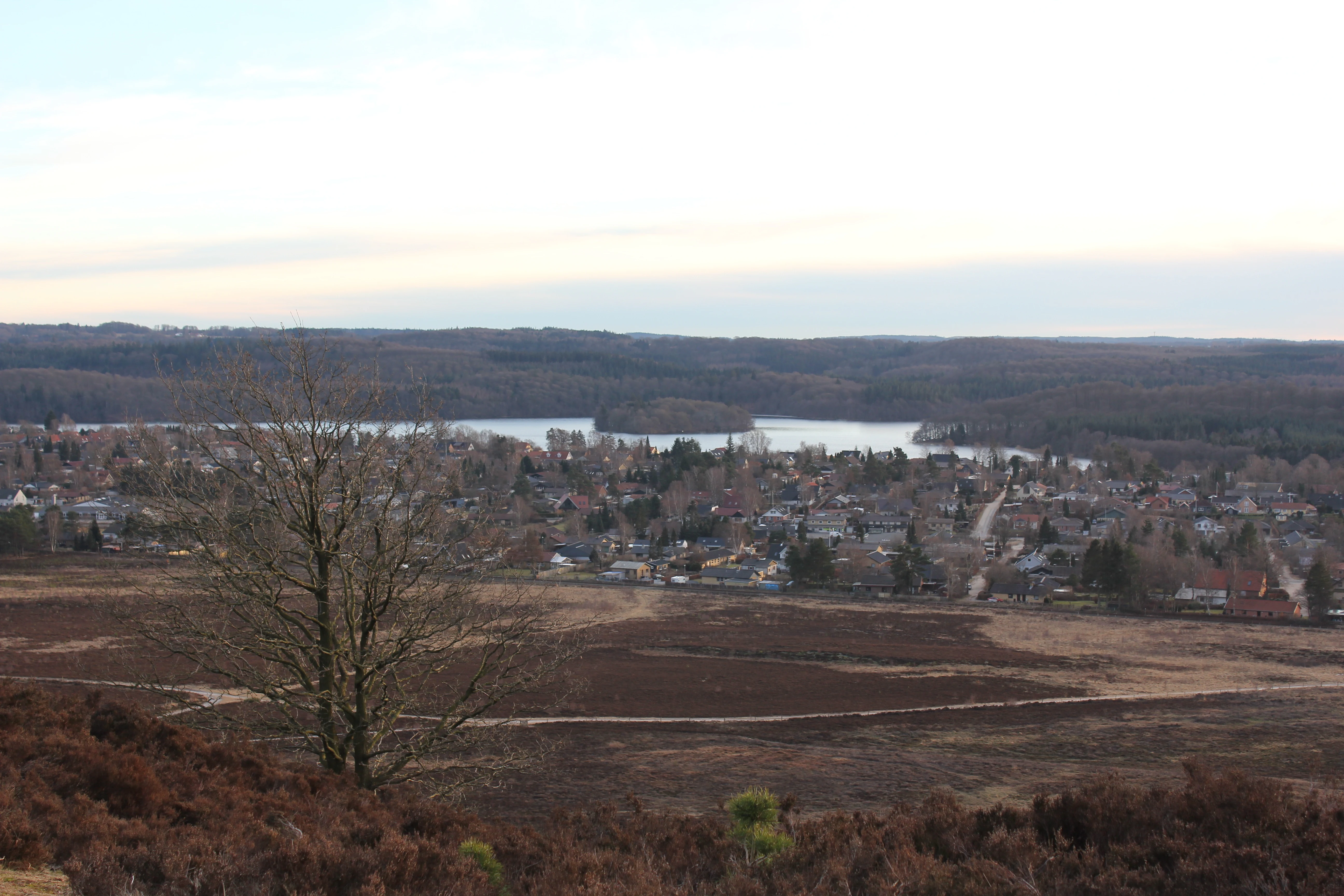
Wide angle view from a elevated heather-covered hill looking down over a town nestled beside a lake, with rolling wooded hills in the distance.
Panoramic view over the town of Sejs-Svejbaek and the surrounding lake from the heather-clad slopes of Sindbjerg.

Sindbjerg og Stovbjerg wildlife and species highlights

The article does not provide detailed information about fauna at Sindbjerg og Stovbjerg beyond the general setting in a Danish heath and lake-landscape environment, so wildlife-specific content cannot be supported without speculation. The heath and mixed woodland mosaic of the wider Silkeborg area is broadly known for typical Jutland heathland and forest species, but the source material does not give specific, verifiable detail about species associated with this exact site.
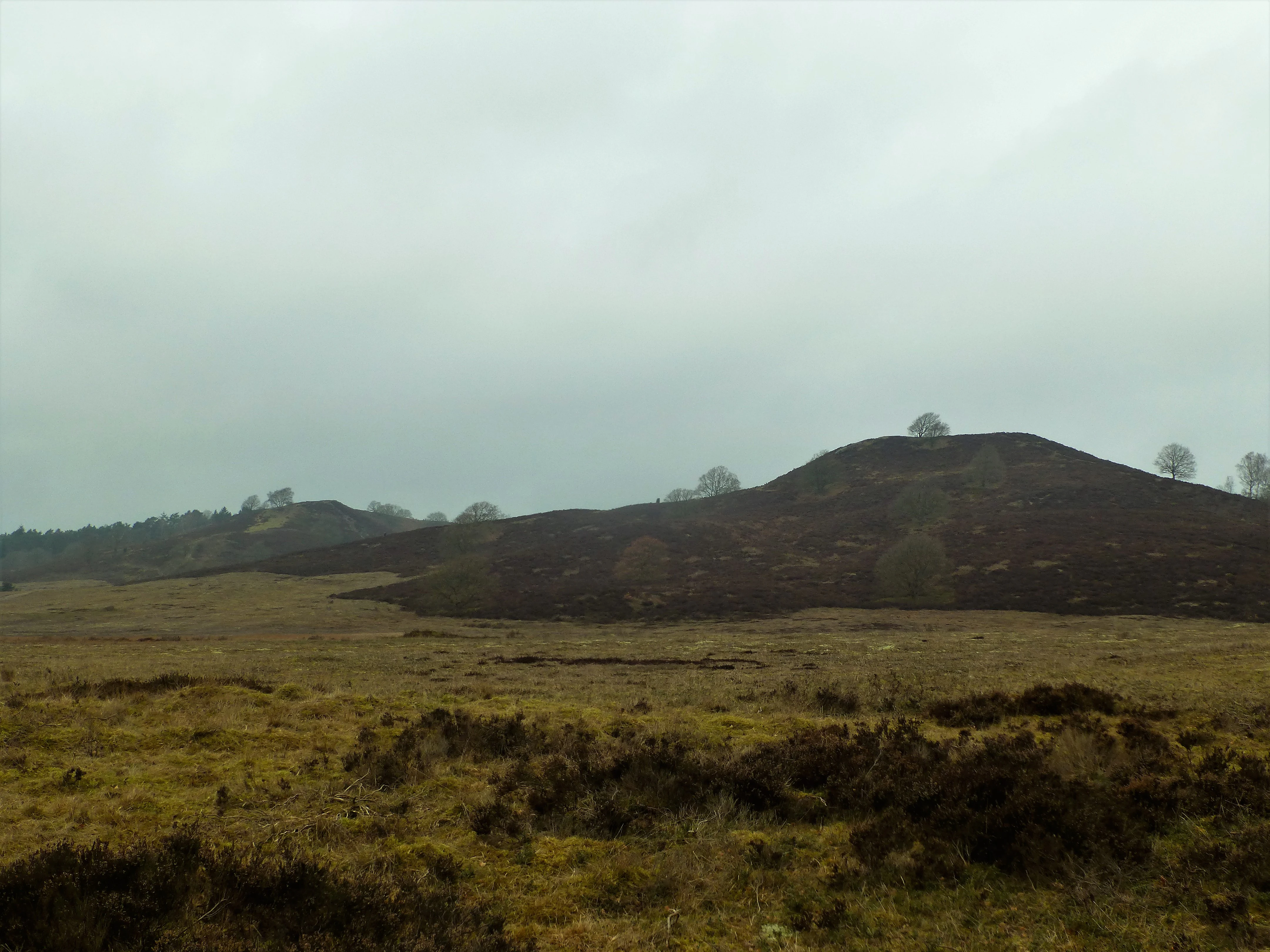
A wide view of rolling heathland hills under a cloudy, grey sky in Denmark.
The heather-covered hills of Sindbjerg and Stovbjerg under an overcast sky.

Sindbjerg og Stovbjerg conservation status and protection priorities

Sindbjerg og Stovbjerg is one of the older conserved localities in the Silkeborg area and an early example of private-led nature protection in Denmark. In 1919 the then-owners registered a servitude guaranteeing the hills would never be afforested or cultivated, with the explicit goal of keeping them as open heather heights for the future. This private commitment was later reinforced by a formal conservation order in 1947 that also extended protection to Sejs Hede, driven in part by fear of summer-house development on the surrounding open land.

Active conservation management has shaped the site ever since. Editor Sophus Sørensen personally maintained the hills for years, but official maintenance lagged until 1964, when parliamentary attention from Viggo Hauch finally brought funding for systematic management by the forest service. Burning of heather to encourage regeneration was permitted in 1969, eroded paths were restored in 1974, and in 1985 fences and natural timber gates were introduced to enable sheep grazing while excluding free-roaming dogs. Today the area remains a small but representative example of how legal protection, active vegetation management, and grazing are combined to preserve an open heath landscape.

Sindbjerg og Stovbjerg cultural meaning and human context

Sindbjerg og Stovbjerg carry a rich layer of local folk tradition and toponymy. According to the source material, the first element of Sindbjerg comes from the Old Norse word sinder, meaning "slag" or "ash," hinting at historical charcoal burning on the hill, a fact that may be supported by A.L. Drewsen's description of finding what looked like a volcanic crater beside Sindbjerg. The name Stovbjerg, sometimes spelled Stoubjerg, has a less certain first element; "stue" may suggest an ancient burial mound or a legendary dwelling of underground beings, while linguists also note a possible connection to "stub," referring to tree stumps left after felling for charcoal production.

The hills are also woven into local legend. Folk tradition supplies an explanation for why the two summits stand where they do, and the valley between them is said to be the body of the buried giant Borke, whose limbs form the surrounding heights. Beyond legend, the cultural identity of the site is closely tied to Silkeborg's 19th-century emergence as a Danish tourism center, and the painter Christian Zacho depicted Stovbjerg Hede in 1909, cementing its place in the visual culture of the Søhøjlandet.

Top sights and standout views in Sindbjerg og Stovbjerg

A panoramic overlook over the Silkeborg lake chain and Gudenå tunnel valley, including Borre Sø, Julsø, Svejbæk, and Himmelbjerget is the defining draw. The twin heather-clad summits themselves form a striking visual landmark visible from most surrounding heights and have been painted by artists such as Christian Zacho. Geologically they are textbook examples of glacial "false hills" surviving above a deeply eroded ice-age landscape, while culturally they carry both a charcoal-burning toponymy and a giant legend about the buried champion Borke.

Best time to visit Sindbjerg og Stovbjerg

The source material does not provide seasonal or operational guidance beyond the fact that the hills have long been a tourist viewpoint described in 19th-century guidebooks. Evergreen seasonality cannot be reliably supported beyond the general character of Danish heath and lake-district landscapes. Visitors in any season typically experience the open heath plateau, views over the lakes, and changing light over the Gudenå valley, but specific seasons are not enough supported to recommend confidently.

Monthly climate preview

Measured monthly climate rhythms and long-term averages for Silkeborg Municipality

Annual Temperature and Precipitation Normals for Sindbjerg og Stovbjerg

Representative point records show average temperatures ranging from near freezing through warmer summer maximums alongside consistent daily precipitation throughout the year. Reviewing the complete twelve-month profile provides a deeper look into the long-term climatic patterns recorded at this protected elevation.
Annual mean8 °C
1 °C16 °C
Jan
Feb
Mar
Apr
May11°
Jun14°
Jul16°
Aug16°
Sep13°
Oct
Nov
Dec
Warmest month
July

16.5 °C

Coolest month
February

0.8 °C

Wettest month
October

2.9 mm/day

Driest month
April

1.6 mm/day

Park location guide

Geography guide, regional context, and park location map for Sindbjerg og Stovbjerg

Sindbjerg og Stovbjerg park geography, regions, and map view in Denmark

Understand where Sindbjerg og Stovbjerg sits in Denmark through a broader geographic reading of the surrounding landscape, nearby location context, and its mapped position within the national park landscape.

How Sindbjerg og Stovbjerg fits into Denmark

Denmark is a constitutional monarchy and Nordic country in Northern Europe. It is the southernmost of the Scandinavian countries, bordering Germany to the south, Norway to the north, and Sweden to the southwest. The country consists of the Jutland peninsula and an archipelago of islands, with Copenhagen as its capital and largest city. Denmark has a population of over 6 million and is characterized by flat, arable land, sandy coasts, and a temperate climate.

Wider geography shaping Sindbjerg og Stovbjerg in Denmark

Denmark occupies the Jutland peninsula and roughly 406 islands in Northern Europe. It is situated between the North Sea to the west and the Baltic Sea to the east. The country borders Germany to the south and is connected to Sweden via the Øresund Bridge. Denmark is predominantly flat terrain with low elevation, the highest point being Møllehøj at 170.86 meters.

Map view of Sindbjerg og Stovbjerg

Use this park location map to pinpoint Sindbjerg og Stovbjerg in Denmark, understand its exact geographic position, and read its mapped placement within the surrounding landscape more clearly.

Pigeon | © OpenStreetMap contributors

Location context for Sindbjerg og Stovbjerg

Silkeborg Municipality

Visual reference for the protected heath terrain and glacial geology in the central Danish lake district.

Sindbjerg og Stovbjerg Photos: Landscapes and Scenery of the Twin Hills

Visual documentation captures the heather-clad summits and glacial tunnel valleys that define Sindbjerg og Stovbjerg. Detailed photography reveals the open terrain and expansive panoramic views across the surrounding protected landscape.

An aerial view showing a large, reddish-brown heather covered hill rising above a surrounding forest and a residential neighborhood.

An oil painting depicting a heather-covered hill with rolling terrain, a distant body of water, and a foreground path.

A large, weathered boulder sits in the foreground on a grassy hill, overlooking a rolling, dark-colored valley and a body of water under a pale evening sky.

Wide angle view from a elevated heather-covered hill looking down over a town nestled beside a lake, with rolling wooded hills in the distance.

A wide view of rolling heathland hills under a cloudy, grey sky in Denmark.

Park atlas

Compare adjacent Danish lake district terrain and conserved regional geography

Parks Near Sindbjerg og Stovbjerg and Surrounding Protected Landscapes

Explore protected areas near Sindbjerg og Stovbjerg to examine related glacial formations and neighboring lake valley habitats. Comparing adjacent reserves reveals the broader geomorphological context of the central Jutland lake district.
A soft watercolor painting depicting a scenic landscape with distant purple hills, green forests, and a body of water in the foreground, set against a plain white background.
Nature reserveRegion Midtjylland
About 0.9 km away#1 closest

West

Silkeborgskovene Nature Reserve: Mapping the Forest and Lake Highlands of Central Jutland

Protected woodlands and freshwater mosaic in Denmark

Silkeborgskovene represents a profound example of Denmark's inland natural heritage, spanning a wide array of mature beech forests and clear lakes across the Søhøjland. This structured record provides geographic and habitat context for the reserve, detailing its role as a vital Natura 2000 protected area that preserves diverse ecosystems ranging from dry heathland to calcareous fens and unique brown-water aquatic environments.

Area
14.55 km²
Established
2011
Relief
Upland
Climate
Temperate
A horizontal watercolor illustration depicting a river flowing through a lush green valley with rolling hills in the background under a soft, warm sky.
Protected areaCentral Denmark Region
About 11 km away#2 closest

Southeast

Salten Å Protected Area: Geography and Landscape Atlas of Central Denmark

Mapping inland river valleys and protected heathland corridors

Salten Å serves as a primary freshwater tributary and a protected natural corridor in the Central Denmark Region. This atlas entry provides insight into the valley's diverse terrain, spanning from the elevated inland heath at Sepstrup Sande to the forest-lined slopes and lake systems that characterize this unbroken Jutland habitat.

Water
Major water bodies
Panoramic watercolor illustration of a lake with green and pink trees and purple mountains in the background.
Protected areaCentral Denmark Region
About 12 km away#3 closest

Southeast

Natura 2000-område nr. 52: Protected Lake and River Landscape in Central Denmark

Mapping freshwater habitats, mires, and sandy heath ridges.

Centered on the Salten Å river valley and the expansive waters of Mossø and Salten Langsø, this protected area represents one of the most significant freshwater networks in Denmark. The territory includes diverse habitat types ranging from calcareous fens and rare raised bogs to sandy dry heaths and Atlantic beech woodlands, creating a vital ecological corridor within the Central Denmark Region.

Area
44.7 km²
Established
2011
Watercolor painting of a soft, hazy landscape with stylized evergreen trees and wildflowers in the foreground and rolling hills in the background.
Protected areaRegion Midtjylland
About 15 km away#4 closest

Southwest

Natura 2000-område nr. 53 Sepstrup Sande, Vrads Sande, Velling Skov og Palsgård Skov Atlas

Protected glacial heathlands and forest landscapes in Central Jutland.

Analyze the topography of this expansive Danish protected area, where flat sandy plains meet undulating moraine hills. The territory contains diverse habitats including the Tingdalsøer lake chain, inland dune complexes, and dense beech woodlands, offering a deep look into the glacial history and regional geography of Central Jutland.

Area
55.72 km²
Relief
Mixed relief
Water
Major water bodies
Nature reserveRegion Midtjylland
About 20 km away#5 closest

Southeast

Natura 2000-område nr. 54 Yding Skov og Ejer Skov: Geography and Protected Area Context

Glacial plateau and forest reserve in Region Midtjylland

Natura 2000-område nr. 54 Yding Skov og Ejer Skov covers roughly 130 hectares of diverse Danish terrain. The reserve encompasses mature broadleaf forests and rare seepage habitats, mapped alongside significant Bronze Age archaeological sites. This protected landscape provides a clear view into the glacial geography and woodland conservation efforts characterizing eastern Jutland.

Area
1.3 km²
Established
2011
Relief
Upland
Climate
Temperate
A horizontal watercolor painting depicting a gentle, rolling green landscape with tall grasses in the foreground and soft hills in the background.
Protected areaAarhus Kommune
About 29 km away#6 closest

East

Årslev Engsø Protected Area in Aarhus Kommune: Geographic and Wetland Map

Restored freshwater lake and ecological tunnel valley habitat

Årslev Engsø is a primary example of freshwater restoration located in the Aarhus Å valley of Denmark. This protected area features a shallow lake basin, managed wet meadows, and essential reed bed habitats that serve as a crucial filtering system for the downstream watershed. Through our mapped atlas, examine the terrain and geographic context of this wetland environment situated near the eastern Jutland coast.

Area
2.1 km²
Established
2003
Relief
Lowland
Climate
Temperate
A wide watercolor illustration of a lake surrounded by green trees and rolling hills, with a small tree and pink flowers in the foreground.
Nature reserveAarhus Kommune
About 31 km away#7 closest

East

Brabrand Sø Nature Reserve: Mapped Geography of an Aarhus Glacial Tunnel Valley

Protected freshwater wetlands and urban green corridors in Denmark

Brabrand Sø represents a rare, shallow freshwater lake and wetland complex located at the edge of the Aarhus urban fabric. This nature reserve, formed within a post-glacial tunnel valley, remains a cornerstone of the regional landscape through its integration of bird habitats, drinking-water protection, and open meadow terrain. The area offers a profound look at how peri-urban green infrastructure sustains both ecological health and geological character in the Aarhus Kommune region.

Area
1.54 km²
Established
1959
Relief
Lowland
Climate
Temperate
Watercolor painting of a hilly, green, and light-filled landscape featuring low mounds and soft vegetation typical of moorland.
Protected areaDenmark
About 35 km away#8 closest

North

Ø Bakker Protected Area: A Map of the Heath-Covered Ridge in Central Jutland, Denmark

Glacial ridge geography in the Nørreå valley

Ø Bakker stands as a striking geological landmark where a heather-clad hill ridge rises sharply from the lowland meadows of Denmark. This protected area offers clear insights into the undulating terrain and dry heath habitats preserved between the meanders of the Nørreå river, providing a valuable study in regional glacial geomorphology and conservation mapping.

Area
2.85 km²
Established
1975
Relief
Upland
Climate
Temperate

Common questions about visiting, size, designation, and location context for Sindbjerg og Stovbjerg

Sindbjerg og Stovbjerg FAQs for park facts, access, geography, and protected area context

Find quick answers about Sindbjerg og Stovbjerg, including protected-area facts, park geography, trail and visitor context, and how the park fits into its surrounding country and regional landscape.
MoriAtlas Explorer

Continue Your Protected Areas Search Across the Global Atlas

Deepen your exploration by continuing the structured search for national parks and protected areas worldwide. Utilize the comprehensive filtering capabilities to compare different conservation landscapes and refine your understanding of global park geography. Discover more about the distribution and characteristics of protected natural areas.

Global natural geography