
Mori Atlas logo
Protected landscapeNaturpark Solling-Vogler

Mapping the forested plateaus and river valleys of this central German nature park

Naturpark Solling-Vogler: A Detailed Geographic Atlas of the Weserbergland Protected Landscape

Naturpark Solling-Vogler encompasses an expansive low-mountain landscape across the southern region of Lower Saxony. Defined by the broad Solling plateau and the elongated, rugged Vogler ridge, this protected area serves as a significant ecological corridor characterized by dense coniferous and beech forests, raised bogs, and deeply incised river valleys. The following map and geographic data trace the terrain and protected boundaries of this working cultural landscape.

low mountain landscapespruce forestbeech forestraised bogriver valleyriparian habitat
A flat-style digital illustration of a meandering river flowing through a lush green valley toward a distant waterfall and rolling mountains under a pale sun.

Naturpark Solling-Vogler

Protected landscape

Park overview

Structured park overview, official facts, and landscape profile for Naturpark Solling-Vogler

Naturpark Solling-Vogler park facts, protected area profile, and essential visitor context

Review the core facts for Naturpark Solling-Vogler, including designation, size, terrain, visitor scale, habitats, and operating context in one park-focused overview.

About Naturpark Solling-Vogler

Naturpark Solling-Vogler occupies a large block of the central German low-mountain landscape in southern Lower Saxony, forming part of the broader Weserbergland. It is built around two connected but visually distinct geographic elements: the broad, dome-like Solling plateau and the more sharply ridged Vogler range, which together create a varied backdrop of forest, valley, and small-scale settlement.

Forested terrain dominates the park. Spruce plantations, mixed beech woodlands, and traditional managed forest give the Solling its reputation as one of the most densely wooded regions in Lower Saxony. The Vogler, by contrast, presents a narrower, more linear ridge, with rocky slopes, beech forest, and view-rich trails. Between and around these two upland cores, a network of valleys carve through the landscape, often with small streams, meadows, and fringe settlements that shape the park's cultural character.

The climate of the park reflects its upland position: cool, humid, and frequently foggy, especially on the Solling plateau. Snow lingers longer here than in the surrounding lowlands, and the deep valleys maintain cooler microclimates that support moisture-loving vegetation such as spruce, alder, and bog plants. This combination of elevation, soil, and moisture defines much of the park's ecological identity.

The watershed structure of the park is significant. Streams rising within the Solling, including the Ilme, feed eastward toward the Leine and ultimately the Weser. These headwater streams shape the drainage pattern of the surrounding region and create the moist valley habitats from which the park derives much of its ecological value. Long ridge-top trails link forested areas with small historic towns such as Dassel, Einbeck, Uslar, and Holzminden, providing the park's principal recreational framework.

As a protected landscape rather than a national park, the Naturpark harmonizes conservation, forestry, farming, and public recreation. It is intended as a sustainable working landscape, an ecologically rich but inhabited and managed region where forests, streams, meadows, and traditional villages remain visibly connected. This balance is central to its identity as a piece of the classic German Naturpark heritage.

Quick facts and research context for Naturpark Solling-Vogler

Naturpark Solling-Vogler is classified as a Naturpark under Lower Saxony and federal German nature park legislation, an administrative designation distinct from a national park. It lies within the Solling-Vogler-Weserbergland region south of Hannover, across the counties of Northeim and Holzminden.

The park covers a large portion of the Solling plateau, an upland area dominated by forests of spruce, beech, and other broadleaf species, and the narrow Vogler ridge to its south. Its terrain ranges from heavily wooded ridges down to stream-cut valleys with meadows, settlements, and protected bog remnants.

The nature park is closely associated with tributaries of the Leine and Weser river systems, including the Ilme, which rises in the central Solling and drains eastward toward Einbeck. It functions as a connective ecological landscape that links forest reserves, river valleys, and traditional low-mountain cultural land.

Protection and recognition

Terrestrial protected area framework and designation records for Naturpark Solling-Vogler

Naturpark Solling-Vogler Protection Status and International Recognition

Naturpark Solling-Vogler holds documented terrestrial protection status within a managed regional conservation landscape. Structured records outline the established designation framework and international recognition data for this protected area.

Protection details

Protection scope
Terrestrial
Transboundary protection
No
Park context

Deeper park guide and search-rich context for Naturpark Solling-Vogler

Naturpark Solling-Vogler history, landscape, wildlife, and travel context

Explore Naturpark Solling-Vogler through its history, landscape character, ecosystems, wildlife, conservation priorities, cultural context, and seasonal travel timing in a structured park guide built for atlas discovery and search intent.

Why Naturpark Solling-Vogler stands out

Naturpark Solling-Vogler is especially known for its continuous expanse of forested low-mountain landscape, its dark, largely coniferous Solling plateau, and a distinctive pattern of deep river valleys that cut through the otherwise uniform upland. The combination of high forests, raised bogs, meandering streams, and meadow-filled valleys gives the area a strong, recognizable character within the Weserbergland. The park is also recognized for the Ilme valley and other stream corridors that rise directly within its interior. These waterways, including the Ilme's spring-fed upper course, support characteristic wildlife such as brown trout and bullhead, while the surrounding forests and valley margins shelter red kites, shrikes, and kingfishers. Beyond ecology, the park is known as a quiet, low-impact recreation landscape, offering marked hiking routes through dense woodland, traditional half-timbered villages on the lower slopes, and long ridgeline views across the surrounding low-mountain region of central Germany.
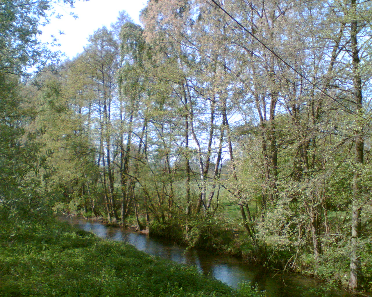
A narrow, calm river flowing through a deciduous forest with light green foliage and grassy banks.
The Ilme river flowing through a forested area near Dassel.

Naturpark Solling-Vogler history and protected-area timeline

The Solling-Vogler region has a long history of human use, with settlements and agricultural clearings established in medieval times. Forests in the Solling were progressively modified by selective logging and land reclamation, and historical records document timber rafting along streams such as the Ilme beginning after the completion of the Lakenteich reservoir.

Industrial-era forestry, especially large-scale spruce planting from the 19th century onward, significantly altered the composition of the Solling's forests. This economic transformation was accompanied by early conservation interest in preserving the upland landscape and its streams, foreshadowing later formal protection.

Naturpark Solling-Vogler itself was eventually established under the German Naturpark program, which designates large working landscapes for combined ecological, cultural, and recreational protection. Its designation recognized both the ecological value of the forested uplands and the cultural importance of the historic towns, valleys, and traditional land-use patterns that surround them.

In the modern period, the park has been shaped by EU-level environmental frameworks such as the Habitats Directive and the Water Framework Directive, which have supported the designation of protected stream corridors, including sections of the Ilme as a Habitats Directive site. Restoration projects, including the redevelopment of historic mill weirs into fish-passable structures, reflect a broader shift toward ecological connectivity within the protected landscape.

Naturpark Solling-Vogler landscape and geographic character

The landscape of Naturpark Solling-Vogler is defined by the contrast between the broad Solling plateau and the elongated Vogler ridge. The Solling rises as a wide, rolling upland mass with relatively smooth contours, dominated by closed forest cover and scattered raised bogs on its higher, flatter sections. Its plateau-like appearance, broken by occasional valleys, gives it a calm, expansive character unusual in the more sharply dissected Weserbergland.

The Vogler presents a different visual rhythm: a narrower, more linear ridge with steeper slopes, rocky outcrops, and deeper incision by local streams. Viewpoints along its crest offer long panoramas over the Weser valley and the surrounding smaller ranges. Together, the plateau and the ridge create a layered landscape in which broad forested uplands alternate with tighter valleys and exposed skylines.

A defining feature of the park is its river valleys. West of the Solling, the Forstbach and its tributaries cut through dense woodland; central Solling streams rise in boggy source areas and descend as small, fast mountain brooks; further east, the Ilme valley transitions from forest-shaded upper course to a wider, traditionally used meadow landscape that opens out toward Einbeck. Ridge villages and half-timbered towns such as Dassel, Markoldendorf, and Hullersen dot the lower slopes, where agriculture and settlement have shaped valley forms over centuries.

Overall, the terrain combines dense forest, soft upland bogs, steep wooded ridges, gentle valley floors, and historic rural settlements into a unified low-mountain landscape characteristic of central Germany.
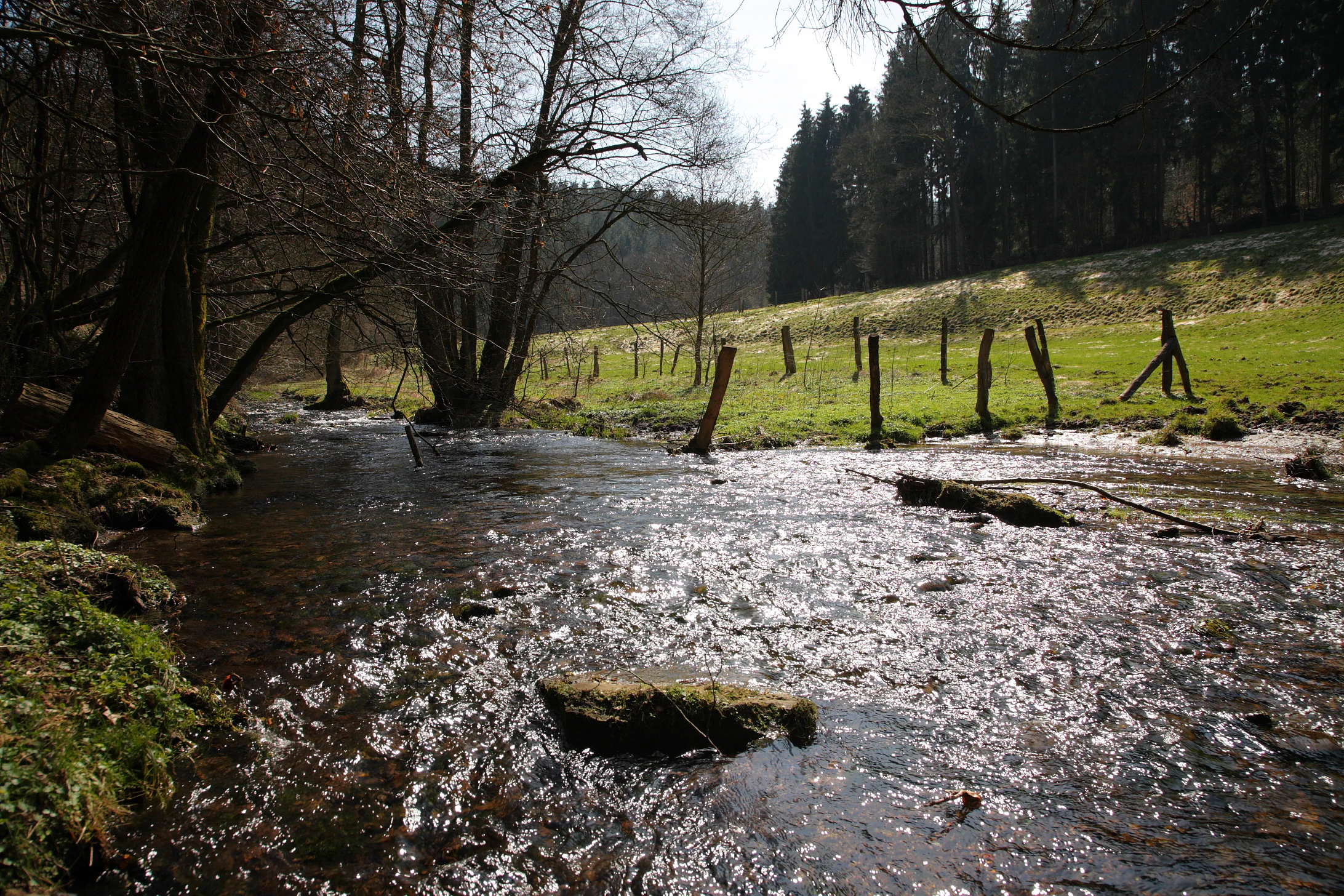
A small, clear stream flowing over a rocky bed, bordered by trees on the left and a grassy slope with a simple fence on the right.
The Ilme river flowing through the forested landscape of Naturpark Solling-Vogler.

Naturpark Solling-Vogler ecosystems, habitats, and plant life

Naturpark Solling-Vogler hosts a substantial transition from acidic, cool upland habitats to warmer, more nutrient-rich valley environments. The Solling plateau carries extensive coniferous forest set among raised bogs and bog-forest transitions, particularly around the high moor sources of streams emerging from the central plateau. Sphagnum moss communities, moor grasses, and willow-birch scrub mark the wetter zones.

Spruce is the dominant forest tree on the higher soils, with beech increasing in places where soil conditions allow. Mixed forests of spruce, beech, oak, and Douglas fir are common across the broader plateau, reflecting the managed, working character of the woodlands. In valley bottoms and along stream courses, alder, willow, and ash appear in narrow bands, supporting characteristic wetland edge habitats.

Along the Ilme and similar streams, the ecology shifts toward valley meadow and riparian habitats. Where historical floodplain forests once dominated, traditional meadows now extend along valley floors, bordered by forest edges and hedgerow-like strips of woody vegetation. The transition from forest to meadow to stream creates a mosaic of habitats that supports both aquatic and terrestrial species.

Moor remnants, bogs, and wet forest fragments on the plateau are particularly important, acting as ecological anchors within the park. These habitats preserve slow-growing, moisture-dependent vegetation and contribute to the hydrological stability of downstream river systems.

Naturpark Solling-Vogler wildlife and species highlights

The wildlife of Naturpark Solling-Vogler reflects the park's blend of dense spruce forest, upland bog, and stream valley habitats. Forest birds such as red kite and the great spotted woodpecker are characteristic of the mature woodland, while open meadow habitats and hedgerow edges host red-backed shrikes and a variety of smaller songbirds tied to traditional farmland landscapes.

Kingfishers haunt sections of the cleaner streams that hold sufficient aquatic prey, including the Ilme valley and tributaries near Einbeck and Dassel. Stream-side shrubs and exposed banks provide nesting opportunities, making these corridors biologically important within the broader forested landscape.

In the aquatic realm, the streams themselves support characteristic fish communities. Brown trout inhabit the cooler upper reaches of the Ilme and similar forest-shaded brooks, often sharing habitat with the bullhead, a small bottom-dwelling fish sensitive to water quality. Restored weirs and reconnected stream sections aim to broaden available habitat and encourage the return of species such as the grayling.

Mammals of the park include typical central European forest species: roe deer and wild boar range across the broader woodlands, while smaller mammals occupy the edge habitats between forest and meadow. The upland bogs and mire forests support specialized invertebrates and amphibians associated with cold, acidic, waterlogged conditions, contributing to the park's overall biodiversity.

Naturpark Solling-Vogler conservation status and protection priorities

Naturpark Solling-Vogler functions as a large-scale landscape protection area, with conservation goals that include maintaining biodiversity, preserving traditional land-use patterns, and supporting ecological connectivity across the low-mountain region. Its framework integrates habitat conservation with sustainable forestry, agriculture, and recreation, allowing active human use to continue within clearly defined ecological constraints.

A key dimension of the park's conservation significance is its stream network. Sections of the Ilme and adjacent tributaries have been designated under the European Habitats Directive, recognizing their importance for protected habitats and species along the river corridor. Stream restoration works, including the conversion of historical mill weirs into fish-passable ramps, reflect efforts to reconnect aquatic habitats and improve water quality under the EU Water Framework Directive.

Forest conservation is a central theme. The park's large, contiguous woodland blocks provide essential habitat for forest-dependent species and contribute to long-term carbon storage and water regulation. Initiatives to increase the proportion of broadleaf species, particularly beech, aim to enhance ecological resilience against drought and storm damage while supporting native biodiversity.

The raised bogs and wet forest fragments on the Solling plateau are particularly important conservation targets. Their protection requires managing drainage, forestry practices, and recreational pressure to maintain peat-forming processes and the species communities they support, positioning these small but ecologically critical areas as key anchors within the broader park.

Naturpark Solling-Vogler cultural meaning and human context

The Solling-Vogler region carries a deep cultural identity rooted in low-mountain forestry, traditional agriculture, and small-scale settlement patterns. Forests have long supported livelihoods through timber, charcoal production, and historically through rafting along streams such as the Ilme, where logs were historically assembled near Holtensen and later Relliehausen.

Villages and small towns around the park's edges, including Dassel, Einbeck, Uslar, Markoldendorf, and Holzminden, preserve a strong heritage of half-timbered architecture, historic mills, and church-centered settled valleys. Mills powered by Ilme water operated locally for centuries, including a historic paper mill at Relliehausen and multiple town mills in Einbeck supplied via a long-standing mill channel.

Cultural landscape elements such as traditional meadows, hedgerow-managed field boundaries, and centuries-old rural road networks give the park a distinctive sense of continuity between past and present land use. Local transport heritage, including the historic Ilmebahn railway connecting Salzderhelden, Einbeck, and Dassel, reinforces the region's identity as a historically well-connected corridor within the Weserbergland.

Today, the park remains a living cultural landscape, where heritage towns, working farms, and active forest management exist alongside ecological protection, embodying the German Naturpark principle of integrating conservation with cultural continuity.

Top sights and standout views in Naturpark Solling-Vogler

Among the park's most distinctive qualities is the unbroken expanse of forested upland that defines the Solling plateau, one of the largest closed woodland areas in Lower Saxony. Its combination of spruce stands, bog remnants, and softly rolling topography creates a calm, contemplative forest landscape rare in the more fragmented lowlands to the north.

Equally defining is the contrasting Vogler ridge, whose elongated crest, beech forest, and steep slopes offer panoramic views and a more dramatic hiking experience. The contrast between the broad forested plateau and the sharp, narrow ridge gives the park a layered scenic identity.

The Ilme valley is one of the park's signature corridors. From its boggy source in the central Solling, the river descends through forest-shaded upper reaches before unfolding into a wide, meadow-rich valley around Dassel and Einbeck. This transition from forest stream to traditional agricultural valley captures the park's integration of natural and cultural landscape within a single river corridor.

Traditional villages, historic mills, and the still-active Ilmebahn railway route complete the park's highlights, anchoring its ecological significance in a working, inhabited cultural landscape that continues to shape the Weserbergland.

Best time to visit Naturpark Solling-Vogler

The Naturpark Solling-Vogler is a year-round landscape, yet its character shifts meaningfully with the seasons. Late spring and early summer are particularly rewarding, as broadleaf trees leaf out, valley meadows turn green along the Ilme and other streams, and forest trails become accessible without deep snow. Bird activity is high in this period, with species such as the red kite, red-backed shrike, and kingfisher easier to observe.

Summer provides long daylight hours for extended ridge and valley hikes, though the Solling plateau can be notably cooler and more humid than surrounding regions, with frequent morning mist draping the forest canopy. Stream corridors remain lush and shaded, and raised bogs on the plateau hold their characteristic bog vegetation at peak visibility.

Autumn is a strong season for visual landscape appreciation, with mixed beech and oak stands coloring the slopes and the ridge viewpoints offering clearer, longer-distance views as forest density thins visually. The damp, quiet atmosphere of late autumn also suits those interested in finding the more sheltered and atmospheric sides of the forest.

Winter transforms the park into a quieter, snow-prone environment. The Solling plateau retains snow longer than the surrounding lowlands, opening opportunities for winter hiking through frosted forest, frozen bogs, and partly ice-edged streams, provided visitors are prepared for cold, foggy, and changeable conditions typical of central German low-mountain winters.

Monthly climate preview

Long-term representative point measurements tracking monthly thermal ranges and precipitation rates

Naturpark Solling-Vogler Climate Normals, Annual Temperature and Precipitation Rhythm

Representative coordinate records show average temperatures ranging from negative winter minimums to warm summer maximums alongside consistent year-round precipitation. Examining the complete twelve-month dataset clarifies the full annual climate rhythm and long-term environmental patterns across the protected landscape.
Annual mean8 °C
-1 °C18 °C
Jan-1°
Feb
Mar
Apr
May12°
Jun16°
Jul18°
Aug18°
Sep14°
Oct
Nov
Dec
Warmest month
July

18 °C

Coolest month
January

-0.6 °C

Wettest month
July

2.5 mm/day

Driest month
April

1.5 mm/day

Park location guide

Geography guide, regional context, and park location map for Naturpark Solling-Vogler

Naturpark Solling-Vogler park geography, regions, and map view in Germany

Understand where Naturpark Solling-Vogler sits in Germany through a broader geographic reading of the surrounding landscape, nearby location context, and its mapped position within the national park landscape.

How Naturpark Solling-Vogler fits into Germany

Germany is a federal republic in Western and Central Europe with a population of over 83 million across sixteen constituent states. It is Europe's largest economy by nominal GDP and a major global exporter and importer. The capital is Berlin, and the country borders Denmark, Poland, Czech Republic, Austria, Switzerland, France, Luxembourg, Belgium, and the Netherlands.

Wider geography shaping Naturpark Solling-Vogler in Germany

Germany is located in Western and Central Europe, spanning 357,022 km². It borders Denmark to the north, Poland and the Czech Republic to the east, Austria and Switzerland to the south, and France, Luxembourg, Belgium, and the Netherlands to the west. The country has coastlines on the Baltic Sea and North Sea to the north, with the Alps located in the southern region.

Map view of Naturpark Solling-Vogler

Use this park location map to pinpoint Naturpark Solling-Vogler in Germany, understand its exact geographic position, and read its mapped placement within the surrounding landscape more clearly.

Pigeon | © OpenStreetMap contributors

Location context for Naturpark Solling-Vogler

Lower Saxony

Visual reference for forested low mountain terrain, raised bogs, and river valleys

Naturpark Solling-Vogler Photos and Landscape Scenery Exploration

Visual documentation captures the continuous upland forest, steep ridges, and meadow river valleys that define the protected landscape. Examining photographic records reveals the varied terrain, habitat patterns, and characteristic scenery across the central German region.

A narrow, calm river flowing through a deciduous forest with light green foliage and grassy banks.

A wide, eye-level view of a moorland landscape under a clear sky, with scattered white flowering plants in the foreground and a dense forest line in the background.

A small, clear stream flowing over a rocky bed, bordered by trees on the left and a grassy slope with a simple fence on the right.

Park atlas

Compare adjacent low-mountain terrain, forested uplands, and regional reserves

Parks Near Naturpark Solling-Vogler and Surrounding Protected Areas

Browsing parks near Naturpark Solling-Vogler reveals connected forest ecosystems, river valleys, and protected landscapes across the surrounding Weserbergland region. Evaluating these adjacent natural areas provides broader geographic context and reveals how regional conservation corridors link distinct upland terrains.
Nature reserveLower Saxony
About 1.5 km away#1 closest

East

Wälder im östlichen Solling Nature Reserve: Regional Geography and Forest Landscape

Protected beech woodland in the Lower Saxony eastern Solling range

Wälder im östlichen Solling is a specialized nature reserve in the German state of Lower Saxony, covering a vast landscape of broadleaf high forest and historical wood-pasture. This atlas entry focuses on its mapped terrain, featuring mature beech stands, alder-ash spring forests, and intact stream ecosystems along the Riepenbach and Wolfsbach, providing a clear view of its ecological boundaries.

Area
14.79 km²
Established
2020
Nature reserveNiedersachsen
About 7.4 km away#2 closest

Southwest

Wälder im südlichen Solling Nature Reserve: A Detailed Atlas of German Protected Woodlands

Ecological mapping of Niedersachsen's southern Solling forest complexes.

Navigate the protected boundaries and landscape character of Wälder im südlichen Solling. This nature reserve provides an essential study in forest conservation, highlighting the intersection of traditional wood-pasture management and steep, near-natural slope forest ecosystems within the Solling-Vogler upland.

Area
10.16 km²
Established
2020
Relief
Upland
Climate
Temperate
Nature reserveLower Saxony
About 9 km away#3 closest

Northeast

Wälder im Solling bei Lauenberg Nature Reserve: Geographic and Landscape Analysis

Protected oak pasture remnants in the Lower Saxony Solling

Analyze the mapped parcels of Wälder im Solling bei Lauenberg. This protected site integrates old growth oak forest with open meadows and brook corridors, showcasing the unique cultural and ecological legacy of the Solling region in southern Lower Saxony.

Area
3.22 km²
Established
2020
Nature reserveLandkreis Holzminden
About 10 km away#4 closest

Northwest

Teiche am Erz- und Finkenbruch im Solling: Protected Nature Reserve and Wetland Geography

Mapped forest ponds and bog-margin habitat in Landkreis Holzminden

Teiche am Erz- und Finkenbruch im Solling comprises a network of forest ponds and peat-moss communities protected within a two-zone nature reserve. Its sheltered position in the Solling range preserves critical habitat for rare dragonfly populations, serving as an essential wetland segment within the larger Solling-Vogler landscape protection area.

Area
0.03 km²
Established
2016
Nature reserveLower Saxony
About 10 km away#5 closest

Southeast

Wald am Großen Streitrodt bei Delliehausen: Protected Beech Forests of Lower Saxony

Geographic overview of the eastern Solling upland nature reserve

The Wald am Großen Streitrodt bei Delliehausen nature reserve protects a rich, near-natural beech woodland matrix in the eastern Solling. Spanning gentle ridges and slopes, the area features significant deadwood habitats and a distinct southeastern meadow mosaic carved by the Kobbeke headwaters. This record details the park landscape and ecological boundaries within the broader forested context of southern Lower Saxony.

Area
228 km²
Established
2020
Nature reserveLower Saxony
About 13 km away#6 closest

Northwest

Stuckenstein-Eichen Nature Reserve: Historic Oak Pasture and Beech Forest Landscapes

A preserved woodland territory within the Solling hill range of Lower Saxony

Stuckenstein-Eichen serves as a vital nature reserve and protected landscape in Germany. It is defined by its striking internal contrast between a southern oak pasture woodland, characterized by historic planting grids, and a northern beech forest developing through natural succession. The site provides a compact yet detailed look at the coexistence of cultural history and forest ecology within the broader Solling region.

Area
0.2 km²
Established
1988
IUCN
IV
Relief
Upland
Nature reserveLower Saxony
About 13 km away#7 closest

Southeast

Wälder am Schäferstein und am Hohen Rott bei Verliehausen: Protected Nature Reserve Landscape

Ancient woodland geography in the Southern Solling uplands

A significant nature reserve in Lower Saxony, these forest tracts at Schäferstein and Hohen Rott protect near-natural beech and oak stands. The site is characterized by an exceptional density of deadwood and historical relict oak pastures, serving as a vital sanctuary for specialized saproxylic beetles and cavity-nesting birds within the broader Solling ridge system.

Area
1.02 km²
Established
2020
Relief
Mountain
Climate
Temperate
Nature reserveLower Saxony
About 13 km away#8 closest

East

Weper, Gladeberg und Aschenburg Protected Nature Reserve and Hilltop Mosaic

Calcareous grassland and forest network in Lower Saxony

Explore the geographic composition of the Weper, Gladeberg und Aschenburg nature reserve in Lower Saxony. This protected area encompasses a series of hill fragments and slopes characterized by sun-exposed calcareous grasslands and dense deciduous forest stands, providing essential habitat connectivity in the regional uplands.

Area
2.67 km²
Established
2020
Relief
Upland
Scope
Terrestrial

Common questions about visiting, size, designation, and location context for Naturpark Solling-Vogler

Naturpark Solling-Vogler FAQs for park facts, access, geography, and protected area context

Find quick answers about Naturpark Solling-Vogler, including protected-area facts, park geography, trail and visitor context, and how the park fits into its surrounding country and regional landscape.
MoriAtlas Explorer

Continue Your Protected Areas Search Across the Global Atlas

Deepen your exploration by continuing the structured search for national parks and protected areas worldwide. Utilize the comprehensive filtering capabilities to compare different conservation landscapes and refine your understanding of global park geography. Discover more about the distribution and characteristics of protected natural areas.

Global natural geography