Mori Atlas logo
Protected areaNatura 2000 area no. 66 Stadil Fjord og Vest Stadil Fjord

A diverse mosaic of brackish lagoons, dunes, and rare aquatic habitats in western Denmark.

Natura 2000 area no. 66 Stadil Fjord og Vest Stadil Fjord Protected Coastal Wetland Landscape

(Natura 2000-område nr. 66 Stadil Fjord og Vest Stadil Fjord)

Natura 2000 area no. 66 Stadil Fjord og Vest Stadil Fjord stands as an ecologically significant coastal wetland complex in western Jutland. This protected area features a unique gradient of landscapes, stretching from North Sea coastal dunes through acidic heaths and meadows to the shallow brackish lagoons of the two primary fjords. Through its documented botanical diversity and status as a critical habitat for migratory birds, the site remains a central point for understanding the conservation and geography of Denmark.

coastal lagoonwetlandNatura 2000Ramsar sitebird protection areadunes and heaths

Natura 2000 area no. 66 Stadil Fjord og Vest Stadil Fjord

Protected area

Park overview

Structured park overview, official facts, and landscape profile for Stadil Fjord og Vest Stadil Fjord

Stadil Fjord og Vest Stadil Fjord park facts, protected area profile, and essential visitor context

Review the core facts for Stadil Fjord og Vest Stadil Fjord, including designation, size, terrain, visitor scale, habitats, and operating context in one park-focused overview.

About Stadil Fjord og Vest Stadil Fjord

Stadil Fjord og Vest Stadil Fjord is a large, multi-designation protected landscape in western Jutland, Denmark. It is one of the country's most important coastal wetland complexes, combining two shallow brackish lagoons with an extensive surrounding mosaic of dunes, heaths, fens, reed beds, and meadows. The area sits within Ringkøbing-Skjern Municipality in the Central Denmark Region, bordering the Husby Klit Natura 2000 area to the west and with the open North Sea beyond.

The site's identity is rooted in its lagoon character. Stadil Fjord drains southward into the larger Ringkøbing Fjord via Vonå, while Vest Stadil Fjord lies to the west, creating a coupled system of shallow coastal waters fed by the surrounding landscape. Together, these brackish lagoons form one of the most significant brackish and freshwater-coastal interfaces in Denmark, supporting an unusually rich community of submerged aquatic plants and providing habitat for protected fish species such as sea lamprey and brook lamprey, as well as otters.

The protected terrestrial zone around the lagoons is equally important. Grey and green dunes, dry dune heathland, wet and dry heaths, acidic grasslands, and lime-rich fens combine to form a transitional landscape between the sandy western Jutland coast and the more cultivated inland. This mosaic supports a wide range of breeding birds, including bittern, marsh harrier, spotted crake, and a small colony of black terns, while also providing important staging and wintering habitat for migratory swans, geese, and dabbling ducks on the surrounding grasslands.

Stadil Fjord og Vest Stadil Fjord carries overlapping layers of protection that reinforce its ecological importance. It is designated as a Natura 2000 habitat area, a Natura 2000 bird protection area, and a Ramsar wetland of international importance. These designations reflect both the site's botanical diversity, particularly the remarkable submerged plant community of Stadil Fjord, and its role in regional and international bird conservation. A 1974 landscape protection order covered parts of the area, while a 1993 state acquisition around Vest Stadil Fjord led to a hydrological restoration that raised water levels to benefit birds, and Hindø island was protected in 1991 under a voluntary conservation agreement.

Quick facts and research context for Stadil Fjord og Vest Stadil Fjord

Stadil Fjord og Vest Stadil Fjord is a Natura 2000 site in western Denmark, covering both a habitat area and a bird protection area on the border of Central Jutland and the North Sea. The combined Natura 2000 designation covers roughly 1,057 hectares owned by the Danish Nature Agency within a larger protected complex, while the full Natura 2000 polygon reaches about 6,903 hectares including surrounding farmland. Two shallow coastal lagoons form the heart of the site: Stadil Fjord at roughly 1,713 hectares and Vest Stadil Fjord at about 512 hectares, surrounded by dunes, heaths, reed beds, and small nutrient-rich lakes.

The site is recognized under multiple international frameworks: Natura 2000 habitat area H59, bird protection area F41, and Ramsar site R3, giving it protection status as both a wetland of international importance and a key European ecological area.

Protection and recognition

Examine the documented conservation scope and regulatory framework governing this protected area.

Protection Status and International Recognition for Natura 2000 Area No. 66 Stadil Fjord og Vest Stadil Fjord

Natura 2000 area no. 66 Stadil Fjord og Vest Stadil Fjord maintains a mixed protection scope supported by documented administrative records and environmental frameworks. Systematic conservation data outlines the established regulatory boundaries and official recognition parameters for this protected landscape.

Protection details

Protection scope
Mixed
Transboundary protection
No
Park context

Deeper park guide and search-rich context for Stadil Fjord og Vest Stadil Fjord

Stadil Fjord og Vest Stadil Fjord history, landscape, wildlife, and travel context

Explore Stadil Fjord og Vest Stadil Fjord through its history, landscape character, ecosystems, wildlife, conservation priorities, cultural context, and seasonal travel timing in a structured park guide built for atlas discovery and search intent.

Why Stadil Fjord og Vest Stadil Fjord stands out

Stadil Fjord og Vest Stadil Fjord is best known for being one of Denmark's most species-rich lagoon lakes. Stadil Fjord hosts around 52 species of submerged aquatic plants, making it possibly the most botanically diverse coastal lagoon in the country, and a portion of its flora is made up of red-listed and responsibility species. The site is also recognized for its combination of marine and terrestrial habitats in a single protected area. Coastal lagoon and dune systems meet wet and dry heathland, acidic grassland, calcareous fen, and small freshwater habitats, supporting breeding birds such as bittern, marsh harrier, spotted crake, and a small colony of black terns, as well as staging and wintering populations of swans, geese, and ducks that use the surrounding meadows.

Stadil Fjord og Vest Stadil Fjord history and protected-area timeline

The protection history of Stadil Fjord og Vest Stadil Fjord reflects a gradual layering of conservation measures beginning in the 1970s. In 1974, Vest Stadil Fjord, Søndre Dyb, and surrounding areas were placed under a landscape protection order covering about 906 hectares. The protected area, which also included parts of the adjacent Husby Klit dunes, was justified by its significant landscape, biological, and recreational value.

A second major step came in 1991, when the small island of Hindø, connected to the mainland by a low bridge, became publicly accessible under a voluntary conservation agreement covering roughly 100 hectares. In 1993, the Danish state acquired a large portion of the land around Vest Stadil Fjord and undertook a habitat restoration project that raised water levels across parts of the area, specifically to benefit birds. This restoration work also led to the establishment of a wildlife reserve within the site.

Broader European protection followed through the Natura 2000 program. A Natura 2000 plan was adopted in 2011, after which local municipalities and the Danish Nature Agency drafted binding action plans to implement it. The area continues to be coordinated with water management planning for the Ringkøbing Fjord catchment. The site also carries Ramsar wetland designation, reflecting its international importance as a habitat for waterbirds and as a representative coastal wetland ecosystem.

Stadil Fjord og Vest Stadil Fjord landscape and geographic character

The landscape of Stadil Fjord og Vest Stadil Fjord is dominated by shallow coastal lagoons framed by dunes and open grasslands. Stadil Fjord, the larger of the two basins at roughly 1,713 hectares, is a flat, brackish lagoon system with extensive submerged plant communities and fringing reed beds. Vest Stadil Fjord, at about 512 hectares, sits to the west and acts as a companion lagoon, surrounded by wet meadows and shallow water zones that were reshaped during the 1993 restoration.

To the west, the terrestrial side of the protected area transitions into the dune belt along the North Sea coast. Grey and green dune formations characterize the seaward edge, while further inland the dunes give way to dune heathland, dry and wet heaths, and acidic grasslands. On slightly richer substrates, lime-rich fens and small lakes add to the habitat diversity. The result is a continuous gradient of habitats moving from open marine coast through dune, heath, and agricultural edge into wetland and open water.

Few physical landmarks are more central than the small island of Hindø, around 100 hectares in size, which is connected to the mainland by a low bridge and adds a distinctive inland-water element to the coastal landscape. South of Stadil Fjord, the drainage network channels water into Ringkøbing Fjord via the Vonå stream, linking the protected area to one of Denmark's largest lagoon systems.

Stadil Fjord og Vest Stadil Fjord ecosystems, habitats, and plant life

The ecological character of Stadil Fjord og Vest Stadil Fjord is defined by the interplay between brackish lagoon, dune, heath, and freshwater habitats within a relatively compact area. According to Danish classifications, the site hosts habitat types including coastal lagoon, grey and green dunes, dune heath, lake shores with small herbs, stonewort-rich lakes, nutrient-rich lakes, watercourses, wet heath, dry heath, acidic grassland, and lime-rich fen. Together these support a gradient from open marine influence through sandy dune vegetation to more stable, moisture-rich habitats inland.

What makes the site stand out ecologically is the botanical richness of its open water. Stadil Fjord is recorded as hosting about 52 species of submerged aquatic plants, making it possibly the most species-rich lagoon lake in Denmark. Among these are several red-listed plant species and a notable share of responsibility species whose conservation status is considered significant at the national level.

Equally important is the wetland-fringe habitat network. Reed beds line substantial portions of the lagoons, providing nesting cover for secretive waterbirds, while the combination of wet meadows, heaths, and fens offers feeding habitat for both breeding and migratory species. Calcareous springs and nutrient-rich lake conditions create additional habitat pockets that sustain rare invertebrates and plant communities, reinforcing the site's species diversity beyond the more obvious waterbird presence.

Stadil Fjord og Vest Stadil Fjord wildlife and species highlights

Wildlife at Stadil Fjord og Vest Stadil Fjord centers on waterbirds and other wetland-dependent species. The site's bird protection area is specifically designated to safeguard undisturbed roosting and feeding grounds, particularly meadows used by ducks and geese, and to provide good breeding conditions for several priority species.

Breeding birds highlighted in the management framework include bittern, marsh harrier, spotted crake, and a small colony of black terns that relies on continued favorable conditions in the breeding area. The area is also recognized as a staging and wintering site for migratory species such as whooper swan, tundra swan, pink-footed goose, barnacle goose, greylag goose, garganey, northern pintail, northern shoveler, Eurasian golden plover, and the locally noteworthy pomarine skua among passage birds.

Mammals and fish also feature in the site's designation. The otter is listed among the protected species of the habitat area, while freshwater fauna include sea lamprey and brook lamprey, both notable indicators of relatively healthy watercourse conditions. In the aquatic plant communities of Stadil Fjord, species such as water crowfoot contribute to a layered habitat that supports invertebrates and fish, ultimately feeding back into bird populations higher in the food web.

Stadil Fjord og Vest Stadil Fjord conservation status and protection priorities

Stadil Fjord og Vest Stadil Fjord sits at the intersection of Danish and European conservation frameworks. It is simultaneously a Natura 2000 habitat area, a Natura 2000 bird protection area, and a Ramsar site, meaning it is recognized as a wetland of both national and international importance. Its conservation profile is unusual in that the same polygon carries overlapping designations, providing multiple legal bases for protection.

The site's conservation value rests on a few key elements: the exceptional botanical richness of Stadil Fjord, the combination of habitat types from coastal lagoon to inland heath, and its importance for both breeding and migratory waterbirds. Hydrological restoration around Vest Stadil Fjord in the 1990s illustrates the management approach, with water levels raised specifically to improve conditions for birds and create a dedicated wildlife reserve. Voluntary conservation agreements, such as that covering Hindø, complement formal statutory protection.

At a policy level, the Natura 2000 plan adopted in 2011 and the accompanying action plans developed by Ringkøbing-Skjern Municipality and the Danish Nature Agency ensure continued management of the site. The natural area plan is explicitly coordinated with the water management plan for the Ringkøbing Fjord catchment, recognizing that the lagoons' ecological state is closely tied to broader hydrological conditions in western Jutland.

Top sights and standout views in Stadil Fjord og Vest Stadil Fjord

Among the strongest distinguishing features of Stadil Fjord og Vest Stadil Fjord is its status as one of Denmark's most botanically diverse coastal lagoon systems, anchored by roughly 52 submerged aquatic plant species in Stadil Fjord alone. The site pairs this freshwater and brackish-water diversity with a rich gradient of dune, heath, and calcareous habitats, producing a layered ecological landscape in a relatively compact area.

Equally distinctive is the depth of protection layered onto the area. A 1974 landscape protection order, a 1991 voluntary conservation agreement for Hindø, a 1993 state-led hydrological restoration around Vest Stadil Fjord, and the 2011 Natura 2000 plan together reflect an unusually long and sustained conservation history. The site's dual identity as both a national nature priority and an internationally recognized Ramsar wetland reinforces its importance within Denmark's wider coastal and wetland network.

Best time to visit Stadil Fjord og Vest Stadil Fjord

Because the area is primarily recognized for its birdlife and seasonal wetlands, the time of year strongly shapes what visitors can observe. Spring and early summer are the most important periods for breeding species such as bittern, marsh harrier, spotted crake, and black terns, when the reed beds and meadows host active nesting and territorial behavior. Wetland vegetation is also most visually rich in this period.

Autumn and winter bring a different but equally significant character, as the surrounding meadows and open water areas attract staging and wintering swans, geese, and ducks. Migratory species such as whooper swan, tundra swan, pink-footed goose, and barnacle goose are typically concentrated in the cooler months, making the area valuable for observation. In the transitional seasons, the open scenery and varying water levels, particularly across the restored Vest Stadil Fjord area, can also be at their most visually dynamic.

Monthly climate preview

Long-term temperature and precipitation normals from representative point measurements

Natura 2000 area no. 66 Stadil Fjord og Vest Stadil Fjord Climate and Weather by Month

Natura 2000 area no. 66 Stadil Fjord og Vest Stadil Fjord exhibits a measured annual thermal and precipitation rhythm recorded across representative baseline coordinates. Examining the complete monthly climate normals reveals detailed long-term variations in average temperature and precipitation across the protected landscape.
Annual mean9 °C
2 °C17 °C
Jan
Feb
Mar
Apr
May11°
Jun14°
Jul17°
Aug17°
Sep15°
Oct11°
Nov
Dec
Warmest month
August

17.2 °C

Coolest month
February

2.3 °C

Wettest month
October

3.3 mm/day

Driest month
April

1.5 mm/day

Park location guide

Geography guide, regional context, and park location map for Stadil Fjord og Vest Stadil Fjord

Stadil Fjord og Vest Stadil Fjord park geography, regions, and map view in Denmark

Understand where Stadil Fjord og Vest Stadil Fjord sits in Denmark through a broader geographic reading of the surrounding landscape, nearby location context, and its mapped position within the national park landscape.

How Stadil Fjord og Vest Stadil Fjord fits into Denmark

Denmark is a constitutional monarchy and Nordic country in Northern Europe. It is the southernmost of the Scandinavian countries, bordering Germany to the south, Norway to the north, and Sweden to the southwest. The country consists of the Jutland peninsula and an archipelago of islands, with Copenhagen as its capital and largest city. Denmark has a population of over 6 million and is characterized by flat, arable land, sandy coasts, and a temperate climate.

Wider geography shaping Stadil Fjord og Vest Stadil Fjord in Denmark

Denmark occupies the Jutland peninsula and roughly 406 islands in Northern Europe. It is situated between the North Sea to the west and the Baltic Sea to the east. The country borders Germany to the south and is connected to Sweden via the Øresund Bridge. Denmark is predominantly flat terrain with low elevation, the highest point being Møllehøj at 170.86 meters.

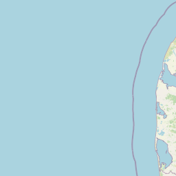
Map view of Stadil Fjord og Vest Stadil Fjord

Use this park location map to pinpoint Stadil Fjord og Vest Stadil Fjord in Denmark, understand its exact geographic position, and read its mapped placement within the surrounding landscape more clearly.

Pigeon | © OpenStreetMap contributors
Park atlas

Compare adjacent coastal lagoons and western Jutland wetland reserves

Explore Protected Areas Near Natura 2000 Area No. 66 Stadil Fjord Og Vest Stadil Fjord

Browse regional nature reserves and wetland protected landscapes situated near Natura 2000 area no. 66 Stadil Fjord og Vest Stadil Fjord. Comparing nearby coastal habitats helps connect broader conservation networks across the surrounding Danish terrain.
Protected areaRegion Midtjylland
About 2.5 km away#1 closest

Northeast

Kimmelkær Landkanal: Mapped Protected Area and Regional Geography in Midtjylland

A rare aquatic habitat within the Ringkøbing Fjord water system.

Focusing on a narrow canal corridor, Kimmelkær Landkanal serves as a vital protected area for threatened aquatic species. Its geography is characterized by soft sandy sediments and a distinct parallel channel structure, connecting small watercourses to the larger wetland ecosystems of the Stadil Fjord catchment area.

Area
0.03 km²
Established
2011
Relief
Lowland
Scope
Terrestrial
Nature reserveRegion Midtjylland
About 7.5 km away#2 closest

North

Husby Sø og Nørresø Nature Reserve: Protected Wetland Landscape in Region Midtjylland

Coastal plain geography and shallow lake habitat mapping

Situated in the coastal landscape of Region Midtjylland, Husby Sø og Nørresø represents a critical nature reserve defined by two interconnected shallow lakes. The protected area features extensive reedswamp margins, bog vegetation, and a human-modified marine foreland, hosting high aquatic plant diversity that remains central to the region's conservation identity.

Area
3.52 km²
Established
2011
Relief
Lowland
Climate
Temperate
A pale watercolor landscape painting of a quiet fjord with soft green and pink marshy vegetation in the foreground and rolling hills in the background.
Protected areaRegion Midtjylland
About 12 km away#3 closest

South

Ringkøbing Fjord og Nymindestrømmen: Coastal Lagoon and Protected Wetland Geography

A vast Danish wetland complex in Region Midtjylland.

Ringkøbing Fjord og Nymindestrømmen defines the Danish west coast through its unique combination of brackish lagoons, salt meadows, and dune belts. This protected area integrates the Skjern Å river delta and the freshwater-lagoon chain of Nymindestrømmen, creating an internationally significant habitat for diverse waterbirds and migratory species across its multi-layered terrain.

Area
276.84 km²
Relief
Lowland
Climate
Temperate
Scope
Mixed
A pale, minimalist watercolor painting showing a green grassy island in the middle of a calm, reflective lagoon under a soft pink and white sky.
Protected areaRegion Midtjylland
About 12 km away#4 closest

North

Nissum Fjord Protected Area: Geography and Coastal Wetland Map of Region Midtjylland

A diverse mosaic of dune systems, lagoon basins, and freshwater habitats

Nissum Fjord stands as a central protected wetland complex on the western Jutland coast. This area provides a comprehensive view of coastal geography, ranging from fixed dune heaths and sea-buckthorn scrub to the quiet, shallow waters of its three interconnected basins. Its protected boundaries include the island of Fjandø and significant inland lake systems, offering a distinct study in Denmark's coastal transitions and avian staging environments.

Area
109.67 km²
Established
2011
Relief
Lowland
Climate
Temperate
Nature reserveCentral Denmark Region
About 22 km away#5 closest

Northeast

Heder og klitter på Skovbjerg Bakkeø, Idom Å og Ormstrup Hede Nature Reserve Atlas and Map

Mapping glacial moraine and inland dune landscapes in the Central Denmark Region

The protected area surrounding Heder og klitter på Skovbjerg Bakkeø, Idom Å og Ormstrup Hede comprises extensive inland dunes and heathlands anchored by a Saalian moraine hill island. This site serves as a crucial ecological link, featuring restored riparian stream habitats and rare forest remnants that provide deep insight into Denmark’s post-glacial geological development.

Area
22.14 km²
Established
1985
Relief
Lowland
Scope
Terrestrial
Nature reserveRegion Midtjylland
About 35 km away#6 closest

Southeast

Natura 2000-område nr. 68 Skjern Å: Protected Riverine Geography and Valley Landscapes

A central Jutland nature reserve featuring glacial valley systems

Explore the geographic boundary and habitat diversity of Natura 2000-område nr. 68 Skjern Å. This protected landscape preserves the vital connection between freshwater river channels, raised bogs, and open heathland, serving as a landmark for regional river management and biodiversity conservation in western Denmark.

Area
25.8 km²
Established
2011
Protected areaRegion Midtjylland
About 36 km away#7 closest

Southeast

Lønborg Hede Protected Area: Heathland Geography and Mire Ecosystems in Denmark

Detailed landscape analysis of a unique Central Jutland nature reserve

Lønborg Hede is a distinctive protected area featuring a rare micro-topographic gradient where inland dune heath rises 15 meters above wet bog and mire environments. This site provides a concentrated look at western Jutland's historical heathland character, featuring a mosaic of nutrient-poor aquatic habitats and diverse ground-nesting bird environments across 350 hectares.

Area
3.53 km²
Established
1970
Relief
Lowland
Scope
Terrestrial
Nature reserveCentral Denmark Region
About 38 km away#8 closest

Southeast

Borris Hede Nature Reserve: Mapping the Protected Heathland of the Central Denmark Region

Glacial plains, wetland mosaics, and habitat conservation zones

Borris Hede encompasses a massive stretch of sandy outwash plain in central-western Denmark. This nature reserve serves as a vital habitat mosaic, ranging from dry and wet heath to bogs and riparian stream corridors. By preserving these open terrain characteristics, the site supports specialized birdlife and maintains one of the most distinctive geological and biological landscapes within the Danish geography.

Area
47.78 km²
Established
1903
Relief
Lowland
Climate
Temperate

Common questions about visiting, size, designation, and location context for Stadil Fjord og Vest Stadil Fjord

Stadil Fjord og Vest Stadil Fjord FAQs for park facts, access, geography, and protected area context

Find quick answers about Stadil Fjord og Vest Stadil Fjord, including protected-area facts, park geography, trail and visitor context, and how the park fits into its surrounding country and regional landscape.
MoriAtlas Explorer

Continue Your Protected Areas Search Across the Global Atlas

Deepen your exploration by continuing the structured search for national parks and protected areas worldwide. Utilize the comprehensive filtering capabilities to compare different conservation landscapes and refine your understanding of global park geography. Discover more about the distribution and characteristics of protected natural areas.

Global natural geography