

Mori Atlas logo
National parkTassili n'Ajjer National Park

Discover the mapped geography and unique terrain of this significant Algerian national park.

Tassili n'Ajjer National Park: Algeria's Vast Protected Landscape for Map Exploration

Tassili n'Ajjer National Park in Algeria represents a significant protected landscape, offering a unique window into vast Saharan geography and mapped terrain. This national park serves as a cornerstone for understanding protected areas within North Africa, highlighting its extensive geographic scope and distinctive natural features. Explore the park's boundaries and discover its place within the broader atlas of protected lands, providing essential context for geographic discovery and landscape analysis.

Sahara DesertRock ArtPrehistoric HeritageSandstone LandscapesDesert ConservationAlgeria

Tassili n'Ajjer National Park

National park

Park overview

Structured park overview, official facts, and landscape profile for Tassili n'Ajjer National Park

Tassili n'Ajjer National Park park facts, protected area profile, and essential visitor context

Review the core facts for Tassili n'Ajjer National Park, including designation, size, terrain, visitor scale, habitats, and operating context in one park-focused overview.

About Tassili n'Ajjer National Park

Tassili n'Ajjer National Park protects a mountainous region in the heart of the Sahara Desert that represents one of Algeria's most significant natural and cultural heritage sites. The Tassili n'Ajjer plateau rises from the surrounding desert floor, creating a unique island of biodiversity and archaeological richness in an otherwise inhospitable environment. The park's establishment reflects Algeria's commitment to preserving both its natural landscapes and the extraordinary cultural legacy left by prehistoric civilizations that thrived in this region when it supported grasslands, rivers, and wildlife populations far different from today's arid conditions. Visitors to the park encounter a landscape of profound geological and historical depth, where ancient rock art sites are embedded within spectacular desert scenery that has remained largely unchanged for centuries.

Quick facts and research context for Tassili n'Ajjer National Park

Tassili n'Ajjer National Park is situated in southeastern Algeria within the Sahara Desert, one of the world's most extensive hot deserts. The park centers on the Tassili n'Ajjer, a sandstone plateau region characterized by distinctive rock formations, natural arches, and ancient wadis. The area is renowned internationally for its archaeological significance, containing one of the largest and most important collections of prehistoric cave art in North Africa. The landscape ranges from stark desert plains to elevated plateau sections, supporting specialized desert-adapted flora and fauna.

Protection and recognition

Documenting terrestrial protection scope and UNESCO Biosphere Reserve designation

Tassili n'Ajjer National Park Protection Status and International Recognition

Established terrestrial boundaries secure the geographic reach of Tassili n'Ajjer National Park within its desert mountain environment. Official records confirm the area carries global significance as a designated UNESCO Biosphere Reserve to support regional conservation framework tracking.

International recognition

Protection details

Protection scope
Terrestrial
Designated year
1986
Core area
12,820.09 km²
Buffer area
11,464.37 km²
Park context

Deeper park guide and search-rich context for Tassili n'Ajjer National Park

Tassili n'Ajjer National Park history, landscape, wildlife, and travel context

Explore Tassili n'Ajjer National Park through its history, landscape character, ecosystems, wildlife, conservation priorities, cultural context, and seasonal travel timing in a structured park guide built for atlas discovery and search intent.

Why Tassili n'Ajjer National Park stands out

Tassili n'Ajjer National Park is best known for its exceptional prehistoric rock art heritage, featuring thousands of cave paintings and engravings created over millennia by Saharan peoples. These artworks depict hunting scenes, cattle herding, religious rituals, and ancient wildlife including elephants, giraffes, and rhinoceroses that once inhabited the region when climate conditions were different. The park's dramatic sandstone landscapes, including natural arches, pillars, and eroded formations, provide a visually striking backdrop that has fascinated travelers, archaeologists, and artists for generations.

Tassili n'Ajjer National Park history and protected-area timeline

The Tassili n'Ajjer region has been inhabited by human populations for tens of thousands of years, as evidenced by the extensive rock art that dots the landscape throughout the protected area. During wetter climatic periods, the Sahara supported diverse ecosystems with abundant wildlife and human populations who left behind the paintings and engravings that now constitute one of the world's most important prehistoric art collections. The area was formally protected as a national park to preserve both its natural values and its irreplaceable archaeological heritage. The establishment of the park recognized that the rock art sites and the desert landscapes containing them required official protection from development pressures and potential vandalism.

Tassili n'Ajjer National Park landscape and geographic character

The Tassili n'Ajjer landscape is characterized by its dramatic sandstone plateau, a formation of layered sedimentary rock that has been shaped by wind and water erosion over millions of years. The plateau rises several hundred meters above the surrounding desert plain, creating a mountainous environment with deep valleys, narrow gorges, and towering rock formations. Natural arches, balanced rocks, and distinctive pillars dot the landscape, the result of differential erosion that has carved the soft sandstone into remarkable shapes. Ancient wadis, now usually dry, snake across the plateau, evidence of a time when seasonal rivers flowed through this region. The color palette of the landscape shifts from golden sands to red-brown rock faces, creating a visually stunning environment under the Saharan sun.

Tassili n'Ajjer National Park ecosystems, habitats, and plant life

Despite the extreme aridity of the Sahara, the Tassili n'Ajjer region supports specialized desert vegetation adapted to survive with minimal water. Sparse vegetation includes drought-resistant shrubs, small trees in wadi beds, and grasses that emerge briefly after rare rainfall events. The protected area represents a Saharan ecosystem characterized by its resilience and adaptation to harsh conditions. Wildlife, while limited in diversity compared to more temperate regions, includes species specifically adapted to desert life, with some animals surviving on moisture obtained from food or exploiting the rare shaded microhabitats found among the rock formations.

Tassili n'Ajjer National Park wildlife and species highlights

The wildlife of Tassili n'Ajjer reflects the harsh desert environment, with species adapted to survive extreme heat, limited water, and sparse vegetation. Desert-adapted reptiles, insects, and small mammals form the base of the terrestrial fauna, while specialized desert birds may be observed passing through or nesting in the rock formations. The rock art preserved within the park documents a much richer past wildlife community, depicting elephants, giraffes, rhinoceroses, hippos, and various antelope species that inhabited the Sahara when climate conditions supported grasslands and permanent water sources.

Tassili n'Ajjer National Park conservation status and protection priorities

Tassili n'Ajjer National Park serves as a critical conservation unit for both natural and cultural heritage in the Sahara region. The protected area preserves geological formations of significant scientific and aesthetic value while safeguarding one of the world's most important collections of prehistoric rock art. Conservation efforts focus on protecting the rock art sites from damage, controlling visitor access to sensitive archaeological areas, and maintaining the ecological integrity of the desert ecosystem. The park represents Algeria's recognition that desert environments hold significant value beyond their apparent barrenness, encompassing unique biodiversity, geological heritage, and irreplaceable cultural evidence of human history.

Tassili n'Ajjer National Park cultural meaning and human context

The Tassili n'Ajjer region holds profound cultural significance as a repository of human artistic expression spanning thousands of years. The rock art created by ancient Saharan peoples provides invaluable insight into the lives, beliefs, and environments of prehistoric communities that inhabited this region long before it became the desert it is today. These artistic representations document the transformation of the Sahara from a wet, savanna-like environment to the arid desert of today, offering unique evidence of climate change and its impacts on both human societies and wildlife. The cultural context extends beyond archaeology to encompass the traditions and histories of Saharan peoples who have lived in proximity to these sites for generations.

Top sights and standout views in Tassili n'Ajjer National Park

Tassili n'Ajjer National Park offers visitors the opportunity to explore one of the Sahara's most visually dramatic landscapes while encountering one of humanity's oldest artistic traditions. The prehistoric rock art sites scattered throughout the park provide a direct connection to ancient Saharan cultures, while the geological formations create memorable scenery. The experience of walking through ancient wadis and examining paintings created by people who lived in a fundamentally different Sahara offers a profound sense of historical depth and environmental change.

Best time to visit Tassili n'Ajjer National Park

The optimal period to visit Tassili n'Ajjer National Park corresponds with the cooler months from October through April, when daytime temperatures are more comfortable for exploration and outdoor activities. Summer temperatures in the Sahara can be extremely high, making sustained outdoor activity challenging. The winter months offer particularly pleasant conditions for trekking and visiting rock art sites, though nights can be cold. Visitors should be prepared for basic facilities and the need for self-sufficiency in this remote desert environment.
Monthly climate preview

Long-term representative point measurements for temperature and precipitation

Tassili n'Ajjer National Park Climate Normals and Annual Weather Rhythm

Representative coordinate records show average monthly temperatures ranging from cool winter lows to high summer peaks alongside consistently low daily precipitation rates. Analyzing these multiyear normals provides clear baseline context for understanding the long-term meteorological profile of this protected landscape.
Annual mean21 °C
10 °C30 °C
Jan10°
Feb12°
Mar17°
Apr22°
May27°
Jun30°
Jul30°
Aug30°
Sep28°
Oct23°
Nov17°
Dec12°
Warmest month
July

29.9 °C

Coolest month
January

9.7 °C

Wettest month
May

0.2 mm/day

Driest month
July

0 mm/day

Park location guide

Geography guide, regional context, and park location map for Tassili n'Ajjer National Park

Tassili n'Ajjer National Park park geography, regions, and map view in Algeria

Understand where Tassili n'Ajjer National Park sits in Algeria through a broader geographic reading of the surrounding landscape, nearby location context, and its mapped position within the national park landscape.

How Tassili n'Ajjer National Park fits into Algeria

Algeria is a North African country spanning over 2.38 million km², making it the largest country in Africa. It borders the Mediterranean Sea to the north and shares land borders with seven countries. The population exceeds 47 million, with most concentrated in the northern coastal region.

Wider geography shaping Tassili n'Ajjer National Park in Algeria

Algeria occupies the central portion of the Maghreb region in North Africa. It is bordered by Tunisia and Libya to the northeast, Niger to the southeast, Mali, Mauritania, and Western Sahara to the southwest, and Morocco to the west. The Mediterranean Sea forms its northern border. The terrain consists of the Tell Atlas mountain range and coastal plains in the north, transitioning to the Sahara desert in the south.

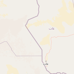
Map view of Tassili n'Ajjer National Park

Use this park location map to pinpoint Tassili n'Ajjer National Park in Algeria, understand its exact geographic position, and read its mapped placement within the surrounding landscape more clearly.

Pigeon | © OpenStreetMap contributors

Location context for Tassili n'Ajjer National Park

Illizi Province
Park atlas

Trace the geographic spread of diverse protected landscapes across Algeria and the adjacent Saharan region

Discover Other National Parks and Protected Areas Near Tassili n'Ajjer National Park

After exploring Tassili n'Ajjer National Park, continue your discovery of additional national parks and significant protected areas across Algeria and the surrounding Saharan geography. A wider perspective enables valuable geographic comparison, highlighting varied conservation landscapes and distinct terrain features throughout this expansive region.
National parkTamanrasset Province
About 472 km away#1 closest

Southwest

Ahaggar National Park: Mapping the Volcanic Highlands and Desert Terrain of Algeria

Highland mountain geography in Tamanrasset Province

Ahaggar National Park spans a vast rocky wilderness in the central Sahara, defined by its extreme elevation contrasts and eroded volcanic formations. This protected area supports a rare concentration of desert biodiversity, including populations of Northwest African cheetahs and specialized bird species adapted to the harsh mountain environment. The geography reveals a complex mosaic of plateaus, wadis, and high summits that anchor one of the most storied regions in North Africa.

Area
450,000 km²
Established
1987
IUCN
II
Relief
Mountain
Nature reserveNiger
About 547 km away#2 closest

South

Aïr and Ténéré National Nature Reserve: Protected Landscape Atlas in Niger's Sahara

Discover unique Sahelian ecosystems isolated within the desert.

Delve into the Aïr and Ténéré National Nature Reserve, a monumental protected area in northern Niger. This reserve is celebrated for its extraordinary geographic setting, acting as an island of Sahelian life within the expansive Sahara Desert. Examine its mapped boundaries, the striking contrast between its blue marble mountains and the Ténéré desert, and its critical role in preserving unique desert flora and fauna. The reserve's vast scale and ecological distinctiveness make it a key destination for understanding protected land geography and Saharan conservation.

Area
64,560 km²
Established
1988
IUCN
IV
Relief
Mountain
National parkLibya
About 807 km away#3 closest

Northeast

Rajma National Park: Libya's National Park for Mapped Landscape and Geographic Discovery

Understanding the protected land and terrain context.

Rajma National Park serves as a vital protected landscape within Libya, offering unique insights into regional geography and natural terrain. This entry focuses on its identity as a national park, detailing its geographic scope and mapped boundaries for atlas exploration. Discover the park's place within the broader context of North African conservation lands and understand its significance for geographic research.

Scope
Terrestrial
Water
Minor water
National parkKébili Governorate
About 820 km away#4 closest

North

Jebil National Park: Protected Area Details in Kébili Governorate

Explore its mapped boundaries and regional geographic context.

Jebil National Park is a key protected area within the Kébili Governorate, designated as a national park. This focus provides essential geographic context for understanding the region's natural landscapes and conservation efforts. Users can delve into its mapped extent and position within Tunisia's atlas, offering structured discovery of its protected land identity.

Area
1,500 km²
Established
1994
Relief
Lowland
Climate
Arid
National parkTunisia
About 829 km away#5 closest

North

Sidi Toui National Park: Discover Tunisia's Protected Landscape and Geographic Features

Explore mapped boundaries and regional atlas context.

Sidi Toui National Park, a protected national park within Tunisia, offers critical insights into the country's geographic identity. Examining its mapped boundaries and landscape context within the broader North African region provides a foundational understanding for atlas exploration. This park represents a key point of discovery for understanding protected lands and their placement within regional geography.

Established
1993
Climate
Arid
Scope
Terrestrial
Water
No major water
National parkLibya
About 846 km away#6 closest

Northeast

Abughilan National Park: National Park Protected Landscape and Geographic Context

Explore Libya's protected area and mapped landscape.

Abughilan National Park stands as a designated national park, offering significant value for geographic discovery and understanding protected landscapes. This entry provides context on its mapped boundaries and its role within the regional geography of Libya, Northern Africa. It serves as a detailed point of reference for anyone exploring national parks and protected areas through an atlas-driven lens, focusing on the park's unique environmental context and its position in the landscape.

Area
40 km²
Established
1992
IUCN
II
Scope
Terrestrial
National parkLibya
About 872 km away#7 closest

Northeast

Sirman National Park National Park: Geographic Atlas and Protected Landscape

Explore the mapped terrain and park boundaries.

Sirman National Park is presented here as a distinct national park entity, focusing on its geographic significance and protected landscape characteristics. Users can examine its mapped boundaries, understand its place within the broader regional geography, and explore its natural terrain through an atlas-driven approach. This detailed view supports a structured understanding of the park's conservation status and its unique environmental context, offering factual geographic discovery.

National parkLibya
About 936 km away#8 closest

Northeast

El Naggaza National Park: A Protected Landscape in Libya's Geographic Atlas

Mapped boundaries and regional terrain of a Libyan national park.

Delve into the specifics of El Naggaza National Park, a designated national park in Libya. This entry focuses on its geographic setting, providing details relevant to atlas exploration and understanding protected land distribution in North Africa. Examine its mapped features and its place within the broader landscape context of the region.

Area
40 km²
Established
1993
IUCN
II
Scope
Terrestrial

Common questions about visiting, size, designation, and location context for Tassili n'Ajjer National Park

Tassili n'Ajjer National Park FAQs for park facts, access, geography, and protected area context

Find quick answers about Tassili n'Ajjer National Park, including protected-area facts, park geography, trail and visitor context, and how the park fits into its surrounding country and regional landscape.
MoriAtlas Explorer

Continue Your Protected Areas Search Across the Global Atlas

Deepen your exploration by continuing the structured search for national parks and protected areas worldwide. Utilize the comprehensive filtering capabilities to compare different conservation landscapes and refine your understanding of global park geography. Discover more about the distribution and characteristics of protected natural areas.

Global natural geography


