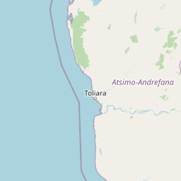
Why Tsimanampetsotsa National Park stands out
Tsimanampetsotsa is renowned for its extraordinary plant endemism within the spiny forest ecoregion, characterized by xerophytic woody species from the Euphorbiaceae family and the narrowly endemic Didiereoideae subfamily. The park protects six primate species representing four of the five lemur families endemic to Madagascar, including the only documented location for the endangered Grandidier's mongoose. The landscape features remarkable ancient baobabs, including specimens over 1,600 years old, and the sacred Mitoho Cave containing a blind cave-dwelling fish and significant subfossil discoveries including elephant bird eggshell fragments.
Tsimanampetsotsa National Park history and protected-area timeline
Tsimanampetsotsa was first protected in 1927 for its exceptional endemic flora and fauna, making it one of Madagascar's earliest conservation designations. The area became a national park in 1966, formalizing its protection under the country's protected area system. In the 1930s, botanist Henri Perrier de la Bâthie conducted significant research in the region, discovering subfossil remains of numerous species including giant tortoise, crocodiles, and eggshell fragments from the extinct elephant birds, confirming the site's paleontological importance. Recent surveys have continued to confirm the park's rich fossil heritage. The establishment of Tsimanampesotse – Nosy Ve Androka as Madagascar's 5th Biosphere Reserve in July 2018 marked a significant expansion of conservation framework, integrating the national park with Nosy Ve-Androka National Park and the community-managed Amoron'i Onilahy protected area into a comprehensive conservation landscape spanning terrestrial, aquatic, and marine ecoregions.
Tsimanampetsotsa National Park landscape and geographic character
The park encompasses four distinct landscape zones that create a dramatic transition from lake basin to limestone plateau. The lake and shore zone features a shallow, alkaline lake with salt concentrations approaching seawater, surrounded by exposed hypersaline flats during the dry season where salt-tolerant plants like glasswort and golden leather fern colonize the receding shoreline. The Mahafaly Plateau edge zone consists of dry forest on sandy soils derived from Quaternary deposits, where underground water emerges at caves and springs, supporting larger fruit trees including tamarind and fig. The Mahafaly Plateau itself is composed of Tertiary limestone with thin calcareous soils, supporting open xerophytic thickets with prominent silver thicket and bottle trees. The eastern zone features red clay soils supporting dry forest and spiny bush dominated by Didiereaceae, Euphorbiaeceae, and Burseraceae families, where exceptional fony baobabs and large Pachypodium specimens create a distinctive silhouette.
Tsimanampetsotsa National Park ecosystems, habitats, and plant life
The ecological character of Tsimanampetsotsa is defined by its position within the Madagascar spiny forests, one of the world's most endemic-rich botanical regions. The vegetation is dominated by xerophytic and drought-tolerant woody species, particularly from the spurge family Euphorbiaceae and the narrowly endemic subfamily Didiereoideae, which occurs only in south-west Madagascar. Plant inventories have documented over 200 vascular plant species from 70 families, with eleven rare species known only from Tsimanampetsotsa or immediately adjacent areas. The park's vegetation communities range from lakeside salt marsh through dry forest on sandy soils to spiny thicket on the limestone plateau and dry forest on ferruginous soils in the eastern zone. This gradient creates multiple distinct habitats within a relatively small area, supporting the exceptional species turnover that makes this ecoregion globally significant.
Tsimanampetsotsa National Park wildlife and species highlights
Tsimanampetsotsa supports remarkable mammalian diversity, including five lemur species: the ring-tailed lemur, Verreaux's sifaka, reddish-gray mouse lemur, fat-tailed dwarf lemur, and white-footed sportive lemur. The park is the only known location for Grandidier's mongoose, a species described as new to science in 1986. Near-endemic mammals include the large-eared tenrec and lesser hedgehog tenrec. The avifauna includes at least 112 species, with 35 endemic to Madagascar, including the vulnerable Madagascar plover and endangered Madagascar grebe at the lake, while the spiny forest supports endemic species including four coua species, Madagascar sparrowhawk, greater vasa parrot, and numerous vanga species. Reptiles are represented by nearly 40 species, including the critically endangered radiated tortoise and spider tortoise, multiple chameleon species, and the blind cave fish Typhleotris madagascariensis in Mitoho Grotto.
Tsimanampetsotsa National Park conservation status and protection priorities
Tsimanampetsotsa represents one of the highest conservation priorities in Madagascar due to its extraordinary plant endemism and the irreplaceable species assemblages of the spiny forest ecoregion. The 1998 Ramsar designation of Lake Tsimanampetsotsa acknowledged the wetland's international importance despite the surrounding arid conditions. The 2018 establishment of the Tsimanampesotse – Nosy Ve Androka Biosphere Reserve created an integrated conservation framework spanning five major Malagasy ecoregions, linking terrestrial, freshwater, and marine protection. The park's isolation has provided some protection, but the extreme sensitivity of the spiny forest ecosystem to disturbance means that visitor access and management require careful oversight to maintain the ecological integrity that makes this area globally significant.
Tsimanampetsotsa National Park cultural meaning and human context
Mitoho Grotto holds sacred significance for the local Antambahoka community, who believe an invisible people inhabit this limestone cave system. The cave contains a permanent lake inhabited by the blind fish Typhleotris madagascariensis, a species found nowhere else on Earth. The region's traditional land use by local communities has shaped the cultural landscape surrounding the park, and the integration of community-managed protected areas into the broader biosphere reserve reflects ongoing relationships between conservation and local stewardship.
Top sights and standout views in Tsimanampetsotsa National Park
The park offers several exceptional natural attractions: the ancient Fony baobabs including the "Grandmother" specimen estimated at 1,600 years old and the "polygamous baobab" with six fused stems; the sacred Mitoho Cave with its endemic blind fish and paleontological significance; the dramatic limestone Mahafaly Plateau with panoramic lake views; and the distinctive spiny forest vegetation found only in this corner of Madagascar. The four landscape zones provide remarkable ecological diversity within a single park, from saline lake to xerophytic plateau, supporting species found nowhere else on Earth.
Best time to visit Tsimanampetsotsa National Park
The optimal visiting period falls between late December and February when rainfall occurs, briefly transforming the otherwise arid landscape. However, the dry season dominates for nine to eleven months annually, and even during the "wet season" precipitation remains minimal. Visitors should be prepared for extreme heat, with maximum temperatures regularly exceeding 40°C outside winter months, while minimum winter temperatures average 15-20°C. The park's accessibility via a sandy track from Anakao requires a 4x4 vehicle, and visitors should anticipate hot, dry conditions year-round with potential for biting insects.