
Why Unteres Ammertal stands out
Unteres Ammertal is best known as a textbook example of a Swabian farmed river valley: a broad, open stretch of the lower Ammer where centuries of agricultural use have produced a finely structured cultural landscape of meadows, fields, wetlands, hedgerows, and traditional orchards. It is particularly valued for the way it combines a working farming environment with ecological richness, situating a relatively small protected area within close reach of the university town of Tübingen and the city of Rottenburg am Neckar, both of which border the protected zone.
Unteres Ammertal history and protected-area timeline
Unteres Ammertal was formally established as a protected landscape on 6 October 1999, when it was designated under the Baden-Württemberg landscape protection framework as Schutzgebietsnummer 4.16.024. Its creation reflected the recognition that the open valley of the lower Ammer, long shaped by agricultural use, warranted formal protection to maintain its character in the face of modern land-use pressures around the growing Tübingen area.
The designation built on a longer pre-existing cultural relationship between local farming communities and this stretch of the Ammer valley. By formalizing protection in 1999, regional authorities sought to anchor the existing agricultural, ecological, and recreational functions of the area within a stable legal framework. Following its registration in the World Database on Protected Areas under the WDPA ID 325330, the area acquired an internationally recognized profile as an IUCN Category V protected landscape, while remaining a working rural environment at the local level.
Unteres Ammertal landscape and geographic character
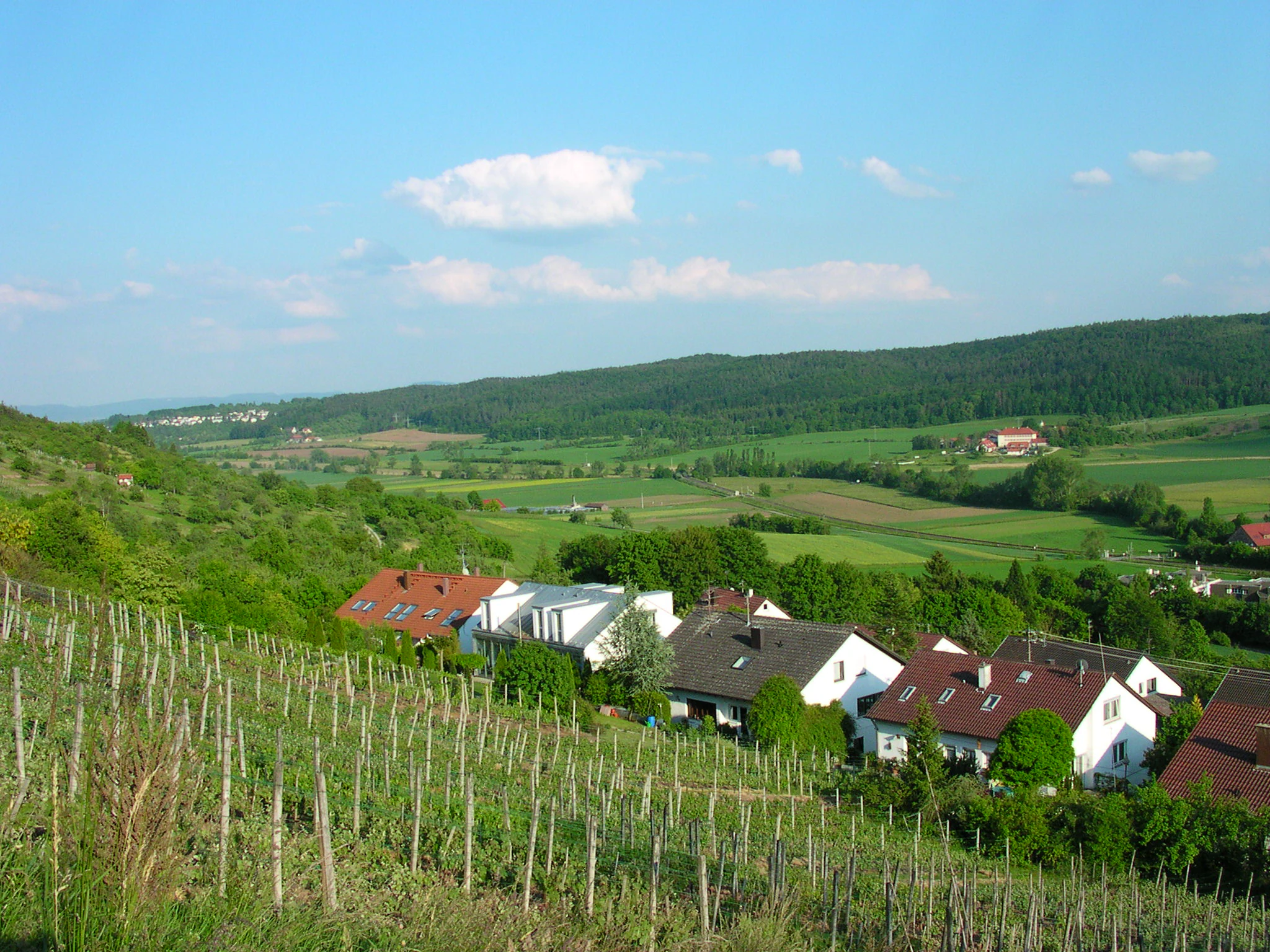
The protected landscape is set within the broad, gently sloping valley of the lower Ammer river, which flows westward through the area before joining larger drainage systems of the Neckar basin. The terrain reflects the geological character of the Schwäbisches Keuper-Lias-Land, where sedimentary layers create alternating ridges and valley floors typical of the Schönbuch and Glemswald foothills north of Tübingen.
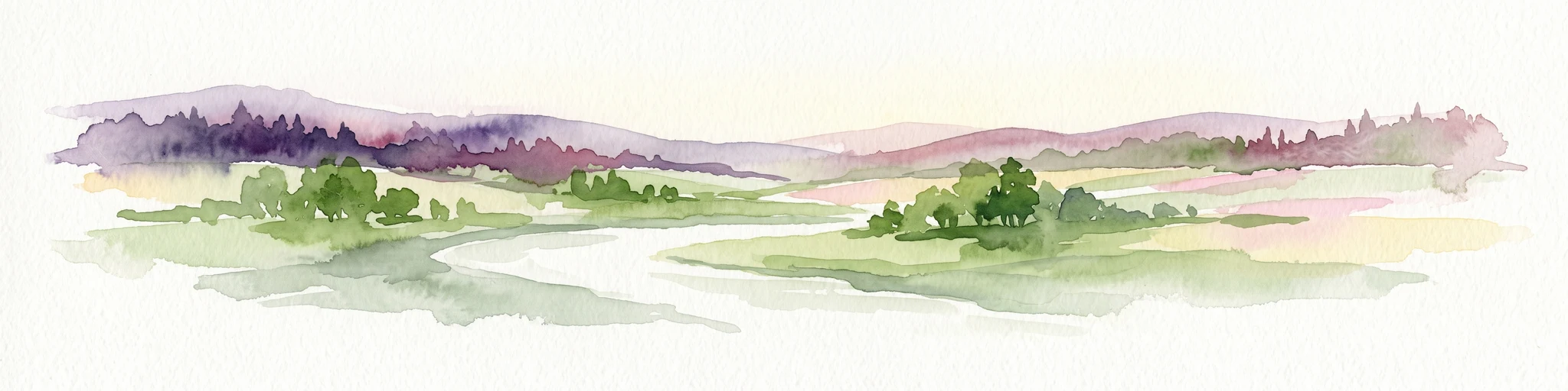
Visually, the area is dominated by open agricultural land rather than forest, giving it a wide, light-filled character. Cultivated fields alternate with meadows, pastures, and stretches of wet grassland along the river and its associated ditches. Hedgerows, small field copses, and traditional orchard meadows, the so-called Streuobstwiesen, break up the open ground and provide both structural diversity and ecological transitions between different land uses.
The river corridor of the Ammer itself, with its Gramme system of parallel drainage channels, is a defining landscape element. Between the wet ditches, reedbeds, and the slightly elevated fields, the topography shifts continuously but gently, producing the patchwork character that is central to the visual identity of the protected area.
Unteres Ammertal ecosystems, habitats, and plant life
Ecologically, Unteres Ammertal combines agricultural habitats with semi-natural wetland and woodland edge communities that together support a strong local biodiversity. Although the area is not a strict nature reserve, its mosaic structure provides habitat for plant and animal species that depend on the interface between cultivated land and natural features.
The river and ditch network of the Ammer supports wet meadows, reedbeds, and reed-rush vegetation that are particularly important for amphibians, aquatic invertebrates, and wetland plants. Hedges, field copses, and traditional orchards add woody habitat elements in an otherwise open landscape, providing nesting sites, foraging areas, and shelter for birds, small mammals, and pollinating insects.
The juxtaposition of dry, intensively used fields with moist valley-bottom vegetation creates an unusually rich ecological gradient within a relatively compact area. This gradient is one of the main reasons the cultural landscape of the lower Ammer valley was considered worthy of formal protection, since the diversity of habitats that has developed under centuries of extensive farming would not otherwise be maintained under more uniform modern land use.
Unteres Ammertal conservation status and protection priorities
The conservation purpose of Unteres Ammertal centres on preserving the diversity, character, and beauty of the open Ammer valley with its edge zones, viewed as a cultural landscape created by long-term agricultural use. The Schutzgebietsverordnung emphasises the maintenance of this landscape's distinct components: arable fields, meadows, pastures, the Ammer river with its ditch system and accompanying vegetation, wet meadows, reedbeds, hedges, field copses, and traditional orchards.
By protecting this combined set of features, the designation aims simultaneously to retain the area as a working agricultural environment, a local recreation resource, and a habitat for species-rich plant and animal communities. The framework thus treats conservation as inseparable from continued farming, recognising that the ecological value of the Ammer valley depends on the maintenance of the traditional land-use practices that originally created its habitat structure.
As an IUCN Category V protected landscape, Unteres Ammertal represents a model of conservation in which ecological, cultural, and economic objectives are reconciled within a single designation. Its inclusion in the World Database on Protected Areas under WDPA ID 325330 signals the international recognition of this approach at the regional level.
Unteres Ammertal cultural meaning and human context
Although the underlying material is modest on this dimension, the protected area can be read as a cultural artefact of its own: an officially recognised expression of the long agricultural heritage of the Ammer valley between Pfäffingen, Unterjesingen, and Tübingen. The very fact that a farming landscape, rather than a wilderness, was chosen for protection reflects the regional identity of this part of Baden-Württemberg, where traditional orchards, field crops, and meadowland continue to shape the working countryside and the visual backdrop of nearby towns.
Top sights and standout views in Unteres Ammertal
Unteres Ammertal combines a compact, easily accessible protected landscape with a deep, multi-layered cultural identity. Its most distinctive features are the open valley floor of the lower Ammer, the dense network of wet ditches and reedbeds along the river, the surrounding pattern of hedgerows and orchard meadows, and the immediate proximity to both Tübingen and Rottenburg am Neckar.
The protected area is notable for demonstrating how a relatively small landscape protection zone can simultaneously serve agriculture, biodiversity conservation, and local recreation. Its 1999 designation marked a deliberate choice to maintain an existing farmed landscape rather than allowing it to be converted to other uses, securing the valley's long-evolved structure for the future.
Best time to visit Unteres Ammertal
Unteres Ammertal is a low-elevation, open valley landscape without extreme seasonal constraints, and can be experienced meaningfully throughout much of the year. Spring brings fresh green growth in the meadows and the flowering of orchard trees, particularly in the traditional Streuobstwiesen, while summer highlights the contrast between ripened fields, lush wet meadows along the Ammer, and the dense greenery of hedgerows and field copses. In autumn, the orchards and hedgerows take on warm colours, and winter reveals the broad, open structure of the valley when leaves have fallen and views across the farmland open up. As a local recreation area near Tübingen, it is generally best enjoyed in mild conditions when walking or cycling along the valley is comfortable.