
Mori Atlas logo
Natural monumentViklan

Tracing the protected landscape and historic geological features near Javorná

Viklan Natural Monument: A Geological Study of the Balancing Dominik Granite Boulder

(Viklan (přírodní památka))

Viklan stands as a distinct geological curiosity within the Karlovarský kraj of the Czech Republic. This protected natural monument preserves the Dominik, a significant 3.5 meter block of porphyritic biotite granite resting in a rare balanced position. The site offers an opportunity to examine isolated granite formations and local meadow terrain, providing insight into the distinctive weathering patterns that define this part of the Bohemian landscape.

balancing rockgeological monumentgranite bouldernatural monumentsmall protected areaBohemian countryside
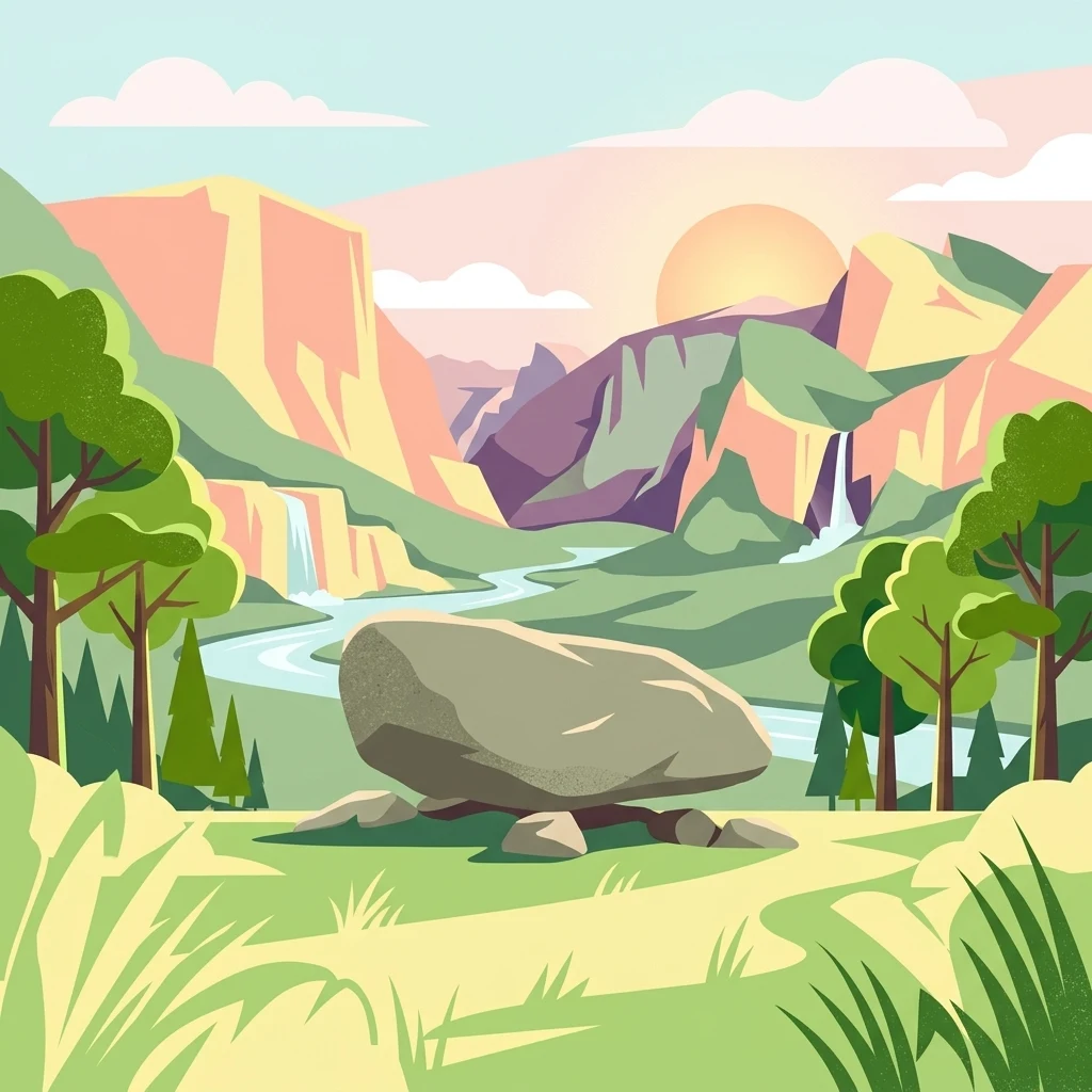
A stylized flat illustration of a large balancing rock sitting on smaller stones in a meadow, with waterfalls, mountains, and a river in the background.

Viklan

Natural monument

Park overview

Structured park overview, official facts, and landscape profile for Viklan

Viklan park facts, protected area profile, and essential visitor context

Review the core facts for Viklan, including designation, size, terrain, visitor scale, habitats, and operating context in one park-focused overview.

About Viklan

Viklan stands out among Czech natural monuments because it protects a single, highly specific geological phenomenon rather than an extensive tract of habitat. The site's defining element is the balancing rock Dominik, formed from porphyritic biotite granite and resting on a gentle slope at roughly 630 meters elevation. The protected footprint is extremely small, only about 0.02 hectares, but the rock itself is substantial, measuring roughly 3.5 meters in length, 1.5 meters in width, and 2 meters in height.

The rock's upper surface has a rounded hollow that looks deliberately made and has given rise to local legends about ancient pagan sacrificial rituals, though geologists consider it most likely a natural depression. Historical records suggest that the stone was once much less stable and could be moved even by strong winds. Over time, attempts have been made to dislodge it entirely, but so far they have failed. The name Dominik is associated with the professionally carved inscription and the dates 1776 and 1796 that appear on the side of the boulder, while a growing number of amateur carvings have gradually affected its aesthetic and cultural-historical value.

The surrounding landscape is typical of the gentler uplands of western Bohemia: short-grass pastures that harbor species such as common bent, harebell, and common toadflax. The monument lies about two kilometers north of Javorná and roughly one kilometer northeast of the hamlet of Rybničná, within the municipality of Bochov. A branch from the blue-marked hiking trail leads visitors directly to the site, which is also marked by an informational panel introducing the rock and its story.

Because Viklan is a national park-sized geographic entity in the structured sense (a recognized protected area with its own identity, page content, and ecological character), it serves as a focused point of geological and cultural interest within the broader pattern of small Czech natural monuments (přírodní památky) that protect individual landforms, rock formations, or biological features rather than large continuous landscapes.

Quick facts and research context for Viklan

Viklan is a Czech natural monument (přírodní památka), classified under IUCN Category III, declared in 1979 by the District National Committee of Karlovy Vary. Its total protected area is approximately 0.02 hectares, situated at around 630 to 640 meters above sea level on a gentle slope.

The site lies in the Karlovarský kraj, within the municipality of Bochov, in the cadastral area of Javorná u Toužimi. Its central feature is the balancing rock Dominik, a block of porphyritic biotite granite carrying historical inscriptions dated 1776 and 1796.

Protection and recognition

Analysis of terrestrial protected area designation and recognition records

Viklan Protection Status and Documented Conservation Scope

Viklan features a documented terrestrial protection scope without international recognition sources assigned in the current dataset. Structured conservation records outline the official designation framework and administrative boundary context.

Protection details

Protection scope
Terrestrial
Transboundary protection
No
Park context

Deeper park guide and search-rich context for Viklan

Viklan history, landscape, wildlife, and travel context

Explore Viklan through its history, landscape character, ecosystems, wildlife, conservation priorities, cultural context, and seasonal travel timing in a structured park guide built for atlas discovery and search intent.

Why Viklan stands out

Viklan is known above all for the balancing rock Dominik, a porphyritic biotite granite block about 3.5 meters long that can be set into motion with sufficient force yet is generally considered stable in its current position. The rock carries an unusual rounded depression near its upper surface, which has been linked in local legend to ancient pagan sacrificial rites but is more likely a natural weathering feature. Old inscriptions and the historical reputation of the rock as a movable stone give the site a distinctive blend of geological, folkloric, and cultural interest, even though the protected footprint is only a few hundred square meters.
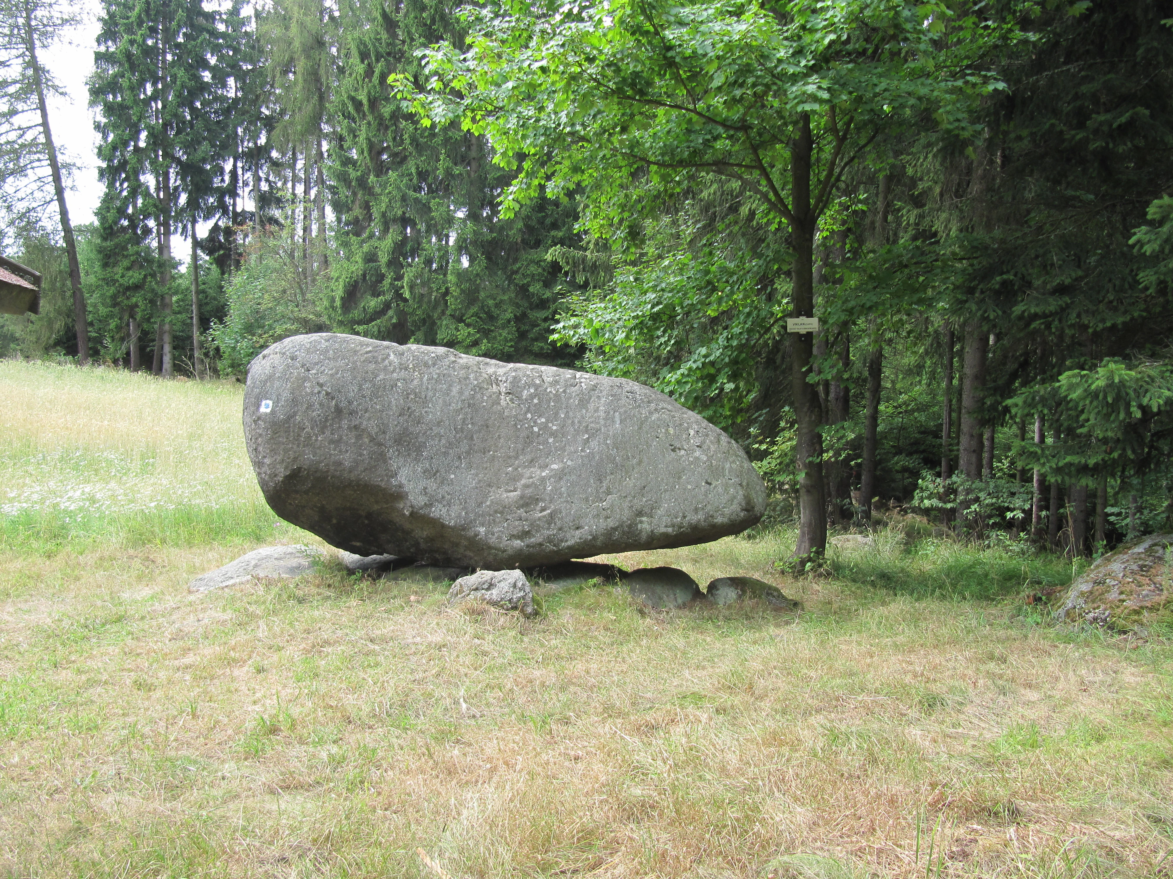
A large grey granite boulder balanced on smaller stones in a grassy clearing at the edge of a forest.
The Dominik granite rocking stone at the Viklan natural monument.

Viklan history and protected-area timeline

Viklan was formally established as a přírodní památka (natural monument) on 20 November 1979 by the District National Committee (Okresní národní výbor) of Karlovy Vary.

The rock itself carries a much older human history. The name Dominik is tied to a professionally carved inscription and the dates 1776 and 1796, suggesting that the stone's distinctive features were already noted and documented in the late 18th century. Historical information indicates that the rock was once far less stable than it appears today, to the point that even strong winds could shift it. Over the decades, various private attempts have been made to dislodge the boulder, none of which have succeeded, and in more recent times amateur carvings and graffiti have accumulated on its surface, gradually diminishing its visual and cultural-historical integrity.

Viklan landscape and geographic character

The landscape of Viklan is defined by a gentle upland slope in the western Bohemian countryside, around 630 to 640 meters above sea level. The terrain is rolling rather than dramatic, opening outward from the protected site toward the village of Javorná to the south and the small settlement of Rybničná to the southwest.

Granite is the geological backbone of this part of the region, and Viklan's main feature is a block of porphyritic biotite granite that has remained balanced at its current location through long-term weathering of the surrounding material. The wider area is agricultural and pastoral in character, with a mosaic of short-grass meadows and scattered woodland typical of the Karlovarský kraj. The combination of subdued topography and an isolated, prominent boulder creates a landscape focal point that is visible as both a natural curiosity and a cultural landmark.

Viklan ecosystems, habitats, and plant life

The botanical character of Viklan is shaped by the surrounding short-grass pastures that dominate the gentle slopes around the rock. These open grasslands host common species of the Bohemian uplands, including the grass Agrostis capillaris, the harebell (Campanula rotundifolia), and common toadflax (Linaria vulgaris).

While the named-protected area itself is only about 0.02 hectares, the broader ecological context is one of open, sun-exposed meadow vegetation interspersed with the surrounding agricultural landscape. This setting keeps the rock itself clearly visible and accessible, and the open habitat around the boulder is the main ecological showcase associated with the monument.

Viklan conservation status and protection priorities

Viklan is one of many small Czech natural monuments whose conservation purpose is to safeguard a single, distinctive landform rather than a large habitat block. Its principal value lies in the preservation of the balancing rock Dominik, a porphyritic biotite granite boulder that, despite its small size, illustrates an unusual geological condition.

Protection extends to the immediate surroundings that maintain the rock's visual context and ecological setting, notably the short-grass pastures with characteristic meadow flora. From a heritage perspective, conservation efforts also address the cumulative damage caused by amateur carvings and graffiti, which do not fundamentally harm the rock but progressively erode its aesthetic and cultural-historical value. The site is also subject to a long history of attempted dislodgement, a recurring concern that has not yet affected the rock's stability but remains a background motivation for its protected status.

Viklan cultural meaning and human context

Viklan is steeped in local folklore, particularly through the mysterious rounded hollow on the upper surface of the boulder, which has been popularly linked to ancient pagan sacrificial rites. While modern understanding suggests this depression is most likely a natural weathering feature rather than a deliberately carved altar, the legend has become part of the site's identity.

The name Dominik attached to the rock, along with the carved dates 1776 and 1796, further embeds the monument within the cultural memory of the Bochov municipality and the wider Karlovy Vary district. The presence of an informational panel on site, visible community interest, and the continuation of stories about the rock's near-magical behavior all reflect how the object has moved between folklore, local curiosity, and formal heritage protection across several centuries.

Top sights and standout views in Viklan

The standout features of Viklan are concentrated in and around the single balancing boulder: a roughly 3.5-meter block of porphyritic biotite granite in a near-balanced position, an unusual rounded depression on its upper surface linked to local legend, and professionally carved historical inscriptions dating back to the late 18th century.

Surrounding the rock, the open short-grass pastures with characteristic Bohemian meadow species, and the fact that the site is reachable by a short branch from the blue-marked hiking trail, give Viklan a compact yet distinctive profile among Czech natural monuments.

Best time to visit Viklan

As a small grassland setting around a single rock formation, Viklan is most approachable in the warmer months when the short-grass pastures are in active growth and the meadow flora around the boulder is visible. Late spring and summer generally offer the clearest conditions for viewing the rock and walking the blue-marked trail without winter snow or muddy ground.

Monthly climate preview

Analyzing monthly weather patterns and average temperature trends across the protected terrain

Viklan Climate Normals, Long-Term Temperature and Precipitation Rhythms

Representative coordinates record measured temperature variation and daily precipitation rates across twelve distinct intervals. Detailed monthly records supply complete climate data for comprehensive long-term evaluation.
Annual mean8 °C
-3 °C19 °C
Jan-3°
Feb-2°
Mar
Apr
May12°
Jun16°
Jul19°
Aug18°
Sep13°
Oct
Nov
Dec-2°
Warmest month
July

18.6 °C

Coolest month
January

-2.8 °C

Wettest month
June

2.5 mm/day

Driest month
February

1.2 mm/day

Park location guide

Geography guide, regional context, and park location map for Viklan

Viklan park geography, regions, and map view in Czechia

Understand where Viklan sits in Czechia through a broader geographic reading of the surrounding landscape, nearby location context, and its mapped position within the national park landscape.

How Viklan fits into Czechia

Czech Republic is a landlocked Central European country with a population of approximately 10.9 million people. The nation was established as an independent state on January 1, 1993, following the dissolution of Czechoslovakia. Its capital and largest city is Prague, with other major urban centers including Brno, Ostrava, Plzeň, and Liberec.

Wider geography shaping Viklan in Czechia

The Czech Republic is a landlocked country in Central Europe. It is bordered by Germany to the west, Austria to the south, Poland to the northeast, and Slovakia to the southeast. The landscape is predominantly hilly, with the territory covering 78,871 square kilometers.

Map view of Viklan

Use this park location map to pinpoint Viklan in Czechia, understand its exact geographic position, and read its mapped placement within the surrounding landscape more clearly.

Pigeon | © OpenStreetMap contributors

Location context for Viklan

Karlovarský kraj

Explore the granite terrain, upland meadows, and geological character of this protected Bohemian site.

Viklan Photos and Protected Area Scenery: Visualizing the Balancing Rock Monument

Visual documentation captures the rare granite balancing rock and pastoral meadow habitats that define the protected landscape of Viklan. Examining these field photographs reveals the geological formations and upland terrain of the western Bohemian countryside more clearly.

A large grey granite boulder balanced on smaller stones in a grassy clearing at the edge of a forest.

Park atlas

Compare surrounding regional geography and adjacent protected areas

Explore Other Parks Near Viklan and Related Protected Landscapes

Continue browsing parks near Viklan to examine similar geological formations and protected natural monuments across the surrounding region. Expanding the search helps connect isolated granite formations to wider regional protected landscapes.
Natural monumentKarlovy Vary District
About 13 km away#1 closest

Southwest

Velikonoční rybník Natural Monument: Protected Wetland and Amphibian Habitat Geography

A core conservation site within the Slavkov Forest landscape

Velikonoční rybník stands as a noteworthy natural monument in the Karlovy Vary District, protecting essential wetland ecosystems. This small yet vital reservoir provides a specialized habitat for endangered amphibians and dragonflies, serving as a landmark of regional conservation efforts and ecological mapping within the Slavkov Forest region.

Area
0.018 km²
Established
2014
IUCN
IV
Relief
Upland
A stylized vector-style illustration showing a man and a child standing on the grassy bank of a pond, watching a swimmer in the middle of the water, with a waterfall and forest in the background.
Natural monumentKarlovarský kraj
About 15 km away#2 closest

West

Na Vážkách Natural Monument: Mapping Protected Forest Landscapes in Karlovarský kraj

A rare oligotrophic pond and wetland habitat in Western Bohemia.

Na Vážkách provides a unique example of small-scale landscape protection, featuring clear, sandy-bottomed waters within the broader forest mosaic of Karlovarský kraj. Designated in 2017, this natural monument is recognized for its significant dragonfly populations and its role in preserving historical aquatic water systems.

Area
0.026 km²
Established
2017
IUCN
III
Relief
Upland
Natural monumentKarlovarský kraj
About 20 km away#3 closest

East

Valeč Natural Monument: Geologic and Ecological Landscapes in the Karlovarský kraj

Tracing volcanic terrain and fossil sites in the Doupovské Hory

Valeč Natural Monument offers a deep look into the volcanic geology and protected wilderness of western Bohemia. Known for its historical paleontological finds and diverse forest cover, this landscape provides an essential case study for mineralogical research and habitat preservation within the wider regional geography.

Area
5.436 km²
Established
1992
IUCN
IV
Relief
Mountain
Natural monumentKarlovy Vary District
About 22 km away#4 closest

East

Valečské sklepy Natural Monument and Protected Bat Hibernation Site in Karlovy Vary

Volcanic terrain and critical wildlife infrastructure in western Bohemia

Valečské sklepy represents a unique form of protected landscape in the Karlovy Vary District, where historical underground cellars function as a specialized natural monument. The site maintains a crucial role as a winter hibernation refuge for the critically endangered western barbastelle, embedded within the volcanic geomorphology of the Doupovské hory region.

Established
2016
IUCN
III
Relief
Mountain
Climate
Temperate
Natural monumentKarlovarský kraj
About 22 km away#5 closest

North

Malý Stolec Natural Monument: Volcanic Landscape and Regional Protected Area Atlas

Exposing neovolcanic rock and ancient feeder conduits in Karlovarský kraj

Malý Stolec provides a focused view into the volcanic processes of the Doupovské hory. This natural monument displays rare geologic features including columnar jointing, coarse agglomeratic tuffs, and an intruded lava body. Its location on the southern slopes above the Ohře river offers a distinct landscape character that demonstrates how localized protected areas contribute to broader European conservation frameworks.

Area
0.06 km²
Established
2016
IUCN
IV
Relief
Mountain
A soft, impressionistic watercolor painting depicting a wide, marshy landscape with green fields, low hills in the distance, and a small meandering stream.
Nature reserveKarlovarský kraj
About 24 km away#6 closest

Southwest

Prameniště Teplé Nature Reserve: Protected Wetland and River Source Geography

A diverse springhead sanctuary in Karlovarský kraj

Prameniště Teplé stands as a significant nature reserve protecting the essential wetland mosaic surrounding the source of the Teplá River. Featuring a delicate balance of bogs, meadows, and forest fringes, this protected area preserves the ecological character of western Bohemian water-dominated landscapes through its unique spring-fed geography.

Area
0.429 km²
Established
1993
IUCN
IV
Relief
Upland
Natural monumentÚstí nad Labem Region
About 24 km away#7 closest

East

Vrbina u Nové Vsi Natural Monument: Protected Habitat Mapping and Geographic Overview

Wetland and meadow conservation in the Ústí nad Labem Region

Vrbina u Nové Vsi provides a deep look into the habitat mosaic of the Doupov Mountains foothills. This protected area stands out for its concentrated distribution of ten distinct biotopes, ranging from wet alder woodlands to orchid-rich meadows, providing a comprehensive example of lowland conservation within a larger volcanic terrain context.

Area
0.113 km²
Established
2016
IUCN
IV
Relief
Upland
A soft, painterly watercolor illustration of a rolling green landscape with distant hills, grassy meadows, and patches of trees.
Protected landscapeChomutov District
About 25 km away#8 closest

Northeast

Doupovská pahorkatina Nature Park: Mapped Geography and Protected Landscape Features

Upland volcanic terrain and steppe grasslands in Czech Republic.

Doupovská pahorkatina Nature Park protects a significant stretch of forest-steppe mosaics and rolling volcanic terrain in the southwestern part of the Chomutov District. This area stands out for its high density of dry grassland communities and wetland pockets along the Liboc river, providing a critical study of transitional geomorphology between the Doupov Mountains and the Žatecká pánev basin.

Area
47.7 km²
Established
1996

Common questions about visiting, size, designation, and location context for Viklan

Viklan FAQs for park facts, access, geography, and protected area context

Find quick answers about Viklan, including protected-area facts, park geography, trail and visitor context, and how the park fits into its surrounding country and regional landscape.
MoriAtlas Explorer

Continue Your Protected Areas Search Across the Global Atlas

Deepen your exploration by continuing the structured search for national parks and protected areas worldwide. Utilize the comprehensive filtering capabilities to compare different conservation landscapes and refine your understanding of global park geography. Discover more about the distribution and characteristics of protected natural areas.

Global natural geography