


Why Vogelschutzgebiet Diemel- und Hoppecketal mit angrenzenden Wäldern stands out
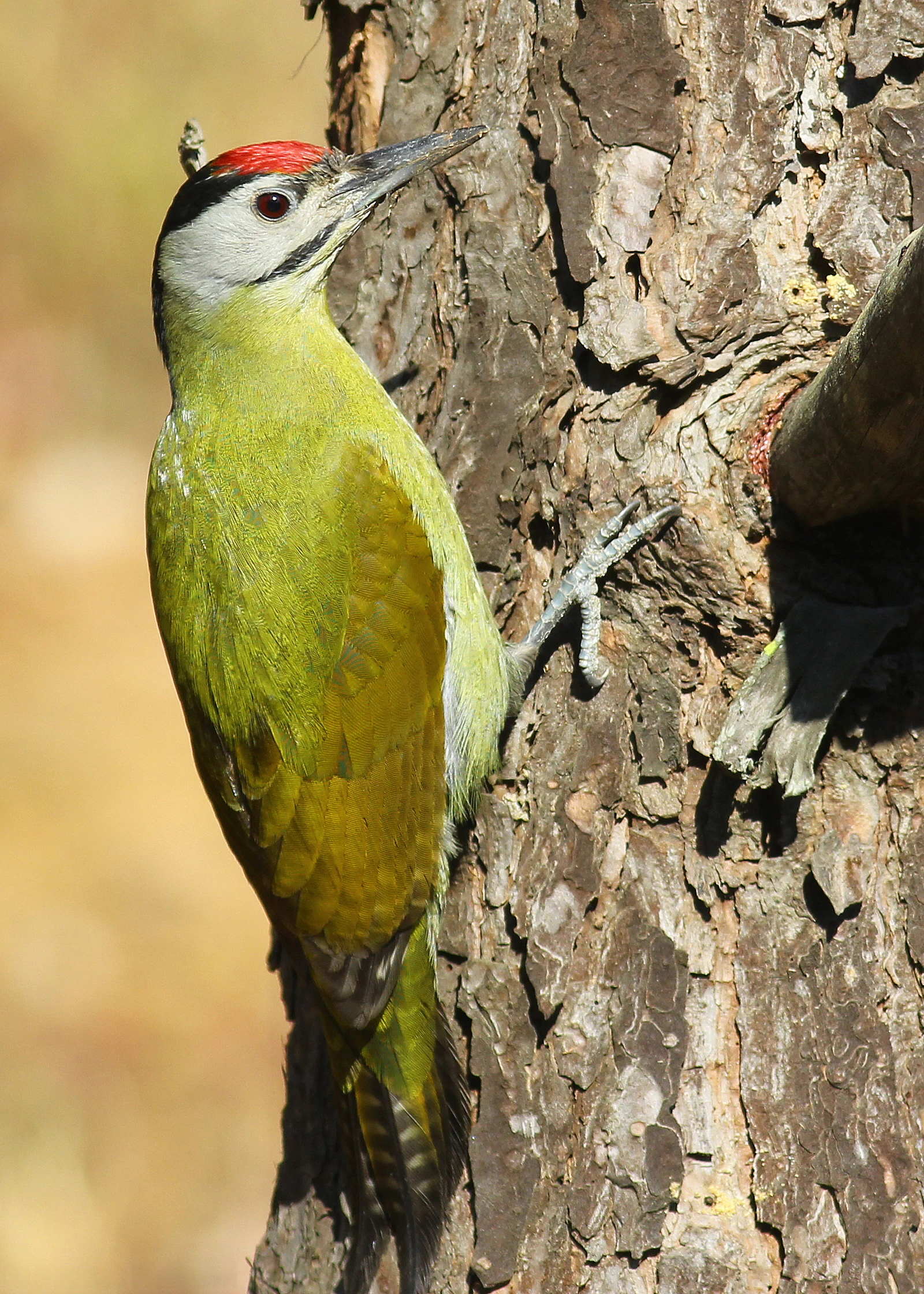
The Vogelschutzgebiet is best known as one of North Rhine-Westphalia's most significant refuges for rare woodland and open-country birds, holding state-level stronghold populations of grey-headed woodpecker, red-backed shrike, northern great grey shrike, black stork, honey buzzard, red and black kite, eagle owl, black woodpecker, wood warbler, tree pipit and meadow pipit. It is also notable for the unusually long and contested process by which it came into existence: it is the only EU Bird Directive site in Germany that was newly notified from scratch after the member state determined that earlier data had been insufficient. The final designated boundaries were strongly criticised by recognised conservation organisations as too narrow to fully cover the breeding and wintering territories of the very species that triggered its designation.
Vogelschutzgebiet Diemel- und Hoppecketal mit angrenzenden Wäldern history and protected-area timeline
The VNV first formally requested the European Commission to designate a Special Protection Area in the Diemel and Hoppecke valleys on 7 December 2019, targeting an area of approximately 28,000 hectares. Copies of the application were simultaneously sent to the state of North Rhine-Westphalia, the Arnsberg district government and the Hochsauerlandkreis.
The application was the culmination of intensive ornithological fieldwork between 2017 and 2019, when the VNV's ornithological working group mapped the breeding distribution of selected Annex I species of the Birds Directive and threatened migratory species under Article 4(2), as well as the winter distribution of the great grey shrike and a staging area for Eurasian dotterel. This research filled a long-standing data gap: when North Rhine-Westphalia designated SPAs in the late 1990s, the state environment agency (LANUV) had lacked sufficient data for this region to determine whether the site met SPA criteria.
Two decades of new evidence created a legal obligation for NRW to notify the area as an SPA. Although the 2023 designation confirmed the need for protection, the final boundaries were significantly smaller and more fragmented than the VNV's original proposal, omitting many of the very breeding and wintering sites that triggered the designation. Recognised nature conservation associations, including BUND, NABU and the Landesgemeinschaft Naturschutz und Umwelt NRW, have stated that without expansion to cover these omissions, the protected area is structurally inadequate to fulfil its stated conservation aims, and that the missing areas should be treated as de facto SPAs in the interim.
Vogelschutzgebiet Diemel- und Hoppecketal mit angrenzenden Wäldern landscape and geographic character
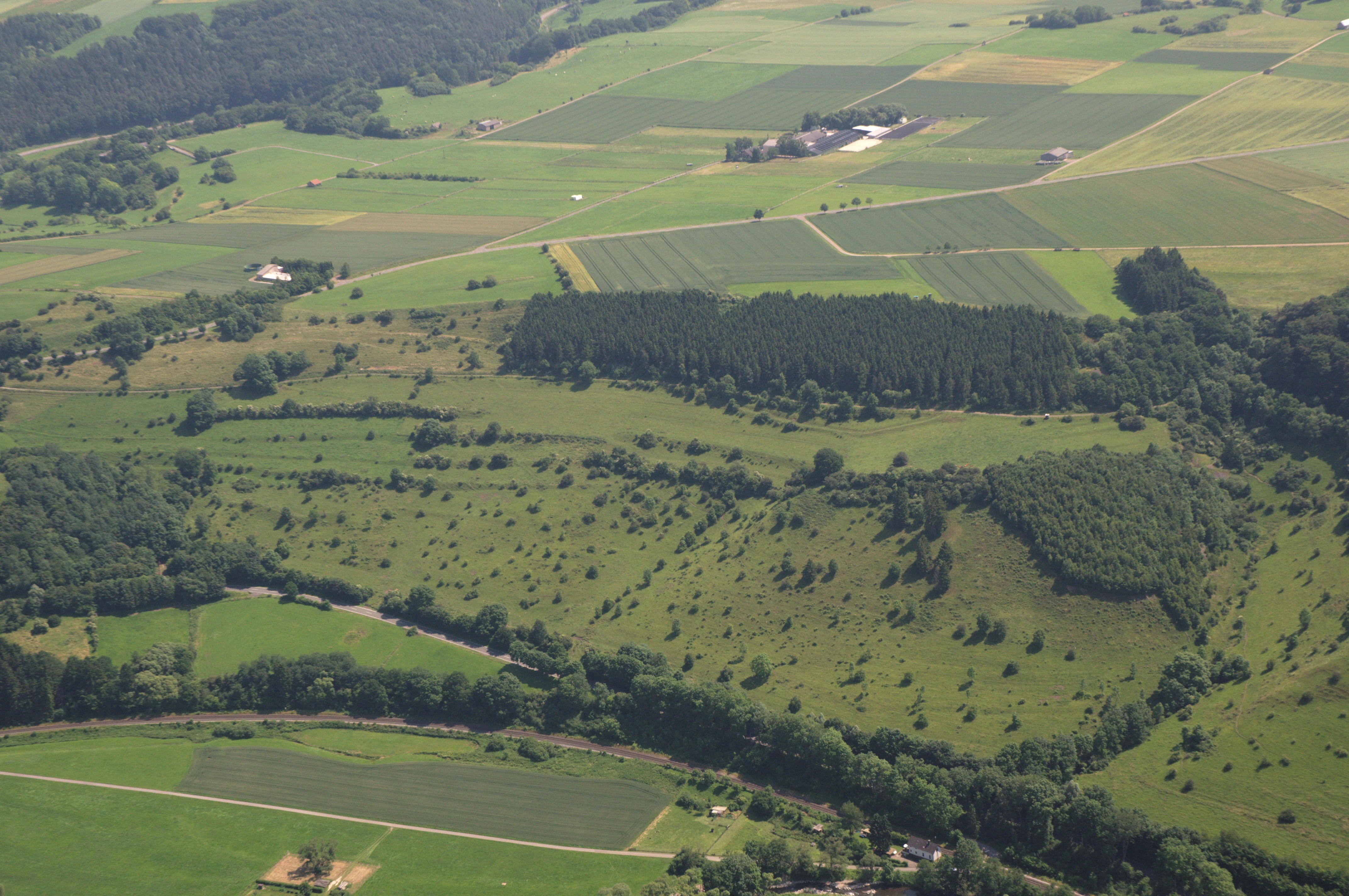
The landscape of the Vogelschutzgebiet is shaped by the valley systems of the Diemel and Hoppecke rivers and the forested uplands that surround them, with a clear divide between a heavily forested north and a more open, fragmented south. The north contains large continuous tracts of woodland dominated by beech forest communities of the Hainsimsen and Waldmeister types, as well as oak-beech mixtures that frequently grade into spruce plantations.
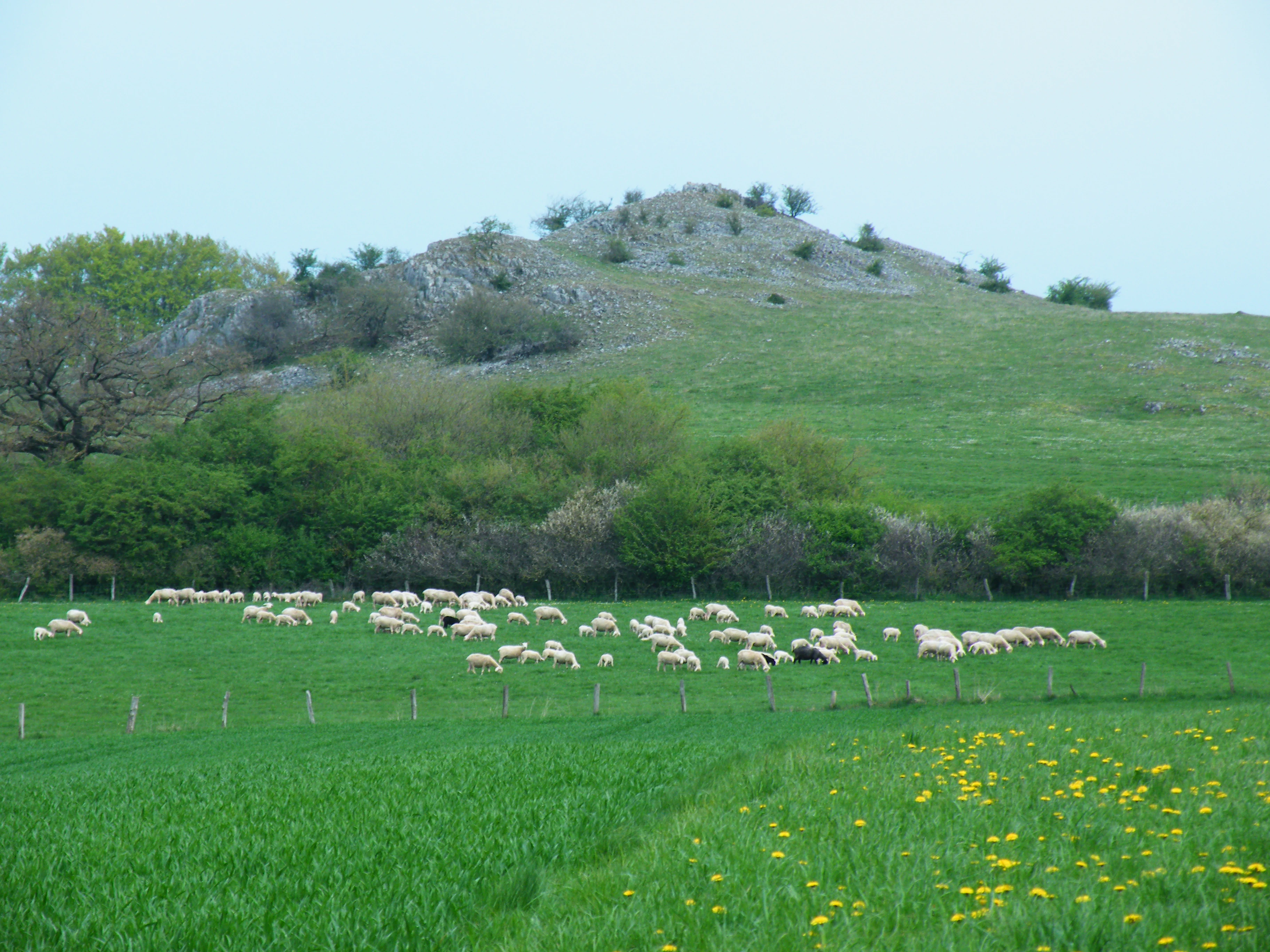
The southern half breaks into a mosaic of smaller protected fragments interspersed with meadows, fields, hedgerows and scattered woodland. Streams meander through near-natural, alder- and ash-lined corridors, with accompanying softwood floodplain forests on their banks. Cliff biotopes and steep slopes host ravine and slope mixed forests, while flatter terrain supports calcareous grasslands, well-developed hay meadows and traditional hedge complexes that provide structural richness across the protected area.
Vogelschutzgebiet Diemel- und Hoppecketal mit angrenzenden Wäldern ecosystems, habitats, and plant life
Ecologically, the Vogelschutzgebiet functions as a large, structured and largely disturbance-poor refuge for forest, cliff and open-country habitats in the eastern Sauerland. The forest communities range from nutrient-poor Hainsimsen beech woodland on acidic substrates through more base-rich Waldmeister beech forests to oak-beech mixtures enriched with spruce, while valleys support alder-ash and softwood floodplain forests that follow near-natural, meandering streams.
Open-land habitats are equally important, including well-developed meadows that retain their species-rich character, calcareous grasslands on suitable substrates, and traditional hedge networks that maintain landscape connectivity for species that need a combination of woody and open habitats. Rock and cliff habitats add another structural layer, supporting species that depend on mature woodland next to vertical rock faces and scree.
Vogelschutzgebiet Diemel- und Hoppecketal mit angrenzenden Wäldern wildlife and species highlights
The site's primary wildlife significance lies in its bird fauna, which was the explicit trigger for its designation as a European Bird Directive site. It holds the largest or among the largest populations in North Rhine-Westphalia of several Annex I and Article 4(2) species, including black stork, honey buzzard, red kite, black kite, eagle owl, black woodpecker, great grey shrike, red-backed shrike, grey-headed woodpecker, wood warbler, tree pipit and meadow pipit.
Mature-forest specialists such as grey-headed woodpecker and black woodpecker are central to the conservation aims, supported by the abundance of old-growth and dead-wood-rich beech and oak stands. Open-country and edge species, including red-backed shrike and great grey shrike, depend on the patchwork of meadows, hedgerows and structured woodland edges in the southern parts of the area. Wintering great grey shrikes and the staging area for migrating Eurasian dotterels in the Marsberg area were also key elements in the original ornithological case for protection. Additional notable species with regular occurrences include European turtle dove, Tengmalm's owl, Eurasian pygmy owl, common kingfisher, middle spotted woodpecker, Eurasian hobby, peregrine falcon, Eurasian skylark and rock bunting.
Vogelschutzgebiet Diemel- und Hoppecketal mit angrenzenden Wäldern conservation status and protection priorities
From a conservation perspective, the Vogelschutzgebiet is significant because it formally recognises an entire landscape complex as essential for several rare bird species whose populations were insufficiently safeguarded in earlier North Rhine-Westphalia SPA designations. Its formal protection aims include maintaining and developing a large, near-natural, low-disturbance, old-growth- and dead-wood-rich beech, oak and mixed forest landscape together with cliffs, ravine forests, near-natural streams with floodplain woodland, species-rich meadows and calcareous grasslands.
These habitats together support breeding, foraging, resting and wintering populations of the bird species for which the site was designated. However, conservation organisations have stressed that the final boundaries are too narrow and too fragmented to fully cover the activity ranges of the relevant species. The southern part in particular resembles a patchwork, with many important breeding and wintering territories of great grey shrike, red-backed shrike and grey-headed woodpecker falling outside the legal boundaries, as well as the key dotterel staging area. Critics argue that, while the designation is legally and symbolically important, operational conservation of the target species will depend on significantly extending the area in the future.
Vogelschutzgebiet Diemel- und Hoppecketal mit angrenzenden Wäldern cultural meaning and human context
The protected area is deeply intertwined with long-running regional conservation work led by the Verein für Natur- und Vogelschutz im Hochsauerlandkreis (VNV), whose volunteer ornithologists produced the foundational inventories that triggered the designation. The NRW-Stiftung and the state of North Rhine-Westphalia also hold significant portions of the southern land, reflecting a tradition of conservation land ownership in the area.
At the same time, the designation process became a focal point of regional conflict, particularly in the municipalities of Brilon and Marsberg and within the Hochsauerlandkreis, alongside the local agricultural association, forestry representatives and the IHK Arnsberg. Concerns centred on perceived restrictions on settlement expansion, quarrying, commercial forestry, wind energy and photovoltaic development, with critics framing the SPA as a threat to regional economic development. This tension between volunteer-driven ecological evidence and local economic interests forms an important part of the area's modern cultural and political context.
Top sights and standout views in Vogelschutzgebiet Diemel- und Hoppecketal mit angrenzenden Wäldern
The Vogelschutzgebiet Diemel- und Hoppecketal mit angrenzenden Wäldern stands out for combining one of North Rhine-Westphalia's most important breeding bird assemblages with a richly structured forest and valley landscape that includes large beech-dominated woodlands, near-natural streams with floodplain forests, cliff and ravine habitats and species-rich grasslands.
It is also distinctive as the only Special Protection Area in Germany to have been newly notified to the European Commission in recent decades rather than simply expanded, and as a case study in how volunteer-led science can drive formal European conservation designations. The mosaic of 48 protected sub-areas across four municipalities, criticised as too fragmented by major nature conservation associations, remains a defining and controversial feature of the site.
Best time to visit Vogelschutzgebiet Diemel- und Hoppecketal mit angrenzenden Wäldern
Bird activity and therefore the most rewarding periods for experiencing the Vogelschutzgebiet's defining wildlife character are generally concentrated in the breeding season, when woodland specialists such as grey-headed woodpecker, black woodpecker and wood warbler are present on territory and open-country species such as red-backed shrike and great grey shrike are most visible along hedgerows, meadows and forest edges. Winter brings a different character, with great grey shrikes occupying open hunting territories across the protected landscape and offering some of the clearest viewing opportunities of the year against snow-free or lightly snowed countryside.
Shoulder seasons in early spring and late autumn are useful for witnessing migratory movements and any visible passage through the Diemel and Hoppecke valleys, while late summer can be productive for observing post-breeding activity in structured edge habitats. Conditions should always be checked locally, as access to specific nature reserves within the SPA is regulated individually.