Why Volcanoes National Park stands out
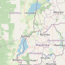
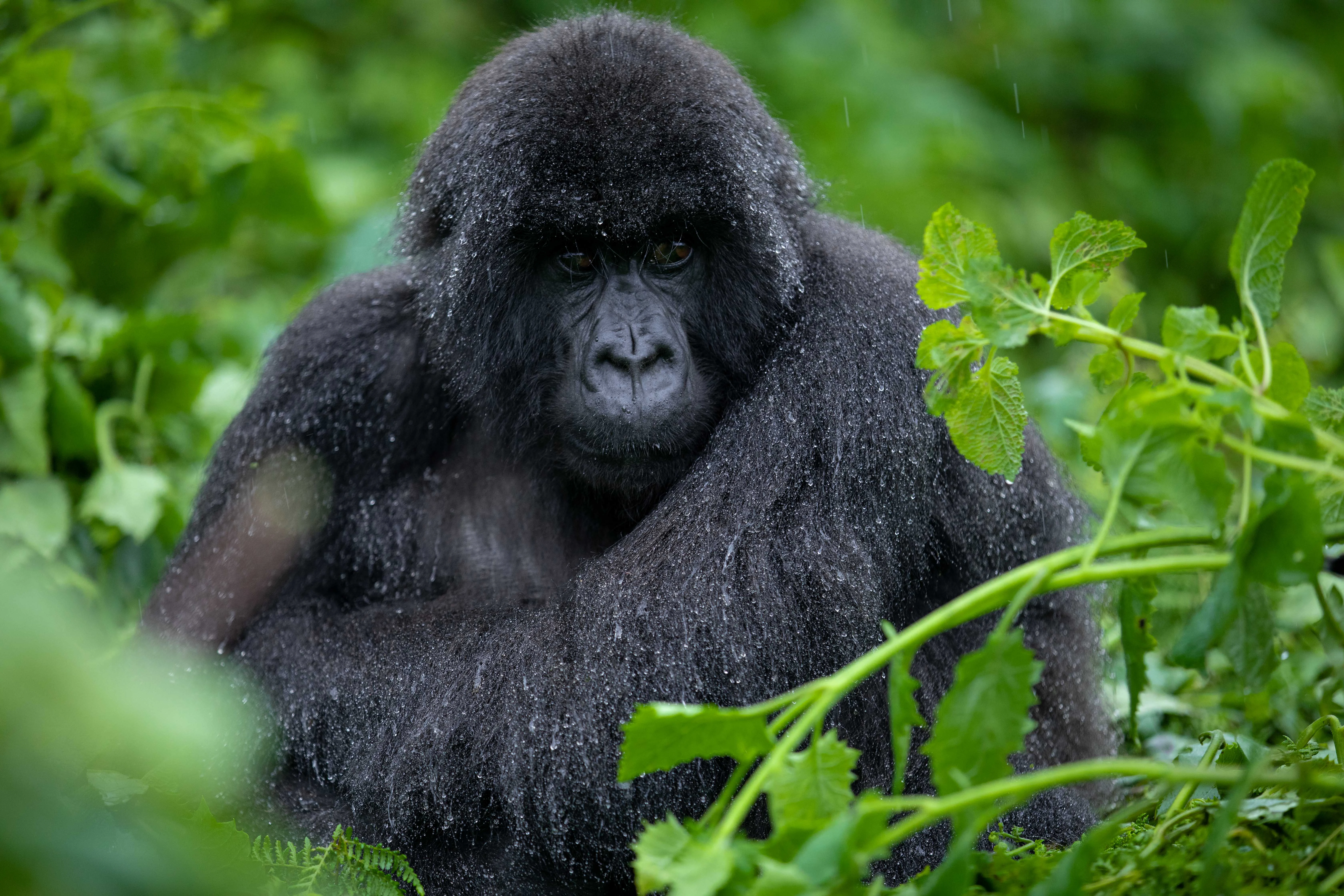
Volcanoes National Park is world-renowned as the premier mountain gorilla habitat in Rwanda, protecting approximately half of the world's remaining population of these endangered great apes. The park is also famous for its population of golden monkeys and the historic Karisoke Research Centre founded by Dian Fossey. The opportunity to trek through misty volcanic slopes to observe mountain gorillas in their natural habitat represents one of Africa's most iconic wildlife experiences. The park's five volcanoes, particularly Mount Bisoke with its crater lake, offer dramatic hiking opportunities and stunning vistas across the Rwandan highlands.
Volcanoes National Park history and protected-area timeline
The establishment of Volcanoes National Park in 1925 represents a landmark in African conservation history. Initially created as a small protected zone bounded by Karisimbi, Bisoke, and Mikeno volcanoes, the park was specifically designed to protect mountain gorillas from the threat of poaching. In 1929, the park underwent significant expansion when Belgian colonial authorities extended its boundaries into Rwanda and the Belgian Congo, creating Albert National Park, an 8,090 square kilometer expanse that represented one of Africa's earliest transboundary conservation initiatives. Throughout the mid-twentieth century, the park faced numerous challenges, including the clearing of 700 hectares in 1958 for human settlement and the conversion of 1,050 hectares between 1969 and 1973 for pyrethrum cultivation. During the 1970s and 1980s, the indigenous Twa people were involuntarily resettled from the park area. The park achieved lasting fame through the work of American primatologist Dian Fossey, who arrived in 1967 and established the Karisoke Research Centre between Karisimbi and Bisoke. Fossey's pioneering research and fierce advocacy for gorilla conservation transformed international understanding of these primates and became instrumental in saving them from extinction. Her murder in 1985, widely attributed to poachers she had fought throughout her career, marked a tragic chapter in the park's history. The Rwandan Civil War brought further turmoil, with park headquarters attacked in 1992 and all tourism suspended until 1999. More recently, the 2022 announcement of a major park expansion from 13,000 to 23,000 hectares, funded by a $255 million investment, signals Rwanda's commitment to strengthening conservation and reducing human-wildlife conflict through the creation of a substantial buffer zone.
Volcanoes National Park landscape and geographic character
The landscape of Volcanoes National Park is defined by its dramatic volcanic terrain, with five distinct volcanoes rising from the surrounding Rwandan highlands. Mount Karisimbi, the highest peak at 4,507 meters, dominates the park's western boundary, while Mount Bisoke, known for its spectacular crater lake, Mount Muhabura, Mount Gahinga, and Mount Sabyinyo complete the volcanic ensemble. The terrain varies dramatically with altitude, progressing from fertile lower slopes through dense forest to alpine meadows and eventually to rocky summit zones. The park contains significant geological features including the Musanze Caves, formed approximately 62 million years ago following the last major volcanic eruption in the region. The Buhanga Eco-Park area encompasses ancient woodland with significance in Rwandan folklore. Rivers originating from the volcanic slopes feed into the surrounding agricultural landscape, while the crater lake on Mount Bisoke represents one of the park's most iconic natural features. The visual impact of the landscape is enhanced by the way mist and clouds commonly envelop the upper slopes, creating an atmosphere that has become synonymous with the gorilla trekking experience.
Volcanoes National Park ecosystems, habitats, and plant life
The ecological diversity of Volcanoes National Park reflects its extraordinary altitudinal range, supporting multiple distinct vegetation zones that transition from tropical forest to alpine moorland. The lower montane forest zone, now largely diminished due to agricultural expansion, once covered the lower slopes. Between 2,400 and 2,500 meters, Neoboutonia forest dominates, while bamboo forest of Oldeania alpina covers approximately 30% of the park area between 2,500 and 3,200 meters. The Hagenia-Hypericum forest, one of the largest continuous stands of Hagenia abyssinica in Africa, occupies the 2,600 to 3,600 meter zone on the more humid southern and western slopes, covering another 30% of the park. Above 3,500 meters, the vegetation transitions to high-altitude heath characterized by Lobelia wollastonii, Lobelia lanurensis, and Dendrosenecio erici-rosenii, covering roughly 25% of the park area. The summit zone above 4,300 meters gives way to grasslands. This vertical stratification creates a remarkable tapestry of habitats that supports exceptional biodiversity.
Volcanoes National Park wildlife and species highlights
Volcanoes National Park is synonymous with mountain gorilla conservation, protecting one of the last viable populations of Gorilla beringei beringei. The park's gorilla populations have been the subject of intensive research since Dian Fossey established the Karisoke Research Centre, and their habituation to human presence enables the trekking experiences that define the park's tourism identity. Beyond gorillas, the park supports a rich community of other primates, most notably the golden monkey, whose vibrant golden-orange fur provides a striking contrast to the darker gorilla populations. The mammalian fauna includes black-fronted duiker, African buffalo, spotted hyena, and a population of harnessed bushbuck estimated between 1,760 and 7,040 individuals. African elephants are reported in the park though their numbers have declined significantly. The avifauna is equally impressive, with 178 recorded bird species, including at least 13 species and 16 subspecies endemic to the Virunga and Rwenzori mountain ranges. This concentration of endemic species makes the park particularly significant for ornithological conservation.
Volcanoes National Park conservation status and protection priorities
Volcanoes National Park represents a critical stronghold for mountain gorilla conservation, with the species listed as endangered and the park protecting a significant portion of the global population. The park's conservation significance extends beyond its borders through its role in the transboundary Virunga landscape, connecting protected areas in Rwanda, the Democratic Republic of the Congo, and Uganda to create a contiguous ecosystem essential for long-term species survival. The 2022 expansion announcement, which will increase the park from 13,000 to 23,000 hectares, demonstrates Rwanda's commitment to strengthening conservation outcomes through the creation of a buffer zone intended to reduce human-wildlife conflict by an estimated 80 percent. The expansion includes plans for agroforestry initiatives that will benefit both conservation and local communities. The park's tourism model, which generates substantial revenue from gorilla trekking permits, has become a globally recognized example of how protected area tourism can fund conservation while providing sustainable livelihoods for surrounding communities.
Volcanoes National Park cultural meaning and human context
The cultural landscape of Volcanoes National Park encompasses both historical human presence and ongoing community relationships. The park area was historically home to the Twa people, indigenous forest dwellers who were involuntarily resettled during the 1970s and 1980s. The Karisoke Research Centre, established by Dian Fossey in 1967, represents a significant cultural and historical site, though the original facility was abandoned during the Rwandan Civil War. The Buhanga Eco-Park contains ancient woodland with deep significance in Rwandan folklore, representing the intersection of natural and cultural heritage. The surrounding communities, particularly those in the Musanze district, maintain strong connections to the park through tourism employment, agricultural activities, and cultural interpretation programs. The park's integration with Rwanda's broader tourism offerings, including visits to cultural villages and memorial sites, creates a framework where conservation and cultural understanding work hand in hand.
Top sights and standout views in Volcanoes National Park
The mountain gorilla trekking experience stands as Volcanoes National Park's most iconic highlight, offering visitors the chance to observe these endangered primates in their natural volcanic forest habitat. Mount Bisoke's crater lake hike provides a rewarding alternative for those seeking a non-gorilla activity, with panoramic views and the opportunity to swim in the mountain lake. The golden monkey treks offer another unique primate experience, with these colorful creatures often found in the bamboo zones. The Musanze Caves provide a fascinating geological excursion into volcanic history. The burial site of Dian Fossey, near the ruins of Karisoke Research Centre, offers a contemplative destination for those interested in the history of gorilla conservation. The park's position at the gateway to Rwanda's northern tourism circuit makes it an ideal base for exploring the broader region.
Best time to visit Volcanoes National Park
The dry seasons from June to September and December to February generally offer the most favorable conditions for visiting Volcanoes National Park, with reduced rainfall making hiking trails more accessible and gorilla trekking excursions more comfortable. However, Volcanoes National Park can be visited year-round, and the park's mountain environment means that rain is possible at any time. The wet seasons bring their own advantages, including lusher vegetation, fewer visitors, and the dramatic visual impact of mist rolling through the volcanic slopes. The mountain gorilla trekking experience remains the primary draw throughout the year, with the animals commonly found at varying altitudes depending on seasonal fruit availability. Visitors should note that gorilla trekking permits must be secured well in advance, particularly during peak seasons, and that the experience involves hiking at altitudes exceeding 2,500 meters regardless of when they visit.