
Mori Atlas logo
Protected landscapeZipfelbachtal, Korber Kopf, Buocher Höhe, Remstalhänge, Ramsbachtal und Grafenberg

A detailed geographic study of Swabian Keuper terrain, traditional orchard meadows, and forested stream valleys

Zipfelbachtal, Korber Kopf, Buocher Höhe, Remstalhänge, Ramsbachtal und Grafenberg: Protected Landscape and Regional Geography

(Landschaftsschutzgebiet Zipfelbachtal, Korber Kopf, Buocher Höhe, Remstalhänge, Ramsbachtal und Grafenberg)

This protected landscape in Baden-Württemberg represents a cohesive network of habitats spanning the Schurwald and Welzheimer Wald natural regions. The area maintains a complex mosaic of vineyards, scattered fruit-tree meadows, and riparian zones along the Zipfelbach and Ramsbach valleys. By examining its topographic features like the Korber Kopf, Buocher Höhe, and Grafenberg, users can trace how traditional land use shapes the ecological structure between the Rems and surrounding hills.

landscape protection areaLandschaftsschutzgebietIUCN Category VBaden-WürttembergRems-Murr-KreisSchurwald
A colorful, flat-design vector illustration showing a central hill covered in terraced vineyards, surrounded by dramatic rock cliffs, twin waterfalls, a forested valley, and a small hilltop village under a soft sky.

Zipfelbachtal, Korber Kopf, Buocher Höhe, Remstalhänge, Ramsbachtal und Grafenberg

Protected landscape

Park overview

Structured park overview, official facts, and landscape profile for Zipfelbachtal, Korber Kopf, Buocher Höhe, Remstalhänge, Ramsbachtal und Grafenberg

Zipfelbachtal, Korber Kopf, Buocher Höhe, Remstalhänge, Ramsbachtal und Grafenberg park facts, protected area profile, and essential visitor context

Review the core facts for Zipfelbachtal, Korber Kopf, Buocher Höhe, Remstalhänge, Ramsbachtal und Grafenberg, including designation, size, terrain, visitor scale, habitats, and operating context in one park-focused overview.

About Zipfelbachtal, Korber Kopf, Buocher Höhe, Remstalhänge, Ramsbachtal und Grafenberg

Zipfelbachtal, Korber Kopf, Buocher Höhe, Remstalhänge, Ramsbachtal und Grafenberg belongs to the long-established system of Landschaftsschutzgebiete in Baden-Württemberg, where the state has, since the post-war decades, grouped larger cultural landscapes under landscape protection ordinances to keep them from being fragmented by suburbanization, road building, and intensive agriculture. The protected area lies in the eastern foothills of the greater Stuttgart region, an area where the Rems valley, the Schurwald wooded heights, and the Welzheimer Wald together have shaped the historical settlement and land-use patterns.

Geologically, the area sits within the Swabian Keuper, a sequence of Upper Triassic sedimentary rocks that produces gently rolling hills, fertile but stony soils, and the conditions that historically favored wine-growing. The official description of the area emphasizes Keuper landscapes, vineyards, fruit-growing slopes, stream valleys, meadows, and woodland, and the natural-area classification places the area inside the unit of Schurwald und Welzheimer Wald, itself a sub-unit of the larger Schwäbisches Keuper-Lias-Land.

Socially and ecologically, the landscape protection area fits into a dense patchwork of related designations. Sections near Schorndorf overlap with the EU Bird Protection Area Streuobst- und Weinberggebiete zwischen Geradstetten, Rudersberg und Waldhausen, an area named for the very landforms that define this region: scattered fruit-tree meadows and vineyards. The nature reserve Oberes Zipfelbachtal mit Seitenklinge und Teilen des Sonnenbergs is largely surrounded by the landscape protection area, so the broader designation functions as a protective buffer for the more strictly protected valley.

In practical terms, the area continues to fulfill the dual purpose that has defined Landschaftsschutzgebiete in Germany since the 1960s: to maintain the diversity, character, and beauty of a culturally produced landscape while also preserving its functionality for the natural balance, including habitats for characteristic wild species. For visitors and residents in Winnenden, Schorndorf, and the communities between them, this means easy access to a landscape where forest walks, vineyard paths, orchard meadows, and small valley streams remain woven into everyday life.

Quick facts and research context for Zipfelbachtal, Korber Kopf, Buocher Höhe, Remstalhänge, Ramsbachtal und Grafenberg

Zipfelbachtal, Korber Kopf, Buocher Höhe, Remstalhänge, Ramsbachtal und Grafenberg is a landscape protection area, an IUCN Category V designation, located in the Rems-Murr-Kreis in Baden-Württemberg, Germany. It was established on November 4, 1968 through a collective ordinance of the former Landkreis Waiblingen and revised in 2004 by the Rems-Murr-Kreis administration. The area covers approximately 2,086 hectares across eight communities stretching between Winnenden in the northwest and Schorndorf in the southeast. It protects a Keuper landscape that combines vineyards, fruit-growing slopes, stream valleys, meadows, and woodland, and it belongs to the natural region known as Schurwald und Welzheimer Wald.

Protection and recognition

Documented terrestrial boundaries, designation year, and official recognition records

Protection Status and Designation History for Zipfelbachtal, Korber Kopf, Buocher Höhe, Remstalhänge, Ramsbachtal und Grafenberg

Terrestrial protection status for Zipfelbachtal, Korber Kopf, Buocher Höhe, Remstalhänge, Ramsbachtal und Grafenberg establishes a formal baseline established in 2004. Structured records outline management scope and international recognition parameters associated with the designated protected area.

Protection details

Protection scope
Terrestrial
Designated year
2004
Transboundary protection
No
WDPA ID
325991
Park context

Deeper park guide and search-rich context for Zipfelbachtal, Korber Kopf, Buocher Höhe, Remstalhänge, Ramsbachtal und Grafenberg

Zipfelbachtal, Korber Kopf, Buocher Höhe, Remstalhänge, Ramsbachtal und Grafenberg history, landscape, wildlife, and travel context

Explore Zipfelbachtal, Korber Kopf, Buocher Höhe, Remstalhänge, Ramsbachtal und Grafenberg through its history, landscape character, ecosystems, wildlife, conservation priorities, cultural context, and seasonal travel timing in a structured park guide built for atlas discovery and search intent.

Why Zipfelbachtal, Korber Kopf, Buocher Höhe, Remstalhänge, Ramsbachtal und Grafenberg stands out

The protection area is best known for safeguarding an unusually varied Swabian Keuper cultural landscape in which vineyards, traditional Streuobst meadows, wooded stream valleys, and forested heights alternate over relatively short distances. Its valleys, such as the Zipfelbach and the Ramsbach, contribute to the hydrological and ecological character of the area, while elevated points like the Grafenberg, Korber Kopf, and Buocher Höhe give it a strong topographic identity. It is also notable for its tight integration with other conservation designations, including an EU Bird Protection Area near Schorndorf focused on orchard and vineyard habitats, and the nature reserve Oberes Zipfelbachtal mit Seitenklinge und Teilen des Sonnenbergs, which the landscape protection area almost completely encircles. Together, these layers of protection underline its importance as more than a scenic backdrop; it is a functioning part of the regional biodiversity network between the Rems and the Schurwald.
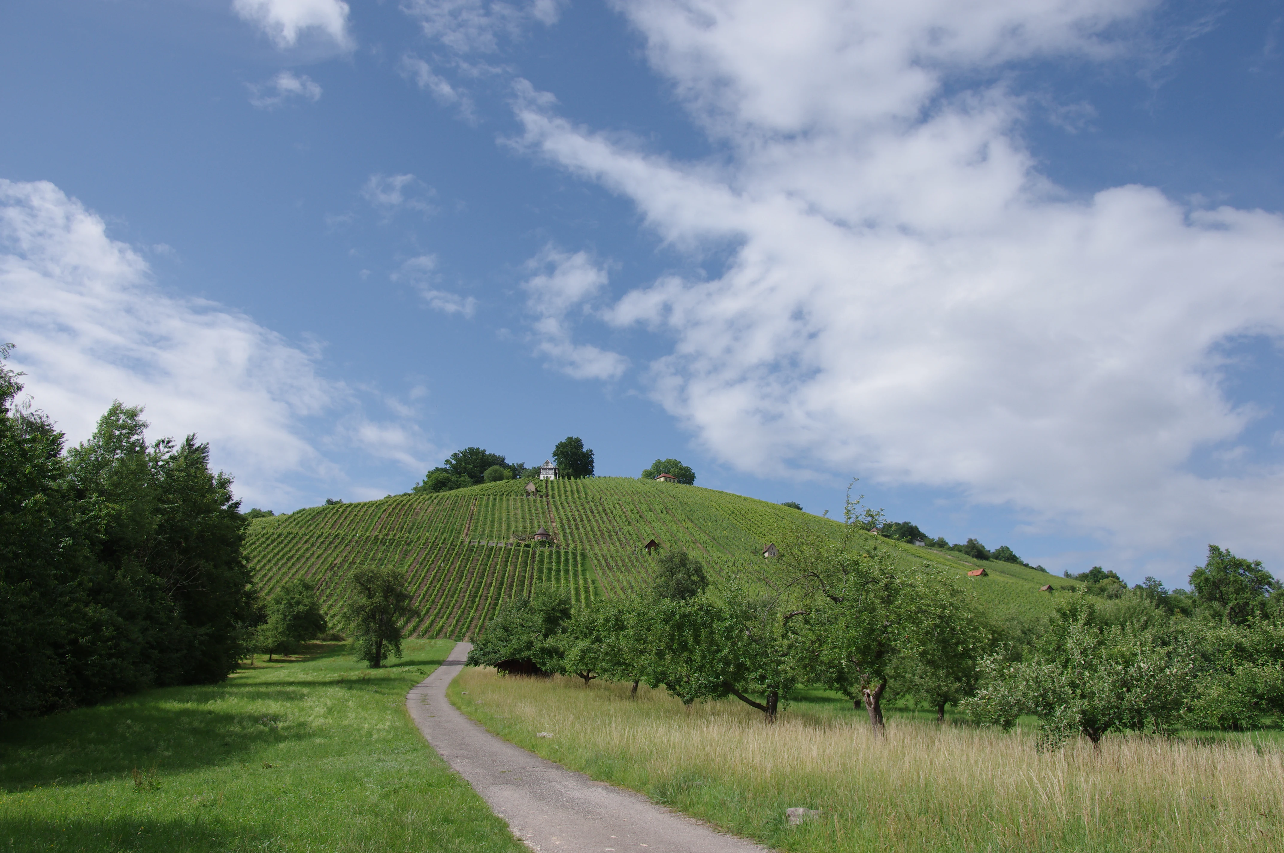
A paved path leads through a green meadow toward a steep hill cultivated with rows of vineyards under a blue sky with scattered clouds.
A scenic view of the Grafenberg hillside covered in vineyards in the Remstal region.

Zipfelbachtal, Korber Kopf, Buocher Höhe, Remstalhänge, Ramsbachtal und Grafenberg history and protected-area timeline

The protected area was created on November 4, 1968 through a Sammelverordnung, a collective ordinance, issued by the former Landratsamt Waiblingen to safeguard landscape elements across what was then Kreis Waiblingen. The ordinance was part of a broader West German effort in the 1960s to systematically catalogue and protect culturally significant landscapes before further suburban growth could erode them. The original order established the legal framework that still governs the area today.

After the administrative restructuring that created the Rems-Murr-Kreis, a new ordinance was issued by the Landratsamt Rems-Murr-Kreis on May 7, 2004. This 2004 revision adjusted the spatial scope of the protected area to reflect changes in municipal boundaries, land use, and ecological understanding. Together, the 1968 establishment and the 2004 amendment mark the main documentary milestones in the area's protection history.

The intent recorded in the ordinance has remained consistent across both versions: to preserve the diversity, character, and beauty of the landscape both for its own sake and because of its special significance for recreation; to maintain the functional capacity of the natural balance; and to safeguard the regenerative and sustainable usability of natural resources, including the habitats of characteristic wild animal and plant species. This continuity of purpose reflects the way German landscape protection has combined ecological, recreational, and cultural-heritage functions since its early postwar codification.

Zipfelbachtal, Korber Kopf, Buocher Höhe, Remstalhänge, Ramsbachtal und Grafenberg landscape and geographic character

The protected area is defined by a finely textured Keuper landscape in which elevation changes are modest but constant, producing a rhythmic alternation between valley floors, slopes, hilltops, and forest. Vineyards and orchards typically occupy the sunnier slopes, while the valley bottoms are given over to streams, wet meadows, and in places to more richly wooded riparian zones. The Keuper substrate underlying the area gives the soil a reddish to brownish character and produces the combination of well-drained slopes and moister valley floors that has long supported this mosaic of land uses.

Several topographic features give the area its identity. The Grafenberg, part of which lies within the town of Schorndorf, is one of its most recognizable hill features and is explicitly highlighted in the landscape protection area's documentation. Korber Kopf and Buocher Höhe add further elevated points, while the slopes labeled in the name as Remstalhänge, the slopes of the Rems valley, mark the lower edges that rise from the Rems itself. The valley of the Zipfelbach, mentioned first in the area's name, is the hydrological backbone of much of the protected area and is closely linked to the surrounding nature reserve.

The Ramsbachtal adds a second notable valley system and contributes to the broader valley network that drains toward the Rems. Together with smaller tributary valleys and wooded ravines, these corridors produce the structural complexity that distinguishes the area from the more continuous vineyards and orchards of the central Remstal further west.

Zipfelbachtal, Korber Kopf, Buocher Höhe, Remstalhänge, Ramsbachtal und Grafenberg ecosystems, habitats, and plant life

Ecologically, the area is best understood as a transition zone between the intensively used Remstal and the more heavily forested Schurwald and Welzheimer Wald. This position produces a habitat mosaic in which dry, warm vineyard slopes give way within short distances to cooler, damper valley habitats and then to closed forest on the higher, less accessible terrain. The result is a landscape that supports both species tied to traditional agricultural management and species that depend on relatively undisturbed woodland.

Within this mosaic, the Streuobst meadows are particularly important for biodiversity. Scattered fruit-tree meadows are a defining feature of the Swabian cultural landscape and provide nesting habitat, pollen and nectar resources, and structurally rich environments for insects, bats, and small birds. The connection of these habitats with the EU Bird Protection Area near Schorndorf underlines how the landscape protection area contributes to a much wider conservation network for orchard- and vineyard-associated species.

The woodlands on the Schurwald edge and along the deeper valley slopes add a forest layer that includes both broadleaf stands and coniferous plantations. The drift from agricultural mosaic into continuous forest, repeated across many small catchments in the area, creates the type of gradient that supports diverse ecological communities including woodland birds, bats, and a range of invertebrates tied to older trees and deadwood. The watercourses themselves, particularly the Zipfelbach, add still further microhabitats along their banks and within their narrow side valleys.

Zipfelbachtal, Korber Kopf, Buocher Höhe, Remstalhänge, Ramsbachtal und Grafenberg wildlife and species highlights

Because of the heavy presence of traditional Streuobst landscapes and the linked EU Bird Protection Area, the wildlife profile of the area is shaped strongly by bird species that depend on orchard meadows, vineyard edges, and structurally rich semi-open habitats. Orchard and vineyard landscapes in this part of Baden-Württemberg are recognized for supporting species such as various woodpeckers, owls, and other cavity-nesting birds, alongside passerines that benefit from the combination of open ground, scattered trees, and edge habitats.

The wooded slopes and side valleys of the Zipfelbach and Ramsbach systems add a forest-dwelling fauna that includes woodland birds, bats hunting along the valley corridors, and small mammals associated with both hedgerows and forest edges. As is typical of mixed cultural-forest mosaics in the region, the area also hosts a rich invertebrate community, much of which is tied to the cycle of old fruit trees, vineyard edges, and forest margins.

The landscape protection area does not function as a single ecological reserve; rather, it sustains wildlife by keeping the overall landscape matrix intact and by maintaining the smaller habitat patches that allow species to move through the terrain. Its value for wildlife is therefore as much about connectivity and continuity as it is about any individual protected species or site.

Zipfelbachtal, Korber Kopf, Buocher Höhe, Remstalhänge, Ramsbachtal und Grafenberg conservation status and protection priorities

The primary conservation significance of the area lies in its role as a wide, landscape-scale protective category under the German Nature Conservation Act. As a Landschaftsschutzgebiet, it provides legal protection against significant landscape interventions, fragmentation, and overuse, while still permitting the continuation of traditional land uses such as viticulture, orcharding, and forestry. This combination is central to the ordinance's purpose. The 2004 revision by the Rems-Murr-Kreis administration confirmed the area's continuing importance in the modern administrative geography of the region.

Beyond its own boundaries, the area contributes to a layered conservation network. Its intersection with the Streuobst- und Weinberggebiete zwischen Geradstetten, Rudersberg und Waldhausen EU Bird Protection Area gives it direct bird-conservation significance at the European level. Its relationship with the nature reserve Oberes Zipfelbachtal mit Seitenklinge und Teilen des Sonnenbergs, which the landscape protection area largely encircles, gives the stricter reserve a buffer of culturally maintained but legally protected terrain around it.

The area is also part of the broader Schurwald and Welzheimer Wald natural region, a recognized unit within the Schwäbisches Keuper-Lias-Land. By maintaining the diversity and functional capacity of this natural region, the protected area helps preserve regional ecological processes, including those tied to soil retention, water management in small catchments, and the long-term continuity of the Swabian Streuobst landscape.

Zipfelbachtal, Korber Kopf, Buocher Höhe, Remstalhänge, Ramsbachtal und Grafenberg cultural meaning and human context

The cultural dimension of the area is inseparable from its physical landscape. The villages and municipalities between Winnenden and Schorndorf have, for centuries, shaped their land use to the rhythms of the Keuper slopes: vineyards on the sun-facing hillsides, scattered fruit-tree meadows on the gentler middle slopes, fields and pasture on the valley floors, and forest reserved for the steeper, less productive ground. This pattern, often called the traditional Swabian cultivation ladder, is one of the defining features of the wider Remstal cultural landscape.

Streuobst in particular is more than an agricultural feature; it is a cultural institution in Baden-Württemberg, embedded in local identity, festivals, and food traditions. The protection of these meadows within the landscape protection area thus safeguards not only biodiversity but also a living cultural practice that connects present-day communities to their rural past. Wine-growing, similarly, has shaped the architectural appearance of slopeside villages, the road network, and even the seasonal rhythm of public life in the Rems valley towns.

The area can also be read as a rural-urban interface, since the protection ordinance maintains a buffer of culturally shaped landscape between the more densely built-up settlements of the Remstal and the wooded heights of the Schurwald beyond. This buffering function is part of why the area was originally designated in 1968, when suburban pressure around Stuttgart began to intensify.

Top sights and standout views in Zipfelbachtal, Korber Kopf, Buocher Höhe, Remstalhänge, Ramsbachtal und Grafenberg

A protected cultural landscape in the Rems-Murr-Kreis that preserves vineyards, Streuobst meadows, stream valleys, and forest in a single connected mosaic. Notable for its tight integration with a European Bird Protection Area focused on orchard and vineyard habitats and for its role as a buffer for the nature reserve along the upper Zipfelbach valley. Strongly characteristic of the Schurwald and Welzheimer Wald natural region and one of the more landscape-diverse protected areas in the eastern Stuttgart region.

Best time to visit Zipfelbachtal, Korber Kopf, Buocher Höhe, Remstalhänge, Ramsbachtal und Grafenberg

As a working cultural landscape, the area changes character meaningfully through the year. Late spring is the classic time to see the Streuobst meadows in blossom, when the fruit trees fill valley slopes and mid-slopes with white and pink flowers and the air above the meadows is active with insects and returning birds. Summer brings the green concentration of vineyards, orchards, and forests, and is the most reliable season for walking the network of paths connecting villages, viewpoints, and valley corridors.

Autumn is arguably the most distinctive season for visitors interested in the agricultural character of the area. The vineyards turn color ahead of harvest, fruit is gathered from the orchards, and the forested heights such as the Grafenberg take on the russet tones typical of mixed Swabian forests. Winter is quieter and more structurally clear: the absence of foliage reveals the topographic contrast between gentle valley floors and steeper slopes, and the bare fruit-tree meadows show the network of old trunks and the traditional structure of the cultural landscape.

Monthly climate preview

Long-term monthly climate patterns measured across representative park terrain in Baden-Württemberg

Annual Temperature and Precipitation Normals for Zipfelbachtal, Korber Kopf, Buocher Höhe, Remstalhänge, Ramsbachtal und Grafenberg

Representative coordinate records show measured monthly temperature variations alongside steady precipitation averages throughout the year. Examining the full twelve-month profile provides complete historical climate normals for detailed environmental comparison.
Annual mean9 °C
0 °C20 °C
Jan
Feb
Mar
Apr
May13°
Jun17°
Jul20°
Aug20°
Sep15°
Oct10°
Nov
Dec
Warmest month
July

19.6 °C

Coolest month
January

-0.2 °C

Wettest month
July

2.7 mm/day

Driest month
April

1.6 mm/day

Park location guide

Geography guide, regional context, and park location map for Zipfelbachtal, Korber Kopf, Buocher Höhe, Remstalhänge, Ramsbachtal und Grafenberg

Zipfelbachtal, Korber Kopf, Buocher Höhe, Remstalhänge, Ramsbachtal und Grafenberg park geography, regions, and map view in Germany

Understand where Zipfelbachtal, Korber Kopf, Buocher Höhe, Remstalhänge, Ramsbachtal und Grafenberg sits in Germany through a broader geographic reading of the surrounding landscape, nearby location context, and its mapped position within the national park landscape.

How Zipfelbachtal, Korber Kopf, Buocher Höhe, Remstalhänge, Ramsbachtal und Grafenberg fits into Germany

Germany is a federal republic in Western and Central Europe with a population of over 83 million across sixteen constituent states. It is Europe's largest economy by nominal GDP and a major global exporter and importer. The capital is Berlin, and the country borders Denmark, Poland, Czech Republic, Austria, Switzerland, France, Luxembourg, Belgium, and the Netherlands.

Wider geography shaping Zipfelbachtal, Korber Kopf, Buocher Höhe, Remstalhänge, Ramsbachtal und Grafenberg in Germany

Germany is located in Western and Central Europe, spanning 357,022 km². It borders Denmark to the north, Poland and the Czech Republic to the east, Austria and Switzerland to the south, and France, Luxembourg, Belgium, and the Netherlands to the west. The country has coastlines on the Baltic Sea and North Sea to the north, with the Alps located in the southern region.

Map view of Zipfelbachtal, Korber Kopf, Buocher Höhe, Remstalhänge, Ramsbachtal und Grafenberg

Use this park location map to pinpoint Zipfelbachtal, Korber Kopf, Buocher Höhe, Remstalhänge, Ramsbachtal und Grafenberg in Germany, understand its exact geographic position, and read its mapped placement within the surrounding landscape more clearly.

Pigeon | © OpenStreetMap contributors

Location context for Zipfelbachtal, Korber Kopf, Buocher Höhe, Remstalhänge, Ramsbachtal und Grafenberg

Baden-Württemberg

Visualizing the terrain, vineyards, and protected habitats of the Swabian Keuper landscape

Zipfelbachtal, Korber Kopf, Buocher Höhe, Remstalhänge, Ramsbachtal und Grafenberg Landscape Photos and Scenery

Photographic records capture the mosaic of vineyards, traditional orchard meadows, and forested heights that define the protected landscape. Visualizing these Keuper valley systems and ridge formations clarifies the ecological structure and topographic diversity of the region.

A paved path leads through a green meadow toward a steep hill cultivated with rows of vineyards under a blue sky with scattered clouds.

Park atlas

Compare adjacent protected landscapes and regional valley terrain in Baden-Württemberg

Explore Other Parks Near Zipfelbachtal, Korber Kopf, Buocher Höhe, Remstalhänge, Ramsbachtal und Grafenberg

Browsing other protected areas near Zipfelbachtal, Korber Kopf, Buocher Höhe, Remstalhänge, Ramsbachtal und Grafenberg reveals connected Swabian Keuper habitats and neighboring valley ecosystems. Examining these adjacent reserves provides valuable geographic context for understanding regional conservation networks across the Rems valley.
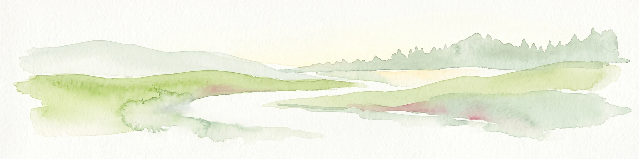
A horizontal watercolor painting showing soft, rounded green hills and a treeline against a pale background.
Protected landscapeBaden-Württemberg
About 8 km away#1 closest

Southeast

Ottilienberg Protected Landscape: Geomorphological Identity and Regional Mapping

A distinct Keuper outlier hill within Baden-Württemberg

The Ottilienberg protected landscape is a landmark Keuper Zeugenberg situated on the southern outskirts of Schorndorf. This compact area features a striking oak-dominated woodland crest and traditional orchard meadows, serving as a key example of a preserved cultural-historic landscape in southwestern Germany.

Area
0.083 km²
Established
1968
IUCN
V
Relief
Upland
Protected landscapeBaden-Württemberg
About 9.3 km away#2 closest

West

Unteres Remstal mit Randgebieten Protected Landscape and Regional Geographic Map

Mapping the cultural landscapes of Baden-Württemberg

Unteres Remstal mit Randgebieten represents a key protected landscape in Baden-Württemberg, encompassing the lower Rems river valley. This area preserves a rich mosaic of traditional orchard meadows, scrubby wastelands, and transitional slope reliefs that connect the valley floor to the rising Gäu plateau, forming a vital buffer for regional habitat connectivity.

Area
2.5 km²
Established
1987
IUCN
V
Relief
Lowland
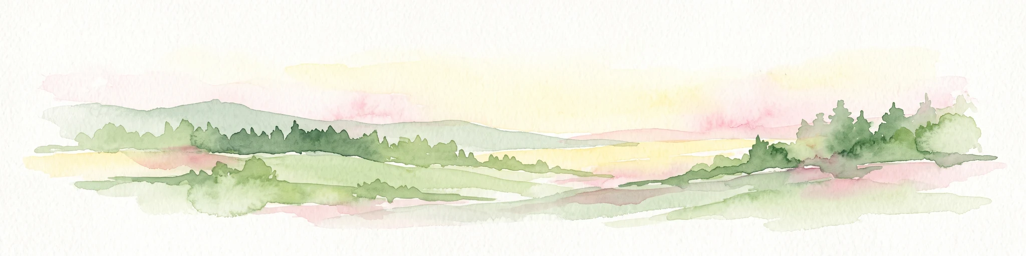
A watercolor painting of a gentle, rolling landscape with soft green hills, forests, and a light-filled sky.
Protected landscapeBaden-Württemberg
About 12 km away#3 closest

West

Hartwald mit Umgebung Protected Landscape and Regional Geographic Map Context

Forested hill topography and traditional orchard landscapes in Baden-Württemberg.

The Hartwald mit Umgebung protected area provides a focal point for understanding regional geography in the Neckar basin. Defined by a forested summit rising above loess plains, the protected landscape preserves valuable stream corridors and ancient burial mounds. This site serves as a vital case study in geological relief inversion and the preservation of culturally shaped natural terrain near the Rems and Neckar river confluence.

Area
2.025 km²
Established
1968
IUCN
V
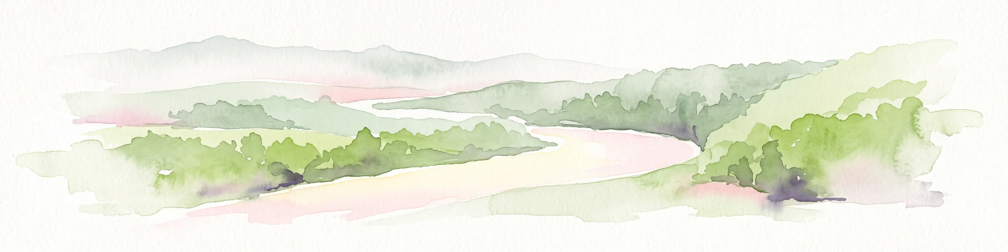
A soft watercolor painting showing a pale river curving through green hills and vegetation.
Protected landscapeBaden-Württemberg
About 14 km away#4 closest

Northwest

Neckartal zwischen den Neckarbrücken von Hochberg und Neckarweihingen Protected Landscape Overview

A detailed geographic look at the Neckar river valley and its surrounding terrain.

Analyze the protected landscape boundaries of the Neckar valley between Hochberg and Neckarweihingen. This area features a complex mosaic of renaturalized river floodplains, traditional terraced vineyards with stone walls, and wooded edge habitats in the Ludwigsburg district of Baden-Württemberg.

Area
3.803 km²
Established
1988
IUCN
V
Relief
Lowland
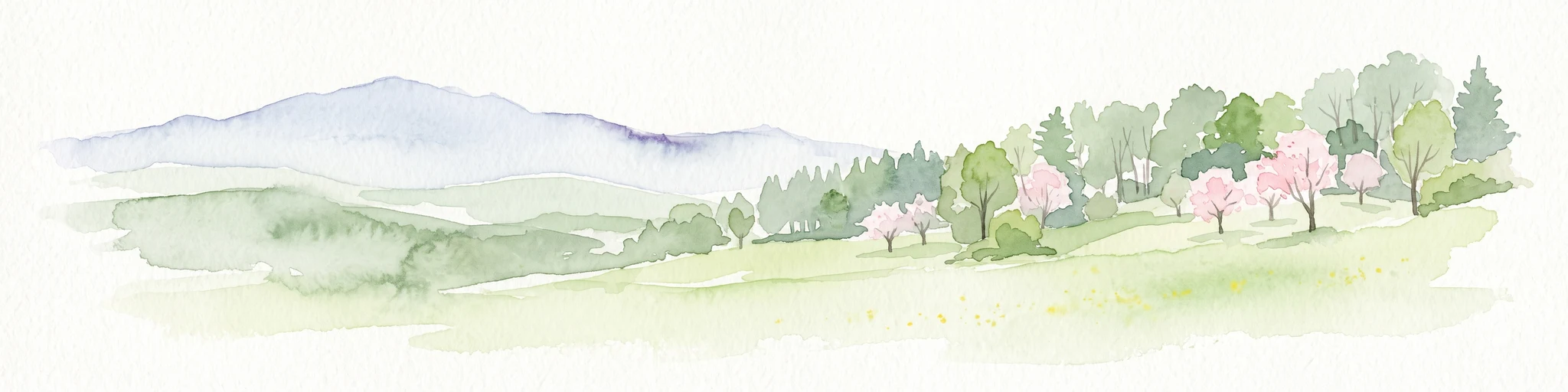
A watercolor painting showing a soft green landscape with rolling hills, a distant mountain range, and flowering trees.
Protected landscapeBaden-Württemberg
About 14 km away#5 closest

Southeast

Nassachtal Protected Landscape: Geographic Overview and Mapped Terrain in Baden-Württemberg

Conservation geography of the Nassach stream catchment area.

Covering the full extent of the Nassach valley in southwestern Germany, this protected landscape serves as a critical ecological link between forest and agricultural zones. The terrain encompasses a typical Swabian hill country profile with incised stream valleys and wooded ridges, securing natural continuity across the Schurwald and Welzheimer Wald regions.

Area
21.666 km²
Established
1982
IUCN
V
Relief
Upland
Protected landscapeBaden-Württemberg
About 14 km away#6 closest

Northeast

Landschaftsschutzgebiet Murrhardter Wald: Protected Landscape and Regional Geography

Keuper forest formations in the Rems-Murr-Kreis region

Spanning over 2,000 hectares across multiple municipal territories, the Landschaftsschutzgebiet Murrhardter Wald protects an intact forest and valley system in the eastern Swabian hill country. The mapped geography highlights a complex interplay of forested heights and narrow valley cuts, serving as a critical example of protected countryside land use in southwestern Germany.

Area
23.403 km²
Established
1971
IUCN
V
Relief
Upland
Protected landscapeLandkreis Esslingen
About 15 km away#7 closest

South

Wernau (Neckar) Protected Landscape: Geographic Overview and Mapped Cultural Terrain

Landscape protection area within the Landkreis Esslingen region

Trace the boundaries of the Wernau (Neckar) protected landscape, an ecologically significant mosaic of meadow orchards, riparian vegetation, and small woodlands. Situated in the Landkreis Esslingen of Baden-Württemberg, this area functions as a critical buffer zone that maintains the continuity of local habitats between the Filder plain and the Swabian Alb foothills.

Area
2.27 km²
Established
1995
IUCN
V
Protected landscapeBaden-Württemberg
About 16 km away#8 closest

West

Zuckerberg-Muckensturm Protected Landscape: Geography and Cultural Viticulture Heritage

Exploring the Neckar valley slopes in Baden-Württemberg

Zuckerberg-Muckensturm represents a vital cultural landscape on the outskirts of Stuttgart, characterized by its historical vine-growing terraces and exposed Muschelkalk limestone cliffs. The area serves as a significant case for studying regional earth history and the interplay between urban-adjacent land use and natural geological monuments within the Neckar river valley.

Area
0.505 km²
Established
1987
IUCN
V

Common questions about visiting, size, designation, and location context for Zipfelbachtal, Korber Kopf, Buocher Höhe, Remstalhänge, Ramsbachtal und Grafenberg

Zipfelbachtal, Korber Kopf, Buocher Höhe, Remstalhänge, Ramsbachtal und Grafenberg FAQs for park facts, access, geography, and protected area context

Find quick answers about Zipfelbachtal, Korber Kopf, Buocher Höhe, Remstalhänge, Ramsbachtal und Grafenberg, including protected-area facts, park geography, trail and visitor context, and how the park fits into its surrounding country and regional landscape.
MoriAtlas Explorer

Continue Your Protected Areas Search Across the Global Atlas

Deepen your exploration by continuing the structured search for national parks and protected areas worldwide. Utilize the comprehensive filtering capabilities to compare different conservation landscapes and refine your understanding of global park geography. Discover more about the distribution and characteristics of protected natural areas.

Global natural geography