
Mori Atlas logo
Protected landscapeAarelandschaft bei Klingnau

A vital ecological corridor featuring floodplain forests, alluvial channels, and diverse avian habitats along the Aare River.

Aarelandschaft bei Klingnau: Exploring the Protected Riverine Landscapes and Wetland Geography of Aargau

(Aarelandschaft bei Klingnau (BLN-Objekt Nr. 1109))

The Aarelandschaft bei Klingnau stands as a major protected landscape in the canton of Aargau, marking the final stretch of the Aare River before its confluence with the Rhine. This area forms a complex mosaic of reservoir waters, alluvial forest, reedbeds, and wet meadows, recognized for its status as an Important Bird and Biodiversity Area. Through these mapped boundaries, observers can trace the intersection of historical river correction works and modern floodplain restoration efforts that support migratory birds and rare flora.

protected landscaperiver floodplainhydroelectric reservoirwetlandwaterbird habitatImportant Bird Area
A flat-style digital illustration showing a calm lake surrounded by mountains, evergreen trees, and a small waterfall cascading down a cliffside under a pastel-colored sky.

Aarelandschaft bei Klingnau

Protected landscape

Park overview

Structured park overview, official facts, and landscape profile for Aarelandschaft bei Klingnau

Aarelandschaft bei Klingnau park facts, protected area profile, and essential visitor context

Review the core facts for Aarelandschaft bei Klingnau, including designation, size, terrain, visitor scale, habitats, and operating context in one park-focused overview.

About Aarelandschaft bei Klingnau

The Aarelandschaft bei Klingnau protects a 360-hectare river and reservoir landscape at the very end of the Aare, where Switzerland's largest interior river empties into the Rhine at the border near Koblenz. The protected area is part object 1109 in the Federal Inventory of Landscapes and Natural Monuments of National Importance (BLN), a status it has held since 1996. It lies in the canton of Aargau, in the district of Zurzach, encompassing parts of the communities of Böttstein, Döttingen, Klingnau, Koblenz, and Leuggern.

The area is a transitional zone between the Swiss Mittelland and the High Rhine, set in a widened breakthrough valley cut through the Tabular Jura by glacial and fluvial action. Although much of its appearance is shaped by human activity, including river regulation, a hydroelectric dam, agricultural land, roads, and settlements, the protected landscape combines open water, surviving floodplain remnants, reedbeds, wet meadows, dry slopes, and alluvial forest into a habitat mosaic of considerable ecological value.

Ecologically, the Aarelandschaft bei Klingnau is most significant for its birdlife. The Klingnauer Stausee, together with the adjoining Aare stretch and floodplain waters, forms the international Important Bird Area 'Aarestau Klingnau', recognized since the late 1970s for hosting major concentrations of ducks, shorebirds, and other waterbirds. The same area is a designated Ramsar site and is part of the Auenschutzpark Aargau, integrating it into a larger floodplain conservation strategy along the Aare.

Beyond its wildlife importance, the protected landscape also plays a role in regional recreation, cycling and hiking routes, waterway transport infrastructure, and the cultural identity of the Zurzach region. It sits at the intersection of several major habitat corridors between the Black Forest, the northern Jura, and the riverine wetlands of the High Rhine, and remains an active focus of conservation, restoration, and environmental management in northern Switzerland.

Quick facts and research context for Aarelandschaft bei Klingnau

The Aarelandschaft bei Klingnau lies in the canton of Aargau in northern Switzerland, along the last four kilometers of the Aare before the river meets the Rhine at Koblenz. The BLN object covers 360 hectares, with an additional 112 hectares within the protected area designated as nationally important alluvial floodplain under the name Auenreste Klingnauer Stausee.

The landscape is classified as IUCN Category V (Protected Landscape/Seascape) and has been part of the federal BLN inventory since 1996. It is also part of the Auenschutzpark Aargau floodplain protection project and includes water bodies and habitat zones that together form around 170 hectares of internationally important waterbird habitat known as Aarestau Klingnau.

Geologically, the area sits in a widened breakthrough valley in the Tabular Jura, with a relatively flat alluvial floor at roughly 317 meters above sea level. The Aare itself averages about 525 cubic meters per second at the confluence, making it hydrologically the main branch of the upper Rhine system at the point of junction.

Protection and recognition

Documented terrestrial protection scope and management parameters for Aarelandschaft bei Klingnau

Aarelandschaft bei Klingnau Protection Status and Recognition Data

Aarelandschaft bei Klingnau maintains a documented terrestrial protection scope without imported international recognition sources. Review official designation records and administrative context for this protected natural landscape.

Protection details

Protection scope
Terrestrial
Transboundary protection
No
Park context

Deeper park guide and search-rich context for Aarelandschaft bei Klingnau

Aarelandschaft bei Klingnau history, landscape, wildlife, and travel context

Explore Aarelandschaft bei Klingnau through its history, landscape character, ecosystems, wildlife, conservation priorities, cultural context, and seasonal travel timing in a structured park guide built for atlas discovery and search intent.

Why Aarelandschaft bei Klingnau stands out

The Aarelandschaft bei Klingnau is best known as one of Switzerland's most important waterbird and migratory bird sites, centered on the Klingnauer Stausee reservoir. The combination of open water, shallow silt-rich bays, reedbeds, and adjacent wet meadows creates resting, wintering, and breeding habitat for ducks, geese, swans, grebes, and numerous shorebirds along a major European migration corridor. Equally defining is the area's character as a partly artificial, partly natural riverine landscape. Large stretches of alluvial forest, surviving gravel banks, side channels like the Gippinger Grien, and partly renaturalized floodplain sections give the protected area its ecological value, while the historical Aare correction and the Klingnau hydroelectric station since the 1930s shaped the present-day mosaic of water, agricultural land, settlement, and infrastructure. The site is also recognized as a Ramsar wetland and an Important Bird and Biodiversity Area. More than 300 bird species have been documented here, including nationally rare breeders and seasonal visitors such as the white stork, osprey, bluethroat, ferruginous duck, and even occasional greater flamingos, an unusually southern visitor for inland Switzerland.
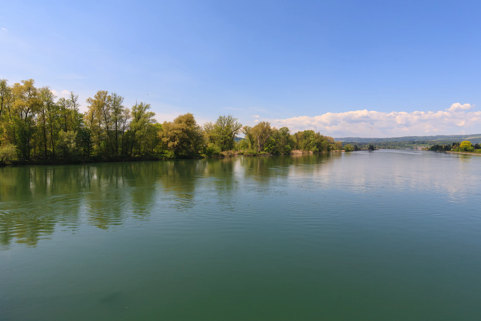
A wide, calm reservoir reflecting a clear blue sky, bordered by a dense line of trees on the left bank.
The Klingnauer Stausee reservoir, a key feature of the Aarelandschaft bei Klingnau protected area.

Aarelandschaft bei Klingnau history and protected-area timeline

Although the ecological richness of the Aare floodplain near Klingnau was recognized early in the 20th century by the botanist and politician Rudolf Siegrist, formal protection came only after decades of effort. The first national inventory of valuable Swiss landscapes, the KLN inventory, was compiled privately in the late 1950s and revised in 1979, when the Aarelandschaft bei Klingnau was finally included as object 1.16. The area became BLN object 1109 in 1996.

A key turning point was the construction of the Klingnau hydroelectric power station between 1931 and 1935. Completed under a 1929 concession, the dam raised the Aare by 6.1 meters, creating the approximately one-square-kilometer Klingnauer Stausee that now defines the landscape. Though originally an industrial intervention, the reservoir quickly proved extraordinarily valuable for waterbirds, prompting the first calls for protection and the eventual purchase of hunting leases by Switzerland's national nature conservation organization in the 1950s.

The canton of Aargau issued the key legal protection, the Decree on the Protection of the Klingnauer Stausee and its Surroundings, on 17 May 1988, effective from 1 July 1989. This divided the area into a nature protection zone, a landscape protection zone, and a power station zone. The waterbird and migratory bird reserve was officially designated in 1991, and additional national inventories added alluvial floodplain (1992), flat moor (1994), and amphibian breeding (2001) designations. In 2018, the canton granted a new hydroelectric concession running until 2075, tied to binding ecological compensation measures by Axpo Power and AEW Energie.

Aarelandschaft bei Klingnau landscape and geographic character

The protected landscape occupies a broad, flat valley floor carved through the Tabular Jura of northern Switzerland, where the Aare makes the final stretch of its journey before joining the Rhine. Quartz-rich sediments and ancient gravel terraces give the area its gentle, open character, while the surrounding landscape rises into the limestone ridges of the Zurzacherberg and the low Full-Reuenthal hills.

The most prominent feature is the Klingnauer Stausee, an artificial reservoir about three kilometers long, up to 500 meters wide, and covering roughly one square kilometer. Side dams raise the water level by several meters above the surrounding floodplain, creating a perched lake whose mirror reflects the Jura hills. Gravel banks and small islands have formed in the more dynamic sections of the Aare itself, while the historic Umberau island, once the largest gravel island in the Aare, was largely removed during the late-19th-century river correction.

Around the water, the landscape varies sharply. Wet reedbeds and marshy shallows dominate the southwestern bay, while mixed alluvial forest, dry embankment slopes, and isolated patches of former Ried and dry meadow line parts of the reservoir's edge. On the wider floodplain, the Gippinger Grien and the Koblenz Giriz preserve older channel traces and side streams, with the Leuggernbach and other small brooks emerging from groundwater. Cultivated fields and pastures form broad buffer zones between settlements and the more sensitive natural areas.
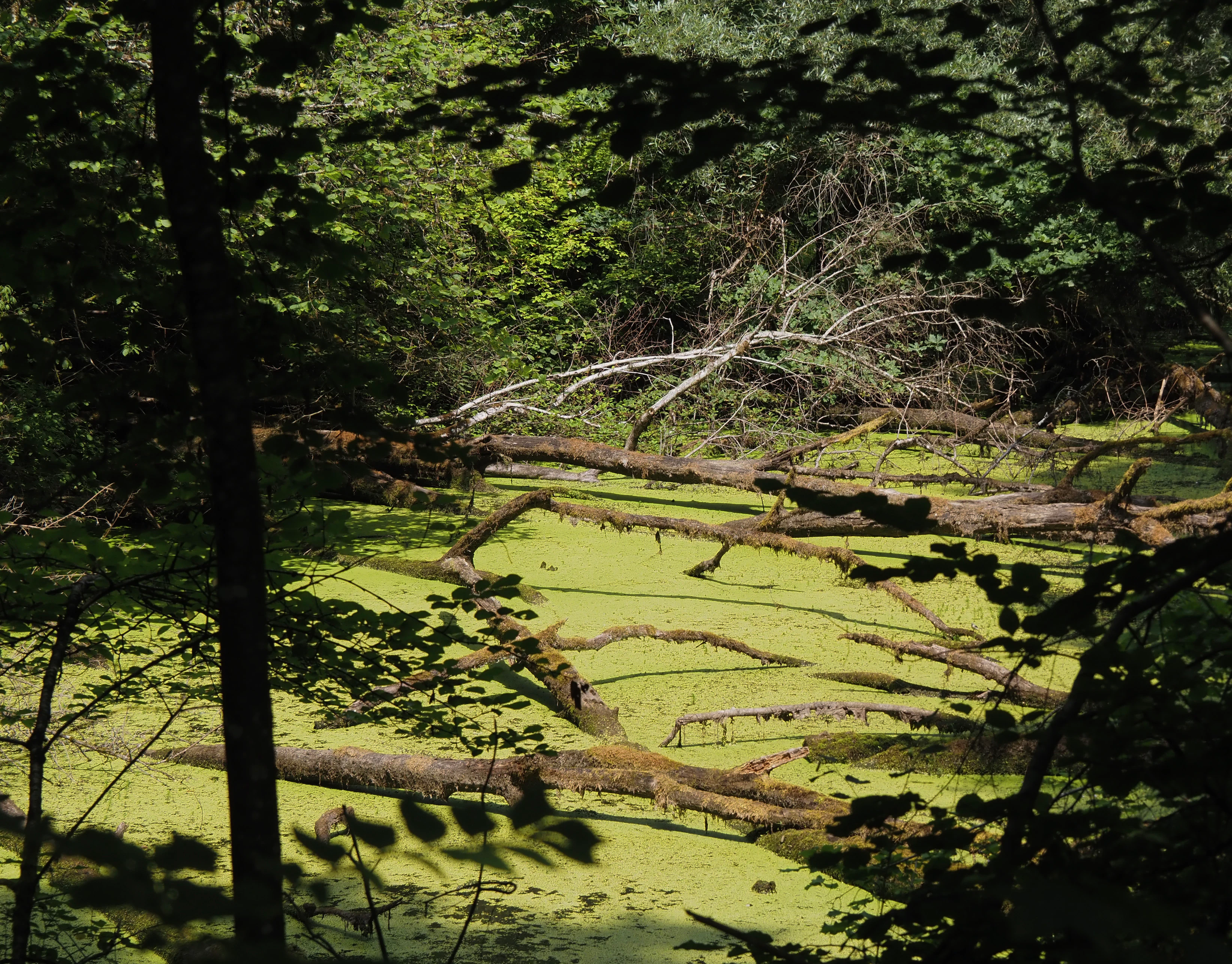
A small pond covered with bright green duckweed and criss-crossing fallen tree trunks, viewed through silhouetted trees in a shaded forest setting.
A shaded pond covered in green duckweed with fallen tree trunks in the Giriz nature reserve.

Aarelandschaft bei Klingnau ecosystems, habitats, and plant life

The Aarelandschaft bei Klingnau supports an unusually diverse mosaic of habitats compressed into a small area. The artificial Klingnauer Stausee, the surviving side channels, the heavily silted southwestern bay, and the river stretches of the lower Aare together create a chain of open-water, reedbed, marsh, wet meadow, and dry grassland environments.

The vegetation reflects this diversity. The wet zones harbor reed communities with reed sweet-grass, bulrush, sedge meadows, and patches of yellow water-lily, while drier areas support silver-willow alluvial forest with black poplar, black alder, pedunculate oak, and increasingly rare elements such as mature sea-buckthorn and a few surviving mountain pines from earlier gravel bars. Embedded within the floodplain are remains of the old Machme oxbow, the Gippinger Grien wetland forest, and the Giriz near Koblenz, where deadwood and open water maintain small but valuable habitats for amphibians, dragonflies, and bats.

Over time, this habitat mosaic has been steadily altered by sedimentation, which since the 1930s has transformed much of the shallow reservoir margin into a succession of reedland and alluvial woodland. Conservation management, including dredging campaigns from 2025 onward, seeks to maintain open water, while controlled grazing with water buffalo helps keep some of the wet meadows open. Invasive species such as black locust, Himalayan balsam, and red-breasted merganser are actively managed.
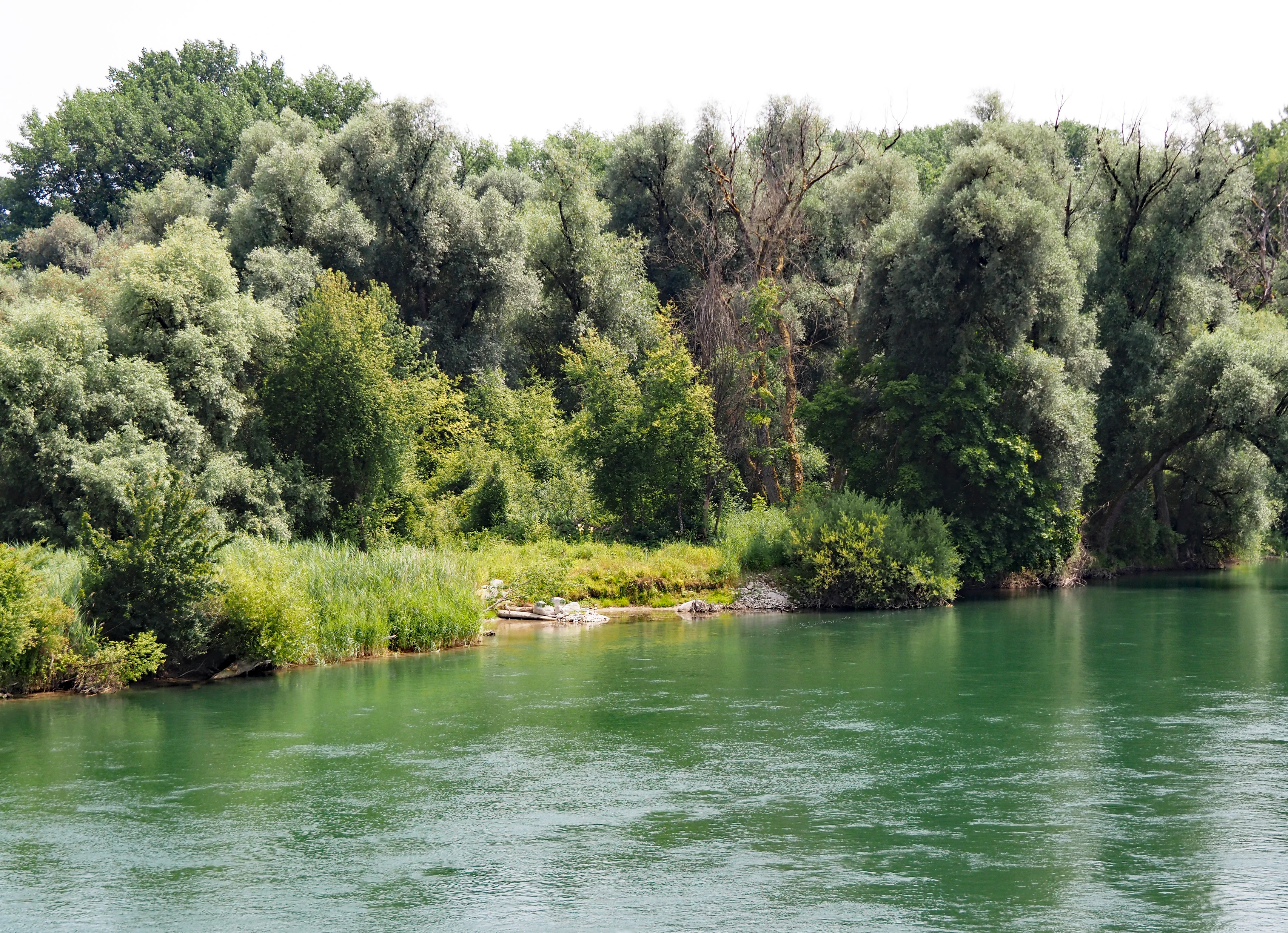
A calm green river flowing past a dense forest with a variety of willow and deciduous trees along the shore.
The lush riparian vegetation along the banks of the Aare River within the Giriz nature reserve.

Aarelandschaft bei Klingnau wildlife and species highlights

The Aarelandschaft bei Klingnau is one of Switzerland's most important sites for waterbirds and migratory birds, with more than 300 species recorded over time. The combination of open water, shallow mudflats, reedbeds, and adjacent wet meadows provides habitat for breeding, moulting, wintering, and resting populations throughout the year.

Ducks dominate the bird community, with species such as Eurasian wigeon, northern pintail, garganey, common pochard, and ferruginous duck wintering or pausing here in significant numbers. Mute swans, grebes including great crested and black-necked, common coots, greylag geese, and, more recently, large flocks of the invasive ruddy shelduck also feature prominently. In dry summers and winters, occasional rarities such as the white stork, osprey, and white-tailed eagle appear. The reservoir has even hosted short-term greater flamingo gatherings, confirming its role as a major node on the European flyway.

The surrounding forests and wet meadows support a rich community of songbirds, raptors, and owls, including wryneck, golden oriole, kingfisher, and savi's warbler. Amphibians are also strongly represented: nearly all of the twelve amphibian species documented in the canton of Aargau, including crested newt, fire salamander, and yellow-bellied toad, occur in or near the protected area. Fish fauna includes the endangered bitterling and the critically endangered nase, although both face pressure from the invasive round goby, which has prompted closures of fish passages at the Klingnau dam.
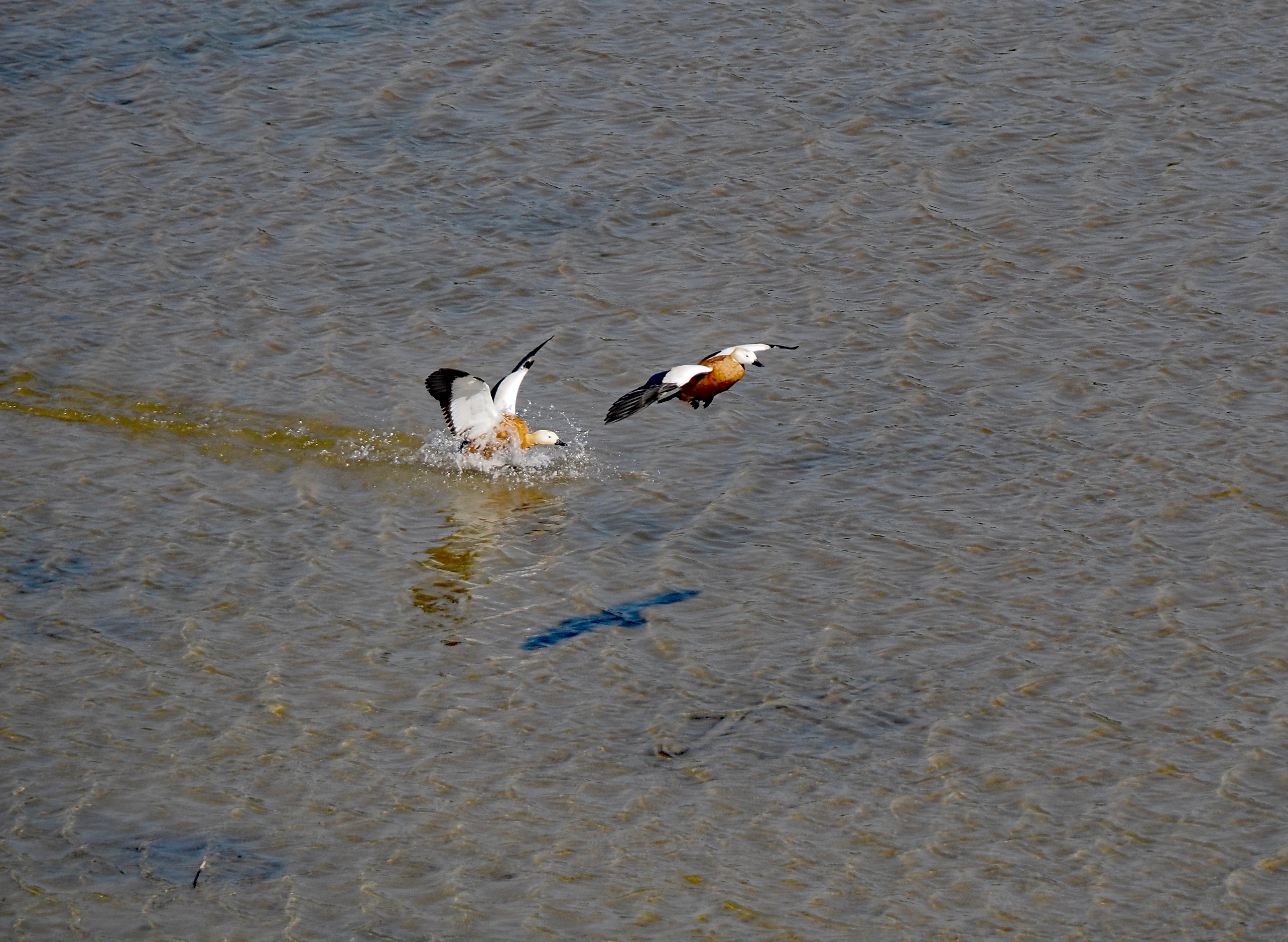
Two ruddy shelducks flying over the surface of a reservoir, with one bird landing and creating a splash.
Ruddy shelducks in flight over the waters of the Klingnauer Stausee.

Aarelandschaft bei Klingnau conservation status and protection priorities

The Aarelandschaft bei Klingnau is protected through a layered system of national and cantonal instruments. It is part of the Federal Inventory of Landscapes and Natural Monuments of National Importance (BLN object 1109), a UNESCO-recognized Ramsar wetland, and an internationally designated Important Bird and Biodiversity Area. Additional designations cover alluvial floodplain, flat moor, and amphibian spawning areas of national importance.

At the cantonal level, the Decree on the Protection of the Klingnauer Stausee and its Surroundings (1988, effective 1989) is the central legal instrument, defining a nature protection zone, a landscape protection zone, and a power station zone within the BLN area. Pro Natura, BirdLife Switzerland, and the regional nature conservation association Aare-Rhein manage additional smaller reserves, while the Auenschutzpark Aargau integrates the site into a larger Aare floodplain conservation strategy.

Conservation challenges are significant and ongoing. Sedimentation is gradually converting the reservoir into reedbed and alluvial forest, with a major dredging program underway in 2025 to recover open water. Contaminated sediments from decades of upstream pollution require careful remediation under a 2020 court order. New or expanded compensation measures, agreed as part of the renewed hydroelectric concession in 2018, include a new Aare side channel, a wet area for waterbirds, renaturalized embankments, and nesting walls for sand martins. Monitoring by the BirdLife Nature Centre Klingnauer Stausee, in operation since 2019, coordinates long-term surveys, public engagement, and management actions.

Aarelandschaft bei Klingnau cultural meaning and human context

The Aarelandschaft bei Klingnau carries a layered cultural identity shaped by centuries of human use of a floodplain landscape. The town of Klingnau itself was founded in the alluvial lowland around 1240 by Ulrich II of Klingen, and the area's medieval and early modern history is marked by river shipping, rafting, ferry crossings, and defensive structures built during the Second World War, some of which survive as military-historical monuments inside the protected zone.

Religious and folk traditions are also embedded in the landscape. A bronze statue of Saint Nicholas, patron of raftsmen, by Ernst Suter stands on the Döttingen bridge at the southern edge of the protected landscape, while a bronze figure of Saint Verena by Eduard Spörri, near the power station road, commemorates the legendary late-antique patron saint of boatmen and fishers who, according to local tradition, travelled the Aare to a settlement near the Rhine. Old place names such as Grien, Machme, and Umberau remain in everyday use, recalling the pre-regulation gravel islands and river arms.

Today, the area's cultural role is increasingly framed by recreation and environmental education. Cycling routes such as the Rhine Route and the Aare Route, hiking trails including the barrier-free Klingnauer Uferweg, and the BirdLife Nature Centre with its exhibition building, adventure trail, and observation tower invite visitors to engage with the landscape's natural and human history. Annual events such as the EuroBirdwatch day and the long-running Stauseelauf organized by the Veloclub Gippingen since 1979 connect the community to the reservoir.
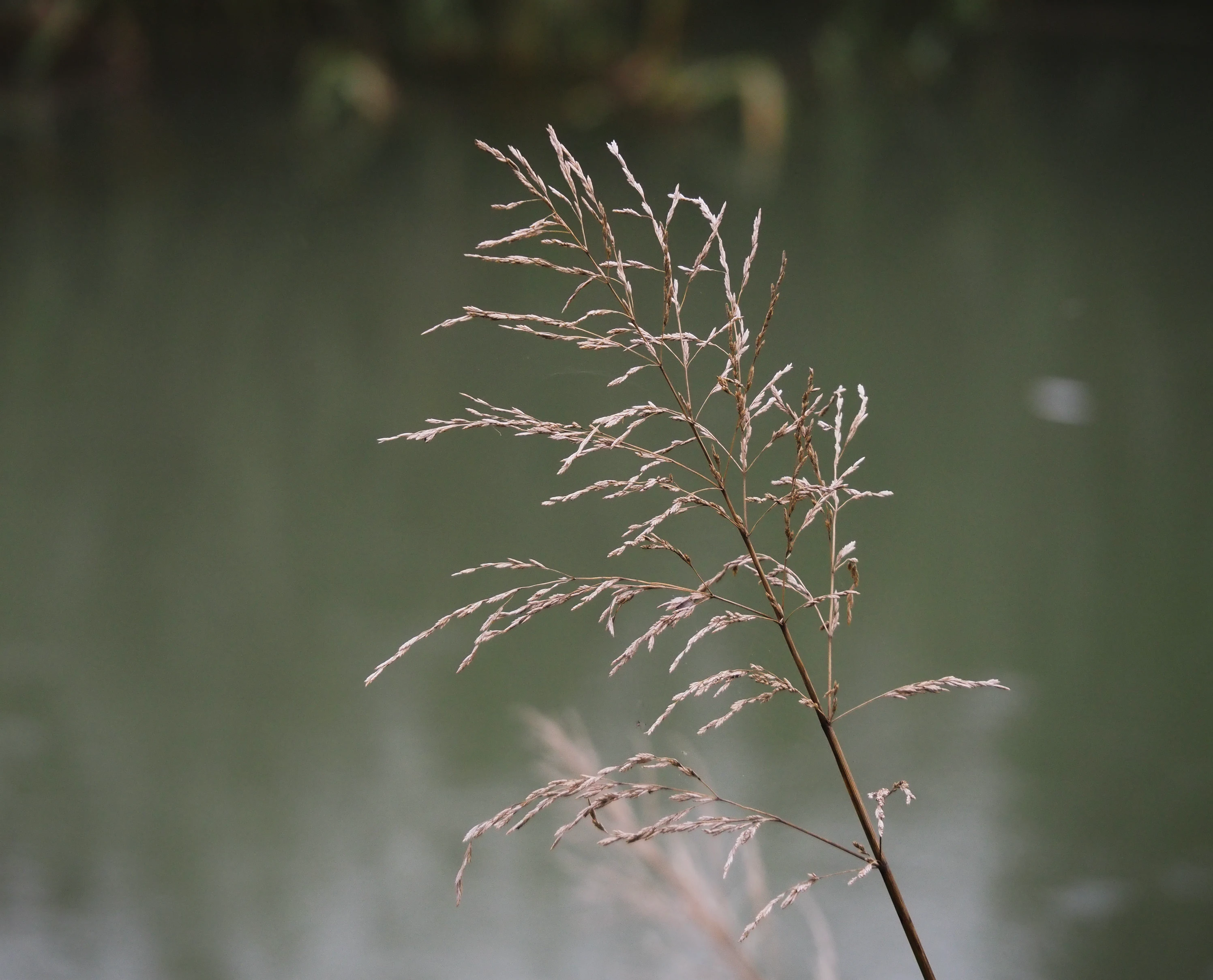
A close-up photograph of a single stalk of Glyceria maxima grass featuring a slender seed head, positioned in the foreground against a blurred, dark water background.
A close-up view of Glyceria maxima seed heads against the water at Klingnauer Stausee.

Top sights and standout views in Aarelandschaft bei Klingnau

The Aarelandschaft bei Klingnau stands out for the extraordinary concentration of birdlife packed into a small, partly artificial riverine landscape, with more than 300 bird species documented at or near the Klingnauer Stausee. The reservoir is recognized internationally as an Important Bird and Biodiversity Area and as a Ramsar wetland, anchoring the site in global frameworks of wetland and migratory bird protection.

Equally distinctive is the layered protection system: BLN national landscape status, national alluvial floodplain, flat moor, and amphibian designations, combined with a cantonal decree and active management by Pro Natura, BirdLife Switzerland, and the Auenschutzpark Aargau. The 2019 BirdLife Nature Centre with its accessible visitor infrastructure represents one of Switzerland's most prominent wetland education sites.

The protected landscape is also a striking example of a historically worked-over floodplain that retains high ecological value. Gravel terraces, surviving oxbows like the Machme, dense alder-willow forest in the Gippinger Grien and Giriz, and the visible imprint of the late-19th-century Aare correction and 1930s Klingnau hydroelectric scheme together tell the story of a river landscape shaped over more than a century but still functioning as a living ecological corridor along the High Rhine.
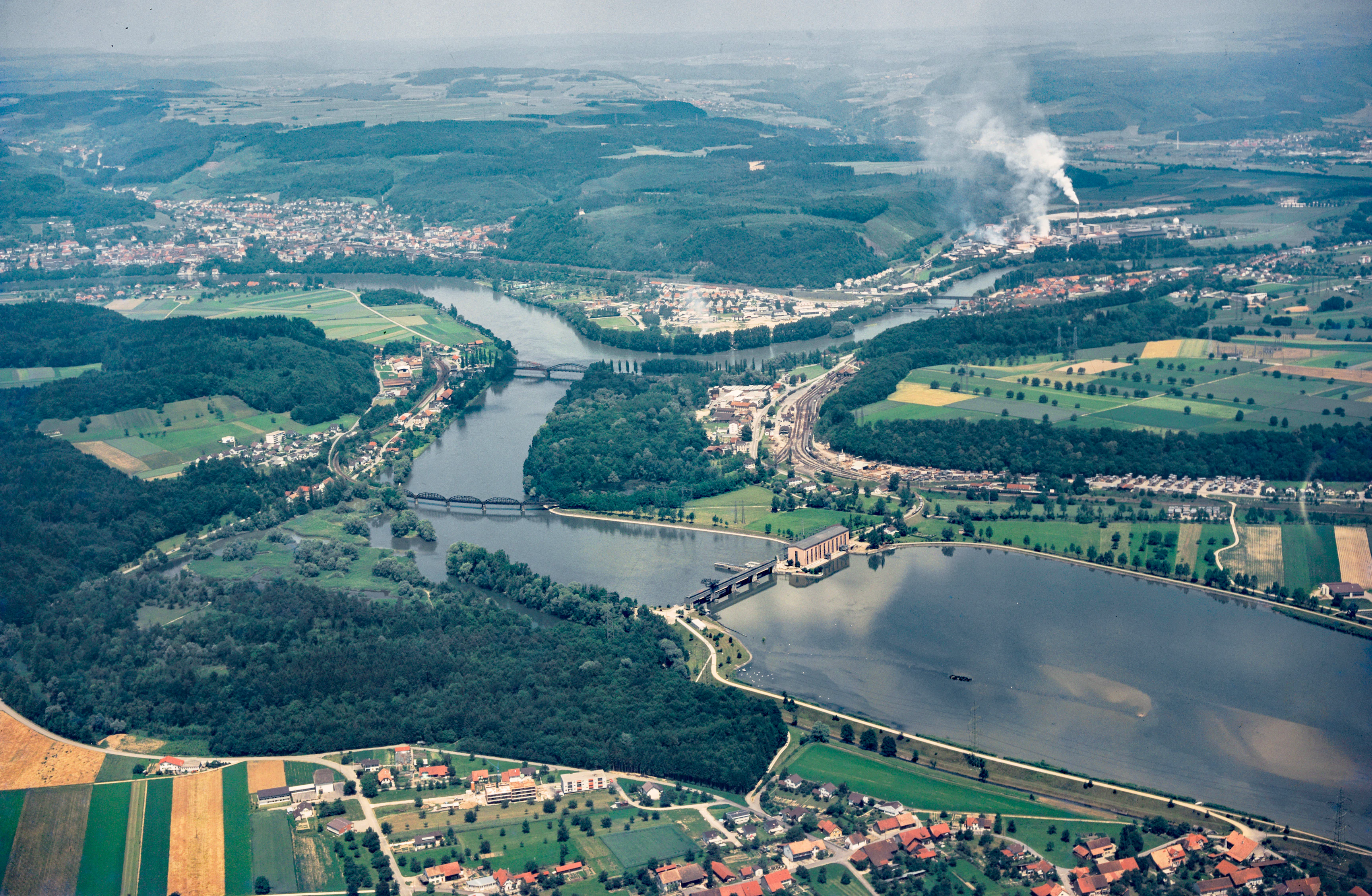
An aerial view showing a wide river landscape in Switzerland featuring the Klingnau power plant, forested riverbanks, agricultural fields, and small residential settlements.
Aerial view of the river landscape, the Klingnau power plant, and the Gippinger Grien nature reserve in the Aarelandschaft bei Klingnau area.

Best time to visit Aarelandschaft bei Klingnau

Spring and autumn are the most rewarding seasons for visiting the Aarelandschaft bei Klingnau. Spring brings migrating waterbirds returning from the south, the start of the breeding season for many species in the reedbeds and alluvial forest, and the emergence of amphibians moving between the wet meadows and woodland. Wildflowers in the dry grassland patches and orchids in some meadow reserves also peak in late spring.

Autumn, and particularly the August-to-October period, is the highlight for migratory shorebirds and ducks stopping over on the High Rhine flyway. Late summer also features the largest gatherings of the invasive ruddy shelduck and regular sightings of rarer visitors such as ospreys and storks. In recent years, even occasional greater flamingos have appeared on the reservoir. Winters are mild and often ice-free, supporting substantial wintering populations of ducks, swans, and grebes, but cold, damp weather can make observation from the towers less comfortable. Summer offers pleasant conditions for walking and cycling routes, although dry periods can lower water levels and reveal more of the dynamic gravel banks.


Monthly climate preview

Measured long-term temperature ranges and monthly precipitation averages

Aarelandschaft bei Klingnau Climate Normals and Annual Weather Patterns

Long-term representative coordinate records outline the annual temperature rhythm and monthly precipitation distribution across Aarelandschaft bei Klingnau. Complete twelve-month climate profiles provide detailed monthly averages for researchers examining regional environmental conditions.
Annual mean9 °C
-1 °C18 °C
Jan-1°
Feb
Mar
Apr
May13°
Jun17°
Jul18°
Aug18°
Sep14°
Oct
Nov
Dec
Warmest month
July

18.3 °C

Coolest month
January

-0.6 °C

Wettest month
May

4 mm/day

Driest month
February

2.3 mm/day

Park location guide

Geography guide, regional context, and park location map for Aarelandschaft bei Klingnau

Aarelandschaft bei Klingnau park geography, regions, and map view in Switzerland

Understand where Aarelandschaft bei Klingnau sits in Switzerland through a broader geographic reading of the surrounding landscape, nearby location context, and its mapped position within the national park landscape.

How Aarelandschaft bei Klingnau fits into Switzerland

Switzerland is a landlocked federal republic in Central Europe comprising 26 cantons, with Bern as the federal city and Zurich as the largest city. The country features the Swiss Alps, Swiss Plateau, and Jura Mountains, with German, French, Italian, and Romansh as official languages. It is noted for its political neutrality, direct democracy traditions, and strong economy.

Wider geography shaping Aarelandschaft bei Klingnau in Switzerland

Switzerland is located in Central Europe at the intersection of Western and Southern Europe. It is bordered by Germany to the north, France to the west, Austria and Liechtenstein to the east, and Italy to the south. The country is geographically divided among the Swiss Alps (covering most of the territory), the Swiss Plateau (where most of the population resides), and the Jura Mountains. Switzerland is landlocked.

Map view of Aarelandschaft bei Klingnau

Use this park location map to pinpoint Aarelandschaft bei Klingnau in Switzerland, understand its exact geographic position, and read its mapped placement within the surrounding landscape more clearly.

Pigeon | © OpenStreetMap contributors

Location context for Aarelandschaft bei Klingnau

Aargau

Examine the habitats, reservoir scenery, and alluvial forest character defining northern Switzerland.

Aarelandschaft bei Klingnau Photos and Landscapes: Visual Exploration of the Protected River Floodplain

Visual documentation captures the complex terrain, open reservoir waters, and rich wetland habitats spanning Aarelandschaft bei Klingnau. Detailed photographic records reveal the intricate mosaic of river channels, reedbeds, and alluvial forests shaping this protected Swiss landscape.

A wide, calm reservoir reflecting a clear blue sky, bordered by a dense line of trees on the left bank.

A Great Spotted Woodpecker with black, white, and red plumage clinging vertically to the side of a tree trunk.

A small pond covered with bright green duckweed and criss-crossing fallen tree trunks, viewed through silhouetted trees in a shaded forest setting.

A calm green river flowing past a dense forest with a variety of willow and deciduous trees along the shore.

Two ruddy shelducks flying over the surface of a reservoir, with one bird landing and creating a splash.

A low-angle shot looking up at the metal trusses of a large road bridge crossing over the Aare River, with river banks and light forest visible in the background.

A close-up photograph of a single stalk of Glyceria maxima grass featuring a slender seed head, positioned in the foreground against a blurred, dark water background.

An aerial view showing a wide river landscape in Switzerland featuring the Klingnau power plant, forested riverbanks, agricultural fields, and small residential settlements.

A large rectangular industrial building with light peach walls and multiple vertical windows stands on the edge of a calm lake, its image reflected in the water, with trees and a power line pylon in the background.

Two white mute swans floating on dark, rippled water.

A person paddling a kayak on calm water, passing near yellow buoys and a red and white marker sign on the Klingnau Reservoir, with a reed-lined shoreline in the background.

Aerial, wide-angle photograph of the Klingnauer Stausee reservoir with its dam structure visible, surrounded by rural landscape, forests, and fields in Aargau, Switzerland.

Three small motorboats moored at a stone pier on a calm lake, with reeds in the foreground and a distant industrial building on the far bank.

A peaceful wetland landscape with a pond surrounded by tall reeds and dense green forest, with a few small ducks swimming in the water.

A Great Crested Grebe sits on a small, floating nest in the middle of a calm, algae-flecked reservoir, framed by out-of-focus foreground elements on either side.

A blue and white passenger boat travels along the Aare river toward a large steel truss bridge in the distance, with wooded hills in the background.

Park atlas

Discover related river floodplains and wetland reserves across northern Switzerland.

Explore Parks Near Aarelandschaft bei Klingnau and Surrounding Protected Landscapes

Compare Aarelandschaft bei Klingnau with adjacent protected areas, wetland reserves, and river floodplains located throughout the surrounding region. Regional exploration helps uncover connected ecological corridors, migratory bird habitats, and riverine landscapes along the High Rhine.
Nature reserveAargau
Mapped location lies within the park boundary#1 closest

Southeast

Klingnauer Stausee Nature Reserve: Aargau Wetland and Aare River Floodplain Landscapes

Protected riparian habitat in the northern Swiss Jura

Klingnauer Stausee stands as a primary example of integrated hydropower and conservation. This artificial reservoir and its surrounding wetlands, located in the Aargau region, encompass a variety of protected habitats ranging from open still waters to alluvial forests. These landscapes provide essential refuge for migratory waterbirds and preserve unique remnants of the historical Aare River floodplain structure.

Area
1.16 km²
Established
1935
Relief
Lowland
Climate
Temperate
Nature reserveBaden-Württemberg
About 14 km away#2 closest

Northeast

Blumberger Pforte und Mittlere Wutach: Protected Landscape and Gorge Geography

Nature reserve terrain and ecological atlas in Baden-Württemberg

This protected area captures the dramatic transition where the Wutach river cuts through limestone strata. Discover a rugged landscape mosaic featuring canyon forests, juniper heaths, and karst cave systems across the Swabian Alb and Black Forest fringe. The site offers significant value for understanding regional ecological gradients and limestone-dependent plant communities within the broader southern German geography.

Area
63.25 km²
Established
2019
A watercolor painting showing a panoramic view of green rolling hills and wooded ridges under a soft light.
Regional parkAargau
About 18 km away#3 closest

Southwest

Jurapark Aargau: Geographic Overview of a Swiss Regional Nature Park and Jura Landscapes

Protected Jura mountain terrain and regional landscape mapping

Located in northern Switzerland, Jurapark Aargau encompasses a vast, connected perimeter defined by the interaction of tabular limestone plateaus and dramatic folded mountain ridges. This regional nature park serves as an essential refugium for native flora, preserving ancient geological history through fossil-rich sediments, steep escarpments, and traditional rural land use that persists between the Aargau, Zurich, and Basel regions.

Area
299 km²
Established
2012
Relief
Mountain
Climate
Temperate
A watercolor painting showing a soft, impressionistic landscape with rolling green hills, forest patches, and pale distant mountains under a light sky.
Protected landscapeBaden-Württemberg
About 20 km away#4 closest

West

Obersäckingen Protected Landscape: Regional Geography and Map Context in Baden-Württemberg

A preserved mosaic of southern Black Forest meadows and mixed woodland habitats

Located in the Waldshut district, the Obersäckingen protected landscape showcases a balanced environmental mosaic of oat-grass meadows, hedgerows, and field copses. This area serves as a key piece of the regional conservation network, closely overlapping with the Murg zum Hochrhein Natura 2000 site to maintain the visual and ecological character of the southern Black Forest countryside.

Area
0.415 km²
Established
2004
IUCN
V
Watercolor painting of a pastoral landscape featuring soft, rolling green hills and a small group of evergreen trees, with light pastel mountains in the background.
Protected landscapeBaden-Württemberg
About 24 km away#5 closest

North

St. Blasien Protected Landscape: Geographic Profile and Glacial Mapping

Southern Black Forest protected area in Baden-Württemberg.

The St. Blasien Protected Landscape represents a significant conservation zone in the southern Black Forest. Defined by its strong glacial influence, the area showcases a complex terrain of trough valleys, moraine ridges, and rocky crests alongside centuries-old alpine pastures. Its role in the regional conservation network makes it a key site for understanding the intersection of Pleistocene geography and traditional land management in Germany.

Area
35.754 km²
Established
2002
IUCN
V
Protected landscapeBaden-Württemberg
About 26 km away#6 closest

West

Südwestlicher Dinkelberg Protected Landscape and Dinkelberg Plateau Geography

Karst terrain and forest habitats in Baden-Württemberg

Located in the Lörrach district, Südwestlicher Dinkelberg protects a diverse mix of ravine forests, dry grasslands, and mires. The area preserves essential ecological corridors within the Lörrach-Basel region, showcasing complex geological features such as stream sinks and dry valleys that define the plateau edge.

Area
13.89 km²
Established
2013
IUCN
V
Relief
Upland
A horizontal watercolor painting depicting a landscape with soft rolling hills, green meadows, and wild grasses under a pale sky.
Nature reserveBaden-Württemberg
About 32 km away#7 closest

West

Dinkelberg und Röttler Wald: Geographic Overview of this Baden-Württemberg Nature Reserve

Protected karst landscapes and mature beech forest habitat

Uncover the ecological and physical geography of Dinkelberg und Röttler Wald, a protected area stretching across diverse limestone plateaus and sandstone slopes in Germany. This site offers a valuable look at managed cultural landscapes that bridge the gap between rural meadows and wild forest reserves, providing critical habitat for European bat populations and rare flora across its varied elevational zones.

Area
46.47 km²
Established
2015
A soft watercolor illustration of rolling hills, forested slopes, and meadow vegetation with a light, airy aesthetic.
Nature reserveBaden-Württemberg
About 33 km away#8 closest

Northwest

Belchen Nature Reserve: Exploring the Mountain Geography of the High Black Forest

A diverse protected landscape in Baden-Württemberg

Belchen represents an essential protected area in the southern Black Forest, known for its compressed ecological profile ranging from lowland beech forests to exposed subalpine summits. The site maps a complex mosaic of scree slopes, mires, and rocky habitats that sustain specialized bat species and rare montane flora, offering a detailed perspective on central European highland ecosystems.

Area
29.072 km²
Established
2019
Relief
Mountain
Climate
Temperate

Common questions about visiting, size, designation, and location context for Aarelandschaft bei Klingnau

Aarelandschaft bei Klingnau FAQs for park facts, access, geography, and protected area context

Find quick answers about Aarelandschaft bei Klingnau, including protected-area facts, park geography, trail and visitor context, and how the park fits into its surrounding country and regional landscape.
MoriAtlas Explorer

Continue Your Protected Areas Search Across the Global Atlas

Deepen your exploration by continuing the structured search for national parks and protected areas worldwide. Utilize the comprehensive filtering capabilities to compare different conservation landscapes and refine your understanding of global park geography. Discover more about the distribution and characteristics of protected natural areas.

Global natural geography