
Mori Atlas logo
Nature reserveEuropäisches Vogelschutzgebiet Altfriedländer Teich- und Seengebiet

Mapping the intricate mosaic of ponds, reedbeds, and migratory waterfowl habitats in the Märkische Schweiz region.

Europäisches Vogelschutzgebiet Altfriedländer Teich- und Seengebiet: A Protected Wetland Landscape in Brandenburg

The Europäisches Vogelschutzgebiet Altfriedländer Teich- und Seengebiet stands as one of the most significant waterbird sanctuaries within Brandenburg. This protected landscape encompasses a complex network of managed fishponds, shallow lakes, and peat remnants, forming a vital node in the regional network of wetlands. Detailed mapping of the area reveals how its unique glacial topography and traditional aquaculture create essential breeding and migration stopovers for rare avian populations.

bird sanctuarywaterbird reserveEUBirdsDirectiveNatura2000ponds and lakesfishpond landscape
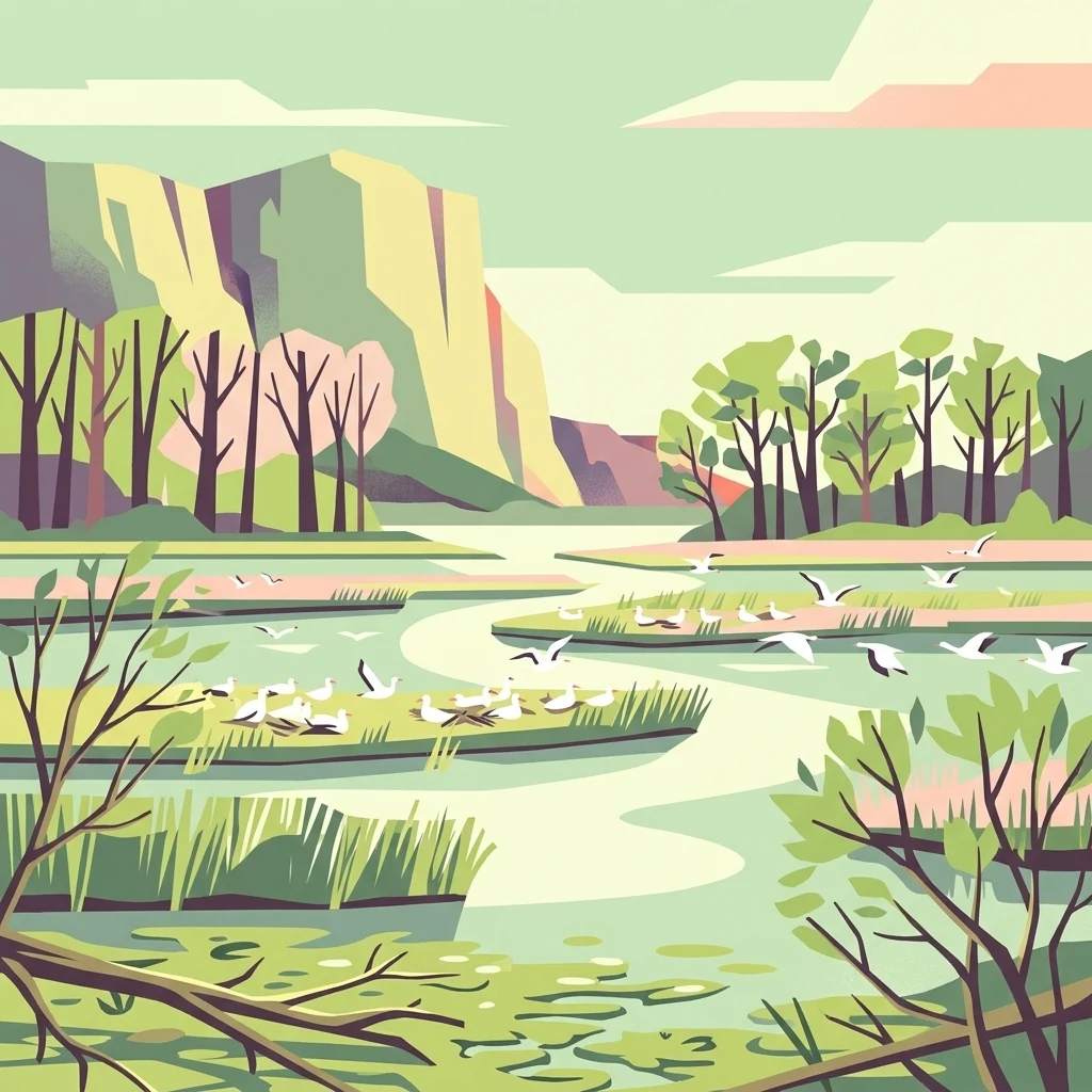
A digital illustration showing a wetlands area with winding channels of water, reeds, and low-lying vegetation. Numerous small white birds are present, some resting on small islands and others in flight. In the background, there are gentle hills and trees under a soft, light-colored sky.

Europäisches Vogelschutzgebiet Altfriedländer Teich- und Seengebiet

Nature reserve

Park overview

Structured park overview, official facts, and landscape profile for Altfriedländer Teich- und Seengebiet

Altfriedländer Teich- und Seengebiet park facts, protected area profile, and essential visitor context

Review the core facts for Altfriedländer Teich- und Seengebiet, including designation, size, terrain, visitor scale, habitats, and operating context in one park-focused overview.

About Altfriedländer Teich- und Seengebiet

The Altfriedländer Teich- und Seengebiet is a protected pond and lake landscape covering roughly seven hundred hectares at the western margin of the Oderbruch in eastern Brandenburg. It lies within the Naturpark Märkische Schweiz, occupying the northeastern corner of that nature park near the historic village of Altfriedland. Although administratively part of the broader SPA Märkische Schweiz, the Altfriedländer ponds and lakes are recognized as the single most important waterbird site in the entire nature park.

Geologically, the area sits in a fascinating transitional position. The ponds occupy the northeastern outlet of the glacially sculpted Buckower Rinne, also known as the Löcknitz-Stobber-Rinne, where this glacial meltwater channel separates the Barnim plateau to the north from the Lebus plateau to the south. Before the large-scale drainage of the Oderbruch in the eighteenth century, the Kietzer See covered about 154 hectares, surrounded by open marsh and bog. The post-drainage landscape progressively turned into a lowland peat mire, and by the 1960s the area was deliberately re-engineered into a managed pond system. Nineteen shallow ponds were created, including seventeen Karlsforfer ponds southwest of the main lake, giving a total pond area of some 280 hectares, while the deepest part remained as the present day Kietzer See.

Despite its origin as a cultural landscape, the reserve has developed extraordinary natural value. Its large open water body, near-natural shoreline zones, striking reedbeds, and remnant lowland peat have created a substitute habitat that supports invertebrates, amphibians, and a remarkable diversity of breeding, resting, and migrating birds. A bird observation tower beside the Stobber, the small river that was dammed to feed the pond system, offers a panoramic view across the water surface and the birdlife that depends on it. The ponds therefore read both as a piece of working aquaculture countryside and as one of Brandenburg's most rewarding wetland reserves.

Quick facts and research context for Altfriedländer Teich- und Seengebiet

Location: West edge of the Oderbruch in eastern Brandenburg, within the Naturpark Märkische Schweiz. The protected area covers roughly 700 hectares around the village of Altfriedland in Landkreis Märkisch-Oderland.

Anchoring feature: the Kietzer See, a shallow, almost flat pond of about 200 hectares and at most one metre deep, the largest artificial pond in Brandenburg.

Structure: the Kietzer See, the nearby Klostersee and several smaller lakes, plus nineteen shallow ponds formed from former lowland peat; the seventeen Karlsforfer ponds lie southwest of the main lake.

Protection status: part of the European SPA Märkische Schweiz under the EU Birds Directive and integrated into the Natura 2000 network, with management coordinating the Naturpark administration and local fishing cooperatives.

Significance: the most important waterbird breeding, staging, and migration area in the Naturpark Märkische Schweiz and a regionally critical refuge for endangered waterbirds including common tern, black tern, and Caspian tern.

Protection and recognition

Documented terrestrial protection scope and official recognition details

Europäisches Vogelschutzgebiet Altfriedländer Teich- und Seengebiet Protection Status

Europäisches Vogelschutzgebiet Altfriedländer Teich- und Seengebiet maintains a documented terrestrial protection scope within the regional protected area network. Official records aggregate available designation data, management classifications, and international recognition metrics without imported external sources.

Protection details

Protection scope
Terrestrial
Transboundary protection
No
Park context

Deeper park guide and search-rich context for Altfriedländer Teich- und Seengebiet

Altfriedländer Teich- und Seengebiet history, landscape, wildlife, and travel context

Explore Altfriedländer Teich- und Seengebiet through its history, landscape character, ecosystems, wildlife, conservation priorities, cultural context, and seasonal travel timing in a structured park guide built for atlas discovery and search intent.

Why Altfriedländer Teich- und Seengebiet stands out

The reserve is best known for the Kietzer See and the surrounding pond system, which together form Brandenburg's most significant assemblage of colonial waterbirds and migrating waterfowl. The site has become regionally famous for the autumn staging flocks of bean geese and white-fronted geese, often totalling thirty thousand birds, that rest on the ponds after fishpond drainage. Equally distinctive is its role as habitat for threatened terns. The breeding colony of common tern here ranks among the most important in Brandenburg, and the reserve has hosted one of the few inland Central European breeding stations of Caspian gull and small but notable colonies of black tern and Caspian tern. These birdlife records, combined with breeding pairs of white-tailed eagle, osprey, and black stork, define the reserve's identity in regional ornithology.
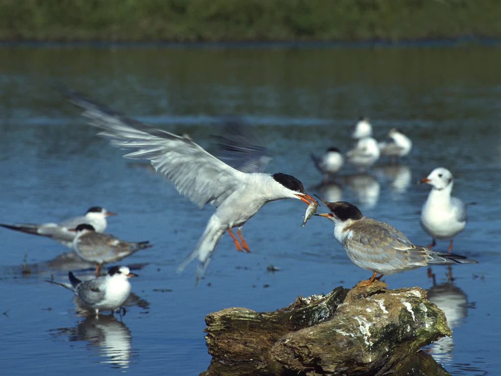
An adult Common Tern in flight delivers a small fish to a juvenile bird perched on a piece of driftwood in the water, with several other birds swimming in the background.
A Common Tern feeding a fish to another bird at Altfriedländer Teich- und Seengebiet.

Altfriedländer Teich- und Seengebiet history and protected-area timeline

The current character of the Altfriedländer Teich- und Seengebiet is the product of several layers of landscape transformation. Before 1751 the central Kietzer See covered around 154 hectares in an open, undrained Oderbruch wetland. The drainage and melioration of the Oderbruch at that time disrupted the lake's hydrology, and over the following decades the lower-lying areas progressively silted up. By 1938 the lake had become too shallow for commercial fishing.

A decisive turning point came in the 1960s, when the remaining lowland peat area was reshaped into the Altfriedländer Teiche through embankment and the damming of the Stobber river. Together with the Karlsforfer ponds to the southwest, nineteen shallow ponds were laid out, although the planned subdivision of the largest basin was never completed, leaving the present day Kietzer See as a roughly two-hundred-hectare open water body at most a metre deep. This re-engineering created a series of substitute open-water habitats that, over time, attracted new breeding bird communities.

The protection story began with the formal designation of the area as a European bird protection area under the EU Birds Directive (Richtlinie 79/409/EWG). The site was integrated into the larger SPA Märkische Schweiz and thus into the Natura 2000 network of protected areas. In 1999, management intensified with the construction of two artificial breeding islands from retired pontoons prepared with gravel, grass swards, and shelters for chicks, and with ongoing collaboration between the Naturpark administration and the local Ornithologie und Vogelschutz Märkische Schweiz e.V. Since then, the site has been continuously monitored by ornithologists and managed together with the local fishing cooperatives who continue to use the ponds commercially.

Altfriedländer Teich- und Seengebiet landscape and geographic character

The Altfriedländer Teich- und Seengebiet is a lowland pond and lake landscape, dominated by shallow open water, reed margins, and fragments of surviving lowland peat. The central Kietzer See is a vast, almost flat water surface with a maximum depth of only about one metre, making it feel more like a flooded meadow than a traditional lake. The Klostersee and several other smaller lakes to its southwest add variety, while the surrounding nineteen ponds produce a layered mosaic of open water, reed beds, and damp meadows.

The setting is shaped by glacial history. The ponds lie at the northeastern mouth of the Buckower Rinne, also called the Löcknitz-Stobber-Rinne, a Weichselian glacial meltwater channel that separates the Barnim plateau from the Lebus plateau and opens westward into the Oderbruch lowland. The Stobber river, regulated and dammed in the 1960s, now winds in a largely canalized form around the western and eastern edges of the pond system. The result is a typical Märkische Schweiz scene: flat to gently undulating terrain with extensive wetland patches framed by wooded slopes and farmland.
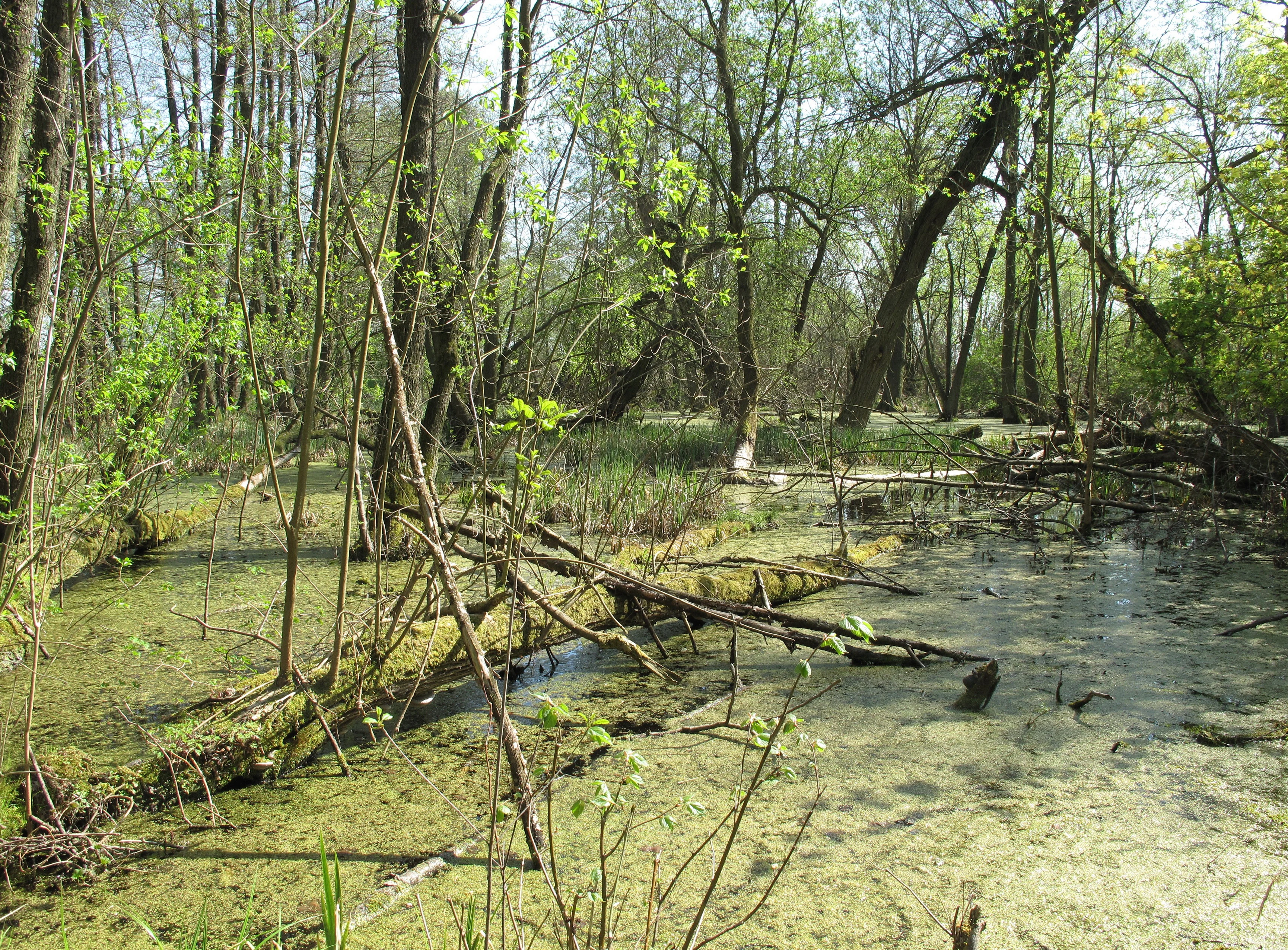
A swampy woodland scene featuring shallow, green water covered with algae and duckweed, surrounded by trees with fresh spring foliage and fallen logs.
A fen area within the Altfriedländer Teich- und Seengebiet protected area in Brandenburg, Germany.

Altfriedländer Teich- und Seengebiet ecosystems, habitats, and plant life

The ecological character of the Altfriedländer Teich- und Seengebiet is built around open water, reed belts, seasonally drained fishpond mudflats, and the surviving edges of lowland peat wetlands. Reed fringes, floating mats of vegetation, shallow shorelines, and the exposed muds during the autumn drawdown each contribute different habitat conditions, and the variability of water levels is a critical ecological driver.

The reserve supports a rich community of invertebrates and amphibians that sustains the higher-profile waterbird populations, and the reedbeds host specialized passerines such as great reed warbler, penduline tit, and bearded tit. Surrounding woodlands provide tree-hole nesting sites for cavity-breeding ducks, while the combination of woodland edge, open water, and wetland edge creates a diversity of microhabitats that is unusual in such a compact area. Visible remnants of the original lowland peat mire survive on the western side of the Kietzer See, providing a quiet reminder of the wetland landscape that existed before the drainage of the Oderbruch.
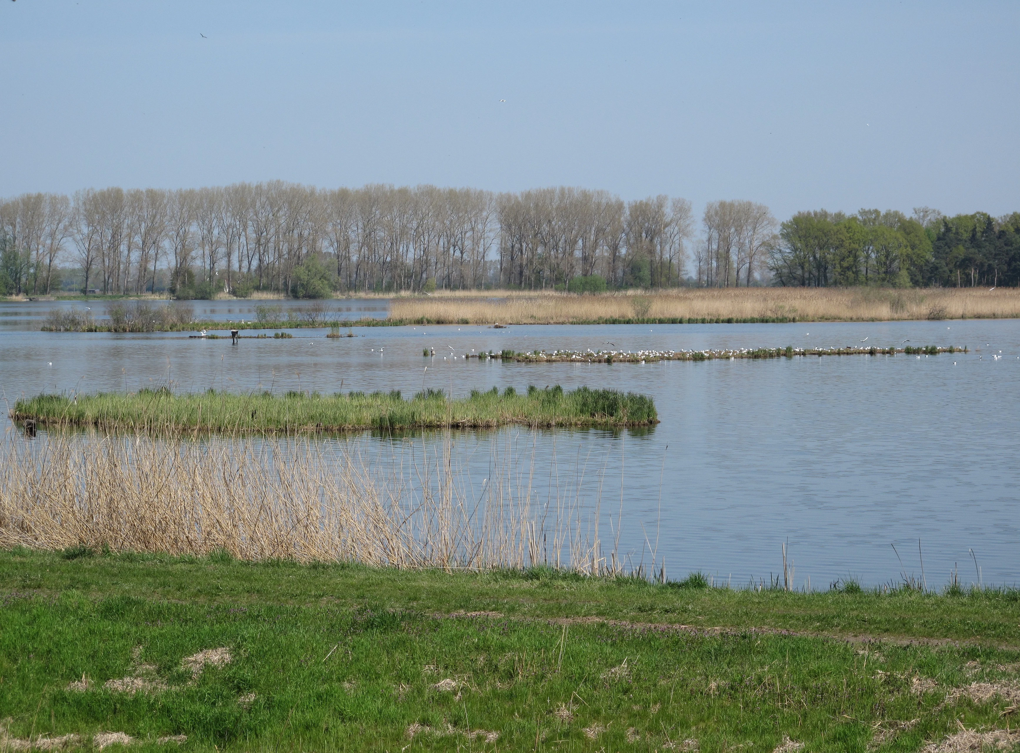
A tranquil view of a wide lake with small islands and reeds in the foreground, backed by a distant line of leafless trees under a clear pale blue sky.
A view across the Kietzer See in the Altfriedländer Teich- und Seengebiet.

Altfriedländer Teich- und Seengebiet wildlife and species highlights

Birdlife is the defining element of the Altfriedländer Teich- und Seengebiet. The reserve supports breeding populations of kingfisher, white-tailed eagle, osprey, and black stork, with white stork, grey heron, cormorant, and goshawk also recorded. Great crested grebes breed commonly on the open water, and a small population of the regionally endangered black-necked grebe nests on the Kietzer See.

The ponds are most important for colonial waterbirds. The Kietzer See holds one of Brandenburg's most significant colonies of the common tern, with breeding pair counts in the range of fifty to one hundred nests, and has also hosted small but notable colonies of the endangered black tern and Caspian tern. Gull colonies include black-headed gull, Caspian gull (one of the few inland Central European breeding records), Mediterranean gull, and the more abundant herring gull. Among ducks, mallard and greylag goose dominate the breeding community, while teal, garganey, tufted duck, pochard, red-crested pochard, and goosander are seasonally important; the goosander is locally considered at risk of extinction and uses tree holes in the surrounding woodlands for nesting.

The reserve's migratory role is equally striking. In autumn, when fishponds are drained for management, roughly 150 hectares of mudflat are exposed, attracting thousands of foraging waders including lapwings, common ringed plovers, little ringed plovers, dunlins, wood sandpipers, and curlews; November lapwing flocks have been counted in the thousands. The ponds are also a staging area for migrating geese, particularly bean geese and white-fronted geese, with peak autumn totals reaching roughly thirty thousand birds. Alongside the birdlife, Eurasian otters use the wetland edges, drawing renewed attention to the reserve's broader mammal fauna even though their presence is sometimes a source of friction with local fisheries.
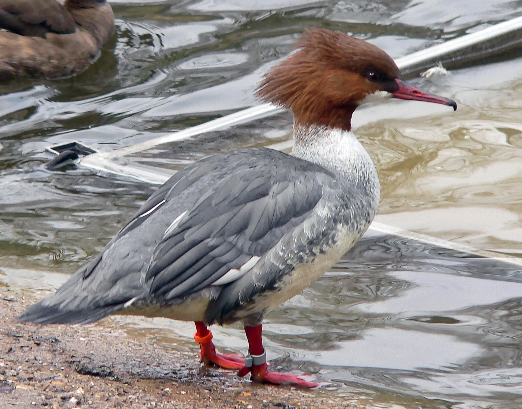
A female common merganser with a shaggy russet crest and gray body stands on a muddy shore at the edge of rippled water; the bird has red leg bands.
A common merganser standing at the edge of a water body, clearly showing leg bands.

Altfriedländer Teich- und Seengebiet conservation status and protection priorities

As a European bird protection area under the EU Birds Directive, the Altfriedländer Teich- und Seengebiet forms part of the Natura 2000 network and the wider European biotope network. Its conservation value is shaped by three intersecting factors: its size and openness, its near-natural shoreline structure with extensive reedbeds, and its significance as breeding, resting, and migration habitat for waterbirds, including threatened species such as common tern, black tern, and goosander.

Conservation management deliberately combines protection and traditional use. The Naturpark administration works closely with local fishermen and other land users to keep fishpond aquaculture compatible with bird conservation. Key interventions include maintaining the artificial pontoon breeding islands since 1999, mowing reed mats on the lake in winter so they remain suitable as nesting substrate, installing and maintaining duck nest boxes, regulating water levels during migration periods to keep mudflats accessible for waders, and conducting annual counts of breeding pairs. Common terns in particular are individually monitored through bird ringing, reflecting the national importance of this colony. Funding has come from contract nature protection schemes from the Naturpark administration and from the Landesanstalt für Großschutzgebiete.

On a broader scale, the reserve stands as a textbook example of how cultural landscapes can evolve into ecologically valuable substitute habitat. Because the original lowland peat wetlands of the Oderbruch have been overwhelmingly drained, the pond system has effectively replaced lost breeding and feeding grounds for waterbirds and has gained significance as a refuge for invertebrates, amphibians, and otters, alongside its flagship birdlife.

Altfriedländer Teich- und Seengebiet cultural meaning and human context

The cultural setting of the Altfriedländer Teich- und Seengebiet is closely tied to the historical interplay between settlement, drainage, and aquaculture in the Märkische Schweiz region. The nearby village of Altfriedland is an old rural community in the former Herrschaft Friedland, whose broader history has been documented in early twentieth-century regional chronicles. The ponds themselves are not a natural wilderness but a product of deliberate landscape engineering.

Traditional pond aquaculture has shaped both the economy and the ecology of the area for many decades. Local fishers continue to manage the ponds for commercial harvest, and the cooperation between this working landscape and the Naturpark administration is a defining feature of how the reserve is run. The Kietzer See, originally a natural lake in the Oderbruch wetlands, became a cultural artefact through the eighteenth-century drainage of the Oderbruch, the silting-up that followed, and the 1960s conversion of the residual peatland into nineteen managed ponds. This layering of human intervention, from early drainage to modern bird-focused habitat works, is central to the site's cultural identity as a managed, lived-in wetland rather than an untouched nature reserve.

Top sights and standout views in Altfriedländer Teich- und Seengebiet

Standout features of the Altfriedländer Teich- und Seengebiet include the vast, shallow Kietzer See, the largest artificial pond in Brandenburg at roughly 200 hectares, and the network of nineteen managed ponds that surrounds it. The reserve is one of the most productive waterbird sites in the Märkische Schweiz, with the common tern colony ranking among the most important for this threatened species in Brandenburg. The site has also hosted one of the few inland Central European breeding records of Caspian gull, a notable colony of black tern, and the only Brandenburg station for Caspian tern during parts of the early 2000s.

The autumn migration cycle is equally memorable: when traditional fishpond management lowers water levels, roughly 150 hectares of mudflat are exposed, attracting thousands of lapwings and other waders, while the wider pond system can hold up to thirty thousand bean geese and white-fronted geese on migration. Active conservation measures, notably the breeding islands built from retired pontoons, annual ringing campaigns, and the local fisher-ornithologist partnership, give the reserve a strong, ongoing story of how working pond landscapes can become high-value wetland habitat.

Best time to visit Altfriedländer Teich- und Seengebiet

Late spring and early summer are rewarding for seeing breeding waterbird colonies at the Kietzer See, including great crested grebes with young on the water, gull colonies on the floating reed islands, and breeding common terns, with their young visible around the artificial pontoon islands. This is also when reedbed passerines such as bearded tit and penduline tit are most active at the edges.

Autumn is the most dramatic period for sheer numbers of birds. As the fishponds are drained for harvest, large expanses of mud are exposed and attract thousands of lapwings and other waders, while the open water becomes a staging ground for migrating geese. Peak goose numbers, particularly bean geese and white-fronted geese, can reach tens of thousands in October and November, making this the season when the reserve feels most alive. Winter brings quieter conditions but also cold-weather visitors such as whooper swan, smew, and goosander on the unfrozen parts of the ponds.

Monthly climate preview

Long-term temperature and monthly precipitation averages across the protected landscape

Europäisches Vogelschutzgebiet Altfriedländer Teich- und Seengebiet Climate Normals

Representative coordinates record measured annual temperature fluctuations alongside steady monthly precipitation baselines. Examining the complete twelve-month climatology profile reveals deeper patterns in long-term environmental norms.
Annual mean9 °C
-1 °C20 °C
Jan-1°
Feb
Mar
Apr
May14°
Jun18°
Jul20°
Aug20°
Sep15°
Oct
Nov
Dec
Warmest month
July

20.3 °C

Coolest month
January

-1.1 °C

Wettest month
July

2.5 mm/day

Driest month
April

1.1 mm/day

Park location guide

Geography guide, regional context, and park location map for Altfriedländer Teich- und Seengebiet

Altfriedländer Teich- und Seengebiet park geography, regions, and map view in Germany

Understand where Altfriedländer Teich- und Seengebiet sits in Germany through a broader geographic reading of the surrounding landscape, nearby location context, and its mapped position within the national park landscape.

How Altfriedländer Teich- und Seengebiet fits into Germany

Germany is a federal republic in Western and Central Europe with a population of over 83 million across sixteen constituent states. It is Europe's largest economy by nominal GDP and a major global exporter and importer. The capital is Berlin, and the country borders Denmark, Poland, Czech Republic, Austria, Switzerland, France, Luxembourg, Belgium, and the Netherlands.

Wider geography shaping Altfriedländer Teich- und Seengebiet in Germany

Germany is located in Western and Central Europe, spanning 357,022 km². It borders Denmark to the north, Poland and the Czech Republic to the east, Austria and Switzerland to the south, and France, Luxembourg, Belgium, and the Netherlands to the west. The country has coastlines on the Baltic Sea and North Sea to the north, with the Alps located in the southern region.

Map view of Altfriedländer Teich- und Seengebiet

Use this park location map to pinpoint Altfriedländer Teich- und Seengebiet in Germany, understand its exact geographic position, and read its mapped placement within the surrounding landscape more clearly.

Pigeon | © OpenStreetMap contributors

Location context for Altfriedländer Teich- und Seengebiet

BrandenburgLandkreis Märkisch-Oderland

Visual exploration of shallow ponds, reedbeds, and lowland wetland habitats in eastern Brandenburg

Europäisches Vogelschutzgebiet Altfriedländer Teich- und Seengebiet Photos and Protected Landscape Scenery

Photographic records capture the expansive open waters, shallow lake basins, and intricate reed margins defining Europäisches Vogelschutzgebiet Altfriedländer Teich- und Seengebiet. Examining these protected wetland habitats reveals the distinct ecological character and seasonal geography of the Märkische Schweiz pond network.

An adult Common Tern in flight delivers a small fish to a juvenile bird perched on a piece of driftwood in the water, with several other birds swimming in the background.

A wide view of a lake with a small, vegetated island in the foreground and a larger, distant island populated by numerous white birds, likely gulls or terns, with a background of trees under a clear sky.

A swampy woodland scene featuring shallow, green water covered with algae and duckweed, surrounded by trees with fresh spring foliage and fallen logs.

A tranquil view of a wide lake with small islands and reeds in the foreground, backed by a distant line of leafless trees under a clear pale blue sky.

A female common merganser with a shaggy russet crest and gray body stands on a muddy shore at the edge of rippled water; the bird has red leg bands.

A rectangular artificial nesting platform floats in the middle of a calm lake, surrounded by water birds, with a reed-lined forest in the background.

Park atlas

Compare surrounding regional wetland reserves and protected landscapes

Parks Near Europäisches Vogelschutzgebiet Altfriedländer Teich- und Seengebiet

Browsing protected areas near Europäisches Vogelschutzgebiet Altfriedländer Teich- und Seengebiet reveals connected lowland pond ecosystems and glacial meltwater channels. Extending geographic comparison across neighboring nature reserves provides broader context for regional waterbird habitats.
Nature reserveBrandenburg
About 0.9 km away#1 closest

Southwest

Stobbertal Nature Reserve: Geography, Mapped Boundaries, and Protected Landscape Context

A detailed geographic study of the Stöbber river valley in Brandenburg, Germany

Stobbertal represents a compact yet ecologically dense protected area in Brandenburg. This study provides access to information regarding its diverse forest and wetland habitats, ranging from ancient oak-hornbeam woodlands to rare floodplain remnants. Gain insight into the regional importance of the river corridor, its hydrologic features, and the protected species that inhabit this distinct northeastern German landscape.

Area
8.84 km²
Established
1990
IUCN
IV
A horizontal watercolor painting showing layers of soft-toned hills in green and purple, with tall blades of grass in the foreground.
Nature reserveBrandenburg
About 8.4 km away#2 closest

Southwest

Klobichsee Nature Reserve: Protected Landscape and Glacial Lake Geography in Brandenburg

Mapping aquatic ecosystems and protected boundaries in eastern Germany

Klobichsee Nature Reserve covers roughly 5.59 square kilometers, centering on the Großer Klobichsee and Kleiner Klobichsee glacial lakes. This protected area in Brandenburg preserves essential forest and wetland habitats, maintaining the ecological character of the region situated between Buckow and Münchehofe.

Area
5.59 km²
Established
1990
IUCN
IV
Climate
Temperate
A soft watercolor painting of a pastoral landscape featuring green rolling hills, distant trees, and a foreground with grassy vegetation and pinkish marsh-like reflections.
Protected landscapeBrandenburg
About 9.8 km away#3 closest

Southwest

Naturpark Märkische Schweiz: A Protected Landscape Discovery in Brandenburg

Glacial terrain, kettle lakes, and river basin geography.

Situated near Berlin, this protected landscape features a textbook glacial relief shaped by retreating ice sheets. The area encompasses the Schermützelsee, deep kettle ponds known as Sölle, and the narrow valleys of the Stobber river. Learn about the park's layered conservation framework, which combines European habitat protection with rich fieldstone architecture and cultural history.

Area
205 km²
Established
1990
Relief
Upland
Climate
Temperate
Protected landscapePoland
About 17 km away#4 closest

East

Park Krajobrazowy Ujście Warty: Protected Landscape and River Valley Atlas

Mapping wetland ecosystems and floodplain geography in western Poland

Park Krajobrazowy Ujście Warty preserves a significant lowland river valley landscape characterized by vast open pastures, marshes, and rare riparian oak forests. Located primarily within the Lubuskie region, this protected area offers a clear view into the floodplain processes of the Warta river basin, providing a distinct geographic context for wetland conservation and waterbird habitat mapping in Poland.

Area
194.96 km²
Established
1996
Relief
Lowland
Climate
Temperate
Protected landscapeWest Pomeranian Voivodeship
About 17 km away#5 closest

North

Cedynia Landscape Park: Mapped Protected Landscapes and Regional Geography in Poland

Protected mosaic of sandy forests and river valleys

Spanning 308 square kilometers, Cedynia Landscape Park protects a complex transition zone in Poland. The area features the expansive Puszcza Piaskowa pine forests, the hilly moraine relief of the Cedynia Carpathians, and the biodiverse wetlands of the lower Oder River. This protected landscape represents an essential study in lowland ecological gradients and postglacial terrain development within the West Pomeranian Voivodeship.

Area
308.5 km²
Established
1993
Relief
Upland
Climate
Temperate
Nature reserveBrandenburg
About 24 km away#6 closest

Northwest

Tongruben Neuenhagen Nature Reserve: Protected Wetland Geography in Brandenburg, Germany

Examining post-industrial clay-pit habitats and protected wetland boundaries

Tongruben Neuenhagen is a designated nature reserve located in Brandenburg, Germany, established to protect biological communities that have developed within former clay extraction pits. The area features a complex mosaic of open water, wetland margins, and transitional scrub habitats. This reserve provides a notable example of how historical industrial land use can be repurposed into valuable habitat for protected species, serving as a key element of the local conservation network in the Märkisch-Oderland region.

Area
1.196 km²
Established
1990
IUCN
IV
Relief
Lowland
Watercolor painting of a green valley with a meandering stream and a cluster of trees against a light background.
Nature reserveBrandenburg
About 26 km away#7 closest

Northwest

Cöthener Fließtal Nature Reserve in Brandenburg: Glacial Geography and Protected Woodland Atlas

Mapping the stream corridors and moraine landscapes of eastern Brandenburg

Cöthener Fließtal is a 75-hectare protected area that bridges the hilly Barnim plateau and the Oderbruch lowlands. The site features a dense concentration of glacial landforms, including end-moraine ridges and spring-fed mires. Visitors can explore the interplay between natural forest ecosystems and the restored elements of a historic nineteenth-century landscape park found along the Cöthener Fließ stream.

Area
0.75 km²
Established
2003
IUCN
IV
Relief
Upland
A horizontal watercolor painting showing a soft-focus landscape of light green trees, yellow fields, and pale blue rolling hills in the background.
Nature reserveBrandenburg
About 27 km away#8 closest

Southwest

Lange Dammwiesen und Unteres Annatal: Glacial Ridges and Nature Reserve Geography

A mapped protected area in the state of Brandenburg, Germany

Lange Dammwiesen und Unteres Annatal represents a compact but ecologically rich nature reserve featuring signature osar ridges and varied meadow habitats. This site provides valuable insight into the glacial landscape of the North German Plain, illustrating the effectiveness of conservation grazing in maintaining diverse ecosystems within the Brandenburg region.

Area
0.013 km²
Established
1990
IUCN
IV
Relief
Lowland

Common questions about visiting, size, designation, and location context for Altfriedländer Teich- und Seengebiet

Altfriedländer Teich- und Seengebiet FAQs for park facts, access, geography, and protected area context

Find quick answers about Altfriedländer Teich- und Seengebiet, including protected-area facts, park geography, trail and visitor context, and how the park fits into its surrounding country and regional landscape.
MoriAtlas Explorer

Continue Your Protected Areas Search Across the Global Atlas

Deepen your exploration by continuing the structured search for national parks and protected areas worldwide. Utilize the comprehensive filtering capabilities to compare different conservation landscapes and refine your understanding of global park geography. Discover more about the distribution and characteristics of protected natural areas.

Global natural geography