
Visit Planning
Best time to visit Altos de Campana National Park: a quick orientation
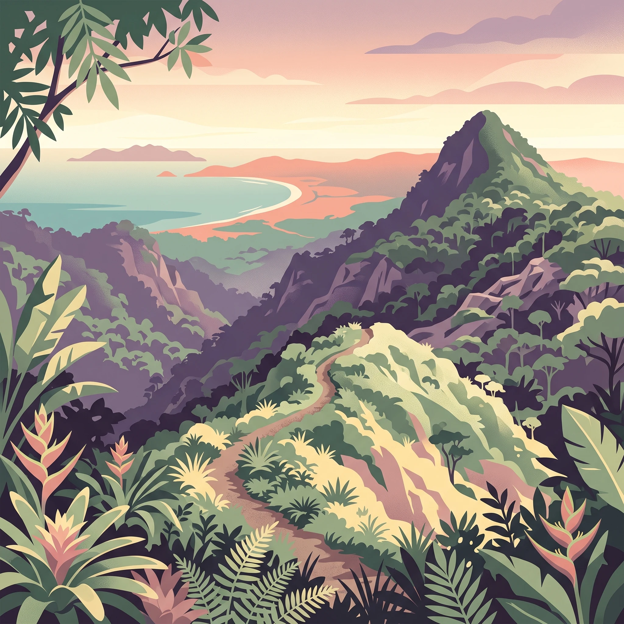
Determining the best time to visit Altos de Campana National Park requires balancing the desire for clear hiking conditions against the ecological richness of the park's wetter months. For most visitors, the most reliable window for outdoor exploration is the dry season, which typically spans from January through March. During these months, precipitation levels drop significantly, humidity remains at its most manageable annual point, and the skies offer the clearest opportunities for capturing the panoramic vistas from Cerro Campana. This period provides the most predictable access for navigating the park's steep trails and rocky terrain without the complications of heavy tropical downpours.
Seasonal Trade-offs in a Tropical Highland
While the dry months provide the most consistent weather, they do not necessarily represent a universal best choice for every visitor. The park's character shifts dramatically once the transition to the rainy season begins. Starting in late April and peaking in intensity through the late summer and autumn months, increased rainfall revitalizes the diverse tropical forest, transforming the landscape into a lush, vibrant green. Those who prioritize birdwatching or observing the park's distinct amphibian populations may find these wetter months more rewarding, despite the trade-off of frequent, often intense, afternoon showers.
Environmental Factors Shaping Your Visit
Beyond simple dry versus wet seasonal cycles, visitors must account for the interplay between the park's elevation and its tropical location. Because the park is situated within the Talamanca mountain range, it experiences localized climate patterns that can differ from the surrounding lowland areas of Panama. High humidity remains a constant factor throughout the year, rarely dropping to uncomfortable lows even in the driest periods. Daylight hours show relatively little annual variation, providing enough consistent time for hiking, though visitors should remain mindful that sudden changes in visibility and trail conditions are possible regardless of the season.
Ultimately, your preferred timing depends on your specific goals. If your primary objective is to reach the summit of Cerro Campana for an unobstructed view of the Bay of Chame or the Pacific coastline, the drier, windier months of early spring provide the highest probability of success. If you are drawn to the park's role as a vital ecological repository, the rainy season offers a unique glimpse into the functional, moisture-dependent ecosystem that characterizes this critical watershed. Because climate normals reflect long-term trends rather than daily guarantees, always prepare for changing conditions by carrying appropriate gear for both sun and rain, regardless of when your travel dates fall.
Visitor timing
Best months to visit Altos de Campana National Park at a glance
Peak visibility and dry conditions: January to March
For travellers whose primary goal is capturing the panoramic views from the summit of Cerro Campana, the period from January through March stands as the most reliable window. These months correspond to the lowest average daily precipitation in the park. With minimal rainfall, the sky remains clearer, allowing for long-distance visibility across the Pacific coastline and the Bay of Chame. Because the soil is drier during this quarter, hiking trails are generally less muddy, providing firmer footing for the steeper sections of the park's network. Visitors should expect higher wind speeds during this season, which can be brisk at the higher elevations of the Talamanca range, but this often helps keep temperatures slightly more manageable during midday hikes.
The lush, high-rainfall season: May to November
Visiting between May and November presents a different set of conditions characterized by high humidity and frequent, often heavy, tropical precipitation. While these months see significantly more rainfall than the dry season, they support the peak of the park's biological activity. If your priority is seeing the dense tropical forest at its most vibrant or engaging in birdwatching, this wetter interval offers the highest levels of ecological productivity. The trade-off is the necessity of constant preparation for rain and trails that can become slippery or saturated. Humidity levels consistently remain above 85 percent during the heart of this period, creating a warm, damp environment that requires breathable gear and careful planning for moisture-sensitive equipment.
Transition periods: April and December
April and December serve as transitional bookends between the two primary weather regimes. April is a hinge month where rainfall begins to increase from the dry-season minimums, moving toward the wetter patterns of mid-year. Conversely, December marks the easing of the heaviest rain as the park shifts toward the drier, breezier conditions of the new year. These months can be unpredictable, occasionally offering the best of both worlds, but they carry a higher risk of sporadic downpours compared to the peak dry months. Travelers choosing these windows should remain flexible with their itineraries, as trail conditions can shift rapidly within a single week as the seasonal patterns pivot. Regardless of the month chosen, remember that the high humidity and tropical climate ensure the forest remains green year-round, even if the frequency of rainfall fluctuates significantly.
Annual Climate Overview
Monthly weather and climate patterns at Altos de Campana National Park
Annual patterns in temperature and humidity
Altos de Campana experiences a tropical climate defined by stability rather than the stark seasonal swings found in higher latitudes. Temperature readings remain remarkably consistent across the twelve-month cycle. Mean temperatures hover between approximately 25 and 27 degrees Celsius, reflecting the park's year-round warmth. While these normals provide a reliable anchor, visitors should remember that these represent historical averages recorded at a specific baseline elevation and cannot predict the precise conditions encountered on any given day. Local relief and the influence of the Talamanca mountain range mean that higher elevations within the park often feel significantly cooler than the regional average, especially when cloud cover settles over the ridges.
Humidity is a defining factor in the park's atmosphere. The relative humidity levels typically stay high, generally fluctuating between 70 and 88 percent. This persistent moisture supports the lush, dense forest character for which the area is famous, but it also means that the heat can feel more intense than the mercury alone might suggest. Even during the months with lower humidity, such as March, the tropical nature of the environment ensures a constant baseline of moisture that keeps the flora vibrant.
Interpreting precipitation and the seasonal divide
The most substantial variation in the park's annual climate is found in precipitation patterns rather than temperature. The data reveals a clear divide, with a notably drier period spanning January through March. During these months, rainfall reaches its minimum, often dropping well below one millimeter per day on average. This interval provides the most reliable window for visitors who prioritize dry trails and clearer skies.
Conversely, as the year progresses toward mid-year, rainfall begins to increase significantly, peaking from September through November. During these months, daily precipitation averages climb toward the nine-millimeter mark. This period is not defined by a constant deluge, but rather by the high probability of frequent, intense tropical showers that characterize the wet season. These variations are critical for planning, as the increased precipitation directly influences the accessibility of certain trails and the overall vitality of the park's water-dependent ecosystems.
Daylight, wind, and atmospheric variability
Daylight availability at the park follows a predictable rhythm dictated by its equatorial position, with the longest days occurring around June and July, reaching approximately 12.5 hours. While the variation in daylight is relatively minor,swinging by only about one hour across the entire year,this extra time can be a practical advantage for those planning full-day hikes or early-morning wildlife observations.
Wind patterns also shift slightly throughout the year, with higher average wind speeds noted during the drier, early months of the year. When combined with the lower humidity of January and February, these breezes can provide a welcome cooling effect. Conversely, the transition into the wetter months of May and June often sees a reduction in wind intensity, which can make the air feel stiller and more humid in the sheltered valleys. These shifts in atmospheric conditions highlight why visitors should avoid relying on a static expectation of the weather; the park environment is dynamic and shifts its character in response to these nuanced changes in wind, rain, and solar exposure.
Annual Weather Phases
Understanding Seasonal Patterns and Climate Transitions in Altos de Campana
Defining the Annual Dry Phase: January to March
The most distinct weather period in Altos de Campana occurs during the first quarter of the year. Historically, this phase is characterized by significantly lower daily precipitation and lower relative humidity, often dropping toward the 70% range by March. These months represent the most stable window for visitors prioritizing clear skies and accessible, firmer trails. The influence of regional trade winds is also most pronounced here, often providing a cooling breeze that mitigates the intensity of the tropical sun. During this phase, the landscape is at its most exposed, offering the reliable panoramic views from the summit of Cerro Campana for which the park is known.
The Transitional Period of April and December
The months of April and December function as essential bridges between the dry and wet phases of the year. April marks a distinct shift, as precipitation levels begin to rise toward the higher values observed throughout the middle of the year. This transition often results in unpredictable weather where short, intense showers become more frequent compared to the steady dryness of early spring. Conversely, December serves as the tail end of the wet season. While rainfall may remain present, it typically begins to taper off, creating a variable landscape where lush vegetation meets increasingly frequent windows of clear, sunny weather.
The Extended Wet Phase: May to November
Spanning the majority of the calendar year, the wet phase is defined by higher daily precipitation averages, which consistently exceed 7 mm per day throughout this period. Relative humidity levels are notably higher as well, often settling between 86% and 88%. This prolonged phase supports the park's dense tropical forest ecosystem and maintains the high biodiversity for which the area is recognized. While the term wet season describes the statistical increase in rainfall, it does not imply constant storms. Instead, visitors should expect a pattern of heavy, periodic tropical rains followed by high humidity and cloud cover. This phase requires different preparations for hiking, as trails may become muddy, and the frequent moisture creates a thicker, more vibrant forest environment that is distinct from the drier early months of the year. Because temperature variations remain minimal across these months, the primary distinction is the intensity and frequency of moisture rather than any significant cooling or warming trend.
Seasonal Experiences
What visiting Altos de Campana National Park is like throughout the year
Navigating Trail Conditions and Topographical Access
The physical experience of hiking in Altos de Campana is heavily dictated by the precipitation cycles that define the park's topography. During the dry season months of January, February, and March, the trails, including the steep ascent of Sendero La Cruz, are typically at their most accessible. The reduced rainfall keeps the terrain firmer, minimizing the mud that can make the steeper sections challenging. While the incline remains strenuous regardless of the month, these drier conditions allow for more secure footing, which is essential for safely reaching the summits that offer sweeping views of the Pacific coastline and the Bay of Chame.
Conversely, as precipitation levels rise significantly from May through November, visitors should expect markedly different walking conditions. The increased saturation of the tropical forest floor often leads to slippery, muddy trail segments. Experienced hikers who choose to visit during this wetter window often prioritize specialized footwear and a slower pace to navigate the terrain. This period transforms the landscape, as the higher moisture levels sustain the lush, dense vegetation that characterizes the Talamanca mountain range, though it often results in reduced visibility on mountain tops due to increased cloud cover and persistent mist.
Seasonal Patterns in Biodiversity and Wildlife Observation
The park's status as an Important Bird Area is a year-round reality, but the observational experience shifts alongside the climate. Birdwatching remains a primary activity in the forest canopy, with the drier, windier months of early in the year offering better visibility through the foliage. During these months, the slightly lower relative humidity can make long periods of stationary observation more comfortable for visitors. The Sendero Zamora is specifically noted for its dense vegetation where tropical birds congregate, and in the drier season, the lower canopy density often assists in spotting active species.
Wildlife encounters, particularly for those searching for the Panamanian Golden Frog, do not follow the same predictability as weather patterns. While the Sendero Rana Dorada is the designated location for spotting this iconic amphibian, its habitat is deeply tied to the park's moist environment. The wetter months provide the necessary humidity for amphibians to be active, although the thick vegetation and increased rainfall can make the trail itself more difficult to traverse. It is important to note that because the trail is lightly used and conditions vary, specific animal sightings are never guaranteed. Visitors hoping to focus on biodiversity should be prepared for the reality that the most biologically active periods often coincide with the times when park access is most physically demanding due to mud and frequent precipitation.
Visitor Priorities
Timing Your Visit to Altos de Campana Based on Travel Priorities
Prioritizing Clear Views and Trail Stability
If your primary motivation is to secure clear, sweeping panoramic views from the summit of Cerro Campana, focus your travel planning on the months of January, February, and March. During this period, the park experiences its lowest monthly precipitation, often dipping below 1 mm per day in February. These drier conditions significantly reduce the likelihood of dense cloud cover obscuring the vistas of the Pacific coastline and the Bay of Chame. Furthermore, the lower humidity levels and moderate wind speeds typical of these months make strenuous climbs, such as the ascent of Sendero La Cruz, more physically comfortable compared to the mid-year months. The trade-off is a landscape that may appear less vibrantly green than during the peak of the rainy season, though the structural clarity of the volcanic topography becomes much more apparent.
Seeking Lush Biodiversity and Forest Activity
For travelers who prioritize wildlife observation, particularly birdwatching or the search for endemic species like the Panamanian golden frog, the months from May through November offer the most ecologically active environment. While these months bring higher precipitation levels, peaking in September, this moisture is exactly what sustains the dense, moss-covered cloud forest ecosystems that characterize the higher elevations of the Talamanca range. During this time, vegetation is at its most lush, and the increased presence of water supports the complex insect and amphibian populations that draw tropical birds to the park. The main compromise for choosing this period is the necessity of navigating muddy trails and the increased probability of afternoon showers, which can shift the landscape from a clear hiking experience to a more atmospheric, mist-filled forest trek. Sturdy, waterproof footwear is essential for any visitor targeting this window.
Balancing Comfort and Variable Conditions
Visitors seeking to avoid the peak heat of the dry season while also bypassing the most intense rainfall of the wet season may find the shoulder months of April and December to be a practical middle ground. April marks the transition toward more frequent rainfall, yet it retains some of the warmth and longer daylight hours of the preceding dry months. December offers a similar transition, as the heavy precipitation begins to taper off. These months require flexibility, as you may encounter weather patterns from either the dry or rainy side of the spectrum. The advantage is a more nuanced experience where you can observe the forest as it shifts from one state to the other, potentially encountering fewer visitors on the trails than in the peak months. However, the trade-off is the loss of the extreme reliability found in either the strictly dry or the deeply rainy periods, meaning you must be prepared for changing conditions on short notice.
Visitor access and logistics
Seasonal access and trip planning at Altos de Campana National Park
Navigating your route to the park
Reaching Altos de Campana National Park is relatively straightforward for independent travelers, as it remains accessible from Panama City throughout the year. The primary transit route involves heading southwest along the Interamerican Highway (CA-1) for approximately 70 kilometers. Travelers typically turn onto Route 808 toward the town of Chica, with the park entrance located roughly nine kilometers from this junction. Because this infrastructure relies on major national roads, the park does not experience seasonal road closures tied to the climate, though visitors should always consult the Ministry of Environment (MiAmbiente) or local park authorities for any notice of temporary maintenance or weather-related impacts on secondary access roads.
Using public transport to reach the entrance
For those relying on public transportation, the journey is a multi-stage process that is consistent across all seasons. Buses depart from the Albrook terminal in Panama City heading toward the interior provinces. You should plan to disembark in the town of Capira. From there, the final leg of the journey typically involves smaller local transit, such as mini-buses or combis, heading toward the community of Chica. It is standard practice to inform the driver of your intention to visit the national park entrance. As bus schedules and the availability of local transport services can change, it is advisable to verify current service frequency and operational status with local transport operators or at the Albrook terminal before your departure date.
Assessing operational status and planning ahead
While the park remains open year-round, its operational character can shift depending on the time of year, primarily due to the influence of the rainy season on trail conditions. There is no official, static permit system for general hiking access to standard trails like Sendero La Cruz, but this status is subject to change based on management policy or safety concerns. If you are planning a visit during the height of the wet season, from May through November, you should anticipate that trails may be muddy or temporarily affected by storm damage. Always confirm the current trail status by contacting the park office or checking official government channels, as these authorities possess the most accurate and real-time information regarding accessibility. Do not rely on seasonal climate trends as a guarantee of specific route status, as individual weather events may trigger localized closures that are independent of long-term monthly averages.
Safety and Preparation
Weather, safety, and seasonal preparation for Altos de Campana National Park
Navigating Tropical Conditions and Humidity
Preparation for a visit to this park centers on adapting to its persistent tropical climate. Regardless of the month, high humidity is a constant factor, often exceeding 80 percent throughout the year. This environment makes moisture-wicking, breathable clothing essential, as heavy fabrics can quickly become uncomfortable during uphill treks on humid days. While the dry season from January through March offers slightly lower relative humidity, travelers should still expect damp conditions within the forest canopy, where shade and dense vegetation retain moisture.
Preparing for Seasonal Precipitation and Trail Terrain
Seasonal rainfall shifts significantly impact hiking preparations. During the wetter months, from May through November, trail surfaces in the park can become slick and muddy. Sturdy footwear with reliable traction is necessary for navigating the uneven terrain and steep sections found on routes like Sendero La Cruz. Visitors should prepare for rapid changes in conditions during the rainy season, where clear mornings can quickly transition into overcast afternoons with precipitation. While the dry season months of February and March present the lowest rainfall totals, the volcanic terrain remains rugged, requiring the same emphasis on appropriate footwear and careful footing regardless of the calendar date.
Managing Solar Exposure and Daylight
Daylight hours fluctuate marginally throughout the year, but the intensity of the tropical sun remains a consistent consideration. Because the park experiences significant solar exposure, particularly on exposed ridges and viewpoints, protective measures are as relevant in the drier months as they are during the transition periods. The sun reaches high intensity throughout the year, and because the park is situated within a mountain range, sudden changes in cloud cover at higher elevations can be deceptive. Bringing a flashlight is recommended for all visitors, as visibility can diminish quickly under the thick forest canopy or when clouds move rapidly across the summits in the late afternoon.
Essential Safety and Park Protocols
Safety planning relies on both environmental awareness and adherence to park guidelines. Visitors should confirm their route plans and always register at the MiAMBIENTE office before entering the park, as this ensures authorities are aware of your presence. Given the remote nature of some trail sections, carrying a basic first-aid kit and sufficient supplies is a standard precaution. Because the park is a protected habitat for diverse wildlife, including sensitive amphibian species, avoiding off-trail activities is vital for both personal safety and ecological preservation. Always check for current official alerts or temporary trail closures before departing, as severe weather or maintenance can alter accessibility without advance notice.
Finalizing your visit
How to choose the best time to visit Altos de Campana National Park
Deciding when to visit Altos de Campana National Park requires weighing your tolerance for tropical precipitation against your desire for clear, panoramic views. Because the park experiences distinct climatic shifts, the most effective way to finalize your travel dates is to match your primary activity with the environmental conditions that support it. If your main objective is hiking the rugged volcanic terrain or reaching the summit of Cerro Campana for a clear view of the Pacific coast and the Bay of Chame, focusing your trip in the dry months of January through March provides the most reliable conditions. During this period, lower precipitation levels and higher wind speeds contribute to better visibility and firmer trail surfaces, which are essential for navigating the park's steep topography comfortably. Conversely, if your interest lies in the park's dense tropical biodiversity, including birdwatching or observing the unique flora that thrives in the moisture of the Talamanca mountain range, the wet season from May through November offers a more vibrant, albeit rainier, experience. While these months bring frequent precipitation, they also sustain the lush forest environment that defines the park's status as an important ecological repository. If you prefer a balance between these extremes, the transitional months of April and December often feature moderate weather, though they remain subject to the variability inherent in tropical mountain climates. Regardless of when you choose to arrive, remember that climate normals serve as a guide rather than a forecast. Localized weather in high-elevation areas like those within this park can change rapidly, and the high humidity and persistent cloud cover are features of the environment throughout the year. Before finalizing your logistics, you should always consult the latest reports from national environmental authorities to confirm current trail accessibility and weather alerts. By prioritizing your personal goals for clear vistas or lush exploration and remaining prepared for the dynamic nature of tropical weather, you can secure an informed and successful visit to Panama's oldest national park.