
Planning Fundamentals
When to visit Angeles National Forest: The primary timing trade-offs
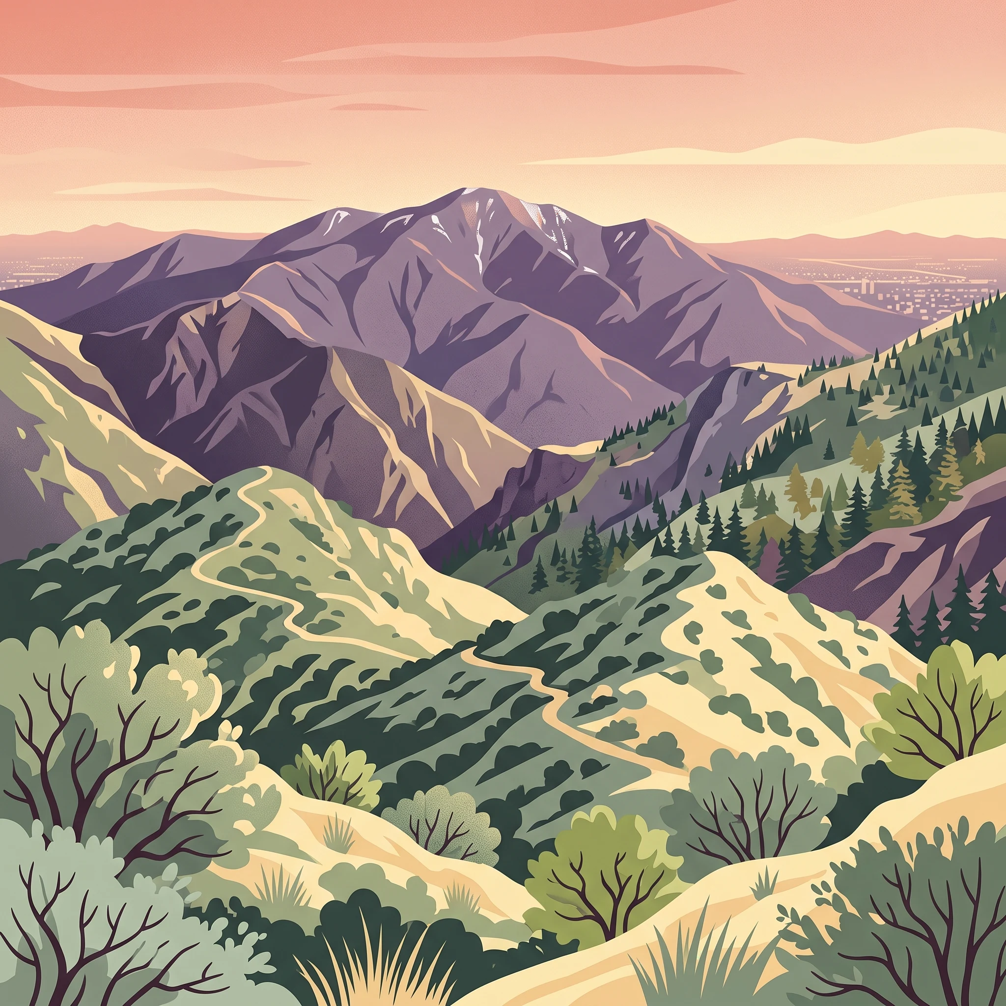
Deciding when to visit Angeles National Forest centers on managing the significant gap between lower-canyon heat and the higher, snow-prone peaks of the San Gabriel Mountains. Because this protected landscape transitions from rugged chaparral slopes at lower elevations to conifer-forested summits exceeding 10,000 feet, the timing of your visit dictates whether you will encounter sweltering mid-day temperatures or winter road closures that effectively partition the forest.
The seasonal temperature spectrum
Temperature ranges are the most immediate variable for prospective visitors. The climate normals for the area reveal a dramatic spread, where average maximums in the height of summer frequently climb above 40 degrees Celsius in mid-elevation zones, while winter lows across the park often dip into sub-freezing territory. If your priority is mountain recreation like hiking or exploring the historic Mount Wilson Observatory, the shoulder seasons of spring and fall provide the most balanced environment. During these periods, the intensity of the summer heat is moderated, and the risk of mountain snow blocking the winding Angeles Crest Highway is significantly lower than in the heart of winter.
Balancing elevation with accessibility
Access is deeply tethered to your travel dates. While the forest remains a year-round destination, the higher-elevation routes are subject to winter conditions that require careful planning. From December through March, the forest experiences colder patterns and the potential for snow, which can transform parts of the San Gabriel Mountains into a site for snowplay and winter recreation. However, these same conditions are a limiting factor for visitors hoping to reach remote wilderness areas or high-altitude landmarks. It is essential to recognize that the forest's Mediterranean-type climate means that even mild winter days can shift rapidly at higher altitudes. Conversely, the summer months bring high fire danger throughout the chaparral-covered lower slopes, which often leads to stricter regulations and potential limitations on specific forest activities that travellers must verify before arrival.
Why timing varies by priority
The best time to go depends entirely on your specific objectives within the forest. Visitors seeking the alpine experience of mountain peaks will find different conditions and hazards compared to those focusing on lower-elevation trails and watershed habitats. Because the forest acts as a critical ecological bridge between coastal environments and the interior desert, local weather can remain unpredictable. Rather than searching for a single universal window, consider your comfort threshold regarding temperature extremes and your flexibility regarding mountain road access, as these two factors create the primary trade-offs for any itinerary in this sprawling, diverse landscape.
Seasonal Planning
Best months to visit Angeles National Forest: A seasonal summary
Choosing the right time to visit requires balancing the need for comfortable hiking weather against the realities of a Mediterranean mountain climate. The most versatile windows for recreation occur during the spring and autumn, while the peak of summer and the depths of winter demand specific preparation due to environmental extremes.### Spring: The Period of Transition and Accessibility.From late March through May, the forest experiences a vital shift as temperatures rise to more temperate levels, with mean temperatures climbing from 11 degrees Celsius to nearly 18 degrees. This window is ideal for those prioritizing lower-elevation trails and canyon exploration before the onset of the summer heat. As April progresses, the risk of icy conditions at higher altitudes begins to diminish, allowing for more predictable access to the higher peaks. The trade-off during this period is the possibility of lingering winter conditions at the highest elevations and the inherent unpredictability of late-season storms that can impact road access.### Summer: High Elevation and Heat Management.June through August brings the most pronounced heat to the San Gabriel Mountains, with average maximum temperatures regularly exceeding 38 degrees Celsius. This season is best suited for those who can head to the high-country conifer forests, where the elevation provides a necessary reprieve from the sweltering heat of the metropolitan lowlands below. The primary constraint here is the heightened risk of wildfire conditions and the extreme temperature delta between the mountain base and the summits. Visitors during these months should prioritize early-morning activities to avoid the heat of the day and must be prepared for the reality that the forest becomes a desert-like environment at many locations.### Autumn: Consistent and Mild Exploration.October and November offer some of the most stable weather patterns of the year. Following the departure of the summer intensity, average maximums drop significantly from 34 degrees in October to 28 degrees in November, while mean temperatures move into a very comfortable range of 12 to 18 degrees Celsius. This is often regarded as an excellent window for extended hikes and overnight camping, as the fire-risk index typically decreases and the intense summer daylight, which peaks at over 14 hours in June, begins to wane into shorter, more manageable days. The main compromise in late autumn is the onset of colder nights as the season progresses, requiring careful gear selection for overnight stays.### Winter: Snow and Seasonal Access.From December through March, the forest enters its coldest phase, with mean temperatures dropping below 10 degrees Celsius and average minimums dipping into negative figures. This is the prime period for those seeking winter experiences like snowplay or skiing. However, visitors must account for the reality that snow cover and freezing temperatures can lead to significant access limitations, particularly for the winding roads leading into the upper reaches of the forest. Planning during these months should always include a contingency for closures and an understanding that the forest's primary appeal shifts from wide-ranging exploration to localized winter activities.
Annual Climate Overview
Understanding Weather and Climate Patterns in Angeles National Forest
The Annual Temperature Cycle and Heat Exposure
The climate of these mountains is defined by a pronounced Mediterranean pattern characterized by hot, dry summers and cooler, moist winters. Average daily highs reflect significant seasonal swings, starting from comfortable ranges in the low 20s Celsius during January and February and climbing steeply toward peak heat in July and August. In the height of summer, maximum daily temperatures often exceed 40 degrees Celsius, a critical metric for visitors to consider when planning strenuous physical exertion. These extremes are not localized incidents but reflect a multi-month period from June through September where heat is a dominant environmental factor. It is important to remember that these long-term climate normals represent specific elevation averages and do not account for the rapid temperature drops often found at higher mountain summits or the intense solar radiation typical of exposed southern slopes.
Precipitation Patterns and the Dry Summer Shift
Rainfall in the forest is highly seasonal and heavily concentrated in the winter months. December, January, and February account for the majority of the annual precipitation, creating a moisture-rich environment that supports the dense chaparral and conifer forests. As spring progresses into April and May, precipitation values drop sharply, transitioning the landscape into a prolonged dry period. From June through September, the forest experiences its driest phase, with monthly averages often falling below 0.15 millimeters per day. This dramatic reduction in rain directly influences fire risk and water availability, shaping the environment for much of the recreation season. Because these figures are historical normals, they should not be treated as a forecast for any specific upcoming trip; visitors must monitor real-time weather reports for localized storm activity or unexpected precipitation events.
Humidity, Wind, and Daylight Availability
Beyond basic temperature and rain, other environmental variables significantly impact the feel and safety of a visit. Relative humidity levels mirror the precipitation cycle, peaking at over 60 percent during the damp mid-winter months and plummeting to around 30 percent during the peak of the dry summer season. This low humidity in the summer months increases the potential for rapid dehydration and wildfire development. Wind patterns remain relatively consistent across the year, though slightly higher average speeds are recorded during the winter months, potentially complicating travel or recreation in exposed high-elevation passes. Daylight duration provides another predictable planning metric, expanding from under 10 hours in late December to a maximum of over 14 hours in June and July. This expansion provides ample time for longer treks during the summer, provided visitors account for the accompanying high-heat risks. These variables collectively illustrate a landscape of stark contrasts, where the environment shifts from a cool, moist winter refuge to an arid, high-exposure wilderness during the summer months.
Seasonal climate
Understanding seasonal weather patterns and transitions in Angeles National Forest
The Rhythm of the San Gabriel Mountains
Rather than adhering to a strict four-season cycle, the environment of the San Gabriel Mountains is best understood through two primary meteorological phases: the cool, moisture-influenced period and the arid, heat-driven period. These phases are separated by transitional windows where elevation creates significant microclimates. Recognizing these shifts allows for a more accurate assessment of what to expect during a visit than relying on a calendar-based seasonal model.
The Cool and Moisture-Influenced Phase
Spanning roughly from December through March, this period is characterized by the highest frequency of precipitation and the coldest temperature normals. During these months, the forest experiences a shift toward atmospheric instability that can result in rain at lower elevations and snow across the higher peaks and passes. This is the most active time for winter-based recreation, though it also marks the period when road access is most frequently restricted by ice or snow accumulation. Visitors during this time notice a stark difference between the sunny, mild days often found in the lower canyons and the freezing, dormant conditions found along the higher ridges of the Angeles Crest Highway. The relative humidity remains at its annual peak here, providing a necessary respite from the desiccating conditions that define the rest of the year.
The Arid and Heat-Driven Phase
Beginning in June and peaking in August, the second major phase is dominated by high temperatures, low humidity, and minimal precipitation. This period represents the most challenging conditions for outdoor activity, as maximum temperatures can frequently exceed the comfortable limits for strenuous hiking. The heat here is dry, which can mask the risks of dehydration and heat exhaustion. Visitors should observe that the absence of rain results in a dry, brittle landscape that becomes highly susceptible to fire risk. During these months, the forest functions as a vertical escape for those seeking slightly cooler temperatures at higher elevations, though even these zones often experience intense midday warmth. The intense solar exposure and long daylight hours, which extend well into the evening, require careful planning to avoid the peak heat of the afternoon.
Navigating the Transitional Windows
Between these two dominant phases exist critical transitional windows that define the shoulder periods of spring and autumn. April and May serve as the bridge from the cool, damp cycle to the onset of summer heat. During these weeks, visitors often encounter highly variable weather, where early morning frost can give way to rapidly rising afternoon temperatures. The vegetation is at its most vibrant during these months, taking advantage of the residual moisture before the long dry season begins.
Conversely, October and November function as a cooling transition, where the intense heat of late summer slowly dissipates. As daylight hours shorten and solar intensity wanes, the forest begins to lose its stored heat. These months are often marked by a return of diurnal temperature swings, where evening air turns crisp and cold, signaling the start of the next moisture-influenced cycle. These transitional windows offer some of the most stable conditions for exploration, as the weather is neither locked into the extremes of winter snow nor the hazards of peak summer heat.
Seasonal Experiences
Seasonal Shifts and Recreational Experiences in Angeles National Forest
Recreational Rhythm and Mountain Accessibility
The ability to explore the San Gabriel Mountains is dictated by the interaction between elevation gains and the seasonal climate cycles. Because the terrain ranges from chaparral slopes to high-altitude conifer forests, specific trails become accessible or challenging depending on the time of year. Mid-to-late spring and early autumn remain the most reliable periods for reaching mid-elevation areas such as Icehouse Canyon and the associated network of trails like the Three T's or the path to Cucamonga Peak. During these windows, stable weather patterns typically provide the safest conditions for navigating mountain paths where terrain exposure is a factor.
Impact of Seasonal Shifts on Hiking Challenges
High-elevation experiences, particularly summits such as Mount San Antonio, are subject to significant variations based on late-winter and early-spring precipitation. While the lower-elevation trails remain clear for most of the year, higher paths frequently experience snow or ice remnants that necessitate caution. Hikers should recognize that trails such as the Devil's Backbone involve hazardous drops, and these sections are specifically sensitive to moisture. During periods of late winter or early spring instability, even if lower-altitude areas appear dry and clear, the summit ridges can remain slick or partially obstructed by localized landslides or patches of ice. The presence of these conditions often persists well after valley temperatures have warmed, and hikers should never assume that a temperate start at the trailhead guarantees safe conditions at higher peaks.
Water Features and Lower-Elevation Activity
Water-based experiences, such as visits to the San Antonio Creek area for fishing, are highly dependent on the seasonal runoff cycle. Visitors often find that the flow of creeks and river systems is most robust following the winter and early-spring moisture window. During the peak summer months, when temperatures in the lower elevations increase significantly, these water sources may become reduced or stagnant. Readers should treat these experiences as seasonally variable and confirm local conditions before planning trips centered on water-focused recreation. Similarly, the accessibility of historical sites like Henninger Flats or the remnants of the Mount Lowe Railway is best matched with the cooler, more temperate windows of the year to avoid the intense heat of July and August, when mean temperatures in the lower elevations climb past 26 degrees Celsius and daily maximums regularly exceed 40 degrees Celsius.
Visitor Priorities
Choosing the best time to visit Angeles National Forest for specific activities
Balancing heat and high-elevation accessibility for hikers
Hiking in the San Gabriel Mountains requires balancing the urge to climb high with the reality of temperature gradients. If your priority is reaching major summits like Mount Baldy or the higher trails near Icehouse Saddle, late spring and early autumn are the most supported periods. During these months, lower-elevation trails remain manageable, and the threat of severe heat that dominates the summer months is mitigated. The trade-off is the persistence of snow and ice on northern, shaded, or high-altitude aspects, which can remain well into late spring, requiring specialized footwear and caution on ridges like the Devil's Backbone. Conversely, hiking in late summer offers the clearest, snow-free paths to the highest peaks, but you must accept the risk of extreme daytime heat in the canyons and lower slopes. Hikers choosing this window should plan for early-morning starts to complete exposed stretches before the intense afternoon temperatures set in.
Prioritizing mild conditions and comfortable walking
Visitors seeking mild temperatures for moderate activity, such as walking in the oak woodlands or lower-canyon trails, should look to the transition months of April and October. In April, the environment is typically lush following the winter rains, with daytime temperatures that provide a buffer between the freezing lows of winter and the rapid heat gain of late spring. The trade-off for this mild weather is that water levels in local creeks can be high, which may impact river crossings and trail conditions, while the lack of shade in many chaparral areas means even moderate sun can feel intense by midday. October offers the inverse experience: the landscape is drier, but the lingering warmth from summer is cooling, creating a stable atmosphere for long-duration outdoor activity. By choosing these months, you avoid the seasonal peak in temperatures that can exceed 40 degrees Celsius in the lower elevations during July and August, as well as the winter period when lower-elevation trails are subject to runoff and saturated soils.
Accessing the landscape for extended daylight
If your priority is maximizing daylight hours for longer excursions, the period surrounding the summer solstice in June is unmatched. You will benefit from over 14 hours of potential light, which provides a critical buffer for complex or longer-distance routes. The significant trade-off here is the stark temperature contrast between the cool mountain air and the extreme heat of the basin foothills. You may begin your day in pleasant conditions, only to face hazardous heat as you descend back toward lower elevations in the afternoon. While this window is excellent for navigation and reducing the risk of being caught in the dark, visitors must be prepared for the rapid shifts in humidity and heat index that characterize the mid-year months, and should monitor local alerts, as these are also the periods when wildfire risk can be most volatile.
Access and Logistics
Seasonal Access Considerations for Angeles National Forest
Navigating Seasonal Road Access and Closures
Access to many of the most popular trailheads and viewpoints within the forest depends heavily on the condition of mountain corridors, most notably the Angeles Crest Highway. Because these roads wind through steep, high-elevation terrain, they are subject to routine seasonal maintenance and unexpected closures triggered by winter storms, rockslides, or fire-related mitigation efforts. Visitors should not assume that a road is open simply because a calendar month appears favorable. Always check current status updates through the official U.S. Forest Service website or the California Department of Transportation before departure, as road conditions can shift rapidly regardless of long-term climatic trends.
Impact of Weather on Trail Availability
While climate normals suggest moderate temperatures at mid-elevations throughout much of the year, the physical reality of the trails often differs. High-elevation areas such as Mount San Antonio can remain heavily snow-packed well into late spring, requiring specialized equipment and skills even when temperatures at the forest base seem warm. Conversely, lower-elevation trails may become inaccessible or hazardous during extreme heat events, particularly in the arid late summer months. When planning your trip, evaluate the specific elevation of your destination. If your goal involves traversing mountain passes or high-altitude ridges, you must verify the latest trail reports for signs of lingering ice or storm damage, as these physical constraints act as the primary gatekeepers for seasonal access.
Permits and Entry Requirements
Access to certain developed recreation areas, wilderness zones, and parking lots may require specific permits or the display of a valid forest adventure pass. These requirements are not tied to the season but are instead a standard operational rule for the park. Do not conflate recreational season with regulatory status. If you plan to visit a designated wilderness area or use facilities that require a reservation, identify the specific permit regulations for that zone well in advance. Check the official park management portals for the most current information on pass acquisition, parking availability at high-traffic trailheads, and any potential group size limitations that could affect your planned itinerary.
Planning for Public and Long-Distance Access
For those utilizing long-distance hiking routes like the Pacific Crest Trail, access is integrated into a larger regional and national network. While these paths remain physically available, they are subject to the same local closures and extreme weather hazards as smaller, forest-specific trails. When planning a multi-day hike or a transit-dependent trip, account for the fact that transport links to the forest boundaries can change, and support services such as water access or shuttle options are not constant. Always confirm the current operational status of the specific entrance point or transport corridor you intend to use before finalizing your travel dates.
Safety and Preparation
Seasonal Safety, Weather Risks, and Packing for Angeles National Forest
Adapting to Rapid Elevation Changes
Preparation for a visit to the San Gabriel Mountains requires accounting for the significant vertical relief that defines the landscape. As you transition from lower-elevation chaparral to high-altitude pine forests, you will encounter rapid shifts in temperature and environmental conditions. Even if conditions are mild at the forest entrance, high-elevation areas like those near Mount San Antonio or the crest can experience starkly different weather. Always check the latest elevation-specific weather reports for the specific zones you intend to explore, as the long-term averages for the park do not reflect the microclimate variations common in rugged mountain terrain.
Seasonal Weather Risks and Monitoring
While Southern California is often associated with permanent warmth, the San Gabriel Mountains experience a distinct Mediterranean cycle. During the summer months of July and August, temperatures at lower and mid-elevations can reach extreme highs. Planning during this period necessitates a focus on heat mitigation. Conversely, the winter months, typically starting in late November and extending into early spring, bring the risk of cold and moisture. Snow and ice on roads and trails are possible at higher elevations, which can materially alter your ability to move safely through the park. Before departing, consult current bulletins from the U.S. Forest Service regarding fire danger levels during the arid months, and check for winter road closures or ice-related travel advisories. These operational alerts are the only reliable way to understand real-time hazards before your arrival.
Practical Considerations for Variable Terrain
Beyond weather, the physical nature of the forest requires informed preparation. Trails within the park can be more strenuous than initial distance estimates might suggest. Because large parts of the forest are remote, it is important to be self-sufficient. This includes carrying adequate supplies and having a clear plan for your route. If you are venturing into designated wilderness areas, your requirements for navigation and safety are higher than on heavily maintained front-country paths. Familiarize yourself with the specific trail conditions by contacting local ranger stations or reviewing recent visitor reports, as trails can be affected by erosion, seasonal runoff, or maintenance cycles. Additionally, be aware that the forest is home to local wildlife, including bears and mountain lions. Practicing standard outdoor safety, such as securing food and being aware of your surroundings at all times, is a standard part of responsible recreation in this landscape. Always prioritize official guidance for the most current information on forest restrictions, permits, and active fire or trail warnings.
Trip Framework
How to choose the best time for your Angeles National Forest visit
Choosing the right time for your visit requires reconciling personal activity goals with the distinct environmental character of the San Gabriel Mountains. Because elevation spans from the valley floor to alpine summits, the forest rarely experiences a uniform climate. Your decision should center on whether your priority is escaping the heat of the metropolitan lowlands or accessing the higher-altitude reaches that define the forest's rugged identity. If you seek to traverse high-country trails or summit iconic peaks like Mount San Antonio, the late spring and early autumn shoulder seasons offer the most stability. During these windows, the risks associated with residual winter snow or mid-summer heat extremes are significantly diminished, providing a temperate environment for sustained outdoor exertion. Conversely, if your goal is snow-based recreation, the core winter months of January and February remain the primary focus, provided that cold-weather equipment and appropriate mountain driving experience are part of your preparation. For visitors focused on photography, lower-elevation nature walks, or educational visits to sites like the Mount Wilson Observatory, the transition months of April, May, and October often provide the most comfortable daily temperature ranges. It is important to emphasize that climate data and seasonal averages serve only as a guide for planning. The San Gabriel Mountains are subject to rapid shifts in weather that can alter trail conditions, road accessibility, and fire risk level within hours. Regardless of when you choose to travel, your decision-making process must include verifying real-time alerts from the U.S. Forest Service and checking current road statuses via official transportation departments. Never assume that a month historically associated with mild weather will be free of sudden storms, heat waves, or access closures. By prioritizing current conditions over calendar-based assumptions, you ensure a safe and successful visit to the forest regardless of the time of year you select.