
Mori Atlas logo
Nature reserveAuf dem Sand zwischen Hergershausen und Altheim

Mapping the distinctive inland dunes and floodplain meadows of the Gersprenz river valley

Auf dem Sand zwischen Hergershausen und Altheim: A Protected Nature Reserve in Hessen

The nature reserve Auf dem Sand zwischen Hergershausen und Altheim preserves an ecologically significant mosaic of habitats in the Untermainebene region of southern Hesse. This protected area bridges rare inland sand dunes with dynamic floodplain meadows and water bodies, creating a refuge for diverse species along the lower Gersprenz river. Discover the geographic character of this preserved cultural landscape and its role within the wider Natura 2000 network.

floodplain meadowwet grasslandinland sand duneshallow waterpondshedgerows
A flat-design, vector-style illustration showing a winding river flowing through a lush mountain valley with a waterfall falling from a cliff on the right, surrounded by pine and birch trees under a sunlit sky.

Auf dem Sand zwischen Hergershausen und Altheim

Nature reserve

Park overview

Structured park overview, official facts, and landscape profile for Auf dem Sand zwischen Hergershausen und Altheim

Auf dem Sand zwischen Hergershausen und Altheim park facts, protected area profile, and essential visitor context

Review the core facts for Auf dem Sand zwischen Hergershausen und Altheim, including designation, size, terrain, visitor scale, habitats, and operating context in one park-focused overview.

About Auf dem Sand zwischen Hergershausen und Altheim

Auf dem Sand zwischen Hergershausen und Altheim is a compact protected area that captures, in miniature, the ecological history of the lower Gersprenz floodplain in southern Hesse. It sits within the Untermainebene natural region and forms the second legally protected unit of the Hergershäuser Wiesen, a cluster of meadows, ditches, and ponds that once stretched far more widely across this part of the Darmstadt-Dieburg district.

Although the reserve covers only around 23 hectares, its conservation value is disproportionate to its size. The site combines extensive wet meadows, ponds, shallow water zones, fallow land, hedgerows, and field copses with rare patches of dry open sand, including a remnant inland dune. This habitat mosaic gives the area both ecological richness and a distinctive visual character, with sandy ridges rising above flatter wet meadows and water surfaces.

Established in October 1998, the reserve is officially classified as a Naturschutzgebiet under the German nature conservation framework, equivalent to an IUCN Category IV Habitat/Species Management Area. It is primarily intended to safeguard threatened species and habitats through active management, rather than as a strictly untouched wilderness reserve. Management efforts focus on maintaining the open character of the meadows, controlling water levels, and keeping the sandy areas free of encroaching vegetation.

Since 2008, with an update in 2016, the reserve and its neighboring protected area have been formally embedded in the European Natura 2000 network as part of the Untere Gersprenz FFH site and the Untere Gersprenzaue EU Bird Directive site. This elevates its status from a local conservation tool to a node in a continent-wide ecological network, reinforcing its function as resting, feeding, and breeding habitat for wetland birds, meadow specialists, and other fauna typical of lowland river floodplains.

Quick facts and research context for Auf dem Sand zwischen Hergershausen und Altheim

Auf dem Sand zwischen Hergershausen und Altheim is a 23.25-hectare nature reserve in the Landkreis Darmstadt-Dieburg, southern Hesse, situated in the Untermainebene natural region within the Gersprenz floodplain. It was formally designated on 12 October 1998 and is classified as an IUCN Category IV Habitat/Species Management Area, with German Naturschutzgebiet status.

The reserve lies north of Altheim, between the settlements of Münster and Hergershausen, and borders the older nature reserve Die kleine Qualle von Hergershausen to the north. Together these reserves are embedded in the Natura 2000 sites Untere Gersprenz (FFH area 6019-303) and Untere Gersprenzaue (EU Bird Directive site 6119-401).

Protection and recognition

Explore documented protection status and official database records for this protected landscape.

Auf dem Sand zwischen Hergershausen und Altheim Protection Status and Designated Area Record

Examine the verified protection status and recorded administrative framework associated with Auf dem Sand zwischen Hergershausen und Altheim. Review official data entries detailing conservation management history and international registry identifiers.

Protection details

WDPA ID
318135
Park context

Deeper park guide and search-rich context for Auf dem Sand zwischen Hergershausen und Altheim

Auf dem Sand zwischen Hergershausen und Altheim history, landscape, wildlife, and travel context

Explore Auf dem Sand zwischen Hergershausen und Altheim through its history, landscape character, ecosystems, wildlife, conservation priorities, cultural context, and seasonal travel timing in a structured park guide built for atlas discovery and search intent.

Why Auf dem Sand zwischen Hergershausen und Altheim stands out

The reserve is best known for preserving a small but ecologically valuable slice of the historic Hergershäuser Wiesen, where sand dunes border wet meadows and shallow water bodies. It is particularly recognized for the rare combination of dry sandy habitats and species-rich wet grassland in close proximity, a pattern largely lost elsewhere along the lower Gersprenz. Its profile is strongly shaped by the contrast between inland dune remnants and floodplain wetlands, which supports a distinctive flora and fauna and gives the area an unusually varied habitat structure for its modest size. The reserve is also valued as part of a connected network of protected floodplain sites that together safeguard one of the most important grassland bird areas in the region.
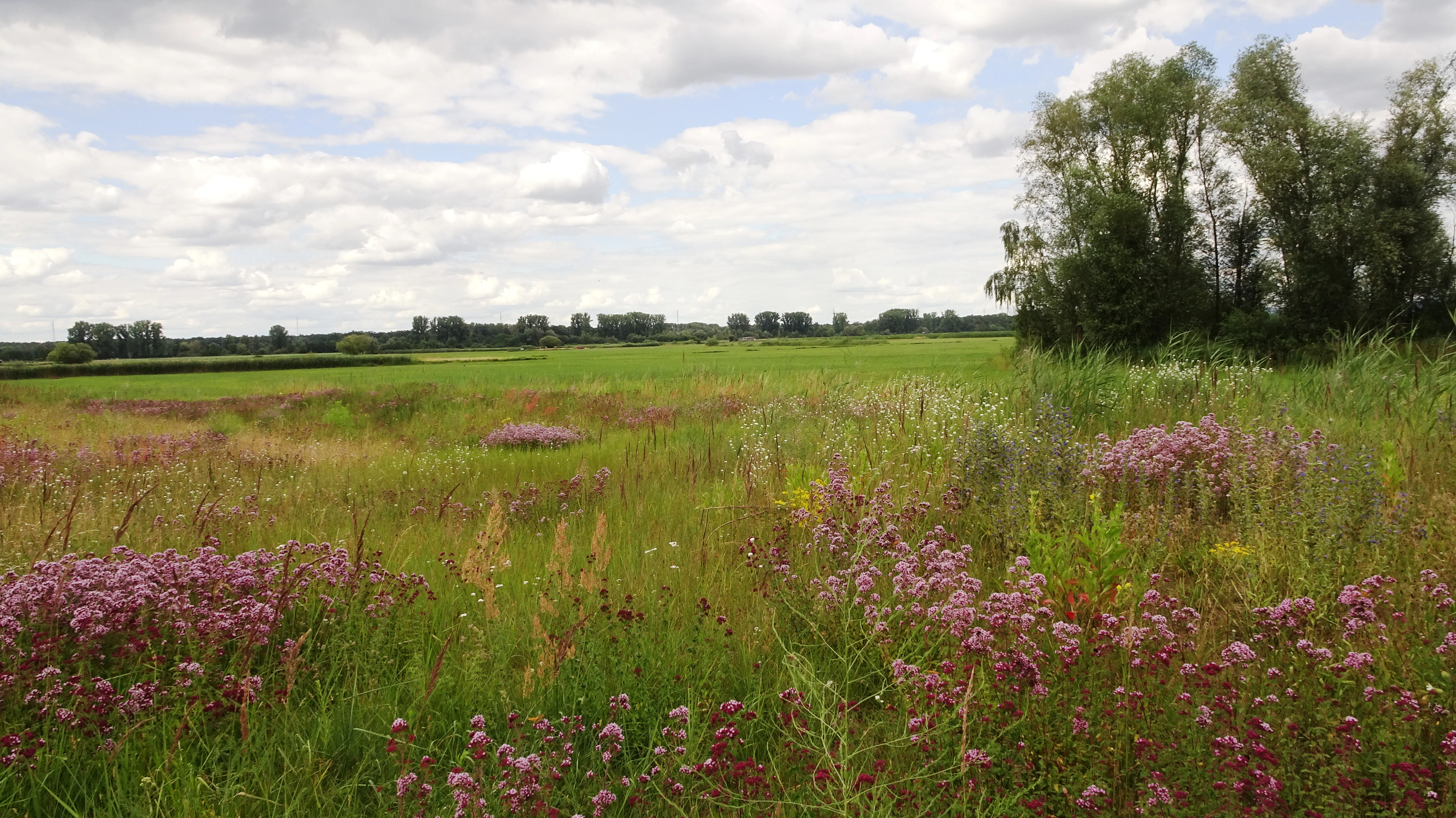
A wide landscape view of a green meadow filled with patches of purple wildflowers in the foreground, with a line of trees in the background under a cloudy sky.
A view of the meadows and inland dune habitat within the Auf dem Sand nature reserve.

Auf dem Sand zwischen Hergershausen und Altheim history and protected-area timeline

The Hergershäuser Wiesen region was historically a continuous river floodplain shaped by the seasonal dynamics of the Gersprenz, supporting extensive meadows, ponds, and wetland habitats. Beginning in the mid-20th century, this landscape underwent severe transformation: the river was canalized in 1940, drainage channels were deepened throughout the 1950s, and groundwater levels fell further due to drinking water extraction.

These changes progressively converted the floodplain into a dry agricultural steppe dominated by arable fields. As recently as 1970, around 170 hectares of meadow still survived between Hergershausen and Münster, but by the time the first protective steps were taken in the 1980s, only about 27 hectares of grassland remained.

In 1984 the first Naturschutzgebiet in this landscape, Die kleine Qualle von Hergershausen, was designated. Auf dem Sand zwischen Hergershausen und Altheim followed as the second protected unit, established by legal ordinance on 12 October 1998. The reserve was conceived both as a refuge for meadow and sand-dependent species and as a stepping stone in a wider effort to reconnect surviving wet habitats with the Gersprenz floodplain.

Since the early 2000s the broader landscape has been partially restored. The Gersprenz itself was renaturalized along the Hergershäuser Wiesen stretch, and since 2008 (with revisions in 2016) the two reserves have been formally integrated into the larger Natura 2000 sites Untere Gersprenz and Untere Gersprenzaue. This sequence, from canalization and drainage to restoration and European-level protection, defines the conservation history of the area.

Auf dem Sand zwischen Hergershausen und Altheim landscape and geographic character

The landscape of Auf dem Sand is shaped by the collision of two very different physical settings: dry sandy ground and low-lying floodplain terrain. Sand deposits from former river activity have left behind a low inland dune along parts of the reserve, a striking feature in an otherwise flat agricultural region. From this slightly elevated viewpoint, visitors can look out across flat meadows, shallow water zones, and ponds in the lower Gersprenz plain.

The reserve lies in the Untermainebene natural region, more specifically in the sub-unit of the Gersprenzniederung, the broad, formerly dynamic floodplain of the Gersprenz river. Although the river was historically straightened and deepened, renaturalization efforts in recent decades have begun to restore parts of the natural channel dynamics.

Beyond the dune, the terrain is dominated by open meadows, scattered trees, hedgerows, old field paths, and small water bodies. Head-pollarded willows (Kopfweiden), isolated fruit trees, and small field copses break up the open ground, while sandy pockets and former arable land create drier microhabitats. The result is a varied, visually appealing small-scale cultural landscape rather than a uniform natural wilderness.
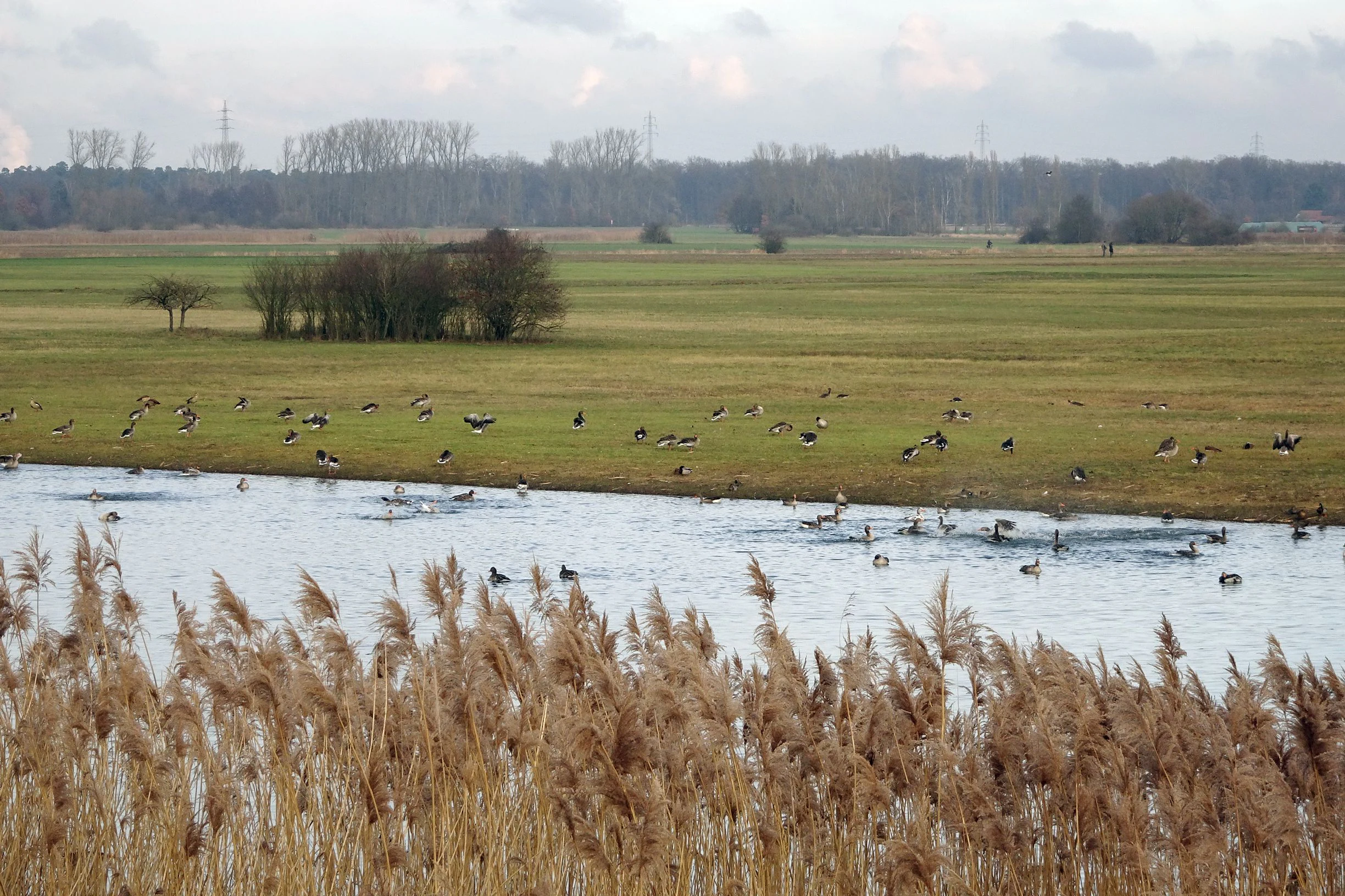
A wide view of a wetland landscape featuring a calm stream in the foreground surrounded by tall brown reeds, with a grassy meadow and a large flock of birds, likely greylag geese, in the midground, and a tree line in the background under an overcast sky.
Greylag geese in the wetlands of the Hergershaeuser Wiesen, part of the Auf dem Sand nature reserve.

Auf dem Sand zwischen Hergershausen und Altheim ecosystems, habitats, and plant life

Ecologically, the reserve is defined by the unusual juxtaposition of sandy and wet habitats. The dry sand areas support heat- and drought-loving plant communities, including species that depend on open mineral soil, while the wet meadows and shallow waters host more typical floodplain flora adapted to seasonal flooding and high groundwater.

Vegetation patterns in the area include extensively managed meadows, reed and rush communities around ponds and ditches, and patches of scrub and tall herb vegetation on transitional ground. Abandoned arable plots and set-aside fields now function as fallow land, providing additional habitat structure and refuge for annual and pioneer species. Field copses, hedgerows, and isolated trees offer nesting sites, cover, and movement corridors for wildlife.

The combination of microclimates, soil types, and water regimes within a small area creates an unusually high habitat diversity for its size. Standing and shallow water bodies also play an important role in buffering seasonal water fluctuations and supporting aquatic and amphibious life.
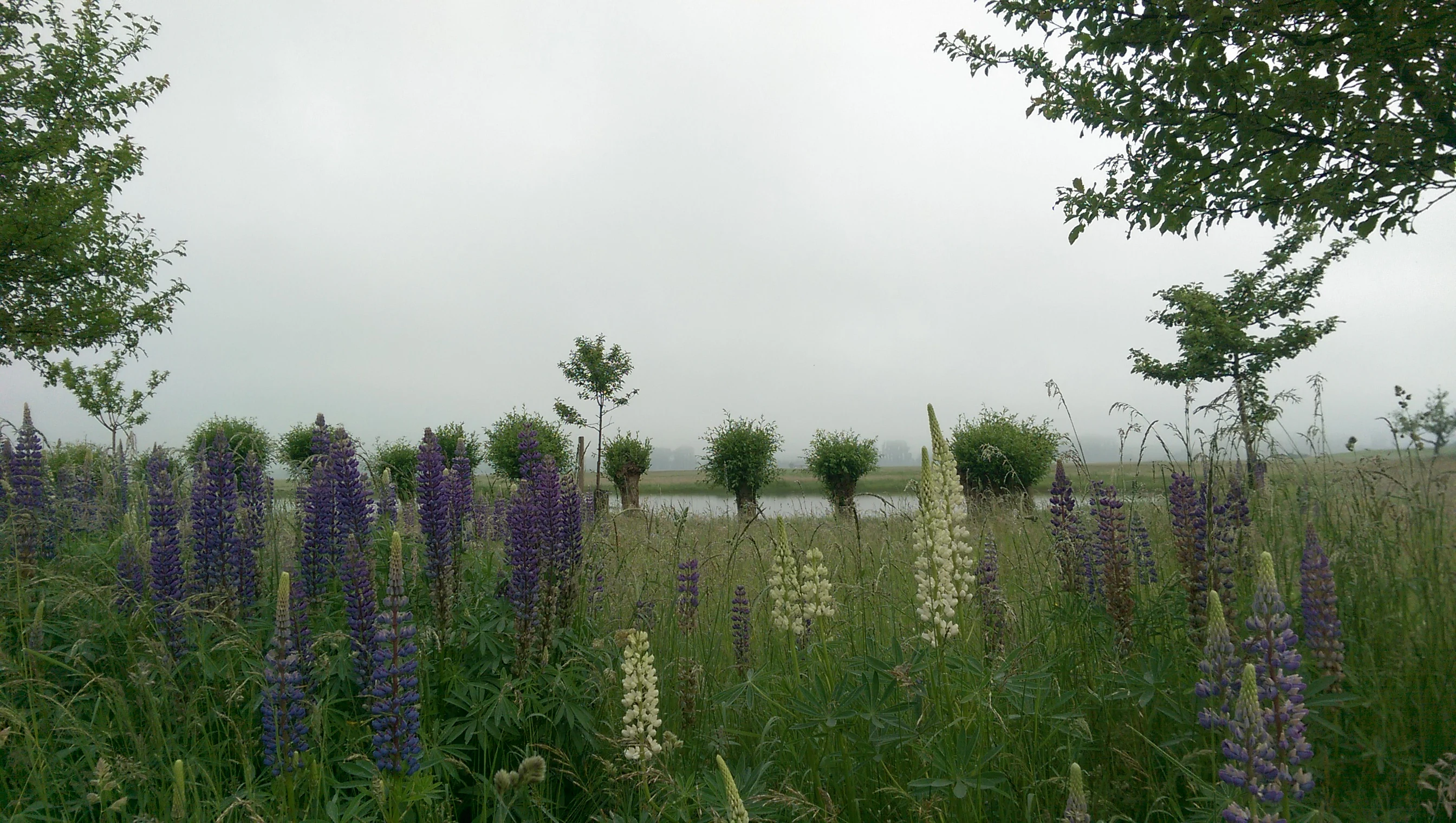
A field of purple and white lupine flowers in the foreground, with a pond and row of small trees in the background under an overcast sky.
A view of the wetland habitat at the Auf dem Sand nature reserve, featuring blooming lupines in the foreground and a calm pond in the distance.

Auf dem Sand zwischen Hergershausen und Altheim wildlife and species highlights

The reserve is especially important for birdlife typical of lowland floodplain and wet meadow habitats. Its shallow water areas and ponds attract waterfowl, including species that use the site as feeding, resting, or wintering habitat. The mention of greylag geese in the protected area highlights the importance of open water and wet grassland for migratory and resident waterbirds.

The mosaic of meadows, ditches, scrub, and field copses also supports a range of meadow-nesting and shrub-nesting songbirds, as well as ground-breeding species that benefit from open, low-vegetation conditions maintained through active management. The integration of the site into the EU Birds Directive area Untere Gersprenzaue underscores its role in safeguarding these populations at a regional scale.

Beyond birds, the ponds, temporary pools, and wet zones provide habitat for amphibians and aquatic invertebrates, while the sandy areas and fallow land support insects such as wild bees and other pollinators. The combination of habitats and the renaturalization of the Gersprenz improve conditions for fish and other aquatic fauna in the connected river system. The presence of a stork nest visible from the reserve underscores how the landscape supports larger breeding birds alongside the smaller meadow specialists.
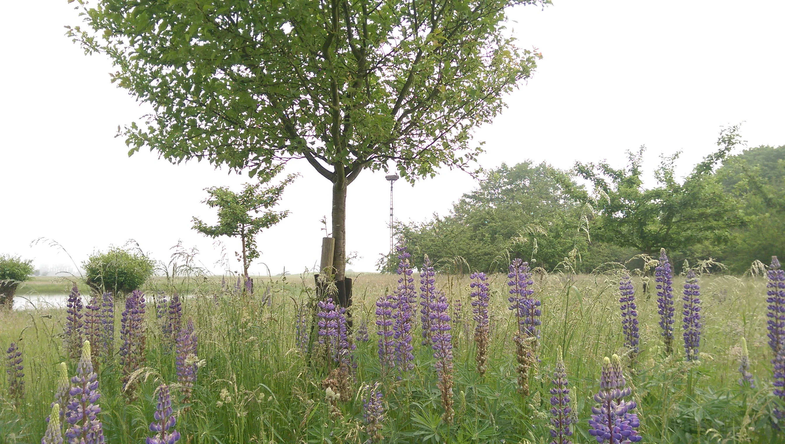
A field of blooming purple lupine flowers in the foreground with a young tree standing in the center and a pond visible in the left background.
A meadow in the Auf dem Sand nature reserve filled with blooming purple lupines, with a central tree and a pond nearby.

Auf dem Sand zwischen Hergershausen und Altheim conservation status and protection priorities

As a designated Naturschutzgebiet, Auf dem Sand untersteht der strengen deutschen Schutzgebietsregelung und ist als IUCN-Kategorie-IV-Gebiet eingestuft. Schutzzweck ist die Erhaltung und Pflege der extensiv genutzten Feuchtwiesen, der Äcker und Brachen, der Tümpel und Flachwasserbereiche, der Feldgehölze sowie der trockenen Sandflächen. Diese Biotope sollen als Lebensraum, Überwinterungs- und Rastgebiet für gefährdete und bedrohte Tier- und Pflanzenarten dienen.

Konservatorisch ist das Gebiet vor allem deshalb bedeutsam, weil hier auf kleiner Fläche ein seltener Biotopkomplex aus nassen Wiesen, offenen Wasserflächen und trockenen Sandstandorten erhalten geblieben ist, der in der intensiv landwirtschaftlich genutzten Untermainebene sonst kaum noch vorkommt. Pflegemaßnahmen zielen darauf, die offene Wiesenstruktur zu sichern, Verbuschung zu verhindern und die hydrologischen Bedingungen für Feuchtbiotope zu stabilisieren.

Auch die Vernetzung mit dem benachbarten Schutzgebiet Die kleine Qualle von Hergershausen und mit der Gersprenzaue ist ein zentrales Anliegen. Durch Trittsteine wie Auf dem Sand sollen isolierte Restbestände von Feuchtwiesenarten wieder miteinander verbunden werden. Die Eingliederung in die Natura-2000-Gebiete Untere Gersprenz und Untere Gersprenzaue gibt dem Schutzgebiet einen zusätzlichen Rahmen auf europäischer Ebene und stellt sicher, dass die Bewirtschaftung an den Erhaltungszielen dieser Gebiete ausgerichtet wird.

Auf dem Sand zwischen Hergershausen und Altheim cultural meaning and human context

The reserve sits within a long-standing cultural landscape in which human use, especially through traditional meadow management, grazing, and fruit-tree cultivation, has shaped the mosaic of habitats that the conservation effort now seeks to protect. Old head-pollarded willows, scattered fruit trees, hedgerows, and the remnants of former hay meadows all reflect decades of rural land use.

The Hergershäuser Wiesen also carry a strong local identity. They are recognized by the district as a key natural and recreational landscape, and the BioTopTour of Landkreis Darmstadt-Dieburg runs a designated hiking and cycling route through them, linking Auf dem Sand and Die kleine Qualle. This combination of ecological and educational value reflects a regional tradition of integrating nature protection with local awareness and visitor engagement.

Although the area is modest in size, its inclusion in a district-wide route network means it functions as a small but visible cultural-natural landmark for surrounding communities such as Babenhausen, Münster, and Hergershausen.

Top sights and standout views in Auf dem Sand zwischen Hergershausen und Altheim

The reserve's chief highlight is its compact but unusually diverse habitat mosaic, which brings together inland sand dune, dry open sand, wet meadows, ponds, ditches, and small woodlands within a single protected perimeter. Few sites in the lower Gersprenz plain preserve such a pattern today.

Equally notable is the reserve's role as a connecting piece in the Hergershäuser Wiesen: it bridges the older reserve Die kleine Qualle with the renaturalized Gersprenz and reinforces the ecological network of the Untermainebene. Its integration into the Natura 2000 system also makes it a small but meaningful contributor to the conservation of lowland floodplain habitats across Hesse.

Finally, the BioTopTour route through the area gives visitors a structured way to experience the contrast between dune and meadow first-hand, making the reserve an accessible example of how small nature reserves in intensively farmed regions can still preserve distinctive landscapes.

Best time to visit Auf dem Sand zwischen Hergershausen und Altheim

Spring and early summer are particularly rewarding periods, when extensive meadows are typically at their richest and many breeding birds are active around the ponds and wet grassland. Shallow water areas and wet meadows tend to be most attractive from spring through early summer, when water levels and vegetation create the strongest visual contrast with the surrounding sand areas.

Autumn and winter also have their own character, when the area can host resting and wintering waterfowl and the open sandy patches become more visible in the landscape. Soft-light mornings and evenings throughout the year can enhance the dune-overlooking-meadow views that many visitors find most striking. As with any protected area, visitors should follow on-site guidance and avoid disturbance to breeding or resting wildlife during sensitive periods.

Monthly climate preview

Long-term representative point measurements tracking monthly temperature and precipitation patterns in Hessen

Auf dem Sand zwischen Hergershausen und Altheim Climate Normals and Annual Temperature Rhythm

Representative coordinate records for Auf dem Sand zwischen Hergershausen und Altheim capture measured long-term temperature swings alongside steady daily precipitation averages from 1991 to 2020. Reviewing the complete monthly climate profile reveals finer seasonal fluctuations and detailed baseline normals across the entire annual cycle.
Annual mean10 °C
0 °C21 °C
Jan
Feb
Mar
Apr10°
May14°
Jun18°
Jul21°
Aug20°
Sep15°
Oct10°
Nov
Dec
Warmest month
July

20.6 °C

Coolest month
January

0.2 °C

Wettest month
July

2.2 mm/day

Driest month
April

1.4 mm/day

Park location guide

Geography guide, regional context, and park location map for Auf dem Sand zwischen Hergershausen und Altheim

Auf dem Sand zwischen Hergershausen und Altheim park geography, regions, and map view in Germany

Understand where Auf dem Sand zwischen Hergershausen und Altheim sits in Germany through a broader geographic reading of the surrounding landscape, nearby location context, and its mapped position within the national park landscape.

How Auf dem Sand zwischen Hergershausen und Altheim fits into Germany

Germany is a federal republic in Western and Central Europe with a population of over 83 million across sixteen constituent states. It is Europe's largest economy by nominal GDP and a major global exporter and importer. The capital is Berlin, and the country borders Denmark, Poland, Czech Republic, Austria, Switzerland, France, Luxembourg, Belgium, and the Netherlands.

Wider geography shaping Auf dem Sand zwischen Hergershausen und Altheim in Germany

Germany is located in Western and Central Europe, spanning 357,022 km². It borders Denmark to the north, Poland and the Czech Republic to the east, Austria and Switzerland to the south, and France, Luxembourg, Belgium, and the Netherlands to the west. The country has coastlines on the Baltic Sea and North Sea to the north, with the Alps located in the southern region.

Map view of Auf dem Sand zwischen Hergershausen und Altheim

Use this park location map to pinpoint Auf dem Sand zwischen Hergershausen und Altheim in Germany, understand its exact geographic position, and read its mapped placement within the surrounding landscape more clearly.

Pigeon | © OpenStreetMap contributors

Location context for Auf dem Sand zwischen Hergershausen und Altheim

Hessen

Visualizing the inland sand dunes, wet meadows, and floodplain habitats of southern Hesse

Auf dem Sand zwischen Hergershausen und Altheim Photos and Landscape Views

Visual documentation reveals the distinct topography and fine-grained habitat mosaic defining Auf dem Sand zwischen Hergershausen und Altheim. Photographic records capture the contrast between dry sandy terrain and lowland river wetlands across the protected reserve.

A wide landscape view of a green meadow filled with patches of purple wildflowers in the foreground, with a line of trees in the background under a cloudy sky.

A wide view of the Auf dem Sand nature reserve featuring flooded green meadows, winding water channels, and trees under a cloudy sky.

A wide view of a wetland landscape featuring a calm stream in the foreground surrounded by tall brown reeds, with a grassy meadow and a large flock of birds, likely greylag geese, in the midground, and a tree line in the background under an overcast sky.

A field of purple and white lupine flowers in the foreground, with a pond and row of small trees in the background under an overcast sky.

A field of blooming purple lupine flowers in the foreground with a young tree standing in the center and a pond visible in the left background.

A meadow filled with tall grasses and wild meadow flowers, with a line of dense shrubs and trees in the background under an overcast sky.

Park atlas

Compare surrounding lowland floodplain landscapes and related nature reserves in the region

Exploring Parks Near Auf dem Sand zwischen Hergershausen und Altheim and Protected Areas

Visitors exploring Auf dem Sand zwischen Hergershausen und Altheim can browse other protected areas featuring similar river floodplains and sandy inland dune habitats. Comparing these regional reserves provides a deeper understanding of connected ecological networks across southern Hesse.
A soft watercolor illustration depicting a meadow landscape with a winding stream, distant hills, and foreground wildflowers.
Nature reserveHessen
About 0.5 km away#1 closest

Northwest

Die kleine Qualle von Hergershausen Nature Reserve and Protected Floodplain Landscapes

A preserved wetland fragment in the Hessen region

Die kleine Qualle von Hergershausen stands as a key protected area within the Gersprenz floodplain. This site offers a unique look at remnant wet meadow terrain, serving as an essential breeding and stopover ground for waterbirds in the Darmstadt-Dieburg district. Its geography provides a clear contrast to the surrounding agricultural fields, highlighting the impact of long-term conservation and habitat restoration efforts.

Area
0.27 km²
Established
1984
IUCN
IV
Watercolor painting of a soft landscape showing a light orange foreground, a band of green trees and bushes in the midground, and faint rolling hills against a pale yellow sky in the background.
Nature reserveLandkreis Darmstadt-Dieburg
About 2.7 km away#2 closest

North

Brackenbruch bei Hergershausen: Nature Reserve and Floodplain Ecosystem in Darmstadt-Dieburg

Protected wetland landscapes and Lache stream geography

Located in the Darmstadt-Dieburg district, Brackenbruch bei Hergershausen preserves a characteristic lowland floodplain mosaic. The terrain includes wet meadows, reed beds, and developing oak-hornbeam forests that reflect the natural vegetation of the southern Hessian river valleys. This site maintains essential wetland habitats for regional biodiversity within its protected boundaries.

Area
0.523 km²
Established
1999
A soft watercolor painting of a winding stream through a green wetland with trees and distant hills in the background.
Nature reserveHessen
About 3.9 km away#3 closest

West

Faulbruch von Münster Nature Reserve: Hessen Wetland and Forest Geography

Mapped protected landscapes in southern Germany.

Discover the geographic composition of Faulbruch von Münster, a protected nature reserve in Hessen. This area features a distinctive mix of alder swamp forest and wet meadows, providing a valuable habitat within the Rhine-Main region. Analyze the terrain, forest patches, and wetland boundaries through our detailed regional atlas.

Area
0.77 km²
Established
1985
IUCN
IV
Watercolor painting of a soft, hazy landscape featuring scattered trees, bushes, and rolling hills in shades of green and pink against a pale background.
Nature reserveHesse
About 4.4 km away#4 closest

West

Fohlenweide von Dieburg: Nature Reserve and Protected Landscape in Hesse, Germany

Mapping the wet meadow habitats and ecological boundaries of southern Hesse.

Located in the Darmstadt-Dieburg district, Fohlenweide von Dieburg is a refined example of a small-scale cultural landscape preserved for its high ecological value. The protected area features a unique mosaic of damp grasslands, forest margins, and riparian strips that support a range of wildlife. This site offers insight into regional conservation management in Central Europe.

Area
0.235 km²
Established
1989
IUCN
IV
Relief
Lowland
A soft watercolor painting showing a tranquil wetland landscape with calm water, grassy shores, and hazy mountains in the background.
Nature reserveHessen
About 4.7 km away#5 closest

North

Kies- und Sandgrube von Dudenhofen: Regional Nature Reserve and Wetland Mapping

Protected post-extraction landscape in the Hessen region

Kies- und Sandgrube von Dudenhofen protects a distinct network of shallow-water habitats and open-ground terrain near Rodgau. Managed as a nature reserve, this area serves as an essential regional hub for wetland biodiversity, mapping the transition between industrial remnants and regenerated forest ecosystems within the Rhine-Main lowlands.

Area
0.173 km²
Established
1995
IUCN
IV
Nature reserveLandkreis Offenbach
About 5.2 km away#6 closest

North

Niederrodener Lache: A Protected Nature Reserve in Landkreis Offenbach, Germany

Brook-side habitat mosaic and regional landscape geography

Niederrodener Lache encompasses 124 hectares of protected woodland and grassland in the Landkreis Offenbach district. Centered on the Lache brook, the reserve hosts a dense interweaving of alder-fringed streams and varied meadow types. Its landscape profile provides a vital refuge for threatened vegetation and wetland biotopes within the suburbanizing Rhine-Main metropolitan area.

Area
1.246 km²
Established
1986
IUCN
IV
A soft watercolor illustration depicting a calm wetland scene with distant rolling hills, foreground reeds, and overhanging tree branches.
Nature reserveHesse
About 5.3 km away#7 closest

Northwest

Rallenteich von Eppertshausen Nature Reserve: Protected Landscape and Regional Geography

Wetland and forest mosaic in the Hesse region

Examine the geographic footprint of Rallenteich von Eppertshausen, a significant nature reserve in Hesse, Germany. This 12-hectare protected area showcases a dense mosaic of pond, reedbed, and acidic oak forest that evolved from historical clay mining. Understanding the park's topography and internal landscape zones offers insight into the evolution of post-industrial protected lands.

Area
0.12 km²
Established
1976
IUCN
IV
Relief
Lowland
A horizontal watercolor painting depicting a soft-focus landscape with rolling green hills, a marshy foreground with grasses, and light purple mountains in the distance.
Nature reserveHesse
About 5.5 km away#8 closest

Southwest

Das große Hörmes bei Dieburg Nature Reserve: A Wetland Protected Area in Hesse

Mapped lowland wetland habitat in the Gersprenz district

This compact nature reserve in southern Hesse provides a essential sanctuary for wetland species, featuring a rare combination of reedbeds, sedge stands, and moist litter meadows. The area highlights the historical character of the Gersprenz lowlands through its protected hydrological network and open herbaceous habitat structure.

Area
0.136 km²
Established
1985
IUCN
IV

Common questions about visiting, size, designation, and location context for Auf dem Sand zwischen Hergershausen und Altheim

Auf dem Sand zwischen Hergershausen und Altheim FAQs for park facts, access, geography, and protected area context

Find quick answers about Auf dem Sand zwischen Hergershausen und Altheim, including protected-area facts, park geography, trail and visitor context, and how the park fits into its surrounding country and regional landscape.
MoriAtlas Explorer

Continue Your Protected Areas Search Across the Global Atlas

Deepen your exploration by continuing the structured search for national parks and protected areas worldwide. Utilize the comprehensive filtering capabilities to compare different conservation landscapes and refine your understanding of global park geography. Discover more about the distribution and characteristics of protected natural areas.

Global natural geography