
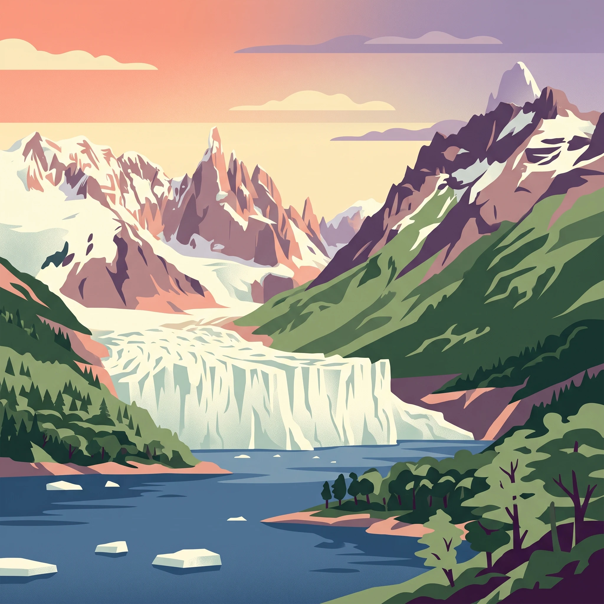
Visit Timing
When is the best time to visit Bernardo O'Higgins National Park?
Determining the best time to visit Bernardo O'Higgins National Park requires navigating one of the most extreme wilderness environments in the world. As a protected area defined by the Southern Patagonian Ice Field, the park does not follow conventional tourism seasonality. The primary window for access occurs during the austral summer, specifically from December through February. During these months, daylight reaches its maximum duration, providing up to 16 hours of light, which is critical for traversing remote terrain that remains cold and prone to rapid weather shifts even at the height of the year. Visitors choosing this period benefit from the most manageable temperatures and the highest probability of stable, albeit unpredictable, mountain conditions.
Navigating the Influence of the Southern Patagonian Ice Field
The central challenge for any visitor is the park's subpolar climate, which is heavily moderated by the immense presence of the Southern Patagonian Ice Field. Because the park spans significant glacial territory, temperatures remain consistently low throughout the year. Even in the peak of January, mean temperatures hover near 1.2 degrees Celsius with maximums rarely climbing above 6 degrees. This cold is compounded by persistent humidity levels often exceeding 95 percent, which makes the air feel substantially colder than thermometer readings might suggest. Planning a trip involves acknowledging that there is no true warm season in the high-country areas of the park. Instead, visitors must prioritize the window where the duration of daylight and the relative reduction in wind intensity allow for safe exploration of sites like the Pío XI Glacier.
Trade-offs in Seasonal Accessibility
Beyond the raw meteorological data, the decision on when to arrive rests on the trade-off between exposure and accessibility. The park's remote nature means that travel is almost exclusively limited to boat or helicopter transport. High wind speeds, which are characteristic of this latitude, frequently influence the viability of these transit routes. While the austral summer months present the most favorable environmental profile, they are also the period where the park's limited, nature-based infrastructure experiences its highest demand. Conversely, visiting outside of the summer months means contending with rapidly shortening daylight,dropping to fewer than eight hours in mid-winter,and intensified, sub-zero cold that fundamentally alters the safety requirements for any expedition. Choosing a date outside the main summer window requires a higher degree of self-sufficiency and a rigorous approach to cold-weather preparation, as the environment becomes increasingly hostile and less accessible to non-specialized visitors. Readers should view the summer window not as a guarantee of mild weather, but as the only period where the environmental baseline supports sustained engagement with the park's glacial and granite-mountain landscapes.
Seasonal timing
Best months for visiting Bernardo O'Higgins National Park
Peak accessibility and daylight
For those targeting the most consistent, if still challenging, conditions, the period from December through February stands as the primary window. During these months, visitors benefit from the longest daylight hours of the year, reaching over 16 hours in December. This extended light is critical for navigating the remote, glacier-heavy terrain of the Southern Patagonian Ice Field, where rapid weather shifts can shorten effective travel time. While temperatures remain modest, with average maximums hovering between 5 and 8 degrees Celsius, this is the only time of year when daily highs regularly stay above freezing. The compromise is that these months represent the height of southern hemisphere summer, meaning competition for limited access points and vessel transport is at its most concentrated.
The shoulder transition: November and March
Travellers who prioritize fewer fellow visitors over the absolute maximum of available daylight often look to the shoulder months of November and March. In November, daylight remains substantial, at over 15 hours, but the park experiences higher average wind speeds, often exceeding 6 m/s. This can significantly impact the stability of boat-based access or helicopter transport, which are the primary means of reaching the park's interior. Conversely, March offers a cooling trend as the region begins its transition toward winter. Mean temperatures drop slightly to around 1 degree Celsius. Choosing these periods requires a higher tolerance for unpredictability, as the climate is less stable than in mid-summer, yet the reward is a quieter experience in one of the world's most isolated wilderness areas.
The off-season: April through October
Visiting between April and October is rarely recommended for general exploration due to the severe environmental constraints of the Aysen and Magallanes regions. During the winter months of June and July, daylight hours fall below 9 hours, and average temperatures at moderate elevations drop deep into the negatives, with mean values sinking toward -4 degrees Celsius. The persistent humidity, which stays above 95 percent throughout the year, combined with these temperatures, makes for an exceptionally harsh climate. Access routes are frequently compromised by ice and severe weather events, and the reduced daylight leaves little margin for error. Explorers considering a visit during this time must be prepared for the reality that the park effectively shuts down its non-essential operations, as the cold and limited light make sustained activity in the high country dangerous andlogistically prohibitive.
Climate Conditions
Annual Weather and Climate Patterns in Bernardo O'Higgins National Park
Environmental Dynamics of the Southern Patagonian Ice Field
Understanding the climate of Bernardo O'Higgins National Park requires viewing the region through the lens of a massive, high-altitude ice cap. Located in Chile's extreme southern latitudes, the park does not follow a conventional four-season cycle. Instead, the climate is defined by consistently cold temperatures, persistent humidity, and significant wind exposure. These long-term normals, recorded at an elevation of approximately 1,096 meters, represent the environment of the higher terrain rather than coastal or sea-level conditions. Travelers should note that these figures are climate records, not daily weather forecasts, and conditions across the park's millions of hectares can fluctuate rapidly due to local topography.
The Shift in Daylight and Thermal Trends
The most dramatic annual variation within the park involves the swing in daylight hours. During the austral summer, specifically December and January, the region experiences over 15 to 16 hours of daylight. This extended light creates the primary window for logistical activity, as darkness is significantly restricted. Conversely, in the heart of the winter period, such as June and July, daylight drops to between 7 and 8 hours. This reduction in solar input has a direct cooling effect on the landscape, contributing to the harsh thermal conditions that define the colder months.
Temperatures remain consistently low throughout the year, with even the warmest months struggling to maintain mean temperatures above freezing. February, often the warmest point in the cycle, reaches an average maximum near 8 degrees Celsius. This is a crucial threshold to understand: while the ice field is the park's defining feature, the air temperatures rarely offer true warmth. Throughout the winter, from May through August, average minimum temperatures frequently drop below negative 10 degrees Celsius. These sub-zero constants, combined with the presence of immense glacial bodies like the Pio XI Glacier, ensure that the park remains a cold-climate environment year-round.
Humidity, Wind, and Precipitation Patterns
Precipitation in this region is substantial and occurs in every month of the year. There is no distinct dry season; rather, the park experiences a steady, high-moisture climate with relative humidity levels consistently exceeding 95 percent. This pervasive moisture, often manifesting as snow or freezing rain, is a core component of the park's ecosystem. Rainfall values appear relatively stable across the months, but the physical state of that precipitation shifts from rain to persistent snow as temperatures drop.
Wind is a persistent factor in the Patagonian landscape, and its influence is felt throughout the year. The wind speeds documented in climatic records typically oscillate between 5 and 6 meters per second, though these averages mask the reality of gusts that can occur in the exposed mountainous terrain. The wind acts as a force multiplier for the cold, significantly increasing the risk of hypothermia for those unprepared for the plummeting wind-chill factors. Because the park's climate is governed by such intense moisture and cold, the relationship between humidity and wind remains a critical consideration for any expedition planning. Even in months that might look slightly more temperate on a chart, the lack of seasonal reprieve from these variables necessitates constant vigilance.
Seasonal dynamics
Seasonal patterns and weather transitions in Bernardo O'Higgins National Park
The rhythm of the Southern Patagonian Ice Field
Bernardo O'Higgins National Park does not adhere to a traditional four-season cycle. Because of its extreme latitude and the presence of the Southern Patagonian Ice Field, the environment is defined more by a struggle between cold-dominated stasis and short-lived light-dominant periods. Travelers should view the annual rhythm as a cycle of light and extreme thermal suppression, where the most meaningful transitions occur between the intense, long-daylight austral summer and the deep, dark winter months.
Peak activity window: The summer pulse
From December through February, the park experiences its most stable phase. While the temperature rarely climbs into what most would call warm, this window offers the longest days of the year, with daylight peaking at over 16 hours in December. This duration provides the only realistic margin for boat-based exploration and photography of the Pío XI Glacier. During this phase, relative humidity remains high, frequently above 95 percent, and wind speeds remain consistent. It is a period of transition toward the highest solar input, yet the proximity to the ice mass ensures that freezing remains a constant baseline risk even on the brightest days.
The transition of the shoulders: March and November
March and November serve as precarious bridges between the active summer season and the deep cold. March sees daylight hours retract sharply, falling from over 14 hours in February to 12.3 hours by the end of the month, signaling a rapid cooling of the landscape. November represents the reverse, with an increase in daylight that begins to thaw the edge of the ice field, though the park remains exceptionally rugged. These months are characterized by increased volatility in wind patterns. Travelers will find these periods to be the most unpredictable, as the environmental threshold between liquid precipitation and snow shifts rapidly. While these months are often considered for lower crowds, the climate data suggests they represent a genuine compromise in safety and access, as the transition periods offer none of the stability found in the core summer months.
The deep cold phase: April through October
From April through October, the park enters a prolonged period of deep thermal suppression. Mean temperatures drop consistently below freezing, with July marking the lowest point where average minimums can reach -14C. Throughout these months, daylight hours diminish to their minimum in June, when the sun is present for fewer than eight hours a day. This phase is defined by constant freezing, extremely limited visibility, and, crucially, a lack of the logistical infrastructure that might otherwise support travel. During this time, the park environment is governed by the persistent influence of the ice field, which maintains a harsh, high-humidity, and subpolar state. Visitors should characterize this not as a winter season in the sense of a snow-sports destination, but as a period of environmental lockdown where the physical reality of the landscape makes standard access nearly impossible.
Seasonal Experiences
Experiencing the landscapes and glaciers of Bernardo O'Higgins National Park by season
Navigating the Southern Patagonian Ice Field through the seasons
The experience of visiting this vast wilderness is fundamentally shaped by the interaction between the extreme latitude and the massive Southern Patagonian Ice Field. Because the park is largely accessible only by water or, in specific high-altitude contexts, via specialized expeditionary air support, the feasibility of exploring landmarks like the Pio XI Glacier depends heavily on the seasonal capacity for maritime transit. During the austral summer months of December through February, extended daylight hours provide the most reliable window for boat-based excursions into the fjords. This period offers the longest daily exposure to the park's coastal and glacial landscapes, allowing for a more manageable pace when viewing the active ice fronts.
Seasonal variations in glacier and mountain accessibility
The physical environment remains harsh year-round, but the risks and physical barriers shift as the climate moves away from the December to February peak. While the Pío XI Glacier is a constant presence, the surrounding waters and weather-dependent approach channels are highly sensitive to the volatile winds that characterize the region. In the shoulder months of November and March, travelers may find reduced vessel traffic and more variable marine conditions, which can alter the stability of planned trips to remote fjords. Access to summits such as Mount Balmaceda or the iconic granite spires of the interior remains limited by the same climatic factors, as shifting snow and ice conditions on the upper slopes dictate what is physically traversable for mountaineers.
Timing for wildlife and wilderness observation
Visitors seeking to observe the park's fragile ecosystems, including the habitat of the Chilean huemul, will find that the timing of their visit aligns with the period of greatest human mobility in the park. During the summer, longer daylight hours increase the probability of spotting wildlife along the coastal fringes or in accessible valleys, though such sightings remain opportunistic rather than guaranteed. Because the park serves as one of the last secure refuges for the huemul, its movements are largely undisturbed by seasonal human activity. Observations should always prioritize the animal's welfare, keeping in mind that the extreme cold of the off-season months from April through October severely restricts both human presence and the visibility of any fauna due to the scarcity of daylight and the intensity of the subpolar environment. Regardless of the month chosen, the park experience is defined by a deep sense of isolation, making the choice of timing a balance between the necessity of safer transit conditions in summer and the pursuit of a profound, albeit logistically challenging, wilderness solitude.
Travel Priorities
Choosing the Best Time to Visit Bernardo O'Higgins National Park Based on Travel Goals
Planning for Maximum Daylight and Extended Activity Windows
For travellers whose primary goal is to maximize the time available for exploration, the window from December through January offers the most favorable conditions. During these months, daylight hours peak, with December reaching approximately 16 hours of light. This extended period is crucial in an environment where travel, whether by boat or foot, is dictated by safety and weather-imposed constraints. Longer days provide a necessary safety margin, allowing for more flexible departure and return times for glacier viewing or coastal navigation, which are the primary activities supported by the park's topography. The trade-off for this extended daylight is the persistence of the park's subpolar environment, where mean temperatures remain low, typically hovering around 0.5 degrees Celsius to 1.6 degrees Celsius, requiring high-performance cold-weather gear regardless of the solar exposure.
Prioritizing Milder Thermal Conditions
Those seeking the least punishing thermal experience should target February. While the park is defined by a lack of traditional summer warmth, February records the highest average maximum temperatures, reaching roughly 8 degrees Celsius. This modest peak in the thermal profile makes outdoor activities feel marginally more sustainable, particularly for those engaged in boat-based glacier excursions where wind chill significantly impacts perceived temperature. However, this preference for relative mildness comes with a slight reduction in daylight hours compared to December and January. Travellers must balance the desire for a higher maximum temperature against the loss of the long-duration light that characterizes the earlier summer months.
Managing Wind Exposure and Navigational Stability
Wind is a constant factor in the Southern Patagonian Ice Field, significantly affecting marine and glacial access. Based on climate normals, wind speeds exhibit volatility throughout the year. For visitors concerned with the stability of boat-based transit to sites like the Pio XI Glacier, early February often presents a slightly more favorable wind profile compared to the intense wind speeds recorded in November and December, which can exceed 6 meters per second. Choosing a period with lower wind energy is not a guarantee of calm conditions, as weather in this region remains highly localized and unpredictable, but it represents the most informed choice available when attempting to mitigate the risk of cancellations for excursions.
Navigating the Trade-offs of the Shoulder Seasons
Visitors who prioritize solitude or specific mountain photography often look toward the shoulder months of November or March. These periods present a distinct set of compromises. November offers long, building daylight hours but is typically accompanied by higher wind speeds and unsettled weather patterns. March, conversely, provides a transition toward shorter days but can offer more stable, albeit colder, atmospheric conditions. Neither month is ideal for those requiring consistent access to the most remote corners of the ice field, as the risk of extreme weather events increases sharply compared to the mid-summer peak. These months are best suited for travellers with high flexibility in their itinerary who can adjust to rapid changes in local conditions without the pressure of a tight, multi-day schedule.
Access & Logistics
Seasonal access and logistical planning for Bernardo O'Higgins National Park
Navigating to a remote wilderness
Bernardo O'Higgins National Park is defined by its extreme isolation and the absence of traditional road access. Because the landscape is dominated by the Southern Patagonian Ice Field and an intricate network of fjords, the park is only reachable by sea or air. Travellers should expect that all entry points require pre-arranged transport, as there are no public roads leading into the park boundaries. The primary maritime gateways for accessing these remote regions include Puerto Natales, Villa O'Higgins, Caleta Tortel, and the isolated outpost of Puerto Edén. Access schedules are heavily influenced by the volatile maritime conditions of the region, and independent travel is rarely viable without significant logistical planning.
Maritime and seasonal transport options
Maritime travel serves as the most common method for reaching the park's most iconic features, such as the Pío XI Glacier and the glaciers located at the head of the Última Esperanza Sound. Navigating these waters involves coordinating with local operators or regional ferry services. For instance, the ferry connecting Puerto Montt and Puerto Natales offers a multi-day journey that traverses significant portions of the coastline. These vessels provide a practical, though time-intensive, way to experience the transition between mainland regions and the park. Visitors often find that booking these maritime routes during the summer months is essential, as availability can be limited and services may fluctuate based on sea states and operational demand. Always verify current sailing schedules and booking requirements directly with transport providers before finalizing your travel dates.
Operational and administrative verification
Beyond transport, administrative requirements for the park are subject to change and must be verified through official channels. The Corporación Nacional Forestal (CONAF) manages the park and remains the only source for definitive information regarding entrance requirements, permit necessities, or temporary closures due to environmental conditions. Because the park encompasses such a vast and rugged territory, specific zones may have distinct access rules or restrictions that are not applied uniformly. Visitors should consult the official CONAF website or reach out to local park authorities in the Aysén and Magallanes regions to confirm current status before arrival. Never rely on third-party guides for up-to-the-minute operational details, as policies concerning visitor management and protected zones are updated to ensure the conservation of the huemul and other sensitive habitats.
Safety & Preparation
Seasonal hazards and essential preparation for Bernardo O'Higgins National Park
Navigating environmental volatility in the ice field
The climate of the Southern Patagonian Ice Field dictates that preparation must center on the reality of subpolar conditions rather than specific calendar dates. Even during the peak summer months, travelers should anticipate persistent humidity levels often exceeding 95 percent, which significantly accelerates heat loss even when ambient temperatures appear moderate. The absence of a dry season means that precipitation is a constant factor. Visitors must prioritize gear that manages moisture effectively, as damp conditions can turn manageable temperatures into a serious risk for hypothermia if clothing layers are compromised.
Preparing for sustained high-latitude wind and chill
Wind serves as the most consistent environmental challenge across all seasons. Normals indicate wind speeds remain relatively stable throughout the year, but the lack of sheltering infrastructure means that gusts can impact movement and safety without warning. Preparation strategies should focus on wind-resistant layering systems. Because the park reaches high elevations within the ice field, wind chill is a constant threat that lowers the perceived temperature well below the mean values. Regardless of the month, the primary safety strategy remains the ability to protect core body temperature against this constant exposure. Reliable outdoor gear, which is windproof and highly breathable, is essential for every visitor planning to move through the fjords or near the glacier fringes.
Managing limited daylight for safe transit
Daylight is a critical variable that fundamentally alters safety planning. During the deep cold period from April through September, the extreme reduction in sun exposure (dipping under 8 hours in June) creates a very narrow margin for error. Travel in this environment is slow, and the lack of daylight limits the window for safe movement between coastal landings and glacier overlooks. During the summer, the 16-hour daylight cycle provides more flexibility, but it also creates a false sense of security. Always plan activities to conclude well before the light fades, as navigation becomes exponentially more difficult in the rugged, pathless terrain characterizing the park. Always consult local maritime authorities regarding light-dependent vessel transit, as visibility and tides are primary factors for safe return to base.
Verifying conditions before departure
Because the park contains no centralized infrastructure or supply points, personal readiness is the only safety margin. Never rely on general seasonal expectations for specific itinerary planning. Before arriving, always check the latest official weather alerts and marine forecasts from authorized Chilean services. The conditions found in the fjords can differ significantly from those reported in inland valleys, and shifting ice conditions near glaciers can occur without notice. Rely on current, region-specific updates provided by the park administration and your transport operators to adjust your plans, gear, and timing to the actual conditions present during your visit.
Final Planning
Deciding the right time to visit Bernardo O'Higgins National Park
Choosing when to journey into this vast expanse of the Southern Patagonian Ice Field requires balancing the desire for extended daylight against the inevitability of a harsh, subpolar climate. There is no single universal window that eliminates the environmental challenges inherent to such a remote region, as the park remains defined by cold temperatures, high humidity, and volatile winds regardless of the season. A successful trip depends on aligning your specific tolerance for these conditions with the logistical realities of accessing an area that offers no traditional infrastructure.
Prioritizing your exploration goals
If your primary objective is to maximize outdoor time and take advantage of the longest daylight hours for glacial photography or remote transit, the austral summer between December and February is the most practical choice. These months offer the highest statistical probability of manageable temperatures, though even during this peak, you must remain prepared for sudden shifts in weather. The transition months of November and March provide a secondary option for those seeking to avoid the highest level of visitor activity. While these shoulder months experience increased wind volatility and cooling trends, they represent a conscious trade-off for a quieter, more solitary experience. Visiting outside these windows, particularly during the deep cold of April through October, presents extreme challenges, including significantly reduced daylight and limited, weather-dependent transport options. This period is reserved only for those with significant experience in high-latitude environments and the capacity for high-risk, independent logistics.
Integrating environmental constraints into your decision
As you finalize your plans, remember that the climate normals provided for this region serve as a baseline for expected patterns rather than as a guarantee of future conditions. The environment is defined by its unpredictability, and safety must remain your guiding principle. Because the park is accessible only via specific maritime or aerial transport, your ability to move through the landscape is tied to the current operational status of these services and the immediate weather forecast. Always verify your intended route and transport options with official sources like CONAF or local operators before committing to a departure date. By acknowledging that you are entering a wilderness where nature dictates access, you can better prepare for the reality of your chosen dates and ensure your expectations align with the actual, current conditions of this southern frontier.