
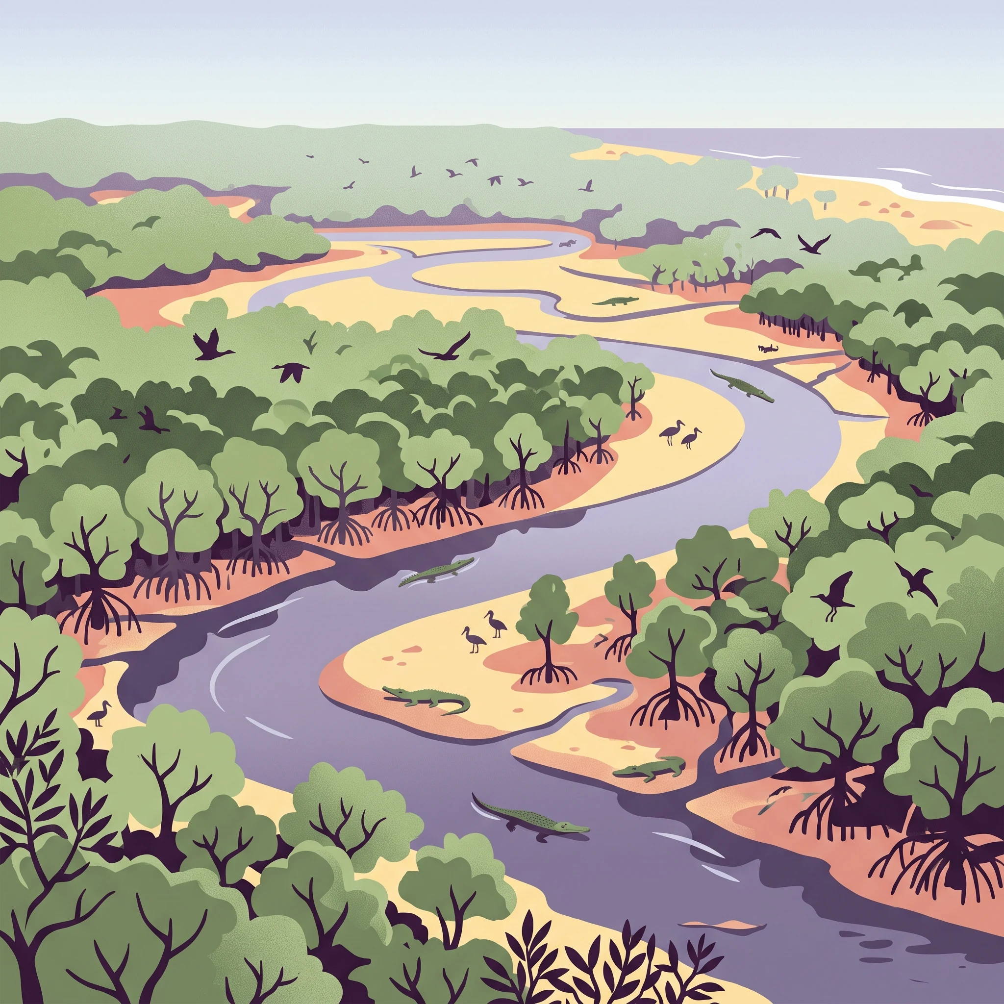
Visit Timing
Best Time to Visit Bhitarkanika National Park: Core Timing Factors
Navigating the Mangrove Climate Cycle
The best time to visit Bhitarkanika National Park centers on the trade-off between comfortable, dry-weather wildlife viewing and the humid, lush, yet restrictive conditions of the monsoon months. For most visitors, the period from November to February is the clear preference, as the moderate temperatures and lower precipitation levels create ideal conditions for exploring the intricate network of tidal creeks and forest trails. During these months, the daytime climate remains pleasant, and the relative humidity levels are at their most manageable for extended boat excursions and shore-based wildlife spotting.
The Impact of Humidity and Rainfall
Bhitarkanika operates within a distinct tropical coastal climate where seasonal precipitation dictates both the character of the landscape and the accessibility of the park. As the year progresses from the dry winter into the heat of spring and the intensity of the summer monsoon, visitors face significant shifts in environmental conditions. While winter months offer dry, stable air and comfortable heat, the onset of the wet season brings dramatically higher humidity and heavy rainfall that transforms the wetlands. Understanding this cycle is essential for planning, as the park’s environment is not a static destination but a dynamic ecosystem that responds sharply to the shift between dry and wet periods.
Balancing Wildlife Visibility and Seasonal Comfort
Choosing when to travel requires balancing the desire for prime wildlife observation against personal tolerance for temperature and humidity. The winter months are popular because the cooler, drier air coincides with higher bird activity and clearer conditions for observing saltwater crocodiles along the riverbanks. As temperatures rise in March and April, the park becomes noticeably hotter, with mean temperatures climbing before the cooling effect of the monsoon rains arrives. Visitors should note that while the park remains a natural sanctuary throughout the year, the logistical requirements for a trip during the summer months differ substantially from those during the winter peak. The decision of when to go is ultimately determined by whether a traveler prioritizes a temperate, easy-access experience or prefers the dramatic, verdant atmosphere of the monsoon season, acknowledging that each period offers a unique perspective on this expansive mangrove habitat.
Seasonal Comparison
Best Visiting Seasons and Months at Bhitarkanika National Park
Cool and Dry Window: November to February
For most visitors, the period from November through February represents the most practical window for exploring the mangrove forests and waterways. During these months, daily temperatures are at their most moderate, with average minimums dipping into the low-to-mid teens Celsius. This cooling effect provides relief from the humidity that defines much of the regional calendar, making extended time on small boats or walking along designated pathways more comfortable. Precipitation is at its annual low during this window, with December and January frequently recording minimal rainfall. This stability is particularly advantageous for wildlife observation, as calm weather and clear skies allow for reliable access to the estuarine creeks where saltwater crocodiles often bask on mudflats.
The Transitional Warmth of March and April
As the winter influence wanes, the park enters a transitional phase characterized by rising temperatures and increased wind speeds. March marks the beginning of this shift, while April brings noticeably warmer days, with average maximums climbing toward 39 degrees Celsius. This window is suitable for travelers who prefer to avoid the larger crowds that may appear during the peak winter holidays but who still require relatively dry conditions. While the intensity of the heat increases, the humidity remains lower than it will be during the approaching monsoon, allowing for active exploration during the early morning hours before the midday peak.
The Humid Monsoon and Summer Experience
From May through October, the park transitions into its humid and rain-heavy phase, with significant increases in precipitation and relative humidity, which often exceeds 85 percent by mid-summer. This period is categorically different from the winter season and requires a shift in priorities. While boat-based exploration can be atmospheric during rain, travelers must weigh the benefits of lush, green landscapes and quieter visitor numbers against the potential for disrupted activities and the challenges of high heat. Visitors choosing this period should be aware that the high moisture content and peak summer temperatures create a demanding environment, and the park experience shifts focus toward the resilience of the mangrove ecosystem during the wettest months of July and August.
Scannable Planning Summary
- November – February: Best for general wildlife viewing, comfortable temperatures, and dry weather. Ideal for boat trips and outdoor walking.
- March – April: Best for avoiding peak crowds while maintaining dry, though increasingly hot, conditions. Recommended for early morning visitors.
- May – October: Best for experiencing the raw, wet intensity of the mangrove ecosystem. Suited for travelers who prioritize scenery and solitude over optimal dry-weather access.
Climate Conditions
Bhitarkanika National Park Monthly Weather and Climate Patterns
Interpreting the Annual Climate Cycle
Understanding the climate of Bhitarkanika requires looking beyond simple temperature highs and lows. The park operates on an annual cycle defined by shifting moisture levels and humidity that change the physical experience of the mangrove environment. These climate normals, derived from data collected between 1991 and 2020, represent long-term regional patterns rather than short-term local forecasts. Visitors should anticipate that current conditions on the ground, influenced by localized tidal shifts and weather anomalies, may deviate significantly from these historical averages.
The Shift from Cool Dryness to Pre-Monsoon Heat
The transition from the cooler, stable months of December and January into the peak heat of April and May marks the most significant climatic change for visitors. During the early year, mean temperatures sit in the low 20s Celsius, with relatively low humidity levels near 66 percent. This period offers the most manageable thermal comfort. As spring approaches, the climate shifts rapidly. By April, average maximum temperatures climb toward 39 degrees Celsius. This warming is accompanied by rising wind speeds, which peak in intensity around the same time, often exceeding 4.8 meters per second. This combination of rising heat and persistent air movement creates a starkly different environment compared to the calm, cool winter mornings.
Humidity and the Onset of the Wet Season
Humidity acts as a primary atmospheric constant that intensifies as the year progresses. While winter months maintain a manageable baseline, relative humidity begins a steady climb starting in May. By the height of the monsoon period in July and August, humidity levels frequently reach the high 80-percent range. This period also coincides with the highest precipitation levels, with average daily rainfall peaking above 11 millimeters. The transition is not merely about rain, but about the saturation of the air, which makes high temperatures feel significantly more intense to the human body. During these months, the increased cloud cover also masks the sun, though daylight hours remain at their longest during June and July, providing more time for potential outdoor activity, provided that the weather remains accessible.
Seasonal Wind Patterns and Daylight Extremes
Daylight availability fluctuates by approximately two and a half hours between the winter solstice and the summer solstice. December features the shortest days, with about 10.76 hours of daylight, which limits the time available for boat-based exploration or trail walking. By contrast, June offers nearly 13.24 hours of light. However, increased daylight during the summer months is often offset by the volatility of the wet season. Wind intensity also demonstrates a clear pattern, peaking during the hot, pre-monsoon transition months of April and May, before tapering off in the late autumn. These wind patterns are important for anyone planning water-based activities, as they influence the overall conditions across the sprawling tidal creeks and estuarine networks characteristic of the park landscape. Always verify current weather alerts and local guidance, as these climate normals do not account for the immediate impact of localized storms or sea-level conditions.
Seasonal Climate Patterns
Understanding Seasonal Weather Transitions at Bhitarkanika National Park
Defining the Annual Weather Rhythm
Bhitarkanika does not fit a rigid four-season model because its climate is governed by the shifting moisture levels and heat intensity of coastal Odisha. Instead, the year is best understood through three distinct phases: the cool, stable dry period, the hot, building transition, and the intense monsoon phase. Each of these segments dictates the character of the mangrove ecosystem and the nature of travel within the tidal landscape.
The Cool, Dry Phase: November to February
This window is defined by the most consistent weather of the year, characterized by lower humidity and moderate, manageable temperatures. Starting in November, as the post-monsoon humidity begins to wane, the park experiences its peak comfort. Minimum temperatures often drop to around 14 to 16 degrees Celsius, providing crisp, clear mornings that are ideal for navigating the creek networks by boat. Wind speeds are generally lower during this time, resulting in calm water conditions that assist in wildlife observation. This phase is the least taxing for visitors, as the lack of sustained rainfall keeps the mudflats and boardwalks accessible, and the lack of extreme heat allows for longer durations spent in the open air.
The Hot Transition: March to May
As the winter influence recedes, the park enters a rapid warming period that peaks before the monsoon breaks. March acts as a bridge, where the mildness of February quickly gives way to rising mercury, with maximum daytime temperatures frequently climbing into the high 30s. Humidity begins to creep upward, making the midday heat feel more oppressive than the thermometer alone might suggest. By April and May, this heat reaches its annual zenith, with sustained high temperatures and increasing wind speeds. While the park remains visually striking, this period tests visitor endurance. The primary environmental change during these months is the drying out of the landscape, which alters the visibility and behavior of wildlife along the riverbanks, though the increased heat requires careful planning for water intake and shade.
The Monsoon Phase: June to October
This phase represents a complete atmospheric shift, defined by high precipitation and extreme humidity. Starting in June, the influx of moisture from the Bay of Bengal brings heavy, frequent rainfall, which sustains the dense mangrove forest. Humidity levels often climb above 85 percent, creating a heavy, saturated air mass. This period is not merely a wet season, but a time of active ecological transformation where the tidal creeks swell and the humidity remains consistently high. While the rain can make boat travel through the creeks a more challenging, albeit immersive experience, the lush green intensity of the forest is at its peak. Visitors during these months must be prepared for variable conditions, as the weather is less predictable than during the winter months and the intensity of the humidity remains a constant factor throughout the day.
Seasonal Experiences
Experiencing the Mangrove Wilderness of Bhitarkanika Throughout the Year
Navigating the Tidal Creeks for Wildlife Observation
The experience of observing the saltwater crocodiles of Bhitarkanika is fundamentally dictated by the interplay of tidal cycles and seasonal water levels. During the cooler, drier months from November to February, the water levels in the estuarine creeks tend to be more stable, providing better conditions for boat-based observation. As temperatures remain moderate with daily maximums typically hovering near 29°C in December and January, the experience of sitting in an open boat is more comfortable for extended periods. This timeframe aligns with the behavioral patterns of the park's reptilian residents, as they are frequently observed basking on the mudflats. When the air is cooler and the humidity is at its lowest annual point, the visibility across the riverbanks remains clearer, allowing for easier spotting of crocodiles that reach lengths exceeding six meters.
Seasonal Shifts in Bird Watching and Avian Habitats
The park hosts a diverse array of bird life, including black ibis and various darters, which utilize the mangrove canopy and the surrounding wetlands as critical habitats. Bird watching is particularly rewarding during the post-monsoon period, starting in November and extending through the winter. The retreat of heavy monsoon rains, which peak between June and August with precipitation often exceeding 11 mm per day, stabilizes the forest trails and creeks. Visitors arriving in late autumn benefit from the influx of migratory bird populations that find refuge in the Ramsar-designated wetlands. Conversely, the high heat and humidity of May, where average maximum temperatures can climb toward 39°C, make long treks through the humid mangrove forest physically demanding. While the biodiversity remains high year-round, the practical capacity to conduct extended nature treks through the park is significantly enhanced when ambient temperatures are lower and humidity levels drop below 70 percent.
Accessing Remote Beaches and Shorelines
The coastal experiences, including visits to beaches near Pentha or areas such as Hukitola, are heavily influenced by the seasonal wind patterns and the transition of the monsoon. The higher wind speeds recorded during the pre-monsoon months of April and May, which can reach averages near 5 m/s, can affect the stability of boat transit and the experience of visiting exposed shorelines. These months also feature higher humidity and the beginning of more frequent precipitation, which may limit the enjoyment of unstructured exploration. Visitors looking to engage in cycling or walking along the coastal fringes of the sanctuary generally find the stable, dry conditions of the winter months most supportive of these activities. By planning travel to coincide with the periods of lower rainfall and moderate wind, visitors can better access the diverse mangrove ecosystems that define this unique Ramsar site without the challenges posed by the peak humidity of the late summer months.
Visitor Priorities
Selecting the Best Time to Visit Bhitarkanika National Park for Your Interests
Prioritizing Mild Weather for Terrestrial Exploration
For travelers who prioritize comfortable walking temperatures and lower humidity levels, the period between December and February is the most suitable window. During these months, the average minimum temperatures drop to approximately 14 to 15 degrees Celsius, while daily highs remain well below the intense heat that characterizes the rest of the year. This timeframe provides the most consistent relief from the high humidity levels seen during the summer and monsoon months, which often exceed 80 percent. The primary trade-off for this mildness is that these months offer the shortest daylight hours of the year, with December averaging around 10.76 hours. While this is sufficient for day excursions, those planning extensive trekking or long photography sessions in the mangrove forests will find their usable daylight window tighter compared to the spring months.
Targeting Drier Conditions for River Navigation
Visitors whose primary objective is to navigate the tidal creeks and estuarine rivers with the lowest possible risk of precipitation should focus on the mid-winter stretch of December through February. December, in particular, records the lowest precipitation of the year, with a mean of 0.3 mm per day. This period offers the most stable conditions for boat-based wildlife observation, as calm skies and clear visibility enhance the experience of spotting the park's saltwater crocodiles and diverse bird populations. The compromise for choosing this driest phase is the lack of the lush, vibrant greenery that characterizes the landscape during the wetter months. Additionally, these months do not coincide with the monsoon, meaning the landscape will lack the high water levels that some visitors find visually dramatic for boating in the rain.
Maximizing Daylight for Wildlife Photography
For those who require the longest daily windows for photography and extended observation, the late spring period of April and May offers the most daylight, averaging between 12.5 and 13 hours per day. This extended light is essential for capturing images of the diverse avian species and crocodiles that define the park. However, this preference requires a significant trade-off in comfort. These months represent the start of the pre-monsoon heat, with average maximum temperatures climbing toward 39 degrees Celsius. The humidity also begins to rise significantly as the season progresses. Travelers choosing this period must be prepared to manage their activity levels during the midday heat peak to avoid the most intense sun exposure, as the increased wind speeds (approaching 5 m/s) can sometimes make stationary photography more challenging than in the calmer winter months.
Balancing Humidity and Thermal Comfort
Travelers seeking the best middle ground between the cold of winter and the heat of the pre-monsoon season often find November to be an ideal window. As the monsoon recedes and the winter chill has not yet fully set in, November maintains a pleasant average mean temperature of 24.42 degrees Celsius. With a moderate relative humidity of around 71 percent, it provides a more balanced environment than the sweltering months of May or June. The trade-off is the potential for lingering effects of the post-monsoon period, where trails may still be drying out, which can impact the accessibility of certain land-based paths.
Visitor Access & Planning
Seasonal Access Requirements and Planning for Bhitarkanika National Park
Navigating Park Entry Points and Transportation
Access to Bhitarkanika is fundamentally dictated by its status as an estuarine mangrove ecosystem, meaning that movement between the various visitor areas often requires boat-based transport. The two primary entry points typically utilized by visitors are Khola and Gupti. Khola serves as a major gateway for exploring the internal creeks and mangrove forests. Travelers arriving from Bhubaneswar or Cuttack generally utilize these entry hubs to initiate their boat journeys into the interior of the park. Because transport routes can be affected by tidal schedules and the availability of authorized vessels, you must verify current boat operating hours and local transport conditions with the park authorities or your tour operator well before your arrival. Road conditions leading to these entry points, particularly the final stretches, can change depending on seasonal maintenance, so travelers planning a visit by private vehicle should confirm current road viability with local sources.
Requirements for Permits and Official Documentation
Visitors entering the protected areas of the national park are subject to specific permit and entry requirements. These protocols are managed by the Odisha forest department and are subject to change based on management policies or seasonal conservation mandates. Before you finalize your travel dates, you must check the latest information regarding entry fees, permit procurement processes, and any specific visitor regulations that may be in effect at the time of your trip. Note that these requirements are not static; they may differ for domestic and international travelers or depend on the specific zones you intend to access. Do not assume that access rules from previous years remain valid. Always consult official forest department portals or contact the park administration directly to confirm the documentation you need to carry for your visit.
Impact of Tidal Cycles and Seasonal Conditions on Access
While the climate normals provided in previous chapters give an overview of general weather trends, your physical movement within the park is heavily influenced by the daily tidal cycle and broader seasonal changes. The navigation of the creeks is inherently linked to water levels, which shift throughout the day. Consequently, boat departure schedules are rarely fixed and must be coordinated with the tides. Furthermore, during the monsoon months from June to October, when precipitation levels are at their highest, the increased water flow and potential for storm activity can impact the availability of certain routes. You should always treat your planned itinerary as flexible, allowing for adjustments dictated by the current state of the waterways. Before travelling, check for any alerts regarding weather-related disruptions or temporary restrictions on boat operations that may impact your ability to reach specific locations within the sanctuary.
Safety and Preparation
Seasonal Weather Safety and Preparation for Bhitarkanika National Park
Navigating Thermal and Humidity Variations
Preparation for a visit to the park must account for the substantial shifts in humidity and thermal comfort throughout the year. During the cooler, drier months from November to February, air temperatures are generally moderate, making extended periods on the water more comfortable. In contrast, the months from March through May bring rising maximum temperatures and higher humidity levels, which can significantly increase physical fatigue for those spending full days in the field. Travelers should monitor local forecasts to understand the specific thermal context of their chosen dates, as the high humidity of the pre-monsoon and monsoon seasons often makes temperatures feel more intense than they appear on a thermometer.
Preparing for Seasonal Rainfall and Exposure
The park landscape is dominated by tidal networks and mangrove forests, environments that are inherently sensitive to moisture. While the winter months are characterized by minimal precipitation, the transition toward the monsoon season in June brings significant increases in rainfall. Preparing for these conditions means anticipating wet, humid weather if you are traveling between June and October. Light, quick-drying clothing and waterproof protection for personal gear are prudent for these periods. Because the park is largely experienced via boat, protection from both sun and sudden showers is essential regardless of the season. Always check the latest local meteorological reports immediately before departure to identify any active weather systems that might influence your time on the water.
Maintaining Safety in the Mangrove Environment
The most important safety protocol in this estuarine ecosystem is absolute compliance with park regulations and guidance provided by local experts. The mangrove creeks are home to large populations of saltwater crocodiles, and visitors should never attempt to swim in the rivers or wander away from designated paths. Safety in this environment is not merely about managing the elements, but also about respecting the distance required between humans and the native wildlife. Stick to official boat routes and follow the specific advice of your authorized guides, who are experienced in navigating the complex tidal movements that define daily access. Always verify your itinerary against current park alerts, as authorities may restrict specific creeks or forest zones based on local wildlife activity or environmental maintenance requirements. By staying within permitted areas and prioritizing official guidance, you ensure a focus on the natural beauty of the region while minimizing unnecessary risks associated with the unpredictable nature of an expansive, protected wilderness.
Final Planning
How to Choose the Best Time for Your Bhitarkanika National Park Trip
Choosing the right time for your journey into this mangrove wilderness ultimately rests on how you prioritize thermal comfort, the density of wildlife sightings, and your tolerance for the logistical constraints inherent in a tidal, wetland environment. Because the park operates within a dynamic cycle of distinct meteorological phases, there is no single month that perfectly serves every visitor, but there are clear windows that align with specific travel goals.
Prioritizing Climate Comfort and Stable Access
If your primary objective is to navigate the mangrove creeks with the highest degree of physical comfort and predictability, the months from November through February represent the most reliable choice. During this window, you benefit from the lowest relative humidity and the most temperate daily conditions, which directly facilitates extended boat-based wildlife observation and land-based exploration. These months offer a stable dry environment, minimizing the risk of disruptions that are common during the monsoon season. Choosing this period allows you to experience the park’s unique landscape of estuarine rivers and mudflats without the intense heat and saturation that characterize the rest of the year.
Embracing Seasonal Shifts and Wilderness Character
For travelers who prioritize witnessing the park in its most dramatic, high-energy state, the pre-monsoon and early monsoon months provide a starkly different experience. While these periods introduce higher temperatures and elevated humidity, they also reveal the raw, seasonal rhythm of the ecosystem. If you are comfortable with more challenging weather conditions, this window offers a chance to see the park outside of its most popular visitor timeframe. However, this choice requires a higher level of preparation and flexibility, as heat stress and logistical complications become more frequent factors in your daily planning.
Making Your Final Decision
Your decision should reflect a realistic assessment of your personal priorities. If you prefer to avoid high heat and humidity while seeking the most accessible conditions, plan your trip for the cooler months. Conversely, if you prefer less crowded periods and are prepared for more intensive weather, consider the transition phases while remaining mindful of the park’s operational realities. Regardless of when you choose to go, remember that historical climate normals serve as a guide to seasonal patterns rather than a forecast for specific dates. Before finalizing your travel arrangements, always verify current operating schedules, permit requirements, and weather alerts provided by local authorities. By aligning your visit with the environmental conditions that best match your comfort level, you ensure a trip that is both well-prepared and fulfilling.