
Mori Atlas logo
Nature reserveBilstein im Höllental

A compressed geological refuge and protected habitat within the Hessen region

Bilstein im Höllental Nature Reserve: Mapping the Diabase Cliff and Ravine Forest Landscapes

(Naturschutzgebiet Bilstein im Höllental)

Bilstein im Höllental stands as a vital protected landscape in northern Hessen, defined by a dramatic Devonian-age diabase cliff that rises sheer above the Berka valley. This nature reserve preserves a rare ecological contrast, where sun-scorched rock faces support heat-loving plant species while sheltered northern slopes nurture a lush ravine forest of beech and lime. The site serves as a distinct geographical marker within the Geo-Naturpark Frau-Holle-Land, illustrating how resistant bedrock forces local stream morphology and creates specialized relict habitats.

rock refugediabase cliffFluitravine forestwarm microclimate relicNatura 2000
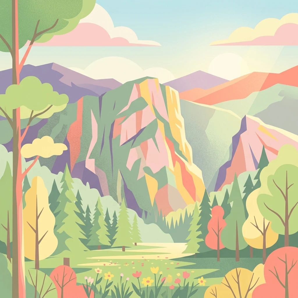
A stylized vector illustration of a mountainous landscape featuring prominent rocky cliffs, a forest of evergreen and deciduous trees, and a sunlit meadow in the foreground with pastel-colored clouds.

Bilstein im Höllental

Nature reserve

Park overview

Structured park overview, official facts, and landscape profile for Bilstein im Höllental

Bilstein im Höllental park facts, protected area profile, and essential visitor context

Review the core facts for Bilstein im Höllental, including designation, size, terrain, visitor scale, habitats, and operating context in one park-focused overview.

About Bilstein im Höllental

Bilstein im Höllental is a compact but scientifically high-value nature reserve in the lower Werra hill country of northern Hesse, Germany. It is defined by a single prominent geological feature: a steep diabase cliff that rises to roughly 284 meters above sea level along the northern edge of the Berka valley near the village of Albungen. Although only about 3.24 hectares in area, the reserve concentrates within that small footprint an exceptional diversity of cliff-dwelling plants, ferns, mosses, lichens, and invertebrates, as well as a contrasting ravine forest on its shaded slopes.

The cliff itself is of significant geological interest. The diabase is a basalt-like volcanic rock that formed during the Devonian and Early Carboniferous periods, roughly 420 to 320 million years ago, when submarine volcanic eruptions along crustal fractures produced lava flows that cooled into this dense, weathering-resistant stone. Its hardness has shaped the surrounding valley: rather than the Berka cutting through the cliff, the stream has been forced to arc around it, producing the narrow, steep-sided valley section that locals call the Höllental, or Hell Valley. Below the cliff, additional diabase outcrops further pinch and darken the valley, enhancing its dramatic character.

In conservation terms, Bilstein im Höllental has built up four overlapping layers of protection over more than a century. A first administrative order in 1914, issued by the royal government of the Prussian Province of Hesse-Nassau, recognized the rock for its geological and botanical significance as a natural monument. By the late 1950s the surrounding Höllental was declared a landscape protection area, and in 1960 the cliff itself was formally entered in the state nature reserve book under the Reich Nature Conservation Act of 1935. Most recently, in 2008, it was incorporated into the European Natura 2000 network as a Fauna-Flora-Habitat site, anchoring it within the European-wide system for protecting rare habitat types.

The reserve's standout ecological feature is its south-facing cliff vegetation. The sun-exposed, shallow-soiled rock creates extreme microclimatic conditions: large daily and seasonal temperature swings at the surface, rapid runoff of rainfall, and limited water availability for plants. These conditions favor warmth-loving, drought-adapted species that in central Germany are otherwise confined to very small relic populations. The flora includes stiff leek (Allium strictum), small meadow-rue, blue fescue, mountain rockcress, blood-red geranium, grape hyacinth-like Anthericum, large-flowered foxglove, and vetchling species, alongside a particularly rich community of small ferns such as spleenworts, wall rue, and rare spleenwort hybrids. Warm-climate butterflies such as the scarce swallowtail (Iphiclides podalirius) and the common Old World swallowtail (Papilio machaon) also live on the rock.

On the shaded north- and east-facing slopes, the contrast is striking. Here, within the same reserve, a mosaic of boulder-strewn scree and ravine forest supports beech, sycamore maple, small-leaved lime, ash, and elm. Conservation management actively removes spruce and pine to maintain and enhance species and structural diversity in this forest type. This sharp juxtaposition of dry, sun-baked rock and moist, shaded forest in so small an area is the source of Bilstein's exceptional conservation profile.

A cultural layer adds further depth. From the 12th to the 16th century, the summit of the Bilstein hosted the ancestral castle of the powerful and wealthy Counts of Bilstein, originally built in 1120 by Rugger II of the Bilstein line. The counts also founded the Premonstratensian monastery of Germerode in 1145. After the last Bilstein count, Otto II, sold his fief to Hessian Landgrave Heinrich I and died impoverished in 1306, the castle gradually fell into ruin and was dismantled in 1594 by the Landgraves of Hesse. Only fragments of walls, remains of a well, and a tower stump rescued from collapse in 1970 survive today, but the site is a listed cultural monument.

Quick facts and research context for Bilstein im Höllental

Bilstein im Höllental is a small nature reserve and Natura 2000 site in the Werra-Meißner-Kreis of northern Hesse, Germany. It protects a steep diabase cliff rising roughly 284 meters above sea level in the Berka valley near Albungen, an area also known locally as the Höllental. The total protected area covers about 3.24 hectares, virtually identical in extent to the associated FFH site (3.19 hectares), and has carried successive layers of formal protection since 1914, becoming a verified nature reserve in 1960 and a Fauna-Flora-Habitat area under Natura 2000 in 2008.

Administratively, the reserve falls within the municipality of Eschwege, in the lower Werra hill country at the edge of the Osthessisches Bergland natural region. It lies within the Geo-Naturpark Frau-Holle-Land and is recognized as one of the most important rock-relict habitats in Hesse for warm-climate, cliff-specialist plants and invertebrates.

Protection and recognition

Documented terrestrial protection history, management scope, and Natura 2000 listings

Bilstein im Höllental Protection Status and International Recognition Data

Bilstein im Höllental maintains a documented terrestrial protection status established in 2008 alongside associated Natura 2000 recognition sources. Structured administrative records outline the conservation scope, official designation timeline, and regulatory framework.

International recognition

Protection details

Protection scope
Terrestrial
Designated year
2008
Transboundary protection
No
WDPA ID
81402
Park context

Deeper park guide and search-rich context for Bilstein im Höllental

Bilstein im Höllental history, landscape, wildlife, and travel context

Explore Bilstein im Höllental through its history, landscape character, ecosystems, wildlife, conservation priorities, cultural context, and seasonal travel timing in a structured park guide built for atlas discovery and search intent.

Why Bilstein im Höllental stands out

The reserve is best known for its dramatic diabase cliff and the unusually rich cliff-specialist vegetation that grows on its sun-exposed rock faces. Its south-facing slopes create an extreme microclimate with strong temperature swings and little available moisture, allowing heat-loving, drought-tolerant species that are otherwise rare in Hesse to persist here. Several plant species reach the northern limit of their global range on this rock, including stiff leek (Allium strictum) and the spleenwort Asplenium ruta-muraria. The site is also notable for its unusual combination of two sharply contrasting habitats in a single tiny area: warm open rock communities with pioneer grasses, ferns, mosses, and lichens on the sunny cliff, and a cool, shady ravine-and-scree forest with beech, sycamore maple, small-leaved lime, ash, and elm on the north- and east-facing slopes. This juxtaposition of hot and cold, dry and moist microhabitats within one cliff is what gives the reserve its exceptional conservation value.
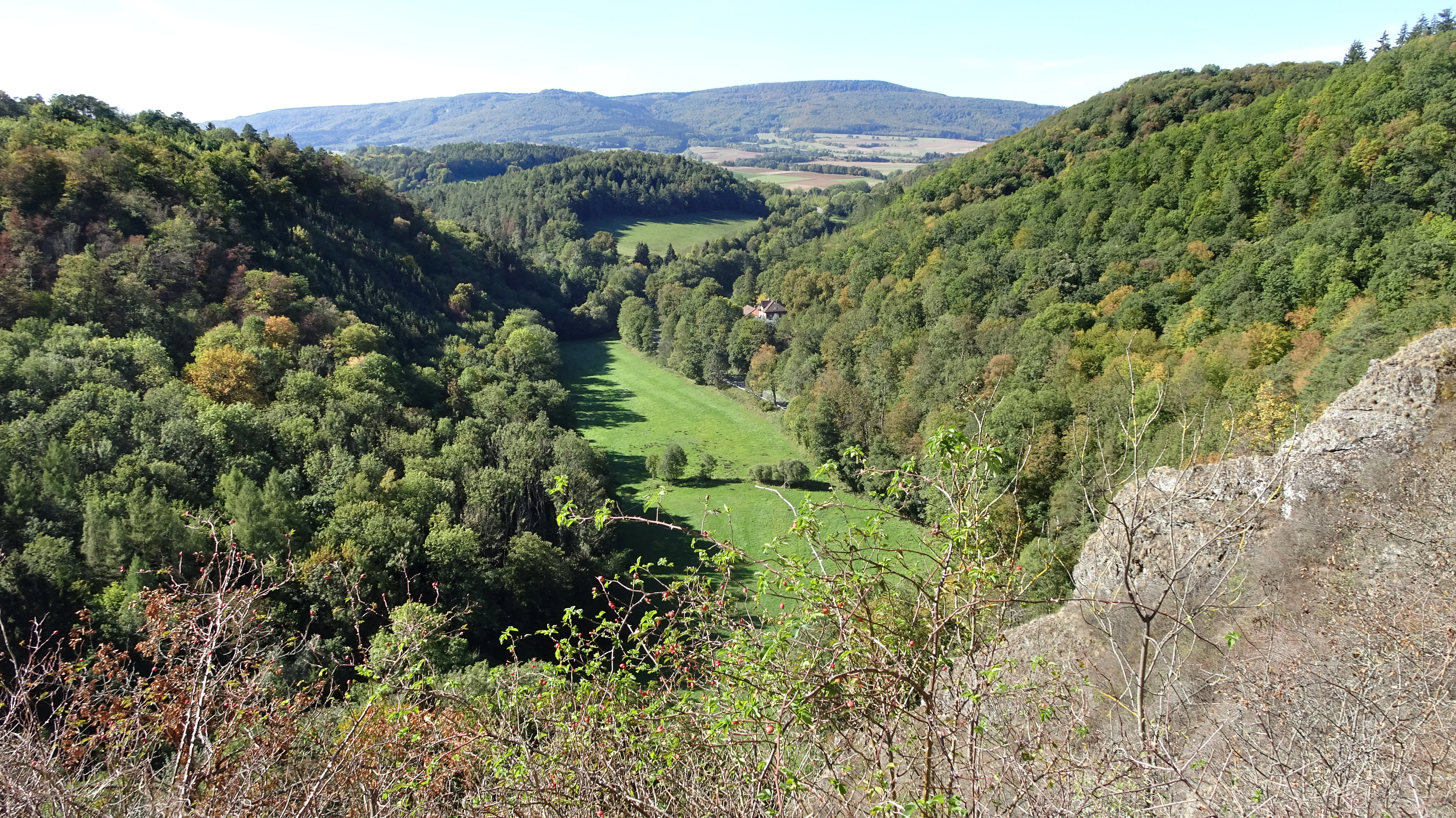
A high-angle scenic view of a deep, green valley surrounded by forested hills, with rocky cliffs visible in the right foreground.
A wide view overlooking the lush valley landscape of the Bilstein im Höllental nature reserve.

Bilstein im Höllental history and protected-area timeline

Bilstein im Höllental has accumulated its protection in a long sequence of formal decisions rather than a single founding event. The first step came in 1914, when the royal government of the Prussian Province of Hesse-Nassau issued an administrative order recognizing the cliff as worthy of protection because of its unusual geological character and its distinctive cliff flora. This effectively made it an early natural monument under the legal framework of the time.

In the late 1950s, attention broadened to the surrounding landscape. The lower nature conservation authority of the former Landkreis Eschwege issued a protection ordinance for landscape parts and features within the district, declaring the Höllental as a whole a landscape protection area. Within that protected setting, further changes to the cliff itself were prohibited.

Two years later, on 29 February 1960, the higher nature conservation authority at the Regierungspräsidium in Kassel entered the Bilstein into the state nature reserve book, bringing it under the formal Naturschutzgebiet designation that still defines its status today. Its national identifier is 1636001 and its WDPA code is 81402.

The most recent and most internationally significant step came at the turn of the century. In June 2000, the federal state of Hesse proposed the site to the European Commission as a candidate Fauna-Flora-Habitat site under the EU Habitats Directive. The Commission confirmed it as a Site of Community Importance in December 2004, and in January 2008 the formal Natura 2000 protection regulation for Hesse brought the FFH site (3.19 hectares, site number 4725-303, WDPA 555520066) into the European protected-area network.

Alongside this natural-protection history, the cliff itself carries a documented medieval chapter. From the 12th to the 16th century the Bilstein was inhabited, and from 1120 onward it hosted the ancestral castle of the Bilstein counts. After the last count sold his holdings and died in poverty in 1306, the fortress declined. The Landgraves of Hesse eventually had it demolished in 1594, leaving only scattered masonry and a tower stump that was stabilized in 1970 to prevent further collapse.

Bilstein im Höllental landscape and geographic character

The defining landscape element is a single dramatic diabase cliff that rises to 284.3 meters above sea level, almost vertically, from the floor of the Berka valley. The cliff rises about a hundred meters above the valley bottom, dominating the narrow, steep-sided valley locally known as the Höllental.

This striking shape is a direct product of the rock itself. Diabase is exceptionally hard and resistant to weathering, so when the Berka stream eroded softer surrounding geology it could not cut through the diabase outcrop. Instead the stream was forced to describe an arc around it, carving the tight bend that gives the Höllental its name and its compressed, gorge-like feel. Downstream of the Bilstein, additional diabase outcrops repeat this pattern, narrowing the valley further and reinforcing its dramatic character.

The landscape has two clearly contrasting visual faces. On the south and southwest, the cliff presents a sun-scorched, near-vertical wall of bare rock with thin soils clinging to ledges and crevices. On the north and east, the slope falls into a cool, boulder-strewn ravine forest where the relief is more broken and sheltered. Together these two faces give the reserve a dramatic, almost compressed topography within a footprint of only a few hectares.

The Bilstein lies within the Geo-Naturpark Frau-Holle-Land and is naturally framed by surrounding higher country: the higher Soodener Bergland to the north and east, the Sooden-Allendorfer Werratal lower down, and the foothills of the Hoher Meißner to the south and west. The view from the cliff itself opens westward across the Berka valley toward the distant silhouette of the Hohen Meißner.
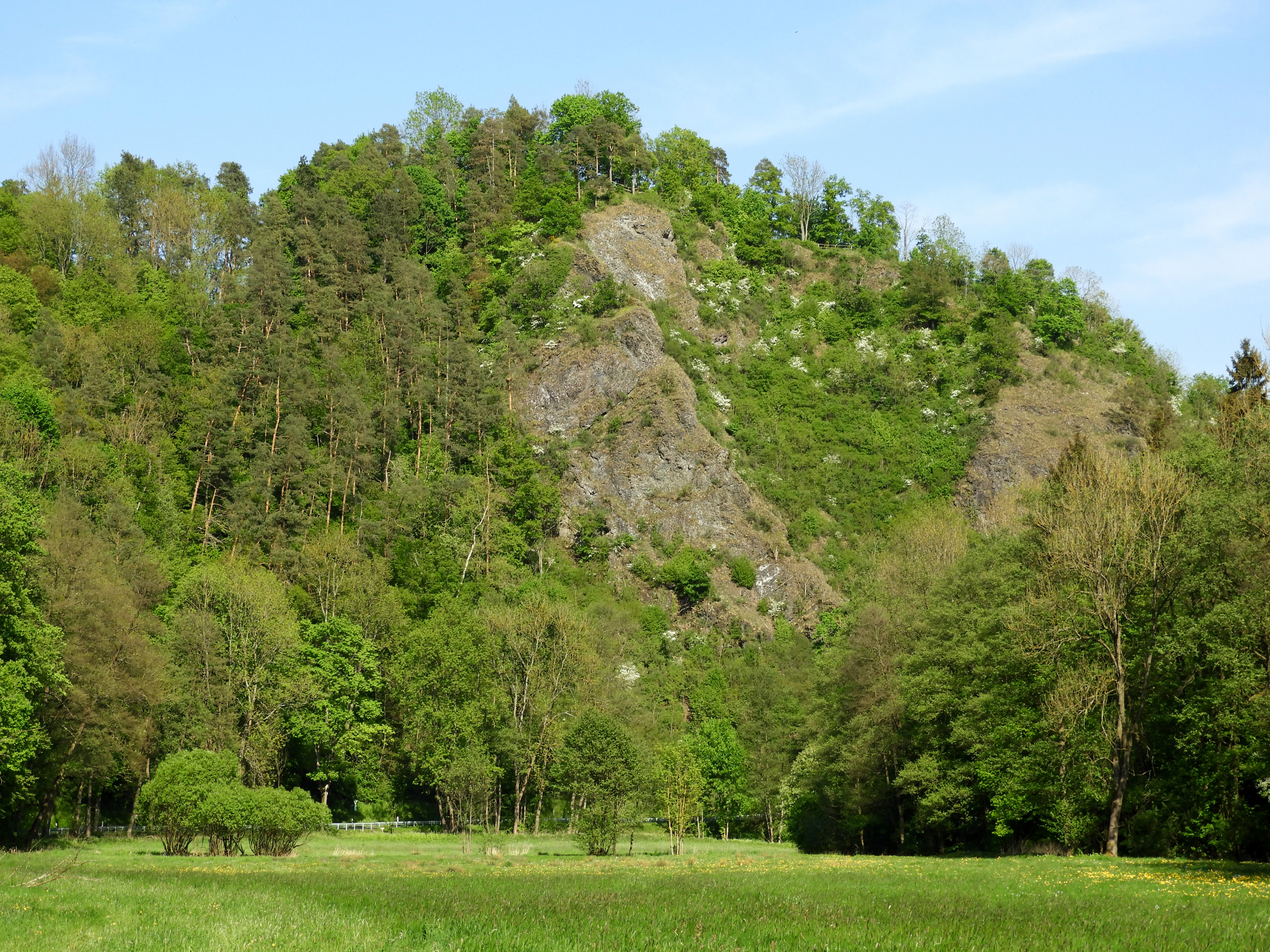
A green, grassy meadow in the foreground leads to a steep, rocky, diabase cliff face covered with deciduous and coniferous trees under a bright blue sky.
The steep diabase cliffs of the Bilstein within the Höllental gorge.

Bilstein im Höllental ecosystems, habitats, and plant life

Ecologically, Bilstein im Höllental is recognized as one of the most important rock-relict habitats in the entire state of Hesse, despite its very limited size. Its nature-value is built around the unusual microclimatic conditions on its south-facing cliff faces, which produce unusually warm, dry conditions in an otherwise relatively cool and humid part of central Germany. As the official Natura 2000 standard data form states, the site is considered one of Hesse's most significant refuges for rare and endangered cliff-typical animals and plants precisely because many species reach the limits of their overall distribution range there.

The vegetation on the sunny rock faces is a classic open, warm-climate rock community. Heat-loving, drought-tolerant plants dominate, including stiff leek (Allium strictum) and the fern Asplenium ruta-muraria, both at the northern edge of their European ranges here; small meadow-rue; blue fescue; mountain rockcress; blood-red geranium; the grape-hyacinth-like Anthericum liliago; large-flowered foxglove; and vetchling species. Small ferns are particularly rich, with spleenworts, wall rue, northern and brown-stalked spleenworts, and several rare hybrid spleenwort forms occupying fissures in the rock. The site also supports scientifically important dry-warm bryophyte communities and rare lichens, making it a notable reference site for warm microclimate cryptogams in Hesse.

By stark contrast, the shaded north- and east-facing slopes support an entirely different kind of habitat: a boulder-rich ravine and scree forest dominated by beech, sycamore maple, small-leaved lime, ash, and elm. This is the habitat type listed as Annex I priority feature 9180, the siliceous Tilio-Acerion ravine forest. Conservation management here is actively increasing structural diversity by removing spruce and pine that were previously planted on parts of the slope.

The sunny rock face itself carries two formally listed Annex I habitat types: siliceous rock with fissure vegetation (8220) and siliceous rock with pioneer swards (8230). Together, the warm rock communities and the cool ravine forest form the basis of the reserve's Natura 2000 designation.
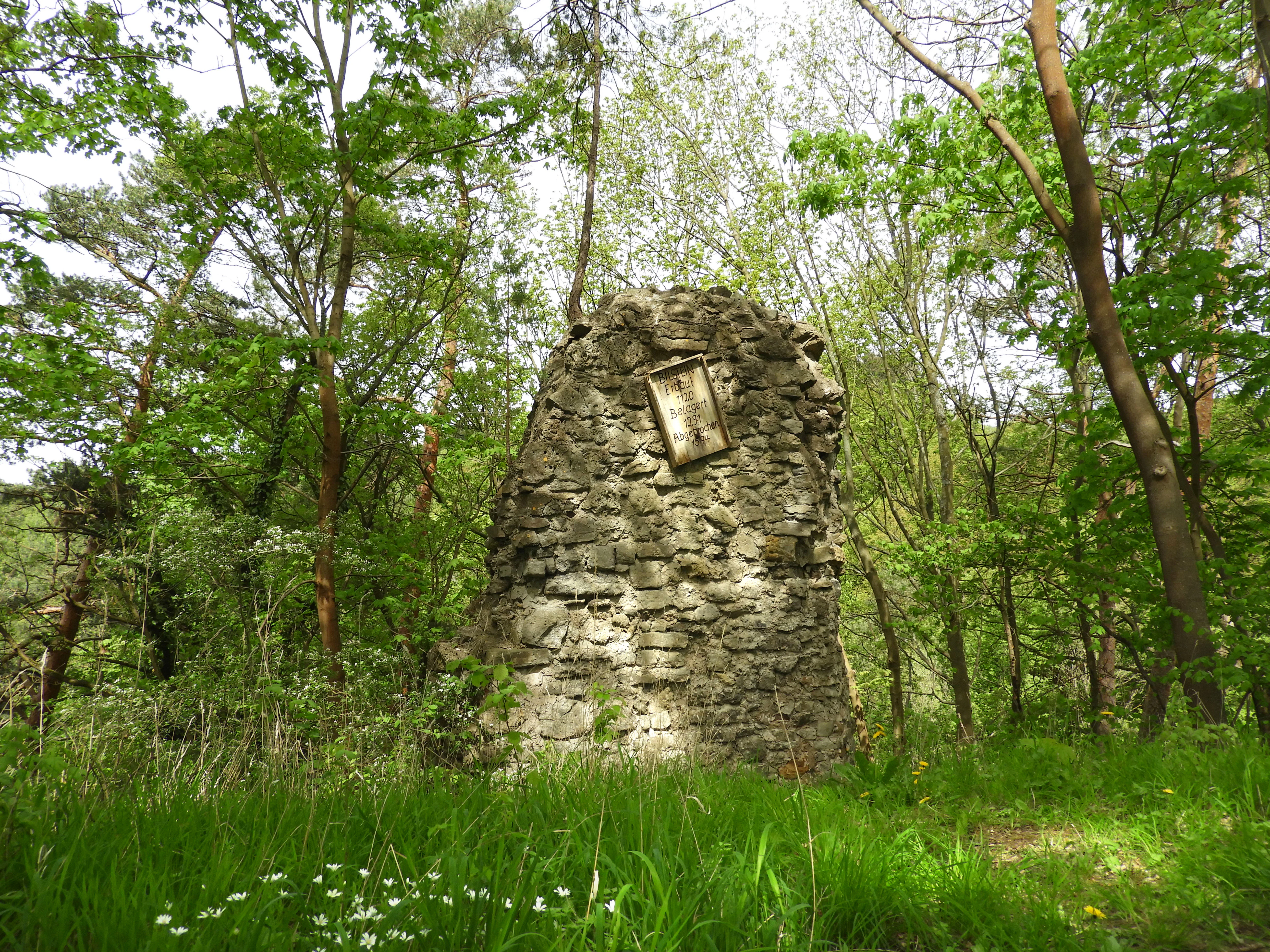
A weathered stone wall fragment from the Bilstein Castle ruins stands amidst a green spring forest, featuring a rectangular plaque embedded in its surface.
The remaining stone masonry of the 12th century Bilstein Castle ruins, surrounded by deciduous forest.

Bilstein im Höllental wildlife and species highlights

Although Bilstein im Höllental is a botanical reserve in character, it also supports a distinctive community of cliff-dwelling invertebrates, especially among butterflies. The sun-exposed, warm, and sheltered rock faces create conditions that favor heat-loving species that are otherwise scarce in Hesse. Among notable butterflies recorded on the cliff are the scarce swallowtail (Iphiclides podalirius), an attractive species now rare across much of its former central European range, and the common Old World swallowtail (Papilio machaon).

The reserve's wider ecological significance lies in the contrast between its dry, sun-baked rock habitats and its cool, shaded ravine forest, which together support very different invertebrate and cryptogam communities within a few meters of each other. The site's official conservation rationale emphasizes that this diversity of cliff-typical fauna and flora is what places Bilstein among Hesse's most important rock-relict habitats.

Because the reserve is so small and focused on cliff vegetation, formal mammal and bird inventories are not highlighted in the available source material, and broader wildlife claims cannot be supported. The reserve's wildlife value should therefore be understood primarily as the unusual concentration of warm-adapted, cliff-specialist invertebrates rather than as a general wildlife area.

Bilstein im Höllental conservation status and protection priorities

Bilstein im Höllental carries an unusually layered conservation status for so small a site. Its protection history stretches back more than a century, beginning with the 1914 Prussian administrative order that recognized the cliff as a natural monument for its geological and botanical importance. It was designated a formal Naturschutzgebiet in 1960, with national ID 1636001 and WDPA code 81402, and has been protected under successive German nature conservation laws ever since. In 2008 it became part of the European Natura 2000 network as a Fauna-Flora-Habitat site under the EU Habitats Directive, with site number 4725-303, WDPA 555520066, and an extent of 3.19 hectares that closely matches the national nature reserve boundary.

The site's conservation significance lies in the combination of three Annex I habitat types within a tiny area: siliceous rock with fissure vegetation (8220), siliceous rock with pioneer swards (8230), and Tilio-Acerion ravine forest on shaded slopes (9180). The official Natura 2000 justification emphasizes that Bilstein is one of Hesse's most important refuges for rare and threatened cliff-typical animals and plants, with several species reaching the absolute limits of their distribution range here. This makes the reserve a key reference site for warm-climate rock biodiversity in central Germany.

Active management is limited but targeted. On the shaded slopes, planted spruce and pine have been progressively removed to restore the structural and species diversity of the native beech-maple-lime-ash forest. On the sunny rock itself, the aim is conservation rather than restoration: the open cliff communities are maintained by their inherent harshness, and any disturbance to the rock vegetation would threaten the isolated populations of nationally rare ferns, mosses, and lichens that depend on the site. The reserve is overseen by the higher nature conservation authority at the Regierungspräsidium in Kassel.

Bilstein im Höllental cultural meaning and human context

The Bilstein carries a layered cultural history on top of its natural-protection story. From the 12th to the 16th century, the steep rock was the site of the ancestral castle of the Counts of Bilstein, who through the 11th century served as Gaugrafen of the Germarmark and wielded regional judicial authority. Their court sat on the Katzenloh near Weidenhausen. The castle itself was built in 1120 by Rugger II of the Bilstein dynasty, who in 1145 also founded the Premonstratensian monastery of Germerode nearby.

In 1301, Otto II, the last Bilstein count, sold his fief to Hessian Landgrave Heinrich I, and by 1306 the last scion of the line had died in poverty. The fortress passed into the hands of the Landgraves of Hesse and was gradually dismantled in 1594. Only fragments of walls, traces of a well, and a single tower stump remain on the rock today. The tower stump was stabilized against further collapse in 1970 through masonry work, and the castle ruins are formally listed as a protected cultural monument under the Hessian monument protection law.

Local legend gives a more dramatic account of the line's end, in which the besieged last count drives his family and horses over the cliff rather than surrender, a story that is preserved in regional song and folklore collections such as Hans Elben's 1884 work Bilstein: Sang und Sage aus dem Werrathale.

Top sights and standout views in Bilstein im Höllental

Within just 3.24 hectares, Bilstein im Höllental concentrates an exceptional range of conservation features: a 284-meter diabase cliff, three formally listed Annex I habitat types, populations of species at the edge of their European range, a medieval castle ruin, and 110 years of layered protection history from a 1914 natural monument order to a 2008 Natura 2000 designation. The site's hallmark is the dramatic contrast between a sun-scorched south face of bare rock with warm-climate plants and ferns, and a shaded north face of beech-maple-lime ravine forest, packed into a footprint small enough to walk around in under an hour.

It is also one of the few places in Hesse where the underlying geology is so legible that visitors can see exactly why the valley bends; the diabase outcrop forced the Berka stream to detour around it, producing the gorge-like Höllental. Combined with its position inside the Geo-Naturpark Frau-Holle-Land and its views toward the Hohen Meißner, Bilstein offers a tightly compressed mix of geology, ecology, and medieval history that is unusual for such a small reserve.

Best time to visit Bilstein im Höllental

Because Bilstein im Höllental is centered on a sun-exposed rock face, the warmer half of the year is when the cliff's defining character is most visible. Late spring through early autumn is when the heat-loving rock plants are in active growth and the fern and lichen communities on the cliff are at their most exposed and recognizable. In winter, ice and frost can dramatically emphasize the cliff's microclimate extremes but also make some of the steep sections slippery, so the reserve is generally best appreciated in milder conditions. A 2.5-kilometer circular walking route links park-and-walk sites at the Frau Holle inn and at the Nedderborn, while the longer Premiumweg P23 Höllental (10 kilometers, rated moderate) takes in the same rock on a broader hike; the latter is described in local guides as best suited to dry conditions because of its steep sections.

Monthly climate preview

Long-term representative monthly temperature and precipitation data patterns

Bilstein im Höllental Climate Normals and Annual Temperature Rhythm

Historical climate data for Bilstein im Höllental reveals a measured annual cycle of shifting monthly temperatures and consistent precipitation norms. Analyzing the complete twelve-month record provides detailed context on long-term temperature ranges and precipitation distributions.
Annual mean8 °C
-1 °C18 °C
Jan-1°
Feb
Mar
Apr
May12°
Jun16°
Jul18°
Aug18°
Sep14°
Oct
Nov
Dec
Warmest month
July

18.3 °C

Coolest month
January

-1.1 °C

Wettest month
July

2.6 mm/day

Driest month
April

1.4 mm/day

Park location guide

Geography guide, regional context, and park location map for Bilstein im Höllental

Bilstein im Höllental park geography, regions, and map view in Germany

Understand where Bilstein im Höllental sits in Germany through a broader geographic reading of the surrounding landscape, nearby location context, and its mapped position within the national park landscape.

How Bilstein im Höllental fits into Germany

Germany is a federal republic in Western and Central Europe with a population of over 83 million across sixteen constituent states. It is Europe's largest economy by nominal GDP and a major global exporter and importer. The capital is Berlin, and the country borders Denmark, Poland, Czech Republic, Austria, Switzerland, France, Luxembourg, Belgium, and the Netherlands.

Wider geography shaping Bilstein im Höllental in Germany

Germany is located in Western and Central Europe, spanning 357,022 km². It borders Denmark to the north, Poland and the Czech Republic to the east, Austria and Switzerland to the south, and France, Luxembourg, Belgium, and the Netherlands to the west. The country has coastlines on the Baltic Sea and North Sea to the north, with the Alps located in the southern region.

Map view of Bilstein im Höllental

Use this park location map to pinpoint Bilstein im Höllental in Germany, understand its exact geographic position, and read its mapped placement within the surrounding landscape more clearly.

Pigeon | © OpenStreetMap contributors

Location context for Bilstein im Höllental

Hessen
Recorded earthquake history

Explore the Historical Earthquake Registry for Bilstein im Höllental

Review documented seismic events associated with this protected nature reserve in Hessen. MoriAtlas provides a clear, organized archive of historical earthquake data to support your interest in the regional geography and past seismicity of the Werra-Meißner hill country.

Bilstein im Höllental Earthquake History

Catalogued events

4 events

Strongest magnitude

Magnitude 3.6

Most recent event

Oct 25, 2006

This history includes earthquakes recorded inside the park or within 50 km of its borders

Visual exploration of rare rock habitats, steep ravine forests, and dramatic valley terrain

Bilstein im Höllental Photos: Scenery, Diabase Cliffs, and Protected Landscapes

Photographic records reveal the striking vertical diabase cliff and contrasting microclimates that define Bilstein im Höllental. Visual documentation highlights the rare juxtaposition of sun-scorched rock faces and shaded ravine forests within the protected landscape.

A high-angle scenic view of a deep, green valley surrounded by forested hills, with rocky cliffs visible in the right foreground.

Steep, weathered rock cliffs topped with pine trees under a clear blue sky at the Bilstein im Höllental nature reserve.

A green, grassy meadow in the foreground leads to a steep, rocky, diabase cliff face covered with deciduous and coniferous trees under a bright blue sky.

A weathered stone wall fragment from the Bilstein Castle ruins stands amidst a green spring forest, featuring a rectangular plaque embedded in its surface.

Park atlas

Compare regional hill country reserves and connected protected landscapes across Hesse

Explore Other Parks Near Bilstein im Höllental and Surrounding Protected Areas

Visitors exploring Bilstein im Höllental can browse adjacent protected areas to compare diabase rock formations and ravine forests across the wider regional geography. Expanding the park search reveals connected natural reserves and geological landmarks situated throughout the surrounding Werra hill country.
A wide watercolor illustration of a rolling landscape with green fields, patches of pink flowers, and distant purple hills under a pale sky.
Nature reserveWerra-Meißner-Kreis
About 2.6 km away#1 closest

Southeast

Jestädter Weinberg: Protected Zechstein Cliffs and Werra River Valley Mosaic

A botanical and geological hotspot in northern Hesse

Jestädter Weinberg represents a critical protected landscape defined by its steep dolomite rock faces and sun-exposed slopes. This nature reserve provides an essential habitat for orchids and diverse insect populations, bridging the gap between high-altitude limestone ridges and the riparian meadows of the Werra river valley.

Area
0.6 km²
Established
1924
IUCN
IV
Relief
Upland
A horizontal watercolor painting showing a soft, muted landscape with rolling hills, a central open area, and clusters of green trees under a pale sky.
Nature reserveWerra-Meißner-Kreis
About 3.9 km away#2 closest

West

Kripp- und Hielöcher Nature Reserve: Karst Geography and Protected Land in Werra-Meißner-Kreis

Geology-focused nature reserve featuring gypsum sinkholes and dry grasslands.

Kripp- und Hielöcher provides a rare look at Zechstein gypsum karst in Hesse. The reserve is split into two distinct areas, the Kripplöcher and Hielöcher, showcasing natural rock monuments, active karst springs, and a historical cultural landscape maintained through centuries of traditional land use.

Area
0.17 km²
Relief
Upland
Climate
Temperate
Access
Moderate access
Watercolor painting of a mountain landscape with green slopes, coniferous forests, and rocky outcroppings under a soft, light-filled sky.
Nature reserveHesse
4.9 km away#3 closest

West

Meißner Nature Reserve in Northern Hesse: Mapping the Hoher Meißner Basaltic Massif

A comprehensive look at forest wilderness, bogs, and volcanic geology

Covering roughly 930 hectares, the Meißner nature reserve in northern Hesse protects an ecologically distinct upland landscape. The area features a significant basalt plateau, ancient scree slopes, mountain meadows, and hanging spring bogs, offering a prime example of protected central German topography and forest wilderness.

Area
9.322 km²
Established
1989
IUCN
IV
Relief
Mountain
Wide watercolor illustration of green trees and hills with purple mountains in the background under a pale sky.
Nature reserveThuringia
6.4 km away#4 closest

Northeast

Stein, Rachelsberg, Gobert: A Protected Limestone Landscape in Western Thuringia

Mapping a historic nature reserve and beech forest complex

Stein, Rachelsberg, Gobert stands as a key protected area within Thuringia. This nature reserve offers deep insights into limestone ridge geography, historic border woodland continuity, and diverse habitats ranging from dry grasslands to tufa springs and orchid-rich beech forests.

Area
7.16 km²
Established
1999
IUCN
IV
Relief
Mountain
A horizontal watercolor illustration depicting gentle rolling hills, grassy meadows, and distant mountain silhouettes in muted pastel tones.
Nature reserveThuringia
7.6 km away#5 closest

North

Röhrsberg - Hasenwinkel - Mühlberg: Mapping the Protected Landscapes of Thuringia

Geological ridge systems and native forest habitat networks.

The Röhrsberg - Hasenwinkel - Mühlberg nature reserve represents a significant protected area in Thuringia, characterized by the juxtaposition of Muschelkalk limestone hills and Zechstein dolomite ridges. This site offers a concentrated view of regional terrain, shifting from closed beech forests to open juniper heaths. It serves as an essential geographic reference for understanding the ecological mosaic of the lower Werra hill country.

Area
4.51 km²
Established
1999
IUCN
IV
Relief
Upland
Watercolor painting of a green landscape with rolling hills, a winding path or stream, and trees on both sides against a light background.
Nature reserveWerra-Meißner-Kreis
About 7.6 km away#6 closest

Northeast

Kalkklippen südlich des Iberges Nature Reserve and Muschelkalk Landscape Atlas

Protected beech forests and active landslide topography

This nature reserve in Werra-Meißner-Kreis reveals an active Muschelkalk ridge characterized by steep limestone cliffs and boulder-strewn talus slopes. Study the site's unique ecological composition, featuring noble hardwood-rich beech forests and native European yew populations that highlight the region's complex natural history and geological significance.

Area
0.473 km²
Established
1995
IUCN
IV
A soft, light-colored watercolor painting of a rolling hilly landscape with sparse trees and open grassy meadows.
Nature reserveWerra-Meißner-Kreis
About 7.9 km away#7 closest

West

Bühlchen bei Weißenbach Nature Reserve: Protected Limestone Grasslands in Werra-Meißner-Kreis

Geographic atlas of a historic juniper heath and limestone hilltop.

Bühlchen bei Weißenbach represents a rare, semi-open cultural landscape shaped by centuries of sheep grazing on shell limestone summits. This nature reserve, integrated into the Natura 2000 network, offers a dense concentration of rare orchids and gentians across its rocky, nutrient-poor slopes, serving as a critical site for regional ecological study and landscape preservation.

Area
0.08 km²
Established
1985
IUCN
IV
Relief
Mountain
A watercolor painting showing a soft, stylized landscape with rolling hills in the background and a variety of bushes and wild vegetation in the foreground.
Nature reserveWerra-Meißner-Kreis
About 8.5 km away#8 closest

East

Mönchesrieth bei Grebendorf Nature Reserve in Werra-Meißner-Kreis, Germany

A restored wetland refuge in the Werra river floodplain.

Located in northern Hesse, Mönchesrieth bei Grebendorf is a protected nature reserve formed by the flooding of a former gravel extraction site. Its geography features a network of shallow bays and shoreline vegetation that provide essential nesting and foraging grounds for waterbirds within the busy Werra valley corridor. The site represents a successful transition from industrial terrain to a quiet, managed refuge for regional biodiversity.

Area
0.181 km²
Established
1999
IUCN
IV
Relief
Lowland

Common questions about visiting, size, designation, and location context for Bilstein im Höllental

Bilstein im Höllental FAQs for park facts, access, geography, and protected area context

Find quick answers about Bilstein im Höllental, including protected-area facts, park geography, trail and visitor context, and how the park fits into its surrounding country and regional landscape.
MoriAtlas Explorer

Continue Your Protected Areas Search Across the Global Atlas

Deepen your exploration by continuing the structured search for national parks and protected areas worldwide. Utilize the comprehensive filtering capabilities to compare different conservation landscapes and refine your understanding of global park geography. Discover more about the distribution and characteristics of protected natural areas.

Global natural geography