
Why Bindarri National Park stands out
Bindarri National Park is best known as an epicentre of biodiversity, protecting populations of exceptionally rare plant species including the fish bone fern, southern quassia, and palm orchid. These three species exemplify the park's significance as a conservation refuge for flora with highly restricted distributions. The park is also renowned for its dramatic escarpment landscape, where the Great Escarpment creates a scenic backdrop of cascading waterfalls, deep gorges, and rugged ridgelines. The mouth of the Urumbilum River, where it breaches the escarpment to reach the coastal plain, represents a particularly striking natural feature that showcases the park's dramatic topography.
Bindarri National Park history and protected-area timeline
Bindarri National Park was formally established on 1 January 1999, making it one of the more recent additions to New South Wales's national park system. The park's creation reflected growing recognition during the late twentieth century of the ecological significance of the Great Escarpment region and the need to protect areas of exceptional biodiversity value. Prior to national park designation, the area had experienced various land uses that shaped its present character, though the steep and rugged terrain limited intensive development in many areas. The establishment of Bindarri National Park was part of a broader expansion of protected areas in northern New South Wales during the 1990s, a period when conservation planning increasingly emphasised the importance of protecting representative examples of the region's diverse ecosystems and rare species habitats.
Bindarri National Park landscape and geographic character
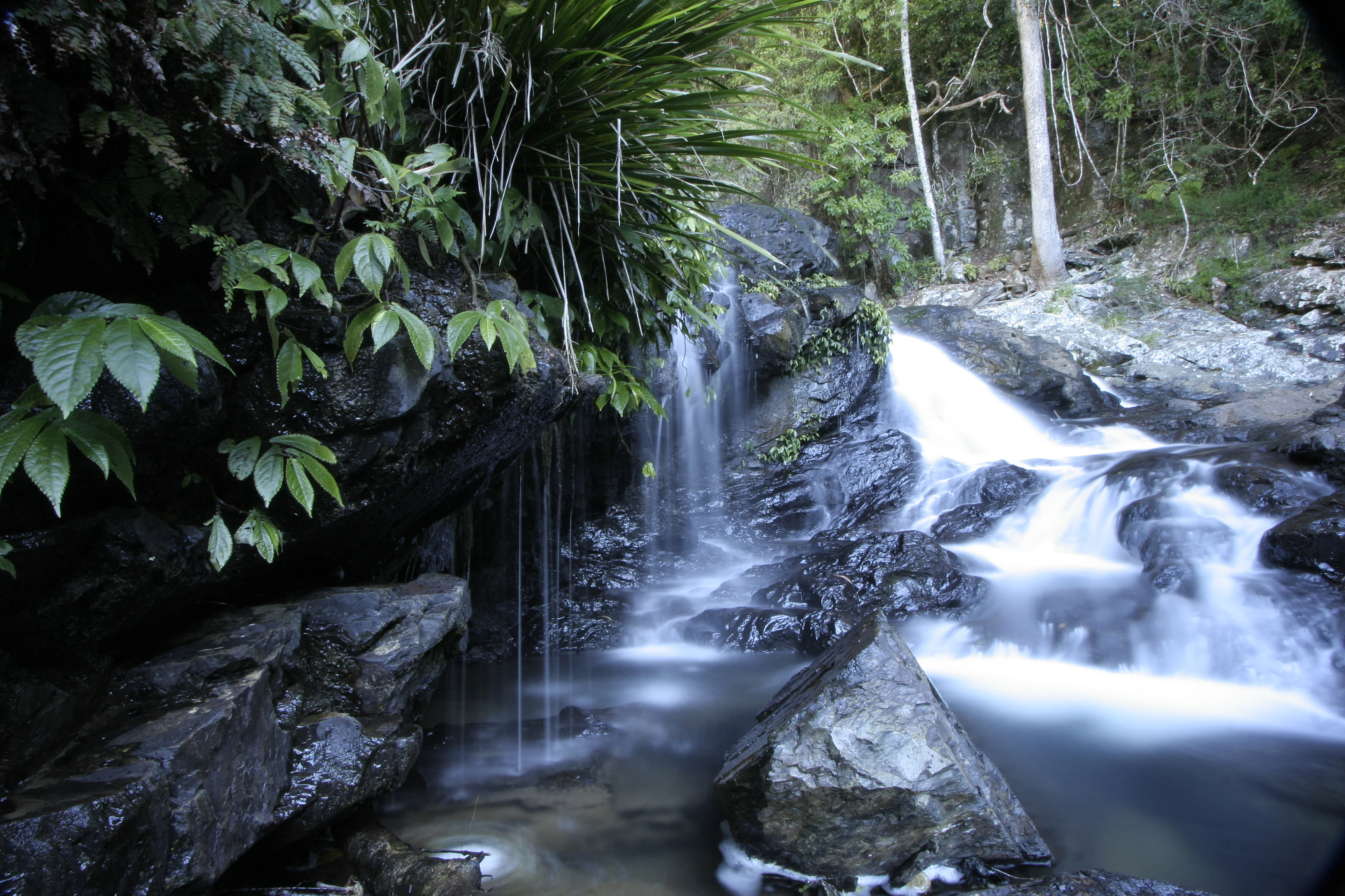
The landscape of Bindarri National Park is defined by the Great Escarpment, a major geological feature that marks the eastern edge of the New England Plateau. The escarpment rises abruptly from the coastal lowlands, creating a dramatic backdrop of sheer cliffs, steep ridgelines, and deeply incised valleys. The Urumbilum River has carved a spectacular course through the escarpment, descending via a series of waterfalls and cascades before reaching its mouth where it exits onto the coastal plain. Bangalore Falls provides one of the park's most accessible waterfall vantage points, where water plunges over resistant rock layers in a characteristic cascade. The interaction between the river systems and the escarpment geology creates a landscape of considerable scenic diversity, with moist gullies, exposed rock platforms, and sweeping views from elevated vantage points.
Bindarri National Park ecosystems, habitats, and plant life
The ecological character of Bindarri National Park centres on its role as a refuge for rare and threatened plant species. The park is recognised as a centre of biodiversity, supporting species with highly restricted distributions that are found in few other locations globally. The fish bone fern, southern quassia, and palm orchid represent flagship species of conservation concern within the park, each occupying specialised habitats within the diverse terrain. The combination of elevation change, varying aspect, and moisture availability creates a mosaic of microhabitats that supports this remarkable plant diversity. The moist, sheltered valleys of the escarpment provide conditions different from the surrounding lowlands, allowing species with specific environmental requirements to persist.
Bindarri National Park wildlife and species highlights
While the Wikipedia source emphasises the park's botanical significance, Bindarri National Park supports diverse wildlife associated with the tall wet forests, rocky outcrops, and riparian zones of the Great Escarpment region. Birdlife typical of New South Wales north coast forests would be expected in the park, including species associated with old-growth forest habitats. The riparian corridors along the Urumbilum River and its tributaries provide habitat for aquatic species and serve as movement pathways for fauna traversing the rugged terrain. The park's location on the coastal margin of the Great Dividing Range places it within a region of significant faunal diversity, where subtropical influences extend further south than in other parts of the continent.
Bindarri National Park conservation status and protection priorities
Bindarri National Park represents an important conservation entity in the northern New South Wales region, protecting a concentration of rare and endangered species within a relatively limited area. The presence of species such as the fish bone fern, southern quassia, and palm orchid demonstrates the park's significance for plant conservation, as these species have very restricted distributions and face threats from habitat loss and modification in unprotected areas. The establishment of the park in 1999 provided formal protection for these species and the habitats upon which they depend. As a Category II protected area, the park aims to protect ecological processes and biodiversity while also providing opportunities for appropriate visitor appreciation of the landscape's natural values.
Bindarri National Park cultural meaning and human context
The traditional Aboriginal connections to the Bindarri National Park area are not detailed in the available source material, though the broader Coffs Harbour region has evidence of continuous Aboriginal occupation spanning many thousands of years. The Great Escarpment and associated river systems would have held significance for local Aboriginal peoples, with the Urumbilum River mouth and waterfall areas likely serving as resource-rich locations for traditional activities. The absence of detailed cultural information in the source material means this aspect of the park's identity remains inadequately documented for inclusion in this profile.
Top sights and standout views in Bindarri National Park
Bangalore Falls offers visitors one of the park's most striking visual experiences, where water cascades over rock shelves in a characteristic display of the area's hydrological energy. The mouth of the Urumbilum River represents a dramatic landscape feature where the watercourse breaches the Great Escarpment and emerges onto the coastal plain, creating a memorable intersection of mountain and coast landscapes. The park's biodiversity significance, centred on rare species such as the fish bone fern, southern quassia, and palm orchid, positions Bindarri as a significant site for understanding the unique flora of northern New South Wales. The combination of scenic waterfalls, rugged escarpment terrain, and exceptional plant diversity creates a park of distinctive character.
Best time to visit Bindarri National Park
The park can be visited throughout the year, though the wetter months of late summer and autumn typically bring increased water flows to the waterfalls that are a defining feature of the park. The warm temperate climate of the Coffs Harbour region makes outdoor exploration pleasant during the cooler winter months when rainfall is typically lower. Summer storms can bring dramatic waterfall displays but may also create access limitations on some trails. The park's relatively compact size means that a visit can be comfortably accommodated in a single day, though overnight stays would allow for more thorough exploration of the trail network.