
Mori Atlas logo
Wildlife reserveBlack Kettle National Grassland

A restored southern Great Plains ecosystem encompassing red slate hills and wooded creek corridors

Black Kettle National Grassland: Mapped Boundaries and Protected Prairie Landscape Geography

Black Kettle National Grassland represents a significant restoration of mixed-grass prairie across Oklahoma and Texas. This protected area preserves a mosaic of sandy prairies, oak brush, and wooded creek bottoms that provide essential habitat within the southern Great Plains. The landscape features a distinct topography of low red slate ridges and riparian corridors, offering a preserved window into the ecological history and environmental recovery of the region.

mixed-grass prairiesouthern Great Plainsnational grasslandshinnery oakWashita Riverpublic land
A flat-style digital illustration of a canyon landscape with a river, a waterfall, and a windmill on a cliff top under a sunny sky.

Black Kettle National Grassland

Wildlife reserve

Park overview

Structured park overview, official facts, and landscape profile for Black Kettle National Grassland

Black Kettle National Grassland park facts, protected area profile, and essential visitor context

Review the core facts for Black Kettle National Grassland, including designation, size, terrain, visitor scale, habitats, and operating context in one park-focused overview.

About Black Kettle National Grassland

Black Kettle National Grassland protects one of the more ecologically significant remnants of mixed-grass prairie in the southern Great Plains. Located primarily in Roger Mills County in western Oklahoma, with a smaller section in Hemphill County in the Texas Panhandle, it is part of the U.S. Forest Service's National Grassland system and is administered through the Cibola National Forest. Despite being broken into roughly 100 separate tracts interspersed with private ranchland, the grassland maintains a continuous ecological character across the landscape.

The terrain is defined by the shinnery oak brush and mixed-grass communities typical of sandy soils in this part of the plains. Red slate and sandy hills rise above flatter prairie swales, while creek bottoms support gallery forests of cottonwood, elm, and hackberry. The Washita River winds through the area near its headwaters as a small, shallow stream, creating wooded margins that contrast with the open upland prairie.

The grassland is named for the Southern Cheyenne chief Black Kettle, known in Cheyenne as Mo'ohtavetoo'o. He was fatally wounded along the Washita during an 1868 U.S. Army attack led by Lt. Col. George Armstrong Custer. The region had long been home to Comanche and other nomadic peoples, drawn by buffalo, wood, and dependable water, before being incorporated into the Cheyenne and Arapaho reservation. The grassland today combines ecological restoration, cultural memory, and continuing working-land uses such as grazing, recreation, and oil and gas production.

Visitors encounter a working landscape rather than a wilderness park. Several small lakes such as Dead Warrior Lake, Spring Creek Lake, Skipout Lake, and Lake Marvin offer fishing, picnicking, and primitive camping, while trails at Croton Creek Watchable Wildlife Area and the adjacent Washita Battlefield National Historic Site support hiking, wildlife observation, and hunting across the broader acreage.

Ecologically, the area is significant because North American grasslands are considered among the most endangered ecosystems on the continent. Joining nearby Packsaddle Wildlife Management Area in Ellis County and the Nature Conservancy's Four Canyon Preserve, Black Kettle anchors one of the larger remaining complexes of contiguous mixed-grass prairie in the southern plains.

Quick facts and research context for Black Kettle National Grassland

Black Kettle National Grassland lies in Roger Mills County in western Oklahoma, with a smaller portion extending into Hemphill County, Texas, and is headquartered near the small town of Cheyenne. It is one of the National Grasslands administered by the U.S. Forest Service under the Cibola National Forest umbrella, alongside Rita Blanca and McClellan Creek National Grasslands.

The protected area covers about 31,286 acres, of which roughly 30,710 acres are in Oklahoma, distributed across approximately 100 non-contiguous tracts of land. Established as a National Grassland in 1960 after earlier Soil Conservation Service restoration work, it is co-managed with Oklahoma as the Black Kettle Wildlife Management Area and represents an important surviving example of mixed-grass prairie.

Protection and recognition

Examine documented protection scope, management frameworks, and international recognition records.

Black Kettle National Grassland Protection Status and Terrestrial Designation Records

Black Kettle National Grassland maintains a terrestrial protection scope within its designated conservation framework. Documented records provide verified administrative details without relying on external recognition sources.

Protection details

Protection scope
Terrestrial
Transboundary protection
No
Park context

Deeper park guide and search-rich context for Black Kettle National Grassland

Black Kettle National Grassland history, landscape, wildlife, and travel context

Explore Black Kettle National Grassland through its history, landscape character, ecosystems, wildlife, conservation priorities, cultural context, and seasonal travel timing in a structured park guide built for atlas discovery and search intent.

Why Black Kettle National Grassland stands out

Black Kettle National Grassland is best known as a restored mixed-grass prairie, recovered from failed Dust Bowl farmland back into native grassland habitat. It preserves a connected landscape of sandy prairies, red slate hills, oak brush mottes, and wooded creek corridors along the upper Washita River, an ecological assemblage that has largely vanished elsewhere in the region. The site is also closely associated with the memory of Southern Cheyenne chief Black Kettle and the 1868 Battle of the Washita, and sits adjacent to the Washita Battlefield National Historic Site. Together, the grassland and the battlefield preserve both the natural heritage and the difficult human history of the southern plains.
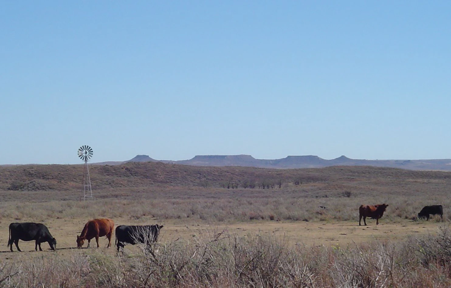
A wide shot of a dry prairie landscape under a clear blue sky, featuring a small herd of cattle grazing in the foreground and a windmill and mesas in the background.
Cattle grazing in the Antelope Hills region of Black Kettle National Grassland.

Black Kettle National Grassland history and protected-area timeline

Before it became a national grassland, the land that now forms Black Kettle National Grassland was part of the territory used by Comanche and other nomadic plains peoples. The presence of reliable water along the Washita River, abundant wood in the creek bottoms, and large buffalo herds made the area a favored camping and hunting ground. It later fell within the Cheyenne and Arapaho reservation established by treaty in 1867.

The grassland's name comes from one of the most consequential events in the region's history. In 1868, Lt. Col. George Armstrong Custer led an attack on a Cheyenne encampment along the Washita in what is remembered as the Battle of the Washita. The Southern Cheyenne chief Black Kettle, Mo'ohtavetoo'o, was killed while fleeing across the river. Today, the adjacent Washita Battlefield National Historic Site preserves the scene of that attack, and the grassland itself carries his name in honor of the people who lived on the land.

Reservation boundaries were progressively reduced by federal legislation, including the Dawes Act, which divided tribal land into individually owned parcels. In 1892 the area was opened to private settlement. During a stretch of unusually wet years, farmers grew successful wheat crops, but the combination of drought, wind, and poor land management that defined the Dust Bowl of the 1930s stripped the topsoil and drove many families off the land. Bankrupt farm properties were acquired by the federal government.

Beginning in 1938, the Soil Conservation Service undertook a long-term effort to replant and restore native grasses on the abandoned fields. By 1960 the area was formally designated as Black Kettle National Grassland. It is currently managed by the U.S. Forest Service, with the Oklahoma portion co-administered as the Black Kettle Wildlife Management Area in partnership with the Oklahoma Department of Wildlife Conservation. The grassland continues to serve multiple purposes, including recreation, grazing, and oil and gas development.

Black Kettle National Grassland landscape and geographic character

The landscape of Black Kettle National Grassland is a working example of southern Great Plains mixed-grass prairie, arranged across roughly 100 separate tracts of land. Sandy soils dominate many of the uplands, supporting open grasslands and dense stands of shinnery oak brush, while harder, redder sediments create low ridges and rolling red slate hills that rise above the surrounding flats.

Drainage lines add vertical structure and visual variety. The Washita River, near its headwaters, passes through the grassland as a small and shallow stream, only a few feet wide, but its corridor supports a narrow ribbon of larger trees along the banks. Smaller creeks flow through wooded bottoms lined with cottonwood, elm, and hackberry, producing shaded, leafy draws that contrast sharply with the bright, open prairie above.

To the north of the grassland, the South Canadian River has carved a steep, hilly canyon that forms a dramatic boundary with adjacent Ellis County. Looking east across the grassland, the Antelope Hills rise as a recognizable landmark, anchoring the horizon with their distinctive profile. Together, the open sandhill prairie, rocky red ridges, wooded creek ribbons, and canyon edge give the area a layered topography that, despite its working-land character, retains strong scenic value.
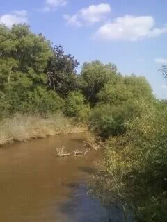
A view of the muddy Washita River flowing between thick, green riparian trees and shrubs under a partly cloudy blue sky.
The Washita River flowing through Black Kettle National Grassland.

Black Kettle National Grassland ecosystems, habitats, and plant life

Black Kettle National Grassland preserves an example of mixed-grass prairie, an ecosystem shaped by the interplay of mid- and short-grass species adapted to the variable rainfall of the southern plains. On sandy soils, shinnery oak forms dense, low thickets that stabilize dunes and provide habitat structure unusual for a grassland setting. On heavier and redder soils, communities of native grasses and forbs cover rolling slopes and flatter uplands.

The creek corridors introduce a different ecological layer. Cottonwood, elm, and hackberry line the bottoms of the Washita and smaller tributaries, creating narrow gallery forests. These wooded draws, together with oak brush mottes across the uplands, produce a patchwork of habitats that supports both prairie species and those associated with brush and woodland edges.

Because grasslands across North America have been extensively converted to cropland and pasture, surviving examples like this one are considered ecologically disproportionate to the area they occupy. Combined with the adjacent Packsaddle Wildlife Management Area and the Nature Conservancy's Four Canyon Preserve to the north, Black Kettle helps maintain a larger block of functioning prairie landscape, including stretches of relatively free-flowing prairie river along the upper Washita.

Black Kettle National Grassland wildlife and species highlights

The mosaic of open prairie, oak brush, and wooded creek bottoms at Black Kettle supports a characteristic suite of southern plains wildlife. White-tailed deer use the wooded draws and brush cover, while wild turkey and northern bobwhite quail are among the more visible game species in the grassland. Hunters regularly pursue these species across the National Grasslands acreage.

The Croton Creek Watchable Wildlife Area, near the grassland headquarters west of Cheyenne, is designed specifically to support wildlife observation along short trail loops. Smaller lakes and reservoirs, including Dead Warrior Lake, Spring Creek Lake, Skipout Lake, and Lake Marvin, add wetland and shoreline habitat that attracts waterbirds and concentrates wildlife viewing opportunities in an otherwise dry landscape.

At a broader regional scale, the grassland is an important component of habitat conservation for prairie-dependent species. Nearby Packsaddle Wildlife Management Area and the Nature Conservancy's Four Canyon Preserve work to maintain habitat for grassland birds such as the lesser prairie chicken, a vulnerable species whose populations have declined sharply across its range. Black Kettle's mix of prairie, brush, and riparian woodland helps anchor a landscape that supports both resident wildlife and seasonal movement of plains species.

Black Kettle National Grassland conservation status and protection priorities

Black Kettle National Grassland exists in large part because grasslands are widely considered the most endangered major ecosystem in North America. Centuries of fire suppression, overgrazing, plowing, and urban expansion have reduced native prairie to scattered fragments. The restoration history of Black Kettle is itself a conservation narrative: cropland abandoned after the Dust Bowl was systematically recovered by the Soil Conservation Service beginning in 1938, and the recovered landscape was elevated to National Grassland status in 1960.

The area's conservation value is reinforced by its neighbors. Together with Packsaddle Wildlife Management Area to the north and the Nature Conservancy's Four Canyon Preserve, Black Kettle preserves a sizeable block of mixed-grass prairie, oak brush communities, and a free-flowing reach of the upper Washita River. Such contiguous habitat is increasingly rare in the southern plains and supports species that depend on large, unfragmented prairie landscapes.

Co-management as the Black Kettle Wildlife Management Area, in partnership with the Oklahoma Department of Wildlife Conservation, reflects an explicit goal of maintaining habitat for native wildlife alongside grazing and recreation. Active management also addresses invasive plants; the Nature Conservancy's efforts at Four Canyon to remove non-native species and improve conditions for the lesser prairie chicken illustrate the broader regional commitment to keeping this prairie landscape ecologically functional rather than purely symbolic.

Black Kettle National Grassland cultural meaning and human context

The cultural landscape at Black Kettle is layered and difficult. For generations, the area was used by Comanche, Cheyenne, Arapaho, and other nomadic peoples whose camps followed buffalo herds and the dependable water of the Washita and its tributaries. The reservation era, formalized by treaty in 1867, was short-lived; successive federal acts reduced the Cheyenne and Arapaho land base, and by 1892 the land was opened to private homesteading.

The 1868 Battle of the Washita, in which Southern Cheyenne chief Black Kettle was killed fleeing U.S. troops under George Armstrong Custer, left a lasting mark on the region. The adjacent Washita Battlefield National Historic Site commemorates the attack, and the grassland's name preserves the memory of the chief and his community. Today the area is a place where visitors encounter both the natural and the human history of the southern plains, including the consequences of dispossession and the Dust Bowl-era transformation of the landscape.

The presence of surviving homestead structures within the grassland, such as those visible to visitors traveling through the area, points to the more recent farming history that shaped the land between 1892 and the 1930s. Together, these layers of Indigenous, military, settlement, and ecological history make Black Kettle a landscape where cultural memory is materially present in the terrain itself.

Top sights and standout views in Black Kettle National Grassland

Among the most distinctive features of Black Kettle National Grassland is its restored mixed-grass prairie, recovered from cropland after the Dust Bowl and now forming one of the larger functioning prairie blocks in the southern plains. The combination of sandy shinnery oak communities, red slate hills, and wooded creek bottoms creates an unusually varied prairie landscape.

Recreation highlights include the small lakes of Dead Warrior, Spring Creek, Skipout, and Lake Marvin, which provide fishing, picnicking, and primitive camping in a quiet rural setting. The Croton Creek Watchable Wildlife Area offers short, accessible trails for observing prairie wildlife, while the nearby Washita Battlefield National Historic Site connects visitors to the site's deeper historical significance. Together, these features make Black Kettle a place where prairie ecology, plains history, and quiet outdoor recreation meet.

Best time to visit Black Kettle National Grassland

The best time to experience Black Kettle National Grassland is during the cooler months from fall through spring, when temperatures are more comfortable for hiking, wildlife observation, and exploring the battlefield and grassland trails. Late spring typically brings fresh green growth and active birdlife to the prairie, while fall offers milder weather and a chance to see deer and turkey movement across the brush and creek bottoms.

Summer on the southern plains can be hot and dry, with limited shade across the open landscape, although the small lakes and creek-bottom woodlands offer cooler places to pause. Visit timing for active prairie management and burning windows can affect access to certain areas, so visitors interested in specific trails or wildlife observation should plan around daytime conditions rather than peak summer heat whenever possible.
Monthly climate preview

Long-term monthly temperature and precipitation rhythm for Black Kettle National Grassland

Black Kettle National Grassland Climate Normals and Annual Temperature Patterns

Representative coordinates record an annual temperature range spanning from sub-zero winter minimums to warm summer peaks alongside measured monthly precipitation rates. Analyzing the complete twelve-month climatology profile reveals detailed variations in temperature and moisture distribution across the protected area.
Annual mean16 °C
3 °C29 °C
Jan
Feb
Mar10°
Apr15°
May21°
Jun26°
Jul29°
Aug28°
Sep23°
Oct16°
Nov
Dec
Warmest month
July

28.8 °C

Coolest month
January

2.5 °C

Wettest month
May

3.3 mm/day

Driest month
January

0.7 mm/day

Park location guide

Geography guide, regional context, and park location map for Black Kettle National Grassland

Black Kettle National Grassland park geography, regions, and map view in United States of America

Understand where Black Kettle National Grassland sits in United States of America through a broader geographic reading of the surrounding landscape, nearby location context, and its mapped position within the national park landscape.

How Black Kettle National Grassland fits into United States of America

The United States of America is a federal presidential republic and one of the world's largest countries by area and population. It consists of 50 states across a vast territory spanning multiple time zones, with its capital in Washington, D.C. and largest city in New York City. The nation has a diverse economy, influential political system, and significant cultural and military presence globally.

Wider geography shaping Black Kettle National Grassland in United States of America

The United States occupies a vast territory in North America, bordered by Canada to the north and Mexico to the south. The 48 contiguous states stretch from the Atlantic to the Pacific Ocean, while Alaska occupies the northwestern region and Hawaii is an archipelago in the Pacific. The country encompasses diverse terrain including the Rocky Mountains, Appalachian Mountains, Great Plains, and extensive river systems.

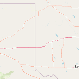
Map view of Black Kettle National Grassland

Use this park location map to pinpoint Black Kettle National Grassland in United States of America, understand its exact geographic position, and read its mapped placement within the surrounding landscape more clearly.

Pigeon | © OpenStreetMap contributors

Location context for Black Kettle National Grassland

Hemphill CountyRoger Mills County
Recorded earthquake history

Explore the Historical Earthquake Catalogue for Black Kettle National Grassland

Review recorded seismic activity associated with the regional geography of Black Kettle National Grassland. MoriAtlas provides a clear, data-driven archive of historical earthquake events, helping users examine documented seismic occurrences across the landscape near the Oklahoma and Texas border.

Black Kettle National Grassland Earthquake History

Catalogued events

9 events

Strongest magnitude

Magnitude 4.1

Most recent event

Aug 9, 2021

This history includes earthquakes recorded inside the park or within 50 km of its borders

Visual reference of mixed-grass prairies, red slate hills, and wooded creek bottoms across the protected area.

Black Kettle National Grassland Photos and Scenery: Exploring Southern Plains Landscapes

Black Kettle National Grassland images reveal a distinctive mixed-grass prairie landscape defined by sandy uplands, red hills, and wooded river corridors. Studying these visual records helps observers understand the restored ecosystem and varied terrain character of the southern Great Plains.

A wide shot of a dry prairie landscape under a clear blue sky, featuring a small herd of cattle grazing in the foreground and a windmill and mesas in the background.

A weathered metal windmill standing next to the remains of a small, crumbling adobe-style building in a snow-covered open grassland under a clear blue sky.

A view of the muddy Washita River flowing between thick, green riparian trees and shrubs under a partly cloudy blue sky.

Park atlas

Compare regional protected landscapes, sandy prairies, and adjacent terrain across the southern Great Plains.

Explore Parks Near Black Kettle National Grassland and Surrounding Protected Areas

Browsing other parks near Black Kettle National Grassland reveals connected mixed-grass prairie ecosystems and related regional conservation lands. Expanding the geographic scope helps compare the distinct topography of red slate hills, wooded river corridors, and restored plains habitats across the surrounding region.
Protected landscapeTexas
91 km away#1 closest

West

McClellan Creek National Grassland: Protected Landscape and Texas Geography Atlas

Restored shortgrass prairie and riparian reservoir geography

Located in the Texas Panhandle, McClellan Creek National Grassland serves as a critical example of soil conservation and shortgrass prairie restoration. The protected area features open, rolling plains surrounding the impounded McClellan Lake, providing a focused look at the environmental history and geographic character of the southern Great Plains.

Area
5.86 km²
Water
Minor water
A watercolor illustration of a landscape with a central lake reflecting soft pink hues, surrounded by green rolling hills and pine forests under a hazy sky.
Protected areaTexas
123 km away#2 closest

West

Lake Meredith National Recreation Area: An Atlas Guide to Texas Panhandle Canyon Landscapes

Geography of the Canadian River reservoir and High Plains terrain

Analyze the topography of Lake Meredith National Recreation Area, where the Canadian River has sculpted deep canyons through the flat Texas High Plains. The site serves as a vital protected area for both water-based recreation and the preservation of arid, canyon-rim habitats near the Alibates Flint Quarries.

Area
182.02 km²
Established
1990
Visitors
1.3M annual
Relief
Upland
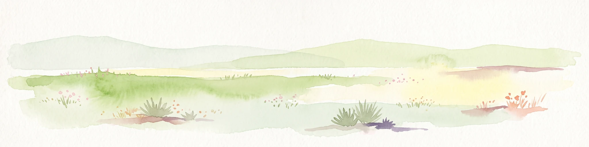
A pale, soft watercolor illustration of a wide, open prairie with gentle rolling hills in the background, low shrubs, and grasses in the foreground.
Protected areaKansas
179 km away#3 closest

Northwest

Cimarron National Grassland: Mapping the Largest Protected Area in Kansas

Shortgrass prairie geography and historical riparian landscapes

Spanning over 100,000 acres in southwestern Kansas, Cimarron National Grassland serves as a major ecological refuge within the Great Plains. The protected area features a unique terrain characterized by sand sagebrush uplands, cottonwood-forested bottomlands, and the winding course of the Cimarron River. This mapping data highlights the intersection of modern wildlife conservation and the remnants of the historic Santa Fe Trail.

Area
437.77 km²
Established
1960
Relief
Upland
Climate
Arid
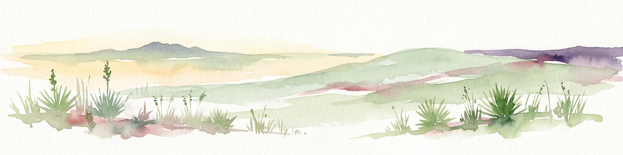
A horizontal watercolor painting showing a soft, stylized view of open, rolling grassland under a hazy sky, with yucca-like plants in the foreground.
Wildlife reserveTexas
186 km away#4 closest

West

Rita Blanca National Grassland: Protected Shortgrass Prairie Geography and Map

Mapping the mosaic of federal lands in the Texas Panhandle

Rita Blanca National Grassland offers a detailed look at restored shortgrass prairie ecosystems within the southern Great Plains. The area consists of intermixed federal and private land parcels that define the regional geography of the Texas and Oklahoma borderlands. This protected landscape provides habitat for pronghorn, prairie dogs, and raptors across a semi-arid, gently sloping terrain.

Area
376.31 km²
Established
1960
Relief
Upland
Climate
Arid
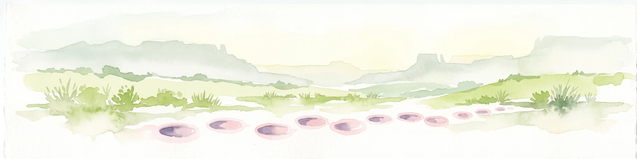
A wide watercolor painting showing a green grassy plain with distant hills and a row of purple circular shapes in the foreground.
Protected areaColorado
227 km away#5 closest

Northwest

Comanche National Grassland: Geographic Atlas of Southeastern Colorado Protected Plains

Exploring canyon systems and prairie landscape boundaries

Spanning across Baca, Otero, and Las Animas counties, Comanche National Grassland represents a distinctive protected landscape of shortgrass prairie and deep canyon networks. The region is marked by the dramatic Purgatoire River and Carrizo Creek systems, offering a rich study in semi-arid topography, riparian corridors, and fossil-rich geological formations within the Colorado plains.

Area
1,793.09 km²
Established
1960
Relief
Upland
Climate
Temperate
A horizontal watercolor illustration of a wide, open prairie landscape featuring soft green hills, sparse shrubs, and grasses against a pale background.
Protected landscapeNew Mexico
259 km away#6 closest

West

Kiowa National Grassland: Protected Landscapes, Canyon Terrain, and Prairie Geography

Northeastern New Mexico shortgrass prairie and river canyon systems.

Kiowa National Grassland represents a distinctive protected landscape within the southwestern Great Plains, featuring a mix of rolling steppe, pinyon-juniper woodland, and the deep gorges of the Canadian River Canyon. This area offers significant insight into the regional geography of New Mexico, where historic Santa Fe Trail corridors and seasonal playa lakes define the local terrain and ecosystem.

Area
554.95 km²
Established
1960
Relief
Upland
Climate
Temperate
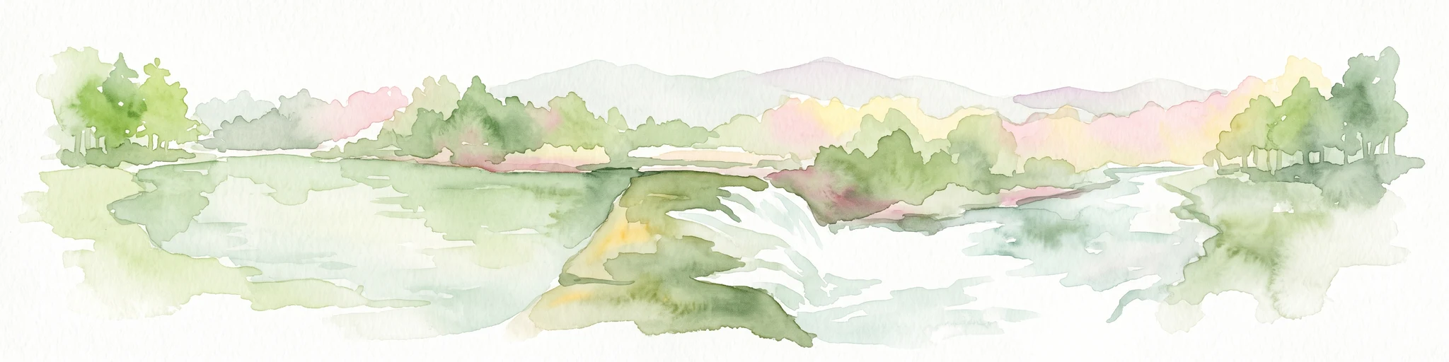
Watercolor painting of a flowing river with a small waterfall and forested banks against a soft, hilly background.
National parkOklahoma
About 268 km away#7 closest

Southeast

Chickasaw National Recreation Area: Geography and Protected Land Map Overview

Explore spring-fed creek corridors and reservoir landscapes in Oklahoma.

Understand the dual landscape of Chickasaw National Recreation Area, where narrow, spring-fed creek valleys contrast with the expansive shoreline of Lake of the Arbuckles. This record highlights the park's distinct transition from historic CCC-designed infrastructure to the surrounding prairie and forested hill terrain in Murray County.

Area
40.06 km²
Established
1902
Visitors
1.5M annual
Relief
Upland
Watercolor painting of soft, rolling green hills and scattered trees against a pale, light-filled sky.
Protected landscapeWise County
293 km away#8 closest

Southeast

Lyndon B. Johnson National Grassland: Atlas and Geographic Landscape Overview

Protected prairie and multiple-use terrain in Wise County

Examine the geographic layout and regional importance of Lyndon B. Johnson National Grassland, a federal protected area in northern Texas. The land offers a unique look at the convergence of open Great Plains prairie and the wooded Cross Timbers, serving as both a working ranching landscape and a preserved natural environment within easy reach of the Dallas-Fort Worth metropolitan area.

Area
82.19 km²
Relief
Lowland
Climate
Temperate
Access
Easy access

Common questions about visiting, size, designation, and location context for Black Kettle National Grassland

Black Kettle National Grassland FAQs for park facts, access, geography, and protected area context

Find quick answers about Black Kettle National Grassland, including protected-area facts, park geography, trail and visitor context, and how the park fits into its surrounding country and regional landscape.
MoriAtlas Explorer

Continue Your Protected Areas Search Across the Global Atlas

Deepen your exploration by continuing the structured search for national parks and protected areas worldwide. Utilize the comprehensive filtering capabilities to compare different conservation landscapes and refine your understanding of global park geography. Discover more about the distribution and characteristics of protected natural areas.

Global natural geography