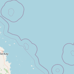
Why Brampton Islands National Park stands out
The park is best known for its compact yet ecologically significant blend of tropical island habitats, ranging from sandy beaches and coral reefs to lush rainforest-covered peaks. Brampton Peak, at 214 metres, stands as the park's most prominent geographical feature and offers visitors a rewarding summit walk with expansive views across the islands and surrounding waters. The park's 8.7-kilometre circuit track provides access through an exceptional variety of vegetation communities rare on such a small island, while the surrounding coral reefs add marine biodiversity to the protected area's value.
Brampton Islands National Park history and protected-area timeline
Brampton Islands National Park was established in 1968, representing an early addition to Queensland's national park system during a period of growing environmental awareness in Australia. The park's designation reflected increasing recognition of the conservation value of coastal and island environments, particularly continental islands that support endemic species and unique ecosystem assemblages. The Queensland Parks and Wildlife Service has managed the protected area since its establishment, maintaining visitor access while preserving the island's natural values. The park's creation preceded modern recognition of the importance of marine protected areas but ultimately contributes to broader coastal conservation in the Mackay region.
Brampton Islands National Park landscape and geographic character
The Brampton Islands consist of two main islands with distinctive topographical features. Brampton Island rises to 214 metres at Brampton Peak, the highest point in the park and a prominent landmark visible from the surrounding waters. The island's terrain supports several distinct landscape zones, from sandy beaches along the coastline through mangrove communities in low-lying coastal areas to forested slopes leading to the summit. The landscape reflects the geological character of continental islands, which differ fundamentally from the coral cays that dominate much of the Great Barrier Reef region. Carlisle Island, while smaller than Brampton, provides a more developed visitor experience with camping facilities and easier beach access.
Brampton Islands National Park ecosystems, habitats, and plant life
The park protects a remarkable concentration of vegetation types for its limited area. The 8.7-kilometre walking circuit passes through open eucalypt forests, vine thickets, dry rainforests, grasslands, and mangrove communities, illustrating how island environments can support multiple distinct plant assemblages in close proximity. Rainforest communities occupy the wettest sites, particularly on southern and eastern slopes where moisture is retained, while eucalypt forests dominate ridge lines and more exposed positions. The surrounding marine environment includes coral reefs that add another dimension to the park's ecological portfolio, though the terrestrial vegetation communities remain the primary terrestrial conservation focus.
Brampton Islands National Park wildlife and species highlights
The park's mammalian fauna includes several notable species despite the islands' small size. Koalas are present on the islands, representing one of the few populations of this iconic Australian marsupial on offshore islands. Two bat species occur in the park: the coastal sheath-tailed bat and the black flying-fox, both of which contribute to the island's ecological functioning through pollination and seed dispersal roles. The surrounding marine environment supports additional wildlife including coral reef fish and sea turtles that utilise the island beaches, while seabirds nest on coastal cliffs. The combination of terrestrial and marine habitats within the protected area supports ecological connections between island and ocean ecosystems.
Brampton Islands National Park conservation status and protection priorities
Brampton Islands National Park protects significant island ecosystems in a region where coastal development pressures continue to affect natural areas. The park's continental island setting means it supports vegetation communities and species not found on coral cays, making it important for representing this habitat type within Queensland's protected area network. The coral reef environments surrounding the islands contribute to marine biodiversity in the Mackay region, though the primary protection focus remains terrestrial ecosystems. The park's relatively small size makes it part of a broader conservation landscape that includes marine protected areas in the Coral Sea.
Brampton Islands National Park cultural meaning and human context
The Brampton Islands are situated in the traditional country of the Yuwi people, the Indigenous inhabitants of the Mackay coast region. The islands have been part of the cultural landscape for thousands of years, though detailed historical documentation of Indigenous use and connection to these specific islands is limited in available sources. European use of the islands included pastoral and agricultural activities prior to national park designation, with the transition to protected area status in 1968 marking a shift toward conservation values. Today the park represents both natural heritage and the ongoing relationship between coastal communities and their island environments.
Top sights and standout views in Brampton Islands National Park
The 8.7-kilometre circuit walk is the park's signature visitor experience, offering access to the full range of island environments within a single hike. Brampton Peak provides a summit destination with panoramic views across the islands and Coral Sea, rewarding visitors who complete the climb. The contrast between beach, mangrove, rainforest, and eucalypt forest environments showcases tropical island ecological diversity. Carlisle Island camping allows extended visits and a more immersive island experience than day trips permit.
Best time to visit Brampton Islands National Park
The park can be visited year-round, though conditions vary seasonally. The cooler months from May to October generally offer more comfortable temperatures for walking, while summer months bring higher temperatures and humidity. Marine stingers are present in the surrounding waters from October to May, affecting swimming activities during the warmer half of the year. The dry season typically provides more stable weather conditions for island access, though Queensland's tropical climate can produce rainfall at any time. Visitors should check current conditions and be prepared for island weather variability.