Mori Atlas logo
Nature reserveBrühl von Merkers

Mapping the meadow and wetland geography of a central German protected floodplain area

Brühl von Merkers Nature Reserve and the Werra River Floodplain Landscape in Wartburgkreis

(Naturschutzgebiet Brühl von Merkers)

Brühl von Merkers serves as a critical nature reserve within the Salzunger Basin of the Wartburgkreis district in Germany. This floodplain landscape encompasses expansive open meadowland along the Werra river, defined by a mosaic of tall herb communities, reed beds, and seasonal ditches. The area functions as a significant avian sanctuary and integral node within the European Natura 2000 network, providing essential habitat for migratory and breeding species.

nature reservefloodplainWerra valleywetland meadowsbird conservationNatura 2000

Brühl von Merkers

Nature reserve

Park overview

Structured park overview, official facts, and landscape profile for Brühl von Merkers

Brühl von Merkers park facts, protected area profile, and essential visitor context

Review the core facts for Brühl von Merkers, including designation, size, terrain, visitor scale, habitats, and operating context in one park-focused overview.

About Brühl von Merkers

Brühl von Merkers is a comparatively small but ecologically rich nature reserve in western Thuringia, situated in the Wartburg district along the middle course of the Werra river. The protected area lies between the localities of Kieselbach, Merkers, and Tiefenort, an Ortsteil of the town of Bad Salzungen, and forms part of the open floodplain landscape that historically characterized the Werra valley. The reserve was designated in January 2014 with the explicit aim of preserving a wide, open cultural landscape shaped by periodic flooding and of allowing near-natural ecological processes to continue within it.

The character of the reserve is defined by its expansive meadows. These are moist to fresh grasslands that are still influenced by seasonal flooding from the Werra, which still maintains relatively near-natural banks in this section. Within the open meadows, a mosaic of tall herb stands, bushes, large sedge beds, and reed stands has developed, together with a network of ditches that are either intermittently or permanently water-bearing. This habitat complexity across a continuous open area is the central conservation asset of Brühl von Merkers and the reason the site has been protected.

In the wider context of European nature conservation, Brühl von Merkers is integrated into the Natura 2000 network through two overlapping larger designations. Nearly all of its surface lies within the FFH area Werra bis Treffurt mit Zuflüssen, which runs from the headwaters of the Werra in the Thuringian Slate Mountains to the Hessian state border, while the entire reserve also lies within the Special Protection Area Werra-Aue zwischen Breitungen und Creuzburg along the Werra valley. Together these designations link the meadows of Brühl von Merkers with the broader system of protected floodplain and river habitats in central Germany.

The reserve is also physically framed by distinctive surrounding landscape features. To the northwest rises the Krayenberg, a 428-meter cone-shaped hill that dominates the view from the meadows, while to the east lies the built-up area of Tiefenort, and to the south and southwest the reserve is bounded by a disused railway line. These boundaries give Brühl von Merkers a clearly defined spatial setting within the Salzunger Basin of the Salzunger Werrabergland.

Administratively, Brühl von Merkers is managed as a Naturschutzgebiet under Thuringian nature conservation law and falls under the responsibility of the lower nature conservation authority of the Wartburg district in Bad Salzungen. It carries the Thuringian internal identification code 223 and World Database on Protected Areas entry 555588708.

Quick facts and research context for Brühl von Merkers

Brühl von Merkers is a Thuringian nature reserve in the Wartburg district, established in January 2014. It comprises around 175.6 hectares of floodplain meadows along the Werra river between the settlements of Kieselbach, Merkers, and Tiefenort.

The protected area lies in the Salzunger Basin, a subunit of the Salzunger Werrabergland, and is bordered by the Krayenberg to the northwest and by a disused railway line to the south and southwest. It is administered by the lower nature conservation authority of the Wartburg district in Bad Salzungen. The reserve is also part of two larger Natura 2000 designations: the FFH area Werra bis Treffurt mit Zuflüssen and the Special Protection Area Werra-Aue zwischen Breitungen und Creuzburg.

Protection and recognition

Examine the verified conservation standing and official international recognition records.

Brühl von Merkers Protection Status and Official Designation Records

Brühl von Merkers maintains recorded protection status details alongside structured international recognition data within the global database. Review verified designation parameters and administrative frameworks associated with this protected area entity.

Protection details

WDPA ID
555588708
Park context

Deeper park guide and search-rich context for Brühl von Merkers

Brühl von Merkers history, landscape, wildlife, and travel context

Explore Brühl von Merkers through its history, landscape character, ecosystems, wildlife, conservation priorities, cultural context, and seasonal travel timing in a structured park guide built for atlas discovery and search intent.

Why Brühl von Merkers stands out

Brühl von Merkers is best known for its open Werra floodplain meadows, which support one of the most important bird habitats in Thuringia. The reserve's large, extensively managed grasslands and wet zones host breeding, feeding, and migratory waterbirds and meadow birds, including several Annex I species of the EU Birds Directive. The reserve is also notable for the way its floodplain landscape combines traditional extensively used meadows with near-natural riverbanks, tall herb vegetation, reed and sedge beds, and patches of alluvial woodland. This combination of flood-influenced open meadows and structurally diverse wetland habitats gives Brühl von Merkers a distinct identity within the Werra valley system of protected areas.

Brühl von Merkers history and protected-area timeline

The current Brühl von Merkers nature reserve is a recent designation in the long history of human use of the Werra floodplain. Its meadows belong to a traditional cultural landscape shaped by centuries of grassland management, with periodic flooding from the Werra as a defining ecological process.

Formal protection arrived in the early twenty-first century. On 13 January 2014, the Thuringian regulation on the Naturschutzgebiet Brühl von Merkers established the reserve along the Werra between Kieselbach, Merkers, and Tiefenort. The stated purpose of the designation was to shield the floodplain area from harmful change and unnecessary disturbance, and to preserve the character of the site together with the communities of plants and animals living there.

Brühl von Merkers did not emerge in isolation but built on prior European-level protection of the Werra valley. The adjacent Fauna-Flora-Habitat area Werra bis Treffurt mit Zuflüssen had already been incorporated into the cross-state Natura 2000 system in July 2008, and the Werra-Aue zwischen Breitungen und Creuzburg had similarly been recognized as a Special Protection Area under the EU Birds Directive. The 2014 designation of Brühl von Merkers therefore completed and consolidated a layered network of conservation instruments along this stretch of the Werra.

Brühl von Merkers landscape and geographic character

The landscape of Brühl von Merkers is defined above all by its open floodplain character. The reserve consists of wide, flat meadows lying within the Werra valley, where the river still runs in a relatively near-natural channel and periodically overflows its banks. The result is a lowland setting where grassland, water, and wetland vegetation interact closely across a continuous, spacious area.

Surrounding this open floodplain, the reserve is framed by a clear and varied topographic context. To the northwest rises the Krayenberg, a 428.3-meter cone-shaped hill that forms the most prominent landmark of the area. To the east lies the built-up area of Tiefenort, while the southern and southwestern edges are marked by the line of a closed railway.

In the regional natural-area classification of Germany, Brühl von Merkers belongs to the Salzunger Basin, a subunit of the Salzunger Werrabergland within the larger Osthessisches Bergland. The Thuringian State Institute for Environment and Geology assigns the area to the Werraaue Meiningen-Vacha landscape zone, which runs through the Bad Salzunger Buntsandsteinland. Within this framework, the meadows of Brühl von Merkers represent one of the few remaining wide, open sections of an otherwise hemmed-in Werra valley.

Brühl von Merkers ecosystems, habitats, and plant life

Ecologically, Brühl von Merkers is a floodplain meadow and wetland complex, organized around the interaction between the Werra and its periodically inundated floodplain. The vegetation is dominated by extensive meadows on fresh to moist soils, which form the structural backbone of the reserve. Within and along these meadows, tall herb communities, stands of large sedges, reed beds, and patches of scrub create a layered vegetation mosaic typical of near-natural floodplains.

A network of ditches, some permanently and some only seasonally water-bearing, runs through the meadows and adds another dimension to the habitat structure. These ditches maintain wet conditions in the grassland and provide additional microhabitats for wetland plants and animals. The Werra itself flows through the reserve with relatively close-to-natural banks, supporting aquatic and riparian vegetation that is otherwise rare in heavily modified river sections.

Under the EU Fauna-Flora-Habitat Directive, Brühl von Merkers contains several habitat types of community interest. These include nutrient-rich natural standing waters with their characteristic vegetation, flowing waters with rich aquatic vegetation, rivers with muddy banks, moist tall herb communities, extensive meadows of lowland and hill country, and the priority habitat type of alluvial forests with alder, ash, and willow. Together these habitats give the reserve an unusually complete representation of floodplain habitats for its modest size.

Brühl von Merkers wildlife and species highlights

Brühl von Merkers is primarily recognized for its exceptional importance for birdlife. The combination of extensive meadows, wet zones, reed beds, and rip shrub, along with the nearby Werra, makes the area attractive to a wide range of bird species that use the reserve for breeding, foraging, roosting, and as a stopover site during migration.

Among the species documented in the reserve and considered particularly worthy of protection are bluethroat, European kingfisher, grey-headed woodpecker, common crane, Eurasian spoonbill, red-backed shrike, western marsh harrier, red kite, black woodpecker, spotted crake, corncrake, white stork, and European honey buzzard. All of these species are listed in Annex I of the EU Birds Directive, which identifies birds considered particularly threatened due to small populations, restricted ranges, or specialized habitat requirements. According to the Birds Directive, EU member states are obliged to designate Special Protection Areas for these species, and Brühl von Merkers contributes directly to that obligation.

Beyond the bird fauna, the reserve also supports a number of other animal species of European conservation concern. Documented records include yellow-bellied toad, the dusky large blue butterfly, Bechstein's bat, greater mouse-eared bat, and Eurasian otter. These species are listed in Annex II of the FFH Directive and represent taxa that have become rare and for which a particular conservation responsibility exists. Their habitats, together with the Annex I habitat types already noted, form the basis for the reserve's role in the Natura 2000 network.

Brühl von Merkers conservation status and protection priorities

From a conservation perspective, Brühl von Merkers is significant less for its size than for the rare combination of habitats it preserves within an open Werra floodplain and for the role it plays within the wider Natura 2000 network. The reserve protects a substantial stretch of contiguous, extensively managed floodplain meadow together with structurally rich wetland vegetation, all in a landscape context where such open floodplain areas have become increasingly scarce.

The reserve's Annex I habitat types, including nutrient-rich standing waters, flowing waters with rich vegetation, rivers with muddy banks, moist tall herb communities, extensive lowland meadows, and priority alluvial forests of alder, ash, and willow, give it a disproportionate ecological value relative to its 175.6-hectare area. These habitats support the Annex II species documented in the reserve and connect Brühl von Merkers to the larger FFH area Werra bis Treffurt mit Zuflüssen and to the Special Protection Area Werra-Aue zwischen Breitungen und Creuzburg.

Management of the site falls under the lower nature conservation authority of the Wartburg district in Bad Salzungen. The reserve's designation specifically aims to maintain the wide, open character of the floodplain landscape, to allow near-natural processes such as periodic Werra flooding to continue, and to keep harmful changes and unnecessary disturbance away from the area. In this way, Brühl von Merkers functions both as a local refuge for threatened meadow and wetland species and as a node within the broader European conservation strategy for the Werra valley.

Brühl von Merkers cultural meaning and human context

The meadows of Brühl von Merkers are part of a long-standing cultural landscape, in which generations of grassland use and periodic Werra flooding have jointly shaped an open agricultural setting. The reserve's character therefore rests on a heritage of extensive farming practices that maintained open meadows in the floodplain rather than converting them to more intensive uses.

The place name itself reflects this local heritage. The word Brühl, common in German-speaking regions, refers historically to wet meadow or marshy ground, a designation that captures precisely the floodplain setting of the reserve around the village of Merkers. Together with the surrounding localities of Kieselbach and Tiefenort, this landscape forms an element of regional identity for the Wartburg district and the broader Salzunger Werrabergland.

Top sights and standout views in Brühl von Merkers

Brühl von Merkers stands out as one of the few remaining wide, open stretches of Werra floodplain in Thuringia, with extensive meadows still influenced by natural flooding. Its habitat mosaic of grassland, tall herb vegetation, reed beds, sedge stands, ditch networks, and near-natural riverbank gives the reserve an unusually complete floodplain character for its size.

The site is particularly notable for its state-wide importance for bird conservation, supporting multiple Annex I species including corncrake, spotted crake, common crane, and white stork, as well as Annex II species such as yellow-bellied toad, Bechstein's bat, and Eurasian otter. Its integration into the Natura 2000 network through the Werra bis Treffurt mit Zuflüssen FFH area and the Werra-Aue zwischen Breitungen und Creuzburg Special Protection Area reinforces its role as a key node of European floodplain conservation along the Werra.

Best time to visit Brühl von Merkers

Brühl von Merkers is best appreciated in seasons when the floodplain meadows are most expressive and when bird activity is at its peak. Late spring and early summer bring flowering tall herb communities and the height of the breeding season for many meadow and reedbed species, while autumn and early spring can be rewarding for observing migratory birds and cranes using the Werra valley as a stopover or roosting area.

Visitors should be aware that the meadows are periodically flooded by the Werra, which can make parts of the open floodplain temporarily inaccessible and gives the landscape a strongly seasonal character. The reserve is managed as a protected area, so visits are best planned around observation along the edges of the site rather than through the meadows themselves, in order to avoid disturbance to breeding and resting birds.


Monthly climate preview

Measured monthly average temperatures and precipitation values across the coordinate profile

Brühl von Merkers Climate Normals, Long-Term Temperature and Precipitation Rhythm

Long-term NASA data records illustrate the annual temperature and precipitation rhythm across representative coordinates within Brühl von Merkers. Examining the complete twelve-month climatology profile reveals detailed variations in average minimum and maximum temperatures throughout the year.
Annual mean8 °C
-1 °C18 °C
Jan-1°
Feb
Mar
Apr
May12°
Jun16°
Jul18°
Aug18°
Sep14°
Oct
Nov
Dec
Warmest month
July

18.3 °C

Coolest month
January

-1.1 °C

Wettest month
July

2.6 mm/day

Driest month
April

1.4 mm/day

Park location guide

Geography guide, regional context, and park location map for Brühl von Merkers

Brühl von Merkers park geography, regions, and map view in Germany

Understand where Brühl von Merkers sits in Germany through a broader geographic reading of the surrounding landscape, nearby location context, and its mapped position within the national park landscape.

How Brühl von Merkers fits into Germany

Germany is a federal republic in Western and Central Europe with a population of over 83 million across sixteen constituent states. It is Europe's largest economy by nominal GDP and a major global exporter and importer. The capital is Berlin, and the country borders Denmark, Poland, Czech Republic, Austria, Switzerland, France, Luxembourg, Belgium, and the Netherlands.

Wider geography shaping Brühl von Merkers in Germany

Germany is located in Western and Central Europe, spanning 357,022 km². It borders Denmark to the north, Poland and the Czech Republic to the east, Austria and Switzerland to the south, and France, Luxembourg, Belgium, and the Netherlands to the west. The country has coastlines on the Baltic Sea and North Sea to the north, with the Alps located in the southern region.

Map view of Brühl von Merkers

Use this park location map to pinpoint Brühl von Merkers in Germany, understand its exact geographic position, and read its mapped placement within the surrounding landscape more clearly.

Pigeon | © OpenStreetMap contributors

Location context for Brühl von Merkers

Wartburgkreis
Park atlas

Compare adjacent wetland habitats, river floodplains, and regional valley nature reserves.

Exploring Parks Near Brühl von Merkers and Surrounding Protected Landscapes

Continue browsing parks near Brühl von Merkers to compare similar floodplain grasslands and regional wetland reserves across the surrounding valley network. Examining adjacent protected areas reveals broader ecological patterns and topographic links throughout the central German natural region.
Nature reserveThuringia
Mapped location lies within the park boundary#1 closest

North

Werra-Aue zwischen Breitungen und Creuzburg: Protected Floodplain and River Geography

Nature reserve sanctuary in western Thuringia

Spanning over 33 kilometers of the Werra river, this protected floodplain is defined by its distinctive geological sinkholes, seasonal wetlands, and diverse bird habitats. Discover the layered conservation status and riparian terrain that mark this significant Thuringian nature reserve as a crucial node for European ecological connectivity.

Area
25.78 km²
Established
2007
IUCN
IV
Relief
Lowland
Nature reserveThuringia
Mapped location lies within the park boundary#2 closest

North

Werra bis Treffurt mit Zuflüssen: Protected River and Floodplain Network in Thuringia

Mapping an extensive 191 kilometer Natura 2000 river corridor.

The Werra bis Treffurt mit Zuflüssen protected area serves as a vital ecological corridor in Thuringia. This site encompasses a complex mosaic of fast-flowing highland brooks, expansive floodplain meadows, inland salt sites, and rare dissolution lakes. Its geography bridges high-altitude source regions with lower river valleys, creating a distinctive landscape transect that supports essential freshwater habitats and rare aquatic species across the state.

Area
22.6 km²
Established
2008
IUCN
IV
Relief
Mixed relief
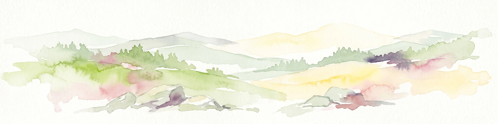
A soft watercolor illustration showing rolling hills, sparse forest clusters, and rocky foreground elements, set against a light background.
Nature reserveThuringia
About 8.9 km away#3 closest

Southwest

Öchsenberg Nature Reserve: Basaltic Peaks and Ancient Landscapes in the Thuringian Rhön

Geographic overview of a volcanic protected area

Öchsenberg stands as a characteristic basalt dome, shaped by ancient volcanic activity and defined by its distinct scree slopes and beech woodlands. This nature reserve, located in the northern Rhön foothills, offers a concentrated landscape where geological history meets the remnants of extensive Celtic fortifications overlooking the Werra valley.

Area
2.67 km²
Established
1990
Relief
Mountain
Climate
Temperate
Nature reserveWartburgkreis
About 9.2 km away#4 closest

East

Erlensee - Maiwiesen Nature Reserve and Werra Floodplain Protected Landscape

A vital wetland and meadow network in Wartburgkreis, Germany

Erlensee - Maiwiesen represents an important nature reserve in the Wartburgkreis district of Germany, characterized by the pairing of an alder-fringed lake with extensive wet meadows. This area plays a significant role in the regional Werra biotope network, focusing on the preservation of riverine habitats and lowland grassland biodiversity within a settled landscape. The site serves as a prime example of active habitat management and floodplain connectivity.

Area
1.089 km²
Established
2018
IUCN
IV
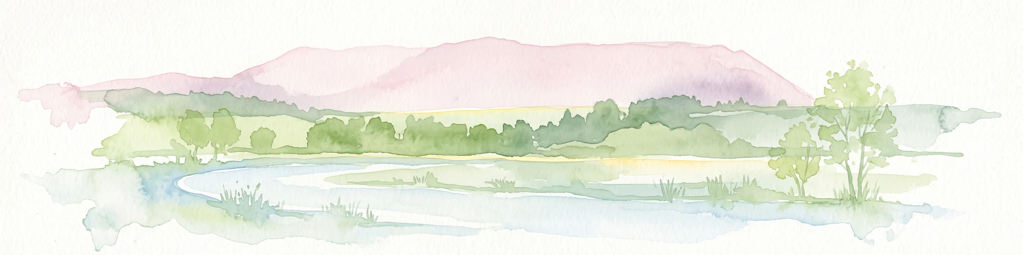
A soft watercolor illustration of a wetland scene with light blue water in the foreground, green trees in the midground, and soft pink hills in the background.
Nature reserveHessen
About 11 km away#5 closest

Northwest

Rohrlache von Heringen Protected Area and Werra Valley Wetland Geography

Nature reserve featuring rare saline meadows and alluvial terrain

Rohrlache von Heringen stands as the largest inland saline site in Hesse. This protected area preserves a rare ecosystem of salt-tolerant flora and vital breeding grounds for waterbirds, shaped by both natural Zechstein geology and long-term industrial influences along the Werra river floodplain.

Area
0.765 km²
Established
1979
IUCN
IV
Relief
Lowland
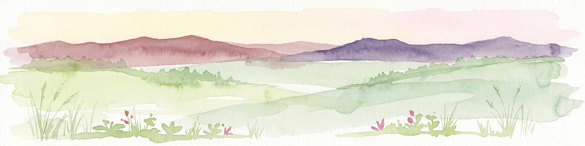
A horizontal watercolor illustration showing a calm lake in the distance with soft, green, hilly horizons and painted leaves framing the foreground.
Nature reserveThuringia
About 13 km away#6 closest

South

Bernshäuser Kutte: A Protected Sinkhole Lake and Geological Landmark in Thuringia

Mapped nature reserve, karst terrain, and salt subsidence geotope.

Bernshäuser Kutte represents a significant protected area known for its near-circular basin and dramatic depth. This geological feature is embedded within the forest landscape of the Thuringian Rhön, serving as a well-documented site for understanding karst processes, water stratification, and long-term conservation in central Germany.

Area
0.131 km²
Established
1942
IUCN
IV
Nature reserveWartburgkreis
About 13 km away#7 closest

Northwest

Werraaue bei Berka und Untersuhl: Protected Floodplain and Wetland Geography in Wartburgkreis

Mapped riverine habitat and regional conservation area

Located in the heart of the Berka basin, this nature reserve protects a diverse floodplain environment featuring rare inland saline habitats and intricate oxbow lake systems. Serving as a vital ecological stepping stone along the former inner-German border, it represents one of the most important meadow bird corridors within the Wartburgkreis district.

Area
2.558 km²
Established
1996
IUCN
IV
Relief
Lowland
Nature reserveThuringia
About 13 km away#8 closest

Southeast

Stoffelskuppe Nature Reserve: Volcanic Terrain and Forested Biodiversity in Thuringia

Explore the geology and conservation landscape of this Rhön volcanic peak.

Stoffelskuppe stands as a significant geological landmark, characterized by its protective basalt cap and natural talus slopes. This nature reserve in Thuringia offers a deep look into undisturbed scree woodland and rare habitats for ground-dwelling flora and fauna. The site serves as a vital ecological anchor within the broader Rhön Biosphere Reserve, showcasing the distinct volcanic landforms of central Germany.

Area
0.229 km²
Established
1961
IUCN
IV
Relief
Mountain

Common questions about visiting, size, designation, and location context for Brühl von Merkers

Brühl von Merkers FAQs for park facts, access, geography, and protected area context

Find quick answers about Brühl von Merkers, including protected-area facts, park geography, trail and visitor context, and how the park fits into its surrounding country and regional landscape.
MoriAtlas Explorer

Continue Your Protected Areas Search Across the Global Atlas

Deepen your exploration by continuing the structured search for national parks and protected areas worldwide. Utilize the comprehensive filtering capabilities to compare different conservation landscapes and refine your understanding of global park geography. Discover more about the distribution and characteristics of protected natural areas.

Global natural geography