

Mori Atlas logo
Nature reserveButcher Gap Conservation Park

A focused protected area preserving layered coastal ecosystems along Lacepede Bay

Butcher Gap Conservation Park: Mapping the Coastal Dune and Wetland Landscapes of South Australia

Butcher Gap Conservation Park represents a compact yet ecologically significant protected landscape along the Limestone Coast of South Australia. The reserve features a dynamic mosaic of young coastal dunes, swales, and saline wetlands, including Salt Lake and Butchers Lake. By protecting this rare intersection of foredune scrub, samphire flats, and swamp paperbark forest, the park serves as a critical refuge for migratory shorebirds and waterfowl in the Lacepede Bay region.

coastal reserveLimestone Coastforedunesamphire wetlandmigratory birdsorange-bellied parrot habitat

Butcher Gap Conservation Park

Nature reserve

Park overview

Structured park overview, official facts, and landscape profile for Butcher Gap Conservation Park

Butcher Gap Conservation Park park facts, protected area profile, and essential visitor context

Review the core facts for Butcher Gap Conservation Park, including designation, size, terrain, visitor scale, habitats, and operating context in one park-focused overview.

About Butcher Gap Conservation Park

Butcher Gap Conservation Park is a compact coastal reserve located about six kilometres south of Kingston SE on South Australia's Limestone Coast, perched above the waters of Lacepede Bay. Although small in area, it protects a distinctive suite of coastal landforms and habitat types that are individually uncommon and tightly arranged, giving the park an unusually high ecological density relative to its size.

The reserve sits on Quaternary-era coastal sediments, with a foredune ridge defining the landward edge of the beach and a series of swales stepping inland toward a shallow wetland basin. This basin encompasses Salt Lake and Butchers Lake, occupying around 40 hectares and fringed by samphire communities and dense stands of the South Australian swamp paperbark, Melaleuca halmaturorum, over a marine meadow understorey.

Beyond the wetland, much of the rest of the park consists of coastal scrub adapted to sandy, saline, and wind-exposed conditions. A drainage line, the Butcher Gap Drain, passes through the reserve and is jointly managed with the South Eastern Water Conservation and Drainage Board to balance drainage with wetland values. The combination of beach, dune, scrub, and inland saline lagoon creates a landscape where marine, lacustrine, and terrestrial habitats converge over a short distance.

Butcher Gap Conservation Park was proclaimed on 29 March 1990 under the National Parks and Wildlife Act 1972 and is now administered by South Australia's Department for Environment and Water. Its IUCN Category III designation reflects its role as a protected natural feature rather than a large landscape-scale reserve, and its management plan emphasizes the importance of the wetland and samphire systems for migratory and resident birdlife.

Quick facts and research context for Butcher Gap Conservation Park

Butcher Gap Conservation Park lies on the Limestone Coast of South Australia, near the small coastal town of Kingston SE, and looks out across Lacepede Bay. Proclaimed in March 1990 under the National Parks and Wildlife Act 1972, it is managed by the state's Department for Environment and Water.

The park covers roughly 1.8 square kilometres and is classified as an IUCN Category III protected area, reflecting its role in conserving a specific natural feature rather than a large-scale ecosystem. Its conservation value centers on a foredune and swale system enclosing a wetland of about 40 hectares, including Salt Lake and Butchers Lake, which together support migratory waders, waterfowl, and endangered species such as the orange-bellied parrot.

Protection and recognition

Terrestrial protection scope and official administrative records

Butcher Gap Conservation Park Protection Status and Designated Area Facts

Butcher Gap Conservation Park maintains a documented terrestrial protection scope within the regional conservation network. Administrative records outline the legal status and management framework governing the natural landscape.

Protection details

Protection scope
Terrestrial
Transboundary protection
No
Park context

Deeper park guide and search-rich context for Butcher Gap Conservation Park

Butcher Gap Conservation Park history, landscape, wildlife, and travel context

Explore Butcher Gap Conservation Park through its history, landscape character, ecosystems, wildlife, conservation priorities, cultural context, and seasonal travel timing in a structured park guide built for atlas discovery and search intent.

Why Butcher Gap Conservation Park stands out

Butcher Gap Conservation Park is best known for the compact but ecologically layered coastal system it protects: a foredune and swale landscape wrapped around a saline wetland basin. Salt Lake and Butchers Lake, ringed by samphire and South Australian swamp paperbark, form the park's defining feature. The reserve has also become notable as a recognised habitat patch for the orange-bellied parrot, one of the world's most threatened migratory parrots, which has been recorded feeding on two-horned searocket near the beach and across the surrounding samphire flats. The park's combination of dune scrub and inland saline lagoon makes it a small but meaningful refuge for migratory shorebirds in the Lacepede Bay region.

Butcher Gap Conservation Park history and protected-area timeline

The land that makes up Butcher Gap Conservation Park was set aside as a formal protected area on 29 March 1990, when it was proclaimed under South Australia's National Parks and Wildlife Act 1972. Its establishment brought the area's coastal dunes, scrub, and inland wetland complex under state-level conservation management.

Following proclamation, the reserve's significance was articulated through a management plan that documented the wetland system surrounding Salt Lake and Butchers Lake, the role of the Butcher Gap Drain, and the importance of the park for migratory and other bird species. The Department for Environment and Water continues to manage the park as a coastal refuge, recognising both its samphire and paperbark habitat and its value for species such as the orange-bellied parrot.

Butcher Gap Conservation Park landscape and geographic character

The landscape of Butcher Gap Conservation Park is dominated by a young coastal dune system dropping inland to a shallow wetland basin. A foredune ridge runs parallel to the coast above Lacepede Bay, with a chain of swales stepping back toward Salt Lake and Butchers Lake. Where the dune system meets the wetland, sandy soils give way to saline flats dominated by samphire.

The wetland itself is shallow and saline, edged by stands of South Australian swamp paperbark forming a low forest over a marine meadow ground layer. To the east and south of the wetland, dune scrubs rise again in low, wind-shaped forms, typical of the Limestone Coast's recent coastal sediments. The Butcher Gap Drain crosses the basin and adds a linear hydrological feature to the broader dune-and-lagoon mosaic.

The result is a tightly compressed coastal landscape in which beach, dune scrub, samphire flat, paperbark wetland, and shallow salt lake are all present within walking distance of one another. This layering is the park's most distinctive scenic and physical feature, distinguishing it from the broader pastoral and forested Limestone Coast that surrounds it.

Butcher Gap Conservation Park ecosystems, habitats, and plant life

Butcher Gap Conservation Park protects a mosaic of coastal and wetland habitats that together form a small but ecologically rich system. The foredune and swale complex supports hardy coastal scrub adapted to salt, wind, and sandy substrate, while the interior basin transitions into the more specialised environment of a saline wetland.

The wetland, encompassing Salt Lake and Butchers Lake, is the ecological heart of the park. Around its margins, dense South Australian swamp paperbark grows over a marine meadow understorey, a vegetation association typical of the region's coastal lagoons. Outside these fringing woodlands, samphire flats form extensive low-growing communities tolerant of saline conditions.

Together, these habitats support a range of coastal and wetland species and provide an important seasonal refuge area along the Lacepede Bay coast. The park's small area is offset by the diversity of vegetation associations it contains within a single reserve boundary, including rare elements such as the swamp paperbark over marine meadow community and broad samphire stands.

Butcher Gap Conservation Park wildlife and species highlights

Wildlife values at Butcher Gap Conservation Park centre on migratory and water-associated birds. The wetland system around Salt Lake and Butchers Lake supports a variety of waterfowl, including migratory waders that move along the Lacepede Bay coastline, while the surrounding dunes and scrub provide additional habitat for coastal passerines and other native fauna.

The park is particularly recognised for its potential importance to the orange-bellied parrot, an endangered migratory species. Orange-bellied parrots have been observed feeding on two-horned searocket near the beach and across the extensive samphire habitat around Salt Lake, highlighting the reserve's role as a stopover or seasonal habitat site.

Although the broader wildlife community is less documented than the birdlife, the combination of dune scrub, paperbark woodland, samphire flats, and shallow lagoon creates conditions for a diverse mix of invertebrates, reptiles, and small mammals typical of southern Australian coastal reserves. The park's small size means that its wildlife significance lies more in habitat specificity and connectivity to broader coastal bird movements than in large resident populations.

Butcher Gap Conservation Park conservation status and protection priorities

Butcher Gap Conservation Park was established specifically to conserve its foredune, swale, and saline wetland features, which together support a recognised sequence of coastal habitats in the Limestone Coast region. Its IUCN Category III status reflects its role in preserving a particular natural feature, the wetland and dune complex, rather than a large ecosystem.

The reserve's conservation significance lies particularly in its wetland value for migratory birds, including waders, waterfowl, and the endangered orange-bellied parrot. The paperbark over marine meadow association in and around Salt Lake and Butchers Lake is a regionally important vegetation type, and the surrounding samphire flats extend the habitat base for shorebirds and halophytic plant communities.

Management of the park also involves coordination with the South Eastern Water Conservation and Drainage Board over the Butcher Gap Drain, recognising that hydrological flows directly affect the wetland's ecological character. The Department for Environment and Water's ongoing administration aims to maintain the integrity of the dune and samphire systems while supporting the seasonal use of the area by migratory species.

Top sights and standout views in Butcher Gap Conservation Park

A compact protected slice of coastal South Australia where foredunes, samphire flats, and a paperbark-fringed saline wetland meet within a single short stretch of landscape. The park is best appreciated as a refuge for migratory shorebirds and waterfowl along Lacepede Bay, including the endangered orange-bellied parrot.

Its proximity to Kingston SE and the coast makes Butcher Gap an accessible example of how small, targeted reserves can protect layered coastal habitats otherwise lost to drainage or development. The combination of recent dune formation, samphire vegetation, and inland salt lake gives the park an unusually distinct ecological signature within the Limestone Coast.

Best time to visit Butcher Gap Conservation Park

Butcher Gap Conservation Park is most rewarding for visitors interested in migratory birdlife and wetland scenery. Spring and early summer bring the most active migrant shorebird and waterfowl presence, when conditions around Salt Lake and Butchers Lake are most biologically expressive. Autumn offers softer light over the dune scrub and quieter wetland views. Winters are mild by South Australian standards but can be wet and windy along the exposed coastal foredunes. Timing visits around cooler parts of the day in warmer months helps when walking the open dune country.
Monthly climate preview

Long-term temperature ranges and monthly precipitation averages for South Australia

Butcher Gap Conservation Park Climate Normals and Annual Weather Patterns

Representative coordinate records show measured shifts in average temperature and precipitation across the annual cycle at Butcher Gap Conservation Park. Examining the complete monthly climate profile reveals detailed twelve-month variations in temperature minimums and maximums.
Annual mean15 °C
10 °C20 °C
Jan20°
Feb20°
Mar18°
Apr15°
May13°
Jun11°
Jul10°
Aug11°
Sep12°
Oct14°
Nov16°
Dec18°
Warmest month
January

20 °C

Coolest month
July

10.4 °C

Wettest month
June

2.5 mm/day

Driest month
February

0.6 mm/day

Park location guide

Geography guide, regional context, and park location map for Butcher Gap Conservation Park

Butcher Gap Conservation Park park geography, regions, and map view in Australia

Understand where Butcher Gap Conservation Park sits in Australia through a broader geographic reading of the surrounding landscape, nearby location context, and its mapped position within the national park landscape.

How Butcher Gap Conservation Park fits into Australia

Australia is a constitutional monarchy and federal parliamentary democracy comprising six states and ten territories. With a population of nearly 28 million, it is one of the world's most urbanised countries, with most people concentrated on the eastern seaboard. The country has a high Human Development Index and is known for its cultural diversity, ancient Aboriginal heritage, and unique wildlife.

Wider geography shaping Butcher Gap Conservation Park in Australia

Australia occupies the entire Australian continent, the island of Tasmania, and numerous smaller islands. It is the world's flattest and driest inhabited continent, featuring vast deserts in the interior (the Outback), tropical rainforests along the eastern coast, and a coastline bordering the Indian and Pacific Oceans.

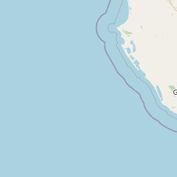
Map view of Butcher Gap Conservation Park

Use this park location map to pinpoint Butcher Gap Conservation Park in Australia, understand its exact geographic position, and read its mapped placement within the surrounding landscape more clearly.

Pigeon | © OpenStreetMap contributors

Location context for Butcher Gap Conservation Park

South Australia
Park atlas

Compare regional coastal reserves and nearby South Australian landscapes

Explore Protected Areas and Parks Near Butcher Gap Conservation Park

Continue your geographic exploration by discovering other protected areas and coastal reserves situated across the surrounding Limestone Coast region. Comparing nearby parks provides a broader understanding of the diverse dune networks and wetland habitats found throughout South Australia.
Nature reserveSouth Australia
About 22 km away#1 closest

South

Guichen Bay Conservation Park: Coastal Nature Reserve and Geologic Map Context

Protected beach ridge plains in South Australia

Guichen Bay Conservation Park represents a vital protected area in South Australia, encompassing a classic Holocene beach ridge plain. This nature reserve is essential for studying coastal geological shifts and provides a sheltered environment for rare coastal scrub habitats along the Limestone Coast.

Area
1.27 km²
Established
1967
IUCN
III
Relief
Lowland
National parkSouth Australia
35 km away#2 closest

North

Coorong National Park: South Australia National Park Mapped Boundaries and Landscape Context

Explore its unique protected landscape and regional geography.

Coorong National Park in South Australia is featured here as a key protected area for geographic discovery. Users can explore the park's specific landscape characteristics, mapped boundaries, and its role within the regional geography of South Australia. This detail page supports an atlas-based understanding of protected lands, offering a focused perspective on the park's natural terrain and conservation significance within Australia.

Area
490.15 km²
Established
1967
IUCN
II
Relief
Lowland
Nature reserveSouth Australia
50 km away#3 closest

East

Fairview Conservation Park: Protected Nature Reserve and Limestone Coast Geography

Mapped wetlands, sandy ridges, and woodlands in southeastern South Australia

Explore the geographic framework of Fairview Conservation Park, a nature reserve in South Australia's Limestone Coast. The protected area features a unique intersection of semi-permanent lagoons, periodically inundated flats, and varied woodland vegetation including blue gum and manna gum, offering a clear window into the regional geological and ecological character of the area.

Area
13.94 km²
Established
1960
IUCN
Ia
Relief
Lowland
Nature reserveSouth Australia
About 52 km away#4 closest

Northeast

Jip Jip Conservation Park: Geologic Formations and Protected Biodiversity in South Australia

A compact reserve of granite outcrops and sandy woodland habitats.

Jip Jip Conservation Park preserves a distinctive cluster of granite outcrops known as the Jip Jip Rocks. The park is significant for its diverse plant life, including rare ferns, and its role as a sanctuary for bird species and small marsupials within the broader South Australian landscape.

Area
1.4 km²
Established
1967
IUCN
III
Relief
Upland
State or regional parkSouth Australia
61 km away#5 closest

Northeast

Desert Camp Conservation Park: Geographic Overview and Protected Area Atlas

Interdunal plains and pink gum woodland in South Australia

Examine the unique geomorphology and protected vegetation of Desert Camp Conservation Park. This record details the park's characteristic sandy duplex soils, low dune ridges, and granite outcrops, offering insight into the specific ecosystems preserved within this South Australian regional conservation area.

Area
0.51 km²
Established
1967
IUCN
III
Relief
Lowland
Nature reserveSouth Australia
62 km away#6 closest

North

Gum Lagoon Conservation Park: Protected Landscapes of the Limestone Coast, South Australia

Mallee woodland and wetland drainage corridor

Investigate the complex terrain of Gum Lagoon Conservation Park. This nature reserve provides essential habitat through its combination of tea-tree scrub, wet heathland, and the Duck Island Watercourse. Recognized for its role in biodiversity conservation, the park offers a clear look at how fragmented ecosystems are restored and maintained within the broader geography of South Australia.

Area
89.06 km²
Established
1970
IUCN
VI
Relief
Lowland
Wildlife reserveSouth Australia
65 km away#7 closest

East

Big Heath Conservation Park: Mapping Protected Landscapes in South Australia

A strict nature reserve of woodland and wetland mosaics.

Big Heath Conservation Park represents a significant protected area in the Limestone Coast region of South Australia. The terrain is characterized by a gently undulating plain where subtle variations in elevation and soil composition create a distinct patchwork of eucalypt woodlands, sandy heath, and seasonal depressions linked to regional hydrological drainage systems.

Area
24.72 km²
Established
1964
IUCN
Ia
Relief
Lowland
Nature reserveSouth Australia
About 68 km away#8 closest

Southeast

Furner Conservation Park Geography and Protected Woodland Atlas for South Australia

A study of forest remnants, sandy rises, and coastal dune topography

Furner Conservation Park preserves a significant mosaic of native woodlands within the Limestone Coast region. The terrain shifts between sandy rises and stony calcarenite ridges, supporting distinct forest communities that offer a vital look into the natural history and regional geography of South Australia.

Area
2.89 km²
Established
1973
IUCN
III
Relief
Upland

Common questions about visiting, size, designation, and location context for Butcher Gap Conservation Park

Butcher Gap Conservation Park FAQs for park facts, access, geography, and protected area context

Find quick answers about Butcher Gap Conservation Park, including protected-area facts, park geography, trail and visitor context, and how the park fits into its surrounding country and regional landscape.
MoriAtlas Explorer

Continue Your Protected Areas Search Across the Global Atlas

Deepen your exploration by continuing the structured search for national parks and protected areas worldwide. Utilize the comprehensive filtering capabilities to compare different conservation landscapes and refine your understanding of global park geography. Discover more about the distribution and characteristics of protected natural areas.

Global natural geography