
Visit Planning
When to Visit Dorrigo National Park: Identifying the Best Time for Your Trip
Deciding when to visit Dorrigo National Park requires balancing the desire for dry, crisp hiking conditions against the appeal of the park's lush, high-rainfall rainforest environment. Because the park is part of a complex Gondwana-era ecosystem on the New South Wales plateau, the climate is defined by its ability to capture moisture, leading to a year-round cycle where rainfall and humidity are constants, though they vary in intensity. For most travellers, the best time to visit is during the cooler, lower-precipitation window of late winter, specifically July and August. During these months, the daily precipitation levels reach their annual minimum, offering a reprieve from the persistent dampness that characterizes much of the rest of the year. The lower humidity and cooler temperatures make the strenuous walks toward waterfalls and through the dense canopy more comfortable for extended exploration.
Understanding the Rainfall and Humidity Trade-off
Unlike destinations where seasonal shifts create distinct wet and dry zones, this park maintains a relatively high baseline of moisture. While late winter offers the clearest trails, those who visit during the transition periods or warmer months must accept that high humidity and afternoon showers are inherent to the rainforest experience. The interaction between elevation and oceanic air masses means that even in drier periods, morning fog is a common feature that often clears by midday. Visitors prioritize their timing based on whether they prefer the lower-risk hiking weather of the winter months or the more intense, verdant atmosphere of the warmer season, which features longer daylight hours but a higher probability of afternoon rainfall.
How Temperature and Elevation Shape the Visit
Temperature in the park is moderated by its plateau position, which generally keeps the heat more manageable than in the surrounding coastal lowlands. Even during the peak of summer, mean temperatures remain comfortable for activity, though the humidity can make these days feel more taxing during physical exertion. Conversely, the cooler months provide a crispness that is ideal for the Wonga Walk or climbing toward the canopy via the Skywalk. Since the park is designed to showcase the ancient nature of these forests, the weather serves as a functional component of the visitor experience rather than a barrier. Choosing the right time depends entirely on your tolerance for rain and your preference for either the crisp, stable days of July and August or the longer, warmer, and wetter days that span from November to January. Regardless of your chosen dates, the park's environment remains dynamic, and you should always prepare for localized changes in conditions that arrive with the mountainous terrain.
Seasonal Planning
Best Months for Visiting Dorrigo National Park: A Quick Comparison
Peak Hiking Conditions in Winter
The period spanning July and August represents the most stable window for visitors prioritizing physical activity, particularly on trails like the Wonga Walk. During these two months, the region experiences its lowest precipitation levels, with monthly rainfall averages of just 1.77 mm per day. The cooler average temperatures, which range from daily lows of about 9.7 degrees Celsius to highs near 22.6 degrees Celsius, minimize the physical strain of humidity during sustained walking. For travellers aiming to avoid the high moisture content that characterizes the rainforest for most of the year, this mid-winter window offers the most reliable terrain conditions. The trade-off for these drier paths is the requirement for warmer layers, as morning temperatures can hover near 10 degrees Celsius before the sun penetrates the canopy.
Transition Windows for Warmer Exploration
Visitors who prefer warmer weather for viewing the Skywalk or exploring the rainforest canopy often look toward the shoulder months of October and November. These months serve as a bridge between the cool, dry winter and the humid heat of the summer months. Average daily highs climb to approximately 27.7 degrees Celsius in October and 29.2 degrees Celsius in November. This period provides an extended duration of daylight, reaching up to 13.5 hours, which allows for a more relaxed pace when navigating the park exhibits. However, visitors must accept a significant trade-off: as the air warms, rainfall probabilities increase alongside humidity levels, often leading to the frequent afternoon showers common to this temperate rainforest ecosystem. Those planning for this time should expect fluctuating conditions where clear, bright mornings are frequently followed by damp afternoons.
Balancing Humidity and Wildlife Activity
For those interested in the park's biodiversity, the transition from late summer into early autumn presents a distinct set of trade-offs. The months of March and April retain much of the warmth from the summer, with average daily highs ranging from 28.3 degrees Celsius down to 25.9 degrees Celsius. While the vegetation remains lush and vibrant, these months occupy a high-humidity bracket, with levels frequently exceeding 75 percent. This creates a dense, immersive atmosphere that some find ideal for photography and wildlife observation, as the rainforest is particularly active. Travelers choosing this period should prepare for consistent, moderate rainfall, as these months remain wetter than the winter dry season. This period is best suited for those who prioritize the sensory experience of a living rainforest over the convenience of dry hiking trails, accepting that humidity and periodic rain are fundamental to the ecosystem's character during these months.
Annual Climate Overview
Understanding Weather and Temperature Patterns in Dorrigo National Park
Dorrigo National Park experiences a climate defined by its plateau location and persistent moisture, characteristics that create significant variability throughout the year. Understanding these patterns requires moving beyond simple temperature ranges to consider the interplay between humidity, daylight, and precipitation. Please note that these figures represent long-term climate normals based on historical data. They are not local weather forecasts and should be treated as general seasonal indicators rather than guarantees for specific travel dates.
The Shift from Dry Winter to Humid Summer
The annual cycle in the park follows a distinct transition between the cooler, relatively dry months of winter and the warmer, more humid months that define the summer peak. During July and August, the park experiences its lowest monthly precipitation levels, with normals indicating around 1.77 mm per day. These months also see the lowest mean temperatures, often hovering between 15.14 degrees Celsius in July and 15.7 degrees in August. This period provides the most stable atmospheric conditions for those who prefer to explore the rainforest trails without the constant threat of afternoon downpours.
As the year progresses into late spring and early summer, the climate shifts significantly. By November and December, mean temperatures rise to roughly 21 to 22 degrees Celsius, and precipitation rates increase to over 4.4 mm per day. The humidity levels also climb during this phase, frequently exceeding 75 percent, which significantly influences how a visitor experiences the temperature. While a summer day may show a comfortable mean, the high humidity can make exertion on steep forest tracks feel more demanding than the thermometer alone suggests.
Daylight and Visibility Patterns
Daylight hours follow a clear, predictable arc that directly influences the length of time available for exploring the park’s extensive trail network. The shortest days occur in June, with approximately 10.07 hours of daylight, which forces a more compressed schedule for visitors planning long walks. Conversely, December provides nearly 14 hours of light, offering a broader window for activity. However, visitors should be aware that longer daylight hours in the summer often coincide with the park's more volatile weather patterns, including the common occurrence of late-afternoon rain. While mornings may begin with the signature mountain fog that defines the Gondwana ecosystem, these clouds often dissipate by midday, only to return with moisture as the afternoon progresses.
Interpreting Rainfall and Humidity
Rainfall is not distributed evenly, and its presence is the primary driver of the park’s lush biodiversity. The months of January and February represent the peak of the wet cycle, with daily precipitation averages reaching 4.89 mm and 6.85 mm respectively. During these times, the forest floor and canopy are at their most vibrant, but the persistent moisture requires careful planning for gear and timing. Wind speeds across the year remain relatively consistent, typically averaging between 3.8 and 4.6 m per second. While these figures appear moderate, they can feel significantly more intense when combined with rain or when standing on exposed sections of the canopy boardwalk. Visitors should anticipate that the combination of high humidity and wind can lead to rapid cooling even when ambient temperatures appear moderate, making it essential to have adaptable layers available regardless of the month.
Seasonal Dynamics
Understanding Climate Phases and Seasonal Patterns in Dorrigo National Park
Defining the Rainforest Climate Cycles
Rather than conforming to a strict four-season model, the climate of the Dorrigo Plateau is governed by two primary atmospheric phases: a dominant high-moisture cycle that sustains the rainforest and a distinct, cooler dry phase that provides relief from humidity. Because the park is situated on a plateau, it experiences frequent orographic rainfall as moist air masses rise against the escarpment. This environment rarely experiences true aridity, but visitors will notice a marked shift in atmospheric consistency between the mid-year and the summer months.
The Cool and Stable Winter Phase
The period from June through August marks the most stable environmental window for the park. During these months, precipitation levels drop to their annual minimums, typically ranging around 1.7 to 3.8 mm per day. Temperature averages stay at their lowest, with mean daily temperatures hovering between 15 and 16 degrees Celsius. This phase is characterized by crisp, cool air and a reduction in the persistent afternoon convectional storms that define other times of the year. For visitors, this translates to improved visibility on the Skywalk and a lower likelihood of sudden, heavy rainfall interrupting outdoor activities. While mornings often remain damp with mist, the cooler temperatures make sustained activity on the forest floor, such as the Wonga Walk, physically more comfortable.
The Warming and Increasing Humidity Transition
As the park moves into September and October, the influence of seasonal warming begins to shift the moisture profile. While September often remains quite dry, the transition into October and November sees a steady climb in humidity and a gradual increase in mean temperatures, moving back toward the 20 to 22 degree Celsius range. This period is effectively the ramp-up to the peak of the wet season. Winds, which remain relatively consistent throughout the year at approximately 4 meters per second, start to carry more significant moisture content, leading to the return of late-afternoon precipitation patterns. Visitors during these shoulder months often find the most variable conditions, as clear mornings frequently yield to cloudier, more humid afternoons.
The High-Energy Wet Season
The summer months, extending from December through February, constitute the peak of the park's moist cycle. Daily mean temperatures are at their highest, often exceeding 23 degrees Celsius, and relative humidity frequently reaches its annual peak, often hovering near 78 percent. This is the period when convectional afternoon thunderstorms are most frequent. Precipitation levels are at their most significant here, with historical data showing daily averages reaching 6.8 mm in February. The environment becomes intensely lush and reactive to this moisture, though the increased humidity and potential for rapid, localized rainfall require a flexible approach to timing visits within the day. Travelers should anticipate that the forest's microclimate during this phase is characterized by quick shifts from bright, high-daylight conditions to intense afternoon cloud cover and precipitation.
Seasonal Experiences
What Visiting Dorrigo National Park is Like Through the Year
Rain-Dependent Waterfall and Creek Experiences
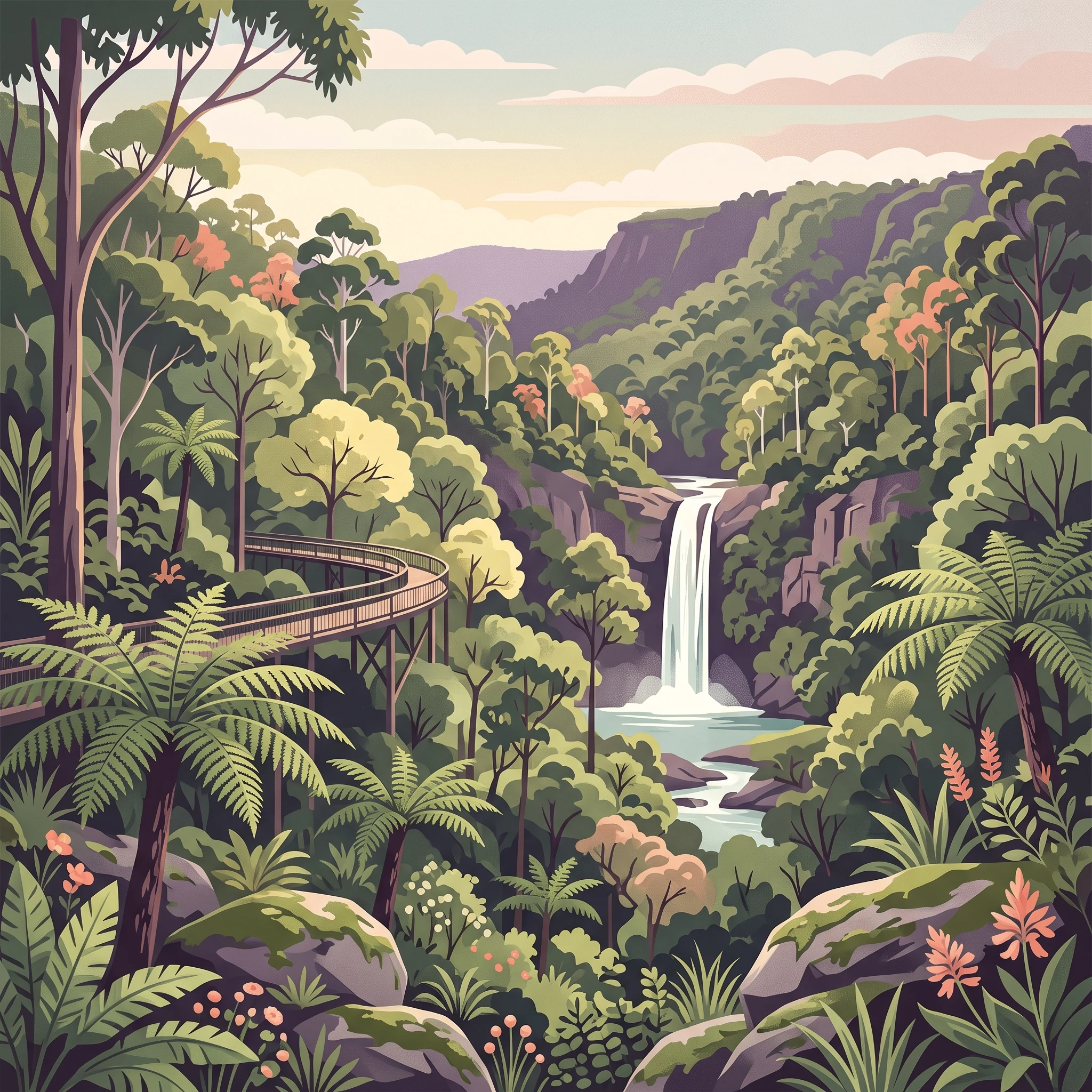
The prominence of waterfalls throughout the Dorrigo Plateau is directly linked to the park's moist, temperate rainforest climate. While the cascades, such as Crystal Shower Falls and Tristania Falls, are permanent fixtures of the Wonga Walk, their visual impact and the volume of water they carry fluctuate with the seasons. During the drier winter window of July and August, when precipitation levels are at their lowest, visitors often find these falls at their most tranquil. This period is well-suited for those who prioritize the clarity of the forest floor and reliable footing over the heavy mist and roaring flow characteristic of higher-rainfall months. Conversely, late spring and early summer often bring increased moisture and convective storm activity, which can significantly enhance the force of these cascades. Hikers should note that high-moisture periods increase the likelihood of slick conditions on steeper trails, particularly the approach to Red Cedar Falls, where steep terrain and higher humidity can make the path challenging even for experienced walkers.
Canopy Access and Birdwatching Rhythms
The Skywalk provides a unique aerial perspective that remains accessible throughout the year, but the experience changes based on atmospheric conditions. In the cooler, low-precipitation months of mid-year, the canopy is often clearer, allowing for expansive views across the plateau. This stability can be beneficial for those visiting primarily for birdwatching, as native species like the superb lyrebird and various honeyeaters remain active in the forest structure. The Walk with the Birds boardwalk, which offers detailed interpretive signage, is particularly rewarding during the shoulder seasons of autumn and spring, when the forest is vibrant but less prone to the intense heat and storm patterns of the peak summer months. Visitors during the warmer months should anticipate higher humidity, which may dictate a preference for shorter, shaded morning walks before the temperatures climb during the middle of the day.
Navigating the Forest Floor
The park's extensive track network, including the Wonga Walk and the routes leading toward the Never Never picnic area, responds differently to the annual cycle. Beyond the climatic factors mentioned, the structural integrity of these trails often mirrors the seasonal moisture regime. During the months with higher rainfall, the temperate rainforest floor retains significant moisture, which supports the park's lush, Gondwana-era vegetation but also necessitates high-quality, slip-resistant footwear. While these trails remain open to public exploration, the physical effort required to traverse the forest rises during periods of high humidity and rainfall. Travelers focusing on deep-forest immersion should plan their treks to align with their physical endurance, keeping in mind that the most humid months can make even shorter loops feel significantly more strenuous due to the dense, warm atmosphere.
Travel Priorities
Optimizing Your Visit to Dorrigo National Park Based on Travel Priorities
Prioritizing Clearer Trails and Dryer Conditions
Visitors whose primary goal is physical hiking, particularly on more challenging routes like the Rosewood Creek Track toward Red Cedar Falls, should target the peak winter months of July and August. During this period, the park experiences its lowest average precipitation of 1.77 mm per day, significantly reducing the likelihood of encountering muddy or slippery surfaces that characterize the rainforest at other times. The trade-off for these stable ground conditions is the temperature range, as averages drop to their yearly minimums in the 9 to 10 degree Celsius range during early mornings and evenings. Hikers should prioritize mid-day starts when temperatures reach their daily highs to ensure comfortable conditions without the humidity spikes seen in the warmer months.
Seeking Milder Temperatures and Extended Daylight
For those who prefer a balance of warmth and daylight for canopy exploration, such as the Skywalk or the Wonga Walk, the spring shoulder season of October and November offers a compelling alternative. Daylight hours extend toward 13.5 hours, providing a larger window for exploration compared to the shorter winter days. The mean temperatures climb toward 20 to 21 degrees Celsius, creating a mild, comfortable climate for leisurely movement through the rainforest. The compromise here is an upward trend in humidity and precipitation, as these months bridge the gap between the drier winter and the wetter summer phase. Visitors choosing this period should be prepared for faster-changing conditions and higher moisture levels than those found in late winter.
Targeting Sensory Immersion and Waterfall Flow
If the priority is witnessing the park's waterfalls at their most impressive while experiencing the lush, active nature of the rainforest, the transition into the warmer months of December and January is the most suitable window. While rainfall and humidity are higher during this time, these factors drive the energetic waterfall flow that defines the Gondwana landscape. Visitors must accept the trade-off of potentially intense humidity and the necessity for protective gear, as the moisture levels are a defining characteristic of the forest's health. Those seeking this experience should plan for shorter, focused outings, as the forest environment can become physically taxing due to the combined effects of heat and moisture, especially during the wetter afternoon periods common in early summer.
Visitor Access
Seasonal Access and Practical Planning for Dorrigo National Park
Access to the rainforest environment of the park is defined by its location on the Dorrigo Plateau, roughly 580 kilometres north of Sydney. The primary route into this region is via Waterfall Way, a scenic thoroughfare that connects the park to nearby towns like Bellingen and the coastal hub of Coffs Harbour. While the route itself is paved, the high-altitude nature of the plateau means that conditions can change rapidly regardless of the season. Visitors should check the official New South Wales National Parks and Wildlife Service website before departure for real-time updates on road conditions, potential closures, or maintenance alerts that may affect access along this scenic corridor.
Navigating the Park Entrance and Facilities
The Dorrigo Rainforest Centre, situated at 142 Dome Road, acts as the main hub for visitors. It serves as the primary gateway for those intending to use the Skywalk or access the major trailheads like the Wonga Walk. Facilities at the centre, including parking and interpretive exhibits, are managed by the park authority. Visitors should be aware that operational hours are subject to change and official guidance on site availability should be verified through the park service website prior to arrival. The centre is where visitors can gather the most current information regarding trail status, as specific tracks may temporarily close for maintenance or due to the impact of heavy weather events, which are common in this moist rainforest ecosystem.
Transport Options and Logistics
For those travelling without a private vehicle, transport requires advance planning. Public bus services, such as those provided by Dorrigo Transit, operate along the Waterfall Way, connecting Coffs Harbour, Dorrigo town, and Armidale. It is important to note that these services typically stop in the Dorrigo central business district, which is approximately three kilometres from the park entrance. While some services may offer on-demand drop-offs at the national park itself, these are not guaranteed and must be arranged directly with the operator. Visitors relying on public transport should confirm availability and the necessity of advance bookings before finalizing their trip dates, as these services do not always operate on a frequent fixed-schedule basis.
Planning for Seasonal Variability
While the park remains accessible year-round, the practicalities of visiting shift with the weather. During wetter months, high-intensity rain can lead to surface water or temporary slips on trails, necessitating caution on walking tracks. Regardless of the season, checking official park alerts is the only reliable way to confirm if specific sections, such as the Rosewood Creek Track or the path to Red Cedar Falls, are open and safe for public use. Do not assume that the season alone guarantees access to all park areas, as management decisions based on current site safety take precedence over seasonal averages.
Safety and Preparation
Seasonal Weather Safety and Preparation for Dorrigo National Park
Adapting Your Preparation to Rainforest Conditions
Preparing for a visit to the Dorrigo Plateau requires acknowledging that this high-moisture environment can change rapidly regardless of the season. While the drier winter months of July and August provide the most stable ground conditions for hiking, the park's elevation and dense canopy mean that morning temperatures are frequently lower than those in the surrounding coastal lowlands. Regardless of the month, visitors should prepare for a layering system that accounts for cool morning starts and the potential for rapid temperature shifts as weather patterns move across the escarpment. Even in the warmer summer months, high relative humidity levels often persist, which can affect comfort levels during strenuous walks. Planning for these environmental variables is more effective than relying on generic seasonal clothing alone.
Navigating Moisture and Trail Realities
The most significant factor influencing your preparation is the park's consistent annual rainfall. Because the rainforest environment is designed to retain moisture, trails can remain damp or slick even several days after a rainfall event. When selecting footwear, prioritize items with good grip for muddy or uneven terrain. If you are visiting during the wetter summer months, such as January or February, anticipate that higher precipitation will influence the physical intensity of your walk. During these periods, focus on managing your pace and ensuring your clothing choice promotes breathability to handle the combination of heat and humidity. Always consult the latest park alerts and local weather forecasts immediately before your departure, as these provide the most accurate assessment of current trail conditions which long-term climate normals cannot predict.
Safety Considerations for Plateau Terrain
Beyond weather-specific adjustments, your safety preparation should focus on communication and self-reliance. As the park is situated in a mountainous area with complex geography, mobile phone coverage is inconsistent and often limited to specific networks. Carry a reliable means of communication beyond standard cellular devices if you intend to explore further afield. Preparation for the park is less about specialized equipment and more about informed decision-making: choosing the right trail for your fitness level, recognizing the limitations of your own energy under humid conditions, and being prepared to shorten your visit if conditions deteriorate. Official visitor guidance remains the primary authority for any specific safety rules or restricted areas. Always check the official website for current park closures, fire danger ratings, or updated advice from the New South Wales National Parks and Wildlife Service before heading to the Dorrigo Rainforest Centre.
Finalizing Your Visit
Deciding the Best Time to Visit Dorrigo National Park
Determining the ideal time for your visit requires a clear assessment of your personal tolerance for humidity versus your interest in cooler, stable hiking conditions. By weighing the environmental data against the experiences you prioritize, you can narrow down a window that aligns with your travel style. If your primary goal is maximizing outdoor activity on the Wonga Walk or enjoying the Skywalk with minimal chance of precipitation, the period from July to August remains the most reliable. During these months, the lowered humidity and reduced rainfall probabilities offer a reprieve from the moisture that defines much of the rest of the year, providing a comfortable climate for exploring the rainforest floor and canopy.
Conversely, if your visit is driven by an interest in the heightened waterfall activity and the lush, high-energy environment of the Gondwana rainforest, the warmer transition months of October and November offer a balance. While you must accept the trade-off of increased humidity and a higher likelihood of afternoon showers, these months provide longer daylight hours and warmer temperatures that can enhance the sensory experience of the forest. The crucial decision lies in recognizing that neither period is objectively superior, but rather that each serves a different set of expectations.
When finalizing your plans, distinguish between climate patterns and real-time conditions. The monthly averages described throughout this guide provide a historical context for what to expect, but they do not serve as a forecast for your specific dates. High-moisture environments are inherently prone to localized weather shifts, and terrain-driven rain can occur even during the traditionally drier months. Before you travel, verify current conditions by checking official sources from the New South Wales National Parks and Wildlife Service. This includes reviewing active alerts for trail closures, potential storm warnings, and updates on facility operations at the Dorrigo Rainforest Centre. By anchoring your planning in both these historical climatic realities and the latest live information, you can ensure a well-informed and practical visit.