Mori Atlas logo
National parkDorrigo National Park

Trace the mapped boundaries and regional geography of this significant Australian natural landscape.

Dorrigo National Park: New South Wales Protected Area and National Park Atlas

Dorrigo National Park represents a key protected area within the diverse geographic context of New South Wales, Australia. This page provides an atlas-centric view, enabling exploration of its mapped natural landscape and its specific identity as a national park. Understand its placement within the regional geography and discover the value of this protected land for detailed geographic study.

RainforestWorld Heritage SiteTemperate RainforestWaterfallsNorthern TablelandsGondwana Rainforests

Dorrigo National Park

National park

Park overview

Structured park overview, official facts, and landscape profile for Dorrigo National Park

Dorrigo National Park park facts, protected area profile, and essential visitor context
Review the core facts for Dorrigo National Park, including designation, size, terrain, visitor scale, habitats, and operating context in one park-focused overview.

About Dorrigo National Park

Dorrigo National Park stands as one of the crown jewels of Australia's protected area network, representing a landscape of profound scientific, ecological, and cultural significance on the Northern Tablelands of New South Wales. The park occupies a commanding position on the Dorrigo Plateau, where its elevated terrain captures moisture-laden clouds rolling in from the coast, sustaining the dense temperate rainforests that define the area's character. This positioning also accounts for the remarkable concentration of waterfalls that cascade from the plateau edges, making the landscape exceptionally scenic and visually dramatic.

The park forms an integral component of the Gondwana Rainforests of Australia World Heritage Site, a serial property encompassing numerous separate protected areas that collectively represent the surviving remnants of the ancient forests that covered much of eastern Australia during the Jurassic and Cretaceous periods. These rainforests contain primitive plant lineages that provide scientists with invaluable insights into the evolutionary history of the southern hemisphere's flora. The World Heritage inscription recognizes the outstanding universal value of these ecosystems, which represent a continuity of ecological processes spanning tens of millions of years.

Access to the park centers on the Dorrigo Rainforest Centre, which serves as both a gateway and educational facility. The Centre houses interpretive displays including The Rainforest Revealed exhibit, which explains how the rainforest evolved and introduces visitors to the complex web of species that inhabit it. The adjoining Canopy Cafe provides opportunities for refreshment while overlooking the forest. Several walking tracks radiate from the centre, including the popular Wonga Walk, which passes multiple waterfalls including Crystal Falls and Tristania Falls, while the Rosewood Creek Track leads to the impressive Red Cedar Falls.

Quick facts and research context for Dorrigo National Park

Dorrigo National Park occupies a plateau in the Northern Tablelands of New South Wales, approximately 5 kilometres east of the township of Dorrigo and accessible via the Waterfall Way scenic route. The protected area spans roughly 119 square kilometres of mountainous terrain that forms part of the larger Gondwana Rainforests of Australia World Heritage Site, inscribed in 1986 and added to the Australian National Heritage List in 2007. The park features dozens of waterfalls owing to its plateau setting, with the northern sections being more mountainous while the southern portions present gentler rolling terrain. The area has been formally protected since 1 October 1967 under the management of the National Parks and Wildlife Service of New South Wales.

Park context

Deeper park guide and search-rich context for Dorrigo National Park

Dorrigo National Park history, landscape, wildlife, and travel context
Explore Dorrigo National Park through its history, landscape character, ecosystems, wildlife, conservation priorities, cultural context, and seasonal travel timing in a structured park guide built for atlas discovery and search intent.

Why Dorrigo National Park stands out

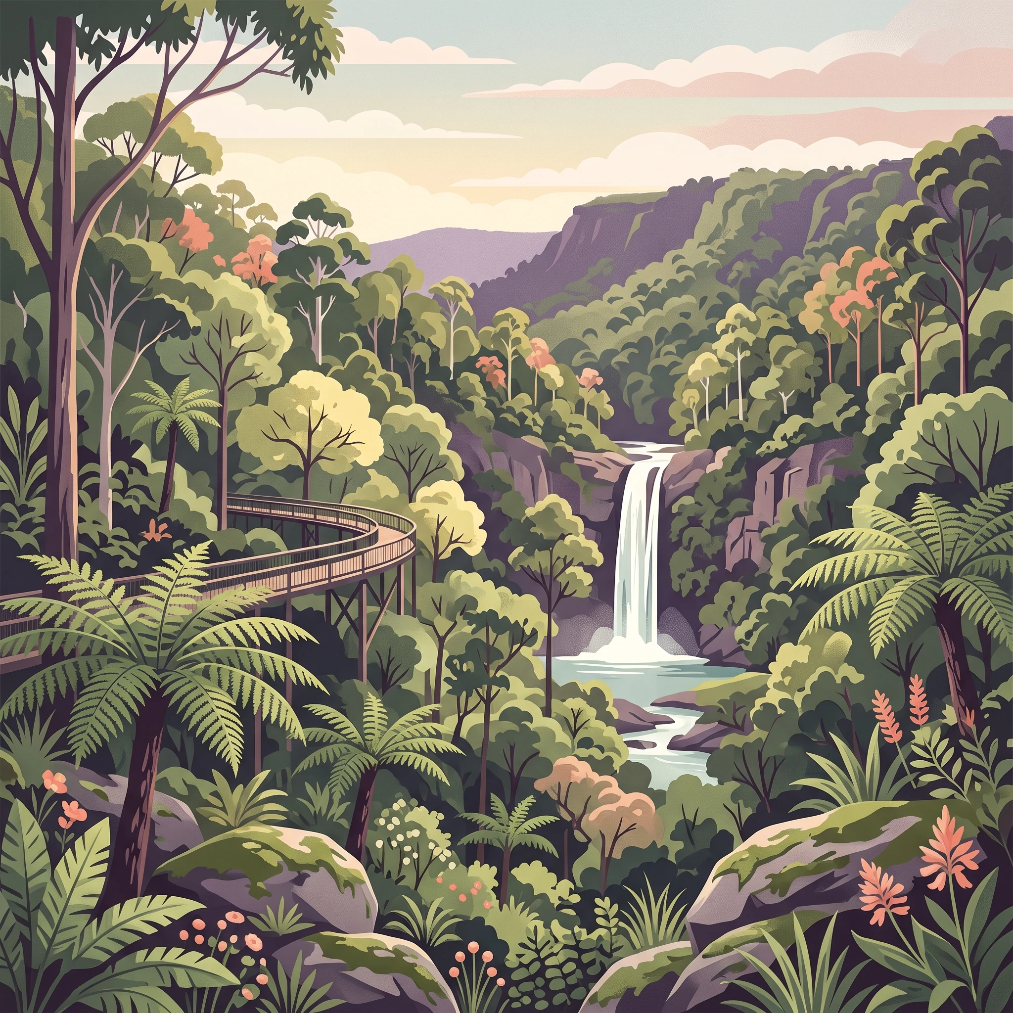
Dorrigo is renowned for its ancient temperate rainforests that represent some of the oldest continuously existing forest ecosystems on Earth, containing species that survived the break-up of the supercontinent Gondwana over 100 million years ago. The park's exceptional birdlife is particularly notable, with species such as the wompoo fruit dove, regent bowerbird, and superb lyrebird inhabiting the canopy and understory. The Skywalk, an elevated boardwalk that passes through and above the rainforest canopy, provides visitors with immersive treetop access for wildlife viewing and offers one of the most distinctive rainforest experiences in Australia. The Dorrigo Rainforest Centre serves as a major interpretation facility with interactive exhibits explaining the evolutionary history and ecological significance of these ancient forests.

Dorrigo National Park history and protected-area timeline

Dorrigo National Park was formally established on 1 October 1967, representing the culmination of growing recognition during the mid-twentieth century of the need to protect Australia's remaining old-growth forests and rainforests. The establishment of the park came during a period when the ecological significance of Australian rainforests was becoming increasingly understood by scientists and conservationists, who recognized that these ecosystems contained evolutionary treasures unlike anything found elsewhere on Earth.

The land has been continuously inhabited by the Gumbaynggirr people for thousands of years, and the park remains within Gumbaynggirr country with great significance to the Traditional Owners. The cultural connection between the Gumbaynggirr people and this landscape predates European settlement by many generations, and the park's management continues to acknowledge and incorporate Indigenous perspectives on country.

In 1986, the area achieved international recognition through its inclusion as part of the Gondwana Rainforests of Australia World Heritage Site, a listing that acknowledged the outstanding universal value of these ancient forest ecosystems. The property was further inscribed on the Australian National Heritage List in 2007, reinforcing its protected status within Australian law. More recently, since 2019, the New South Wales Government has been developing plans for enhanced visitor infrastructure, including a new Dorrigo Arc Rainforest Centre and the proposed 46-kilometre Dorrigo Escarpment Great Walk, though construction of these facilities had not commenced as of 2023.

Dorrigo National Park landscape and geographic character

The physical geography of Dorrigo National Park is defined by its position on the Dorrigo Plateau, a remnant of an ancient erosion surface that stands apart from the surrounding terrain of the Northern Tablelands. The plateau setting is fundamental to the park's character, as the elevated landform intercepts moisture-laden air masses moving inland from the Pacific Ocean, creating the humid conditions necessary to sustain temperate rainforest. The result is a landscape where the plateau surface supports dense forest cover while numerous waterfalls cascade over the edges where the land drops away sharply to the surrounding lowlands.

The terrain varies significantly across the park, with the northern sections presenting more distinctly mountainous character featuring steep-sided valleys and rugged ridgelines. The southern portions of the park are more gently undulating, with only slight hills breaking the general plateau surface. This variation creates diverse visual environments within the one protected area, from the more exposed vantage points offering panoramic views across to the coastal plain to the sheltered, humid depths of the rainforest-filled valleys. The interaction of hard and soft rock types across the area contributes to the diversity of landforms and the prevalence of the waterfalls that give the region its name and character.

Dorrigo National Park ecosystems, habitats, and plant life

The ecological character of Dorrigo National Park is defined by its temperate rainforests, which represent some of the most ancient and botanically significant forest communities in Australia. These forests contain plant lineages that trace their ancestry back to the Cretaceous period, when much of eastern Australia was covered by similar vegetation types. The continuity of these ancient forest types across millions of years makes the area invaluable for understanding evolutionary processes and the mechanisms by which species survive environmental changes over geological time.

The park supports extraordinarily high biodiversity relative to its size, with the rainforest communities providing habitat for approximately 30 mammal species, 128 bird species, and 44 reptile and amphibian species. This richness reflects the complexity of the rainforest environment, which offers multiple layers of habitat from the forest floor through the understory to the canopy, each supporting distinct communities of organisms adapted to particular conditions. The moist, humid conditions within the forest understory support diverse communities of ferns, mosses, and other moisture-loving plants that carpet logs, rocks, and tree trunks, creating an environment that feels distinctly different from the surrounding eucalypt-dominated landscapes.

Dorrigo National Park wildlife and species highlights

The wildlife of Dorrigo National Park is distinguished by the presence of species that represent ancient evolutionary lineages, some of which are found nowhere else on Earth. Among the mammals, marsupials such as the red-necked pademelon occupy the forest understory, moving through the dense vegetation in search of food. The canopy and mid-story support a range of arboreal mammals including various possum and glider species that have adapted to life among the branches.

The birdlife is particularly celebrated, with the park's rainforests providing habitat for an exceptional diversity of avian species. The wompoo fruit dove is one of the more distinctive inhabitants, a large pigeon species that feeds on fruit in the canopy and is known for its distinctive call that echoes through the forest. The regent bowerbird, named for the elaborate structures built by males to attract mates, is another notable species that inhabits the park's forests. The superb lyrebird, renowned for its extraordinary ability to mimic the calls of other birds and even mechanical sounds, is commonly encountered in the park's more sheltered areas. The elevated Skywalk provides an exceptional vantage point for observing these canopy-dwelling species, making it a particular draw for birdwatchers.

Dorrigo National Park conservation status and protection priorities

Dorrigo National Park occupies a central position within Australia's conservation estate, serving as a flagship for the protection of temperate rainforests in New South Wales. The park's inclusion as a core component of the Gondwana Rainforests of Australia World Heritage Site demonstrates its recognition as an area of outstanding universal value, where the ecological processes operating within its boundaries represent values that transcend national boundaries and merit global recognition and protection.

The World Heritage listing reflects the park's significance as a repository of biological diversity, containing species and ecological communities that survive nowhere else. The protection afforded by national park status ensures that these values are preserved against the threats that have degraded or destroyed similar forests elsewhere in Australia. The park also serves an important scientific function, providing researchers with access to relatively intact ecosystems where ecological processes can be studied and understood, offering insights relevant to broader conservation efforts across the continent.

Dorrigo National Park cultural meaning and human context

The cultural landscape of Dorrigo National Park is inseparable from the ongoing connection of the Gumbaynggirr people to country. The park lies within Gumbaynggirr country and holds great significance to the Traditional Owners, representing a landscape that has been actively managed and inhabited for thousands of years. This Aboriginal connection predates the formal establishment of the protected area by many generations, and the cultural values associated with the land continue to be recognized and respected in contemporary park management.

The Gumbaynggirr people's relationship with this landscape encompasses spiritual, cultural, and practical dimensions, with the forests, waterways, and ridges all holding meaning within the broader cultural framework. While the park is managed under the National Parks and Wildlife Service framework, the recognition of Indigenous cultural values is embedded in the approach to interpretation and site management. Visitors engaging with the park's natural wonders are thus experiencing a landscape that carries both outstanding natural heritage and profound Indigenous cultural significance.

Top sights and standout views in Dorrigo National Park

Dorrigo National Park offers several standout experiences that distinguish it from other protected areas in Australia. The Skywalk provides a unique perspective on temperate rainforest, allowing visitors to walk through and above the canopy on an elevated boardwalk that brings the often-inaccessible upper reaches of the forest within reach. The Wonga Walk trail showcases multiple waterfalls including Crystal Falls and Tristania Falls, demonstrating the park's exceptional scenic values. The Dorrigo Rainforest Centre provides comprehensive interpretive context through The Rainforest Revealed exhibit, helping visitors understand the evolutionary significance of these ancient forests. For those seeking more challenging adventure, the Rosewood Creek Track leads to the impressive Red Cedar Falls, while the proposed Dorrigo Escarpment Great Walk promises future long-distance trekking opportunities.

Best time to visit Dorrigo National Park

The temperate climate of the Dorrigo Plateau makes the park a year-round destination, though the experience varies across seasons. The autumn and winter months from April to August typically bring clearer skies and reduced humidity, making walking tracks more comfortable and visibility for photography improved. This period also coincides with the breeding season for many bird species, increasing opportunities to observe activities such as bowerbird courtship displays. Spring and summer from September to March bring warmer conditions and higher humidity, which sustains the rainforest's lush appearance but can make extended walks more taxing. The summer months often see more frequent afternoon thunderstorms, though these typically pass quickly and can actually enhance the waterfall viewing experience. Regardless of season, the mountain weather can change rapidly, and visitors should be prepared for variable conditions.

Park location guide

Geography guide, regional context, and park location map for Dorrigo National Park

Dorrigo National Park park geography, regions, and map view in Australia
Understand where Dorrigo National Park sits in Australia through a broader geographic reading of the surrounding landscape, nearby location context, and its mapped position within the national park landscape.

How Dorrigo National Park fits into Australia

Australia is a constitutional monarchy and federal parliamentary democracy comprising six states and ten territories. With a population of nearly 28 million, it is one of the world's most urbanised countries, with most people concentrated on the eastern seaboard. The country has a high Human Development Index and is known for its cultural diversity, ancient Aboriginal heritage, and unique wildlife.

Wider geography shaping Dorrigo National Park in Australia

Australia occupies the entire Australian continent, the island of Tasmania, and numerous smaller islands. It is the world's flattest and driest inhabited continent, featuring vast deserts in the interior (the Outback), tropical rainforests along the eastern coast, and a coastline bordering the Indian and Pacific Oceans.

Map view of Dorrigo National Park

Use this park location map to pinpoint Dorrigo National Park in Australia, understand its exact geographic position, and read its mapped placement within the surrounding landscape more clearly.

Pigeon | © OpenStreetMap contributors

Location context for Dorrigo National Park

New South Wales
Park atlas

Compare temperate rainforests and World Heritage sites across the Gondwana Rainforests of Australia

Explore Nearby National Parks and Protected Areas Beyond Dorrigo National Park
Extend your discovery from Dorrigo National Park to browse other national parks and protected areas throughout New South Wales, comparing their regional geography. Explore additional ancient temperate rainforests and World Heritage sites, tracing the interconnected conservation landscapes of the wider Gondwana Rainforests region.
National parkNew South Wales

Cascade National Park: National Park in New South Wales with Mapped Protected Boundaries

Explore the unique geography and landscape context of this protected area.

Delve into Cascade National Park, a protected national park located in New South Wales, Australia. This entity is crucial for understanding the mapped geographic extent and specific landscape characteristics of one of Australia's protected natural areas. Its inclusion within the atlas provides a grounded point for examining regional conservation lands and their spatial distribution.

Area
36 km²
Established
1999
IUCN
II
Climate
Temperate
National parkNew South Wales

Junuy Juluum National Park: New South Wales Protected Forest Remnant Exploration

Discover rare warm temperate rainforest and unique Australian birdlife.

Junuy Juluum National Park offers a vital glimpse into a rare warm temperate rainforest habitat within New South Wales. Situated on Campion Mountain, this protected area showcases a distinct forest ecosystem, contrasting sharply with the surrounding eucalypt woodlands and cleared agricultural lands. Its mapped geography and status as a protected forest remnant make it significant for understanding regional conservation landscapes and unique Australian birdlife.

Area
9 km²
Established
1999
IUCN
II
Relief
Mountain
National parkNew South Wales

Bellinger River National Park: Protected River Landscape and Forested Terrain in New South Wales

Explore mapped boundaries and geographic context.

Bellinger River National Park is a protected national park situated in New South Wales, Australia, renowned for its untouched upper river catchment and dense old-growth forests. The park offers valuable insights into the region's natural geography, featuring steep valleys, numerous waterfalls, and a significant river corridor. This page provides detailed information on its protected landscape, mapped boundaries, and geographic setting, essential for atlas-style discovery and understanding its ecological significance.

Area
28.3 km²
Established
1997
IUCN
II
Relief
Mixed relief
National parkNew South Wales

Bongil Bongil National Park: Exploring New South Wales' Protected Landscape Identity

Mapped boundaries and regional geography of a national park.

This entry for Bongil Bongil National Park provides an atlas-focused view of its protected landscape within New South Wales. Understand the park's geographic context, its designation as a national park, and how its mapped boundaries contribute to the broader regional geography. It serves as a distinct point of entry for exploring the specific conservation lands and natural terrain that define this Australian park entity for detailed atlas-based study.

Area
42.33 km²
Established
1995
IUCN
II
Relief
Lowland
National parkNew South Wales

Ulidarra National Park: New South Wales Strict Nature Reserve and Wildlife Sanctuary

Explore its elevation range, mapped forest ecosystems, and protected habitats.

Ulidarra National Park represents a small yet ecologically vital protected area within New South Wales, Australia. Classified as a strict nature reserve, it preserves significant old-growth eucalyptus forests and intact rainforests across a notable elevation gradient. The park is recognized for providing critical habitat for species like koalas and various native birds, making it a key site for understanding regional wildlife diversity and protected landscape conservation through detailed mapping and geographic context.

Area
6.8 km²
Established
1999
IUCN
Ia
Relief
Mixed relief
National parkNew South Wales

Nymboi-Binderay National Park: Protected Landscape in New South Wales

Explore its mapped boundaries and regional natural geography.

Nymboi-Binderay National Park stands as a protected natural landscape within New South Wales, Australia, offering valuable geographic context for atlas explorers. This entry focuses on its identity as a national park, providing insights into its mapped protected area and its position within the broader regional geography of New South Wales, enabling structured discovery of its natural landscape features.

Area
172.43 km²
Established
1997
IUCN
II
Relief
Upland
National parkNew South Wales

Dunggir National Park: Protected Subtropical Rainforest and Biodiversity Hub in New South Wales

Mapped national park landscape and Gumbaynggirr cultural context.

Dunggir National Park offers a detailed view into Australia's protected natural areas, specifically highlighting the unique subtropical rainforest environments of New South Wales. With a focus on conservation, this national park preserves a dense mosaic of three distinct rainforest types and is a sanctuary for significant biodiversity, including multiple endangered species. Its geographic placement and designation as a national park make it a key location for understanding regional ecosystems and the indigenous Gumbaynggirr heritage, with the park's name honouring the culturally significant koala.

Area
25 km²
Established
1997
IUCN
II
Relief
Upland
National parkNew South Wales

New England National Park: Escarpment Landscape and Protected Area Discovery in New South Wales

Explore dramatic cliffs, ancient rainforests, and diverse ecosystems.

New England National Park represents a critical protected landscape on the eastern edge of New South Wales' Northern Tablelands. This area is characterized by its spectacular escarpment country, featuring impressive cliffs, rugged ridges, and deep valleys that cradle some of Australia's most botanically rich environments. As a designated national park, it preserves ancient ecosystems and offers unique opportunities for atlas-based geographic discovery of its mapped terrain and wilderness character.

Area
673 km²
Established
1937
IUCN
Ib
Relief
Mountain

Common questions about visiting, size, designation, and location context for Dorrigo National Park

Dorrigo National Park FAQs for park facts, access, geography, and protected area context
Find quick answers about Dorrigo National Park, including protected-area facts, park geography, trail and visitor context, and how the park fits into its surrounding country and regional landscape.
MoriAtlas Explorer

Continue Your Protected Areas Search Across the Global Atlas

Deepen your exploration by continuing the structured search for national parks and protected areas worldwide. Utilize the comprehensive filtering capabilities to compare different conservation landscapes and refine your understanding of global park geography. Discover more about the distribution and characteristics of protected natural areas.

Global natural geography