Why Drysdale River National Park stands out
Drysdale River National Park is best known for its exceptional remoteness and pristine wilderness character, representing one of the most untouched landscapes in the Kimberley region. The park features two prominent waterfalls, Morgan Falls and Solea Falls, with numerous smaller cascades along the river's course. The deep gorges, dramatic cliffs, and permanent pools of the Drysdale River system create a striking landscape that remains largely unaltered by human development. The park's inaccessibility has preserved both its natural values and its cultural significance, with the area supporting nearly 600 plant species including approximately 25 fern species, two of which are found nowhere else on Earth.
Drysdale River National Park history and protected-area timeline
The human history of the Drysdale River area spans thousands of years of Indigenous occupation by the Ngarinjin, Miwa, and Wilawila peoples, whose traditional connections to the land continue to the present day. European exploration of the region began in 1886 when C.A. Burrowes, a surveyor with a squatting company, became the first non-Indigenous person to visit the area. Subsequent expeditions by Brockman and Crossland in 1901 further explored the region, though the area remained extremely remote and sparsely populated. The first vehicular track through the region was constructed during an expedition and survey in 1954, establishing a route from Gibb River Station to Kalumburu that would later provide the basis for access to the park. Following recommendations from the Australian Academy of Science committee on National Parks, the park was officially gazetted in September 1974, establishing formal protection for this remote wilderness area. The park's establishment reflected growing recognition of the need to preserve representative examples of Kimberley ecosystems and landscapes.
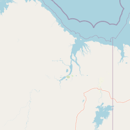
Drysdale River National Park landscape and geographic character
The landscape of Drysdale River National Park is defined by the rugged, ancient terrain characteristic of the Kimberley region. The park encompasses the valley of the Drysdale River, a perennial watercourse that cuts through the landscape creating deep gorges with towering cliff walls. The river system features permanent pools that persist even through the dry season, flanked by numerous smaller creeks and tributaries. The terrain supports open woodland vegetation across the plateaus and valleys, while the gorge walls and cliff faces create dramatic vertical relief throughout the park. Waterfalls are a prominent feature, with Morgan Falls and Solea Falls representing the two largest cascades, supplemented by numerous smaller falls that punctuate the river's course. The combination of ancient rock formations, steep gorges, seasonal waterfalls, and persistent river pools creates a landscape of exceptional visual diversity and wilderness character.
Drysdale River National Park ecosystems, habitats, and plant life
The ecological character of Drysdale River National Park reflects the Kimberley's unique position as a biodiversity hotspot in northern Australia. The park supports nearly 600 documented plant species, including approximately 30 aquatic and swamp varieties that inhabit the permanent pools along the Drysdale and Carson Rivers. Notably, about 25 species of fern have been recorded within the park, with two of these species found nowhere else in the world. The riparian zones along the watercourses support distinctive vegetation communities including fan palms, kalumbaru gums, and paperbarks that thrive in the moister microenvironments created by the river system. The combination of permanent water, diverse habitats from river pools to woodland ridges, and the protection afforded by the park's remoteness has allowed this ecosystem to persist largely unchanged.
Drysdale River National Park wildlife and species highlights
The wildlife community of Drysdale River National Park reflects the park's diverse habitats and the availability of permanent water throughout the year. Over 100 species of birds have been recorded within the park, making it an important area for avifauna in the Kimberley region. The mammal population includes sugar gliders, various bat species, and wallabies that inhabit the woodland and gorge environments. The permanent river pools support populations of salt water crocodiles, which are a characteristic feature of northern Australian freshwater systems. The park's mix of riparian habitats, woodland areas, and cliff environments provides shelter and foraging resources for this diverse faunal community, though the remote nature of the park means that many species remain poorly documented compared to more accessible conservation areas.
Drysdale River National Park conservation status and protection priorities
Drysdale River National Park represents one of the most significant conservation areas in the Kimberley region due to its large size, exceptional remoteness, and relatively unmodified ecosystem. The park protects representative examples of Kimberley open woodland, gorge, and river systems that have been less impacted by pastoral development than many other parts of the region. The protection of the Drysdale River system is particularly important given the permanent water sources that support specialized aquatic and riparian species, including the numerous endemic plant species that depend on these unique habitats. The park's status as a wilderness area with minimal infrastructure and no public access roads has helped preserve its ecological integrity, though this remoteness also presents challenges for management and monitoring.
Drysdale River National Park cultural meaning and human context
The lands encompassed by Drysdale River National Park hold deep cultural significance for the Ngarinjin, Miwa, and Wilawila peoples, who maintain traditional ownership and ongoing connections to the area. The river system and its permanent waterholes have likely been important locations for Indigenous communities for thousands of years, providing resources and cultural meaning that continue today. The requirement for permission from the Kalumburu Aboriginal Corporation before entering the park reflects the continued recognition of Indigenous rights and interests in the management of this country. The relationship between the traditional owners and the park's management reflects broader developments in Australian conservation that increasingly recognize the importance of Indigenous involvement in land management and the value of traditional ecological knowledge.
Top sights and standout views in Drysdale River National Park
The defining highlights of Drysdale River National Park are its extraordinary remoteness and the dramatic landscapes preserved within its boundaries. The two major waterfalls, Morgan Falls and Solea Falls, represent significant scenic features along the Drysdale River, while the deep gorges and towering cliffs create a landscape of considerable visual impact. The park's status as the largest and least accessible protected area in the Kimberley means that visitors who do reach this remote destination experience a wilderness essentially untouched by modern development. The permanent river pools, some of which support salt water crocodiles, add both ecological interest and a sense of pristine natural systems continuing unchanged. Nearly 600 plant species, including globally significant ferns, underscore the park's botanical importance.
Best time to visit Drysdale River National Park
The optimal time to visit Drysdale River National Park is during the dry season from mid-April to October, when conditions are most suitable for exploring this remote area. During the dry season, the park experiences warm to hot daytime temperatures, minimal rainfall, and generally clear conditions that make travel through the region more feasible. The wet season from November to mid-April brings significant rainfall that can make access difficult or impossible, with the landscape transformed by flowing waterfalls and full river channels but with reduced accessibility. The dry season also offers more comfortable conditions for camping and outdoor activities, though visitors should be prepared for the park's lack of facilities and the need for self-sufficiency. The extreme temperatures range from lows around 1.6 degrees Celsius in August to highs reaching 44 degrees Celsius in October, meaning that mid-dry season months typically offer the most temperate conditions for exploration.